68
Moreton Bay Regional Council – Pine Rivers Shire Planning Scheme Policy PSP22 Development Contributions for Trunk Infrastructure – Water Supply
Moreton Bay Regional Council – Pine Rivers Shire Planning Scheme Policy PSP22 Development Contributions for Trunk Infrastructure – Water Supply
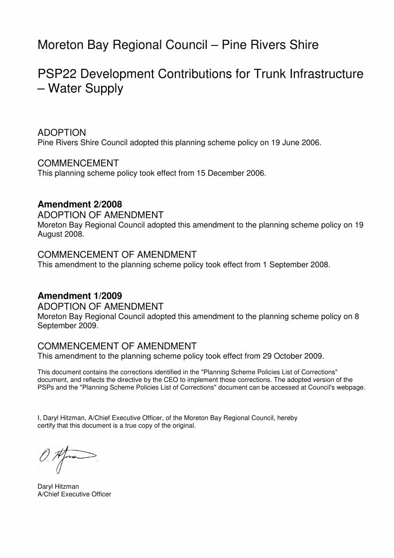
Moreton Bay Regional Council – Pine Rivers Shire PSP22 Development Contributions for Trunk Infrastructure – Water Supply ADOPTION Pine Rivers Shire Council adopted this planning scheme policy on 19 June 2006.
COMMENCEMENT This planning scheme policy took effect from 15 December 2006.
Amendment 2/2008 ADOPTION OF AMENDMENT Moreton Bay Regional Council adopted this amendment to the planning scheme policy on 19 August 2008.
COMMENCEMENT OF AMENDMENT This amendment to the planning scheme policy took effect from 1 September 2008.
Amendment 1/2009 ADOPTION OF AMENDMENT Moreton Bay Regional Council adopted this amendment to the planning scheme policy on 8 September 2009.
COMMENCEMENT OF AMENDMENT This amendment to the planning scheme policy took effect from 29 October 2009. This document contains the corrections identified in the "Planning Scheme Policies List of Corrections" document, and reflects the directive by the CEO to implement those corrections. The adopted version of the PSPs and the "Planning Scheme Policies List of Corrections" document can be accessed at Council's webpage. I, Daryl Hitzman, A/Chief Executive Officer, of the Moreton Bay Regional Council, hereby certify that this document is a true copy of the original. Daryl Hitzman A/Chief Executive Officer
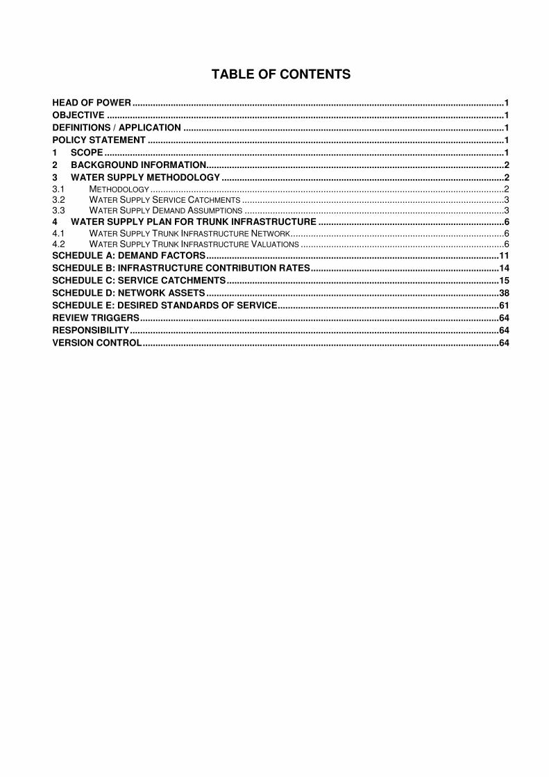
TABLE OF CONTENTS
HEAD OF POWER ..................................................................................................................................................1 OBJECTIVE ............................................................................................................................................................1 DEFINITIONS / APPLICATION ..............................................................................................................................1 POLICY STATEMENT ............................................................................................................................................1 1 SCOPE .............................................................................................................................................................1 2 BACKGROUND INFORMATION.....................................................................................................................2 3 WATER SUPPLY METHODOLOGY ...............................................................................................................2 3.1 METHODOLOGY ...........................................................................................................................................2 3.2 WATER SUPPLY SERVICE CATCHMENTS .......................................................................................................3 3.3 WATER SUPPLY DEMAND ASSUMPTIONS ......................................................................................................3 4 WATER SUPPLY PLAN FOR TRUNK INFRASTRUCTURE .........................................................................6 4.1 WATER SUPPLY TRUNK INFRASTRUCTURE NETWORK....................................................................................6 4.2 WATER SUPPLY TRUNK INFRASTRUCTURE VALUATIONS ................................................................................6 SCHEDULE A: DEMAND FACTORS...................................................................................................................11 SCHEDULE B: INFRASTRUCTURE CONTRIBUTION RATES..........................................................................14 SCHEDULE C: SERVICE CATCHMENTS...........................................................................................................15 SCHEDULE D: NETWORK ASSETS ...................................................................................................................38 SCHEDULE E: DESIRED STANDARDS OF SERVICE.......................................................................................61 REVIEW TRIGGERS.............................................................................................................................................64 RESPONSIBILITY.................................................................................................................................................64 VERSION CONTROL............................................................................................................................................64

Moreton Bay Regional Council PINERIVERSPLAN
PLANNING SCHEME POLICY PSP22 – DEVELOPMENT CONTRIBUTIONS FOR TRUNK INFRASTRUCTURE – WATER SUPPLY
Effective from 29 October 2009 Page 1
PSP 22 – DEVELOPMENT CONTRIBUTIONS FOR TRUNK INFRASTRUCTURE – WATER SUPPLY
Head of Power
This document is a Planning Scheme Policy for the purposes of the Integrated Planning Act 1997 (the Act) and is made in compliance with the process prescribed in Schedule 3 of the Act.
Objective
The objective of this policy is to apportion the cost of Water Supply Trunk Infrastructure over all benefiting development (existing and future) commensurate with the demand or load that existing and future development will place on existing and planned future infrastructure while ensuring a reasonable and equitable distribution of the costs of Water Supply Trunk Infrastructure works between Council and developers of land in the former Pine Rivers Shire.
Definitions / Application
Application
This policy applies to all applications for development which has been made assessable against the PineRiversPlan and which will utilise any part of the Water Supply Trunk Infrastructure Network. For the purposes of this policy, the extent of the Water Supply Trunk Infrastructure Network within the former Pine Rivers Shire is shown in Schedule D.
The policy outlines the basis of Council’s Infrastructure Contributions Regime for the Water Supply Trunk Infrastructure Network in the former Pine Rivers Shire. It is to be read in conjunction with Planning Scheme Policy PSP21 Development Contributions for Trunk Infrastructure – Administration Policy.
Payment of any monetary contribution under this policy will in no way relieve the development proponent from any requirement under a condition of development approval to undertake non-trunk works or to connect the development to trunk infrastructure. Nothing contained in this policy precludes Council and the development proponent from entering into an infrastructure agreement in regard to the matters dealt with by this policy.
Definitions
The definitions of applicable terms are contained in PSP21 Development Contributions for Trunk Infrastructure – Administration Policy. Where a term used in this policy is not defined in PSP21 that term shall, unless the context indicates or requires otherwise, have the meaning assigned to it in the PineRiversPlan or in the Integrated Planning Act 1997.
Policy Statement
1 Scope
This policy sets out the basis for determining the amount of Development Contributions for Water Supply Trunk Infrastructure which Council will impose as conditions of development approval. The provisions of this policy shall apply to applications for development within the Shire which will utilise Water Supply Trunk Infrastructure either immediately or at some time in the future. This policy:
• is to be read in conjunction with Planning Scheme Policy PSP21 Development Contributions for Trunk Infrastructure – Administration Policy;
• specifies the assumptions made in determining the rate of the contribution payable towards the cost of Water Supply Trunk Infrastructure within Council’s Designated Infrastructure Service Area (DISA);
• lists the land use, density and demand assumptions made for predicting demand and planning the Water Supply Trunk Infrastructure Network;
• specifies the works, structures or equipment, which the Council determines to be Water Supply Trunk Infrastructure;
• establishes the estimated cost of construction and any required augmentation of the Water Supply Trunk Infrastructure Network in respect of which contributions are to be made; and
• lists the applicable Demand Factors and Schedules of Infrastructure Contributions Rates.
Moreton Bay Regional Council PINERIVERSPLAN
PLANNING SCHEME POLICY PSP22 – DEVELOPMENT CONTRIBUTIONS FOR TRUNK INFRASTRUCTURE – WATER SUPPLY
Effective from 29 October 2009 Page 2
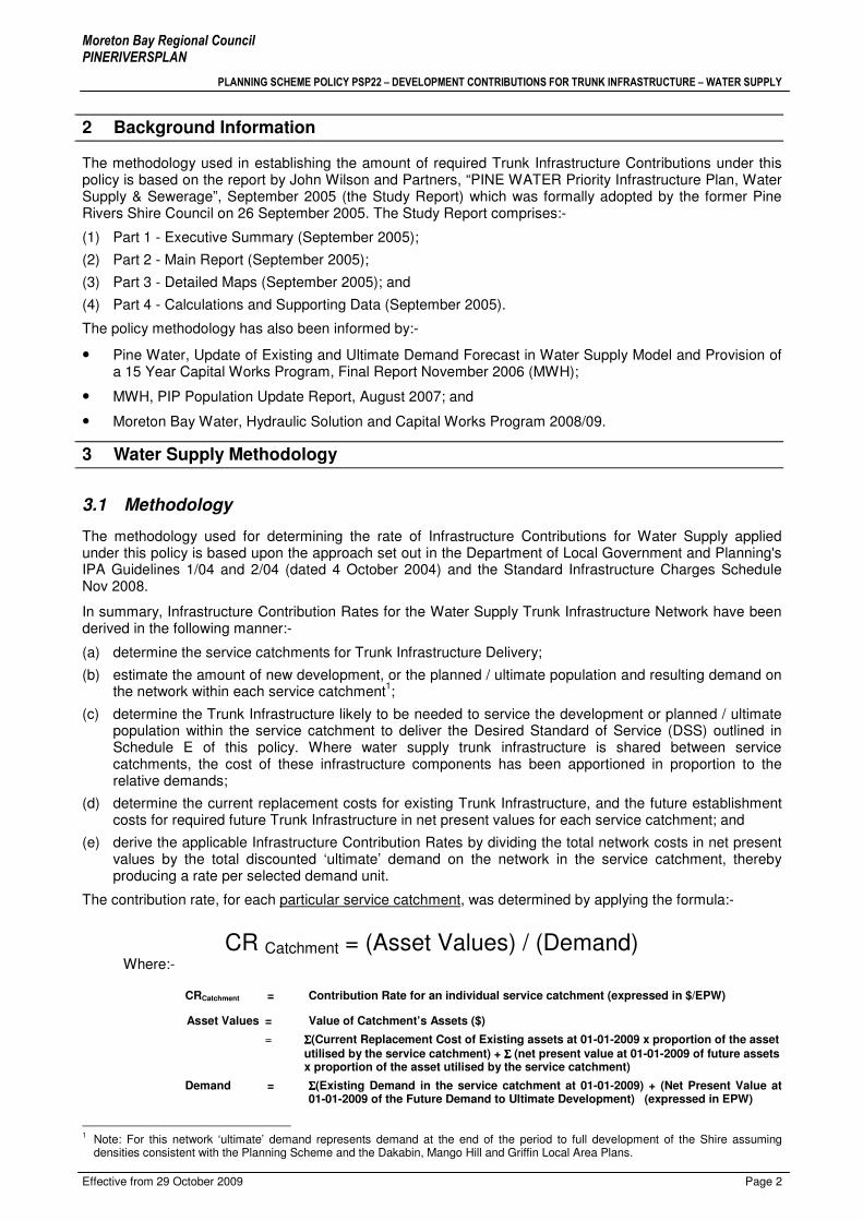
2 Background Information
The methodology used in establishing the amount of required Trunk Infrastructure Contributions under this policy is based on the report by John Wilson and Partners, “PINE WATER Priority Infrastructure Plan, Water Supply & Sewerage”, September 2005 (the Study Report) which was formally adopted by the former Pine Rivers Shire Council on 26 September 2005. The Study Report comprises:-
(1) Part 1 - Executive Summary (September 2005);
(2) Part 2 - Main Report (September 2005);
(3) Part 3 - Detailed Maps (September 2005); and
(4) Part 4 - Calculations and Supporting Data (September 2005).
The policy methodology has also been informed by:-
• Pine Water, Update of Existing and Ultimate Demand Forecast in Water Supply Model and Provision of a 15 Year Capital Works Program, Final Report November 2006 (MWH);
• MWH, PIP Population Update Report, August 2007; and
• Moreton Bay Water, Hydraulic Solution and Capital Works Program 2008/09.
3 Water Supply Methodology
3.1 Methodology
The methodology used for determining the rate of Infrastructure Contributions for Water Supply applied under this policy is based upon the approach set out in the Department of Local Government and Planning's IPA Guidelines 1/04 and 2/04 (dated 4 October 2004) and the Standard Infrastructure Charges Schedule Nov 2008.
In summary, Infrastructure Contribution Rates for the Water Supply Trunk Infrastructure Network have been derived in the following manner:-
(a) determine the service catchments for Trunk Infrastructure Delivery;
(b) estimate the amount of new development, or the planned / ultimate population and resulting demand on the network within each service catchment
1;
(c) determine the Trunk Infrastructure likely to be needed to service the development or planned / ultimate population within the service catchment to deliver the Desired Standard of Service (DSS) outlined in Schedule E of this policy. Where water supply trunk infrastructure is shared between service catchments, the cost of these infrastructure components has been apportioned in proportion to the relative demands;
(d) determine the current replacement costs for existing Trunk Infrastructure, and the future establishment costs for required future Trunk Infrastructure in net present values for each service catchment; and
(e) derive the applicable Infrastructure Contribution Rates by dividing the total network costs in net present values by the total discounted ‘ultimate’ demand on the network in the service catchment, thereby producing a rate per selected demand unit.
The contribution rate, for each particular service catchment, was determined by applying the formula:-
CR Catchment = (Asset Values) / (Demand) Where:-
CRCatchment = Contribution Rate for an individual service catchment (expressed in $/EPW)
Asset Values = Value of Catchment’s Assets ($)
= ΣΣΣΣ(Current Replacement Cost of Existing assets at 01-01-2009 x proportion of the asset utilised by the service catchment) + ΣΣΣΣ (net present value at 01-01-2009 of future assets x proportion of the asset utilised by the service catchment)
Demand = ΣΣΣΣ(Existing Demand in the service catchment at 01-01-2009) + (Net Present Value at 01-01-2009 of the Future Demand to Ultimate Development) (expressed in EPW)
1 Note: For this network ‘ultimate’ demand represents demand at the end of the period to full development of the Shire assuming
densities consistent with the Planning Scheme and the Dakabin, Mango Hill and Griffin Local Area Plans.

Moreton Bay Regional Council PINERIVERSPLAN
PLANNING SCHEME POLICY PSP22 – DEVELOPMENT CONTRIBUTIONS FOR TRUNK INFRASTRUCTURE – WATER SUPPLY
Effective from 29 October 2009 Page 3
This methodology applies an equitable distribution of trunk infrastructure costs between Council (on behalf of the existing community), and entities proposing new development. Each development proponent will only be responsible for meeting the establishment costs of that proportion of the water supply trunk infrastructure network planned to be consumed by that entity’s development proposal.
3.2 Water Supply Service Catchments
The Designated Infrastructure Service Area (DISA) for the former Pine Rivers Shire has been divided into the Water Supply Service Catchments shown in Table 3.2A:-
Table 3.2A - Water Supply Service Catchments
WATER SUPPLY SERVICE CATCHMENTS SHORT NAME
DAYBORO DAY ALBANY CREEK LLZ ACL ALBANY CREEK HLZ ALC CLEAR MOUNTAIN HLZ CMH DAKABIN DKB EATONS HILL HLZ EAH GRIFFIN GRF HILLS LLZ HLA HILLS HLZ HLH KALLANGUR KAL MANGO HILL MHL NORTH LAKES NLK PETRIE PET SAMFORD DOWNS SAD SAMFORD VILLAGE SAM STRATHPINE / LAWNTON LLZ STR
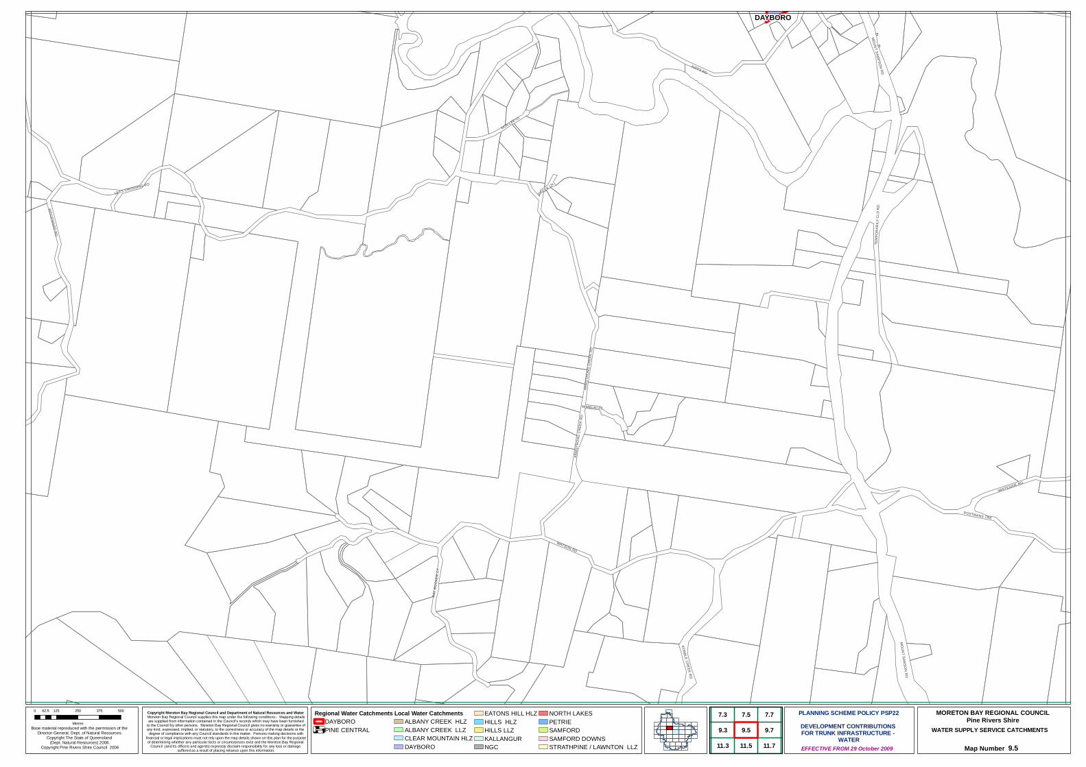
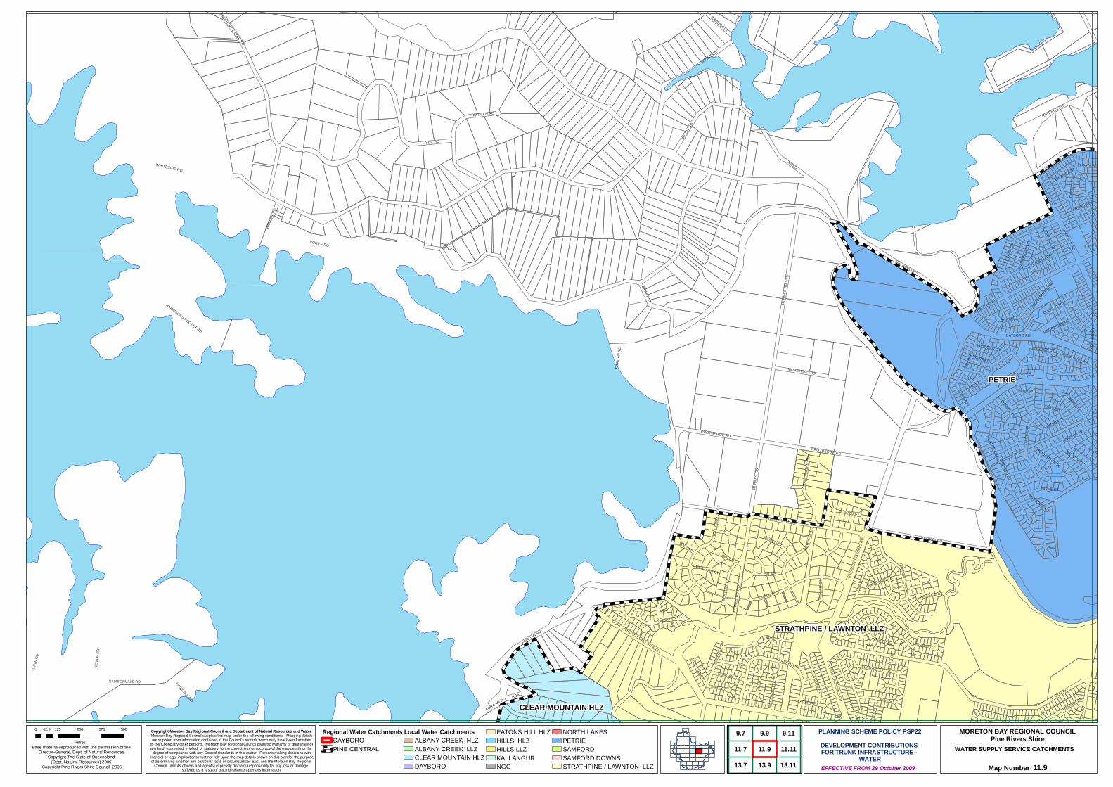
The extent of each of the Service Catchments is shown graphically on the maps contained in Schedule C.
The North Lakes development at Mango Hill and the development of the former CSIRO land in the Samford Valley are subject to infrastructure agreements, and, as such, are specifically excluded from the scope of this policy.
While it is acknowledged that these catchments do impose a load on existing trunk infrastructure, and that load is likely to increase over time until the development in those areas is completed, appropriate mechanisms have been included in the Contributions regime adopted under this policy to ensure that the costs associated with this load are not passed onto other development.
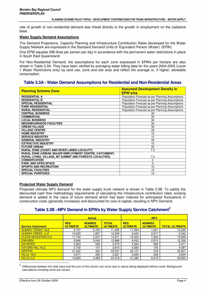
3.3 Water Supply Demand Assumptions
Approach to Demand and Load Modelling
The reports referred to in Section 2 of this policy document both assumed demand across the whole Shire and the most cost effective strategy for servicing those demand areas as well as providing a valuable input into aligning Council’s Capital Works Programs with assumed growth rates. These reports cover the full anticipated extent of urban areas within the Shire up to the planning horizon of this policy.
As part of the revisions undertaken to produce this version of the policy, new Demand and Load Models for Water Supply, consistent with the Planning Assumptions documented in PSP21 Section 3 were built. The demand for 2026 was compared to the changes in demand indicated in Council’s previously adopted Water Master Plan for the period 2006 to full development of the Shire assuming densities consistent with the Planning Scheme and the Dakabin, Mango Hill and Griffin Local Area Plans – this being termed ‘ultimate’ development. Council’s consultants advised that the differences were minor. The Hydraulics Models have been re-run to reflect the new Desired Standards of Service and the permanent water restrictions imposed for SEQ by the State.
The determination of demand and load for residential zoned land was based on population numbers assumed for the land. Demand and load for non-residential zoned land was derived from land use zoning and an assumed number of Equivalent Persons (Water) per hectare per zone as outlined in Table 3.3A. The
Moreton Bay Regional Council PINERIVERSPLAN
PLANNING SCHEME POLICY PSP22 – DEVELOPMENT CONTRIBUTIONS FOR TRUNK INFRASTRUCTURE – WATER SUPPLY
Effective from 29 October 2009 Page 4
rate of growth of non-residential demand was linked directly to the growth in employment on the cadastral base.
Water Supply Demand Assumptions
The Demand Projections, Capacity Planning and Infrastructure Contribution Rates developed for the Water Supply Network are expressed in the Standard Demand Units of ‘Equivalent Person (Water)’ (EPW).
One EPW equates 296 litres per person per day in accordance with the permanent water restrictions in place in South East Queensland.
For Non-Residential Demand, the assumptions for each zone expressed in EPWs per hectare are also shown in Table 3.3A. They have been verified by averaging water billing data for the years 2004-2005 (Level 1 Water Restrictions only) by land use, zone and site area and reflect the average or, if higher, allowable consumption.
Table 3.3A - Water Demand Assumptions for Residential and Non-Residential Areas
Planning Scheme Zone Assumed Development Density in EPW’s/ha
RESIDENTIAL A Population Forecast as per Planning Assumptions RESIDENTIAL B Population Forecast as per Planning Assumptions SPECIAL RESIDENTIAL Population Forecast as per Planning Assumptions PARK RESIDENTIAL Population Forecast as per Planning Assumptions RURAL RESIDENTIAL Population Forecast as per Planning Assumptions CENTRAL BUSINESS 30 COMMERCIAL 30 LOCAL BUSINESS 30 NEIGHBOURHOOD FACILITIES 30 URBAN VILLAGE 30 VILLAGE CENTRE 30 HOME INDUSTRY 10 SERVICE INDUSTRY 15 GENERAL INDUSTRY 30 EXTRACTIVE INDUSTRY 15 FUTURE URBAN 30 RURAL ZONE (COAST AND RIVER LANDS LOCALITY) 7.5 RURAL ZONE (URBAN, MAJOR EMPLOYMENT CENTRE, CATCHMENT, RURAL LIVING, VILLAGE, MT SUMMIT AND FORESTS LOCALITIES) 7.5 CONSERVATION 0 PARK AND OPEN SPACE 5 SPORTS AND RECREATION 15 SPECIAL FACILITIES 15 SPECIAL PURPOSES 15
Projected Water Supply Demand
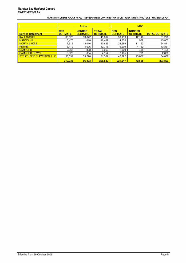
Projected ultimate NPV demand for the water supply trunk network is shown in Table 3.3B. To satisfy the discounted cash flow methodology requirements of calculating the infrastructure contribution rates, existing demand is added to the value of future demand which has been indexed for anticipated fluctuations in construction costs (generally increases) and discounted for cost of capital, resulting in NPV Demand.
Table 3.3B –NPV Demand in EPWs by Water Supply Service Catchment2
Actual NPV
Service Catchment RES ULTIMATE
NONRES ULTIMATE
TOTAL ULTIMATE
RES ULTIMATE
NONRES ULTIMATE TOTAL ULTIMATE
ALBANY CREEK HLZ 5,727 5,765 11,492 11,584 1,641 13,226
ALBANY CREEK LLZ 10,633 1,667 12,299 6,425 2,917 9,342
CLEAR MOUNTAIN HLZ 11,744 3,227 14,971 12,024 1,635 13,659
DAKABIN 9,848 3,049 12,898 9,432 2,874 12,306
DAYBORO 2,653 926 3,579 2,564 908 3,471
EATONS HILL HLZ 3,702 107 3,810 4,282 105 4,387
GRIFFIN 21,632 404 22,037 20,127 379 20,507
HILLS HLZ 3,071 250 3,321 3,265 239 3,504
HILLS LLZ 19,829 4,489 24,318 21,285 8,518 29,803
2 Differences between the total value and the sum of the column can occur due to values being displayed without cents. Background calculations including cents are correct.
Moreton Bay Regional Council PINERIVERSPLAN
PLANNING SCHEME POLICY PSP22 – DEVELOPMENT CONTRIBUTIONS FOR TRUNK INFRASTRUCTURE – WATER SUPPLY
Effective from 29 October 2009 Page 5
Actual NPV
Service Catchment RES ULTIMATE
NONRES ULTIMATE
TOTAL ULTIMATE
RES ULTIMATE
NONRES ULTIMATE TOTAL ULTIMATE
KALLANGUR 36,020 13,672 49,692 39,159 12,110 51,270
MANGO HILL 15,470 1,018 16,487 14,855 952 15,807
NORTH LAKES 17,612 13,016 30,629 23,689 11,152 34,841
PETRIE 8,112 4,606 12,718 9,209 4,152 13,361
SAMFORD 2,667 393 3,060 1,020 405 1,425
SAMFORD DOWNS 3,520 634 4,154 2,105 701 2,806
STRATHPINE / LAWNTON LLZ 38,097 33,270 71,367 40,222 23,867 64,089
210,336 86,493 296,830 221,247 72,555 293,802
Moreton Bay Regional Council PINERIVERSPLAN
PLANNING SCHEME POLICY PSP22 – DEVELOPMENT CONTRIBUTIONS FOR TRUNK INFRASTRUCTURE – WATER SUPPLY
Effective from 29 October 2009 Page 6
4 Water Supply Plan For Trunk Infrastructure
4.1 Water Supply Trunk Infrastructure Network
The following Infrastructure items as shown on the maps contained in Schedule D of this policy are deemed to be Trunk Infrastructure for the purpose of planning and funding of the Trunk Water Supply Network:-
(1) pumping stations and trunk mains to transport the treated water to distribution or storage reservoirs or elevated tanks;
(2) distribution or non-regional storage reservoirs and elevated tanks;
(3) chlorination and rechlorination equipment;
(4) trunk delivery and distribution infrastructure (generally 300mm diameter mains and larger) which transports the water from distribution or storage reservoirs to the reticulation system, or which provides a general benefit to the water supply scheme;
(5) local control and monitoring systems;
(6) the following specific items of Infrastructure within the rural residential areas:-
• the 250mm diameter main which traverses Bunya Road and thence runs northwards to supply the Bergin and Wongam Creek area;
• the 200mm and 220mm diameter mains supplying reservoirs in Samford Village and Samford Downs;
(7) the 100mm and 150mm diameter mains at Dayboro from:-
• the intake wells to the treatment plants;
• the treatment plants to the Low Level Zone reservoir; and
• the Low Level Zone No. 1 (Roderick St) reservoirs to the High Level Zone reservoir at Sellin Road; and
(8) bulk water meters, pressure and flow control valves as well as the telemetry/SCADA systems which provide system monitoring and/or control.
Assets are also grouped into ‘Active’ and ‘Passive’ Assets:
Active water infrastructure assets consist mainly of above ground visible assets such as treatment plants, pumping stations, reservoirs and dams.
Passive water infrastructure assets consist of underground assets such as trunk mains, reticulation mains, pipe fittings and property connections.
The various elements of this Trunk Infrastructure are shown on the maps in Schedule D and are tabulated in Section 4.2.
Specific Exclusions
The North Pine Dam WTP is situated in the Pine Rivers Shire but it is neither owned nor operated by Council. Treated water from this facility is supplied to Council under a Bulk Supply Agreement. Hence, this facility has been excluded from infrastructure contribution calculations on the grounds that establishment costs are recovered by the current owner/operator through the water tariff detailed in the Bulk Supply Agreement.
4.2 Water Supply Trunk Infrastructure Valuations
Costing information for existing Passive Assets
Valuations of existing water mains and other passive assets listed in this policy are based on a report titled “Water and Sewerage Mains Unit Costs” dated March 2006 prepared by Consultant Cardno Limited. The unit rates provided therein only take into account pipe diameter and depth. Refinements such as type of soil, water table, acid sulphate soil, urban or rural etc are not considered but the rates do include 20% oncost for construction in sand in an urban residential area. Valuations of water mains include an allowance for connections, valves and hydrants. The valuations shown in Tables 4.2A and 4.2B have been derived directly from the June 2006 asset valuations for Pine Water’s assets and are higher than those calculated using the

Moreton Bay Regional Council PINERIVERSPLAN
PLANNING SCHEME POLICY PSP22 – DEVELOPMENT CONTRIBUTIONS FOR TRUNK INFRASTRUCTURE – WATER SUPPLY
Effective from 29 October 2009 Page 7
rates reported in Cardno’s March 2006 report due to escalation from March 2006 to January 2009 based on Rawlinson’s Construction Index for Brisbane.
Costing information for existing Active Assets
Current replacement value of existing active assets was determined ‘in house’ using the criteria contained within the definition of the ‘establishment cost of trunk infrastructure’ in IPA.
Costing information for Planned Future Assets
Costs for Future Assets have been derived using the estimates in the current Capital Works Program escalated to reflect values current at 1 January 2009.
Table 4.2A – Water Supply Trunk Infrastructure Establishment Cost3
Network Value (current at 01 January 2009)
Existing Assets $130,749,426
Future Infrastructure $34,761,498
TOTAL $165,510,923
Existing Water Supply Asset Schedule
Table 4.2B - Existing Active Trunk Water Supply Assets 4
Existing Active Assets Network Cost (current at 1 January 2009)
MAJOR ASSETS
Bulk Water Meters $294,444
RESERVOIRS & TANKS
Albany Creek High Level Reservoir - 6.8ML $1,978,482
Albany Creek Low Level Reservoir No. 1 - 2.25ML $1,188,519
Albany Creek Low Level Reservoir No. 2 - 9ML $2,325,784
Barber Road H. L.Reservoir (New) - 4.6ML $1,698,414
Barber Road L. L Reservoir - 4.5ML $1,541,879
Boundary Rd Reservoir No 2 - 32ML $5,490,733
Boundary Road Reservoir No 1- 18.2ML $3,469,215
Clear Mountain Reservoir No. 1 - 2ML $1,029,092
Clear Mountain Reservoir No. 2 - 5ML $1,579,834
Clear Mountain Reservoir No. 3 - 7ML $1,791,558
Clear Mtn Res No 1 - 9ML $225,851
Dayboro High Level $232,744
Dayboro High Level Reservoir - 1.25ML $566,787
Dayboro Low Level $452,961
Eatons Hill Reservoir - 8.4ML $2,302,651
Eatons Hill Tower - 0.45ML $1,380,812
Hutton Road Reservoir No. 2 - 15.5ML $3,312,798
Hutton Road Reservoir, No. 1 - 9ML $2,345,475
Ira Buckby - Reservoir No 1- 24ML $4,001,726
Ira Buckby 60ML Reservoir $9,329,656
Kallangur Tower - 0.25ML $459,268
Mt Mee Reservoir -1.8ML $71,415
Petrie Tower Water Station - 0.45 ML $1,380,559
Samford Downs Reservoir No. 1 - 1ML $759,085
Samford Downs Reservoir No. 2 - 2.40ML $1,169,489
Samford Downs Reservoir No. 3 (Bygott's Rd)- 4.2ML $1,553,404
Torrens Road Tower- 0.15ML $310,751
W640 Pressure Valves $16,231
WP5230 - Dayboro Rd - below dam $2,452,231
WP6140 - Kallangur $1,229,776
WP6190 - Kallangur High Level $359,382
WP6280 - Torrens Rd, Petrie $211,489
WP6300 - James Cash Park, Eatons Hill $690,839
WP6310 - Eatons Hill $145,628
3 Values in this table exclude any water trunk infrastructure directly attributable to the North Lakes catchment as these are subject to a separate agreement and charge.
4 Differences between the total value and the sum of the column can occur due to values being displayed without cents. Background calculations including cents are correct.

Moreton Bay Regional Council PINERIVERSPLAN
PLANNING SCHEME POLICY PSP22 – DEVELOPMENT CONTRIBUTIONS FOR TRUNK INFRASTRUCTURE – WATER SUPPLY
Effective from 29 October 2009 Page 8
Existing Active Assets Network Cost (current at 1 January 2009)
WP6400 - Albany Creek High Level WP $966,863
WP6500 - Albany Creek, Low Level $1,701,726
WP6510 - Ira Buckby Rd $856,120
WP6630 - Barber Rd $574,985
WP6700 - Strathpine Booster WP $2,650,859
WP6810 - Dayboro LL Res PS $201,878
WP7100 - Regent St $1,211,120
WP7600 - Gibbons Rd, Samford $521,570
System Leakage Management $2,582,500
$68,616,587
Future Water Supply Trunk infrastructure
Table 4.2C Future Asset Schedule 5
Project ID Project Name Anticipated
Commencement of Construction
Service Catchment
NPV -
01 January 2009
WATER SUPPLY PROGRAMME
PIPWS0029 Source Augmentation - Dayboro 2009 Dayboro $4,000
NEW RESERVOIRS
PIPWS0002 RES-03, Dayboro LLZ Res No 2 near the existing reservoir site (1.5Ml) 2009/2010 Dayboro $698,222
PIPWS0003 RES-04, Boundary Road Reservoir No 3 (24Ml) 2010/2012 Petrie/Kallangur $2,045,140
MAINS
PIPWS0031 WM-NLC, (500mm x 2800m) Main for feed from North Link Main Connector 2009/2012 Petrie/Kallangur $3,395,714
PIPWS0032 Flow Modulated Valve - RCC Main Protheroe Road 2009 Petrie/Kallangur $61,000
PIPWS0006 WM-BA01, (750mm x 2600m) Hughes Road (Boundary Road Res to Old Gympie Road) 2009 Petrie/Kallangur $3,563,763
PIPWS0007 WM-KW01, (750mm x 1300m) Old Gympie Road (Hughes Road to White Horse Road) 2009 Petrie/Kallangur $2,500,000
PIPWS0008 WM-WA01, (750mm x 2300m) Old Gympie Road (White Horse Road to Anzac Avenue) 2009 Petrie/Kallangur $5,552,289
PIPWS0009 WM-KN02, (600mm x 180m) - Hughes Road (Old Gympie Road to Goodwin Road) 2009 Petrie/Kallangur $416,200
PIPWS0010 WM-OB01, (750 mm x 864m) Kerr Road Main (Old Gympie Road-Balstrup Road) 2009 Petrie/Kallangur $1,553,504
PIPWS0011 WM-BR01, (750mm x 62m) Boundary Road Reservoir intake Main 2016 Petrie/Kallangur $138,393
PIPWS0038 WM-BY01, (300 mm x 428m) Anzac Avenue across the Creek to Brays Road 2009 Petrie/Kallangur $330,000
PIPWS0015 WM-NS02A, (450mm x 911m) North South Arterial Road up to Kinsellas Road East 2009 Petrie/Kallangur $848,431
PIPWS0033 WM-NS02B, (375mm x 410m) Kinsellas Road East to Future Transport corridor 2010 Petrie/Kallangur $457,527
PIPWS0016 WM-DG01, (300mm x 408m) Dohles Rocks Road (across Bruce Highway) 2009/2011 Petrie/Kallangur $425,602
PIPWS0039 WM-KRE, (375mm x 1250m) Water trunk main along Kinsellas Road East 2009/2011 Petrie/Kallangur $1,286,753
PIPWS0034 WM-MVR, (300mm x 1650m) Water trunk main along Maryvale Road 2009/2011 Petrie/Kallangur $1,682,677
PIPWS0035 WM-FWC, (300mm x 2300m) Water trunk main for Freshwater Creek development 2009/2011 Petrie/Kallangur $2,335,920
PIPWS0036 WM-DHN, (300mm x 1220m) Water trunk main along Dohles Rocks Road & Henry Road 2009/2011 Petrie/Kallangur $1,237,263
PIPWS0037 WM-KRM, (450mm x 120m) Duplication of main from Kallangur Booster Pumps 2017 Petrie/Kallangur $86,201
PIPWS0019 WM-BR02, (1200 m x 150mm) - Buranda Road Loop 2009/2010
Clear Mountain/Samford $698,387
PIPWS0028 WM-JM01, (178m x 100mm) - Fire Flow Deficiency Jancy Court 2009/2010
Clear Mountain/Samford $79,731
5 Differences between the total value and the sum of the column can occur due to values being displayed without cents. Background calculations including cents are correct.
Moreton Bay Regional Council PINERIVERSPLAN
PLANNING SCHEME POLICY PSP22 – DEVELOPMENT CONTRIBUTIONS FOR TRUNK INFRASTRUCTURE – WATER SUPPLY
Effective from 29 October 2009 Page 9
Project ID Project Name Anticipated
Commencement of Construction
Service Catchment
NPV -
01 January 2009
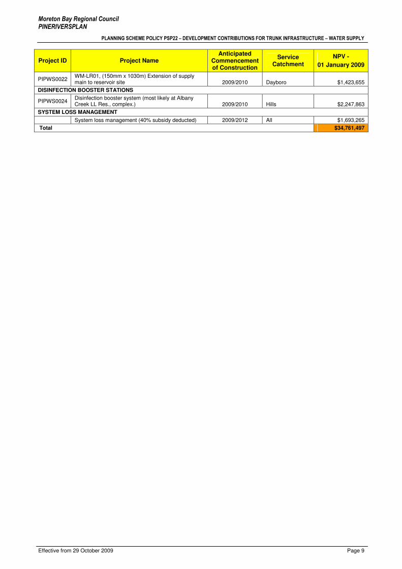
PIPWS0022 WM-LR01, (150mm x 1030m) Extension of supply main to reservoir site 2009/2010 Dayboro $1,423,655
DISINFECTION BOOSTER STATIONS
PIPWS0024 Disinfection booster system (most likely at Albany Creek LL Res., complex.) 2009/2010 Hills $2,247,863
SYSTEM LOSS MANAGEMENT
System loss management (40% subsidy deducted) 2009/2012 All $1,693,265
Total $34,761,497

A
LB
AN
Y C
RE
EK
HL
Z
C
LE
AR
MT
N H
LZ
D
AY
BO
RO
E
AT
ON
S H
ILL
HL
Z
H
ILL
S H
LZ
H
ILL
S L
LZ
K
AL
LL
AN
GU
R
P
ET
RIE
S
AM
FO
RD
VIL
LA
GE
S
AM
FO
RD
DO
WN
S
S
TR
AT
HP
INE
LA
WN
TO
N L
LZ
D
AK
AB
IN
G
RIF
FIN
M
AN
GO
HIL
L
TOTALS
$6,464,040 $5,686,707 $1,559,618 $5,118,429 $2,526,840 $9,534,577 $5,360,735 $1,965,028 $426,840 $4,892,007 $17,586,221 $1,168,271 $1,663,195 $1,351,993 $70,198,930
$5,107,155 $3,041,741 $0 $801,954 $1,305,935 $8,594,251 $10,664,434 $3,437,467 $1,265,724 $2,599,896 $14,333,642 $1,297,127 $1,573,209 $4,705,612 $60,550,496
$86,480 $787,698 $2,148,573 $28,685 $207,594 $1,765,671 $9,993,947 $513,339 $90,986 $18,347 $419,055 $2,415,511 $9,887,279 $5,844,868 $34,761,498
$11,657,675 $9,516,146 $3,708,190 $5,949,068 $4,040,368 $19,894,500 $26,019,116 $5,915,834 $1,783,550 $7,510,251 $32,338,917 $4,880,910 $13,123,683 $11,902,473 $165,510,923
13,226 13,659 3,471 4,387 3,504 29,803 51,270 13,361 1,425 2,806 64,089 12,306 20,507 15,807 258,963
$489 $416 $449 $1,167 $721 $320 $105 $147 $300 $1,743 $274 $95 $81 $86
$386 $223 $0 $183 $373 $288 $208 $257 $888 $927 $224 $105 $77 $298
$7 $58 $619 $7 $59 $59 $195 $38 $64 $7 $7 $196 $482 $370
$881 $697 $1,068 $1,356 $1,153 $668 $507 $443 $1,252 $2,676 $505 $397 $640 $753

Moreton Bay Regional Council PINERIVERSPLAN
PLANNING SCHEME POLICY PSP22 – DEVELOPMENT CONTRIBUTIONS FOR TRUNK INFRASTRUCTURE – WATER SUPPLY
Effective from 29 October 2009 Page 11
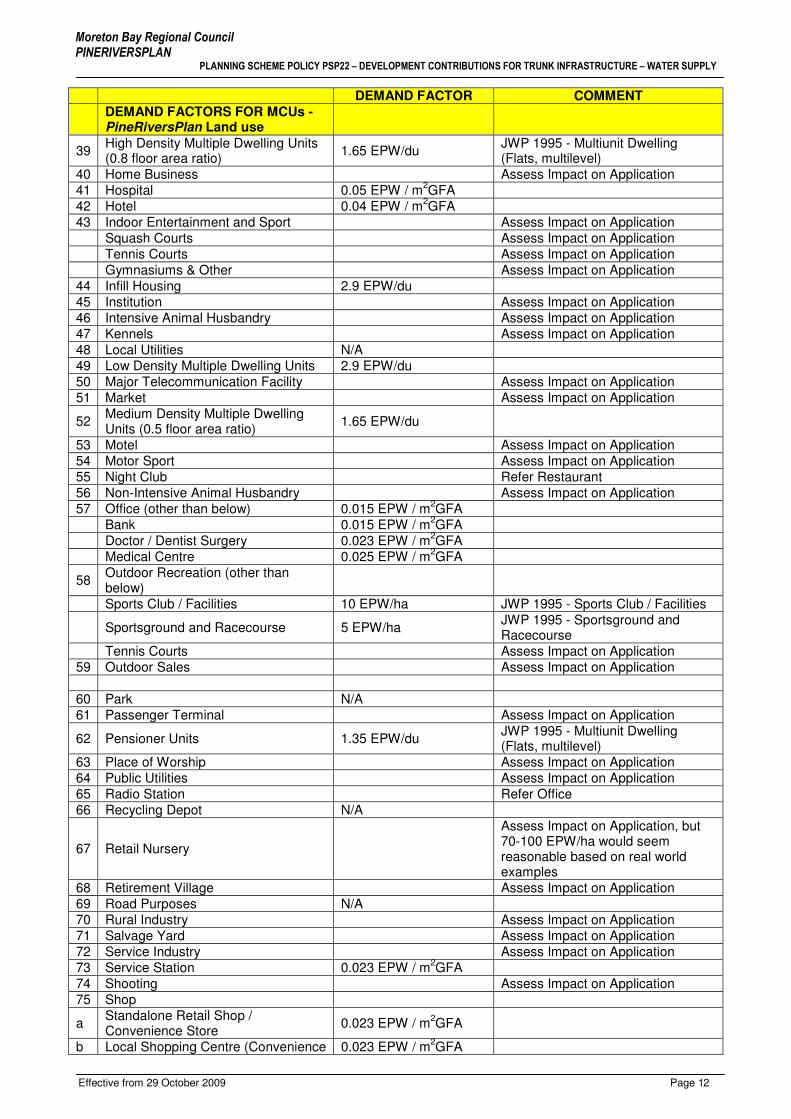
Schedule A: Demand Factors
Demand factors are calculated based on defined uses within the jurisdiction of each relevant planning scheme, and are therefore unique to each district within the Moreton Bay Regional Council area.
Table A - Demand Factors for Water Supply Infrastructure Contributions
DEMAND FACTOR COMMENT
DEMAND FACTORS FOR MCUs - PineRiversPlan Land use
1 Accommodation Units Refer Motel 2 Adult Product Shop Refer Shop 3 Agriculture Assess Impact on Application 4 Airstrip Assess Impact on Application 5 Animal Accommodation Assess Impact on Application 6 Aquaculture Assess Impact on Application
7 Associated Unit 1.65 EPW/du JWP 1995 - Multiunit Dwellings (single level, semi-detached)
8 Bed and Breakfast Accommodation Assess Impact on Application
9 Bulk Garden Supplies 10 EPW/ha JWP 1995 - Warehouses and Bulk Stores
10 Camping Grounds Assess Impact on Application 11 Car Depot Assess Impact on Application 12 Car Park Assess Impact on Application 13 Caravan/Transportable Home Park 50 EPW/ha JWP 1995 14 Caretaker’s Residence 2.9 EPW/du Refer Detached House 15 Cattery Assess Impact on Application 16 Cemetery 2.3 EPW/ha JWP 1995
17 Child Care Centre 0.10 EPW/licensed child and each staff member at planned capacity
JWP 1995 - Child Care Excluding Kindergartens
18 Commercial Services Assess Impact on Application Video Store Assess Impact on Application 19 Community Facilities Assess Impact on Application 20 Concrete Batching Plant Assess Impact on Application
21 Contractor’s Depot 5 EPW/ha JWP 1995 - Builders Yard and Contractors Yard
22 Crematorium Assess Impact on Application 23 Dairy Assess Impact on Application 24 Detached House 2.9 EPW/du 25 Display Home 2.9 EPW/du
26 Domestic Storage 2 EPW/Domestic Storage Building
JWP 1995 - Outbuildings
27 Duplex Dwelling 5.8 EPW/duplex
28 Educational Establishment 0.15 EPW / student and each staff member at planned capacity
Includes Kindergarten
29 Environmental Park N/A 30 Estate Sales Office Refer Office 31 Extractive Industry Assess Impact on Application 32 Farm Forestry Assess Impact on Application 33 Fast Food Delivery Service Assess Impact on Application 34 Food Outlet - Restaurant 0.04 EPW / m
2GFA
Drive Through 0.05 EPW / m2GFA
35 Funeral Parlour Assess Impact on Application 36 General Industry Assess Impact on Application 37 Hardware Shop 0.03 EPW / m
2GFA
38 Hazardous and Offensive Industry (other than below)
Assess Impact on Application
Oil Depot & Refinery 5 EPW/ha JWP 1995 - Oil Depot & Refinery
Moreton Bay Regional Council PINERIVERSPLAN
PLANNING SCHEME POLICY PSP22 – DEVELOPMENT CONTRIBUTIONS FOR TRUNK INFRASTRUCTURE – WATER SUPPLY
Effective from 29 October 2009 Page 12
DEMAND FACTOR COMMENT
DEMAND FACTORS FOR MCUs - PineRiversPlan Land use
39 High Density Multiple Dwelling Units (0.8 floor area ratio)
1.65 EPW/du JWP 1995 - Multiunit Dwelling (Flats, multilevel)
40 Home Business Assess Impact on Application 41 Hospital 0.05 EPW / m
2GFA
42 Hotel 0.04 EPW / m2GFA
43 Indoor Entertainment and Sport Assess Impact on Application Squash Courts Assess Impact on Application Tennis Courts Assess Impact on Application Gymnasiums & Other Assess Impact on Application 44 Infill Housing 2.9 EPW/du 45 Institution Assess Impact on Application 46 Intensive Animal Husbandry Assess Impact on Application 47 Kennels Assess Impact on Application 48 Local Utilities N/A 49 Low Density Multiple Dwelling Units 2.9 EPW/du 50 Major Telecommunication Facility Assess Impact on Application 51 Market Assess Impact on Application
52 Medium Density Multiple Dwelling Units (0.5 floor area ratio)
1.65 EPW/du
53 Motel Assess Impact on Application 54 Motor Sport Assess Impact on Application 55 Night Club Refer Restaurant 56 Non-Intensive Animal Husbandry Assess Impact on Application 57 Office (other than below) 0.015 EPW / m
2GFA
Bank 0.015 EPW / m2GFA
Doctor / Dentist Surgery 0.023 EPW / m2GFA
Medical Centre 0.025 EPW / m2GFA
58 Outdoor Recreation (other than below)
Sports Club / Facilities 10 EPW/ha JWP 1995 - Sports Club / Facilities
Sportsground and Racecourse 5 EPW/ha JWP 1995 - Sportsground and Racecourse
Tennis Courts Assess Impact on Application 59 Outdoor Sales Assess Impact on Application 60 Park N/A 61 Passenger Terminal Assess Impact on Application
62 Pensioner Units 1.35 EPW/du JWP 1995 - Multiunit Dwelling (Flats, multilevel)
63 Place of Worship Assess Impact on Application 64 Public Utilities Assess Impact on Application 65 Radio Station Refer Office 66 Recycling Depot N/A
67 Retail Nursery
Assess Impact on Application, but 70-100 EPW/ha would seem reasonable based on real world examples
68 Retirement Village Assess Impact on Application 69 Road Purposes N/A 70 Rural Industry Assess Impact on Application 71 Salvage Yard Assess Impact on Application 72 Service Industry Assess Impact on Application 73 Service Station 0.023 EPW / m
2GFA
74 Shooting Assess Impact on Application 75 Shop
a Standalone Retail Shop / Convenience Store
0.023 EPW / m2GFA
b Local Shopping Centre (Convenience 0.023 EPW / m2GFA

Moreton Bay Regional Council PINERIVERSPLAN
PLANNING SCHEME POLICY PSP22 – DEVELOPMENT CONTRIBUTIONS FOR TRUNK INFRASTRUCTURE – WATER SUPPLY
Effective from 29 October 2009 Page 13
DEMAND FACTOR COMMENT
DEMAND FACTORS FOR MCUs - PineRiversPlan Land use
Shopping Centre)
c Central Business Shopping Centre (incl. Supermarket)
0.023 EPW / m2GFA
d Major Shopping Centre 0.023 EPW / m2GFA
76 Showroom (other than below) 0.01 EPW / m2GFA
Fruit and Vegetable store >300m2 0.025 EPW / m
2GFA
77 Simulated Conflict Assess Impact on Application 78 Special Use Assess Impact on Application 79 Stock Sales Yard Assess Impact on Application 80 Tourist Cabins Assess Impact on Application
81 Vehicle Sales 10 EPW/ha JWP 1995 - Sales Area Outdoors (Dealers and Car and Boats etc)
82 Veterinary Clinic 0.025 EPW / m2GFA
83 Veterinary Hospital 0.025 EPW / m2GFA
84 Warehouse 10 EPW/ha JWP 1995 - Warehouses & Bulk Stores
DEMAND FACTOR FOR RALs Residential A & Future Urban
Lot Size ≤1200m
2 – (can
accommodate Duplex) 5.8 EPW/lot 15 du/ha developable area
Lot Size < 1200m
2 - to accommodate
Associated Unit 4.55 EPW/lot 15 du/ha developable area
Lot Size < 1200m2 - single dwelling 2.9 EPW/lot 15 du/ha developable area
Residential B & Future Urban Residential B ≤600m
2 4.55 EPW/lot 35 du/ha developable area
Residential B lots >600m2
101.5 EPW/ha developable area
35 du/ha developable area
Special Residential Urban (1250m2) 4.55 EPW/lot 6 du/ha developable area
Special Residential Non-Urban 4.55 EPW/lot 1.25 du/ha developable area Park Residential 4.55 EPW/lot 1.25 du/ha developable area Rural Residential N/A N/A Future Urban Refer Residential A & B Central Business 30 EPW/ha site area Water Planning Assumptions Commercial 30 EPW/ha site area Water Planning Assumptions Local Business 30 EPW/ha site area Water Planning Assumptions Neighbourhood Facilities 30 EPW/ha site area Water Planning Assumptions Urban Village 30 EPW/ha site area Water Planning Assumptions Village Centre 30 EPW/ha site area Water Planning Assumptions Home Industry 10 EPW/ha site area Water Planning Assumptions Service Industry 15 EPW/ha site area Water Planning Assumptions General Industry 30 EPW/ha site area Water Planning Assumptions Extractive Industry 15 EPW/ha site area Water Planning Assumptions Rural (Coast & Riverlands Locality.) 7.5 EPW/ha site area Water Planning Assumptions
Rural (Urban, Major Employment Centre, Catchment, Rural Living, Village, Mt Summit and Forest Localities)
7.5 EPW/ha site area Water Planning Assumptions
Conservation 0 EPW/ha site area Water Planning Assumptions Park & Open Space N/A Water Planning Assumptions Sports & Recreation 15 EPW/ha site area Water Planning Assumptions Special Purposes 15 EPW/ha site area Water Planning Assumptions

Moreton Bay Regional Council PINERIVERSPLAN
PLANNING SCHEME POLICY PSP22 – DEVELOPMENT CONTRIBUTIONS FOR TRUNK INFRASTRUCTURE – WATER SUPPLY
Effective from 29 October 2009 Page 14
Schedule B: Infrastructure Contribution Rates
Table B – Water Supply - Infrastructure Contribution Rates (ICR’s)
Service Catchment ICR / ($/EPW)
DAYBORO DAY $1,068
ALBANY CREEK LLZ ACL $778
ALBANY CREEK HLZ ALC $881
CLEAR MTN HLZ CMH $697
EATONS HILL HLZ EAH $1,356
HILLS HLZ HLA $1,153
HILLS LLZ HLH $668
KALLANGUR KAL $507
PETRIE PET $443
SAMFORD VILLAGE SAM $1,252
SAMFORD DOWNS SAD $2,676
STRATHPINE LAWNTON LLZ STR $505
DAKABIN DAK $397
GRIFFIN GRN $640
MANGO HILL MGH $753
Moreton Bay Regional Council PINERIVERSPLAN
PLANNING SCHEME POLICY PSP22 – DEVELOPMENT CONTRIBUTIONS FOR TRUNK INFRASTRUCTURE – WATER SUPPLY
Effective from 29 October 2009 Page 15
Schedule C: Service Catchments
BUNYA
CAMP MOUNTAIN
CASHMERE
CEDAR CREEK
CLEARMOUNTAIN
GRIFFIN
FERNY HILLS
ALBANY CREEK
ARANAHILLS
HIGHVALE
JOLLYS LOOKOUT
JOYNER
KALLANGUR
KING SCRUB
YUGAR
KOBBLE CREEK
KURWONGBAH
LACEYS CREEK
LAWNTON
WIGHTSMOUNTAIN
DAYBORO
DRAPER
EATONS HILL
EVERTONHILLS
BRENDALE
PETRIE
RUSH CREEK
SAMFORD VALLEY SAMFORDVILLAGE
WARNER
ARMSTRONG CREEK
BRAY PARK
CLOSEBURN
DAKABIN
MANGO HILL
MOUNT GLORIOUS
MOUNT NEBO
MOUNT PLEASANT
MOUNT SAMSON
MURRUMBA DOWNS
SAMSONVALE
STRATHPINE
WHITESIDE
NORTH LAKES
OCEAN VIEW
19.4 19.6 19.8
17.4 17.6 17.8 17.10
15.3 15.5 15.915.7
13.3 13.5 13.7 13.9 13.1113.1
11.1 11.3 11.5 11.7 11.9 11.11
9.1 9.3 9.5 9.7 9.9 9.11 9.13
7.1 7.3 7.5 7.7 7.9 7.13
5.3 5.7
3.3 3.5
1.5
7.11
19.10
11.13
13.13
15.11
5.5
MAP SHEET INDEXPine Rivers Shire

DAYBORO
ROAD
ROWE RD
HAY RD
DAYBORO RD
ROYS
TON
ST
DIANE DR
MCKENZIE ST
BAKE
R RD
TOBY CTMOUNT MEE RD
CREEK RD
MT M
EE R
D
FINGE
RBOA
RD R
D
STRA
IN R
D
STRONG RD
JUFFS RD WST
EDMONDS CT
LAIDLAW ST
ROHLF ST
LACEYS CREEK RD
LYND
HURS
T RD
LESLIE CT
MORRIS ST
HOMESTEAD CT
RODEO DR
HILLVIEW CT
NUGENT RD
WIDDEN PL
GYMKHANA PL
JUFFS RD
MOUNT SAMSON RD
RIVERVIEW CT
SADD
LEBA
CK D
R
MOUNT PLEASANT RD
CRUICE ST
ASPE
L PL
VINER
Y PL
OAKL
AND
CT
BOBBIE CT
JACKAROO CT
BRECKLYN CL
CAMPDRAFT PL
WATT
LEBR
AE S
T
RODERICK ST
BRADLEY ST
BANMORE CT
MCGINN CL
WILLIAMS ST
HORIZON CT
KELLY ST
LEES CROSSING RD
DELANEY RD
ENCHELMAIR ST
STACEY CT
DOWLING ST
TARE
ENA S
T
BRISCOE RD
BRAHMAN CT
HEATHWOOD ST
SELLIN RD
GLOVER RD
MOUNT SAMPSON RD
GLOVER RD
FINGERBOARD RD
ROAD
LACEYS CREEK RD
MCKENZIE ST
ROWE RD
LACEYS CREEK RD
LACEYS CREEK RD
ROAD
LACEYS CREEK RD
SELLIN RD
Copyright Moreton Bay Regional Council and Department of Natural Resources and Water Moreton Bay Regional Council supplies this map under the following conditions:- Mapping detailsare supplied from information contained in the Council's records which may have been furnished
to the Council by other persons. Moreton Bay Regional Council gives no warranty or guarantee ofany kind, expressed, implied, or statutory, to the correctness or accuracy of the map details or the
degree of compliance with any Council standards in this matter. Persons making decisions withfinancial or legal implications must not rely upon the map details shown on this plan for the purposeof determining whether any particular facts or circumstances exist and the Moreton Bay Regional
Council (and its officers and agents) expressly disclaim responsibility for any loss or damage suffered as a result of placing reliance upon this information.
WATER SUPPLY SERVICE CATCHMENTS
Map Number 7.5
Base material reproduced with the permission of the Director-General, Dept, of Natural Resources.
Copyright The State of Queensland (Dept. Natural Resources) 2006.
Copyright Pine Rivers Shire Council 2006 EFFECTIVE FROM 29 October 2009
0 125 250 375 50062.5
Metres
PLANNING SCHEME POLICY PSP22DEVELOPMENT CONTRIBUTIONS FOR TRUNK INFRASTRUCTURE -
WATER
MORETON BAY REGIONAL COUNCILPine Rivers Shire
Regional Water CatchmentsDAYBOROPINE CENTRAL
Local Water CatchmentsALBANY CREEK HLZALBANY CREEK LLZCLEAR MOUNTAIN HLZDAYBORO
EATONS HILL HLZHILLS HLZHILLS LLZKALLANGURNGC
NORTH LAKESPETRIESAMFORDSAMFORD DOWNSSTRATHPINE / LAWNTON LLZ
7.7
9.7
5.3
7.3
9.3
5.75.5
7.5
9.5

NGC
NORTH LAKES
NARANGBA RD
HARE ST
GLIDER ST
KANGAROO ST
MULGARA CT
WALL
AROO
CCT
BOUNTY BLVD
WOMBAT PDE
DINGO ST
BILBY LN
POSSUM PDE
ECHIDNA PDE
QUOKKA ST
WALLABY ST
Copyright Moreton Bay Regional Council and Department of Natural Resources and Water Moreton Bay Regional Council supplies this map under the following conditions:- Mapping detailsare supplied from information contained in the Council's records which may have been furnished
to the Council by other persons. Moreton Bay Regional Council gives no warranty or guarantee ofany kind, expressed, implied, or statutory, to the correctness or accuracy of the map details or the
degree of compliance with any Council standards in this matter. Persons making decisions withfinancial or legal implications must not rely upon the map details shown on this plan for the purposeof determining whether any particular facts or circumstances exist and the Moreton Bay Regional
Council (and its officers and agents) expressly disclaim responsibility for any loss or damage suffered as a result of placing reliance upon this information.
WATER SUPPLY SERVICE CATCHMENTS
Map Number 7.11
Base material reproduced with the permission of the Director-General, Dept, of Natural Resources.
Copyright The State of Queensland (Dept. Natural Resources) 2006.
Copyright Pine Rivers Shire Council 2006 EFFECTIVE FROM 29 October 2009
0 125 250 375 50062.5
Metres
PLANNING SCHEME POLICY PSP22DEVELOPMENT CONTRIBUTIONS FOR TRUNK INFRASTRUCTURE -
WATER
MORETON BAY REGIONAL COUNCILPine Rivers Shire
Regional Water CatchmentsDAYBOROPINE CENTRAL
Local Water CatchmentsALBANY CREEK HLZALBANY CREEK LLZCLEAR MOUNTAIN HLZDAYBORO
EATONS HILL HLZHILLS HLZHILLS LLZKALLANGURNGC
NORTH LAKESPETRIESAMFORDSAMFORD DOWNSSTRATHPINE / LAWNTON LLZ
9.9
7.9
9.11
7.11
9.13
7.13
11.9 11.11 11.13
NORTH LAKESLACEBARK ST
Copyright Moreton Bay Regional Council and Department of Natural Resources and Water Moreton Bay Regional Council supplies this map under the following conditions:- Mapping detailsare supplied from information contained in the Council's records which may have been furnished
to the Council by other persons. Moreton Bay Regional Council gives no warranty or guarantee ofany kind, expressed, implied, or statutory, to the correctness or accuracy of the map details or the
degree of compliance with any Council standards in this matter. Persons making decisions withfinancial or legal implications must not rely upon the map details shown on this plan for the purposeof determining whether any particular facts or circumstances exist and the Moreton Bay Regional
Council (and its officers and agents) expressly disclaim responsibility for any loss or damage suffered as a result of placing reliance upon this information.
WATER SUPPLY SERVICE CATCHMENTS
Map Number 7.13
Base material reproduced with the permission of the Director-General, Dept, of Natural Resources.
Copyright The State of Queensland (Dept. Natural Resources) 2006.
Copyright Pine Rivers Shire Council 2006 EFFECTIVE FROM 29 October 2009
0 125 250 375 50062.5
Metres
PLANNING SCHEME POLICY PSP22DEVELOPMENT CONTRIBUTIONS FOR TRUNK INFRASTRUCTURE -
WATER
MORETON BAY REGIONAL COUNCILPine Rivers Shire
Regional Water CatchmentsDAYBOROPINE CENTRAL
Local Water CatchmentsALBANY CREEK HLZALBANY CREEK LLZCLEAR MOUNTAIN HLZDAYBORO
EATONS HILL HLZHILLS HLZHILLS LLZKALLANGURNGC
NORTH LAKESPETRIESAMFORDSAMFORD DOWNSSTRATHPINE / LAWNTON LLZ 9.11
7.11
9.13
7.13
DAYBORO
JUFFS RD
WOODWARD RD
WATSON RD
MOUNT SAMSON RD
RAY
BOOK
ER C
T
WHITESIDE RD
KOBBLE CREEK RD
POSTMANS TRK
MOUNT SAMPSON RD
ARMS
TRON
G CR
EEK
RD
MIMBURI PL
DON LEE CL
TEMP
ORAR
ILY C
LD R
D
CREEK LNLEES CROSSING RD
ARMS
TRON
G CR
EEK
RD
Copyright Moreton Bay Regional Council and Department of Natural Resources and Water Moreton Bay Regional Council supplies this map under the following conditions:- Mapping detailsare supplied from information contained in the Council's records which may have been furnished
to the Council by other persons. Moreton Bay Regional Council gives no warranty or guarantee ofany kind, expressed, implied, or statutory, to the correctness or accuracy of the map details or the
degree of compliance with any Council standards in this matter. Persons making decisions withfinancial or legal implications must not rely upon the map details shown on this plan for the purposeof determining whether any particular facts or circumstances exist and the Moreton Bay Regional
Council (and its officers and agents) expressly disclaim responsibility for any loss or damage suffered as a result of placing reliance upon this information.
WATER SUPPLY SERVICE CATCHMENTS
Map Number 9.5
Base material reproduced with the permission of the Director-General, Dept, of Natural Resources.
Copyright The State of Queensland (Dept. Natural Resources) 2006.
Copyright Pine Rivers Shire Council 2006 EFFECTIVE FROM 29 October 2009
0 125 250 375 50062.5
Metres
PLANNING SCHEME POLICY PSP22DEVELOPMENT CONTRIBUTIONS FOR TRUNK INFRASTRUCTURE -
WATER
MORETON BAY REGIONAL COUNCILPine Rivers Shire
Regional Water CatchmentsDAYBOROPINE CENTRAL
Local Water CatchmentsALBANY CREEK HLZALBANY CREEK LLZCLEAR MOUNTAIN HLZDAYBORO
EATONS HILL HLZHILLS HLZHILLS LLZKALLANGURNGC
NORTH LAKESPETRIESAMFORDSAMFORD DOWNSSTRATHPINE / LAWNTON LLZ
7.7
9.7
7.3
9.3
7.5
9.5
11.711.3 11.5

NGC
NORTH LAKES
KALLANGUR
NGC
KALLANGUR
NGC
KERR RD EAST
ALMA RD
NARANGBA RD
ENDEAVOUR BLVD
KEITH RD
ANN ST
HUGHES RD EST
BRUCE HIGHWAY
OLD GYMPIE RD
SHEA
VES
RD
KERR RD WEST
HUGHES RD WST
NORTH-SOUTH ARTERIAL RD
ANZA
C AV
NUND
AH R
D
LAKESIDE RD
MARSDEN RD
NICKLIN RD
COOPER RD
AURORA BLVD
LYONS ST
NICHOLSON RD
FISHER RD
CHELMSFORD RD
ROAD
GOODWIN RD
NELLIES LN
BALS
TRUP
RD
LYND
ON S
T
MEMORIAL DR
BOUN
TY BL
VD
LAKEFIELD DR
MCNE
ILL D
RGAIR RD
SCHO
OL R
D
OLIVIA DR
MAUR
ICE
ST
LADY
BIRD
ST
PAGE ST
MARK
ST
ALEXANDER AV
DUFF
IELD
RD
NORT
H LA
KES D
R
ORCHID AV
IAN CT
FLINDERS PDOXLEY ST
CHILT
ON C
R
CHERMSIDE RD
GARDENIA PDE
ABBO
T ST
KLIEN CCT
KNOX ST
ALLISON DR
JOHN
SON
STPURNELL ST
BOLTE CR
DIANE PDE
CLEARVIEW CT
CHEVIOT ST
COPELAND DR
GYP C
T
LAMB ST
GILB
ERT S
T
BOYANDA DR
GANNET CCT
EURE
KA S
T
WHITE HORSE RD
WOOD CT
GREB
E CC
T
PERON CR
SIBLEY ST
LAVERCOMBE DR
DISCOVERY DR
THE C
ORSO
CAMPBELL ST
GIBBS STREET
PENS
ON C
T
ASTLEY PD
COLLEGE ST
PETA
ST
HOYA
CL
ANDR
ACIA
ST
POPLAR PL
WINN ST
MADDOCK ST
SEFT
ON C
T
BROC
KMAN
ST
TOW
NLEY
DR
BEER
WAH
PD
KYAH CL
OTWAY PDE
SOME
RSET
ST
CRAWFORD ST
LOOWA ST
VINE
CR
NUMBAT ST
BARR
IER ST
ALPHA ST
JACANA PDE
BRIMSTONE CT
AINSL
IE ST
PINTAIL ST
RAINBIRD CCT
DANG
ERIE
ST
STANDISH ST
DARBY ST
LIMOSA CT
LOCHSIDE DR
FIG ST
PANDANUS CT
LESLIE ST
EVER
ARD S
T
GRAMPION CCT
ELS CT
CANTOR ST
CALDER ST
JANI
NE C
T
JOWA
RRA S
T
BRINDABELLA CT
LITCH
FIELD
CT
ARRA
KUNE
CR
VIBRANT CT
WYEN
A ST
WARABI CR
TALARA WY
LOCHERN CTAB
ERNA
NT C
T LEIC
HHAR
DT ST
DOTTEREL CR
KENT
ST
OUTL
OOK
CT
PALU
MA C
T
GREGOR ST WEST
MELISSA CCT
FARADAY CT
CANNAWAY ST
LILLYPILLY CT
PRICE ST
ALLENBY C
L
ESK PL
HIGHGATE CT
TRUM CCT
FRANGIPANI CT
LILLY CR
DONNEGAL DR
TALBOT DR
BUTTERFLY DR
CAMP
ION
DR
BURNS RD
CANU
NDRA
ST
SENIOR CL
THOM
SON C
L
EVE
CT
CIVETTA CT
OAK CT
BRICKWORKS RD
LANGER CCT
CONJOLA ST
MOUN
TAIN
BLU
E DR
TYLAH ST
BIRDW
ING
CR
EATON CL
JILLIA
N ST
DAVENPORT PDE
CLIFF
ST
CRANE ST
SUNDOES CT
WILL
MOTT
CT
DUSKY S
TREE
T
WHITFIELD CR
MOUTARA ST
VISTA CT
NIND
ERRY
ST
SANDPIPER AV
HIGHCLIFFE CR
DENISON PDE
PARRY ST
DUGG
AN S
T
SWORDGRASS CT
BALLESTEROS ST
COPPIN ST
HAME
RSLE
Y CT
COOT
HA D
R
LANA
GAN
CCT
VIOLET DR
HIGHET ST
NICK
LAUS
PD
MCPH
ERSO
N CT
PARKSIDE DR
SKIPTON CCT
PAMPLING CT
ATTH
OW ST
LESTER PL
WADER ST
FALDO CT
PLANIGALE CR
CHESTERTON CTGUNSYND DR
GLEESON ST
DARTER CL
FIRST ST
MURPHY ST
MOWBRAY CT
SILKYOAK CT
ASCOT CR
MORG
AN ST
CORAL ST
RILEY CT
HETHERINGTON ST
CASE
Y CT
DRUM
MOND
CT
RIDGE VIEW CT
OCTAVIUS DR
APPLEBY CL
NORT
H ST
PLAYER ST
JOEL CT
WYPE
RFIEL
D CT
SPRINGSURE PDE
BRIAN
CT
MARLAY CT
ALBATROSS CL
CAMR
YN C
T
FREEMAN ST
TAMBORINE CCT
FINNE
GAN
DR
ANDR
EW ST
SILVE
STER
ST
KEY ST
SUNJ
OY PL
NICH
OLAS
ST
BLAZ
EY S
T
TEMPORARILY CLD RD
DONN
ELLY
DR
KALAMUNDA ST
CROW
N ST
CHANTREY CT
GARDNER ST
MEAD
OWS
DR
WASHPOOL ST
MALANDA CT
MUSG
RAVE
ST
ULYSSES ST
COUPLES ST
ROPER PL
JENELLE ST
MACARTHUR DR
EMPEROR CT
THETEN CT
BALLIE ST
CORINTO CT
RAWLINS CRESCENT
KIFT C
T
KAHALA RD
RAYM
ONT S
T
JEZEBEL PL
COTT
ONWO
OD C
CT
BENH
AM AV
E
LYNETTE ST
MIKA
ELA C
T
SAFFRON CT
MINS
TREL
ST
WILLANDRA PDE
FALCON CT
SEARS PD
CONONDALE CCT
BERG
IN ST
CURTIS RD
POSSUM PDE
HOLBORN ST
FORRESTAL CCT
WIRR
AGRO
VE C
CT
RAVENSCRAIG CT
MING DYNASTY CT
CAITL
IN C
T
WILLS ST
LUCAS CT
ELKINGTON CCT
GALAXY CT
RUTHVEN CT
KALA
MOUN
CT
ARCH
ER S
T
NINGAUI CR
KILSY
TH C
T
NORTHAMPTON CT
PINNOCK CR
GLEN
VEAG
H PL
TUFN
ELL S
T
HUXL
EY S
T
GARCIA PD
SYLVANIA ST
SAMS
ON ST
ALDIS PL
WOLL
EMI S
T
BERR
Y LN
LINTO
NE ST
SEAB
ISCU
IT CR
REGA
L PL
HERV
EY ST
APA C
T
JAPONICA ST
CARD
IFF C
T
CARLA CT
ITHACA ST
CASS
AVA C
T
ALPINE CT
NIMBO PL
BALLARA ST
EMIRATES ST
ALEXANDRA AV
MCNI
VEN
CT
IBIS CT
SORRENTO ST
MART
IN C
T
KULTA
RR ST
MONTGOMERIE PD
LEAFWING ST
BRIDGEMAN ST
APPL
EMIN
T CT
DUNNART ST QUOLL CCT
MCCALLUM ST
PRIM
ROSE
CT
ADELAIDE ST
MOONBEAM ST
SHAW CT
GATS
BY C
T
DAVI
D CT
KERR RD
THOMPSON RD
KERR RD EAST
THOM
PSON
RD
ROAD
ROAD
BRUCE HIGHWAY
MARSDEN RD
BRUCE HIGHWAY
OLD G
YMPIE
RD
FINNEGAN DR
Copyright Moreton Bay Regional Council and Department of Natural Resources and Water Moreton Bay Regional Council supplies this map under the following conditions:- Mapping detailsare supplied from information contained in the Council's records which may have been furnished
to the Council by other persons. Moreton Bay Regional Council gives no warranty or guarantee ofany kind, expressed, implied, or statutory, to the correctness or accuracy of the map details or the
degree of compliance with any Council standards in this matter. Persons making decisions withfinancial or legal implications must not rely upon the map details shown on this plan for the purposeof determining whether any particular facts or circumstances exist and the Moreton Bay Regional
Council (and its officers and agents) expressly disclaim responsibility for any loss or damage suffered as a result of placing reliance upon this information.
WATER SUPPLY SERVICE CATCHMENTS
Map Number 9.11
Base material reproduced with the permission of the Director-General, Dept, of Natural Resources.
Copyright The State of Queensland (Dept. Natural Resources) 2006.
Copyright Pine Rivers Shire Council 2006 EFFECTIVE FROM 29 October 2009
0 125 250 375 50062.5
Metres
PLANNING SCHEME POLICY PSP22DEVELOPMENT CONTRIBUTIONS FOR TRUNK INFRASTRUCTURE -
WATER
MORETON BAY REGIONAL COUNCILPine Rivers Shire
Regional Water CatchmentsDAYBOROPINE CENTRAL
Local Water CatchmentsALBANY CREEK HLZALBANY CREEK LLZCLEAR MOUNTAIN HLZDAYBORO
EATONS HILL HLZHILLS HLZHILLS LLZKALLANGURNGC
NORTH LAKESPETRIESAMFORDSAMFORD DOWNSSTRATHPINE / LAWNTON LLZ
9.9
7.9
11.9
9.11
7.11
9.13
7.13
11.11 11.13

NGC
NGC
NGC
NORTH LAKES
NORTH LAKES
KALLANGUR
KALLANGUR
ANZA
C AV
KINSELLAS RD EST
GREGORY RD
RICHA
RD RD
CHERMSIDE RD
LAKEFIELD DR
HALPINE DR
LEE-
ANN
CT
LAMINGTON RD
KINSELLAS RD WST
DANIEL RD
HAMILTON RD
PERIDOT CR
TOPAZ DR
NATH
AN S
T
CHELMSFORD RD KINSE
LLAS
RD
HOYA
CL
FANTAIL CSTOSPREY CT
MORW
ELL C
RSA
TINAY
PDE
GARD
ENIA
PDE
PIPIT CL
WILGA ST
TUCKEROO PDE
MAY ST
NEPTUNE CT
CAPPARIS
RIBE
RRY
CT
WHITECEDAR CCT
HEAT
HCOT
E AV
SATIN
ASH
CTJO
HN S
T
RUBY ST
SUNS
TONE
CCT
ALICE ST
HOBBY CT
SPINEL CT
KALB
ARRI
CT
KURR
AJON
G CC
T
JAME
S ST
MILLETTIA CL
MURIEL ST
TITAN CT
MIDYIM ST
ROBE
RT S
T
GEOR
GE S
THE
RBER
T ST
CRAKE PL
WINIFRED ST
PANDOREA CCT
ROSE ST WEST
PICAB
EEN
CT
ROAD
BRIAR CL
GREY
GUM
ST
TEA-
TREE
PL
WHITF
IELD
CR
ROAD
Copyright Moreton Bay Regional Council and Department of Natural Resources and Water Moreton Bay Regional Council supplies this map under the following conditions:- Mapping detailsare supplied from information contained in the Council's records which may have been furnished
to the Council by other persons. Moreton Bay Regional Council gives no warranty or guarantee ofany kind, expressed, implied, or statutory, to the correctness or accuracy of the map details or the
degree of compliance with any Council standards in this matter. Persons making decisions withfinancial or legal implications must not rely upon the map details shown on this plan for the purposeof determining whether any particular facts or circumstances exist and the Moreton Bay Regional
Council (and its officers and agents) expressly disclaim responsibility for any loss or damage suffered as a result of placing reliance upon this information.
WATER SUPPLY SERVICE CATCHMENTS
Map Number 9.13
Base material reproduced with the permission of the Director-General, Dept, of Natural Resources.
Copyright The State of Queensland (Dept. Natural Resources) 2006.
Copyright Pine Rivers Shire Council 2006 EFFECTIVE FROM 29 October 2009
0 125 250 375 50062.5
Metres
PLANNING SCHEME POLICY PSP22DEVELOPMENT CONTRIBUTIONS FOR TRUNK INFRASTRUCTURE -
WATER
MORETON BAY REGIONAL COUNCILPine Rivers Shire
Regional Water CatchmentsDAYBOROPINE CENTRAL
Local Water CatchmentsALBANY CREEK HLZALBANY CREEK LLZCLEAR MOUNTAIN HLZDAYBORO
EATONS HILL HLZHILLS HLZHILLS LLZKALLANGURNGC
NORTH LAKESPETRIESAMFORDSAMFORD DOWNSSTRATHPINE / LAWNTON LLZ
9.11
7.11
9.13
7.13
11.11 11.13
7.9
9.9
11.9
PETRIE
STRATHPINE / LAWNTON LLZ
CLEAR MOUNTAIN HLZ
VORES RD
HYDE RD
WHITESIDE RD
TODDS RD
SCOUT RD
DAYBORO RD
OSWI
N RD
GUNN
RD
NELSON RD
BYRN
ES R
D NT
H
CIRCU
IT RD
ANDREW CLARKE RD
BYRN
ES R
D
HARRISONS POCKET RD
PROTHEROE RD
GRANT ST
SAMSONVALE RD
PATMAN RD
MIDSON ST
KILLA
RA C
R
BYRN
ES R
D ST
H
LINKS
CR
MOREHEAD RD
BENT
LEY
CT
ROAD
TORRENS RD
MCILLWRAITH RD
JEAN
CL
FERRARI ST
SANDRA CT
REBE
CCA C
R
FAIRLANE ST
ARUNGA ST
FRENCHS RD
BEEVILLE RD
KIRRI AV
GLADYS CT
KARELYN DR
CONSTANTIA
DR
ISIS
RD
BARN
ES R
D
HUNTER CCT
ROMEO CT
DUNCAN CR
MERC
EDES
ST
LINDFIELD DR
COOPS PL
OLERON TCE
KURWONGBAH DR
RUBY CR
ALAWARA ST
JAMES CT
NATIU
S ST
INVERPINE CT
WILL CT
WOMBAT CT
MONA VALE WY
ASHFORD CCT
HOPKINS ST
MARC
IA-BE
LLE
PL
PETE
CT
AFFLECK AV
MARY JANE CT
AMAN
DA JU
NE C
L
JAGU
AR C
T
CARW
ELL A
V
TOKAI CT
GORDONS CROSSING RD EAST
LAWSON CL
PINE VALLEY DR
YOUN
GS C
ROSS
ING
RD
MAURIENNE RD
HANSEN DR
FIREFLY CR
MIRRIGAN CT
ELGATA ST
D'AGU
ILAR
ST
HILLSIDE CT
CALAIS CT
ROLL
S RO
YCE
CT
VOLVO PL
PINEDALE RD
VERD
ON C
T
PAYNE CT
TIMBARRA CT
BEAKEY CL
COURTAGE CT
APRIL CT
CONDAMINE CT
WARGON CT
WARR
INGA
H GR
LAKEVIEW CT
DAIMLER CT
SAPPHIRE CT
FARR PL
HOMESTEAD PL
ISABE
LLA S
T
CHESTER CT
MYUNA PL
FORGAN RD
DAYBORO RD
FORGAN RD
ROAD
YOUNGS CROSSING RD
PROTHEROE RD
ROAD
BEEVILLE RD
ROAD
FORG
AN R
D
Copyright Moreton Bay Regional Council and Department of Natural Resources and Water Moreton Bay Regional Council supplies this map under the following conditions:- Mapping detailsare supplied from information contained in the Council's records which may have been furnished
to the Council by other persons. Moreton Bay Regional Council gives no warranty or guarantee ofany kind, expressed, implied, or statutory, to the correctness or accuracy of the map details or the
degree of compliance with any Council standards in this matter. Persons making decisions withfinancial or legal implications must not rely upon the map details shown on this plan for the purposeof determining whether any particular facts or circumstances exist and the Moreton Bay Regional
Council (and its officers and agents) expressly disclaim responsibility for any loss or damage suffered as a result of placing reliance upon this information.
WATER SUPPLY SERVICE CATCHMENTS
Map Number 11.9
Base material reproduced with the permission of the Director-General, Dept, of Natural Resources.
Copyright The State of Queensland (Dept. Natural Resources) 2006.
Copyright Pine Rivers Shire Council 2006 EFFECTIVE FROM 29 October 2009
0 125 250 375 50062.5
Metres
PLANNING SCHEME POLICY PSP22DEVELOPMENT CONTRIBUTIONS FOR TRUNK INFRASTRUCTURE -
WATER
MORETON BAY REGIONAL COUNCILPine Rivers Shire
Regional Water CatchmentsDAYBOROPINE CENTRAL
Local Water CatchmentsALBANY CREEK HLZALBANY CREEK LLZCLEAR MOUNTAIN HLZDAYBORO
EATONS HILL HLZHILLS HLZHILLS LLZKALLANGURNGC
NORTH LAKESPETRIESAMFORDSAMFORD DOWNSSTRATHPINE / LAWNTON LLZ
9.99.7
11.911.7
9.11
13.913.7
11.11
13.11

KALLANGUR
PETRIE
NGC
STRATHPINE / LAWNTON LLZ
NGC
NGC
NGC
NGC
OGG RD
BICKL
E RD
BRAY
RD
AKERS RD
ANZAC AVTORRENS RD
SAMU
EL R
D
DOHLES ROCKS RD
STATION RD
GYMPIE RD
BRAYS RD
GREENS RD
ELSIE
ST
WIND
SOR
RD
BLYTH RD
WESLEY RD
ROAD
REID
ST
GRAD
I ST
ELM DR
LEIS PDE
BEAT
TIE S
T
WHITTOME ESPL
TODDS RD
GOODRICH RD
SLATER AV
DOON ST
HARD
ING
ST
EYRE AV
CECILY ST
GOODFELLOWS RD
YEBRI ST
WOONARA DR
VINEY AV
TESC
H RD
CAIRNS RD
TI-TREE
PEAR
L AV
EACHAM ST
GOOD
WOOD
RD
GAIL
ST
KUBIA
K DR
TULIP ST
NUTTALL ST
LAWNTON POCKET RD
MCCLINTOCK DR
CREST ST
BARRINGTON CL
WARREGO CR
KEDR
ON RD
NARANGBA RD
MARS
DEN
RD
TI-TREE RD
OISIN ST
DUFF
IELD
RD
JOORA AV
ASHLEY CT
BOONA ST
TOKE
LY C
T
WATE
R ST
PETRIE ST
BRUC
E HI
GHWA
Y
SPRING RD
GOLD
EN AV
SCHO
OL R
D
WATT
LE S
T
WELLINGTON RD
WINTER RD
HALY CT
STOREY RD
ORLA CT
FRENCHS RD
RIVER ST
COLL
EEN
ST
MALLEE ST
LERO
SE AV
CHESTNUT DR
CONNORS ST
SPEN
CER
RD
WASHBROOK CR
ALANA ST
TULIP
TREE
RD
CLAR
EMON
T DR
MELIN
DA S
T
WOODLANDS AV
GARN
ET AV
FACT
ORY S
T
DAYBORO RD
OLD GYMPIE RD
CAMARSH DR
MOHR CT
TAPINI AV WEST
KATE
CT
TAYL
OR S
T
DENIS ST
ELGATA ST
CASTLE HILL DR
LENAE CT
JUNCTION RD
BUTCHER AV
GOSHAWK DR
COTTON STKA
HALA
RD
BURNETT DR
PAUL ST
ALBANY CT
CHAMPAGNE ST
AQUARIUS ST
MACQUARIE DR
GLEN
MORE
ST
STYLES RD
PINE RIVER DR
MIA ST
KAPA
LAMA
RD
MILL
ST
ARMST
RONG
ST
KENT
ST
CASTLE CT
YOUNG ST
WALT
ON C
R
ILLOURA ST
THE CRESCENT
ADAM CT
SEPI
A PL
WEYBA CT
CASCADE CT
TURQUOISE CR
CANIA CR
JODIE STCLARAGH CT
HANL
ON R
D
CHES
TERF
IELD
DR
BLACKALL RD
SELBY ST
ROSEBROOK ST
LOIRE AV
ILING
A PL
BELROSE AV
ENTRY PD
CULGOA CT
KALMIA CL
LAKEVIEW TCE
D'ARCY WY
IVORY CL
WATERWAY CR
BARNARD CR
IVES S
T
PINE CREST DR
BRIGA
LOW
CT
EBERT PDE
ALLSOP ST
BORDEAU CR
BREWSTER CT
EVEL
YN S
T
TWIN LAKES DR
TAND
OOR DR
GREE
NAW
AY S
T
HERM
AN S
T
PARKWAY CR
HAWKHURST CT
AZALEA CT
VERD
ON C
T
DIAM
OND
AV
WYLLIE
ST
NEILS
ON S
T
BRAID
WOOD
AV
MERY
LL C
T
TOUL
OUSE
AV
HAMPSTEAD OUTLOOK
ULTRAMARINE PDE
MUNDIN ST
SHIEL
D ST
ARGY
LE ST
EDGEWATER CT
ANDR
EW ST
AZURE CR
MICA CT
VOLTAIRE CR
PRUS
SIAN
ST
BURRUMBEET ST
FREEDOM DR
CARBEEN CR
TYRR
ELL C
T
LOUGH CT
FERNWOOD CT
YARAKI CT
EGAR CT
BRONZE CT
COTTER CT
BREMER CT
RUE MONTAIGNE ST
DRYSDALE CT
HAMB
LETO
N CR
MASJ
AKIN
CT
COOKE ST
TAVISTOCK CR
HIGHLAND CT
WYARA CT
MAND
Y CT
BALD
WIN ST
CHANCERY CL
BAYBREEZE CR
CLEM
ITSON
CT
BALLARD CT
DUYV
ESTY
N TC
E
MARLE
NE ST
TAPINI AV EAST
ARRAKUNE CR
MACS LN
ABLE ST
LORIENT CT
NORTHQUARTER DR
BOND ST
WATT
LEBR
USH
CT
CAINE ST
BOARDMAN ST
AHERN ST
CYPR
ESS
STCONSTANCE CT
CRYSTE
LLE CT
DIAMANTINA CT
AFFLECK AV
VAUCLUSE CR
CAMION CT
MAGE
NTA S
T
CECCATO DR
ST AIDENS CT
VALMADRE CT
GLEN
DON C
T
FORDINGTON WY
AUGUSTINS CR
TUDOR CL
JULIUS CT
HASTINGS ST
TURNBULL CT
VERONIC CT
PAPERBARK ST
FRESHWATER CREEK RD
SCOTTS CT
HILLCREST CT
SYLVAN CT
PATT
ERSO
N ST
BREWER ST
EUCUMBE
NE DR
KINGSHAND DR
FERN
AN C
T
SAPPHIRE CL
DECKLE RD
CHAB
ROL C
T
KUHR CT
WADE CT
ROSENLUND ST
FUCHSIA PL
FERRIER ST
ALBE
RT S
T
VERMILION AVE
FOLE
Y ST
RAINBOW CTBLAT
CHFO
RD DR
AVONLEA ST
PARIS ST
SYLVESTER DR
LEIS RD WST
CHER
INGTO
N WY
BEEVILLE RD
HUON
CT
HADLEIGH CT
CALVERT CL
TALARA WY
OAKVIEW CT
WARANGA CT
BRITTAINY ST
WINC
HCOM
BE AV
CAEN CT
BROMLEY CL
DIJON
CT
PEDDER CT
JUSTIN ST
AMETHYST CT
CARMODY CT
NOOJEE CT
COWAL CT
NANCY ST
OLD DAYBORO RD
SUTTOR CT
EAGE
R CT
BAINES ST
BARR CT
PEMBRIDGE ST
MICHEL CT
SCENIC DR
CHAMBERY RD
LOCKHART PL
ALONGA CT
COGNAC CT
PUTNEY CT
LEIS RD EST
BAYEAU CT
FLOR
ENCE
ST
RODGERS LN
BOORO
GARI P
L
BONNINGTON CT
LADY
BIRD
ST
KARLOO PL
PAROO PL
HART CT
ROBIN CT
CLYD
E ST
VENETIAN CT
TUFFLEY CT
WHITES RD
ANDREW PETRIE DR
FORESTVILLE RD
MERY
LL R
D
PASCO CT
KATHLEEN ST
JARRAH ST
LIMOSA CT
OCHR
E CR
OBERONG CT
MAUR
EEN
ST
VALMY CT
ALLEGRA CT
GLENCOE ST
MARLER CT
MEDH
URST
ST
FARRINGTON DR
BURDEKIN CT
EUSTON CT
MORETON ST
RELESAH DR
LYDFORD CT
ST Q
UENT
IN R
D
COOPER CT
MORA
N ST
CHATEAU CT
ST MARCEL CT
BRAYS RD
ANZA
C AV
GOODRICH RD
NARANGBA RD
GOODFELLOWS RD
ROAD
DOHLES ROCKS RD
BRAYS RD
BRUC
E HI
GHWA
Y
ROAD
DOHLES ROCKS RD
NARANGBA RD
ROAD
ROAD
GYMP
IE RD
BLACKALL RD
Copyright Moreton Bay Regional Council and Department of Natural Resources and Water Moreton Bay Regional Council supplies this map under the following conditions:- Mapping detailsare supplied from information contained in the Council's records which may have been furnished
to the Council by other persons. Moreton Bay Regional Council gives no warranty or guarantee ofany kind, expressed, implied, or statutory, to the correctness or accuracy of the map details or the
degree of compliance with any Council standards in this matter. Persons making decisions withfinancial or legal implications must not rely upon the map details shown on this plan for the purposeof determining whether any particular facts or circumstances exist and the Moreton Bay Regional
Council (and its officers and agents) expressly disclaim responsibility for any loss or damage suffered as a result of placing reliance upon this information.
WATER SUPPLY SERVICE CATCHMENTS
Map Number 11.11
Base material reproduced with the permission of the Director-General, Dept, of Natural Resources.
Copyright The State of Queensland (Dept. Natural Resources) 2006.
Copyright Pine Rivers Shire Council 2006 EFFECTIVE FROM 29 October 2009
0 125 250 375 50062.5
Metres
PLANNING SCHEME POLICY PSP22DEVELOPMENT CONTRIBUTIONS FOR TRUNK INFRASTRUCTURE -
WATER
MORETON BAY REGIONAL COUNCILPine Rivers Shire
Regional Water CatchmentsDAYBOROPINE CENTRAL
Local Water CatchmentsALBANY CREEK HLZALBANY CREEK LLZCLEAR MOUNTAIN HLZDAYBORO
EATONS HILL HLZHILLS HLZHILLS LLZKALLANGURNGC
NORTH LAKESPETRIESAMFORDSAMFORD DOWNSSTRATHPINE / LAWNTON LLZ
9.9
11.9
9.11
13.9
9.13
11.11
13.11
11.13
13.13
NGC
NGC
NGC
NGC
NGC
KALLANGUR
KALLANGUR
NGC
KORMAN RDBRAYS RD
ROADELIZABETH RD
HENR
Y RD
TESC
H RD
ANTHONY ST
BARRY RD
DANIEL RD
GREENS RD DOHLES ROCKS RD
MARYVALE RD
CAIRNS RD
JABIRU DR
LAPWING CRWHIS
TLER
ST
TI-TREE RD
SPIN
EBILL
CT FRESHWATER CREEK RD
BASIL
ST
STIRLING ESP
VANILL
A AV
WESLEY RD
SAGE PD
GRANDVIEW PD
TOPA
Z DR
PELICAN CL
MERCURY PDE
SATU
RN C
T
GINGER CR
PRATINCOLE CL
WHITEFACE ST
ILLAWARRA CL
VERM
ILION
AVE
BRONZEWING ST
LAVENDER DR
JAEGER CT
VENT
URA C
T
VENU
S CT
WATTLEBIRD ST STARLING ST
COBALT CT
FIRETAIL PL
Copyright Moreton Bay Regional Council and Department of Natural Resources and Water Moreton Bay Regional Council supplies this map under the following conditions:- Mapping detailsare supplied from information contained in the Council's records which may have been furnished
to the Council by other persons. Moreton Bay Regional Council gives no warranty or guarantee ofany kind, expressed, implied, or statutory, to the correctness or accuracy of the map details or the
degree of compliance with any Council standards in this matter. Persons making decisions withfinancial or legal implications must not rely upon the map details shown on this plan for the purposeof determining whether any particular facts or circumstances exist and the Moreton Bay Regional
Council (and its officers and agents) expressly disclaim responsibility for any loss or damage suffered as a result of placing reliance upon this information.
WATER SUPPLY SERVICE CATCHMENTS
Map Number 11.13
Base material reproduced with the permission of the Director-General, Dept, of Natural Resources.
Copyright The State of Queensland (Dept. Natural Resources) 2006.
Copyright Pine Rivers Shire Council 2006 EFFECTIVE FROM 29 October 2009
0 125 250 375 50062.5
Metres
PLANNING SCHEME POLICY PSP22DEVELOPMENT CONTRIBUTIONS FOR TRUNK INFRASTRUCTURE -
WATER
MORETON BAY REGIONAL COUNCILPine Rivers Shire
Regional Water CatchmentsDAYBOROPINE CENTRAL
Local Water CatchmentsALBANY CREEK HLZALBANY CREEK LLZCLEAR MOUNTAIN HLZDAYBORO
EATONS HILL HLZHILLS HLZHILLS LLZKALLANGURNGC
NORTH LAKESPETRIESAMFORDSAMFORD DOWNSSTRATHPINE / LAWNTON LLZ
11.11
13.11
11.13
13.13

CLEAR MOUNTAIN HLZ
WINN RD
DOBSONS RD
ROAD
KUND
ES RD
FISCHLE RD
OLD SCHOOL RD
BROA
DS R
D
ANDREW RD
RON B
ISCHO
F CL
WESSL
ING CL
KAI CT
COUNTRY LN
TOM SCHMIDT CT
JAGE
RA CT
ROSEMONT CT
SAJLA CT
HIGH
LAND
ER C
T
BASIN RD
RANGE VIEW DR
HACKER RD
BROWNLOW CT
TEMPORARILY CLD RD
MOUNT SAMSON RD
BLAKE CT
GRAY
SON
CT
CLEAR MOUNTAIN RD
NIXON RD
HILLS RD
HILLS RD
CLEAR MOUNTAIN RD
JAGE
RA C
T
ROAD
ROAD
MOUNT SAMSON RD
ROAD
ROAD
NIXON RD
Copyright Moreton Bay Regional Council and Department of Natural Resources and Water Moreton Bay Regional Council supplies this map under the following conditions:- Mapping detailsare supplied from information contained in the Council's records which may have been furnished
to the Council by other persons. Moreton Bay Regional Council gives no warranty or guarantee ofany kind, expressed, implied, or statutory, to the correctness or accuracy of the map details or the
degree of compliance with any Council standards in this matter. Persons making decisions withfinancial or legal implications must not rely upon the map details shown on this plan for the purposeof determining whether any particular facts or circumstances exist and the Moreton Bay Regional
Council (and its officers and agents) expressly disclaim responsibility for any loss or damage suffered as a result of placing reliance upon this information.
WATER SUPPLY SERVICE CATCHMENTS
Map Number 13.7
Base material reproduced with the permission of the Director-General, Dept, of Natural Resources.
Copyright The State of Queensland (Dept. Natural Resources) 2006.
Copyright Pine Rivers Shire Council 2006 EFFECTIVE FROM 29 October 2009
0 125 250 375 50062.5
Metres
PLANNING SCHEME POLICY PSP22DEVELOPMENT CONTRIBUTIONS FOR TRUNK INFRASTRUCTURE -
WATER
MORETON BAY REGIONAL COUNCILPine Rivers Shire
Regional Water CatchmentsDAYBOROPINE CENTRAL
Local Water CatchmentsALBANY CREEK HLZALBANY CREEK LLZCLEAR MOUNTAIN HLZDAYBORO
EATONS HILL HLZHILLS HLZHILLS LLZKALLANGURNGC
NORTH LAKESPETRIESAMFORDSAMFORD DOWNSSTRATHPINE / LAWNTON LLZ
11.911.711.5
13.913.7
15.7 15.9
13.5
15.5
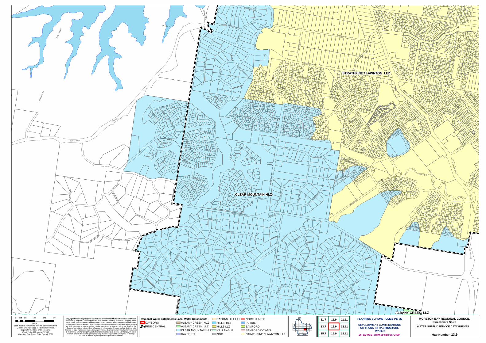
CLEAR MOUNTAIN HLZ
STRATHPINE / LAWNTON LLZ
ALBANY CREEK LLZ
OXFORD ST
FOREST RD
PINED
ALE R
D
HACKER RD
BRISBANE RD
ADAM
S RDLIN
DALE
CT
RAVEN CT
LOWAN ST
STARLING ST
AMAMOOR CT
SAROW DR
TELOPIA CT
OLD NORTH RD
JACK
SONI
A DR
PALMER RD
WAGTAIL PL
CLEMATIS CT
CORVUS DR
REGE
NT S
T
BRACKEN CT
JIMNA CT
PARAKEET CT
GUM ST
PEPPERMINT DR
SHE-OAK CT SHASTA CT
LILLE
Y RD
IRA B
UCKB
Y RD
MITZE ST
DUND
EE S
T
IRA BUCKBY RD WST
SUND
OWN C
T
SPRIN
GBOOK C
T
PARD
ALOT
E PL
DEAN
ST
PALLAS PD
HEATH CT
LAVARACK RD
CORREA CT
TATTLER ST
MEANDER ST
SANDERLING DR
HERON CL
BELL
A ST
TASM
AN S
T
FIR PL
RYAN CT
MONDIAL DR
SWAN
PD
BULIM
BA R
D
PAMELA DR
HAYWARD AV
JARV
IS CT
CORA
L PEA
CL
RUSSET BURBANK PDE
GRAY
RD
KYM CT
COLO
NIAL
DR
HANSEN DR
LOCK
YER
DR
ZITA PLHILLARY DR
YELLOW BUTTON CL
CAMEO CT
TOSCA STMUNDIE PL
RIBBLESDALE CT
GILLAM CR
GIBSON CT
PARAMOUNT DR
CREBRA LN
ANKAFF ST
COMO CCT
SONATA DR
EVEREST ST
WINLOCK CCT
ELMW
OOD
DR
BRENDA CT
GRANDIS CTWHIMBREL ST
WHIPTAIL CT
NANB
AREE
DR
KURRAJONG DR
HEMLOCK ST
HARRISON ST
PATRONE CT
KARENIA ST
GRETA ST
BROWNELL ST
KENTWOOD DR
QUARRION CT
BEECH DR
HUDSON CT
HAZLEMERE CT
MIND
I CT
MAJOR CT
BAYBERRY CR
DEVON ST
LIDO CCT
BRAMWELL CT
LAVE
NDER
CT
WHIP BIRD CT
BARAMBAH CCT
SANDRINGHAM CT
BAROONA RDAVONDALE RD
LACE
WOO
D CC
T
BRAMBLE CL
TREV
OR PL
LUKE
CT
GIRR
AWEE
N PL
TENZING CT
BOOB
OOK C
T
COCK
ATOO
CT
DENALI CCT
GRANVILLE DR
CREEKWOOD CT
CATA
NI C
T
POSSUM ST
LOUISE CT
ELLE CTSAMSONVALE RD
EUCALYPT CT
OAKWOOD RD
BAKER ST
FANTAIL ST
FERNWREN CT
GLEN ST
HOME
LAND
CR
COLIN PL
CORMORANT CL
EDMUND CT
NADINE CT
WIST
ERIA
CT
SILKWOOD CT
MICH
IGAN
CCT
MONTCLARE CT
TAWNY CT
MICHAEL DAVID DR
ISIS
RD
FRANCIS RD
EDITH CT
ANNA CT
RIDGE CT
LATONA S
T
SQUIRE CT
SYCAMORE CT
LUKLA CT
BALL
YALL
A CR
FENTON CL
FORT
RESS
CT
DOYEN CT
CANOPY CL
BOXW
OOD
CT
SUND
ERLA
ND DR
GRANOLA CL
NORLAND ST
NOEL
INE C
T
MORENE CR
FRAN
ZIN D
R
CONIFER CR
RENE CT
AUST
ER AV
SASSAFRAS CT
MORRIS CT
SILVE
RASH
CT
SILVE
R CT
PAUL
ETTE
CT
LEOP
ARD
CT
KIPFL
ER LN
MACI
NTYR
E CT
PIKE LN
MAZZER CT
RANIERI CT
RAYLEA CT
ONTARIO DR
HAZELNUT CL
MAGE
LLAN
CT
VERS
ACE A
VE
PONT
IAC
CCT
AARO
N ST
DELA
WAR
RD
KREMZOW RD
CRAIGAVON ST
LOTT
IE PL
IDAH
O ST
VANTAGE CT
LESTER ST
CASTLEWELLAN CCT
PLOVER CT
KING EDWARD ST
RENWOOD CT
MUSTANG CT
NARR
ELL C
T
FORGAN RD
ATLA
NTIC
PL
BRISTOL CT
NOOK CL
BOSTON CT
EBON
Y CT
RED
GUM
CT
MAYFAIR ST
CURLEW CT
CATALINA AVE
ROAD
YOUNGS CROSSING RD
ROAD
IRA B
UCKB
Y RD
SAMSONVALE RD
ROAD
PINED
ALE R
D
LILLE
Y RD
KREMZOW RD
FRANCIS RD
OLD NORTH RD
ROAD
Copyright Moreton Bay Regional Council and Department of Natural Resources and Water Moreton Bay Regional Council supplies this map under the following conditions:- Mapping detailsare supplied from information contained in the Council's records which may have been furnished
to the Council by other persons. Moreton Bay Regional Council gives no warranty or guarantee ofany kind, expressed, implied, or statutory, to the correctness or accuracy of the map details or the
degree of compliance with any Council standards in this matter. Persons making decisions withfinancial or legal implications must not rely upon the map details shown on this plan for the purposeof determining whether any particular facts or circumstances exist and the Moreton Bay Regional
Council (and its officers and agents) expressly disclaim responsibility for any loss or damage suffered as a result of placing reliance upon this information.
WATER SUPPLY SERVICE CATCHMENTS
Map Number 13.9
Base material reproduced with the permission of the Director-General, Dept, of Natural Resources.
Copyright The State of Queensland (Dept. Natural Resources) 2006.
Copyright Pine Rivers Shire Council 2006 EFFECTIVE FROM 29 October 2009
0 125 250 375 50062.5
Metres
PLANNING SCHEME POLICY PSP22DEVELOPMENT CONTRIBUTIONS FOR TRUNK INFRASTRUCTURE -
WATER
MORETON BAY REGIONAL COUNCILPine Rivers Shire
Regional Water CatchmentsDAYBOROPINE CENTRAL
Local Water CatchmentsALBANY CREEK HLZALBANY CREEK LLZCLEAR MOUNTAIN HLZDAYBORO
EATONS HILL HLZHILLS HLZHILLS LLZKALLANGURNGC
NORTH LAKESPETRIESAMFORDSAMFORD DOWNSSTRATHPINE / LAWNTON LLZ
11.911.7
13.9
15.7
13.7
15.9
11.11
13.11
15.11
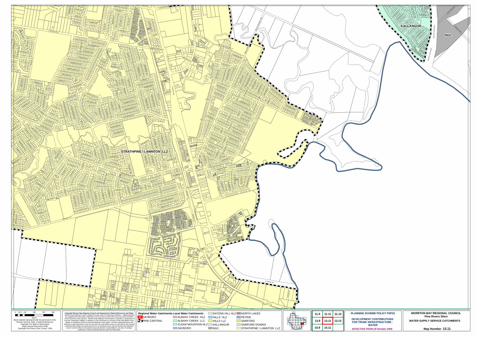
STRATHPINE / LAWNTON LLZ
NGC
KALLANGUR
STANLEY ST
BAKE
R ST
GYMPIE RD
RAILWAY AV
REILEY RD
BULT DR
LEITC
HS R
D
TAED
I AV
IRULA ST
NICOL WY
BAILE
Y CT
KEAT
S AV
DIXON ST
HINKLER CT
FOX ST
CADIZ ST
VIENNA WY
MAREE ST
BEITZ ST
MYLE
S ST
GRAHAMS RD
CENTR
E ST
TAMARIX AV
CALALA DR
WALKER RD
ROSEWOOD DR
UNLEY ST
ANDALUCIA ST
SOVEREIGN AV
NANBAREE DR
AVALON CT
DEL RIO ST
ELLIS
ST
NAVUA ST
SANTA CRUZ ST
SPITF
IRE A
V
BROW
N ST
MACKIE WYPAISLEY DR
TOLOSA ST
LEONE ST
PETER ST
LEON
ARD
CR
DANUBE DR
MECKLEM ST
BRODIEK ST
HEDGE ST
CHIVALRY ST
TODDS RD
TARANDI ST
LAWNTON POCKET RD
BELL
S POC
KET R
D
CAHILL ST
HOPETOUN ST
COOK
ST
HARVEY ST
MITC
HELL
ST
DURHAM CR BATEMAN ST
BRAHMS ST
WALTER CR
WAIR
OA D
R
LEAR
MONT
H ST
SPARKES RD
ULSTER CT
EMBASSY STFEDERATION DR
TECO
MA ST
BINNOWIE ST
SOUT
H PIN
E RD
LEAN
NE C
R
GRENADIER ST
KENSINGTON WY
WINDREST S
T
PALMER PDE
LORRAINE CT
ULMARRA CR
SAIALA CT
GERTRUDE ST
JUDITH ST
LOANE CR
JILLO
ONG
ST
ARTHUR ST
CHAU
CER
PDE
WALSHAM ST
BRENNAN PDE
MARSHALL ST
DUBARDA DR
BUCKBY ST
CASU
ARIN
A DR
CHARLOR ST
SHAKESPEARE PDE
PATRICIA ST
JUNCTION RD
ROBEL ST
GLOUCESTER CR
RONALD ST
GUARDS ST
BRUC
E HI
GHWA
Y
PATMAR ST
MOYL
AN C
T
WAGNER RD
PINE RIVER DR
PLATEAU PDE
LAVARACK RD
DOBSON DR
MELALEUCA DR
ROAD
HALL ST
TORELLIANA DR
WIRRAWAY ST
CLIFFORD ST
COORABIN ST
VALIA
NT CR
GERBERA CR
HALO CT
BURKELL CT
SYMPHONY AV
NOTTINGHAM PDE
BISHO
P CT
JOCK
ERS
ST
ADA ST
SCHUBERT ST
PINAC
LE S
T
DOMINION ST
GARBALA DR
ACLAND DR
SLACK CT
KINROSS ST
WOODBURY AV
EVERGREEN AV
COMINO ST
SAMSONVALE RD
OUTLOOK PDE
KREM
ZOW RD
LANCASTER ST
ALONZO CL
ALDI
NGA S
T
TENN
YSON
ST
BEECHCRAFT ST
WORD
SWOR
TH ST
HIGHF
IELD
CR
TULO
NG C
T
BANKSIA ST
MOTT ST
POPE
AV
FLYNNS LN
CALADIUM ST
HILLSDALE ST
VISCOUNT ST
LINCOLN ST
NYANDA ST
MANS
FIELD
ST
KING
ST
CLARENCE ST
FRENCH AVE
GOULD ST
STIRLING ST
BYGRAVE ST
BEARCAT CT
IANDRA ST
DOIG
ST
MACLEAY ST
LANG ST
CHELTENHAM ST
DELPHINIUM ST
MCKINLAY CR
WELSH ST
BLAND ST
MANTHEY CR
AUST
ER AV
BRACE CL
JILBA ST
PANORAMA ST
PINCHES CT
FLINT ST
BLENHEIM ST
ELIO
TT ST
AVEN
GER
CL
WILS
MITH
ST
GERARD ST
GALVIN ST
NORMAN PL
LUCY ST
MCCALL STDEE CT
JACQUE CT
FRANCIS RD EAST
MAJESTIC ST
MELL
ING
ST
OTTIL
IE ST
DOVER ST
BARWON ST
LARUE CT
KIAH CT
FARROW ST
HELL
CAT C
CT
DUNC
AN ST
ZINNIA ST
BACH ST
ANCO
NA ST
ELIZA ST
KNIGHT ST
CRAIG
AN ST REGENCY CT
STANLEY ST EST
KUMBARI ST
KEND
ALL S
T
CASSIA ST
EBON CT
WRIGHT CT
CEDRELA CR
ELLERDALE ST
DIANNE ST
QUIAMONG CT
GILM
ORE S
T
TARGE ST
ROWL
AND S
T
GARDINER ST
MELBA DR
CROTON ST
BODIAM CT
FRANCIS RD
GRIGG CT
MARQUIS ST
HIGH
VIEW
ST
BROW
NING
CT
ASH CT
MOON
EY S
T
DORIS PL
PAXTON CT
DON CT
TEMPI CT
AIRLIE CT
KAURI CT
DEL C
T
BEAUFORT ST
CONSUL CT
BRUC
E HI
GHWA
Y
ROAD
GYMPIE RD
FRANCIS RD
KENSINGTON WY
ROAD
MAREE ST
ROAD
LEITCHS RD
BELL
S POC
KET R
D
SAMSONVALE RD
KREMZOW RD
Copyright Moreton Bay Regional Council and Department of Natural Resources and Water Moreton Bay Regional Council supplies this map under the following conditions:- Mapping detailsare supplied from information contained in the Council's records which may have been furnished
to the Council by other persons. Moreton Bay Regional Council gives no warranty or guarantee ofany kind, expressed, implied, or statutory, to the correctness or accuracy of the map details or the
degree of compliance with any Council standards in this matter. Persons making decisions withfinancial or legal implications must not rely upon the map details shown on this plan for the purposeof determining whether any particular facts or circumstances exist and the Moreton Bay Regional
Council (and its officers and agents) expressly disclaim responsibility for any loss or damage suffered as a result of placing reliance upon this information.
WATER SUPPLY SERVICE CATCHMENTS
Map Number 13.11
Base material reproduced with the permission of the Director-General, Dept, of Natural Resources.
Copyright The State of Queensland (Dept. Natural Resources) 2006.
Copyright Pine Rivers Shire Council 2006 EFFECTIVE FROM 29 October 2009
0 125 250 375 50062.5
Metres
PLANNING SCHEME POLICY PSP22DEVELOPMENT CONTRIBUTIONS FOR TRUNK INFRASTRUCTURE -
WATER
MORETON BAY REGIONAL COUNCILPine Rivers Shire
Regional Water CatchmentsDAYBOROPINE CENTRAL
Local Water CatchmentsALBANY CREEK HLZALBANY CREEK LLZCLEAR MOUNTAIN HLZDAYBORO
EATONS HILL HLZHILLS HLZHILLS LLZKALLANGURNGC
NORTH LAKESPETRIESAMFORDSAMFORD DOWNSSTRATHPINE / LAWNTON LLZ
11.9
13.9
15.9
11.11
13.11
15.11
11.13
13.13
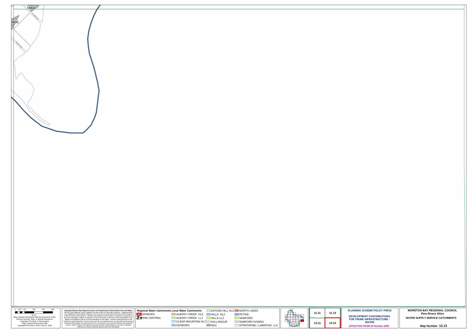
NGC
NGC
TI-TREE RD
REILEY RD
Copyright Moreton Bay Regional Council and Department of Natural Resources and Water Moreton Bay Regional Council supplies this map under the following conditions:- Mapping detailsare supplied from information contained in the Council's records which may have been furnished
to the Council by other persons. Moreton Bay Regional Council gives no warranty or guarantee ofany kind, expressed, implied, or statutory, to the correctness or accuracy of the map details or the
degree of compliance with any Council standards in this matter. Persons making decisions withfinancial or legal implications must not rely upon the map details shown on this plan for the purposeof determining whether any particular facts or circumstances exist and the Moreton Bay Regional
Council (and its officers and agents) expressly disclaim responsibility for any loss or damage suffered as a result of placing reliance upon this information.
WATER SUPPLY SERVICE CATCHMENTS
Map Number 13.13
Base material reproduced with the permission of the Director-General, Dept, of Natural Resources.
Copyright The State of Queensland (Dept. Natural Resources) 2006.
Copyright Pine Rivers Shire Council 2006 EFFECTIVE FROM 29 October 2009
0 125 250 375 50062.5
Metres
PLANNING SCHEME POLICY PSP22DEVELOPMENT CONTRIBUTIONS FOR TRUNK INFRASTRUCTURE -
WATER
MORETON BAY REGIONAL COUNCILPine Rivers Shire
Regional Water CatchmentsDAYBOROPINE CENTRAL
Local Water CatchmentsALBANY CREEK HLZALBANY CREEK LLZCLEAR MOUNTAIN HLZDAYBORO
EATONS HILL HLZHILLS HLZHILLS LLZKALLANGURNGC
NORTH LAKESPETRIESAMFORDSAMFORD DOWNSSTRATHPINE / LAWNTON LLZ
11.11
13.11
11.13
13.13
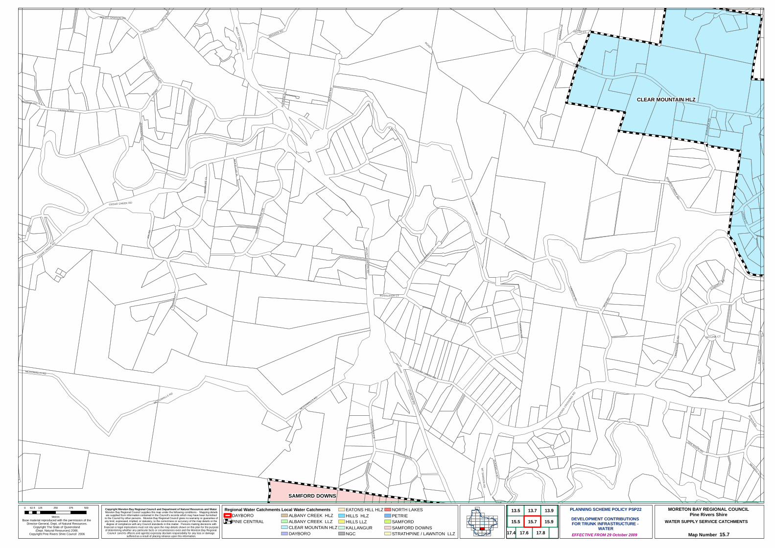
CLEAR MOUNTAIN HLZ
SAMFORD DOWNS
CAMFIN RD
CURLEW RD
LAWSON RD
MCDOWALLS RD
IAN R
D
ALBE
RT R
D
WOOD
S RD
HANSEN RD
ROAD
BROADS RD
LERG
ESSN
ER R
D
BIRRA
LEE
CL
ERNE
ST K
RAUS
E DR
BURA
NDA R
D
OLD MOUNT SAMSON RD
JENNIFER CL
EATO
NS CROSSING RD
BRANCH CREEK RD
COOROORA CR
SERA
YA C
T
CEDARDELL CT
OAK RIVER RDPINBARREN PL
RAMSAY RD
KELSO CT
OLD CEDAR CREEK RD
BUNYA RD
SHANNON CT
MOUNT SAMSON RD
SKYLINE CT
HERRON RD
MASKELL CT
DUNDIALLA WY
MT SAMSON RD
VADA
RD
HILLS RD
CEDAR CREEK RD
STANSELL CT
ROSSLEIGH CT
MCKELLAR PL
LOGAN CT
RAND
ALL C
L
ANDR
EW R
D
CAMFIN RD
CEDAR CREEK RD
ROAD
MOUNT SAMSON RDMCDOWALLS RD
ROAD
MOUNT SAMSON RD
LAWSON RD
MCDOWALLS RD
HERRON RD
HILLS RD
Copyright Moreton Bay Regional Council and Department of Natural Resources and Water Moreton Bay Regional Council supplies this map under the following conditions:- Mapping detailsare supplied from information contained in the Council's records which may have been furnished
to the Council by other persons. Moreton Bay Regional Council gives no warranty or guarantee ofany kind, expressed, implied, or statutory, to the correctness or accuracy of the map details or the
degree of compliance with any Council standards in this matter. Persons making decisions withfinancial or legal implications must not rely upon the map details shown on this plan for the purposeof determining whether any particular facts or circumstances exist and the Moreton Bay Regional
Council (and its officers and agents) expressly disclaim responsibility for any loss or damage suffered as a result of placing reliance upon this information.
WATER SUPPLY SERVICE CATCHMENTS
Map Number 15.7
Base material reproduced with the permission of the Director-General, Dept, of Natural Resources.
Copyright The State of Queensland (Dept. Natural Resources) 2006.
Copyright Pine Rivers Shire Council 2006 EFFECTIVE FROM 29 October 2009
0 125 250 375 50062.5
Metres
PLANNING SCHEME POLICY PSP22DEVELOPMENT CONTRIBUTIONS FOR TRUNK INFRASTRUCTURE -
WATER
MORETON BAY REGIONAL COUNCILPine Rivers Shire
Regional Water CatchmentsDAYBOROPINE CENTRAL
Local Water CatchmentsALBANY CREEK HLZALBANY CREEK LLZCLEAR MOUNTAIN HLZDAYBORO
EATONS HILL HLZHILLS HLZHILLS LLZKALLANGURNGC
NORTH LAKESPETRIESAMFORDSAMFORD DOWNSSTRATHPINE / LAWNTON LLZ
13.9
15.7
13.7
15.9
17.6 17.8
13.5
15.5
17.4

CLEAR MOUNTAIN HLZ
ALBANY CREEK LLZ
EATONS HILL HLZ
ALBANY CREEK HLZ
BUNYA RD
CHURCH RD
CASHS RD
BURANDA RD
WESTON DR
GARRAWIN CT
BARKER ST
HEATHER ANNE DR
CLAYFIELD RD
RINN
AV
HARR
IER
PL
EDEN DR
MILFORD CT
PAULI CT
BOLAND CT
LILLE
Y RD
ROAD
MONT
EGO
CT
THOMAS CT
SALISBURY CT
LASC
ELLE
CT
ALBE
RT R
D
IRELAND CT
LAMA
UR S
T
ALBION RD
DRAPERS RD
HARLEY CT
CRIBB RD
BUNY
A CRO
SSIN
G RD
LAUREL CTBEECH DR
TERBEN ST
SARAH CT
BRANCH CREEK RD
CORYMBIA LN
RAVE
N CT
MORG
AN RD
SOMERS ST
HENR
Y CT
PADDY R
D
WHIM
BREL
ST
BELLBIRD CT
FITZGERALD CT
BUNYA PINE CT
WARNER RD WST
OLD N
ORTH
RD
CHRI
STIN
E DR
STEILER CT
TALISMAN CT
SCEN
IC C
L
BULIM
BA R
D
LOWA
I CT
FAHEYS RD
DENNISTON CT
KEST
REL C
T
JANE CT
ROTH
SCHI
LD S
T
EXPL
ORER
DR
BREEN DR
MINE
RVA C
T
HIDDEN VALLEY DR
STAR
LING
ST
ASHLEIGH CT
MCCARTNEY CT
QUEEN ELIZABETH DR
MAYFL
OWER ST
ALLEN RD
MAYN
ARD
DR
BIRMINGHAM ST
SYLVIA CT
HODGE RD
ALBERIC CT
DOVE
CT
SARA
BAND
DR
ROUTLEDGE CT
HILL GR CL
COROWA CT
WYLAH CT
CASSINIA CT
SAVOY PL
COORPAROO RD
PRASADA CT
OLYMPUS CT
MASKELL CT
RIVER
GUM
DR
FRYA
R CT
JANNA CT
JANUS CT
WIND
SONG
ST
SOUTH PINE RD
TIBBI
TS C
L
JUBIL
EE CT
KARENA ST
DUDLEY CT
TAMMY CT
MARY CT
CABARITA CR
HOARE CT
HERO ST
MELIA CT
DUET CT
CALYPSO CT
LA V
ISTA
CT
GOWRIE ST
PEGAS
US AV
GLEN
EAT
ON ST
GIRRAH ST
DIANA CT
FLETCHERS RD
ZORINA CT
CLEAR MOUNTAIN RD
RIVERSLEIGH CR
TONNERE CT
TANAGER ST
DAWNET
A CT
TURB
AL CT
RIVE
R OA
KS D
R
SUNB
LEST
CT
BANKS CT
OPHELIA CR
ORION AV
MARINA CT
BUNYA PA
RK DR
GOLD CREEK CT
SONORA CT
KINGF
ISHER
ST
TIFFANY CT
EATONS CROSSING RD
BETH
CT
CHOWCHILLA ST
MEILL
AND
CT
MARYLIN TCE
SALLY CT
GUMVIEW ST
ROCHEADON DR
FIREWHEEL CT
ROMULUS ST
PEAC
E CT
VALENCIA CT
ATOL
L CR
ROUN
DELA
Y CT
ATKINSON CT
GHOST GUM CT
EDENDERRY CT
PASCALI CR
PRION CT
BONSOIR CT
FLAMINGO DR
LAMBERT CT
LEE CL
MABELLA CT
TRIBUTARY CT
BART
ON C
T
CORS
O ST
ARIANNA CL
ATLAS CT
HARRY CT
CRESSBROOK DR
APOL
LO C
T
CONFLUENCE CT
BRIAN MORRISON RD
CLAPHAM CT
FINCH CT
MONICA CT
BASSINO CT
SANCTUARY CT
ANGEL CT
GEORGETTE CT
GLENLYON CT
WEBB CT
BEND CTCROSSING DR
FELICIA PL
MEMOIRE CT
JAMES CASH CT
OSIRA CL
ELWOOD CT
EXCELCIA CT
PARADISE CT
BLAXLAND CL
STARINA CT
WARNER RD
ROSMARIN AV
CORSO PL
PEER
CT
JASON TCE
GARGANEY ST
PORTIA CL
PEACOCK ST
MASCOTTE CT
SUNB
EAM
CT
JESS
ICA C
T
FAIRY
PL
LARK CT
FEE PL
BONICA CT
PERL
A CL
HANDEL CT
HYLACOLA DR
ILONA PL
PLOVER CT
AJAX
CT
CAND
ELLA
CT
APEX GR
WARNER RD
SOUT
H PIN
E RD
EATO
NS CR
OSSIN
G RD
EATONS CROSSING RD
BUNY
A RD
HODG
E RD
ROAD
SOUT
H PIN
E RD
LILLE
Y RD
OLD
NORT
H RD
EATONS CROSSING RD
EATONS CROSSING RD
Copyright Moreton Bay Regional Council and Department of Natural Resources and Water Moreton Bay Regional Council supplies this map under the following conditions:- Mapping detailsare supplied from information contained in the Council's records which may have been furnished
to the Council by other persons. Moreton Bay Regional Council gives no warranty or guarantee ofany kind, expressed, implied, or statutory, to the correctness or accuracy of the map details or the
degree of compliance with any Council standards in this matter. Persons making decisions withfinancial or legal implications must not rely upon the map details shown on this plan for the purposeof determining whether any particular facts or circumstances exist and the Moreton Bay Regional
Council (and its officers and agents) expressly disclaim responsibility for any loss or damage suffered as a result of placing reliance upon this information.
WATER SUPPLY SERVICE CATCHMENTS
Map Number 15.9
Base material reproduced with the permission of the Director-General, Dept, of Natural Resources.
Copyright The State of Queensland (Dept. Natural Resources) 2006.
Copyright Pine Rivers Shire Council 2006 EFFECTIVE FROM 29 October 2009
0 125 250 375 50062.5
Metres
PLANNING SCHEME POLICY PSP22DEVELOPMENT CONTRIBUTIONS FOR TRUNK INFRASTRUCTURE -
WATER
MORETON BAY REGIONAL COUNCILPine Rivers Shire
Regional Water CatchmentsDAYBOROPINE CENTRAL
Local Water CatchmentsALBANY CREEK HLZALBANY CREEK LLZCLEAR MOUNTAIN HLZDAYBORO
EATONS HILL HLZHILLS HLZHILLS LLZKALLANGURNGC
NORTH LAKESPETRIESAMFORDSAMFORD DOWNSSTRATHPINE / LAWNTON LLZ
13.9
15.7
13.7
15.9
17.8
13.11
15.11
17.1017.6

ALBANY CREEK LLZ
STRATHPINE / LAWNTON LLZ
ALBANY CREEK HLZ
CRIBB RD
DAVIS LN
LEITC
HS R
D
GREENSILL RD
JOHNSTONE RD
SCOU
TS C
ROSS
ING
RD
TERRENCE RD
DUNTROON ST
MAUD
ST
BEVLIN CT
MOON
BI S
T
WRUCK CR
WIND
EMER
E RD
WILLOW ST
DOLCOATH ST
CUTHBERT ST
DEAK
IN ST
JADE
ST
GIRRAH ST
GASKILL CT
WILSON AV
SELIGAN ST
DUKA
MP ST
BOWEN AV
EARL
ST
JACARANDA DR
PLEA
SANT
DR
AGNE
S ST
AVON CR
WARA
TAH
ST
MAX CT
CURRAJON ST
BALSWIDDEN ST
KEON
G RD
GOWRIE ST
KENW
ORTH
PL
BELCONNEN CR
FAHEYS RD
OLD NORTHERN RD
CHAPMAN CT
GILFORD CR
DOONSIDE PDE
LINKFIELD CONNECTION RD
ALDI
NGA S
T
ROAD
STRATHWYN ST
ERNIE ST
KARENA ST
ALBANY CREEK RD
GEORGE ST
OSCAR CR
LEITC
HS RD
STH
CROFTY ST
WHITES CT
JULLYAN ST
STEWART RD
DEVORAN ST
RUFUS CT
MALVERN RD
CATHY CT
SUSSEX DR
PINAC
LE S
T
GARRET ST
FRED CAMPBELL DR
FOLKESTONE AV
STEP
HEN S
T
FERGUSON ST
YORK
CT
COLO
RADO
CR
RAFTER AV
PATH
WAY
LAWN ST
JESSIE CT
NILE C
T
THAMES ST
LEVA
NT S
T
JANICE ST
TOMA
NBIL
CT
SESAME ST
KELV
IN CT
WIGAM CT
BREN
DALE
ST
ARUN
DELL
CT
SOUTH PINE RD
DERBY CT
CRESCENT CT
ROAD
Copyright Moreton Bay Regional Council and Department of Natural Resources and Water Moreton Bay Regional Council supplies this map under the following conditions:- Mapping detailsare supplied from information contained in the Council's records which may have been furnished
to the Council by other persons. Moreton Bay Regional Council gives no warranty or guarantee ofany kind, expressed, implied, or statutory, to the correctness or accuracy of the map details or the
degree of compliance with any Council standards in this matter. Persons making decisions withfinancial or legal implications must not rely upon the map details shown on this plan for the purposeof determining whether any particular facts or circumstances exist and the Moreton Bay Regional
Council (and its officers and agents) expressly disclaim responsibility for any loss or damage suffered as a result of placing reliance upon this information.
WATER SUPPLY SERVICE CATCHMENTS
Map Number 15.11
Base material reproduced with the permission of the Director-General, Dept, of Natural Resources.
Copyright The State of Queensland (Dept. Natural Resources) 2006.
Copyright Pine Rivers Shire Council 2006 EFFECTIVE FROM 29 October 2009
0 125 250 375 50062.5
Metres
PLANNING SCHEME POLICY PSP22DEVELOPMENT CONTRIBUTIONS FOR TRUNK INFRASTRUCTURE -
WATER
MORETON BAY REGIONAL COUNCILPine Rivers Shire
Regional Water CatchmentsDAYBOROPINE CENTRAL
Local Water CatchmentsALBANY CREEK HLZALBANY CREEK LLZCLEAR MOUNTAIN HLZDAYBORO
EATONS HILL HLZHILLS HLZHILLS LLZKALLANGURNGC
NORTH LAKESPETRIESAMFORDSAMFORD DOWNSSTRATHPINE / LAWNTON LLZ
13.11
15.11
13.9
15.9
13.13
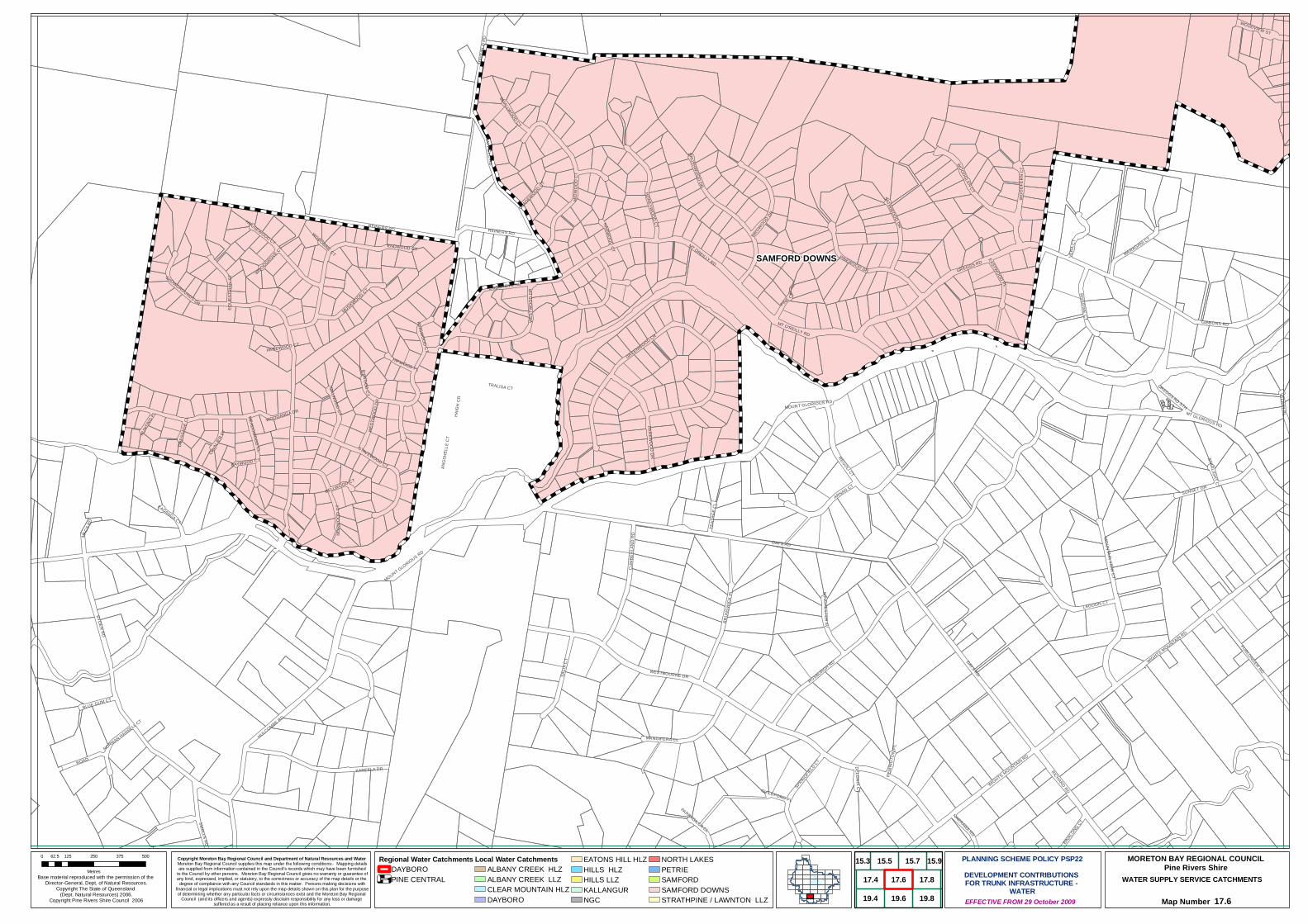
SAMFORD DOWNS
DAYS RD
REINERS RD
KAREELA DR
RYDER RD
SALIX
CT
GIBBONS RD
MOUNT GLORIOUS RD
HULCOMBE RD
FURLONGER RD
ROAD
REGOLI CT
ARNAN CT
CUMB
ERLA
ND R
D
WOODGLEN CT
BRUN
SWIC
K PL
LAGOON CT
ROXBURGH RD
RICHARD RD
MANGIFERA CL
ENDWOOD CT
HONEYWOOD CT
GREGGS RD
BRUSHWOOD DR
MT OREILLY RD
MIDW
OOD
CT
WESTBOURNE DR
TRALISA CT
GREENWOOD CR
RIVERINE CT
COSGROVE RD
PINEWOOD DR
WIGHTS MOUNTAIN RD
MT O'REILLY RD
VERA
CT
BIRDWOOD DR
MUSKWOOD CT
MARAGANI CT
HAIG
H CR
SATINWOOD DR
MOUNTAIN VIEW CT
MACS
RD
STAVEWOOD CT
VALRAY PLWOODVIEW ST
MALWOOD CT
WINCHESTER AV
SHOWGROUNDS DR
SUNSET GR
PARKWOOD DR
WOOD
FERN
CT
SPRINGFIELD CT
EASTWOOD PL
HOUSEWOOD CT
EQUE
STRI
AN C
T
WEST
WOOD
DR
PINE CT
BINALONG CT
NARRAWA RD
KADANGA CT
NORW
OOD
CT
BLUE GUM CT
ANGS
HELL
E CT
WOODANGA DR
SMALLS RD
SMALLWOOD CT
HIPWOOD PL
MEADOWOOD CL
CAVA
LIER C
T
TEAT
REE
CL
RINGWOOD CT
BYWOOD CT
GREGGS RD STH
HARWOOD CT
GLADEWOOD CT
HUNT
ING PL
BAYWOOD CT
PARRAGILGA CL
DELONIX CT
BELLWOOD CT
NORMAN HANSELL CT
MT GLORIOUS RD
WOODGROVE CT
REMI
NGTO
N PL
MAYF
IELD
RD
GUILDFORD PL
DRES
SAGE
CL
STARLIGHT CT
WOODBINE CT
PAGEWOOD CT
WIGHTS MOUNTAIN RD
REINERS RD
DAYS RD
MOUNT GLORIOUS RD
WEST
WOOD
DR
MAYFIELD RD
Copyright Moreton Bay Regional Council and Department of Natural Resources and Water Moreton Bay Regional Council supplies this map under the following conditions:- Mapping detailsare supplied from information contained in the Council's records which may have been furnished
to the Council by other persons. Moreton Bay Regional Council gives no warranty or guarantee ofany kind, expressed, implied, or statutory, to the correctness or accuracy of the map details or the
degree of compliance with any Council standards in this matter. Persons making decisions withfinancial or legal implications must not rely upon the map details shown on this plan for the purposeof determining whether any particular facts or circumstances exist and the Moreton Bay Regional
Council (and its officers and agents) expressly disclaim responsibility for any loss or damage suffered as a result of placing reliance upon this information.
WATER SUPPLY SERVICE CATCHMENTS
Map Number 17.6
Base material reproduced with the permission of the Director-General, Dept, of Natural Resources.
Copyright The State of Queensland (Dept. Natural Resources) 2006.
Copyright Pine Rivers Shire Council 2006 EFFECTIVE FROM 29 October 2009
0 125 250 375 50062.5
Metres
PLANNING SCHEME POLICY PSP22DEVELOPMENT CONTRIBUTIONS FOR TRUNK INFRASTRUCTURE -
WATER
MORETON BAY REGIONAL COUNCILPine Rivers Shire
Regional Water CatchmentsDAYBOROPINE CENTRAL
Local Water CatchmentsALBANY CREEK HLZALBANY CREEK LLZCLEAR MOUNTAIN HLZDAYBORO
EATONS HILL HLZHILLS HLZHILLS LLZKALLANGURNGC
NORTH LAKESPETRIESAMFORDSAMFORD DOWNSSTRATHPINE / LAWNTON LLZ
15.7
19.6
17.6
19.8
17.8
15.5
19.4
17.4
15.3 15.9

HILLS LLZ
SAMFORD
HILLS HLZ
SAMFORD DOWNSCLEAR MOUNTAIN HLZ
WILLEM DR
RETREAT CT
NIGBER RD
MT SAMSON RD
MCLE
AN R
D
ASCOT CR
BURTON LNGIBBONS RD
BYGOTTS RD
BERESFORD DR
KAY DR
CARSON DR
WARWICK LN
VALRAY PL
CURLEW RD
BREEN DR
ALLE
N RD
COONAN RD
BLUE HILLS DR
GREGGS RD STH
CAMP
MOU
NTAI
N RD
CURRELL CCT
DICKENS PL
ROAD
SYLV
ATER
RE C
T
CANNINGTON CT
BERGIN CREEK RD
CASH AV
PINEC
ONE C
T
BUNYA RD
PETERSON RD
JANCY CT
WOODVIEW ST
RIDGEWOOD CT
CASH AV NTH
CORB
ETT S
T
FURLONGER RD
SERENDIPITY DR
HAVELOCK CT
ASHW
OOD C
T
CHAL
MERS
CT
LINKWOOD DR
INGRID ST
NARRIEN CT
DUNN
CT
MAILMAN
S TRK
BENJ
AMIN
CL
PHOEBE CT
BRAH
AN CT
MAYF
AIR D
R
SCHOOL RD
MARY
RIN
G DR
BALM
ORAL
RD
HUTTON RD
TREN
THAM
PL
ERNEST CT
REGATTA AV
AUTUMNWOOD CT
UPPER CAMP MOUNTAIN RD
MAHDEEN PL
SHEPPARD ST
JUNC
TION S
T
MOUNT GLORIOUS RD
STATION ST
SAMFORD RD
PROGRESS ST
LIUDA CT
NAVILLUS PDE
WOODTOP C
T
CORE
LLA A
V
BERTH
A CT
GREER CT
MT GLORIOUS RD
MEREDITH CT
WIGHTS MOUNTAIN RD
VILLAGE LN
MILLINER CT
SILVERWOOD CT
BERG
MAN ST
MAIN
ST
SAMFORD RD
COONAN RD
NIGB
ER R
D
ROAD
ROAD
BYGOTTS RD
SAMFORD RD
CAMP MOUNTAIN RD
GIBBONS RD
BUNYA RD
ROAD
ROAD
MAILMANS TRK
SAMFORD RD
Copyright Moreton Bay Regional Council and Department of Natural Resources and Water Moreton Bay Regional Council supplies this map under the following conditions:- Mapping detailsare supplied from information contained in the Council's records which may have been furnished
to the Council by other persons. Moreton Bay Regional Council gives no warranty or guarantee ofany kind, expressed, implied, or statutory, to the correctness or accuracy of the map details or the
degree of compliance with any Council standards in this matter. Persons making decisions withfinancial or legal implications must not rely upon the map details shown on this plan for the purposeof determining whether any particular facts or circumstances exist and the Moreton Bay Regional
Council (and its officers and agents) expressly disclaim responsibility for any loss or damage suffered as a result of placing reliance upon this information.
WATER SUPPLY SERVICE CATCHMENTS
Map Number 17.8
Base material reproduced with the permission of the Director-General, Dept, of Natural Resources.
Copyright The State of Queensland (Dept. Natural Resources) 2006.
Copyright Pine Rivers Shire Council 2006 EFFECTIVE FROM 29 October 2009
0 125 250 375 50062.5
Metres
PLANNING SCHEME POLICY PSP22DEVELOPMENT CONTRIBUTIONS FOR TRUNK INFRASTRUCTURE -
WATER
MORETON BAY REGIONAL COUNCILPine Rivers Shire
Regional Water CatchmentsDAYBOROPINE CENTRAL
Local Water CatchmentsALBANY CREEK HLZALBANY CREEK LLZCLEAR MOUNTAIN HLZDAYBORO
EATONS HILL HLZHILLS HLZHILLS LLZKALLANGURNGC
NORTH LAKESPETRIESAMFORDSAMFORD DOWNSSTRATHPINE / LAWNTON LLZ
15.7 15.9
19.6
17.6
19.8
17.8 17.10
19.10
15.5

HILLS LLZ
ALBANY CREEK HLZ
HILLS LLZ
HILLS HLZ
HILLS LLZ
CLEAR MOUNTAIN HLZALBANY CREEK LLZ
FARM RD
VIEW CR
TIMMS RD
ROAD
ALLEN RD
REGINALD AV
BUNY
A LAK
E CT
GARD
ONIA
PL
HUTTON RD
BARBER RD
BUNYA RD
ALPINIA CT
COLLINS RD
PEPPER RD
KOAL
A CT
JAGORA DR
YINGA
LLY D
R
THIESS DR
WEST
ON D
R
NYORA ST
DANIEL DR
BUCKLAND RD
OLD NORTHERN RD
LEMM STTARAWILL CR
PETTYS RD
FRIG
O CT
LEATHERWOOD DR
LISTONIA DR
BOON
DOOM
A CCT
STRATHFORD AV
LYNAGH CT
ALRE
X ST
BORD
ER C
TSILK
YOAK WY
WALKERS RD
BALLINGER CR
PATHWAY
YATH
ONG C
T
LANC
EWOO
D DR
KEONG RD
TABU
LAM
DROAKMONT CR
THE BOULE
VARD
ALLAMANDA CR
FAIRHAVEN PL
JOHN
ST
HILL
ENVA
LE AV
ALLAWAH ST
KARM
A PL
PARKLEIGH ST
COWRIE
PDE
ELIZA
BETH
ST
MARA
RA C
T
KOST
A PL
LARWOOD PL
CHISHOLM CT
CRESSBROOK DR
CANE
BY S
T
EGRET CT
HEND
ERSO
N RD
TOWRI ST
TINAROO CT
BALF
OUR
ST
FRAN
CIS RD
ALBANY FOREST DR
MOOG
ERAH
CT
VAUTON CT
HAVENWOOD CT
TARCOOLA AV
LINKWOOD DR
EDWARDS DR
DAWN RD
HENG
IS CT
MILLER PDE
TEAK CT
TEENAN ST
GARFIELD TCEBENNETTS RD
JOB P
L
LONGFORD ST
SILVEREYE CR
LANGLEY PL
CHINOOK ST
LEONARDA DR
HALE ST
QUANDONG CR
WOODFIELD CT
MARI
ANNE
ST
LAMB
ERTIA
CT
UKAMIRRA CT
MAREEBA CT
TAUN
CT
CASTLEROY CT
BLUEWOOD CT
DISS CT
FIDDLE CT
WOODHILL RD
BIGGS CT
CHAM
PIONS
CT
THE JINKER TRK
BORO
NIA C
T
DUGA
NDAN
RD
BAUP
LE ST
TALLEBUDGERA CR
ST ANDREWS CT
BARNEY ST
LYNWOOD CT
CASITA CT
HARB
ORD
PL
PINEHURST CT
ALAN CT
CRAMPTON CT
LONGREEF CT
DENA ST
HUNT
INGD
ALE
CT
WANDA CT
CEDA
R CL
MERANTI CR
NARRAB
EEN RD
YARRAMAN ST
TIVER
TON
ST
EXPL
ORER
DR
CADA
GI C
T
LAMBETH CT
PLUCKS RD
JONQUIL CT
CONN
ELLY
CT
TARNOOK DR
GLEN
VALE
CT
RELF CT
CORDIA CT
SHOR
T ST
BLAC
KWOO
D DR
PETE
R ST
SOU
TH
MANLY CL
FOREST CT
FIESTA CT
JACQUELINE CT
FREDERICK ST
HAWKES AV
ATRIUM WAY
MAGPIE PL
IRONBARK CCT
DOWNEY CT
WILLS CT
DELVIN CT
TURNBERRY CR
OLYMPIC CT
BERN
AYS
CL
BIRCH CT
BELAH CT
GUM LEAF CT
GLEN
EAGL
ES C
R
CARROLL CT
HAMPSHIRE TCE
PETE
R ST
NOR
TH
BEL-AIR CT
BOREE CT
BOWE
RS R
D NT
H
BRIGHTON CT
MATHEW CL
CARNARVON CT
WIDEVIEW TCE
FLIN
DERS
WY
TUAN CT
JANET PL
PALM CT
WARRIGAL PL
YALAMBA CT
VIOLIN PL
GANTON CT
NIMB
IN C
T
WICKHAM
CL
MEYUMI CT
BLACK BEAN CT
KITE
PL
ST ANNES CT
DELL
WOO
D CT
SOMERSET CT
CHAL
LINOR
DR
ASHT
ON C
T
ALTON CT
CRANWOOD CT
LEWES CTGORDONBROOK CL
DOVER CT
JAMBAROO ST
ROADBLACKWOOD DR
COLLINS RD
THE JINKER TRK
BUNYA RD
DUGA
NDAN
RD
YINGALLY DR
COLLINS RD
FRANCIS RD
OLD
NORT
HERN
RD
OLD NORTHERN RD
BUNYA RD
BUNYA RD
Copyright Moreton Bay Regional Council and Department of Natural Resources and Water Moreton Bay Regional Council supplies this map under the following conditions:- Mapping detailsare supplied from information contained in the Council's records which may have been furnished
to the Council by other persons. Moreton Bay Regional Council gives no warranty or guarantee ofany kind, expressed, implied, or statutory, to the correctness or accuracy of the map details or the
degree of compliance with any Council standards in this matter. Persons making decisions withfinancial or legal implications must not rely upon the map details shown on this plan for the purposeof determining whether any particular facts or circumstances exist and the Moreton Bay Regional
Council (and its officers and agents) expressly disclaim responsibility for any loss or damage suffered as a result of placing reliance upon this information.
WATER SUPPLY SERVICE CATCHMENTS
Map Number 17.10
Base material reproduced with the permission of the Director-General, Dept, of Natural Resources.
Copyright The State of Queensland (Dept. Natural Resources) 2006.
Copyright Pine Rivers Shire Council 2006 EFFECTIVE FROM 29 October 2009
0 125 250 375 50062.5
Metres
PLANNING SCHEME POLICY PSP22DEVELOPMENT CONTRIBUTIONS FOR TRUNK INFRASTRUCTURE -
WATER
MORETON BAY REGIONAL COUNCILPine Rivers Shire
Regional Water CatchmentsDAYBOROPINE CENTRAL
Local Water CatchmentsALBANY CREEK HLZALBANY CREEK LLZCLEAR MOUNTAIN HLZDAYBORO
EATONS HILL HLZHILLS HLZHILLS LLZKALLANGURNGC
NORTH LAKESPETRIESAMFORDSAMFORD DOWNSSTRATHPINE / LAWNTON LLZ
15.7 15.9
19.8
17.8
15.11
17.10
19.10
17.6
19.6
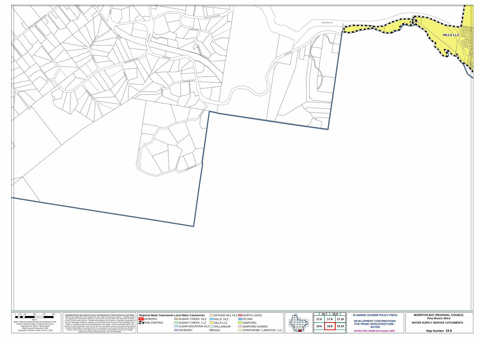
HILLS LLZ
SUTT
ON CT
SAMFORD RD
LANITA RD
LOCHINVAR RD
LOOKOUT CT
ROAD
CAMP MOUNTAIN RD
MCLE
AN R
D
VONNE CT
HOGAN CT
UPPER CAMP MOUNTAIN RD
NULLAMANNA RD
MARY ORR CT
WARRANDYTE CT
PATRICKS RD
GRAN
DVIEW
CT
ANCA
STER
RD
LANITA RD
ROAD
Copyright Moreton Bay Regional Council and Department of Natural Resources and Water Moreton Bay Regional Council supplies this map under the following conditions:- Mapping detailsare supplied from information contained in the Council's records which may have been furnished
to the Council by other persons. Moreton Bay Regional Council gives no warranty or guarantee ofany kind, expressed, implied, or statutory, to the correctness or accuracy of the map details or the
degree of compliance with any Council standards in this matter. Persons making decisions withfinancial or legal implications must not rely upon the map details shown on this plan for the purposeof determining whether any particular facts or circumstances exist and the Moreton Bay Regional
Council (and its officers and agents) expressly disclaim responsibility for any loss or damage suffered as a result of placing reliance upon this information.
WATER SUPPLY SERVICE CATCHMENTS
Map Number 19.8
Base material reproduced with the permission of the Director-General, Dept, of Natural Resources.
Copyright The State of Queensland (Dept. Natural Resources) 2006.
Copyright Pine Rivers Shire Council 2006 EFFECTIVE FROM 29 October 2009
0 125 250 375 50062.5
Metres
PLANNING SCHEME POLICY PSP22DEVELOPMENT CONTRIBUTIONS FOR TRUNK INFRASTRUCTURE -
WATER
MORETON BAY REGIONAL COUNCILPine Rivers Shire
Regional Water CatchmentsDAYBOROPINE CENTRAL
Local Water CatchmentsALBANY CREEK HLZALBANY CREEK LLZCLEAR MOUNTAIN HLZDAYBORO
EATONS HILL HLZHILLS HLZHILLS LLZKALLANGURNGC
NORTH LAKESPETRIESAMFORDSAMFORD DOWNSSTRATHPINE / LAWNTON LLZ
19.6
17.6
19.8
17.8 17.10
19.10
15.915.7
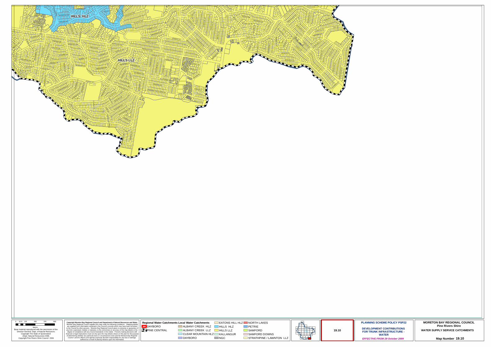
HILLS LLZ
HILLS HLZPLUCKS RD
KYLIE AV
CAESAR RD
NARELLAN ST
CASU
LA S
T
VIOLE
T ST
CALCA CR
LESL
IE S
T
PATRICKS RD
COLO
ST
JANE ST
COBBITY CR CAW
DOR
ST
LILY ST
CYCA
S ST
PAVO
NIA S
T
KOLORA CR
ARDISIA ST
YANDERRA AV
HIBI
SCUS
ST
BARGO ST
ALLARA CR
FERNY WY
JOALAH CR
CORANG CR
LOOM
BAH
CR
EVELEIGH RD
KURI
NGAL
DR
HAKEA ST
BUNORA AV
KIRIN
YA S
T
MINT
O CR
CUPH
EA S
T
IRRUK
A CR
CONLO CR
CARRAMA CR
MENANGLE AV
CEST
RUM
STCOOLIBAH CR
GREVILLEA ST
BURRIL CR
LEAWARRA CR
GORD
ON R
D ARILPA CR
ILLUTA AV
KIAMA CR
VIEW CR
EROM
BA C
R
LOMATIA ST
DANY
O CR
BATES DR
PIMELEA ST
MITC
HELL
ST
ACACIA ST
TARNOOK DR
PENA
MBUL
CR
HOVE
A ST
PINDA
RI AV
ALKIRA LN
GRANDIS ST
PARK
RD
NIKOLA ST
NEPEAN AV
WIRLPANA AV
BUNDAR CR
BARBER RD
CAMELIA AV
ANDINA CR
GOOD
ENIA
ST
BURLOO CR
PYLARA CR
CRAIG ST
NYMPHAEA ST
GLENLEE ST
HULL STANORA CR
CARI
SSA S
T
DERRIMA CR
COLES ST
LANG
URA C
R
GROVE AV
PINNATA CT
BEL-A
IR C
T
FAIRWAY OUTLOOK ST
BURSARIA ST
PARNOOLAR CR
LURNEAH CR
DOOLOO CR
KOOTANGAL CR
BEN ST
BRINGELLY ST
WAND
EARA
H CR
PYANG GR
DRYA
NDRA
CT
FRAN
CISC
EA S
T
KEILA
R CT
NARWIN GR
DYA PL
ILGA GR
DAWSON PDE
ONSL
OW ST
CAMDEN CT
OWARRA AV
ALKO
OMI A
V
SOUTH PINE RD
DINTERRA AV
DUNBIL AV
KALDO GR
MIRBELIA ST
HOXTON ST
PALALL CR
ORR CT
GALEOLA ST
DROSERA ST
YAKKI CT
KARA GR
NUROM AV
TARNEE ST
AKEBIA ST
ROAD
ARALIA ST
LEURA GR
HEND
RY C
T
AMAR
OO AV
MAWA
RRA C
R
CLIANTHUS ST
YERA CT
ALSTONIA ST
LANA CT
OLEARIA ST
CAPS
ELLA
ST
QUIN
NIA C
T
ELAROO CR
EUROBIN CR
PARK
RD
PATRICKS RD
Copyright Moreton Bay Regional Council and Department of Natural Resources and Water Moreton Bay Regional Council supplies this map under the following conditions:- Mapping detailsare supplied from information contained in the Council's records which may have been furnished
to the Council by other persons. Moreton Bay Regional Council gives no warranty or guarantee ofany kind, expressed, implied, or statutory, to the correctness or accuracy of the map details or the
degree of compliance with any Council standards in this matter. Persons making decisions withfinancial or legal implications must not rely upon the map details shown on this plan for the purposeof determining whether any particular facts or circumstances exist and the Moreton Bay Regional
Council (and its officers and agents) expressly disclaim responsibility for any loss or damage suffered as a result of placing reliance upon this information.
WATER SUPPLY SERVICE CATCHMENTS
Map Number 19.10
Base material reproduced with the permission of the Director-General, Dept, of Natural Resources.
Copyright The State of Queensland (Dept. Natural Resources) 2006.
Copyright Pine Rivers Shire Council 2006 EFFECTIVE FROM 29 October 2009
0 125 250 375 50062.5
Metres
PLANNING SCHEME POLICY PSP22DEVELOPMENT CONTRIBUTIONS FOR TRUNK INFRASTRUCTURE -
WATER
MORETON BAY REGIONAL COUNCILPine Rivers Shire
Regional Water CatchmentsDAYBOROPINE CENTRAL
Local Water CatchmentsALBANY CREEK HLZALBANY CREEK LLZCLEAR MOUNTAIN HLZDAYBORO
EATONS HILL HLZHILLS HLZHILLS LLZKALLANGURNGC
NORTH LAKESPETRIESAMFORDSAMFORD DOWNSSTRATHPINE / LAWNTON LLZ
19.10
Moreton Bay Regional Council PINERIVERSPLAN
PLANNING SCHEME POLICY PSP22 – DEVELOPMENT CONTRIBUTIONS FOR TRUNK INFRASTRUCTURE – WATER SUPPLY
Effective from 29 October 2009 Page 38
Schedule D: Network Assets

BUNYA
CAMP MOUNTAIN
CASHMERE
CEDAR CREEK
CLEARMOUNTAIN
GRIFFIN
FERNY HILLS
ALBANY CREEK
ARANAHILLS
HIGHVALE
JOLLYS LOOKOUT
JOYNER
KALLANGUR
KING SCRUB
YUGAR
KOBBLE CREEK
KURWONGBAH
LACEYS CREEK
LAWNTON
WIGHTSMOUNTAIN
DAYBORO
DRAPER
EATONS HILL
EVERTONHILLS
BRENDALE
PETRIE
RUSH CREEK
SAMFORD VALLEY SAMFORDVILLAGE
WARNER
ARMSTRONG CREEK
BRAY PARK
CLOSEBURN
DAKABIN
MANGO HILL
MOUNT GLORIOUS
MOUNT NEBO
MOUNT PLEASANT
MOUNT SAMSON
MURRUMBA DOWNS
SAMSONVALE
STRATHPINE
WHITESIDE
NORTH LAKES
OCEAN VIEW
19.4 19.6 19.8
17.4 17.6 17.8 17.10
15.3 15.5 15.915.7
13.3 13.5 13.7 13.9 13.1113.1
11.1 11.3 11.5 11.7 11.9 11.11
9.1 9.3 9.5 9.7 9.9 9.11 9.13
7.1 7.3 7.5 7.7 7.9 7.13
5.3 5.7
3.3 3.5
1.5
7.11
19.10
11.13
13.13
15.11
5.5
MAP SHEET INDEXPine Rivers Shire

#*!(
#*
#*PIPWS0002
PIPWS0022
ROAD
ROWE RD
DAYBORO RD
HAY RD
ROYS
TON
ST
DIANE DR
MCKENZIE ST
BAKE
R RD
TOBY CTMOUNT MEE RD
CREEK RD
FINGE
RBOA
RD R
D
MT M
EE R
D
STRA
IN R
D
STRONG RD
JUFFS RD WST
EDMONDS CT
LAIDLAW ST
ROHLF ST
LACEYS CREEK RD
LYND
HURS
T RD
LESLIE CT
MORRIS ST
HOMESTEAD CT
RODEO DR
HILLVIEW CT
NUGENT RD
GYMKHANA PL
WIDDEN PL
MOUNT SAMSON RD
RIVERVIEW CT
JUFFS RD
SADD
LEBA
CK D
R
MOUNT PLEASANT RD
CRUICE ST
ASPE
L PL
VINER
Y PL
OAKL
AND
CT
RAIL CL
JACKAROO CT
BOBBIE CT
BRECKLYN CL
CAMPDRAFT PL
WATT
LEBR
AE S
T
RODERICK ST
BRADLEY ST
BANMORE CT
MCGINN CL
WILLIAMS ST
HORIZON CT
LEES CROSSING RD
ENCHELMAIR ST
DELANEY RD
STACEY CT
TARE
ENA S
T
BRISCOE RD
BRAHMAN CT
HEATHWOOD ST
SELLIN RD
GLOVER RD
MOUNT SAMPSON RD
GLOVER RD
FINGERBOARD RD
MOUNT PLEASANT RD
ROAD
LACEYS CREEK RD
MCKENZIE ST
ROWE RD
LACEYS CREEK RD
LACEYS CREEK RD
ROAD
LACEYS CREEK RD
SELLIN RD
Copyright Moreton Bay Regional Council and Department of Natural Resources and Water Moreton Bay Regional Council supplies this map under the following conditions:- Mapping detailsare supplied from information contained in the Council's records which may have been furnished
to the Council by other persons. Moreton Bay Regional Council gives no warranty or guarantee ofany kind, expressed, implied, or statutory, to the correctness or accuracy of the map details or the
degree of compliance with any Council standards in this matter. Persons making decisions withfinancial or legal implications must not rely upon the map details shown on this plan for the purposeof determining whether any particular facts or circumstances exist and the Moreton Bay Regional
Council (and its officers and agents) expressly disclaim responsibility for any loss or damage suffered as a result of placing reliance upon this information.
WATER SUPPLY NETWORK ASSETS
Map Number 7.5
Base material reproduced with the permission of the Director-General, Dept, of Natural Resources.
Copyright The State of Queensland (Dept. Natural Resources) 2006.
Copyright Pine Rivers Shire Council 2006 EFFECTIVE FROM 29 October 2009
0 125 250 375 50062.5
Metres
PLANNING SCHEME POLICY PSP22DEVELOPMENT CONTRIBUTIONS FOR
TRUNK INFRASTRUCTURE -WATER SUPPLY
MORETON BAY REGIONAL COUNCILPine Rivers ShireWATER ROUTE
PINE WM PIPESWater Treatment Plants
XYExisting Bulk Meters
$+Lake Kurwongbah Facilities
!(Existing Water Pumps
#*Existing Reservoirs
Future Water Mains!(Future Water Pumps
#*Future Water Reservoirs7.79.7
5.37.39.3
5.75.57.59.5

#*#*#*
PIPWS0031BROWNS RD
SMITHS RD
ERIC MCSWEENEY CT
THEO
DORE
RD
BROW
NS C
REEK
RD
MCCO
RMAC
K RD
NARANGBA RD
ROAD
BONN
IE VI
EW C
TPATHWAY
PIONE
ER D
R
Copyright Moreton Bay Regional Council and Department of Natural Resources and Water Moreton Bay Regional Council supplies this map under the following conditions:- Mapping detailsare supplied from information contained in the Council's records which may have been furnished
to the Council by other persons. Moreton Bay Regional Council gives no warranty or guarantee ofany kind, expressed, implied, or statutory, to the correctness or accuracy of the map details or the
degree of compliance with any Council standards in this matter. Persons making decisions withfinancial or legal implications must not rely upon the map details shown on this plan for the purposeof determining whether any particular facts or circumstances exist and the Moreton Bay Regional
Council (and its officers and agents) expressly disclaim responsibility for any loss or damage suffered as a result of placing reliance upon this information.
WATER SUPPLY NETWORK ASSETS
Map Number 7.9
Base material reproduced with the permission of the Director-General, Dept, of Natural Resources.
Copyright The State of Queensland (Dept. Natural Resources) 2006.
Copyright Pine Rivers Shire Council 2006 EFFECTIVE FROM 29 October 2009
0 125 250 375 50062.5
Metres
PLANNING SCHEME POLICY PSP22DEVELOPMENT CONTRIBUTIONS FOR
TRUNK INFRASTRUCTURE -WATER SUPPLY
MORETON BAY REGIONAL COUNCILPine Rivers ShireWATER ROUTE
PINE WM PIPESWater Treatment Plants
XYExisting Bulk Meters
$+Lake Kurwongbah Facilities
!(Existing Water Pumps
#*Existing Reservoirs
Future Water Mains!(Future Water Pumps
#*Future Water Reservoirs 9.97.9
9.77.75.7
9.117.11

#*#*#*
PIPWS0031
NARANGBA RD
HARE STKOWARI CR
KOALA CLGLIDER ST
KANGAROO ST
MULGARA CT
WALL
AROO
CCT
BOUNTY BLVD
WOMBAT PDE
DINGO ST
BILBY LN
POSSUM PDE
ECHIDNA PDE
QUOKKA ST
WALLABY ST
Copyright Moreton Bay Regional Council and Department of Natural Resources and Water Moreton Bay Regional Council supplies this map under the following conditions:- Mapping detailsare supplied from information contained in the Council's records which may have been furnished
to the Council by other persons. Moreton Bay Regional Council gives no warranty or guarantee ofany kind, expressed, implied, or statutory, to the correctness or accuracy of the map details or the
degree of compliance with any Council standards in this matter. Persons making decisions withfinancial or legal implications must not rely upon the map details shown on this plan for the purposeof determining whether any particular facts or circumstances exist and the Moreton Bay Regional
Council (and its officers and agents) expressly disclaim responsibility for any loss or damage suffered as a result of placing reliance upon this information.
WATER SUPPLY NETWORK ASSETS
Map Number 7.11
Base material reproduced with the permission of the Director-General, Dept, of Natural Resources.
Copyright The State of Queensland (Dept. Natural Resources) 2006.
Copyright Pine Rivers Shire Council 2006 EFFECTIVE FROM 29 October 2009
0 125 250 375 50062.5
Metres
PLANNING SCHEME POLICY PSP22DEVELOPMENT CONTRIBUTIONS FOR
TRUNK INFRASTRUCTURE -WATER SUPPLY
MORETON BAY REGIONAL COUNCILPine Rivers ShireWATER ROUTE
PINE WM PIPESWater Treatment Plants
XYExisting Bulk Meters
$+Lake Kurwongbah Facilities
!(Existing Water Pumps
#*Existing Reservoirs
Future Water Mains!(Future Water Pumps
#*Future Water Reservoirs 9.97.9
9.117.11
9.137.13
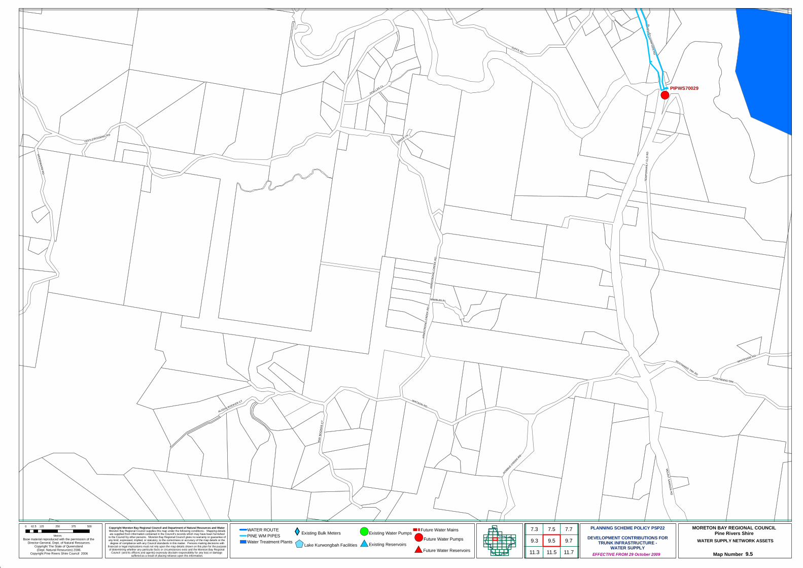
#*!(
!(PIPWS70029
JUFFS RD
WOODWARD RD
WATSON RD
MOUNT SAMSON RD
RAY
BOOK
ER C
T
WHITESIDE RD
KOBBLE CREEK RD
POSTMANS TRK
MOUNT SAMPSON RD
ARMS
TRON
G CR
EEK
RD
ALISON BOOKER CT
MIMBURI PL
DON LEE CL
TEMP
ORAR
ILY C
LD R
D
POSTMANS TRK RD
CREEK LNLEES CROSSING RD
ARMS
TRON
G CR
EEK
RD
Copyright Moreton Bay Regional Council and Department of Natural Resources and Water Moreton Bay Regional Council supplies this map under the following conditions:- Mapping detailsare supplied from information contained in the Council's records which may have been furnished
to the Council by other persons. Moreton Bay Regional Council gives no warranty or guarantee ofany kind, expressed, implied, or statutory, to the correctness or accuracy of the map details or the
degree of compliance with any Council standards in this matter. Persons making decisions withfinancial or legal implications must not rely upon the map details shown on this plan for the purposeof determining whether any particular facts or circumstances exist and the Moreton Bay Regional
Council (and its officers and agents) expressly disclaim responsibility for any loss or damage suffered as a result of placing reliance upon this information.
WATER SUPPLY NETWORK ASSETS
Map Number 9.5
Base material reproduced with the permission of the Director-General, Dept, of Natural Resources.
Copyright The State of Queensland (Dept. Natural Resources) 2006.
Copyright Pine Rivers Shire Council 2006 EFFECTIVE FROM 29 October 2009
0 125 250 375 50062.5
Metres
PLANNING SCHEME POLICY PSP22DEVELOPMENT CONTRIBUTIONS FOR
TRUNK INFRASTRUCTURE -WATER SUPPLY
MORETON BAY REGIONAL COUNCILPine Rivers ShireWATER ROUTE
PINE WM PIPESWater Treatment Plants
XYExisting Bulk Meters
$+Lake Kurwongbah Facilities
!(Existing Water Pumps
#*Existing Reservoirs
Future Water Mains!(Future Water Pumps
#*Future Water Reservoirs
7.79.7
7.39.3
7.59.5
11.711.3 11.5

!(
ADSETTS RD
WHITESIDE RD
EASTER RD
POSTMANS TRK
ROAD
STRONG RD
BERN
IER
RD
JACKS RD
RANDALL RD
RUSH CREEK RD
TREODORE RD
THEO
DORE
RD
BUTT
ERFL
Y CR
BENNETT RD
JOYNERS RD
DAYBORO RD
BRANCH RD
VALLEY VIEW CT
BERN
IER RD
ROAD
EASTER RD
BERNIER RD
DAYBORO RD
DAYBORO RD
Copyright Moreton Bay Regional Council and Department of Natural Resources and Water Moreton Bay Regional Council supplies this map under the following conditions:- Mapping detailsare supplied from information contained in the Council's records which may have been furnished
to the Council by other persons. Moreton Bay Regional Council gives no warranty or guarantee ofany kind, expressed, implied, or statutory, to the correctness or accuracy of the map details or the
degree of compliance with any Council standards in this matter. Persons making decisions withfinancial or legal implications must not rely upon the map details shown on this plan for the purposeof determining whether any particular facts or circumstances exist and the Moreton Bay Regional
Council (and its officers and agents) expressly disclaim responsibility for any loss or damage suffered as a result of placing reliance upon this information.
WATER SUPPLY NETWORK ASSETS
Map Number 9.7
Base material reproduced with the permission of the Director-General, Dept, of Natural Resources.
Copyright The State of Queensland (Dept. Natural Resources) 2006.
Copyright Pine Rivers Shire Council 2006 EFFECTIVE FROM 29 October 2009
0 125 250 375 50062.5
Metres
PLANNING SCHEME POLICY PSP22DEVELOPMENT CONTRIBUTIONS FOR
TRUNK INFRASTRUCTURE -WATER SUPPLY
MORETON BAY REGIONAL COUNCILPine Rivers ShireWATER ROUTE
PINE WM PIPESWater Treatment Plants
XYExisting Bulk Meters
$+Lake Kurwongbah Facilities
!(Existing Water Pumps
#*Existing Reservoirs
Future Water Mains!(Future Water Pumps
#*Future Water Reservoirs9.97.9
9.77.77.5
9.511.911.711.5
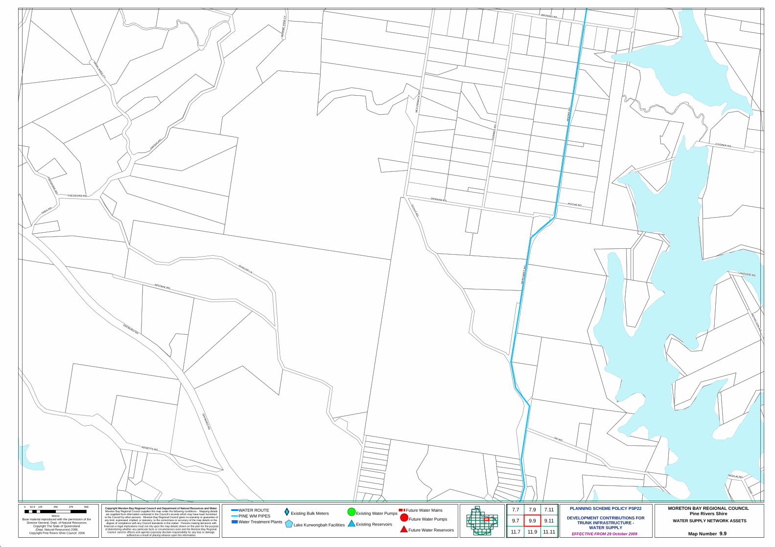
#*
#*
#*
!(
#*
!(
!(
!(
#*
!(
SKI RD
DUNLOP LN
ADSETTS RD
SCOUT RD
FORB
ES R
D
MOOR
E RD
SMITHS RD
MISTAKE RD
MCCO
RMAC
K RD
MARG
ARET
RD
PARKLANDS CT
DENHAM RD
COOPER RD
BROWNS RD
DAYBORO RD
SHEA RD
TREODORE RD
ROAD
ROCHE RD
LAKESIDE RD
THEODORE RD
NICHOLSON RD
BONN
IE VI
EW C
T
NICKLIN RD
DAYBORO RD
Copyright Moreton Bay Regional Council and Department of Natural Resources and Water Moreton Bay Regional Council supplies this map under the following conditions:- Mapping detailsare supplied from information contained in the Council's records which may have been furnished
to the Council by other persons. Moreton Bay Regional Council gives no warranty or guarantee ofany kind, expressed, implied, or statutory, to the correctness or accuracy of the map details or the
degree of compliance with any Council standards in this matter. Persons making decisions withfinancial or legal implications must not rely upon the map details shown on this plan for the purposeof determining whether any particular facts or circumstances exist and the Moreton Bay Regional
Council (and its officers and agents) expressly disclaim responsibility for any loss or damage suffered as a result of placing reliance upon this information.
WATER SUPPLY NETWORK ASSETS
Map Number 9.9
Base material reproduced with the permission of the Director-General, Dept, of Natural Resources.
Copyright The State of Queensland (Dept. Natural Resources) 2006.
Copyright Pine Rivers Shire Council 2006 EFFECTIVE FROM 29 October 2009
0 125 250 375 50062.5
Metres
PLANNING SCHEME POLICY PSP22DEVELOPMENT CONTRIBUTIONS FOR
TRUNK INFRASTRUCTURE -WATER SUPPLY
MORETON BAY REGIONAL COUNCILPine Rivers ShireWATER ROUTE
PINE WM PIPESWater Treatment Plants
XYExisting Bulk Meters
$+Lake Kurwongbah Facilities
!(Existing Water Pumps
#*Existing Reservoirs
Future Water Mains!(Future Water Pumps
#*Future Water Reservoirs9.97.9
9.77.7
11.911.79.117.11
11.11
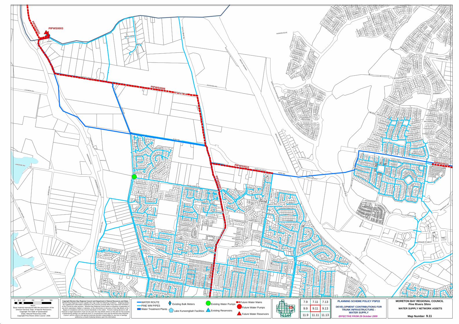
#*
#*
#*
!(
#*
!(
!(
!(
#*
!(
PIPWS0003
PIPWS0006
PIPWS
0008
PIPWS0010
PIPWS0031
PIPWS0007
PIPWS0015
KERR RD EAST
ALMA RD
NARANGBA RD
ENDEAVOUR BLVD
KEITH RD
ANN ST
HUGHES RD EST
BRUCE HIGHWAY
OLD GYMPIE RD
KERR RD WEST
SHEA
VES
RD
HUGHES RD WST
NORTH-SOUTH ARTERIAL RD
ANZA
C AV
NUND
AH R
D
LAKESIDE RD
MARSDEN RD
NICKLIN RD
COOPER RD
AURORA BLVD
LYONS ST
NICHOLSON RD
FISHER RD
CHELMSFORD RD
GOODWIN RD
BALS
TRUP
RD
NELLIES LN
LYND
ON S
T
ROAD
MEMORIAL DR
BOUN
TY BL
VD
LAKEFIELD DR
MCNE
ILL D
R
SCHO
OL R
DGAIR RD
MAUR
ICE
ST
OLIV
IA DR
LADY
BIRD
ST
PAGE ST
ALEXANDER AV
MARK
ST
NORT
H LA
KES D
R
DUFF
IELD
RD
ORCHID AV
FLINDERS PD
IAN CT
OXLEY ST
CHERMSIDE RD
CHILT
ON C
R
GARDENIA PDE
ABBO
T STKL
IEN
CCT
ALLISON DR
JOHN
SON
STPURNELL ST
KNOX ST
BOLTE CR
CLEARVIEW CT
DIANE PDE
MENARA C
CT
COPELAND DR
CHEVIOT ST
WHITE HORSE RD
BOYANDA DR
GANNET CCT
GILB
ERT S
T
EURE
KA S
T
LAMB ST
GYP C
T
WOOD CT
GREB
E CC
T
LAVERCOMBE DR
DISCOVERY DR
PERON CR
SIBLEY ST
THE C
ORSO
CAMPBELL ST
GIBBS STREET
PENS
ON C
T
ASTLEY PD
COLLEGE ST
BYFIELD ST
ANDR
ACIA
ST
PETA
ST
POPLAR PL
MADDOCK ST
HOYA
CL
SEFT
ON C
T
WINN ST
BROC
KMAN
ST
TOW
NLEY
DR
BEER
WAH
PD
OTWAY PDE
SOME
RSET
ST
CRAWFORD ST
KYAH CL
NUMBAT ST
LOOWA ST
BARR
IER ST
JACANA PDE
VINE
CR
BRIMSTONE CT
ALPHA ST
AINSL
IE ST
RAINBIRD CCT
PINTAIL ST
DANGERIE ST
STANDISH ST
LOCHSIDE DR
LIMOSA CT
DARBY ST
PANDANUS CT
GRAMPION CCT
EVER
ARD
ST
GARDEN TCE
LESLIE ST
RAFFINDALE AV
BRINDABELLA CT
CANTOR ST
FIG ST
JOWA
RRA S
T
CALDER ST
JANI
NE C
T
ELS CT
LITCH
FIELD
CT
ARRAKUNE CR
VIBRANT CT
WYEN
A ST
LOCHERN CT
WARABI CR
TALARA WY
LEIC
HHAR
DT ST
ABERNANT CT
DOTTEREL CR
GREGOR ST WEST
OUTL
OOK
CT
PALU
MA C
T
MELISSA CCT
KENT
ST
FARADAY CT
CANNAWAY ST
LILLYPILLY CT
ALLENBY C
L
HIGHGATE CTFRANGIPANI CT
PRICE ST
TRUM CCT
DONNEGAL DR
BUTTERFLY DR
ESK PL
TALBOT DR
CAMP
ION
DR
CANU
NDRA
ST
LILLY CR
BRICKWORKS RD
THOM
SON C
L
BURN
S RD
SENIOR CL
CIVETTA CT
MOUN
TAIN
BLU
E DR
LANGER CCT
CONJOLA ST
BIRDW
ING
CR
EVE
CT
OAK CT
TYLAH ST
DAVENPORT PDE
EATON CL
SURROUND ST
DUSKY S
TREE
T
WILL
MOTT
CT
SUNDOES CT
JILLIA
N ST
GLASSHOUSE CCT
WHITFIELD CR
COOK
SLAN
D CR
MOUTARA ST
CRANE ST
HIGHCLIFFE CR
NIND
ERRY
ST
SANDPIPER AV
CLIFF
ST
FORESTER PL
DENISON PDE
SWORDGRASS CT
BALLESTEROS ST
HAME
RSLE
Y CT
DUGG
AN S
T
DOUGLAS CCT
VISTA CT
PARRY ST
COPPIN ST
LANA
GAN
CCT
COOT
HA D
R
MCPH
ERSO
N CT
NICKLAUS PD
VIOLET DR
HIGHET ST
PARKSIDE DR
SKIPTON CCT
PAMPLING CT
PEARSON CT
ATTH
OW ST
CHESTERTON CT
PLANIGALE CR
LESTER PL
WADER ST
FALDO CT
BACKH
OUSIA CT
GUNSYND DR
GLEESON ST
MOWBRAY CT
SILKYOAK CT
MOORRINYA CCT
MURPHY ST
HETHERINGTON ST
MORG
AN ST
ASCOT CR
FIRST ST
DRUM
MOND
CT
RIDGE VIEW CT
RILEY CT
CASE
Y CT
SPRINGSURE PDE
OCTAVIUS DR
WYPE
RFIEL
D CT
APPLEBY CL
PLAYER ST
ALBATROSS CL
NORT
H ST
CARM
ODY P
D
MARLAY CT
TAMBORINE CCT
CAMR
YN C
T
BRIAN
CT
FREEMAN ST
JOEL CT
FINNE
GAN
DR
BRIDGEPORT DR
ANDR
EW ST
SILVE
STER
ST
DORRIGO CT
TEMPORARILY CLD RD
NICH
OLAS
ST
SUNJ
OY PL
ADRAAN CT
MONARCH CT
KALAMUNDA ST
DONN
ELLY
DR
BLAZ
EY S
T
CHANTREY CT
GARDNER ST
MEAD
OWS
DR
WASHPOOL ST
KEY ST
CROW
N ST
PETTIGREW LN
TURNSTONE CCT
MUSG
RAVE
ST
ULYSSES ST
MACARTHUR DR
COUPLES ST
JENE
LLE
ST
EMPEROR CT
ROPER PL
RAWLINS CRESCENT
THETEN CT
HIRSCH CT
COTT
ONWO
OD C
CT
CORINTO CT
BALLIE ST
KAHALA RD
BENH
AM AV
E
JEZEBEL PL
LYNETTE ST
KIFT C
T
MIKA
ELA C
T
SAFFRON CT
WILLANDRA PDE
WAKE
HAM
ST
WOODCROFT CT
FALCON CT
CONONDALE CCT
SEARS PD
POSSUM PDE
WIRR
AGRO
VE C
CT
BERG
IN ST
FORRESTAL CCT
CURTIS RD
HOLBORN ST
MING DYNASTY CT
RAVENSCRAIG CT
ELKINGTO
N CCT
CAITL
IN C
T
KENWOOD CTRUTHVEN CT
GALAXY CT
WILLS ST
LUCAS CT
HART
NETT
ST
ARCH
ER S
T
ROSEANN ST
HONEYSUCKLE CT
NINGAUI CR
NORTHAMPTON CT
KILSY
TH C
T
PINNOCK CR
GLEN
VEAG
H PL
TUFN
ELL S
T
HUXL
EY S
T
SYLVANIA ST
CONW
AY C
T
GARCIA PD
BERR
Y LN
ALDIS PL
AKUN
A WY
CURRAWINYA ST
LINTO
NE ST
HERV
EY ST
JAPONICA ST
REGA
L PL
CARD
IFF C
T
MAPLE ST
DURAN ST
CARLA CT
ITHACA ST
LEMONWOOD CT
CASS
AVA C
T
KOOK
ABUR
RA S
T
ALPINE CT
MACA
DAM
CT
NIMBO PL
BALLARA ST
EMIRATES ST
ALEXANDRA AV
MCNI
VEN
CT
SORRENTO ST
IBIS CT
MART
IN C
T
MONTGOMERIE PD
WINZEAR DR
LEAFWING ST
SWORDS PDE
AUBU
RN LN
BRIDGEMAN ST
APPL
EMIN
T CT
QUAIL PL
ADELAIDE ST
MOONBEAM ST
KERR RD
THOMPSON RD
THOM
PSON
RD
FINNEGAN DR
KERR RD EAST
ROAD
BRUCE HIGHWAY
MARSDEN RD
BRUCE HIGHWAY
OLD G
YMPIE
RD
Copyright Moreton Bay Regional Council and Department of Natural Resources and Water Moreton Bay Regional Council supplies this map under the following conditions:- Mapping detailsare supplied from information contained in the Council's records which may have been furnished
to the Council by other persons. Moreton Bay Regional Council gives no warranty or guarantee ofany kind, expressed, implied, or statutory, to the correctness or accuracy of the map details or the
degree of compliance with any Council standards in this matter. Persons making decisions withfinancial or legal implications must not rely upon the map details shown on this plan for the purposeof determining whether any particular facts or circumstances exist and the Moreton Bay Regional
Council (and its officers and agents) expressly disclaim responsibility for any loss or damage suffered as a result of placing reliance upon this information.
WATER SUPPLY NETWORK ASSETS
Map Number 9.11
Base material reproduced with the permission of the Director-General, Dept, of Natural Resources.
Copyright The State of Queensland (Dept. Natural Resources) 2006.
Copyright Pine Rivers Shire Council 2006 EFFECTIVE FROM 29 October 2009
0 125 250 375 50062.5
Metres
PLANNING SCHEME POLICY PSP22DEVELOPMENT CONTRIBUTIONS FOR
TRUNK INFRASTRUCTURE -WATER SUPPLY
MORETON BAY REGIONAL COUNCILPine Rivers ShireWATER ROUTE
PINE WM PIPESWater Treatment Plants
XYExisting Bulk Meters
$+Lake Kurwongbah Facilities
!(Existing Water Pumps
#*Existing Reservoirs
Future Water Mains!(Future Water Pumps
#*Future Water Reservoirs9.97.9
11.99.117.11
9.137.13
11.11 11.13
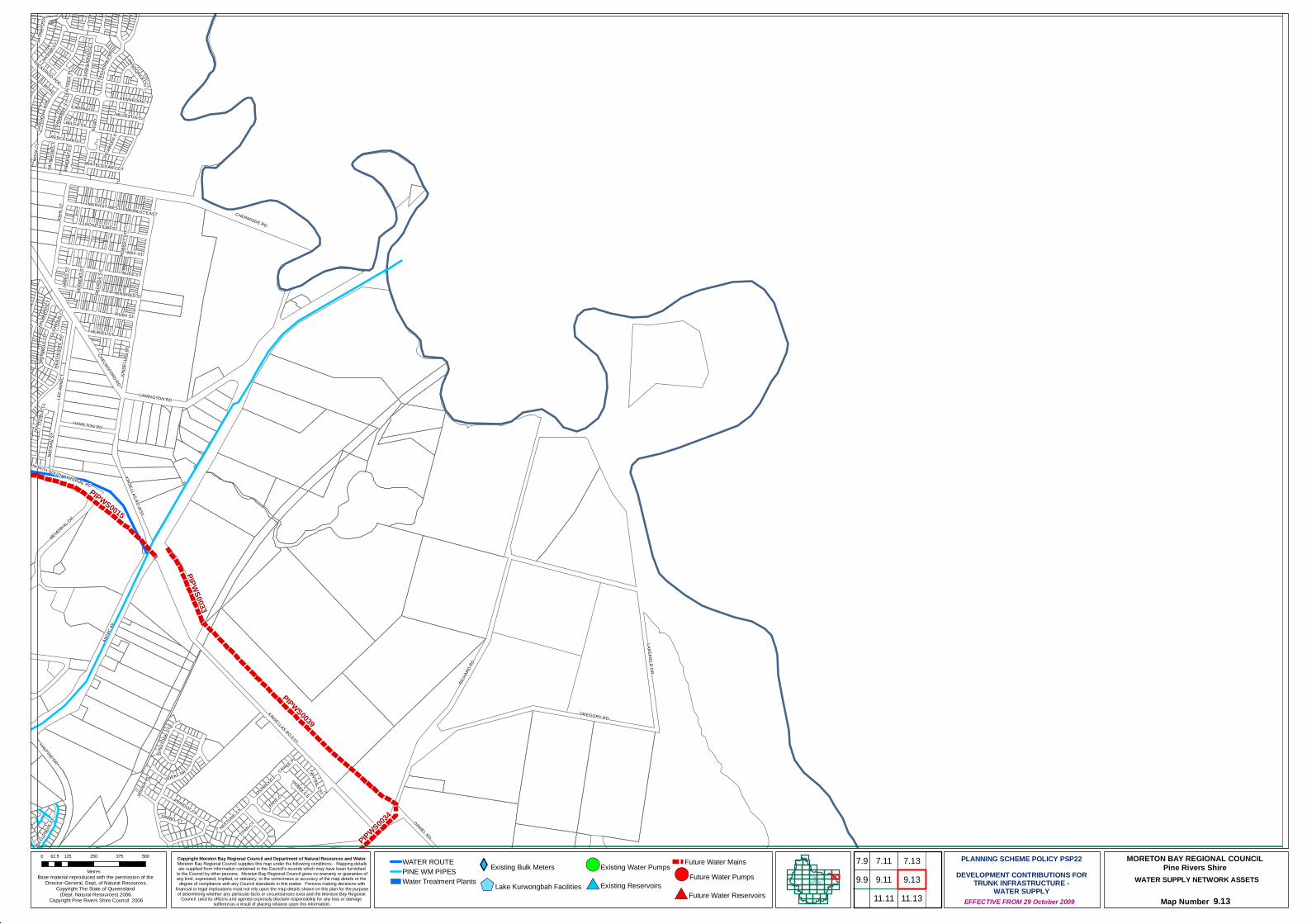
PIPWS0039
PIPWS0015
PIPWS0033
PIPWS0034
ANZA
C AV
KINSELLAS RD EST
GREGORY RD
RICHA
RD RD
CHERMSIDE RD
LAKEFIELD DR
HALPINE DR
LEE-
ANN
CT
LAMINGTON RD
MEMORIAL DR
KINSELLAS RD WST
DANIEL RD
HAMILTON RD
PERIDOT CR
TOPAZ DR
CHELMSFORD RD
NATH
AN S
T
KINSE
LLAS
RD
HOYA
CL
FANTAIL CSTOSPREY CT
MORW
ELL C
RSA
TINAY
PDE
GARD
ENIA
PDE
PIPIT CL
TUCKEROO PDE
WILGA ST
NEPTUNE CT
MAY ST
NORTH-SOUTH ARTERIAL RD
RIBE
RRY
CT
CAPPARIS
WHITECEDAR CCT
HEAT
HCOT
E AV
JASP
ER PL
SATIN
ASH
CT
STAG
HORN
PDE
SUNS
TONE
CCT
KENNEDIA CT
JOHN
ST
RUBY ST
BELL
ONGI
A ST
ALICE ST
HOBBY CT
SPINEL CT
KALB
ARRI
CT
KURR
AJON
G CC
T
MILLETTIA CL
JAME
S ST
MURIEL ST
TITAN CT
MIDYIM ST
ROBE
RT S
T
GEOR
GE S
T
HERB
ERT S
T
WINIFRED ST
CRAKE PL
PANDOREA CCT
MARY ST EAST
MARY ST WEST
ROSE ST WEST
PICAB
EEN
CT
HOME
VALE
CL
ROAD
FOAM
BARK
STTE
A-TR
EE P
L
GLOR
IOUS
CT
REDCEDAR ST
ROAD
Copyright Moreton Bay Regional Council and Department of Natural Resources and Water Moreton Bay Regional Council supplies this map under the following conditions:- Mapping detailsare supplied from information contained in the Council's records which may have been furnished
to the Council by other persons. Moreton Bay Regional Council gives no warranty or guarantee ofany kind, expressed, implied, or statutory, to the correctness or accuracy of the map details or the
degree of compliance with any Council standards in this matter. Persons making decisions withfinancial or legal implications must not rely upon the map details shown on this plan for the purposeof determining whether any particular facts or circumstances exist and the Moreton Bay Regional
Council (and its officers and agents) expressly disclaim responsibility for any loss or damage suffered as a result of placing reliance upon this information.
WATER SUPPLY NETWORK ASSETS
Map Number 9.13
Base material reproduced with the permission of the Director-General, Dept, of Natural Resources.
Copyright The State of Queensland (Dept. Natural Resources) 2006.
Copyright Pine Rivers Shire Council 2006 EFFECTIVE FROM 29 October 2009
0 125 250 375 50062.5
Metres
PLANNING SCHEME POLICY PSP22DEVELOPMENT CONTRIBUTIONS FOR
TRUNK INFRASTRUCTURE -WATER SUPPLY
MORETON BAY REGIONAL COUNCILPine Rivers ShireWATER ROUTE
PINE WM PIPESWater Treatment Plants
XYExisting Bulk Meters
$+Lake Kurwongbah Facilities
!(Existing Water Pumps
#*Existing Reservoirs
Future Water Mains!(Future Water Pumps
#*Future Water Reservoirs9.117.11
9.137.13
11.11 11.13
7.99.9
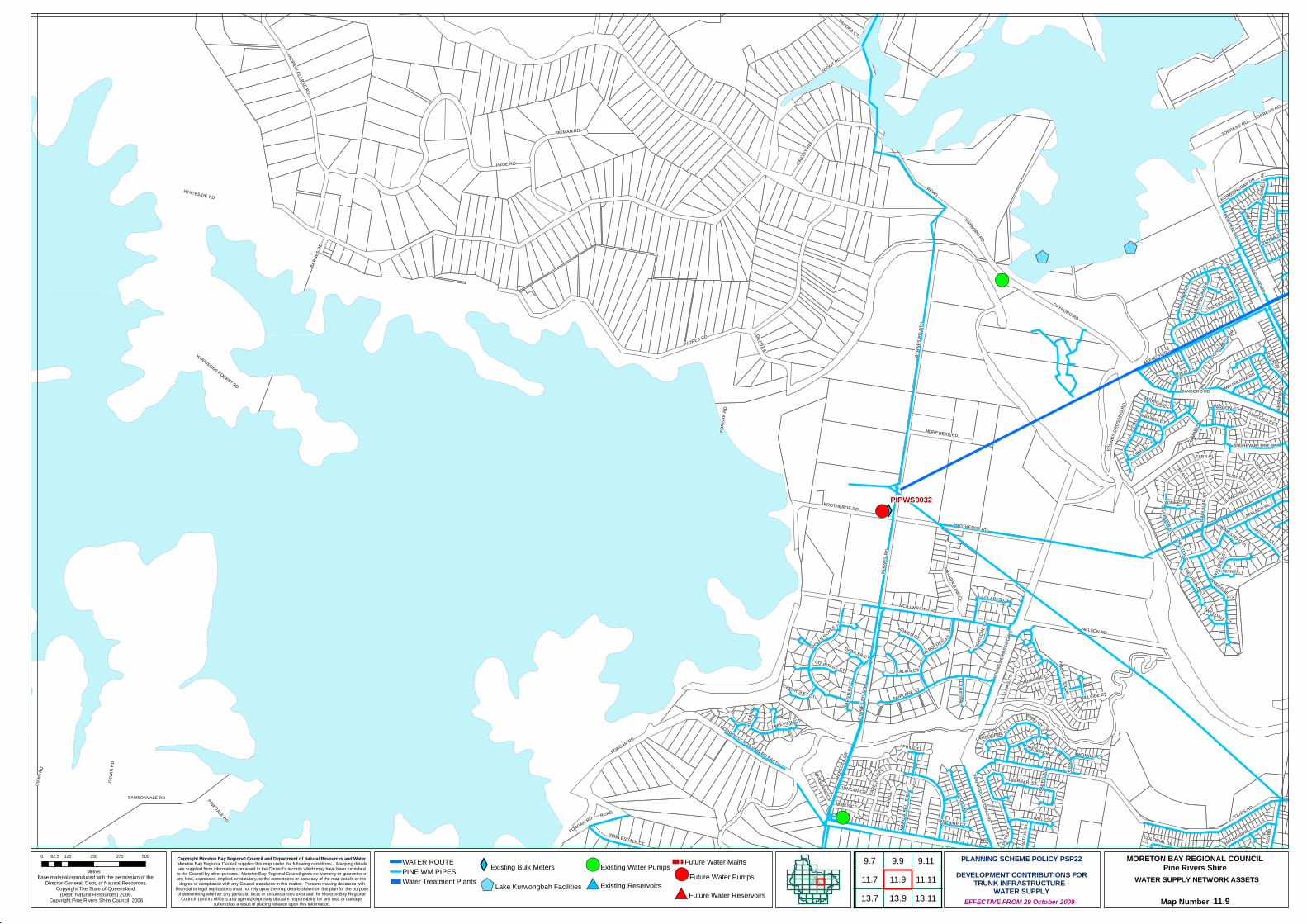
$+$+
XY
XY
XY
XY
#*
#*
!(
!(
!(
!(
!(
#*
!(PIPWS0032
VORES RD
WHITESIDE RD
HYDE RD
TODDS RD
SCOUT RD
DAYBORO RD
OSWI
N RD
GUNN
RD
NELSON RD
BYRN
ES R
D NT
H
CIRCU
IT RD
ANDREW CLARKE RD
BYRN
ES R
D
HARRISONS POCKET RD
PROTHEROE RD
GRANT ST
SAMSONVALE RD
PATMAN RD
MIDSON ST
BYRN
ES R
D ST
H
KILLA
RA C
R
MOREHEAD RD
LINKS
CR
BENT
LEY
CT
TORRENS RD
MCILLWRAITH RD
ROAD
FERRARI ST
SANDRA CT
JEAN
CL
REBE
CCA C
R
FAIRLANE ST
RIBBLESDALE CT
ARUNGA ST
FRENCHS RD
BEEVILLE RD
GLADYS CT
CONSTANTIA
DR
KARE
LYN
DR
KIRRI AV
BARN
ES R
D
HUNTER CCT
ISIS
RD
ROMEO CT
DUNCAN CR
MERCEDES ST
LINDFIELD DR
OLERON TCE
COOPS PL
KURWONGBAH DR
NEWBURY CR
WALL
ERS C
T
ALAWARA ST
RUBY CR
JAMES CT
INVERPINE CT
NATIU
S ST
ANDREW PETRIE DR
WILL CT
WOMBAT CT
MONA VALE WY
MARC
IA-BE
LLE
PL
ASHFORD CCT
HOPKINS ST
AFFLECK AV
MARY JANE CT
PETE
CT
PORS
CHE C
T
AMANDA JUNE CL
CARW
ELL A
V
GORDONS CROSSING RD EAST
JAGU
AR C
T
TOKAI CT
PINE VALLEY DR
LAWSON CL
YOUN
GS C
ROSS
ING
RD
MAURIENNE RD
HANSEN DR
FIREFLY CR
MIRRIGAN CT
D'AGU
ILAR
ST
HILLSIDE CT
CALAIS CT
ROLLS ROYCE CT
PINEDALE RD
VERD
ON C
T
TIMBARRA CT
PAYNE CT
BEAKEY CL
CHEVROLET CT
COURTAGE CT
LADNERS CT
APRIL CT
CONDAMINE CT
WARR
INGA
H GR
WARGON CT
HIDD
EN C
T
LAKEVIEW CT
DAIMLER CT
SAPPHIRE CT
LAMBOURNE CT
COLONIAL DR
TREWHELLA CT
TWEEDALE CT
FARR PL
HOMESTEAD PL
ISABE
LLA S
T
CHESTER CT
TAMA
RI PL
FORGAN RD
ROAD
DAYBORO RD
FORGAN RD
ROAD
YOUNGS CROSSING RD
PROTHEROE RD
ROAD
BEEVILLE RD
DAYBORO RD
TORRENS RD
YOUN
GS C
ROSS
ING
RD
FORG
AN R
D
Copyright Moreton Bay Regional Council and Department of Natural Resources and Water Moreton Bay Regional Council supplies this map under the following conditions:- Mapping detailsare supplied from information contained in the Council's records which may have been furnished
to the Council by other persons. Moreton Bay Regional Council gives no warranty or guarantee ofany kind, expressed, implied, or statutory, to the correctness or accuracy of the map details or the
degree of compliance with any Council standards in this matter. Persons making decisions withfinancial or legal implications must not rely upon the map details shown on this plan for the purposeof determining whether any particular facts or circumstances exist and the Moreton Bay Regional
Council (and its officers and agents) expressly disclaim responsibility for any loss or damage suffered as a result of placing reliance upon this information.
WATER SUPPLY NETWORK ASSETS
Map Number 11.9
Base material reproduced with the permission of the Director-General, Dept, of Natural Resources.
Copyright The State of Queensland (Dept. Natural Resources) 2006.
Copyright Pine Rivers Shire Council 2006 EFFECTIVE FROM 29 October 2009
0 125 250 375 50062.5
Metres
PLANNING SCHEME POLICY PSP22DEVELOPMENT CONTRIBUTIONS FOR
TRUNK INFRASTRUCTURE -WATER SUPPLY
MORETON BAY REGIONAL COUNCILPine Rivers ShireWATER ROUTE
PINE WM PIPESWater Treatment Plants
XYExisting Bulk Meters
$+Lake Kurwongbah Facilities
!(Existing Water Pumps
#*Existing Reservoirs
Future Water Mains!(Future Water Pumps
#*Future Water Reservoirs
9.99.711.911.7
9.11
13.913.711.1113.11
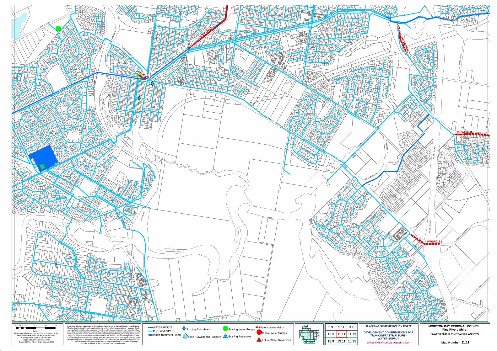
XY
XY
XY
#*
#*
!(
!(
!(
!(
!(
#*
!(
PIPWS0008
PIPWS0035
PIPWS0016
PIPWS0038
PIPWS0037
BICKL
E RD OGG RD
BRAY
RD
AKERS RD
ANZAC AVTORRENS RD
SAMU
EL R
D
DOHLES ROCKS RD
STATION RD
GYMPIE RD
BRAYS RD
GREENS RD
WIND
SOR
RD
ELSIE
ST
BLYTH RD
WESLEY RD
REID
ST
GRAD
I ST
ROAD
ELM DR
WHITTOME ESPL
LEIS PDE
BEAT
TIE S
T
GOODRICH RD
TODDS RD
SLATER AV
DOON ST
HARD
ING
ST
HIGSON ST
GOODFELLOWS RD
EYRE AV
CECILY ST
WOONARA DR
YEBRI ST
VINEY AV
CAIRNS RD
TESC
H RD
GOOD
WOOD
RD
EACHAM ST
PEAR
L AV
TI-TREE
LAWNTON POCKET RD
KUBIA
K DR
GAIL
ST
NUTTALL ST
MCCLINTOCK DR
TULIP ST
BARRINGTON CL
WARREG
O CR
CREST ST
KEDR
ON R
D
NARANGBA RD
MARS
DEN
RD
TI-TREE RDDU
FFIE
LD R
D
OISIN ST
JOORA AV
ASHLEY CT
TOKE
LY C
T
BOONA ST
WATE
R ST
BRUC
E HI
GHWA
Y
PETRIE ST
SPRING RD
GOLD
EN AV
WELLINGTON RD
SCHO
OL R
D
WATT
LE S
T
WINT
ER R
D
STOREY RD
FRENCHS RD
HALY CT
ORLA CT
COLL
EEN
ST
RIVER ST
MALLEE S
T
GRACE CT
CHESTNUT DR
LERO
SE AV
CONNORS ST
WASHBROOK CR
SPEN
CER
RD
TULIP
TREE
RD
CLAR
EMON
T DR
WOODLANDS AV
ALANA ST
MELIN
DA S
T
OLD GYMPIE RD
DAYBORO RD
GARN
ET AV
FACT
ORY S
T
CAMARSH DR
TAPINI AV WEST
MOHR CT
KATE
CT
CASTLE HILL DR
TAYL
OR S
T
ELGATA ST
DENIS ST
LENAE CT
JUNCTION RD
BUTCHER AV
GOSHAWK DR
COTTON ST
BURNETT DR
KAHA
LA R
D
ALBANY CT
CHAMPAGNE ST
MACQUARIE DR
AQUARIUS ST
GLEN
MORE
ST
PAUL ST
PINE RIVER DR
STYLES RD
KAPA
LAMA
RD
ARMS
TRON
G ST
THE CRESCENT
WALTON CR
ILLOURA ST
MILL
ST
CASTLE CT
MIA ST
YOUNG ST
ADAM CT
KENT
ST
SEPI
A PL
TURQUOISE CR
CASCADE CT
WEYBA CT
TRAY
LEN
AV
CHES
TERF
IELD
DR
CANIA CR
CLARAGH CTJODIE ST
HANL
ON R
D
BLACKALL RD
ROSEBROOK ST
ACACIA CR
SELBY ST
BELROSE AVLOIRE AV
ILING
A PL
LAKEVIEW TCE
ENTRY PD
CULGOA CT
D'ARCY WY
KALMIA CL
WATERWAY CR
IVORY CL
BARNARD CR
PINE CREST DR
BRIGA
LOW
CT
EBERT PDE
BORDEAU CR
BREWSTER CT
TWIN LAKES DR
PYMBLE AV
GREE
NAW
AY S
T
ALLSOP ST
TAND
OOR DR
IVES S
T
EVEL
YN S
T
HERM
AN S
T
PARKWAY CR
HAWKHURST CT
HAVE
NHILL
CT
AZALEA CT
CLEARWATER CR
BRAID
WOOD
AV
DIAMOND AV
VERDON CT
NEILS
ON S
T
WYLLIE
ST
TOUL
OUSE
AV
MERY
LL C
T
HAMPSTEAD OUTLOOK
ULTRAMARINE PDE
EDGEWATER CT
MUNDIN ST
ANDR
EW ST
SHIEL
D ST
ARGY
LE ST
VOLTAIRE CR
COPPER CR
AZURE CR
BURRUMBEET ST
BARRINE CT
PRUS
SIAN
ST
FREEDOM DR
CARBEEN CR
TYRR
ELL C
T
MICA CT
FERNWOOD CT
RUE MONTAIGNE ST
LOUGH CT
YARAKI CT
BRONZE CT
HAMBL
ETON CR
COTTER CT
DRYSDALE CT
BREMER CT
EGAR CT
TAVISTOCK CR
HIGHLAND CT
COOKE ST
WYARA CT
MAND
Y CT
BALD
WIN ST
CHANCERY CL
BAYBREEZE CR
ALEISHA CT
CLEM
ITSON
CT
DUYV
ESTY
N TC
E
TAPINI AV EAST
MARLE
NE ST
BALLARD CT
ARRAKUNE CR
NORTHQUARTER DR
RIVER VISTA CR
WATT
LEBR
USH
CT
BOARDMAN ST
LORIENT CT
CONSTANCE CT
CYPR
ESS
ST
CRYSTE
LLE CT
MACS LN
AHERN ST
ABLE ST
CAINE ST
BOND ST
DIAMANTINA CT
VAUCLUSE CR
AFFLECK AV
FONTENAY CT
CAMION CT
MAGE
NTA S
T
PLAT
YPUS
CT
CECCATO DR
ST AIDENS CT
FORDINGTON WY
VALMADRE CT
GLEN
DON C
T
CATHERINE CT
AUGUSTINS CR
FRESHWATER CREEK RD
JULIUS CT
PAPERBARK ST
HASTINGS ST
TURNBULL CT
VERONIC CT
FULLER CT
HILL
CRES
T CT
SCOTTS CT
EUCUMBE
NE DR
SYLVAN CT
BREWER ST
KINGSHAND DR
FERN
AN C
T
SAPPHIRE CL
ROSENLUND ST
CHAB
ROL C
T
DECKLE RD
WADE CT
KUHR CTFERRIER ST
VERMILION AVE
ALBE
RT S
T
BLAT
CHFO
RD DR
ST DENIS CT
RAINBOW CT
FOLE
Y ST
AVONLEA ST
SYLVESTER DR
PARIS ST
GOLDSMITH CT
CHER
INGTO
N WY
FITZROY CR
LEIS RD WST
BEEVILLE RD
WINC
HCOM
BE AV
HADLEIGH CT
CALVERT CL
WARANGA CT
BRITTAINY ST
OAKVIEW CT
TALARA WY
KU RING GAI CHS
HUON
CT
BROMLEY CL
ROSEVILLE ST
CAEN CT
AMETHYST CT
PEDDER CT
STRIN
GYBAR
K CT
GRENOBLE ST
CARMODY CT
JUSTIN ST
NOOJEE CT
OLD DAYBORO RD
COWAL CT
NANCY ST
SUTTOR CT
PEMBRIDGE ST
CHARTR
ES ST
BAINES ST
VALE
NCE C
T
ROSE
ST
BARR CT
CHAMBERY RD
LOCKHART PL
SCENIC DR
MICHEL CT
MURC
HISO
N CT
PINELANDS ST
ALONGA CT
COGNAC CT
PORTLAND ST
PUTNEY CT
LEIS RD EST
OLERON TCE
MOSSMAN CT
MATILDA CT
FLOR
ENCE
ST
BAYEAU CT
RODGERS LN
BONNINGTON CT
BOORO
GARI P
L
LADY
BIRD
ST
KARLOO PL
ASTE
R ST
CAMMERAY PL
PAROO PL
NORFOLK AV
HART CT
BROLGA A
V
EVERGREEN PDE
BANCROFT CT
VENETIAN CT
CLYD
E ST
TUFFLEY CT
NOTTINGHILL RD
WHITES RD
COOBA CT
KATHLEEN ST
BIARRITZ CT
PASCO CT
CONNEWARRE CT
ROCHELLE CT
LA FAYETTE CT
CERATODUS CT
LIMOSA CT
OBERONG CT
MAUR
EEN
ST
COLAC CT
VALMY CT
ALLEGRA CT
GLENCOE ST
SAWYER CT
TOTT
ENHA
M CT
MEDH
URST
ST
COACHWOOD CT
BURDEKIN CT
EUSTON CT
MORETON STRITC
HIE CT
ST Q
UENT
IN R
D
LYDFORD CT
ANZA
C AV
BRUC
E HI
GHWA
Y
ROAD GOODRICH RD
ROAD
CARMODY CT
MCCLINTOCK DR
DOHLES ROCKS RD
BRAYS RD
DOHLES ROCKS RD
BLACKALL RD
ROAD
BRAYS RD
NARANGBA RD
ROAD
GOODFELLOWS RD
GYMP
IE RD
BRUCE HIGHWAY
HILLCREST CT
Copyright Moreton Bay Regional Council and Department of Natural Resources and Water Moreton Bay Regional Council supplies this map under the following conditions:- Mapping detailsare supplied from information contained in the Council's records which may have been furnished
to the Council by other persons. Moreton Bay Regional Council gives no warranty or guarantee ofany kind, expressed, implied, or statutory, to the correctness or accuracy of the map details or the
degree of compliance with any Council standards in this matter. Persons making decisions withfinancial or legal implications must not rely upon the map details shown on this plan for the purposeof determining whether any particular facts or circumstances exist and the Moreton Bay Regional
Council (and its officers and agents) expressly disclaim responsibility for any loss or damage suffered as a result of placing reliance upon this information.
WATER SUPPLY NETWORK ASSETS
Map Number 11.11
Base material reproduced with the permission of the Director-General, Dept, of Natural Resources.
Copyright The State of Queensland (Dept. Natural Resources) 2006.
Copyright Pine Rivers Shire Council 2006 EFFECTIVE FROM 29 October 2009
0 125 250 375 50062.5
Metres
PLANNING SCHEME POLICY PSP22DEVELOPMENT CONTRIBUTIONS FOR
TRUNK INFRASTRUCTURE -WATER SUPPLY
MORETON BAY REGIONAL COUNCILPine Rivers ShireWATER ROUTE
PINE WM PIPESWater Treatment Plants
XYExisting Bulk Meters
$+Lake Kurwongbah Facilities
!(Existing Water Pumps
#*Existing Reservoirs
Future Water Mains!(Future Water Pumps
#*Future Water Reservoirs
9.911.9
9.11
13.9
9.1311.11 11.1313.11 13.13

PIPWS0034
PIPWS
0036
PIPWS
0035
KORMAN RDBRAYS RD
ROADELIZABETH RD
HENR
Y RD
ANTH
ONY S
T
TESC
H RD
BARRY RD
DANIEL RD
GREENS RD DOHLES ROCKS RD
MARYVALE RD
CAIRNS RD
JABIRU DR
LAPWING CRWHIS
TLER
ST
TI-TREE RD
FRESHWATER CREEK RD
SPIN
EBILL
CT
BASIL
ST
STIRLING ESP
HOLL
Y CR
VANILL
A AV
WESLEY RD
GRANDVIEW PD
SAGE PD
TOPA
Z DR
PELICAN CL
MERCURY PDE
SATU
RN C
T
GINGER CR
WHITEFACE ST
ILLAWARRA CL
VERM
ILION
AVE
ANISE
ED CR
BRONZEWING ST
LAVE
NDER
DR
JAEGER CT
VENT
URA C
T
VENU
S CT
WATTLEBIRD STSONG
LARK
CT
STARLING STLAKEFIELD DR
COBALT CT
Copyright Moreton Bay Regional Council and Department of Natural Resources and Water Moreton Bay Regional Council supplies this map under the following conditions:- Mapping detailsare supplied from information contained in the Council's records which may have been furnished
to the Council by other persons. Moreton Bay Regional Council gives no warranty or guarantee ofany kind, expressed, implied, or statutory, to the correctness or accuracy of the map details or the
degree of compliance with any Council standards in this matter. Persons making decisions withfinancial or legal implications must not rely upon the map details shown on this plan for the purposeof determining whether any particular facts or circumstances exist and the Moreton Bay Regional
Council (and its officers and agents) expressly disclaim responsibility for any loss or damage suffered as a result of placing reliance upon this information.
WATER SUPPLY NETWORK ASSETS
Map Number 11.13
Base material reproduced with the permission of the Director-General, Dept, of Natural Resources.
Copyright The State of Queensland (Dept. Natural Resources) 2006.
Copyright Pine Rivers Shire Council 2006 EFFECTIVE FROM 29 October 2009
0 125 250 375 50062.5
Metres
PLANNING SCHEME POLICY PSP22DEVELOPMENT CONTRIBUTIONS FOR
TRUNK INFRASTRUCTURE -WATER SUPPLY
MORETON BAY REGIONAL COUNCILPine Rivers ShireWATER ROUTE
PINE WM PIPESWater Treatment Plants
XYExisting Bulk Meters
$+Lake Kurwongbah Facilities
!(Existing Water Pumps
#*Existing Reservoirs
Future Water Mains!(Future Water Pumps
#*Future Water Reservoirs
11.11 11.13
13.11 13.13
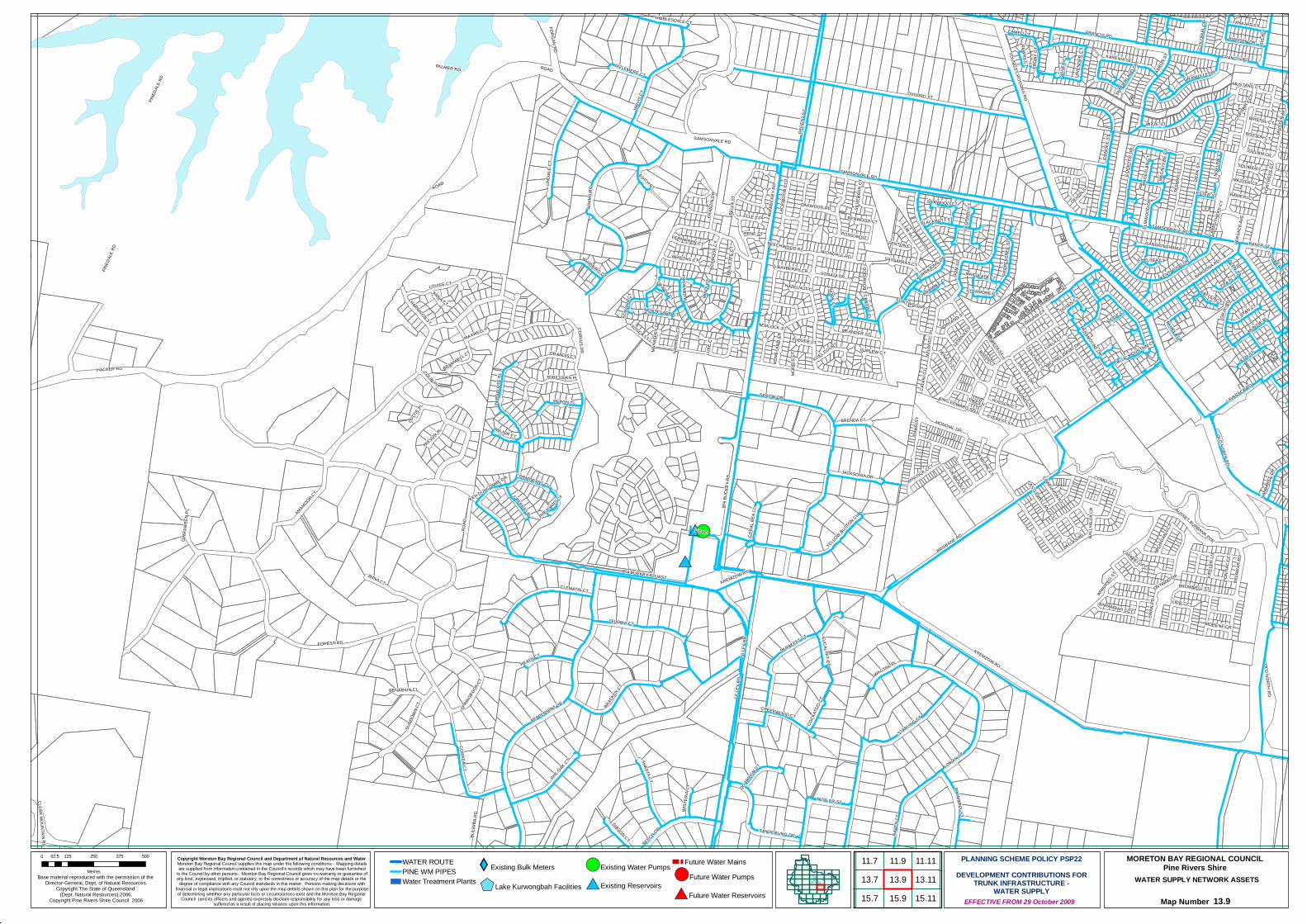
XY
#*
!(
#*
!(
!(
!(
#*
!(
OXFORD ST
FOREST RD
PINED
ALE R
D
HACKER RD
BRISBANE RD
ADAM
S RDLIN
DALE
CT
RAVE
N CT
LOWAN ST
STARLING ST
AMAMOOR CT
SAROW DR
TELOPIA CT
OLD NORTH RD
JACKSONIA DR
PALMER RD
CLEMATIS CT
WAGTAIL PL
CORVUS DR
REGE
NT S
T
BRAC
KEN CT
PARAKEET CT
JIMNA CT
PEPPERMINT DR
GUM
ST
SHE-OAK CT SHASTA CT
LILLE
Y RD
IRA B
UCKB
Y RD
MITZE ST
DUND
EE S
T
IRA BUCKBY RD WST
SPRIN
GBOOK C
T
SUND
OWN C
T
PARD
ALOT
E PL
DEAN
ST
PALLAS PD
LAVARACK RD
HEATH CT
CORREA CT
TATTLER ST
MEANDER ST
SANDERLING DR
HERON CL
TASM
AN S
T
BELL
A ST
MONDIAL DR
RYAN CT
BULIM
BA R
D
FIR PL
SWAN
PD
PAMELA DR
HAYWARD AV
CORA
L PEA
CL
TORESSIAN PL
JARV
IS CT
RUSSET BURBANK PDE
COLO
NIAL
DR
GRAY
RD
HANSEN DR
LOCK
YER
DR
YELLOW BUTTON CL
HILLARY DR
KYM CT
CAMEO CT
RIBBLESDALE CT
ZITA PL
TOSCA ST
PARAMOUNT DR
MUNDIE PL
GIBSON CT
GILLAM CR
CREBRA LN
ANKAFF ST
COMO CCT
SONATA DR
EVEREST ST
WINLOCK CCT
ELMW
OOD
DR
BRENDA CT
GRANDIS CTWHIMBREL ST
WHIPTAIL CT
KURRAJONG DR
NANB
AREE
DR
HEMLOCK ST
HARRISON ST
PATRONE CT
FLINTWOOD ST
BROWNELL ST
KARENIA ST
KENTWOOD DR
GRETA ST
PEPP
ERTR
EE S
T
QUARRION CT
HAZLEMERE CT
BEECH DR
HUDSON CT
BAYBERRY CR
MAJOR CT
MIND
I CT
BRAMWELL CT
DEVON ST
LIDO CCT
SANDRINGHAM CT
BARAMBAH CCT
LAVE
NDER
CT
WHIP BIRD CT BAROONA RD
AVONDALE RD
LACE
WOO
D CC
T
BRAMBLE CL
BISON CT
TREVOR PL
GIRR
AWEE
N PL
BENARKIN CL
LUKE
CT
TENZING CT
BOOB
OOK C
T
COCK
ATOO
CT
GRANVILLE DR
CREEKWOOD CT
DENALI CCT
CATA
NI C
T
POSSUM ST
SAMSONVALE RD
LOUISE CT
KOEL COURT
OAKWOOD RD
EUCALYPT CT
BAKER ST
ELLE CT
FERNWREN CT
HOME
LAND
CR
CORMORANT CL
GLEN ST
EDMUND CTMONTCLARE CT
MICH
IGAN
CCT
MICHAEL DAVID DR
SILKWOOD CT
COLIN PL
WIST
ERIA
CT
NADINE CT
FRANCIS RD
TAWNY CT
EDITH CT
ISIS
RD
LATONA S
T
RIDGE CT
ANNA CT
SYCAMORE CT
SQUIRE CT
MAXWELL PL
LUKLA CT
BALL
YALL
A CR
FORT
RESS
CT
FENTON CL
PHEASANT CT
CANOPY CL
DOYEN CT
BOXW
OOD
CT
SUND
ERLA
ND DR
GRANOLA CL
NORLAND ST
NOEL
INE C
T
MORENE CR
FRAN
ZIN D
R
CONIFER CR
SASSAFRAS CT
BLUE MOUNTAIN CR
SILVE
RASH
CT
AUST
ER AV
MORR
IS CT
RENE CT
PAUL
ETTE
CT
LEOP
ARD
CT
SILVE
R CT
SONO
MA C
T
MACI
NTYR
E CT
KIPFL
ER LN
MAZZER CT
RANIERI CT
KEN DUNCOMBE DR
PIKE LN
RAYLEA CT
ONTARIO DR
HAZELNUT CL
MAGE
LLAN
CT
VERS
ACE A
VE
PONT
IAC
CCT
DELA
WAR
RD
KREMZOW RD
AARO
N ST
CRAIGAVON ST
BLACKBUTT ST
CAPABELLA CT
ORINDA CT
LOTT
IE PL
IDAH
O ST
CHELSEA CT
CASTLEWELLAN CCT
LESTER ST
PLOVER CT
KING EDWARD ST
WINNIPEG ST
RENWOOD CT
MUSTANG CT
NARR
ELL C
T
CARR
UTHE
RS C
T
FORGAN RD
ATLA
NTIC
PL
BRISTOL CT
MACULATA CT
BOSTON CT
MAHA
FFEY
CT
NOOK CL
EBON
Y CT
BEECHWOOD PL
CURLEW CT
CORS
AIR CC
T
CLEAR MOUNTAIN RD
ROAD
YOUNGS CROSSING RD
ROAD
IRA B
UCKB
Y RD
SAMSONVALE RD
ROAD
PINED
ALE R
D
LILLE
Y RD
KREMZOW RD
SAMSONVALE RD
FRANCIS RD
OLD NORTH RD
ROAD
Copyright Moreton Bay Regional Council and Department of Natural Resources and Water Moreton Bay Regional Council supplies this map under the following conditions:- Mapping detailsare supplied from information contained in the Council's records which may have been furnished
to the Council by other persons. Moreton Bay Regional Council gives no warranty or guarantee ofany kind, expressed, implied, or statutory, to the correctness or accuracy of the map details or the
degree of compliance with any Council standards in this matter. Persons making decisions withfinancial or legal implications must not rely upon the map details shown on this plan for the purposeof determining whether any particular facts or circumstances exist and the Moreton Bay Regional
Council (and its officers and agents) expressly disclaim responsibility for any loss or damage suffered as a result of placing reliance upon this information.
WATER SUPPLY NETWORK ASSETS
Map Number 13.9
Base material reproduced with the permission of the Director-General, Dept, of Natural Resources.
Copyright The State of Queensland (Dept. Natural Resources) 2006.
Copyright Pine Rivers Shire Council 2006 EFFECTIVE FROM 29 October 2009
0 125 250 375 50062.5
Metres
PLANNING SCHEME POLICY PSP22DEVELOPMENT CONTRIBUTIONS FOR
TRUNK INFRASTRUCTURE -WATER SUPPLY
MORETON BAY REGIONAL COUNCILPine Rivers ShireWATER ROUTE
PINE WM PIPESWater Treatment Plants
XYExisting Bulk Meters
$+Lake Kurwongbah Facilities
!(Existing Water Pumps
#*Existing Reservoirs
Future Water Mains!(Future Water Pumps
#*Future Water Reservoirs
11.911.713.9
15.7 15.913.7
11.11
15.1113.11

XY
XY
!(
!(
!(
#*
!(
STANLEY ST
BAKE
R ST
GYMPIE RD
RAILWAY AV
REILEY RD
BULT DR
LEITC
HS R
D
TAED
I AV
IRULA ST
NICOL WY
BAILE
Y CT
KEAT
S AV
DIXON ST
HINKLER CT
FOX ST
CADIZ ST
VIENNA WY
MAREE ST
BEITZ ST
GRAHAMS RDMY
LES
ST
CENTR
E ST
TAMARIX AV
CALALA DR
WALKER RD
ROSEWOOD DR
ANDALUCIA ST
SOVEREIGN AV
UNLEY ST
NANB
AREE
DR
AVALON CT
DEL RIO ST
SANTA CRUZ ST
NAVUA ST
SPITF
IRE A
V
ELLIS
ST BR
OWN
ST
MACKIE WYPAISLEY DR
TOLOSA ST
LEONE ST
LEON
ARD
CR
PETER ST
DANUBE DR
MECKLEM ST
BRODIEK ST
CHIVALRY ST
HEDGE ST
TARANDI ST
LAWNTON POCKET RD
BELL
S POC
KET R
D
HOPETOUN ST
CAHILL ST
MITC
HELL
ST
HARVEY ST
CLARENDON DR
COOK
ST
DURHAM CR BATEMAN ST
BRAHMS ST
WALTER CR
LEAR
MONT
H ST
WAIR
OA D
R
SPARKES RD FEDERATION DR
EMBASSY STULSTER CT
TECO
MA ST
BINNOWIE ST
SOUT
H PIN
E RD
GRENADIER ST
LEAN
NE C
R
KENSINGTON WY
WINDREST S
T
PALMER PDE
LORRAINE CT
ULMARRA CR
GILLAM CR
GERTRUDE ST
SAIALA CT
JILLO
ONG
ST
JUDITH ST
LOANE CR
CHAU
CER
PDE
ARTHUR ST
WALSHAM ST
BRENNAN PDE
MARSHALL ST
DUBARDA DR
SHAKESPEARE PDE
CASU
ARIN
A DR
RANG
EVIEW
ST
BUCKBY ST
CHARLOR ST
JUNCTION RD
PATRICIA ST
GLOUCESTER CR
ROBEL ST
DUKE ST
RONALD ST
GUARDS ST
BRUC
E HI
GHWA
Y
PINE RIVER DR
PATMAR ST
MOYL
AN C
T
WAGNER RD
MELALEUCA DR
PLATEAU PDE
LAVARACK RD
DOBSON DR
TORELLIANA DR
WIRRAWAY ST
CLIFFORD ST
HALL ST
COORABIN ST
ROAD
GERBERA CR
VALIA
NT CR
SYMPHONY AV
NOTTINGHAM PDE
BURKELL CT
SCHUBERT ST
DOMINION ST
PINAC
LE S
T
GARBALA DR
ACLAND DR
ADA ST
KINROSS ST
WOODBURY AV
SLACK CT
EVERGREEN AV
SAMSONVALE RD
COMINO ST
OUTLOOK PDE
KREM
ZOW RD
LANCASTER ST
BEECHCRAFT ST
TENN
YSON
ST
WORD
SWOR
TH ST
ALDI
NGA S
T
ALONZO CL
HIGHF
IELD
CR
TULO
NG C
T
BANKSIA ST
HILLSDALE ST
CALADIUM ST
VISCOUNT ST
MOTT ST
POPE
AV
FLYNNS LN
LINCOLN ST
NIGHT
INGAL
E DR
MANS
FIELD
ST
CLARENCE ST
FRENCH AVE
KING
ST
NEALES ST
STIRLING ST
GOULD ST
BYGRAVE ST
BEARCAT CT
LACHLAN ST
PITCHIE ST
LORD BYRON PDE
SANDRA COOKE CT
DOIG
ST
CHELTENHAM ST
DELPHINIUM ST
MACLEAY ST
MCKINLAY CR
LANG ST
FORTRESS CT
WELSH ST
MANTHEY CR
BLAND ST
BRACE CL
PANORAMA ST
BLENHEIM ST
JILBA ST
FLINT ST
WILS
MITH
ST
ELIO
TT ST
GERARD ST
GALVIN ST
NORMAN PL
MCCALL ST
FRANCIS RD EAST
LUCY ST
JACQUE CT
MAJESTIC ST
JAKARI CT
MELL
ING
ST
DEE CT
OTTIL
IE ST
BARWON ST
HELL
CAT C
CT
FARROW ST
LARUE CT
DUNC
AN ST
ZINNIA ST
KIAH CT
BACH ST
STANLEY ST EST
KNIGHT ST
REGENCY CT
ELIZA ST
KUMBARI ST
JEFF JONES CT
KEND
ALL S
T
CASSIA ST
EBON CT
WRIGHT CT
DUMARESQ CR
ELLERDALE ST
CEDRELA CR
DIANNE ST
QUIAMONG CT
GILM
ORE S
T
GREE
NDAL
E CT
ROWL
AND S
T
GARDINER ST
CROTON ST
MELBA DR
BODIAM CT
FRANCIS RD
MARQUIS ST
HIGH
VIEW
ST
GRIGG CT
BROW
NING
CT
KEV BRASH CT
LIVINGSTONE ST
ASH CT
PAXTON CT
DON CT
TEMPI CT
AIRLIE CT
KAURI CT
STATION ST
SUTHERLAND DR
BEAUFORT ST
DEL C
T
CONSUL CT
FRANCIS RD
BRUC
E HI
GHWA
Y
KENSINGTON WY
KREMZOW RDGYMPIE RD
ROADMAREE ST
ROAD
ROAD
LEITCHS RD
BELL
S POC
KET R
D
Copyright Moreton Bay Regional Council and Department of Natural Resources and Water Moreton Bay Regional Council supplies this map under the following conditions:- Mapping detailsare supplied from information contained in the Council's records which may have been furnished
to the Council by other persons. Moreton Bay Regional Council gives no warranty or guarantee ofany kind, expressed, implied, or statutory, to the correctness or accuracy of the map details or the
degree of compliance with any Council standards in this matter. Persons making decisions withfinancial or legal implications must not rely upon the map details shown on this plan for the purposeof determining whether any particular facts or circumstances exist and the Moreton Bay Regional
Council (and its officers and agents) expressly disclaim responsibility for any loss or damage suffered as a result of placing reliance upon this information.
WATER SUPPLY NETWORK ASSETS
Map Number 13.11
Base material reproduced with the permission of the Director-General, Dept, of Natural Resources.
Copyright The State of Queensland (Dept. Natural Resources) 2006.
Copyright Pine Rivers Shire Council 2006 EFFECTIVE FROM 29 October 2009
0 125 250 375 50062.5
Metres
PLANNING SCHEME POLICY PSP22DEVELOPMENT CONTRIBUTIONS FOR
TRUNK INFRASTRUCTURE -WATER SUPPLY
MORETON BAY REGIONAL COUNCILPine Rivers ShireWATER ROUTE
PINE WM PIPESWater Treatment Plants
XYExisting Bulk Meters
$+Lake Kurwongbah Facilities
!(Existing Water Pumps
#*Existing Reservoirs
Future Water Mains!(Future Water Pumps
#*Future Water Reservoirs
11.913.915.9
11.11 11.13
15.1113.11 13.13
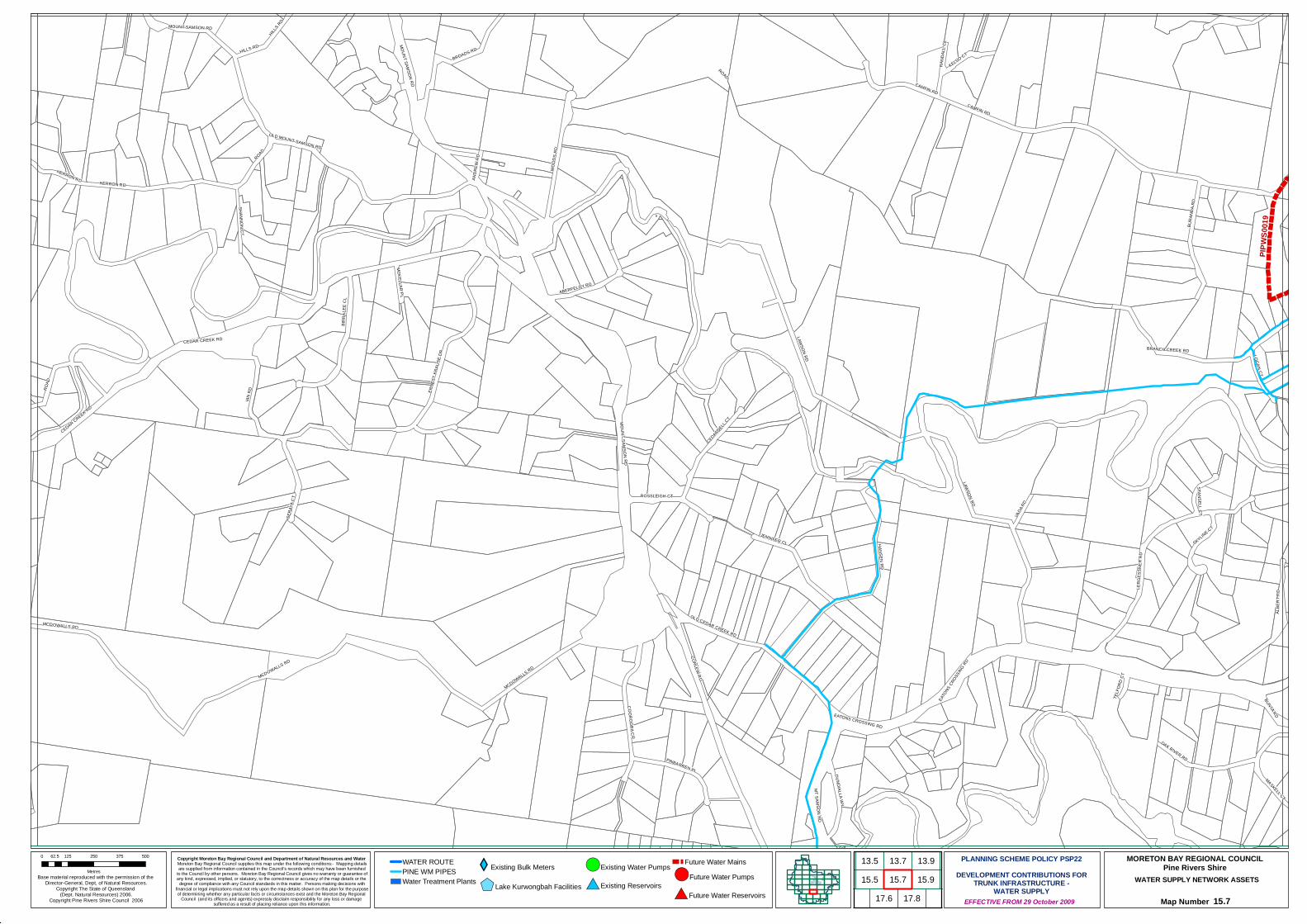
#*#*
#*
#*
!(
PIPWS
0019
CAMFIN RD
CURLEW RD
LAWSON RD
MCDOWALLS RD
IAN R
D
ALBE
RT R
D
WOOD
S RD
HANSEN RD
ROAD
BROADS RD
LERG
ESSN
ER R
D
BIRRA
LEE
CL
ERNE
ST K
RAUS
E DR
BURA
NDA R
D
OLD MOUNT SAMSON RD
JENNIFER CL
EATO
NS CROSSING RD
BRANCH CREEK RD
COOROORA CR
SERA
YA C
T
CEDARDELL CT
OAK RIVER RDPINBARREN PL
KELSO CT
OLD CEDAR CREEK RD
ABERFELDY RD
BUNYA RD
SHANNON CT
MOUNT SAMSON RD
SKYLINE CT
HERRON RD
DUNDIALLA WY
MASKELL CT
MT SAMSON RD
CEDAR CREEK RD
VADA
RD
HILLS RD
STANSELL CT
ROSSLEIGH CT
MCKELLAR PL
LOGAN CT
RAND
ALL C
L
TELF
ORD
CT
ANDR
EW R
D
EATONS CROSSING RD
CAMFIN RD
HILLS RD
ROAD
MOUNT SAMSON RDMCDOWALLS RD
ROAD
MOUNT SAMSON RD
LAWSON RD
MCDOWALLS RD
HERRON RD
CEDAR CREEK RD
Copyright Moreton Bay Regional Council and Department of Natural Resources and Water Moreton Bay Regional Council supplies this map under the following conditions:- Mapping detailsare supplied from information contained in the Council's records which may have been furnished
to the Council by other persons. Moreton Bay Regional Council gives no warranty or guarantee ofany kind, expressed, implied, or statutory, to the correctness or accuracy of the map details or the
degree of compliance with any Council standards in this matter. Persons making decisions withfinancial or legal implications must not rely upon the map details shown on this plan for the purposeof determining whether any particular facts or circumstances exist and the Moreton Bay Regional
Council (and its officers and agents) expressly disclaim responsibility for any loss or damage suffered as a result of placing reliance upon this information.
WATER SUPPLY NETWORK ASSETS
Map Number 15.7
Base material reproduced with the permission of the Director-General, Dept, of Natural Resources.
Copyright The State of Queensland (Dept. Natural Resources) 2006.
Copyright Pine Rivers Shire Council 2006 EFFECTIVE FROM 29 October 2009
0 125 250 375 50062.5
Metres
PLANNING SCHEME POLICY PSP22DEVELOPMENT CONTRIBUTIONS FOR
TRUNK INFRASTRUCTURE -WATER SUPPLY
MORETON BAY REGIONAL COUNCILPine Rivers ShireWATER ROUTE
PINE WM PIPESWater Treatment Plants
XYExisting Bulk Meters
$+Lake Kurwongbah Facilities
!(Existing Water Pumps
#*Existing Reservoirs
Future Water Mains!(Future Water Pumps
#*Future Water Reservoirs
13.915.713.7
15.917.6 17.8
13.515.5
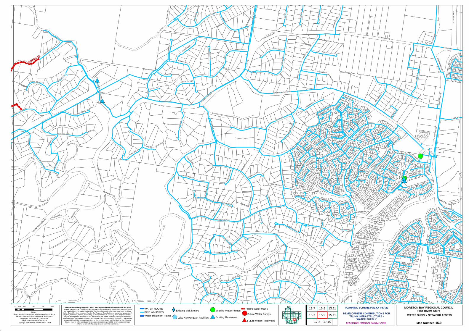
#*
!(#*
#*
#*
#*!(#*
#*
!(
!(
!(
#*
!(
!(
PIPWS0019
BUNYA RD
CHURCH RD
CASHS RD
BURANDA RD
WESTON DR
GARRAWIN CT
BARKER ST
HEATHER ANNE DR
CLAYFIELD RD
RINN
AV
HARR
IER
PL
MILFORD CT
EDEN DR
BOLAND CT
PAULI CT
LILLE
Y RD
MONT
EGO
CT
ROAD
THOMAS CT
SALISBURY CT
LASC
ELLE
CT
ALBERT RD
IRELAND CT
LAMA
UR S
T
DRAPERS RD
ALBION RDHARLEY CT
BUNY
A CRO
SSIN
G RD
CRIBB RD
LAUREL CT
BEECH DR
TERBEN ST
BRANCH CREEK RDSARAH CT
CORYMBIA LN
MORG
AN RD
SOMERS ST
RAVE
N CT
KIMBE
RLEY
CT
HENR
Y CT
WHIM
BREL
ST
PADDY R
D
BELLBIRD CT
FITZGERALD CT
BUNYA PINE CT
WARNER RD WST
OLD N
ORTH
RD
CHRI
STIN
E DR
STEILER CT
TALISMAN CT
SCEN
IC C
L
BULIM
BA R
D
DENNISTON CT
FAHEYS RD
KEST
REL C
T
LOWA
I CT
JANE CT
ROTH
SCHI
LD S
T
HIDDEN VALLEY DR
EXPL
ORER
DR
MINE
RVA C
T
BREEN DRST
ARLIN
G ST
ASHLEIGH CT
MCCARTNEY CT
QUEE
N ELIZ
ABET
H DR
MAYFL
OWER ST
BIRMINGHAM ST
MAYN
ARD
DR
ALLEN RD
SYLVIA CT
HODGE RD
ALBERIC CT
SARA
BAND
DR
DOVE CT
ROUTLEDGE CT
HILL GR CL
COROWA CT
CASSINIA CT
WYLAH CT
COORPAROO RD
PRASADA CT
SAVOY PL
OLYMPUS CT
MASKELL CT
RIVERGUM DR
SOUTH PINE RD
WIND
SONG
ST
FRYA
R CT
JANNA CT
JANUS CT
TIBBI
TS C
L
JUBILEE CT
KARENA ST
DUDLEY CTESTELLE CT
TAMMY CT
CABARITA CR
MARY CT
HOARE CT
HERO ST
CALYPSO CT
SNOW WOOD DR
MELIA CT
DUET CT
LA V
ISTA
CT
GYPSY CT
GOWRIE ST
GLEN
EAT
ON ST
PEGAS
US AV
FLETCHERS RD
WIVE
NHOE
AV
GIRRAH ST
CLEAR MOUNTAIN RD
DIANA CT
RIVERSLEIGH CR
ZORINA CT
TONNERE CT
TANAGER ST
DAWNET
A CT
RIVE
R OA
KS D
R
TURB
AL CT
LACEFLOWER CR
DANAUS CT
SUNB
LEST
CT
BUNYA PARK DR
OPHELIA CR
BANKS CT
MARINA CT
ORION AV
BETTINA CT
SONORA CT
DIORAMA CT
EATONS CROSSING RD
KINGF
ISHER
ST
TIFFANY CT
BETH
CT
CHOWCHILLA ST
FLINDERS WY
MEILL
AND
CT
MARYLIN TCE
ROCHEADON DR
FIREWHEEL CT
GUMVIEW ST
SALLY CT
ROMULUS ST
VALENCIA CT
PEAC
E CT
ROUN
DELA
Y CT
ATKINSON CT
ATOL
L CR
MANCH
ESTE
R CT
GHOST GUM CT
EDENDERRY CT
PASCALI CR
FLAMINGO DR
BONSOIR CT
PRION CT
LAMBERT CT
MABELLA CT
OEDI
PUS
CT
TRIBUTARY CT
BART
ON C
T
LEE CL
ALBANY FOREST DR
CORS
O ST
CRESSBROOK DR
BRIAN MORRISON RD
CONFLUENCE CT
ATLAS CT
HARRY CT
APOL
LO C
T
CLAPHAM CT
FINCH CT
MONICA CT
BASSINO CT
SANCTUARY CT
GEORGETTE CT
GLENLYON CT
ANGEL CT
WEBB CT
GLENDORE CT
MEMOIRE CT
FELICIA PL
BEND CT
JAMES CASH CT
PENELOPE CT
FOAMBARK CT
ELWOOD CT
OSIRA CL
BUTTONWOOD CL
EXCELCIA CT
PARADISE CT
BLAXLAND CL
STARINA CT
ROSMARIN AV
CAMARA CT
WARNER RD
SHALLOWS CT
ELDERBERRY CT
CORSO PL
WIND
RUSH
CL
BRANDY CT
GARGANEY ST
JASON TCE
PORTIA CL
PEACOCK ST
MASCOTTE CT
SUNB
EAM
CT
CARTER CT
HEAT
HERL
EA ST
JESS
ICA C
T
FAIRY
PL
PARIN
GA CL
LARK CTKAORIKI CT
BONICA CT
PERL
A CL
HANDEL CT
PLUM
PINE
CT
HYLACOLA DR
DELORE CL
AVAN
DEL CT
ILONA PL
BRIGA
DOON
CR
PLOVER CT
AJAX
CT
LEANDER ST
DALRYMPLE CT
AMOROSA CT
APEX GR
WARNER RD
SOUT
H PIN
E RD
EATONS CROSSING RD
BUNY
A RD
CLEAR MOUNTAIN RD
HODG
E RD
ROAD
SOUT
H PIN
E RD
LILLE
Y RD
OLD
NORT
H RD
EATONS CROSSING RD
EATONS CROSSING RD
Copyright Moreton Bay Regional Council and Department of Natural Resources and Water Moreton Bay Regional Council supplies this map under the following conditions:- Mapping detailsare supplied from information contained in the Council's records which may have been furnished
to the Council by other persons. Moreton Bay Regional Council gives no warranty or guarantee ofany kind, expressed, implied, or statutory, to the correctness or accuracy of the map details or the
degree of compliance with any Council standards in this matter. Persons making decisions withfinancial or legal implications must not rely upon the map details shown on this plan for the purposeof determining whether any particular facts or circumstances exist and the Moreton Bay Regional
Council (and its officers and agents) expressly disclaim responsibility for any loss or damage suffered as a result of placing reliance upon this information.
WATER SUPPLY NETWORK ASSETS
Map Number 15.9
Base material reproduced with the permission of the Director-General, Dept, of Natural Resources.
Copyright The State of Queensland (Dept. Natural Resources) 2006.
Copyright Pine Rivers Shire Council 2006 EFFECTIVE FROM 29 October 2009
0 125 250 375 50062.5
Metres
PLANNING SCHEME POLICY PSP22DEVELOPMENT CONTRIBUTIONS FOR
TRUNK INFRASTRUCTURE -WATER SUPPLY
MORETON BAY REGIONAL COUNCILPine Rivers ShireWATER ROUTE
PINE WM PIPESWater Treatment Plants
XYExisting Bulk Meters
$+Lake Kurwongbah Facilities
!(Existing Water Pumps
#*Existing Reservoirs
Future Water Mains!(Future Water Pumps
#*Future Water Reservoirs
13.913.715.7 15.9
17.815.1113.11
17.10
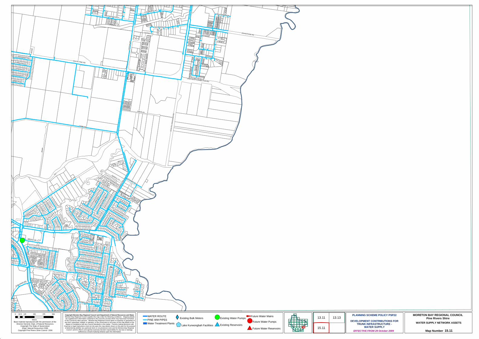
!(#*
#*!(#*
!(
!(
#*
!(
!(
CRIBB RD
DAVIS LN
LEITC
HS R
D
GREENSILL RD
JOHNSTONE RD
SCOU
TS C
ROSS
ING
RD
TERRENCE RD
DUNTROON ST
MAUD
ST
BEVLIN CT
MOON
BI S
T
WRUCK CR
WIND
EMER
E RD
WILLOW ST
DOLCOATH ST
CUTHBERT ST
DEAK
IN ST
JADE
ST
GIRRAH ST
GASKILL CT
EXPLORER DR
WILSON AV
SELIGAN ST
DUKA
MP ST
BOWEN AV
JACARANDA DR
EARL
ST
PLEA
SANT
DR
AGNE
S ST
WARA
TAH
ST
CURRAJON ST
AVON CR
BALSWIDDEN ST
KEON
G RD
MAX CT
KENW
ORTH
PL
GOWRIE ST
BELCONNEN CR
OLD NORTHERN RD
FAHEYS RD
CHAPMAN CT
DOONSIDE PDE
LINKFIELD CONNECTION RD
GILFORD CR
CARADON ST
ALDI
NGA S
T
STRATHWYN ST
ALBANY CREEK RD
KARENA ST
ERNIE ST
KESTEVEN ST
GEORGE ST
OSCAR CR
ROAD
LEITC
HS RD
STH
CROFTY ST
WHITES CT
JULLYAN ST
STEWART RD
DEVORAN ST
MALVERN RD
SUSSEX DR
RUFUS CTCATHY CT
GARRET ST
FOLKESTONE AV
STEP
HEN S
T
FERGUSON ST
SHARON CT
COLO
RADO
CR
CHOWCHILLA ST
YORK
CT
RAFTER AV
PATH
WAY
GABRELLE CT
MCCONACHIE CT JESSIE CT
NILE C
T
THAMES ST
LEVA
NT S
T
TOOR
AK R
D
JANICE ST
TOMA
NBIL
CT
KELV
IN CT
BREN
DALE
ST
WIGAM CT
ARUN
DELL
CT
SOUTH PINE RD
DERBY CT
ROAD
Copyright Moreton Bay Regional Council and Department of Natural Resources and Water Moreton Bay Regional Council supplies this map under the following conditions:- Mapping detailsare supplied from information contained in the Council's records which may have been furnished
to the Council by other persons. Moreton Bay Regional Council gives no warranty or guarantee ofany kind, expressed, implied, or statutory, to the correctness or accuracy of the map details or the
degree of compliance with any Council standards in this matter. Persons making decisions withfinancial or legal implications must not rely upon the map details shown on this plan for the purposeof determining whether any particular facts or circumstances exist and the Moreton Bay Regional
Council (and its officers and agents) expressly disclaim responsibility for any loss or damage suffered as a result of placing reliance upon this information.
WATER SUPPLY NETWORK ASSETS
Map Number 15.11
Base material reproduced with the permission of the Director-General, Dept, of Natural Resources.
Copyright The State of Queensland (Dept. Natural Resources) 2006.
Copyright Pine Rivers Shire Council 2006 EFFECTIVE FROM 29 October 2009
0 125 250 375 50062.5
Metres
PLANNING SCHEME POLICY PSP22DEVELOPMENT CONTRIBUTIONS FOR
TRUNK INFRASTRUCTURE -WATER SUPPLY
MORETON BAY REGIONAL COUNCILPine Rivers ShireWATER ROUTE
PINE WM PIPESWater Treatment Plants
XYExisting Bulk Meters
$+Lake Kurwongbah Facilities
!(Existing Water Pumps
#*Existing Reservoirs
Future Water Mains!(Future Water Pumps
#*Future Water Reservoirs 15.11
13.11 13.13
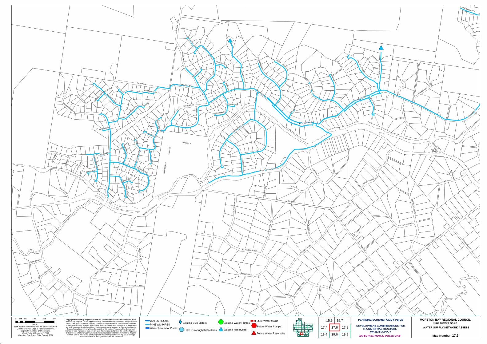
#*#*
!(
DAYS RD
REINERS RD
KAREELA DR
RYDER RD
GIBBONS RD
SALIX
CT
MOUNT GLORIOUS RD
HULCOMBE RD
FURLONGER RD
ROAD
REGOLI CT
CUMB
ERLA
ND R
D
ARNAN CT
WOODGLEN CT
BRUN
SWIC
K PL
LAGOON CT
ROXBURGH RD
RICHARD RD
MANGIFERA CL
HONEYWOOD CT
ENDWOOD CT
BRUSHWOOD DR
GREGGS RD
MT OREILLY RD
MIDW
OOD
CT
WESTBOURNE DR
VICTOR RUSSELL DR
GREENWOOD CR
TRALISA CT
RIVERINE CT
COSGROVE RD
WIGHTS MOUNTAIN RD
PINEWOOD DR
MT O'REILLY RD
VERA
CT
BIRDWOOD DR
MUSKWOOD CT
MARAGANI CT
HAIG
H CR
SATINWOOD DR
MOUNTAIN VIEW CT
STAVEWOOD CT
MACS
RD
MESSMATE CT
WOODVIEW ST
MALWOOD CT
WINCHESTER AV
SHOWGROUNDS DR
SUNSET GR
PARKWOOD DR
WOOD
FERN
CT
SPRINGFIELD CT
EASTWOOD PL
HOUSEWOOD CT
EQUE
STRI
AN C
T
WEST
WOOD
DR
PINE CT
BINALONG CT
NARRAWA RD
KADANGA CT
NORWOOD CT
BLUE GUM CT
ANGS
HELL
E CT
WOODANGA DR
SMALLS RD
SMALLWOOD CT
HIPWOOD PL
MEADOWOOD CL
CAVA
LIER C
T
WOODVILLE CT
CASTLEWOOD CT
RINGWOOD CT
TEAT
REE
CL
BYWOOD CT
PRIMWOOD CT
GREGGS RD STH
HARWOOD CT
GLADEWOOD CT
HUNT
ING PL
BAYWOOD CT
BELLWOOD CT
DELONIX CT
NORMAN HANSELL CT
WOODGROVE CT
REMI
NGTO
N PL
MAYF
IELD
RD
GUILDFORD PL
DRES
SAGE
CL
STARLIGHT CT
SHERWOOD CT
WOODBINE CT
PAGEWOOD CT
WIGHTS MOUNTAIN RD
REINERS RD
DAYS RD
MOUNT GLORIOUS RD
WEST
WOOD
DR
MAYFIELD RD
Copyright Moreton Bay Regional Council and Department of Natural Resources and Water Moreton Bay Regional Council supplies this map under the following conditions:- Mapping detailsare supplied from information contained in the Council's records which may have been furnished
to the Council by other persons. Moreton Bay Regional Council gives no warranty or guarantee ofany kind, expressed, implied, or statutory, to the correctness or accuracy of the map details or the
degree of compliance with any Council standards in this matter. Persons making decisions withfinancial or legal implications must not rely upon the map details shown on this plan for the purposeof determining whether any particular facts or circumstances exist and the Moreton Bay Regional
Council (and its officers and agents) expressly disclaim responsibility for any loss or damage suffered as a result of placing reliance upon this information.
WATER SUPPLY NETWORK ASSETS
Map Number 17.6
Base material reproduced with the permission of the Director-General, Dept, of Natural Resources.
Copyright The State of Queensland (Dept. Natural Resources) 2006.
Copyright Pine Rivers Shire Council 2006 EFFECTIVE FROM 29 October 2009
0 125 250 375 50062.5
Metres
PLANNING SCHEME POLICY PSP22DEVELOPMENT CONTRIBUTIONS FOR
TRUNK INFRASTRUCTURE -WATER SUPPLY
MORETON BAY REGIONAL COUNCILPine Rivers ShireWATER ROUTE
PINE WM PIPESWater Treatment Plants
XYExisting Bulk Meters
$+Lake Kurwongbah Facilities
!(Existing Water Pumps
#*Existing Reservoirs
Future Water Mains!(Future Water Pumps
#*Future Water Reservoirs
15.7
19.617.6
19.817.8
15.5
19.417.4
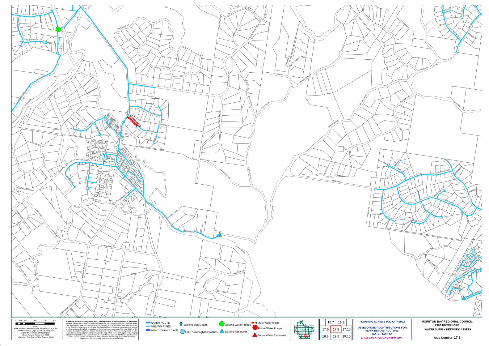
#*
#*
#*
#*
!(
!(
PIPWS0028WILLEM DR
RETREAT CT
NIGBER RD
MT SAMSON RD
MCLE
AN R
D
ASCOT CR
BURTON LNGIBBONS RD
BYGOTTS RD
BERESFORD DR
WARWICK LN
CARSON DR
KAY DR
CURLEW RD
VALRAY PL
BREEN DR
ALLE
N RD
COONAN RD
BLUE HILLS DR
GREGGS RD STH
CAMP
MOU
NTAI
N RD
CURRELL CCT
DICKENS PL
BERGIN CREEK RD
CANNINGTON CT
SYLV
ATER
RE C
T
PINEC
ONE C
T
PETERSON RD
CASH AV
BUNYA RD
ROAD
SOVEREIGN WY
WOODVIEW ST
JANCY CT
RIDGEWOOD CT
CASH AV NTH
CORB
ETT S
T
FURLONGER RD
SERENDIPITY DR
HAVELOCK CT
ASHW
OOD
CT
CHAL
MERS
CT
LINKWOOD DR
INGRID ST
NARRIEN CT
MAILMAN
S TRK
DUNN
CT
BENJ
AMIN
CL
PHOEBE CT
BRAH
AN CT
MAYFAIR DR
SCHOOL RD
MARY RING DR
BALM
ORAL
RD
HUTTON RD
TREN
THAM
PL
ERNEST CT
REGATTA AV
AUTUMNWOOD CT
UPPER CAMP MOUNTAIN RD
MAHDEEN PL
SHEPPARD ST
JUNC
TION S
T
MOUNT GLORIOUS RD
STATION ST
SAMFORD RD
PROGRESS ST
NAVILLUS PDE
LIUDA CT
WOODTOP CT
CORE
LLA A
V
BERTH
A CTMT GLORIOUS RD
GREER CT
MEREDITH CT
CREEK ST
TORWOOD CT
CHURCH ST
HEMWOOD CL
KATH FITZGERALD DR
MILLINER CTBE
RGMAN
ST
MAIN
ST
NIGB
ER R
D
GIBBONS RD
SAMFORD RD
ROAD
ROAD
BYGOTTS RD
SAMFORD RD
CAMP MOUNTAIN RD
COONAN RD
ROAD
BUNYA RD
ROAD
MAILMANS TRK
MOUNT GLORIOUS RD
SAMFORD RD
Copyright Moreton Bay Regional Council and Department of Natural Resources and Water Moreton Bay Regional Council supplies this map under the following conditions:- Mapping detailsare supplied from information contained in the Council's records which may have been furnished
to the Council by other persons. Moreton Bay Regional Council gives no warranty or guarantee ofany kind, expressed, implied, or statutory, to the correctness or accuracy of the map details or the
degree of compliance with any Council standards in this matter. Persons making decisions withfinancial or legal implications must not rely upon the map details shown on this plan for the purposeof determining whether any particular facts or circumstances exist and the Moreton Bay Regional
Council (and its officers and agents) expressly disclaim responsibility for any loss or damage suffered as a result of placing reliance upon this information.
WATER SUPPLY NETWORK ASSETS
Map Number 17.8
Base material reproduced with the permission of the Director-General, Dept, of Natural Resources.
Copyright The State of Queensland (Dept. Natural Resources) 2006.
Copyright Pine Rivers Shire Council 2006 EFFECTIVE FROM 29 October 2009
0 125 250 375 50062.5
Metres
PLANNING SCHEME POLICY PSP22DEVELOPMENT CONTRIBUTIONS FOR
TRUNK INFRASTRUCTURE -WATER SUPPLY
MORETON BAY REGIONAL COUNCILPine Rivers ShireWATER ROUTE
PINE WM PIPESWater Treatment Plants
XYExisting Bulk Meters
$+Lake Kurwongbah Facilities
!(Existing Water Pumps
#*Existing Reservoirs
Future Water Mains!(Future Water Pumps
#*Future Water Reservoirs
15.7 15.9
19.617.6
19.817.8 17.10
19.10
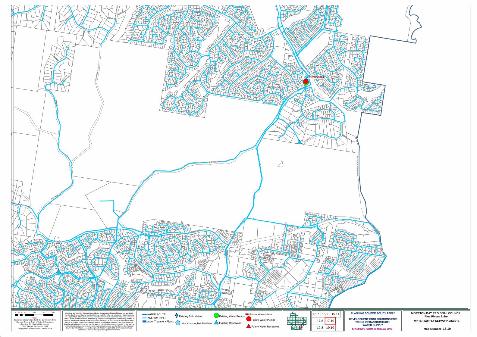
#*
#*
#*
#*
#*
!(
#*
#*
!(
!(
!(PIPWS0024
FARM RD
VIEW CR
TIMMS RD
ROAD
ALLEN RD
REGINALD AV
BUNY
A LAK
E CT
GARD
ONIA
PL
HUTTON RD
BARBER RD
BUNYA RD
ALPINIA CT
COLLINS RD
PEPPER RD
KOAL
A CT
JAGORA DR
YINGA
LLY D
R
THIESS DR
WESTO
N DR
NYORA ST
DANIEL DR
BUCKLAND RD
OLD NORTHERN RD
TARAWILL CR
LEMM ST
LEATHERWOOD DR
PETTYS RD
FRIG
O CT
BOON
DOOM
A CCT
LISTONIA DR
STRATHFORD AV
LYNAGH CT
ALRE
X ST
BORD
ER C
TSILK
YOAK WY
BALLINGER CR
WALKERS RD
PATHWAY
YATH
ONG C
T
LANC
EWOO
D DR
TABU
LAM
DR
KEONG RD
YEER
INBOO
L CT
THE BOULE
VARD
OAKMONT CR
ALLAMANDA CR
FAIRHAVEN PL
HILL
ENVA
LE AV
ALLAWAH ST
JOHN
ST
PARKLEIGH ST
KARM
A PL
COWRIE
PDE
ELIZA
BETH
ST
MARA
RA C
T
LARWOOD PL
CRES
SBRO
OK DR
CHISHOLM CT
KOST
A PL
FLEETWOOD CT
CANE
BY S
T
SIMPSON CT
SOUTH PINE RD
EGRET CT
HEND
ERSO
N RD
FOLKESTONE AV
TINAROO CT
TOWRI ST
BALF
OUR
ST
ALBANY FOREST DR
FRAN
CIS RD
HOWARD CT
MOOG
ERAH
CT
HAVENWOOD CT
TARCOOLA AV
LINKWOOD DR
VAUTON CT
BUNYAVILLE CL
EDWARDS DR
DAWN RD
MAHO
GANY
DR
MILLER PDE
HENGIS CT
TEAK CT
TEENAN ST
GARFIELD TCEBENNETTS RD
LONGFORD ST
SILVEREYE CR
TETRAGONA DR
LANGLEY PL
WOODTOP CT
CHINOOK ST
LEONARDA DR
JOB
PL
QUANDONG CR
WOODFIELD CT
WEBER CT
MARI
ANNE
ST
LAMB
ERTIA
CT
HALE ST
UKAMIRRA CT
CASTLEROY CT
MAREEBA CT
BLUEWOOD CT
WOODHILL RD
CHAM
PIONS
CT
TAUN
CT
FIDDLE CT
BIGGS CT
DISS CT
THE JINKER TRK
BORO
NIA C
T
WILLOW GLEN CT
DUGA
NDAN
RD
TALLEBUDGERA CR
ST ANDREWS CT
BAUP
LE ST
BARNEY ST
LYNWOOD CT
PINEHURST CT
HARB
ORD
PL
CRAMPTON CT
CASITA CT
LONGREEF CT
HUNT
INGD
ALE
CT
ALAN CT
EUCALYPTUS PL
DENA ST
MERANTI CR
WANDA CT
CEDA
R CL
NARRABEEN RD
YARRAMAN ST
TIVER
TON
ST
LAMBETH CT
CADAGI CT
PLUCKS RD
CONN
ELLY
CT
TARN
OOK D
R
JONQUIL CT
GLEN
VALE
CT
WOODGATE CT
BLAC
KWOO
D DR
PETE
R ST
SOU
TH
CORDIA CT
RELF CT
SHOR
T ST
JACQUELINE CT
FREDERICK ST
FOREST CT
MANLY CL
ATRIUM WAY
HAWKES AV
IRONBARK CCT
FIESTA CT
MAGPIE PL
WOODBURN PL
DOWNEY CT
LEOPARDWOOD CT
TURNBERRY CR
WILLS CT
DELVIN CT
OLYMPIC CT
BERN
AYS
CL
GLEN
EAGL
ES C
R
GUM LEAF CT
BIRCH CT
BELAH CT
TRIANTHA CT
CARROLL CT
HAMPSHIRE TCE
PINE BARK CT
SEAFORTH CL
ARTHUR ST
UMBANA CT
PETE
R ST
NOR
TH
COUNTRY CLUB DR
BEL-AIR CT
CEDARWOOD CT
COLVILLEA CT
BOREE CT
BLUE HILLS DR
MILLETTA CT
BOWERS RD NTH
BRIGHTON CT
CARNARVON CT
FLOYD CT CR
MATHEW CL
WHITEWOOD PL
SOPHORA CT
FRAN
KLIN
CT
YELLOWOOD DR
FLIN
DERS
WY
FIG TREE CT
SILVE
R GU
M CT
TUAN CT
WARRIGAL PL
JANET PL
PALM CT
MUIRFIELD CT
YALAMBA CT
CALLI
STEM
ON CT
GANTON CT
VIOLIN PL
WURUMA PL
MARKORE CT
MEYUMI CT
BOWERS RD STH
ST ANNES CT
KITE
PL
CHANTILLY CT
DELL
WOO
D CT
SOMERSET CT
CHALLINOR DR
WOODVALE CT
WATTLE
TREE CT
GAZE
LLE S
T
LOWOO
D PL
ALTON CT
CRANWOOD CT
LEWES CT
COOLGARDIE CT
HARP
ULIA
PL
MAVIS CT
LAMO
RNA C
T
DOVER CT
ROAD
OLD
NORT
HERN
RD
BOWE
RS R
D ST
H
FRANCIS RD
LEONARDA DR
COLLINS RD
BUNYA RD
THE JINKER TRK
BLACKWOOD DR
COLLINS RD
QUAN
DONG
CR
OLD NORTHERN RD
BUNYA RD
BUNYA RD
DUGA
NDAN
RD
Copyright Moreton Bay Regional Council and Department of Natural Resources and Water Moreton Bay Regional Council supplies this map under the following conditions:- Mapping detailsare supplied from information contained in the Council's records which may have been furnished
to the Council by other persons. Moreton Bay Regional Council gives no warranty or guarantee ofany kind, expressed, implied, or statutory, to the correctness or accuracy of the map details or the
degree of compliance with any Council standards in this matter. Persons making decisions withfinancial or legal implications must not rely upon the map details shown on this plan for the purposeof determining whether any particular facts or circumstances exist and the Moreton Bay Regional
Council (and its officers and agents) expressly disclaim responsibility for any loss or damage suffered as a result of placing reliance upon this information.
WATER SUPPLY NETWORK ASSETS
Map Number 17.10
Base material reproduced with the permission of the Director-General, Dept, of Natural Resources.
Copyright The State of Queensland (Dept. Natural Resources) 2006.
Copyright Pine Rivers Shire Council 2006 EFFECTIVE FROM 29 October 2009
0 125 250 375 50062.5
Metres
PLANNING SCHEME POLICY PSP22DEVELOPMENT CONTRIBUTIONS FOR
TRUNK INFRASTRUCTURE -WATER SUPPLY
MORETON BAY REGIONAL COUNCILPine Rivers ShireWATER ROUTE
PINE WM PIPESWater Treatment Plants
XYExisting Bulk Meters
$+Lake Kurwongbah Facilities
!(Existing Water Pumps
#*Existing Reservoirs
Future Water Mains!(Future Water Pumps
#*Future Water Reservoirs
15.9
19.817.8
15.1115.717.1019.10
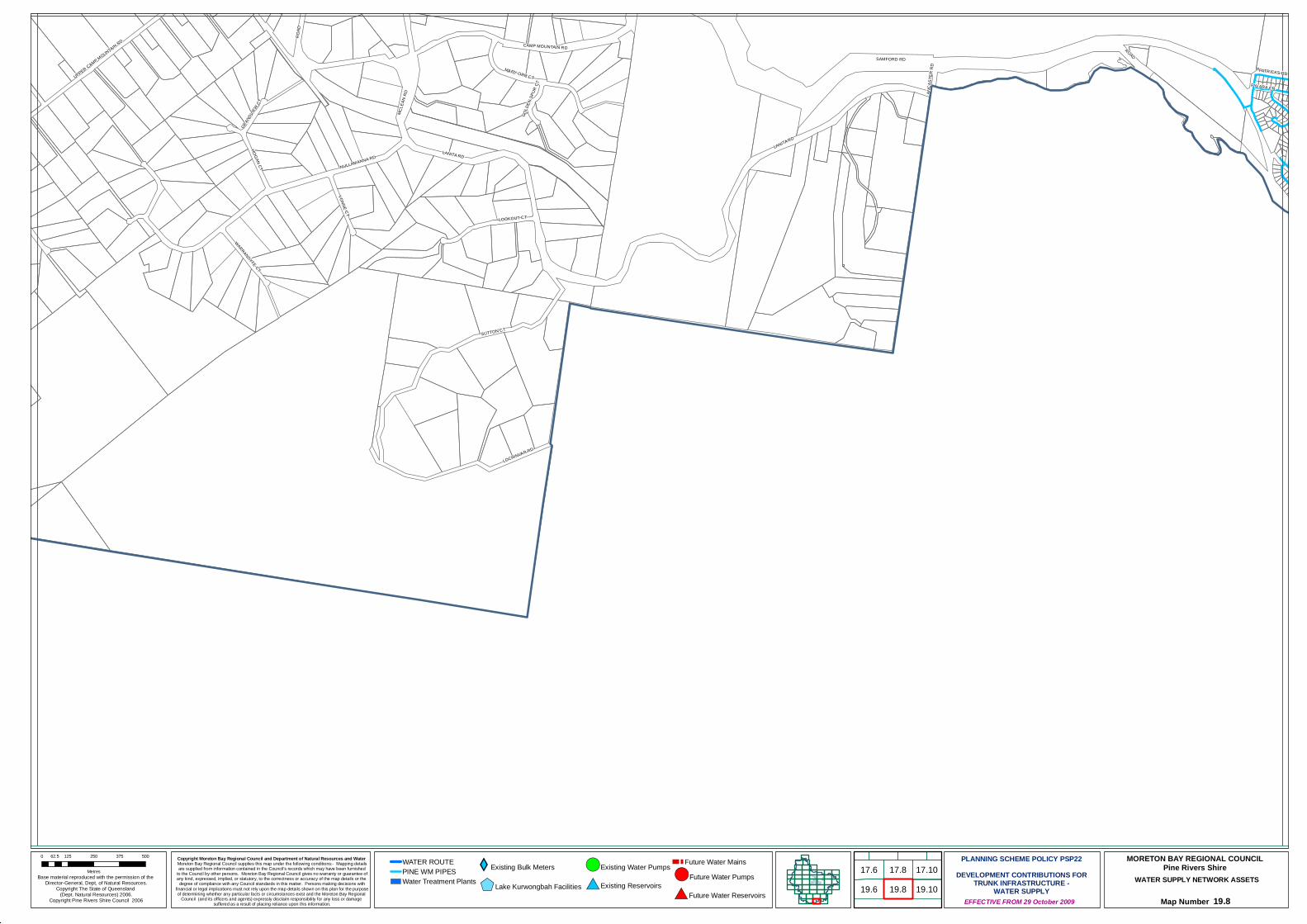
#*
#*
#*
#*
!(
SUTTON CT
SAMFORD RD
LANITA RD
LOCHINVAR RD
LOOKOUT CT
ROAD
CAMP MOUNTAIN RD
MCLE
AN R
D
VONNE CT
HOGAN CT
UPPER CAMP MOUNTAIN RD
NULLAMANNA RD
MARY ORR CT
WARRANDYTE CT
PATRICKS RD
GRAN
DVIEW
CT
GOLD
EN SP
UR C
T PYLARA CR
ANCA
STER
RD
LANITA RD
ROAD
Copyright Moreton Bay Regional Council and Department of Natural Resources and Water Moreton Bay Regional Council supplies this map under the following conditions:- Mapping detailsare supplied from information contained in the Council's records which may have been furnished
to the Council by other persons. Moreton Bay Regional Council gives no warranty or guarantee ofany kind, expressed, implied, or statutory, to the correctness or accuracy of the map details or the
degree of compliance with any Council standards in this matter. Persons making decisions withfinancial or legal implications must not rely upon the map details shown on this plan for the purposeof determining whether any particular facts or circumstances exist and the Moreton Bay Regional
Council (and its officers and agents) expressly disclaim responsibility for any loss or damage suffered as a result of placing reliance upon this information.
WATER SUPPLY NETWORK ASSETS
Map Number 19.8
Base material reproduced with the permission of the Director-General, Dept, of Natural Resources.
Copyright The State of Queensland (Dept. Natural Resources) 2006.
Copyright Pine Rivers Shire Council 2006 EFFECTIVE FROM 29 October 2009
0 125 250 375 50062.5
Metres
PLANNING SCHEME POLICY PSP22DEVELOPMENT CONTRIBUTIONS FOR
TRUNK INFRASTRUCTURE -WATER SUPPLY
MORETON BAY REGIONAL COUNCILPine Rivers ShireWATER ROUTE
PINE WM PIPESWater Treatment Plants
XYExisting Bulk Meters
$+Lake Kurwongbah Facilities
!(Existing Water Pumps
#*Existing Reservoirs
Future Water Mains!(Future Water Pumps
#*Future Water Reservoirs 19.617.6
19.817.8 17.10
19.10

#*
#*
#*
#*
#*
!(
PLUCKS RD
KYLIE AV
CAESAR RD
NARELLAN ST
CASU
LA S
T
VIOLE
T ST
CALCA CR
LESL
IE S
T
PATRICKS RD
COLO
ST
COBBITY CR
JANE ST
CAW
DOR
ST
CYCA
S ST
PAVO
NIA S
T
KOLORA CR
LILY ST
ARDISIA ST
YANDERRA AV
HIBI
SCUS
ST
ALLARA CR
BARGO ST
FERNY WY
JOALAH CR
CORANG CR
LOOM
BAH
CR
EVELEIGH RD
KURI
NGAL
DR
BUNORA AV
HAKEA ST
KIRIN
YA S
T
MENANGLE AV
CARRAMA CR
CUPH
EA S
T
IRRUK
A CR
MINT
O CR
CONLO CR
CEST
RUM
ST
COOLIBAH CR
GREVILLEA ST
BURRIL CR
LEAWARRA CR
GORD
ON R
D ARILPA CR
ILLUTA AV
KIAMA CR
EROM
BA C
R
LOMATIA ST
VIEW
CR
DANY
O CR
PIMELEA ST
MITC
HELL
ST
BATES DR
ACACIA STBOLONG CR
TARNOOK DR
PENA
MBUL
CR
HOVE
A ST
PINDA
RI AV
GRANDIS ST
ALKIRA LN
PARK
RD
NIKOLA ST
WIRLPANA AV
NEPEAN AV
BUNDAR CR
CAMELIA AV
GOOD
ENIA
ST
ANDINA CRBURLOO CR
PYLARA CR
NYMPHAEA ST
GLENLEE ST
CRAIG ST
HULL ST
CARI
SSA S
T
ANORA CRDERRIMA CR
WINGARA GR
CALA
DENI
A CT
COLES ST
LANG
URA C
R
CROSBY AV
GROV
E AV
PINNATA CT
FAIRWAY OUTLOOK ST
BEL-A
IR CT
PARNOOLAR CR
BURSARIA ST
KOOTANGAL CR
DOOLOO CR
BRINGELLY ST
WANDEARAH CRBEN ST
PYANG GR
DRYA
NDRA
CT
FRAN
CISC
EA S
T
KEILA
R CT
NARWIN GR
DYA PL
ILGA GR
DAWSON PDE
ONSL
OW ST
CAMDEN CT
OWARRA AV
NAAL
ONG
GR
SOUTH PINE RD
ALKO
OMI A
V
DINTERRA AV
DUNBIL AV
KALDO GR
KEPE
RRA C
T
MIRBELIA ST
HOXTON ST
PALA
LL CR
ORR CT TRISTANIA ST
GALEOLA ST
DROS
ERA S
T
NUROM AV
SAMANTHA CT
TARNEE ST
AKEBIA ST
WALLAROY CT
YOOTHA AV
MONARO CR
ARALIA ST
LEURA GR
HEND
RY C
T
AMAR
OO AV
CLIANTHUS ST
ALSTONIA ST
OLAKUNA CRIN
BAND
I GR
LANA CT
OLEARIA ST
TABULAM DR
CAPS
ELLA
ST
HOBBS ST
QUIN
NIA C
T
ELAROO CR
EUROBIN CR
PATRICKS RD
Copyright Moreton Bay Regional Council and Department of Natural Resources and Water Moreton Bay Regional Council supplies this map under the following conditions:- Mapping detailsare supplied from information contained in the Council's records which may have been furnished
to the Council by other persons. Moreton Bay Regional Council gives no warranty or guarantee ofany kind, expressed, implied, or statutory, to the correctness or accuracy of the map details or the
degree of compliance with any Council standards in this matter. Persons making decisions withfinancial or legal implications must not rely upon the map details shown on this plan for the purposeof determining whether any particular facts or circumstances exist and the Moreton Bay Regional
Council (and its officers and agents) expressly disclaim responsibility for any loss or damage suffered as a result of placing reliance upon this information.
WATER SUPPLY NETWORK ASSETS
Map Number 19.10
Base material reproduced with the permission of the Director-General, Dept, of Natural Resources.
Copyright The State of Queensland (Dept. Natural Resources) 2006.
Copyright Pine Rivers Shire Council 2006 EFFECTIVE FROM 29 October 2009
0 125 250 375 50062.5
Metres
PLANNING SCHEME POLICY PSP22DEVELOPMENT CONTRIBUTIONS FOR
TRUNK INFRASTRUCTURE -WATER SUPPLY
MORETON BAY REGIONAL COUNCILPine Rivers ShireWATER ROUTE
PINE WM PIPESWater Treatment Plants
XYExisting Bulk Meters
$+Lake Kurwongbah Facilities
!(Existing Water Pumps
#*Existing Reservoirs
Future Water Mains!(Future Water Pumps
#*Future Water Reservoirs19.10

Moreton Bay Regional Council PINERIVERSPLAN
PLANNING SCHEME POLICY PSP22 – DEVELOPMENT CONTRIBUTIONS FOR TRUNK INFRASTRUCTURE – WATER SUPPLY
Effective from 29 October 2009 Page 61
Schedule E: Desired Standards of Service
The Desired Standards of Service (DSS) for water supply and sewerage trunk infrastructure within the Designated Infrastructure Service Area have been determined in accordance with the requirements of the Water Supply (Safety and Reliability) Act 2008. Moreton Bay Water’s approved Strategic Asset Management Plan and Total Management Plan detail ongoing practice and future initiatives to achieve and maintain the published standards of service.
The Desired Standards of Service for water supply and sewerage infrastructure provision under this policy are expressed in terms of ‘Operational Objectives’ and ‘Detailed Design Parameters’.
The ‘Operational Objectives’ and ‘Detailed Design Parameters’ are aimed at achieving the stated purpose of the Integrated Planning Act while satisfying the relevant requirements of the Environmental Protection Act. The detailed design parameters are the means by which the performance requirements of the operational objectives are achieved.
The Guidelines prepared by the Queensland Government for design of urban water supply and a survey of current practice of local governments in South-East Queensland have also been used in establishing the desired standards of service and design criteria for the water supply systems. Authorities that were consulted to confirm current practice in South-East Queensland included Ipswich Water, Redland Water, Brisbane Water, former CalAqua, former Cooloola Shire, Wide Bay Water, Logan Water and Gold Coast Water.
Operational Objectives for Trunk Water Supply Services
Each of the ‘Operational Objectives’ for the provision of water supply services in Moreton Bay Regional Council’s local government area is examined in the context of corresponding user benefits and environmental effects. The Primary Objectives adopted for water services in this policy are set out in Table E1.
Table E1 – Water Supply Operational Objectives
Objective User Benefit Environmental Effect
• Corporate / Business Objective
• Community and Customer Service • Quality and Safety
• Environmental Protection
Drinking water will comply with the Australian Drinking Water Guidelines.
• Uniform quality of water monitored in relation to recognised standards.
• Safe and reliable water supply
• Improves community health
Designs will comply with State Government Guidelines, and Council’s Planning Scheme Policy PSP 28 “Civil Infrastructure Design”.
• System will be adequate in terms of; o day-to-day reliability, o long term continuity of supply; o delivery of high quality drinking
water to the consumer ;and o minimum life cycle cost (i.e.,
optimum maintenance, replacement and operation costs).
• Cost effective service for community.
• Maintains the health of the community.
• Chemicals are stored and handled in accordance with relevant legislation to ensure safety of worker, public safety and to protect the environment.
• Minimisation of Greenhouse gas emissions.
• Optimum use of resources. Minimise water loss • Extend asset life
• Defer system augmentation • Conserve raw water supply • Minimise energy consumption • Optimise size of elements within water
supply network.
• Improve environmental flows • Minimisation of Greenhouse
gas emissions.
Effective management of water consumption (Demand Management)
• Reduced cost of water • Defer requirement for new water source • Minimise energy consumption • Optimise size of elements within water
supply network.
• Improve environmental flows • Minimisation of Greenhouse
gas emissions.
Implement environmental responsibilities with respect to water supply operations
• Noise control • No adverse visual impact • Control of overflows from system. • Management of flushing water. • Maintain flows or storage in raw water
sources for environmental purposes.
• Improves community health • Maintain amenity (e.g., visual
and noise characteristics) of locality.
• Reductions in discharges that have concentrations of free chlorine greater than 1 mg/l.
• Control of discharge of turbid water to stormwater drainage
Moreton Bay Regional Council PINERIVERSPLAN
PLANNING SCHEME POLICY PSP22 – DEVELOPMENT CONTRIBUTIONS FOR TRUNK INFRASTRUCTURE – WATER SUPPLY
Effective from 29 October 2009 Page 62
Objective User Benefit Environmental Effect
• Corporate / Business Objective
• Community and Customer Service • Quality and Safety
• Environmental Protection
during construction of infrastructure and flushing or scouring operations.
• Required environmental flows maintained
System design will aim to minimise energy consumption and optimise the use of green energy
• Reduced energy costs. • Cost effective service for community.
The design of the water supply network shall provide fire fighting flow and specified water pressures and flow to the consumer.
• Reliable water supply • Adequate supply for community services • Adequate pressures and flow for fire
fighting purposes.
• Maintains health and safety of the community.
Infrastructure will be designed, constructed and operated in accordance with Workplace Health and Safety Legislation.
• Minimisation of risk to workers and community (reduction in accidents and insurance premiums).
• Minimise risk of pollution events.
• Safer work environment for staff and public.
Detailed Design Parameters – Water Supply
Following an examination of the Queensland Government Guidelines and a survey of current practice of local governments in South East Queensland, Moreton Bay Regional Council has adopted the parameters summarised in Table E2 for design and assessment of water supply systems.
These factors are applied in accordance with procedures detailed in the Queensland Government Guidelines.
The summary outlined in Table E2 must be interpreted in conjunction with the design and construction standards for water supply set out in other Planning Scheme Policies of the relevant planning scheme.
Table E2 - Water Supply Design Parameters
Item Description Adopted Design Parameter
Water Demand
1 Average Day Demand (AD)
Existing and Future Demand – 296 L/EPW/d AD is calculated as follows: AD= (230 x 1.2) + System Losses Where:
• 230 L/EPW/day is the demand target under SEQ ‘permanent water conservation measures’;
• 1.2 is an operational flexibility factor that provides sufficient capacity to maintain an adequate level of service in the event that an element of the trunk infrastructure fails; and
• System Losses = 20 L/EPW/day Peaking Factors
2 Mean Day Maximum Month (MDMM/AD)
1.2 x AD (355.2 L/EPW/day)
3 Maximum Day (MD/AD) 1.6 x AD (473.6 L/EPW/day) 4 Maximum Hour (MH/AD) 4.3 x AD (53.03 L/hr/EPW)
System Pressure
5 Minimum Operating Pressure
• At maximum hour demand the minimum pressure at the water meter shall not be less than 22m.
• In isolated high level areas, the minimum operating pressure may be reduced to 16 m above the highest elevation on any lot with the water level in the reservoir not more than 1.0 m above reservoir floor level.
6 Maximum Operating Pressure
80 m at the property’s water meter
Fire Fighting Requirements
7 System Pressure 12 m minimum pressure head at the hydrant/dedicated service location, and minimum 6m pressure head at any location in the water supply zone during the fire event with model conditions as detailed in Items 8, 9 and 10.
8 Fire Flow • Predominantly residential development not more than 3 storeys - 15 L/s

Moreton Bay Regional Council PINERIVERSPLAN
PLANNING SCHEME POLICY PSP22 – DEVELOPMENT CONTRIBUTIONS FOR TRUNK INFRASTRUCTURE – WATER SUPPLY
Effective from 29 October 2009 Page 63
Item Description Adopted Design Parameter
simultaneous with background demand as defined in Item 9 for a period of 2 hours.
• Predominantly commercial/industrial and residential buildings greater than 3 storeys - 30 L/s simultaneous with background demand as defined in Item 9 for a period of 4 hours.
• Special risk/hazard land use – to be assessed. 9 Background demand • Predominantly Residential Area - 2/3 of MH demand
• Predominantly Commercial/Industrial Area - MH demand (generally between 10 am to 4 pm)
10 Reservoir level • At the commencement of the fire fighting event the reservoir level should be set at Mid-Water Level; where: Mid-Water Level = (Top Water Level + Floor Level) ÷ 2 (AHD).
• The reservoir must not empty during the fire fighting event for the duration of the event specified in item 8 with supply pumps turned off.
Storage
11 Design Condition • Reservoirs must not empty in less than 3 consecutive MD demands. • During MDMM demand the reservoir shall have net positive inflow and shall be
capable of continuous operation under this demand. 12 Ground Level Storage Required Storage = [3 x (MD – MDMM)] + Fire Fighting Storage.
Where: • Fire Fighting Storage = 4 hrs of MDMM demand or 0.5 ML whichever is the
greater. 13 Elevated Storage Required Storage Volume = Operating Volume + Fire Fighting Reserve
Where: • Operating Volume = 6 x (MH – 1/12 MDMM) • Fire storage = 150 kL
Pumping Capacity
14 Duty pump capacity to serve ground level reservoirs.
Supply MDMM demand in 20 hours of operation in any 24 hour period.
15 Pumps serving elevated storage.
Pump must discharge not less than; [(6 x MH) – Operating Volume]/(6 x 3600) Where: Operating Volume is defined in item 13 above.
16 Standby Pump Capacity Equal to the capacity of the largest pump Pipeline Design
17 Trunk Main Capacity Sized for MDMM flows 18 Reticulation Capacity Sized for Maximum Hour and Fire Flow 19 Friction Default Values Hazen Williams Coefficients of Friction:
• C = 100 (diameters ≤ 150 mm) • C = 110 (150 mm> diameter < 300 mm) • C = 120 (diameter ≥ 300 mm)
20 Maximum Flow Velocity 2.5 m/s Pressure and Leakage Management
21 District Meter Area (DMA)
• The sizes of the reticulation mains should be designed according to the planned DMAs.
• Existing DMA boundary should not be breached.
Moreton Bay Regional Council PINERIVERSPLAN
PLANNING SCHEME POLICY PSP22 – DEVELOPMENT CONTRIBUTIONS FOR TRUNK INFRASTRUCTURE – WATER SUPPLY
Effective from 29 October 2009 Page 64
REVIEW TRIGGERS
This policy is reviewed internally for applicability, continuing effect and consistency with related documents and other legislative provisions when any of the following occurs:
(1) The related documents are amended;
(2) The related documents are replaced by new documents;
(3) Amendments which affect the allowable scope and effect of a policy of this nature are made to the head of power; and
(4) Other circumstances as determined from time to time by a resolution of Council.
RESPONSIBILITY
This policy is to be:
(1) implemented by the Senior Manager Development Services; and
(2) reviewed and amended in accordance with the "Review Triggers" by the Senior Manager Strategic Direction and Sustainability in consultation with the Senior Manager Development Services, the Senior Manager Regional and Environmental Planning and the Senior Manager Planning and Strategic Asset Management.
VERSION CONTROL
CEO Approval Date 15/09/2009
Related Links:

Moreton Bay Regional Council PINERIVERSPLAN
PLANNING SCHEME POLICY PSP22 – DEVELOPMENT CONTRIBUTIONS FOR TRUNK INFRASTRUCTURE – WATER SUPPLY
Effective from 29 October 2009 Page 65
ENDNOTES
Amendment No –
2/2008 Date Adopted – 19 August 2008
Effective Date – 1 September 2008
Planning Scheme Policy Reference
Description of Amendment
PSP 22 � To reflect updated network planning
� Update infrastructure contribution rates
� Incorporate additional material, for example, desired standards of service
� Re-wording and restructuring of the document to improve readability
� Revised demand factors
Amendment No – 1/2009
Date Adopted – 8 September 2009
Effective Date – 29 October 2009
Planning Scheme Policy Reference
Description of Amendment
PSP 22 � To reflect updated network planning
� Update infrastructure cost estimates
� Update infrastructure mapping
� Incorporate discounted cash flow methodology for the calculation of contribution rates


![St John the B Cnr Wyllie St & D yboro Rd, Petrie • St ...€¦ · Andrew [Dayboro SS]; Kirsty [Bray Park SS]; Dave [Pine Rivers SHS]; Tilla [Pine Rivers Special School]. •every](https://static.documents.pub/doc/80x56/5ec7b93813c2b83d4b19ef53/st-john-the-b-cnr-wyllie-st-d-yboro-rd-petrie-a-st-andrew-dayboro.jpg)