Quality Reviews of FUDS MMRP GIS Data Environmental Monitoring and Data Quality Workshop March 31, 2011 Larry Tinney - TerraSpectra Geomatics Ken Simmons, Scott Denzer – Laboratory Data Consultants Brian Jordan – US Army Corps of Engineers US Army Corps of Engineers TerraSpectra G E O M A T I C S
Transcript
Quality Reviews of FUDS
MMRP GIS Data
Environmental Monitoring and Data Quality Workshop
March 31, 2011
Larry Tinney - TerraSpectra Geomatics
Ken Simmons, Scott Denzer – Laboratory Data Consultants
Brian Jordan – US Army Corps of Engineers
US Army
Corps of
Engineers
TerraSpectra
G E O M A T I C S
Report Documentation Page Form ApprovedOMB No. 0704-0188
Public reporting burden for the collection of information is estimated to average 1 hour per response, including the time for reviewing instructions, searching existing data sources, gathering andmaintaining the data needed, and completing and reviewing the collection of information. Send comments regarding this burden estimate or any other aspect of this collection of information,including suggestions for reducing this burden, to Washington Headquarters Services, Directorate for Information Operations and Reports, 1215 Jefferson Davis Highway, Suite 1204, ArlingtonVA 22202-4302. Respondents should be aware that notwithstanding any other provision of law, no person shall be subject to a penalty for failing to comply with a collection of information if itdoes not display a currently valid OMB control number.
1. REPORT DATE 31 MAR 2011 2. REPORT TYPE
3. DATES COVERED 00-00-2011 to 00-00-2011
4. TITLE AND SUBTITLE Quality Reviews of FUDS MMRP GIS Data
5a. CONTRACT NUMBER
5b. GRANT NUMBER
5c. PROGRAM ELEMENT NUMBER
6. AUTHOR(S) 5d. PROJECT NUMBER
5e. TASK NUMBER
5f. WORK UNIT NUMBER
7. PERFORMING ORGANIZATION NAME(S) AND ADDRESS(ES) TerraSpectra Geomatics,2700 E. Sunset Road, Suite A-10,Las Vegas,NV,89120
8. PERFORMING ORGANIZATIONREPORT NUMBER
9. SPONSORING/MONITORING AGENCY NAME(S) AND ADDRESS(ES) 10. SPONSOR/MONITOR’S ACRONYM(S)
11. SPONSOR/MONITOR’S REPORT NUMBER(S)
12. DISTRIBUTION/AVAILABILITY STATEMENT Approved for public release; distribution unlimited
13. SUPPLEMENTARY NOTES Presented at the 2011 DoD Environmental Monitoring & Data Quality Workshop (EMDQ 2011), 28 Mar ?1 Apr, Arlington, VA.
14. ABSTRACT
15. SUBJECT TERMS
16. SECURITY CLASSIFICATION OF: 17. LIMITATION OF ABSTRACT Same as
Report (SAR)
18. NUMBEROF PAGES
28
19a. NAME OFRESPONSIBLE PERSON
a. REPORT unclassified
b. ABSTRACT unclassified
c. THIS PAGE unclassified
Standard Form 298 (Rev. 8-98) Prescribed by ANSI Std Z39-18
Presentation Outline
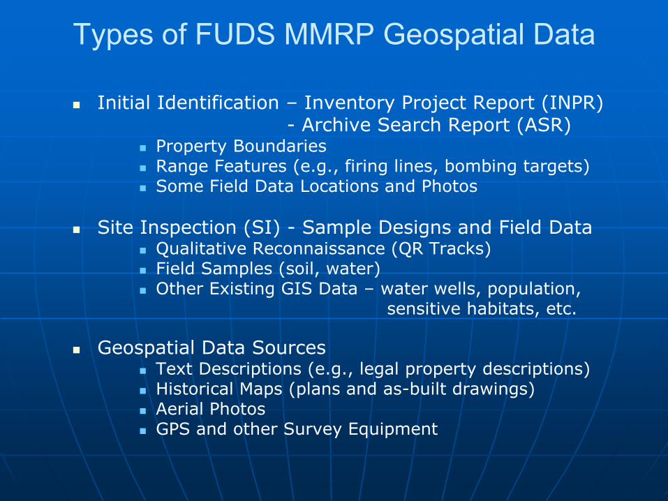
FUDS-MMRP Geospatial Data and Standards
Project Data Reviews – Historical Photos & Metadata
Property Boundaries Range Features (e.g., firing lines, bombing targets) Some Field Data Locations and Photos
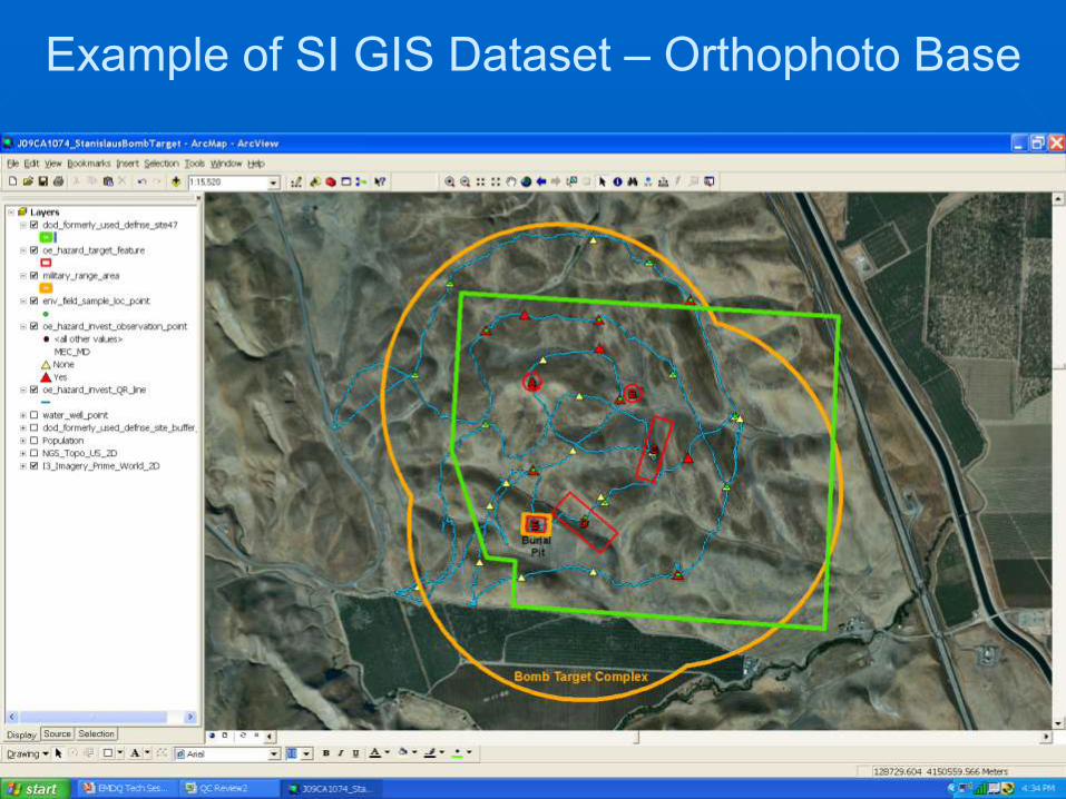
Site Inspection (SI) - Sample Designs and Field Data Qualitative Reconnaissance (QR Tracks) Field Samples (soil, water) Other Existing GIS Data – water wells, population, sensitive habitats, etc.
Geospatial Data Sources Text Descriptions (e.g., legal property descriptions) Historical Maps (plans and as-built drawings) Aerial Photos GPS and other Survey Equipment
Over 65% of NM FUDS MMRP Range centroids checked had apparent offsets >25 meters
Range Centroid Orthophoto Adjustments
Offset
Distance (meters)
ASR/CAD
to 2005
Orthophotos
Sort of Site Centroid Location Offsets
0
200
400
600
800
1,000
1,200
0 20 40 60 80 100 120
ASR Observations
Data Sources and Procedures Well Documented
• But source details not carried forward as metadata
• Confidence statements not carried forward as metadata
Historical Photography
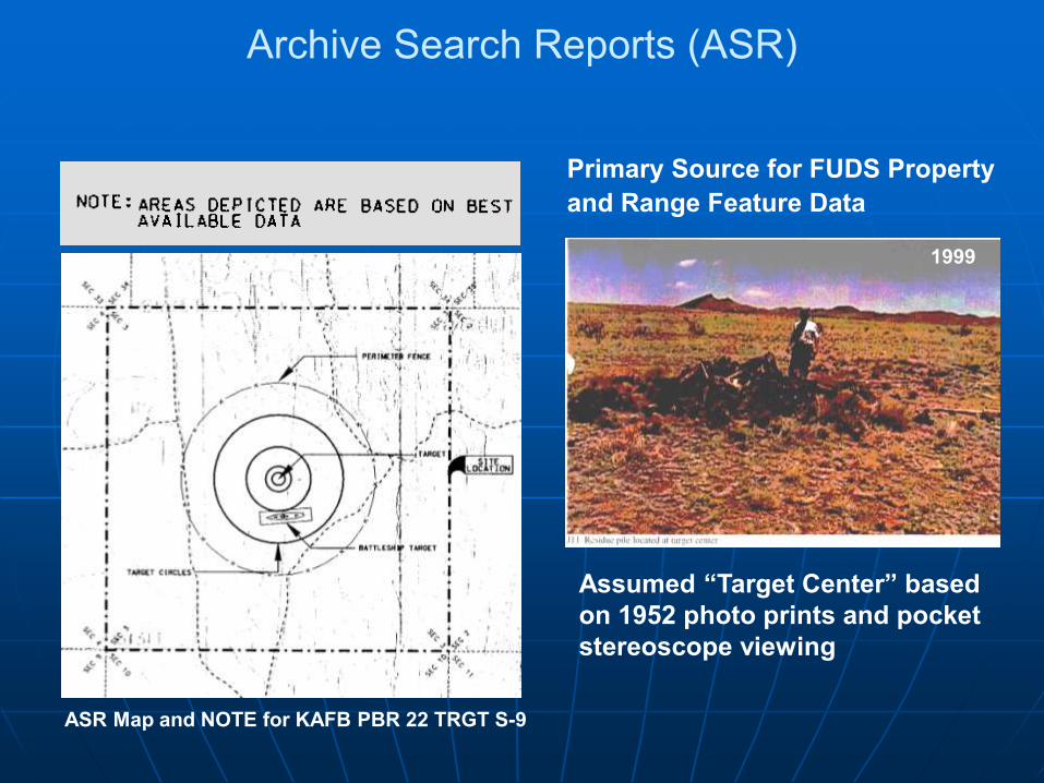
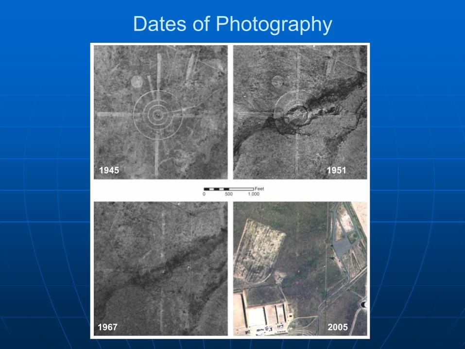
• Dates used were sometimes decades after site operational periods – some features not very persistent and some affected by land use changes
• Use of Photo Prints and Pocket Stereoscope viewers instead of Film Diapositives (transparencies) and Zoom Stereoscope equipment affects dynamic range and resolution available – some range features missed
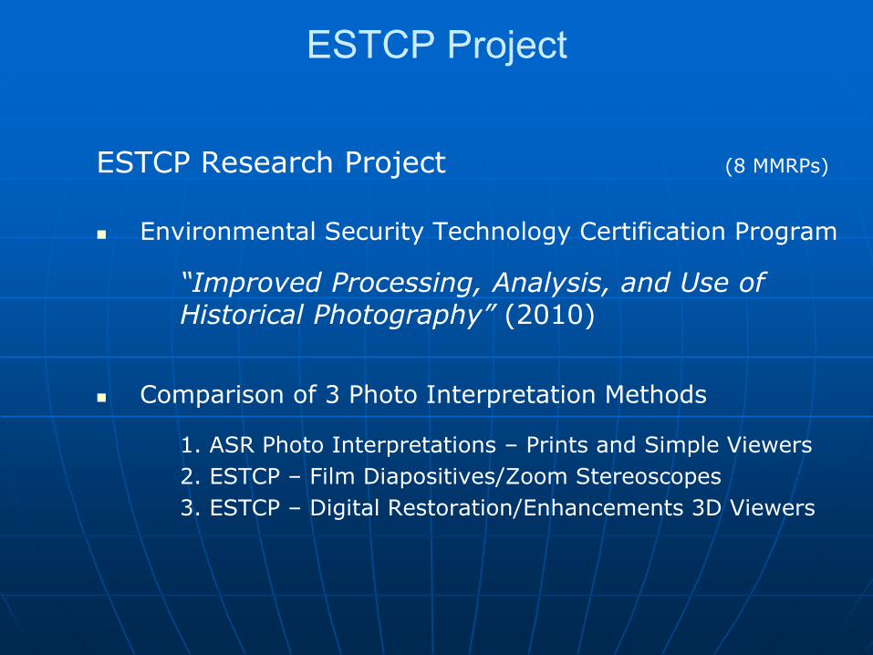
ESTCP Project
ESTCP Research Project (8 MMRPs)
Environmental Security Technology Certification Program
“Improved Processing, Analysis, and Use of Historical Photography” (2010)
Comparison of 3 Photo Interpretation Methods
1. ASR Photo Interpretations – Prints and Simple Viewers
2. ESTCP – Film Diapositives/Zoom Stereoscopes
3. ESTCP – Digital Restoration/Enhancements 3D Viewers
Dates of Photography
1967 2005
1945 1951
Photo Scale
(Resolution)
Scanning Resolution
1000 DPI 3629 DPI
1954 Photo for Dalhart PBR #3 & #4 (1:60,000 scale)
ESTCP Observations
Some historical photo searches need to be updated and more extensive – photo search results are not static as archive additions are made and search tools are improving
Use of historical film diapositives and digital analysis techniques can result in improved target feature interpretations and proper range definitions
Image registration or ortho-correction provides a useful basis for analysis and use of historical photos in Geographic Information Systems
Historical photo analyses can provide a cost-effective baseline component prior to any Wide Area Assessment (WAA) of World War II era Bombing Ranges
California MMRP SI Metadata Review
Frequent Findings (54 MMRPs)
• Identification of site (FUDSMIS ID) inconsistent 8-digit, 9-digit, 10-digit FUDSMIS
• Source material references limited Generally just “ASR” or “SI” as source (no titles, dates)
No original sourcing – aerial photos, maps, etc.
• Range areas defined by multiple methods Target features, target features plus property
• Multiple identical ranges defined for same area One range polygon for each type of munitions
• Feature naming conventions varied Generally well described, but not SDSFIE compliant
• SDSFIE attributes generally unpopulated
FGDC Metadata
Relatively Complex
• Basic framework for all possible types of geospatial data
Many “free text” elements
• 0pen to individual interpretation without restrictions
Time Consuming
• Detailed (e.g., 334 elements, many nested)
• Often “last step” of GIS project
Metadata Tools
Examples of Metadata Tools
• USACE Corpsmet (template) – discontinued
• US Geological Survey – Metadata Parser (MP)
• National Park Service – Metadata Tools & Editor (MTE)
• EPA – EPA Metadata Editor (EME)
USACE FUDSGeoRev (Proposed) • Goal – “Facilitate development and review of Metadata
that meets FUDS MMRP programmatic and FGDC content standards via tools to ensure consistent, simplified, and high quality metadata”
FUDSGeoRev Design Elements
Standard Metadata Guidelines and Instructions
• Identify priority programmatic FGDC metadata elements
• Develop consistent language and libraries for priority programmatic and mandatory metadata elements
Metadata Checker utility
• Online secure server (SSL, 24/7)
• Downloadable reporting tool
• Automated review of metadata elements, such as:
Theme, place and temporal keywords
Use constraints and data quality statements
Reference coordinate system
Entity and attribute information
• Upload of compliance results
Archival Metadata storage
• Validate metadata against stored templates
Summary
ASR and SI sources of geospatial data for MMRPs are well documented, but key details and confidence statements are generally not carried forward in GIS metadata
Historical aerial photos are a unique source for FUDS MMRP features locations, but some searches need to be updated; photo search results are not static!
Metadata tools, such as guidelines, editors, and checkers, can facilitate development and compliance with needed documentation of geospatial data
Geospatial standards compliance is critical to data sharing, confidence for future (long-term) reuse, and broader enterprise applications
QUESTIONS?
US Army
Corps of
Engineers
TerraSpectra
G E O M A T I C S
1943 1954
1967 2007
Kingman, AZ GTG Gunnery Range 15-Skeet Ranges Clay Pigeon Debris Apparent on Photos Used for Field Sample Design