33
Report to Nevada State Legislature-AB75 Fire-Fuels-Forest Restoration Activities and Accomplishment at Lake Tahoe, NV. Compiled and Prepared by Nevada Division of Forestry 2010

Report to Nevada State Legislature-AB75
Fire-Fuels-Forest Restoration Activities and Accomplishment at Lake Tahoe, NV.
Compiled and Prepared by Nevada Division of Forestry
2010
AB-75 Report
1
Summary This report is in accordance with Assembly Bill 75 and is a recommendation of the Bi-State Fire Commis-
sion.
Forest restoration and wildfire hazard reduction/prevention activities are ongoing activities carried out by several entities at Lake Tahoe. On the Nevada side of the Lake Tahoe Basin those entities are Nevada Division of Forestry(NDF), Nevada Division of State Lands (NDSL), Nevada Division of State Parks (NDSP), USDA Forest Service - Lake Tahoe Basin Management Unit (USFS/LTBMU), North Lake Tahoe Fire Protection Dis-trict (NLTFPD), Tahoe-Douglas Fire Protection District (TDFPD), Nevada Fire Safe Council (NVFSC) and the Tahoe Regional Planning Agency (TRPA). Following passage of the White Pine County Conservation, Recre-ation, and Development Act of 2006, a 10-year Multi-jurisdictional Basin wide plan was developed by the agen-cies listed above along with several California Agencies to direct fuel reduction planning and implementation. Availability of federal funds through direct Forest Service Grants, the California Grant Clearing house, and the Southern Nevada Public Land Management Act (SNPLMA) since has lead to increases in annual accomplish-ments in wildfire hazard reduction/prevention by responsible agencies. Accomplishments by the agencies and non-profits include coordinated planning for wildfire hazard reduction/prevention, fuel reduction on thousands of acres since 2007, coordinated public information campaigns, electronic tracking of progress, and modifying and streamlining the regulatory environment.
NOTE: The original report was produced in 2009 and is presented here in its entirety for reader background. Agency accomplishments for 2010 are contained Table 2 on page 2 and in greater detail in an addendum begin-ning on page 28.
Fire Protection/Prevention Organizations
There are many government agencies responsible for forest management and fire prevention/suppres-sion within the Lake Tahoe Basin. All are actively involved in protecting visitors and residents at Lake Tahoe through their mandated activities. The USFS/LTBMU is responsible for forest management and fire suppression on the National Forest System lands at Lake Tahoe. This accounts for approximately 29,100 acres on the Ne-vada side of the Lake Tahoe basin. The two fire districts on the Nevada side of the basin, TDFPD and NLTFPD have responsibility for fire suppression on the private and local government-owned lands within Douglas and Washoe counties, which accounts for 5,331 acres and 10,442 acres respectively. NDF and NDSL have responsi-bility for forest management on state lands in the Basin which include approximately 8,000 acres of state parks and 214 acres of Tahoe Bond Act parcels. Wildfire suppression on these lands is NDF’s responsibility.
Prior to the Angora Fire in 2007 and the subsequent Bi-State Fire Commission recommendations, all the agencies listed above were actively engaged in wildfire hazard reduction. Each land management agency and fire protection district was working relatively independently on managing the wildfire hazard on lands within their jurisdiction. Both fire districts in Nevada, TDFPD and NLTFPD had active defensible space and curbside chipping programs and NLTFPD had their own 20 person hand crew for hazardous fuel reduction and supres-sion. The Nevada Division of Forestry was assisting residents with forestry management issues, silivcultural practices to improve forest health, marking trees for removal on private residential lots and issuing TRPA Tree Removal permits. NLTFPD began a prescribed burning program on greenbelt properties within their district in the early 1990s. The NDF forester attached to the Nevada Tahoe Resource Team was actively managing fuels on Lake Tahoe State Park lands and the Division of State Lands forester was managing fuels on Tahoe Bond Act parcels. The LTBMU had been conducting vegetation projects on their lands for several years with the East Shore Project in the mid 1990s being one of the earlier, larger projects on the Nevada side of the Basin. Table 1 gives an indication of the agencies and their respective fuel reduction accomplishments back to 2000.

AB-75 Report
2
Table 1. Acres of fuel reduction projects completed by Lake Tahoe Basin agencies since 2000
Year USDAForestService
LTBMU*
North LakeTahoe FPD**
NevadaStateParks
NevadaState
Lands
Total
2000 677 151 50 26 9042001 691 215 55 24 9852002 1,260 240 100 23 1,6232003 1,254 145 270 32 1,7012004 1,918 178 253 12 2,3612005 1,913 377 101 17 2,4082006 2,160 171 20 3,009
Total 9,873 1,306 1,000 154 12,991 *Includes lands in Nevada and California**North Lake Tahoe FPD includes projects on federal lands, which were also reported by the USFS/LTBMU; therefore, the NLTFPD accomplishments were reduced by 42%, the amount of federal land in the fire district.Source: TRPA Fuel Reduction Plan prepared by Steve Holl Consulting (2007), NDSL, USFS/LTBMU.
Table 2. Acres of Fuel Reduction Completed Since the Bi-State Fire Commission in 20072007 thru 2009 2010 TOTAL
NDF for State Parks 1,362 210 1,572NV State Lands 149 108 257NLTFPD 591 305 896TDFPD 432 164 596USFS-LTBMU 3,031 108 3,139
TOTAL 5,565 895 6,460 WildfireHazardMitigationPlansatLakeTahoe
SNPLMA funding became available to the Tahoe Basin fire agencies through the White Pine County Con-servation, Recreation, and Development Act of 2006 (Act). A requirement of the Act was that the federal and state land managers, local agencies, and regulators were required to create a “Multi-Jurisdiction Fuels Reduc-tion and Fire Prevention Strategy – 10 Year Plan” to be eligible for SNPLMA funding. The agencies in Nevada that participated in the plan development were the NDF, NDSL, NDSP, the Nevada Tahoe Resource Team, NLTFPD, USFS/LTBMU, TDFPD and TRPA.
The plan comprehensively combined existing wildfire hazard reduction plans prepared by the federal, state and local government agencies, and fire protection districts, including the Community Wildfire Protection Plans (CWPP), within the Basin, and provided a framework for participating agencies to identify priority areas and a strategy to work collaboratively on accomplishing those priorities. Figures 1 and 2 show the proposed treatment areas by 5 year planning periods and Figure 3 shows the annual schedule for proposed treatment areas.

AB-75 Report
3
Figure 1. Proposed Treatment Areas for the North East Part of the Lake Tahoe Basin.

AB-75 Report
4
Figure 2. Proposed Treatment Areas for the South East Part of the Lake Tahoe Basin.

AB-75 Report
5
Figure 3. Proposed Schedule for Treatment Areas

AB-75 Report
6
The 10-Year Plan created an oversight body composed of the chief executive officers of the federal and state land management agencies and the local fire agencies. This group, called the Multi-Agency Coordinat-ing Group (MAC) is the principal group that monitors the implementation of the 10-Year Plan. The MAC is charged with strategic management of fuels reduction in Lake Tahoe.
The local fire agencies also formed a basin wide implementation group called the Tahoe Fire and Fuels Team (TFFT). The TFFT includes members from the TRPA, Lahontan Regional Water Quality Control Board, Cal Fire and the local fire agencies. The TFFT is an organization responsible for implementing projects on non-fed-eral lands that are consistent with the CWPP. And while the CWPP are a base document, final project locations are planned by the foresters for the fire district or state agency. In this respect, the TFFT is responsible for final treatment planning. The USDA-FS is responsible for planning and implementing projects on federal property within the Tahoe Basin.
Table 3. Summary of roles and responsibilities of agencies and individuals to implement the Strategy
Agency Land Management RegulatoryLead Agency for Environmental Compliance
Funding Programmatic Oversight
Individual Landowners X X
TRPA X X X X
Nevada Fire Safe Council X X
USDA-FS LTBMU X X X X XFire Protection districts X X XNevada Division of Forestry X X XNevada Division of State Parks X XNevada Division of State Lands X X X
AccomplishmentsSince2007
NevadaTahoeResourceTeam(LakeTahoeStatePark)
The Nevada Tahoe Resource Team (NTRT) is responsible for managing lands owned by the State of Nevada within the Lake Tahoe Basin. These lands consist of Lake Tahoe Nevada State Park and the smaller urban inter-mix parcels acquired through the Tahoe Bond Act.
The NTRT is funded through the Tahoe Bond Act and implements the Environmental Improvement Plan (EIP) developed in 1997 for the properties. Phase Two of the EIP is nearly finalized and is expected to be adopted by the TRPA Governing board in the spring, 2010. The plan includes a focus on wildfire hazard reduc-

AB-75 Report
7
tion, forest health and wildlife habitat improvement. Projects have been located in Slaughterhouse Canyon, North Canyon, Spooner Meadow, Van Sickle, Sand Harbor and Tunnel Creek (Figure 4). The majority of the work has been accomplished using NDF conservation crews. Some crew work has been contracted out and there have been two commercial timber harvests. There has been 840 acres of thinning and brush removal and 522 acres of pile burning completed on State Park lands since 2007. NDF’s biomass transportation system hauled 885 tons of material to the powerplant at Northern Nevada Correctional Center in Carson City. Fuel treatments are currently in progress on 400 additional acres and plans have been completed for 300 more. See Appendix maps 1-4 for project locations. The NTRT also received Round 8, 9, and 10 funding from SNPLMA for fuel reduction projects in the wildland-urban-interface (WUI). The NTRT is expected to complete fuel treat-ments identified in the 10-year strategy on time or ahead of schedule.
The NDSL forester is responsible for managing the vegetation on the Tahoe Bond Act parcels in the Tahoe Basin. SNPLMA Round 8, 9, and 10 funds have been received for treatment on these lands as well. Since January 2007, NDSL has treated 221 Tahoe Bond Act parcels. Treatments included thinning of over-stocked forest stands and brush reduction. In addition, 23 acres of piles were burned. Tahoe Bond Act expenditures totaled $34,000 and SNPLMA funds expended to date are $111,550. SNPLMA funds are from Round 8 and the treatment portion is 75% complete. Total dollars spent on hand-thinning and pile burning is $146,500. Parcels treated are located in Douglas and Washoe Counties and the goal is to complete Round 8 thinning treatments in
Figure 4. Before and after fuel reduction at Tunnel Creek, Lake Tahoe State Park.

AB-75 Report
8
the early 2010 field season. The largest remaining treatment area for Round 8 is Rocky Point which will tie in with State Parks treatment work.
Crews performing treatment and pile burning are NDF, TDFPD, and NLTFPD. Round 8 treatments began in
Douglas County October 2008 and continued during the 2009 field season in Washoe County focusing on Crys-tal Bay and Incline Village. Douglas County parcel treatments continued into the 2009 season with the largest parcel on Daggett Summit (14 acres of initial entry work) completed by TDFPD.
NDSL anticipates burning 52 acres/71 urban lots comprising 2450 cubic yards of biomass and 530 piles beginning fall 2009 and into spring 2010. These piles were generated by SNPLMA funded hazardous fuels reduction treatment dollars.
Round 9 SNPLMA treatments are scheduled to commence in the 2010 field season. Seven parcels have been initially identified for entry in the Glenbrook/Hwy 50 corridor. Appendix maps 5 and 6 show the Tahoe Bond Act parcels and the treatment schedule for each.
TahoeDouglasFireProtectionDistrict
The availability of funds through Forest Service grants through the NVFSC, SNPLMA funds, and a district wide property tax override allowed TDFPD to expand their wildfire hazard reduction activities beyond defen-sible space inspections and curbside chipping. With the additional funds the District formed a 20-person fire crew, hired a forester and expanded fuel reduction efforts to larger acreages on lands identified in the CWPP within the district.
The TDFPD hand crew has been extensively involved in fuel reduction projects on privately owned as well
as on local-, state- and federal government-owned lands (Figure 5). The TDFPD forester has led the fuel re-duction planning and implementation efforts on 432 acres of private and local government lands identified in the CWPP for the Fire District. See Appendix maps 7-9 for the locations of treatment areas. The fire crew has also contracted with the USFS and the State of Nevada to conduct fuel reduction work on 137 acres of state and federally-owned lands.
Figure 5. Before and after fuel reduction on private lands, Eastshore Lake Tahoe Basin.

AB-75 Report
9
NorthLakeTahoeFireProtectionDistrict
NLTFPD has been actively working to reduce the wildfire threat in their district for many years. Their ef-forts in public education and proactive fuel management efforts have become a model for communities nation-ally. The Fire District has completed most of the non-federal areas surrounding their communities identified in the 2004 CWPP and current efforts are focused on high fire hazard areas in the urban core, as well as treating stream environment zones that have been difficult to access due to environmental regulations and high treatment costs.
Funding for work on private and local government-owned lands within the Fire District has come from SNPLMA, the Incline Village General Improvement District and USFS grants through the NVFSC. Using these funding sources, the NLTFPD has conducted fuel reduction treatments on 591 acres of private and local gov-ernment-owned lands since 2007. Treatments have included hand thinning and pile burning, mechanical and prescribed burning (Appendix map 10).
The NLTFPD hand crews have been treating between 50 and 100 acres of LTBMU lands annually in their district through thinning and pile burning.
USDA-ForestService,LakeTahoeBasinManagementUnit
The LTBMU manages the largest acreage at in the Lake Tahoe Basin. The 10-year plan prioritizes USFS owned lands for fuel and vegetation treatments. Those areas are largely located adjacent to the Communities at Risk identified in the 10-year Plan. In Nevada those lands with highest priority are identified as WUI lands located in the Kingsbury corridor, along Highway 50 from Roundhill to Logan Shoals, Glenbrook, Slaughter-house Canyon and perimeter areas around Incline Village and Crystal Bay.
The USFS/LTBMU has completed, or nearly so, fuel reduction projects and treatments on approximately 600 acres of USFS/LTBMU urban lots in Incline Village, 950 acres in the Kingsbury corridor, 956 acres along Highway 50 from Roundhill to Zephyr Cove, and 525 acres in Slaughterhouse Canyon, near Glenbrook (see Appendix maps 11, 12 & 13). Treatments have been accomplished using hand crews and mechanical equipment contractors.
Project planning is underway, (or has been completed) for 3,800 acres of fuel and vegetation treatment proj-ects running north from Zephyr Cove to Marlette Lake (USFS Spooner Project) and approximately 4,200 acres around Incline Village/Crystal Bay and Northwest along the Mt. Rose corridor (USFS Incline Project).
Nevada Fire Safe Council
The NVFSC has been working closely with TRPA and Fire Protection Districts to promote wildfire hazard awareness and defensible space. To encourage compliance with Nevada Revised Statutes 472.120 and recom-mendations in Living with Fire, the NVFSC developed a rebate program for residents who voluntarily imple-ment defensible space measures on private property. As of December 2009, 456 residents have completed defensible space recommendations and received a rebate. Currently, the average rebate received by participating homeowners is $827. Because the rebate amount is capped at $1000, homeowners on average incur 63% of the defensible space costs. The rebate program has been funded with SNPLMA grant funds.
Additionally, the NVFSC has secured California Clearinghouse grants and direct grants from the USFS for defensible space treatment on residential lots throughout all the Nevada neighborhoods resulting in defensible space treatments on 147 lots.

AB-75 Report
10
ForestRestorationandRehabilitation
Although the focus of much of the work described above is on fuel and wildfire hazard reduction, restoration of the forest ecosystem is often accomplished by the same projects. The history of forest settlement and use over the past 150 years has significantly changed the Lake Tahoe Basin forest ecosystem, making it more prone to catastrophic wildfires. Generally speaking, the forests contain a greater number of trees, the distribution of tree species is less fire tolerant, the forest is even-aged and there is more biomass (fuel) available to burn. The vegetation management and wildfire hazard reduction efforts conducted by forest land managers and fire protec-tion districts typically address these changes in the forest through selective thinning of the understory and over-story trees, cutting openings for new age classes of trees to establish, and burning of biomass. Consequently, in addition to reducing the fire hazard, these treatments help restore sustainable conditions our forests.
The east shore of Lake Tahoe has not experienced a significant wildfire since the Gondola fire in 2002. Con-sequently the need for fire rehabilitation since then has been minimal and largely confined to the rehabilitation of fire lines around burn piles.
PublicEducation
Public education is a critical component of the effort to reduce the threat of catastrophic wildfire at Lake Ta-hoe. Because public information is a distinct function in the incident command system, the Tahoe Fire and Fuels Team formed a sub-committee to address this important issue.
This sub-committee, the Fire Public Information Team (Fire PIT), is comprised of public education and communications professionals who implemented a comprehensive outreach strategy throughout 2008 and 2009 to raise awareness of wildfire issues at Tahoe and to increase defensible space practices on private properties. Members of the Fire PIT include NVFSC, TRPA, USFS/LTBMU, NLTFPD, the South Tahoe Public Utility District, the Tahoe Resource Conservation District, the Nevada Tahoe Conservation District, as well as the Co-operative Extensions of both the University of Nevada and the University of California, Davis. TRPA provided leadership and oversight for the execution of the outreach campaign, which resulted in development of a clear, concise message for the public. The team created the umbrella message “Healthy Forest-Healthy Lake” as part of a campaign to clear up confusion among property owners about the implementation of fire defensible space and erosion-control measures. Lessons learned from the Angora wildfire pointed to the urgent need for this clarification.
The team is responsible for the successful distribution of 10 press releases and five opinion columns in local and regional newspapers and advertisements in multiple publications. Community events and a host of other ac-tivities spread key messages about fire safety and fuels reduction projects at Lake Tahoe. Additional highlights of the Fire PIT’s projects include:
• Coordination to disseminate clear, concise, and consistent messaging with the Living with Fire publica-tion. The team provided fire agencies and the NVFSC with enough copies of the publication to reach every homeowner in the Tahoe Basin. All environmental, land management and fire agencies agreed to use this publication as the message vehicle for the public.
• Developed the “Get Defensive” (see Figure 6) campaign for distribution via billboards and publications. • Developed and placed print advertisements with “Healthy Forest-Healthy Lake” theme to promote integra-
tion of fire safety and Best Management Practices (BMPs).• Coordinated Tahoe Basin Season-Long Events: block parties, demonstration garden events, Fire Fest, walk-
ing tours of fuels projects.• Organized media tours in the field throughout the season to showcase fuels reduction work underway by the
Tahoe Fire and Fuels Team.

AB-75 Report
11
Figure 6. Defensibile Space Public Education Program Flyer.

AB-75 Report
12
TahoeRegionalPlanningAgency
The TRPA is increasingly active in addressing wildfire hazard and forest health issues in the Lake Tahoe Basin. The agency is involved in several wildfire hazard planning efforts and has modified its own regulations in an effort to further the wildfire hazard reduction and forest health improvement programs of the land manage-ment agencies at Lake Tahoe.
The Bi-State Fire Commission Report contains 30 Recommendations and 55 individual actions that are TRPA specific. Of the 55 actions items, TRPA has fully implemented 34 items, partially implemented 9 items and has 12 action items either under development with partners or is in need of funding to complete. Some of the highlights of those actions are as follows:
TRPA Code Changes:
• Increased diameter of trees requiring a permit for removal to 14 inches DBH• Added a “Defensible Space Assessor” definition to TRPA Code to allow FPD’s to get more Defensible
Space inspections completed with trained personnel.• TRPA accepted the recommendations in the Basin Fire Chiefs’ “Nine-Point Letter”.• TRPA Advisory Planning Commission (APC)• TRPA added representation of the Basin Fire Chiefs to the APC in 2007. • Basin Fire Protection District (FPD) Plan Review • TRPA has added FPD review of building projects in order to get their input on fire issues during the plan-
ning process.• TFFT Fire Public Information Team (Fire PIT)
Permit Streamlining
• TRPA and the USFS created a Memorandum of Understanding with the USFS to streamline permitting of vegetation management activities.
• Defensible Space/Erosion Control BMP Integration • Updated Erosion Control BMP requirements to integrate defensible space requirements.
Defensible Space Database Development
TRPA has utilized staff resources to create a defensible space database for the Tahoe Basin Fire Districts. This database is still under construction and Nevada recently awarded TRPA with $110,500 to continue the ef-fort.
TRPA continues to lead the Fire PIT as a communication and outreach sub-team of the TFFT. TRPA prompted the TFFT to allocate funding to the Fire PIT for an integrated media and communication campaign to raise awareness of wildfire issues at Lake Tahoe and to increase defensible space practices on private properties. The campaign includes:• A series of columns running in local newspapers educating readers on free services, defensible space and
fire behavior.• “Get Defensive” advertisements in publications and billboards• Direct mail to all Nevada and California property owners• Website and social media.
AB-75 Report
13
TRPA has represented the TFFT at numerous, high-profile community events to promote forest fuel reduc-tion and defensible space. TRPA coordinated the design and layout of an oversized, portable display panel for events. The panel debuted at the annual Lake Tahoe Forum in Roundhill, NV in August, 2009.
TRPA communications staff regularly assists Nevada fire districts such as TDFPD to publicize fuel reduction projects by writing and disseminating press releases and assisting in design of project signage and flyers. The Zephyr Cove Park, Friday’s Station, and Stateline fuel reduction projects received this type of assistance from TRPA.
IndividualLandowners
There is no up to date or comprehensive information source which can provide the cumulative actions of Lake Tahoe landowners have taken to provide wildfire protection on their properties. The Defensible Space database under development by the TRPA will be a useful tool for tracking the percent of properties within the Basin that have defensible space. The fire protection districts will populate the database once it’s completed with data from their defensible space inspections.
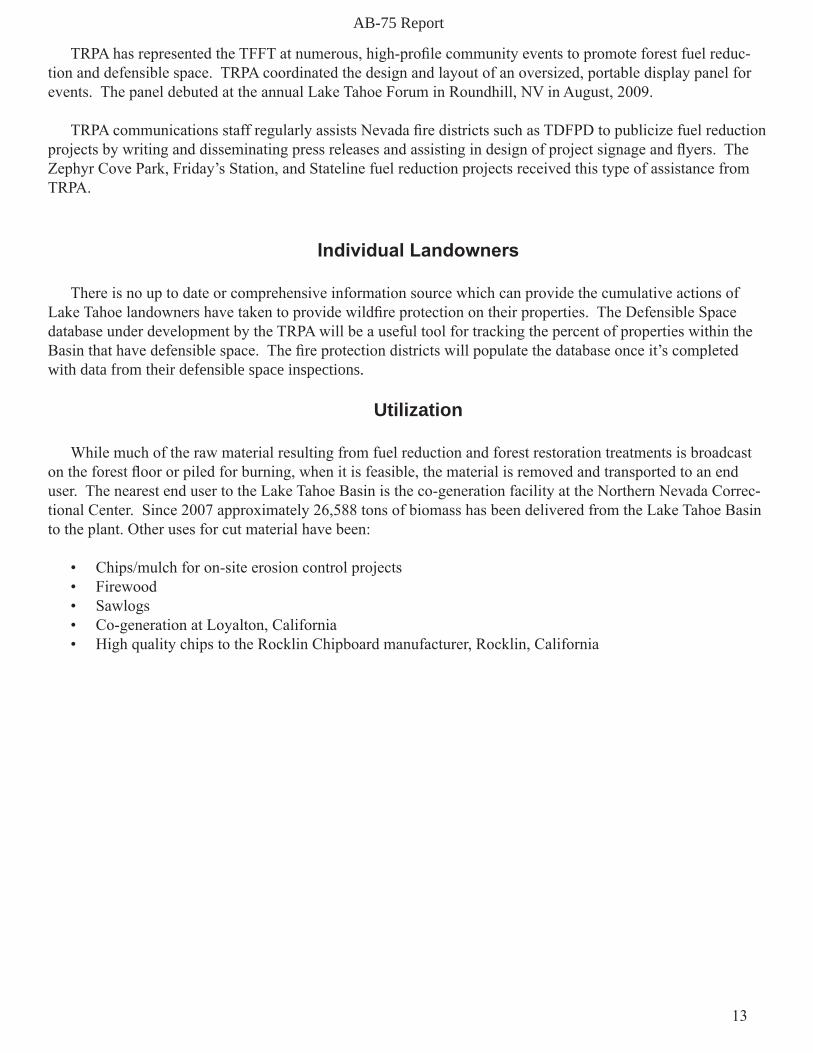
Utilization
While much of the raw material resulting from fuel reduction and forest restoration treatments is broadcast on the forest floor or piled for burning, when it is feasible, the material is removed and transported to an end user. The nearest end user to the Lake Tahoe Basin is the co-generation facility at the Northern Nevada Correc-tional Center. Since 2007 approximately 26,588 tons of biomass has been delivered from the Lake Tahoe Basin to the plant. Other uses for cut material have been:
• Chips/mulch for on-site erosion control projects• Firewood• Sawlogs• Co-generation at Loyalton, California• High quality chips to the Rocklin Chipboard manufacturer, Rocklin, California

AB-75 Report
14
Appendix

AB-75 Report
15
Map 1. Overview Map of Treatment Areas Done by the NTRT and NDF at Lake Tahoe State Park

AB-75 Report
16Map 2. Sand Harbor/Tunnel Creek Treatment Areas.

AB-75 Report
17Map 3. Spooner Lake Treatment Areas

AB-75 Report
18Map 4. Van Sickle Treatment Areas.
AB-75 Report
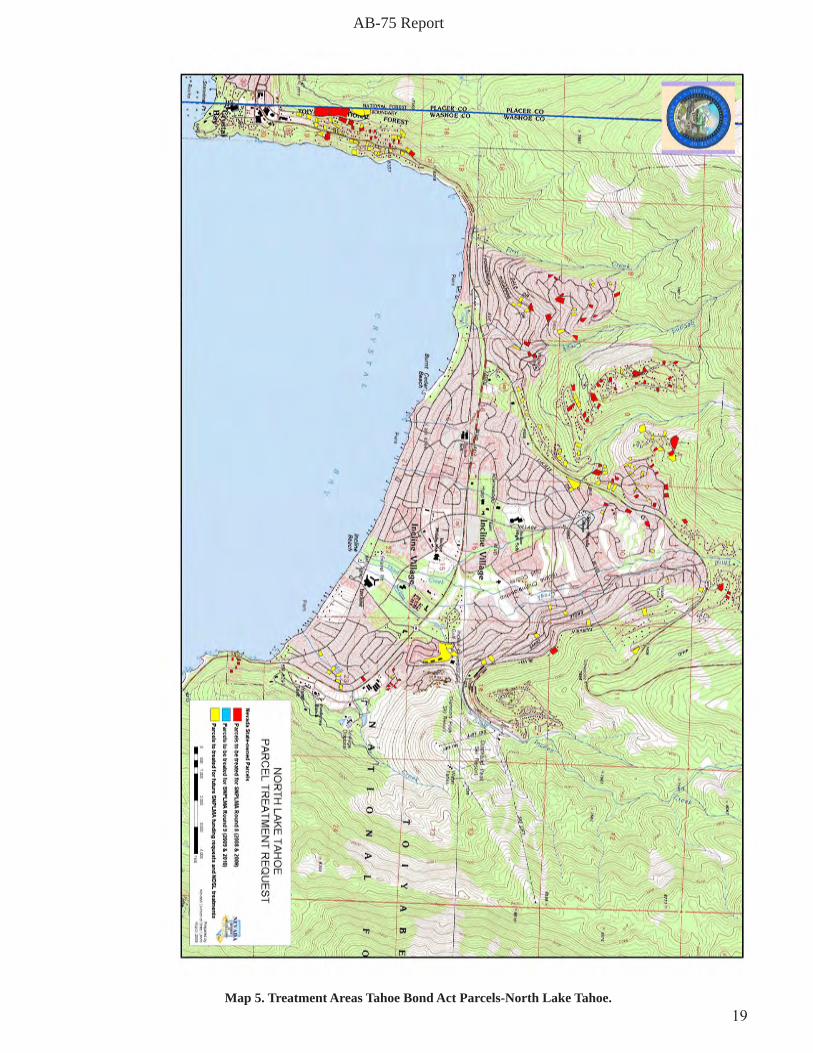
19Map 5. Treatment Areas Tahoe Bond Act Parcels-North Lake Tahoe.
AB-75 Report
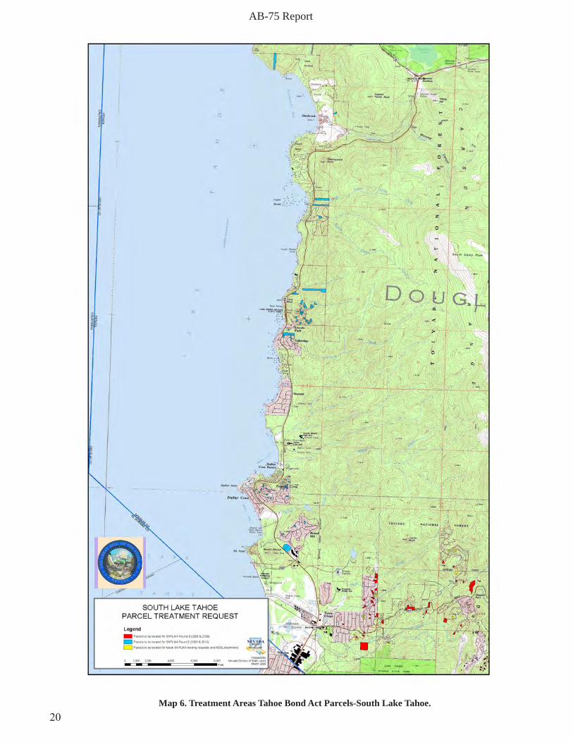
20Map 6. Treatment Areas Tahoe Bond Act Parcels-South Lake Tahoe.

AB-75 Report
21Map 7. TDFPD Projects-Overview.
US R
OUT
E 50
STATE ROUTE 28
LANDS END DR
THE BAC
K RD
KINGSBURY GRADEKAHLE DR
SKYL
AND
DR
LAKE
PKW
Y
S MARTIN DR
ELKS
POI
NT R
D
HILL R
D
ELKS AVE
JUN
IPER
DR
WARRIOR WAY
N P
EAK
DR
US
RO
UTE
50
US R
OU
TE 50
²TDFPD CWPP Projects and
2008 and 2009 Field Season Accomplishments
0 1 20.5 Miles
Legend
TreatmentsHand Thinning
Mastication
Mechanical Thinning
CWPP Projects

AB-75 Report
22
²TDFPD Kingsbury Region Fuels Reduction Projects
2008 and 2009 Field Season
0 0.6 1.20.3 Miles
LegendTreatments
Hand Thinning
Mastication
Mechanical Thinning
Map 8. TDFPD Projects-Kingsbury.

AB-75 Report
23
US R
OU
TE 50
LANDS END DR
THE B
ACK R
D
OLD US ROUTE 50
LINCOLN HWY
GLE
NBR
OO
K R
D
NO NAME
LAKE FR
ON
T DR
YELLOW JACKET RD
KELLY CIR
SHORT RD
YERINGTO
N CIR
DRIVING RANGE RD
US ROUTE 50
²TDFPD Glenbrook Region Fuels Reduction Projects
2008 and 2009 Field Season
0 0.4 0.80.2 Miles
LegendLegendTreatment
Mastication
Hand Thinning
Map 9. TDFPD Projects-Glenbrook.

AB-75 Report
24Map 10. NLTFPD Projects- All years.

AB-75 Report
25Map 11. USFS/LTBMU Projects- Kinsgbury.
Kingsbury Treatment Units

AB-75 Report
26Map 12. USFS/LTBMU Projects- Roundhill.

AB-75 Report
27Map 13. USFS/LTBMU- Slaughterhouse Treatment Units.

AB-75 Report
28
Addendum
2010Accomplishments

AB-75 Report
29
Thispageleftblank
AB-75 Report
30
This report is an addendum to the original “Report to Nevada State Legislature-AB75: Fire-Fuels-Forest Restoration Activities and Accomplishments at Lake Tahoe, NV”, and covers activities on the Nevada side of the Lake Tahoe Basin during calendar year 2010. The reader is referred to the original report for background and previous years’ activities and accomplishments dating to 2007 rather than repeating the information here.
The land management agencies, fire protection districts and NGOs involved in fire prevention and fire hazard reduction had another successful year. In total, approximately 900 acres were treated for fuel reduction. Treatments included thinning, slash chipping and burning.
Planning for future fuel reduction projects has been completed for large acreages of private, state and federal lands.
Both of the fire protection districts on Lake Tahoe’s east shore are using a Basin-wide data base developed by TFFT to input and track defensible space evaluations and compliance. This data-base is currently being populated by input from the fire district staff and will be ready for trials next spring.
Fuel reduction work since the Blue Ribbon Commission has focused on areas identified in the Multi-jurisdictional 10-year plan. These areas are primarily close to urbanized development and on relatively easily accessible ground, commonly referred to as the “low hanging fruit”. As this “low hanging fruit” is picked, the remaining terrain needing treatment is less accessible and consequently more expensive to treat. Cost per acre to treat the remaining areas will increase and funding will not go as far. Coupled with anticipated decreases in one of the primary funding sources, SNPLMA, annual accomplishments will likely begin to decrease in the near future.
The loss of the co-generation power plant at the Northern Nevada Correctional Center in Carson City re-moved the primary repository for chipped material from fuel reduction treatments on the east shore of Lake Tahoe. This has reduced the amount of slash treatment using chippers and increased the reliance on burning.
The increasing difficulty with site access combined with the loss of an end user for chipped material makes the ability to use fire in accomplishing wildfire hazard reduction goals increasingly important. A concern of for-est managers at Lake Tahoe, and indeed across the western U.S., is the anticipated restriction on the use of fire as a management tool due to concerns about its impact on air quality. It is critical that this important tool is not removed from land manager’s tool kit.
2010Accomplishments
NevadaTahoeResourceTeam-LakeTahoeStatePark
The NDF forester assigned to the NTRT is responsible for hazard reduction in Lake Tahoe State Park. This past year he focused on the Van Sickle property in Stateline, North Canyon at Spooner Lake, and Tunnel Creek and Sand Harbor on the north end of the park.
Funding for the work conducted in 2010 came from both the Tahoe Bond Act and the Southern Nevada Pub-lic Land Management Act (SNPLMA). Bond act funds were use to complete 165 acres of thinning and brush removal and 45 acres of pile burning. Fuel treatment is in progress on an additional 223 acres.
The focus of work funded by rounds 8, 9, 10 and 11 of SNPLMA has been in the wildland/urban interface. Three hundred forty five acres are being treated in the Van Sickle property, 100 acres and 80 acres are planned for burning in Tunnel Creek and Slaughterhouse canyon respectively. Additionally, 100 acres of fuel treatment

AB-75 Report
31
has been planned and approved for Sand Harbor.
NevadaTahoeResourceTeam-TahoeBondActUrbanParcels
The State Lands forester assigned to the NTRT is responsible for managing the vegetation and fuel on sensi-tive urban parcels purchased through the Tahoe Bond Act. Left unmanaged, these parcels represent a significant hazard to adjacent privately owned lands in urban areas. The important fuel reduction work conducted on 108 acres of urban parcels in 2010 was funded with SNPLMA rounds 8 and 9. It is important to note that many of these parcels being treated tie in with other agency work such as NDF, USFS and the fire protection districts adding to the eventual impact of treated area.
Round eight funding was used to complete the vegetation/fuel treatment on 28 parcels located in Incline Village/Crystal Bay and Upper Kingsbury at Dagget summit, and along Burke creek in Douglas county. Fuel reduction work using round nine funds focused on urban lots located along Highway 50, between Glenbrook and Round Hill. Fifty-seven parcels were treated during the 2010 field season. Lots were located in Round Hill Zephyr Heights, Cave Rock Estates, Logan Creek Estates and Lake Ridge Estates. Additionally, work began on five acres in Glenbrook which will be completed in 2011.
TahoeDouglasFireProtectionDistrict
The TDFPD has been aggressively pursuing funding for its fire prevention and fuel reduction programs. Funding sources have come from special taxes on residents in the district, as well as grant funding from SN-PLMA, and the FEMA pre-disaster mitigation program.
The district conducted over 200 free defensible space evaluations in 2010. The district is applying for fund-ing to support a district-wide defensible inspection program. If successful, the program would employ two to three defensible space inspectors to blanket the entire district.
In 2010 the TDFPD implemented fuel reduction treatments on federal and state owned lands as well as on privately owned properties. This year all fuel reduction was conducted by hand and amounted to 163.5 acres of thinning on private, 28.5 acres of thinning on state and 2 acres of thinning on federally owned lands.
NorthLakeTahoeFireProtectionDistrict
The NLTFPD is responsible for implementing fuel reduction and forest restoration projects within the com-munities of Incline Village and Crystal Bay. Funding for this work comes from several sources including local property taxes, State Fire Assistance Grants and SNPLMA.
In 2010 the district hand-thinned 165 acres and conducted pile burning on 110 acres within the district. Ad-ditionally, 30 acres of understory, controlled burning was completed. Ninety one additional acres were thinned in preparation for understory burning next season.
The district provides defensible space evaluation and curbside chipping services to district residents on re-quest. In 2010 district staff performed 191 evaluations, issued 103 tree removal permits and chipped 142 curb-side piles.

AB-75 Report
32
Prevention education programs in the district included a Fire Adapted Community workshop, an annual pan-cake breakfast and presentation to local associations and volunteer groups. The district also publicizes their fuel reduction programs through their website, an information board in a local market, mailbox stuffing campaigns and through frequent press releases. The district collaborated with the Nevada Fire Safe Council and the Nevada Tahoe Conservation District to host a Tahoe Wildfire Awareness Week event. Planning is in progress to install an interpretive trail along a popular walking trail in a local drainage that highlights hand thinning and under-story burning. Funding is provided by NDF and USFS.
USDA-ForestService,LakeTahoeBasinManagementUnit
The Forest Service focused on work in the Round Hill and Slaughterhouse Canyon areas, in addition to the urban lots they manage. They finished work on 10 acres of mechanical thinning in Round Hill and 15 acres of hand thinning in Slaughterhouse Canyon. Additionally, they completed three acres of initial thinning on urban lots and 45 acres of second entry thinning.
These figures represent what the Forest Service calls “foot print” acres. Although footprint acres report only an acre of treatment, several various treatments often occur on any given acre before it has been completed. This can lead to some confusion regarding reported numbers.
The Forest Service awarded two contracts for work on their “Spooner project” in 2011. One contract is for 95 acres of hand thinning and the other is for 164 acres of mechanical thinning..
Planning is ongoing for 3,500 acres of treatment on the “Incline project” which includes the pertinent areas around Incline Lake. Planning for this project should be completed in 2011. Planning for Aspen restoration has been completed. Aspen restoration projects are included in the Spooner and Incline projects. Others will be scheduled under the Aspen Restoration Categorical Exclusion.


