40
European Union European Regional Development Fund REPORT VALCONCA Learning Experience Best Practice Transfer
| Date post: | 02-Apr-2016 |
| Category: |
Documents |
| Upload: | paesaggio-er |
| View: | 236 times |
| Download: | 19 times |
European UnionEuropean Regional Development Fund
European UnionEuropean Regional Development Fund
R E P O R T VALCONCALearning Experience Best Practice Transfer
European UnionEuropean Regional Development Fund
European UnionEuropean Regional Development Fund
2 | REPORT VALCONCA
Direzione Generale Programmazione Territoriale e Negoziata, Intese. Relazioni Europee e Relazioni Internazionali
www.territorio.regione.emilia-romagna.it/[email protected]
Alfredo PeriAssessore Programmazione territoriale, urbanistica, reti di infrastrutture materiali e immateriali, mobilità, logistica e trasporti
Enrico CocchiDirettore Generale Programmazione Territoriale e Negoziata, Intese. Relazioni Europee ed Internazionali.
Roberto GabrielliDirigente Servizio pianificazione urbanistica,paesaggio e uso sostenibile del territorio
Gruppo di lavoro Servizio pianificazione urbanistica, paesaggio e uso sostenibile del territorio
Barbara FucciCoordinatrice del progetto GreenInfraNet
Francesco GuaraldiValentina Manzato Francesca Poli Laura PunzoGruppo di lavoro
Francesca BredaNicolò MaltoniTirocinanti
Finito di stampare dal Centro Stampa della Regione Emilia-RomagnaSettembre 2014
General Directorate for Territorial Planning and agreements. European and International Relations.
www.territorio.regione.emilia-romagna.it/[email protected]
Alfredo PeriCouncillor for Territorial Planning, urbanism, material and immaterial infrastructural networks, mobility, logistics and transports
Enrico CocchiGeneral Director for Territorial Planning and agreements.European and International Relations.
Roberto GabrielliDirector Department of urban planning, landscape and sustainable land use
Workgroup Department of urban planning, landscape and sustainable land use
Barbara FucciCoordinator of the GreenInfraNet project
Francesco GuaraldiValentina Manzato Francesca Poli Laura PunzoWorkgroup
Francesca BredaNicolò MaltoniInterns
Printed by the Print Centre of the Emilia-Romagna RegionSeptember 2014
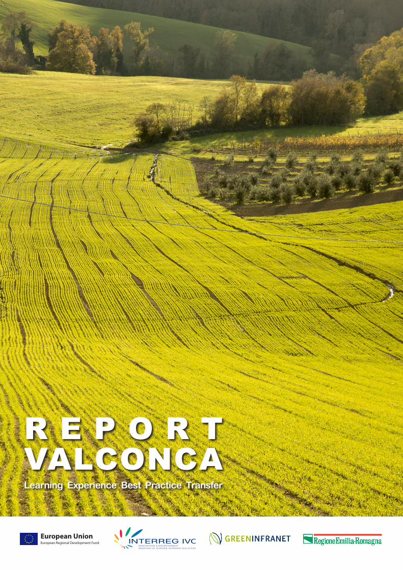
In copertinaPaesaggi della Valconca: campi di grano a Gemmano (©Matteo Conti)
On the front pageValconca landscapes: cornfields in Gemmano(©Matteo Conti)
REPORT VALCONCA | 3
INTRODUZIONE
PROGETTO CONCAValorizzazione ambientale e paesaggistica della valle del torrente ConcaMarialuisa Cipriani, Elena Farnè
OLTRE I PARCHINuove tipologie di aree protette in Emilia-RomagnaMonica Palazzini, WIller Simonati
MODALITÀ DI GESTIONEObiettivi ed azioni di attuazione Roberta Laghi, Francesco Bosco
UN PICCOLO FIUMENatura e biodiversità nel Paesaggio Protettodel ConcaLino Casini
A PASSO D’UOMO FESTIVALUn festival per celebrare arte e naturaAssociazione A Passo d’Uomo
APPUNTI DI UN VIAGGIATORENicolò Maltoni
PARTECIPAZIONE E PRESIDIOQuando la partecipazione funzionae cammina con le proprie gambe (o quasi)Matteo De Angelis
IL DIRITTO ALLA MEMORIAConoscere le proprie radiciper confrontarsi con altre cultureSilvana Cerruti
LA CURA DEL TERRITORIOL’instancabile contributo dei volontariAlfredo Galeazzi
PERCHÈ IL PROGETTOÈ UNA BUONA PRATICA?Barbara Fucci, Valentina Manzato, Francesca Poli, Laura Punzo
UNA LEZIONE DA IMPARAREIl progetto Conca esportato a Gozo [Malta]Krista Farrugia
SENTIERI NATURALI E CULTURALIIl progetto Conca esportato a Stara Zagora [BG]Rumyana Grozeva, Francesca Poli
Indice Index
5
6
14
16
18
22
24
26
28
30
32
34
36
5
6
14
16
18
22
24
26
28
30
32
34
36
INTRODUCTION
CONCA PROJECTEnvironmental and Landscape implementation of the Conca river valleyMarialuisa Cipriani, Elena Farnè
BENEFIT BEYOND BOUNDARIESNew protected areas in Emilia-RomagnaMonica Palazzini, WIller Simonati
MANAGEMENT PROCESSGoals and implementation activities Roberta Laghi, Francesco Bosco
A LITTLE RIVERNature and biodiversity in the Concaprotected landscapeLino Casini
AT A WALKING PACE FESTIVALA festival to celebrate art and natureAssociazione A Passo d’Uomo
NOTES OF A TRAVELLERNicolò Maltoni
PARTECIPATION AND SAFEGUARDWhen public involvement worksand stand on its own two feet (or almost)Matteo De Angelis
THE RIGHT TO REMEMBERKnowing one’s own roots will help to relatewith other culturesSilvana Cerruti
CARE FOR THE TERRITORYThe tireless work of volunteersAlfredo Galeazzi
THE CONCE PROJECT:WHY IS IT A BEST PRACTISE?Barbara Fucci, Valentina Manzato, Francesca Poli, Laura Punzo
A LESSON TO LEARNThe Conca project exported to Gozo [Malta]Krista Farrugia
NATURAL AND CULTURAL ROUTESThe Conca project exported to Stara Zagora [BG]Rumyana Grozeva, Francesca Poli
4 | REPORT VALCONCA
1
2
REPORT VALCONCA | 5
L’aspetto più straordinario nello sviluppo del progetto di pa-esaggio della Valconca è rappresentato dalla creazione di una cittadinanza verde attiva che attraverso associazioni lo-cali, ma anche a titolo personale, svolge un ruolo di presidio del territorio e di valorizzazione e diffusione dei valori cultu-rali e paesaggistici.Il risultato è la ricostruzione di quel senso di appartenenza, di rispetto per i luoghi e della loro storia che fanno emergere il senso - l’anima - del paesaggio.
Tramite il lavoro degli amministratori, dei tecnici e dei cittadini tutti, dal 2007 ad oggi, si sono sviluppati piani e azioni che hanno tenuto conto della salvaguardia del paesaggio e dei bisogni della popolazione locale, emersi dai numerosi incon-tri pubblici e dall’articolata partecipazione che ha accompa-gnato lo svolgersi del progetto istituzionale. Si è innescato così un processo virtuoso che continua nel tempo ed alimen-ta sia la progettualità locale che aspetti sociali di aggregazio-ne ed inclusione. Questi risultati concreti necessitano di atti-vità di cura e coinvolgimento costanti e comportano spesso un impegno di tipo volontaristico.
Questo dossier illustra, in sintesi, il progetto di valorizzazione ambientale e paesaggistica della Valconca, un’esperienza che nasce dall’applicazione di una legge regionale (ex art.49 LR 20/2000) attraverso la quale la Regione Emilia-Romagna ha voluto investire saperi e risorse sul tema del paesaggio, creando l’occasione per un’area come quella del Conca, già oggetto di numerosi studi, di mettere a sistema e finalizzare le energie degli attori locali. Si è anche cercato di offrire, con le interviste, le fotografie e le personali narrazioni, punti di vista diversificati di questa esperienza.
Nell’ambito del progetto europeo GreenInfraNet, dedicato alla promozione e lo sviluppo delle infrastrutture verdi, come definite nella recente Comunicazione della Commissione Eu-ropea “Infrastrutture verdi - Rafforzare il capitale naturale in Europa” (COM 2013-249), abbiamo sperimentato il trasferi-mento ai partner europei delle conoscenze ed esperienze del progetto di paesaggio Valconca, organizzando numero-si incontri, presentazioni ed una visita-studio nel settembre 2013.
Buona lettura!
Barbara Fucci | giugno 2014
In my opinion, the most extraordinary feature in the develop-ment of the Valconca landscape project is represented by the creation of a green active citizenship, which through local associations but also on a personal level, plays an important role for the safeguard of the territory but also for the improve-ment and dissemination of cultural and landscape values. The result is the reenactment of that sense of belonging, re-spect for places and their history which let the true meaning - the soul - of landscape reemerge.
Thanks to the work of administrators, technicians and citi-zens, since 2007, plans and actions have been developed, taking into account the landscape preservation and the needs of local population emerged during the numerous pub-lic meetings and a well-structured participatory process that accompanied the development of the institutional project. It was thus triggered a virtuous process which continues over time and nourishes both local planning and aspects of social aggregation and inclusion. A concrete result that obviously didn’t grow spontaneously, but requires care and dedication and that often implies a voluntary commitment.
This booklet summarizes the Valconca environmental and landscape implementation plan, an experience that originate from the application of a regional law (ex art.49 LR 20/2000) through which the Emilia-Romagna region wanted to invest knowledge and resources on landscape topics, creating the opportunity for an area like the Conca Valley, already inves-tigated in numerous studies, to create synergies and finalize all the energies of local stakeholders. The aim of the dossier also is to illustrate, with interviews, photographs and person-al stories, diverse point of views of this experience.
Within the GreenInfraNet European project, dedicated to the promotion and development of green infrastructures, as de-fined in the recent Communication from the European Com-mission “Green Infrastructure - Enhancing Europe’s Natural Capital” (COM 2013-249), we tried to transfer knowledge and experiecnes from the Valconca landscape project to the European partners, organizing several meetings, presenta-tions and a study tour in September 2013.
Have a nice reading!
Barbara Fucci | June 2014
Introduzione Introduction
Venezia
Ferrara
Bologna
Rimini
Urbino
Verona
Trento
ValconcaMisano Adriatico
San Clemente
MontefioreConca
MontecolomboMontescudo
Gemmano
San Giovanniin Marignano
Saludecio
Mondaino
Montegridolfo
Cattolica
Morcianodi Romagna
Regione Emilia-Romagna / Emilia-Romagna region
Territoriio comunale / Municipality territory
Comuni principali / Main municipality
Torrente Conca / Conca River
Misano Adriatico
San Clemente
MontefioreConca
MontecolomboMontescudo
Gemmano
San Giovanniin Marignano
Saludecio
Mondaino
Montegridolfo
Cattolica
Morcianodi Romagna
6 | REPORT VALCONCA
PROGETTO CONCA
VALORIZZAZIONE AMBIENTALE E PAESAGGISTICA DELLA VALLE DEL TORRENTE CONCA
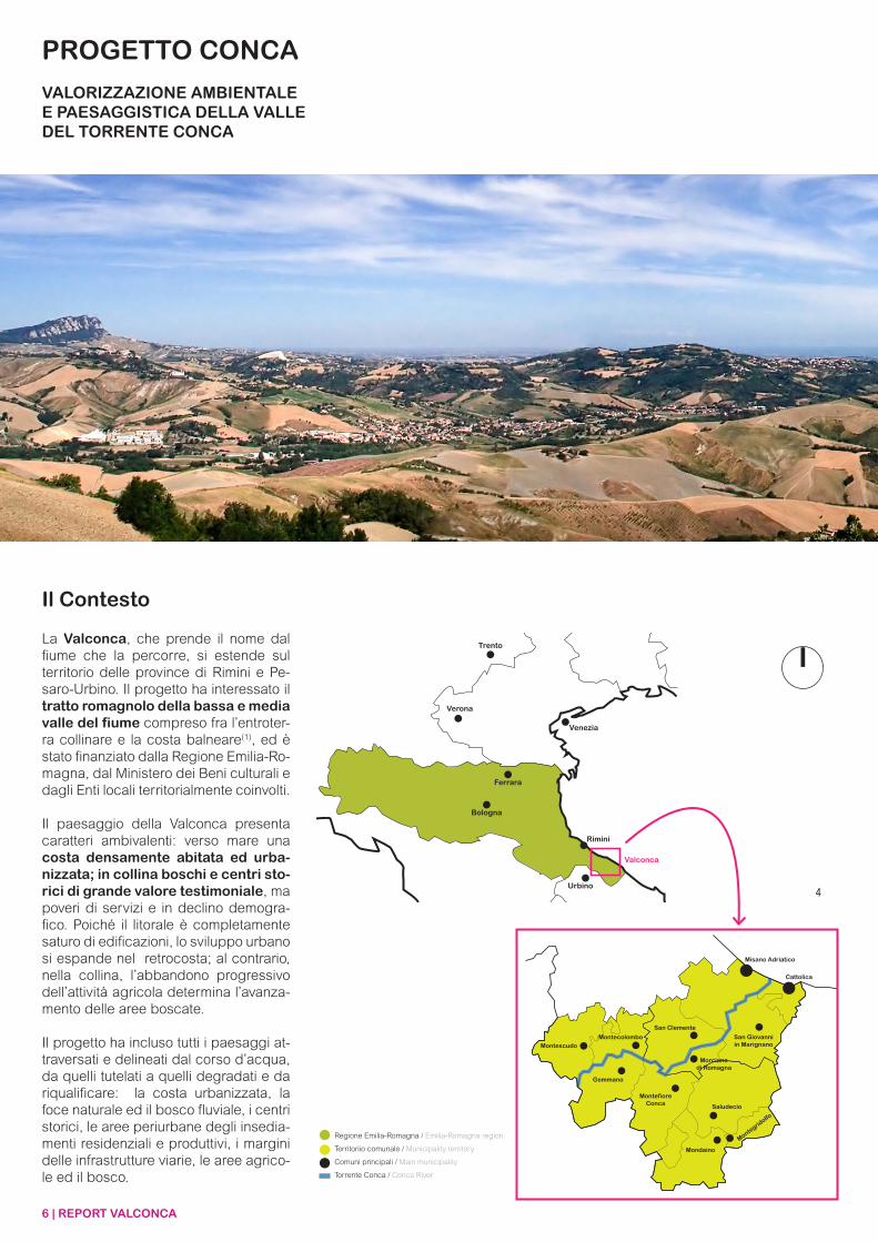
Il Contesto
La Valconca, che prende il nome dal fiume che la percorre, si estende sul territorio delle province di Rimini e Pe-saro-Urbino. Il progetto ha interessato il tratto romagnolo della bassa e media valle del fiume compreso fra l’entroter-ra collinare e la costa balneare(1), ed è stato finanziato dalla Regione Emilia-Ro-magna, dal Ministero dei Beni culturali e dagli Enti locali territorialmente coinvolti.
Il paesaggio della Valconca presenta caratteri ambivalenti: verso mare una costa densamente abitata ed urba-nizzata; in collina boschi e centri sto-rici di grande valore testimoniale, ma poveri di servizi e in declino demogra-fico. Poiché il litorale è completamente saturo di edificazioni, lo sviluppo urbano si espande nel retrocosta; al contrario, nella collina, l’abbandono progressivo dell’attività agricola determina l’avanza-mento delle aree boscate.
Il progetto ha incluso tutti i paesaggi at-traversati e delineati dal corso d’acqua, da quelli tutelati a quelli degradati e da riqualificare: la costa urbanizzata, la foce naturale ed il bosco fluviale, i centri storici, le aree periurbane degli insedia-menti residenziali e produttivi, i margini delle infrastrutture viarie, le aree agrico-le ed il bosco.
4
REPORT VALCONCA | 7
CONCA PROJECT
ENVIRONMENTAL AND LANDSCAPE IMPLEMENTATION OF THE CONCA RIVER VALLEY
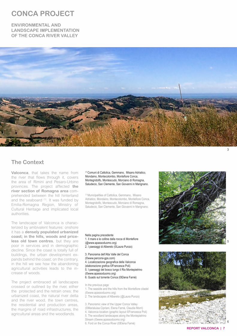
Valconca, that takes the name from the river that flows through it, covers the area of Rimini and Pesaro-Urbino provinces. The project affected the river section of Romagna area com-prehended between the hill hinterland and the seaboard (1). It was funded by Emilia-Romagna Region, Ministry of Cultural Heritage and implicated local authorities.
The landscape of Valconca is charac-terized by ambivalent features: onshore it has a densely populated urbanized coast; in the hills, woods and price-less old town centres, but they are poor in services and in demographic decline. Since the coast is totally full of buildings, the urban development ex-pands behind the coast; on the contrary, in the hill we see how the abandoning agricultural activities leads to the in-crease of woods.
The project embraced all landscapes crossed or outlined by the river, either the protected and the retrain ones: the urbanized coast, the natural river delta and the river wood, the town centres, the residential and production areas, the margins of road infrastructures, the agricultural areas and the woodlands.
The Context
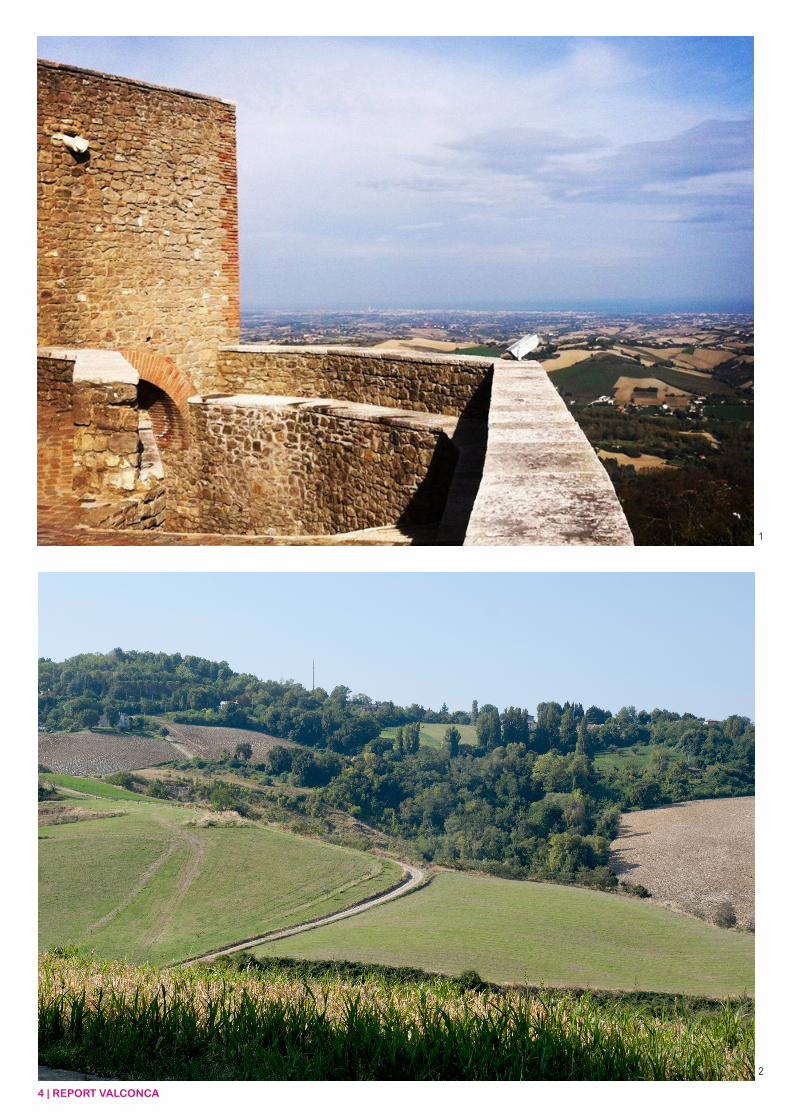
Nella pagina precedente1. Il mare e le colline dalla rocca di Montefiore(@www.apassoduomo.org)2. I paesaggi di Albereto (©Laura Punzo)
3. Panorama dell’Alta Valle del Conca(©www.percorsi-gps.com)4. Localizzazione geografica della Valconca(elaborazione grafica ©Francesca Poli)5. I paesaggi del bosco lungo il Rio Montepietrino(©www.apassoduomo.org)6. Guado sul torrente Conca (©Elena Farnè)
In the previous page1. The seaside and the hills from the Montefiore citadel(©www.apassoduomo.org)2. The landscapes of Albereto (@Laura Punzo)
3. Panoramic view of the Upper Conca Valley (©Marialuisa Cipriani, Elena Farnè, Claudia Morri)4. Valconca location (graphic layout ©Francesca Poli)5. The woodland landscapes along the Montepietrino Stream (©www.apassoduomo.org)6. Ford on the Conca River (©Elena Farnè)
(1) Comuni di Cattolica, Gemmano, Misano Adriatico, Mondaino, Montecolombo, Montefiore Conca, Montegridolfo, Montescudo, Morciano di Romagna, Saludecio, San Clemente, San Giovanni in Marignano.
(1) Municipalities of Cattolica, Gemmano, Misano Adriatico, Mondaino, Montecolombo, Montefiore Conca, Montegridolfo, Montescudo, Morciano di Romagna, Saludecio, San Clemente, San Giovanni in Marignano.
3
5
6
8 | REPORT VALCONCA
7
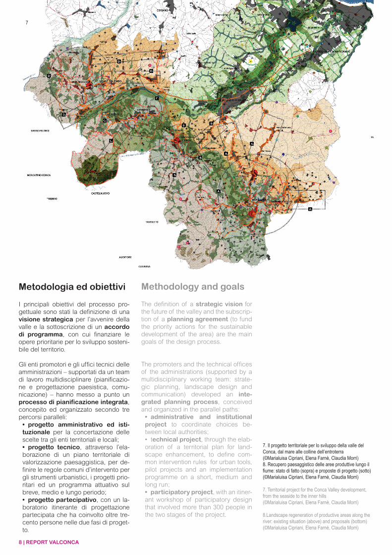
I principali obiettivi del processo pro-gettuale sono stati la definizione di una visione strategica per l’avvenire della valle e la sottoscrizione di un accordo di programma, con cui finanziare le opere prioritarie per lo sviluppo sosteni-bile del territorio.
Gli enti promotori e gli uffici tecnici delle amministrazioni – supportati da un team di lavoro multidisciplinare (pianificazio-ne e progettazione paesistica, comu-nicazione) – hanno messo a punto un processo di pianificazione integrata, concepito ed organizzato secondo tre percorsi paralleli:• progetto amministrativo ed isti-tuzionale per la concertazione delle scelte tra gli enti territoriali e locali;• progetto tecnico, attraverso l’ela-borazione di un piano territoriale di valorizzazione paesaggistica, per de-finire le regole comuni d’intervento per gli strumenti urbanistici, i progetti prio-ritari ed un programma attuativo sul breve, medio e lungo periodo;• progetto partecipativo, con un la-boratorio itinerante di progettazione partecipata che ha coinvolto oltre tre-cento persone nelle due fasi di proget-to.
The definition of a strategic vision for the future of the valley and the subscrip-tion of a planning agreement (to fund the priority actions for the sustainable development of the area) are the main goals of the design process.
The promoters and the technical offices of the administrations (supported by a multidisciplinary working team: strate-gic planning, landscape design and communication) developed an inte-grated planning process, conceived and organized in the parallel paths:• administrative and institutional project to coordinate choices be-tween local authorities;• technical project, through the elab-oration of a territorial plan for land-scape enhancement, to define com-mon intervention rules for urban tools, pilot projects and an implementation programme on a short, medium and long run; • participatory project, with an itiner-ant workshop of participatory design that involved more than 300 people in the two stages of the project.
Metodologia ed obiettivi Methodology and goals
7. Il progetto territoriale per lo sviluppo della valle del Conca, dal mare alle colline dell’entroterra(©Marialuisa Cipriani, Elena Farnè, Claudia Morri) 8. Recupero paesaggistico delle aree produttive lungo il fiume: stato di fatto (sopra) e proposte di progetto (sotto)(©Marialuisa Cipriani, Elena Farnè, Claudia Morri)
7. Territorial project for the Conca Valley development, from the seaside to the inner hills(©Marialuisa Cipriani, Elena Farnè, Claudia Morri)
8.Landscape regeneration of productive areas along the river: existing situation (above) and proposals (bottom)(©Marialuisa Cipriani, Elena Farnè, Claudia Morri)
REPORT VALCONCA | 9
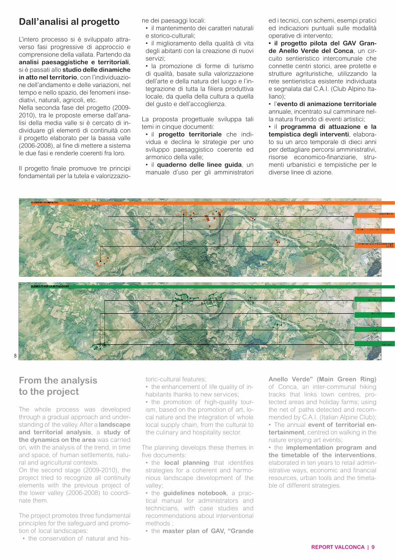
L’intero processo si è sviluppato attra-verso fasi progressive di approccio e comprensione della vallata. Partendo da analisi paesaggistiche e territoriali, si è passati allo studio delle dinamiche in atto nel territorio, con l’individuazio-ne dell’andamento e delle variazioni, nel tempo e nello spazio, dei fenomeni inse-diativi, naturali, agricoli, etc.Nella seconda fase del progetto (2009-2010), tra le proposte emerse dall’ana-lisi della media valle si è cercato di in-dividuare gli elementi di continuità con il progetto elaborato per la bassa valle (2006-2008), al fine di mettere a sistema le due fasi e renderle coerenti fra loro.
Il progetto finale promuove tre principi fondamentali per la tutela e valorizzazio-
ne dei paesaggi locali:• il mantenimento dei caratteri naturali e storico-culturali;• il miglioramento della qualità di vita degli abitanti con la creazione di nuovi servizi;• la promozione di forme di turismo di qualità, basate sulla valorizzazione dell’arte e della natura del luogo e l’in-tegrazione di tutta la filiera produttiva locale, da quella della cultura a quella del gusto e dell’accoglienza.
La proposta progettuale sviluppa tali temi in cinque documenti:
• il progetto territoriale che indi-vidua e declina le strategie per uno sviluppo paesaggistico coerente ed armonico della valle;• il quaderno delle linee guida, un manuale d’uso per gli amministratori
ed i tecnici, con schemi, esempi pratici ed indicazioni puntuali sulle modalità operative di intervento; • il progetto pilota del GAV Gran-de Anello Verde del Conca, un cir-cuito sentieristico intercomunale che connette centri storici, aree protette e strutture agrituristiche, utilizzando la rete sentieristica esistente individuata e segnalata dal C.A.I. (Club Alpino Ita-liano);• l’evento di animazione territoriale annuale, incentrato sul camminare nel-la natura fruendo di eventi artistici;• il programma di attuazione e la tempistica degli interventi, elabora-to su un arco temporale di dieci anni per dettagliare percorsi amministrativi, risorse economico-finanziarie, stru-menti urbanistici e tempistiche per le diverse linee di azione.
Dall’analisi al progetto
The whole process was developed through a gradual approach and under-standing of the valley. After a landscape and territorial analysis, a study of the dynamics on the area was carried on, with the analysis of the trend, in time and space, of human settlements, natu-ral and agricultural contexts.On the second stage (2009-2010), the project tried to recognize all continuity elements with the previous project of the lower valley (2006-2008) to coordi-nate them.
The project promotes three fundamental principles for the safeguard and promo-tion of local landscapes:
• the conservation of natural and his-
toric-cultural features;• the enhancement of life quality of in-habitants thanks to new services;• the promotion of high-quality tour-ism, based on the promotion of art, lo-cal nature and the integration of whole local supply chain, from the cultural to the culinary and hospitality sector.
The planning develops these themes in five documents:
• the local planning that identifies strategies for a coherent and harmo-nious landscape development of the valley;• the guidelines notebook, a prac-tical manual for administrators and technicians, with case studies and recommendations about interventional methods ;• the master plan of GAV, “Grande
Anello Verde” (Main Green Ring) of Conca, an inter-communal hiking tracks that links town centres, pro-tected areas and holiday farms; using the net of paths detected and recom-mended by C.A.I. (Italian Alpine Club);• The annual event of territorial en-tertainment, centred on walking in the nature enjoying art events;• the implementation program and the timetable of the interventions, elaborated in ten years to retail admin-istrative ways, economic and financial resources, urban tools and the timeta-ble of different strategies.
From the analysisto the project
8
10 | REPORT VALCONCA
Dal processo e dagli attori coinvolti è emerso come il paesaggio possa e debba essere il motore per lo svilup-po sostenibile della Valconca, attra-verso il quale far emergere l’attrattività e l’identità di un territorio.
Il paesaggio della valle, attraverso azio-ni progettuali integrate e diversificate, potrà coinvolgere e includere, nel me-desimo obiettivo di sviluppo locale, tutti i settori e le attività già esistenti con pro-spettive a lungo termine.
Il progetto ha ricevuto diversi premi e riconoscimenti, dimostrando come for-me di democrazia partecipativa, se realmente integrate all’elaborazione di piani e progetti tecnici, possano divenire strumenti efficaci per gover-nare le trasformazioni del paesaggio.
The project showed how the land-scape could e should be the driving force for the sustainable develop-ment of Valconca, through which the attractiveness and the identity of the re-gion could emerge.
The landscape of the valley, through integrated and diversified planning ac-tions, could involve all the existing sec-tors and activities under the same pur-pose of local development with long term perspectives.
The project received several prizes and recognitions, showing how democratic participatory methods can become effective tools for the landscape management if well integrated within the planning and technical projects.
Primi esiti First results
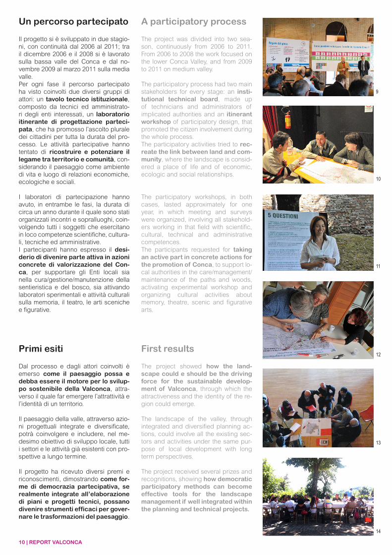
Il progetto si è sviluppato in due stagio-ni, con continuità dal 2006 al 2011; tra il dicembre 2006 e il 2008 si è lavorato sulla bassa valle del Conca e dal no-vembre 2009 al marzo 2011 sulla media valle.Per ogni fase il percorso partecipato ha visto coinvolti due diversi gruppi di attori: un tavolo tecnico istituzionale, composto da tecnici ed amministrato-ri degli enti interessati, un laboratorio itinerante di progettazione parteci-pata, che ha promosso l’ascolto plurale dei cittadini per tutta la durata del pro-cesso. Le attività partecipative hanno tentato di ricostruire e potenziare il legame tra territorio e comunità, con-siderando il paesaggio come ambiente di vita e luogo di relazioni economiche, ecologiche e sociali.
I laboratori di partecipazione hanno avuto, in entrambe le fasi, la durata di circa un anno durante il quale sono stati organizzati incontri e sopralluoghi, coin-volgendo tutti i soggetti che esercitano in loco competenze scientifiche, cultura-li, tecniche ed amministrative.I partecipanti hanno espresso il desi-derio di divenire parte attiva in azioni concrete di valorizzazione del Con-ca, per supportare gli Enti locali sia nella cura/gestione/manutenzione della sentieristica e del bosco, sia attivando laboratori sperimentali e attività culturali sulla memoria, il teatro, le arti sceniche e figurative.
The project was divided into two sea-son, continuously from 2006 to 2011. From 2006 to 2008 the work focused on the lower Conca Valley, and from 2009 to 2011 on medium valley.
The participatory process had two main stakeholders for every stage: an insti-tutional technical board, made up of technicians and administrators of implicated authorities and an itinerant workshop of participatory design, that promoted the citizen involvement during the whole process.The participatory activities tried to rec-reate the link between land and com-munity, where the landscape is consid-ered a place of life and of economic, ecologic and social relationships.
The participatory workshops, in both cases, lasted approximately for one year, in which meeting and surveys were organized, involving all stakehold-ers working in that field with scientific, cultural, technical and administrative competences. The participants requested for taking an active part in concrete actions for the promotion of Conca, to support lo-cal authorities in the care/management/maintenance of the paths and woods, activating experimental workshop and organizing cultural activities about memory, theatre, scenic and figurative arts.
Un percorso partecipato A participatory process
9
10
11
12
13
14
REPORT VALCONCA | 11
Marialusia CiprianiElena Farnè
Intercity Lab
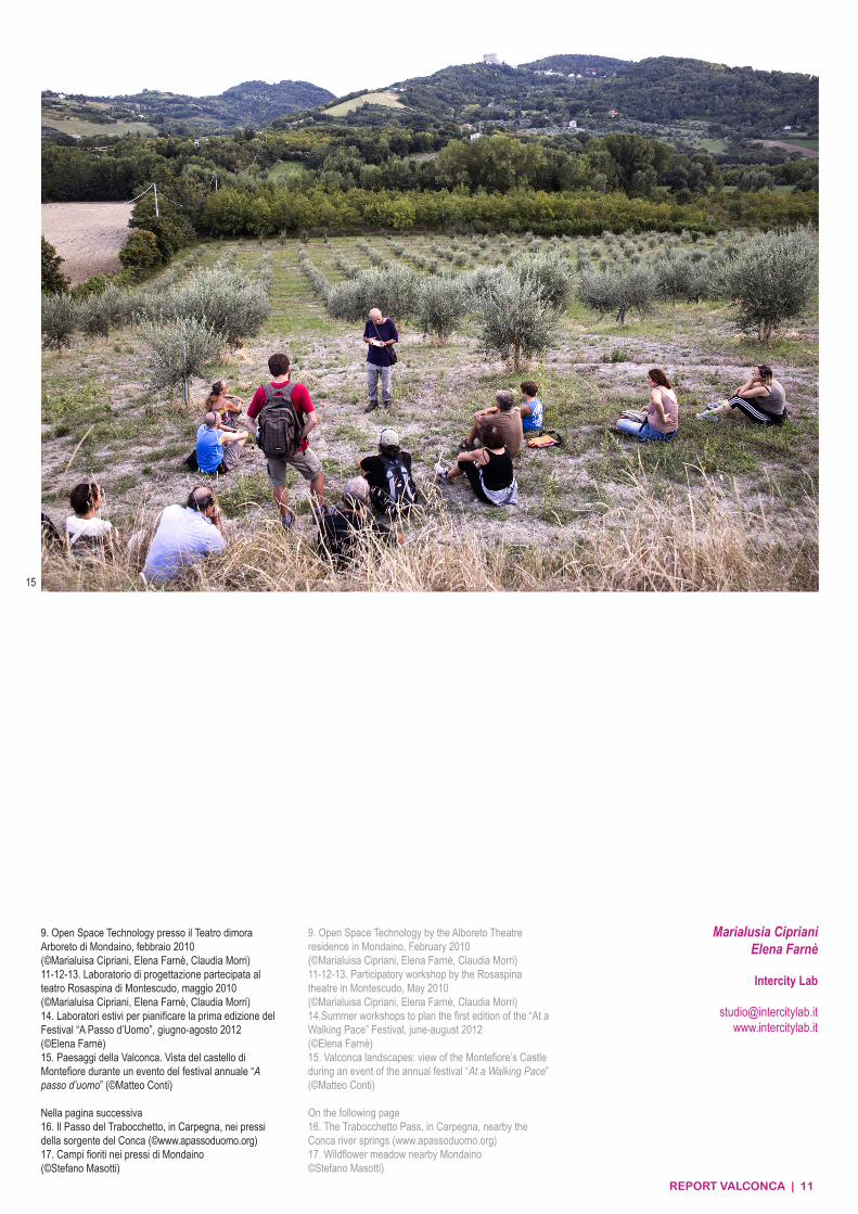
9. Open Space Technology presso il Teatro dimora Arboreto di Mondaino, febbraio 2010(©Marialuisa Cipriani, Elena Farnè, Claudia Morri) 11-12-13. Laboratorio di progettazione partecipata al teatro Rosaspina di Montescudo, maggio 2010(©Marialuisa Cipriani, Elena Farnè, Claudia Morri) 14. Laboratori estivi per pianificare la prima edizione del Festival “A Passo d’Uomo”, giugno-agosto 2012(©Elena Farnè)15. Paesaggi della Valconca. Vista del castello di Montefiore durante un evento del festival annuale “A passo d’uomo” (©Matteo Conti)
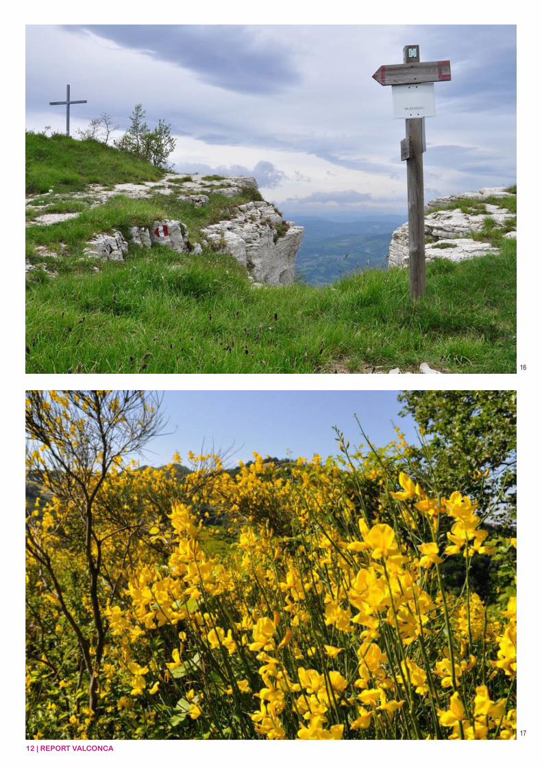
Nella pagina successiva16. Il Passo del Trabocchetto, in Carpegna, nei pressi della sorgente del Conca (©www.apassoduomo.org)17. Campi fioriti nei pressi di Mondaino(©Stefano Masotti)
15
9. Open Space Technology by the Alboreto Theatre residence in Mondaino, February 2010(©Marialuisa Cipriani, Elena Farnè, Claudia Morri)11-12-13. Participatory workshop by the Rosaspina theatre in Montescudo, May 2010(©Marialuisa Cipriani, Elena Farnè, Claudia Morri)14.Summer workshops to plan the first edition of the “At a Walking Pace” Festival, june-august 2012(©Elena Farnè)15. Valconca landscapes: view of the Montefiore’s Castle during an event of the annual festival “At a Walking Pace” (©Matteo Conti)
On the following page16. The Trabocchetto Pass, in Carpegna, nearby the Conca river springs (www.apassoduomo.org)17. Wildflower meadow nearby Mondaino©Stefano Masotti)
12 | REPORT VALCONCA
16
17
REPORT VALCONCA | 13
PROGETTO CONCASCHEDA TECNICA
LOCALIZZAZIONE GEOGRAFICA Valle del fiume Conca, Provincia di Rimini, Regione Emilia-Romagna
ENTI PROMOTORIProvincia di Rimini (ente capofila)Regione Emilia-RomagnaMinistero per i Beni e le Attività Culturali - Direzione dell’Emilia-RomagnaComuni di Cattolica, Gemmano, Mondaino, Monte Colombo, Montefiore Conca, Montegridolfo, Montescudo, Morciano di Romagna, Misano Adriatico, Saludecio, San Clemente, San Giovanni in Marignano
GRUPPO DI LAVORO
1° FASE - 2007-2008 BASSA VALCONCA
COORDINAMENTOElena Farnè
ANALISI E PROGETTAZIONEChristine DalnokyMarialuisa CiprianiClaudia Morri
PARTECIPAZIONERita Micarelli
2° FASE - 2009-2010MEDIA VALCONCA
COORDINAMENTOANALISI E PROGETTAZIONEPARTECIPAZIONEMarialuisa CiprianiElena FarnèClaudia Morri
PAESAGGIO NATURALEE SEMINATURALE PROTETTOLino Casini
PROVINCIA DI RIMINIFrancesco BoscoRoberta LaghiFabio Tomasetti
REGIONE EMILIA-ROMAGNAEnrico CocchiVittoria MontalettiGiancarlo Poli
MIBACCristina Sanguineti
COMUNE DI CATTOLICADaniele FabbriLuca GamucciMarialuisa Stoppioni
COMUNE DI MISANO ADRIATICOGiancarlo Zoffoli
COMUNE DI SAN CLEMENTEAlberto Gerini
COMUNE DI SAN GIOVANNIIN MARIGNANOCarlo Palmerini
COMUNE DI MORCIANO DI ROMAGNAMonica Galli
COMUNE DI SALUDECIOAntonella Alagia
COMUNE DI GEMMANOSanzio Brunetti
COMUNE DI MONDAINOGiuliana GeneraliLuca Berardi
COMUNE DI MONTECOLOMBODaniele Livi
COMUNE DI MONTEFIORE CONCAClaudia Cavalli
COMUNE DI MONTEGRIDOLFOPier Paolo Copponi
COMUNE DI MONTESCUDOPaola FavaleLuca Tontini
CRONOLOGIA
2006-2008Progetto di tutela, recupero e valorizzazione(L.R. 20/2000 – art.49)
2008-2009Accordo Territoriale(L.R. 20/2000 – art.15)
2010-2011Analisi territoriale, laboratori di partecipazi-one, progetto territoriale, progetto pilota, linee guida ed approvazione del progetto
2011Istituzione del PNSP Paesaggio Naturale e Semi-naturale Protetto del Conca(L.R. 6/2005)
2012-in corso• Progettazione esecutiva e realizzazione sentiero ciclo-naturalistico di lungofiume (progetto pilota Progetto Conca 1°ed-izione)• Progettazione esecutiva, Manutenzione e Segnaletica sentiero ciclo-naturalistico di lungofiume (progetto pilota PNSP Paesag-gio Naturale e Semi-naturale Protetto del Conca)• Progettazione esecutiva e realizzazione festival A passo d’uomo (progetto pilota Progetto Conca 2°edizione)• Progettazione esecutiva, Mappatura georeferenziata e tabellazione del GAV “Grande Anello Verde del Conca” e di due sotto-anelli sperimentali (progetto pilota Progetto Conca 2°edizione)
SITO WEBwww.provincia.rimini.it/paesaggio/mn_p_conca/www.apassoduomo.org
PREMI E RICONOSCIMENTI
2012Laboratorio Italia. Esposizione in occasione della 13° Mostra Internazionale di Architet-tura della Biennale di Venezia
2011Premio del Paesaggio del Consiglio d’EuropaMenzione speciale
2008Premio IQU Innovazione e Qualità Urbana1° premio
CONCA PROJECTTECHNICAL SHEET
GEOGRAPHIC LOCATIONValley of the Conca river, Province of Rimini, Emilia-Romagna Region
PROMOTERSProvince of Rimini (lead partner)Emilia-Romagna RegionMinistry of Cultural heritage and Actvities- Emilia-Romagna DirectorateMunicipalities of Cattolica, Gemmano, Mondaino, Monte Colombo, Montefiore Conca, Montegridolfo, Montescudo, Morciano di Romagna, Misano Adriatico, Saludecio, San Clemente, San Giovanni in Marignano
WORKGROUP
1° PHASE - 2007-2008 LOWER VALCONCA
COORDINATIONElena Farnè
ANALYSIS AND DESIGNChristine DalnokyMarialuisa CiprianiClaudia Morri
PARTECIPATORY PROCESSRita Micarelli
2° PHASE - 2009-2010MEDIUM VALCONCA
COORDINATIONANALYSIS AND DESIGNPARTECIPATORY PROCESSMarialuisa CiprianiElena Farnè PROVINCE OF RIMINIFrancesco BoscoRoberta LaghiFabio Tomasetti
EMILIA-ROMAGNA REGIONEnrico CocchiVittoria MontalettiGiancarlo Poli
MIBACCristina Sanguineti
MUNICIPALITY OF CATTOLICADaniele FabbriLuca GamucciMarialuisa Stoppioni
MUNICIPALITY OF MISANO ADRIATICOGiancarlo Zoffoli
MUNICIPALITY OF SAN CLEMENTEAlberto Gerini
MUNICIPALITY OF SAN GIOVANNIIN MARIGNANOCarlo Palmerini
MUNICIPALITY OF MORCIANO DI ROMAGNAMonica Galli
MUNICIPALITY OF SALUDECIOAntonella Alagia
MUNICIPALITY OF GEMMANOSanzio Brunetti
MUNICIPALITY OF MONDAINOGiuliana GeneraliLuca Berardi
MUNICIPALITY OF MONTECOLOMBODaniele Livi
MUNICIPALITY OF MONTEFIORE CONCAClaudia Cavalli
MUNICIPALITY OF MONTEGRIDOLFOPier Paolo Copponi
MUNICIPALITY OF MONTESCUDOPaola FavaleLuca Tontini
CHRONOLOGY
2006-2008Protection, recovery and valorization project (L.R. 20/2000 – art.49)
2008-2009Territorial Agreement(L.R. 20/2000 – art.15)
2010-2011Territorial analysis, participatory workshops, land project, pilot project, guide lines and project approval
2011Institution of the Conca Protected Landscape(L.R. 6/2005)
2012-ongoing• Working Plan and realization of a cycle-natural path along the river (pilot project of the 1°edition of the Conca Project)• Working Plan, Maintainance and Sig-nage System of the cycle-natural path along the river (pilot project of the Conca Protected Landscape)• Working Plan and organization of the “At a walking pace - A passo d’uomo” festival (pilot project of the 2°edition of the Conca Project)• Working Plan, geo-referenced mapping e definition of the hiking tracks of GAV “Main Conca Green Ring - Grande Anello Verde del Conca” and of two secondary experimental networks (pilot project of the 2°edition of the Conca Project)
WEB SITEwww.provincia.rimini.it/paesaggio/mn_p_conca/www.apassoduomo.org
AWARDS AND HONOURS
2012Laboratorio Italia. Exhibition during the 13° International Architecture Exhibition at the Venice Biennale
2011Landscape Award of the Council of EuropeHonourable mention
2008IQU Award for Innovation and Urban Quality1° prize
14 | REPORT VALCONCA
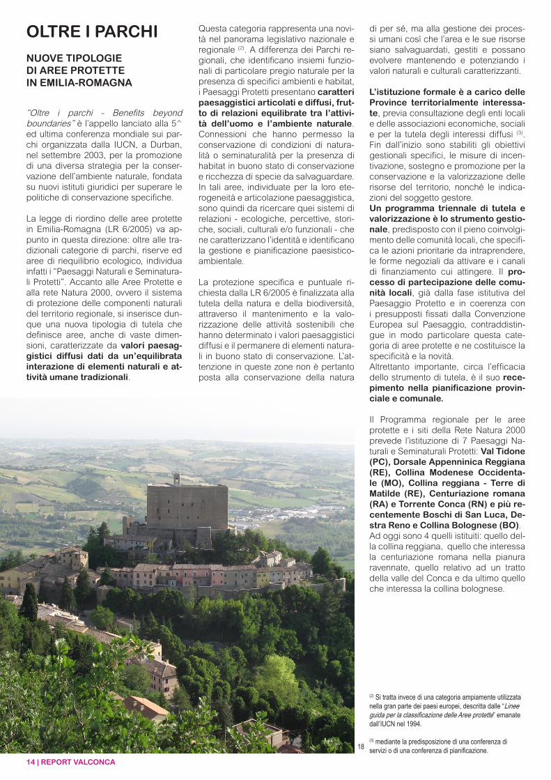
“Oltre i parchi - Benefits beyond boundaries” è l’appello lanciato alla 5^ ed ultima conferenza mondiale sui par-chi organizzata dalla IUCN, a Durban, nel settembre 2003, per la promozione di una diversa strategia per la conser-vazione dell’ambiente naturale, fondata su nuovi istituti giuridici per superare le politiche di conservazione specifiche.
La legge di riordino delle aree protette in Emilia-Romagna (LR 6/2005) va ap-punto in questa direzione: oltre alle tra-dizionali categorie di parchi, riserve ed aree di riequilibrio ecologico, individua infatti i “Paesaggi Naturali e Seminatura-li Protetti”. Accanto alle Aree Protette e alla rete Natura 2000, ovvero il sistema di protezione delle componenti naturali del territorio regionale, si inserisce dun-que una nuova tipologia di tutela che definisce aree, anche di vaste dimen-sioni, caratterizzate da valori paesag-gistici diffusi dati da un’equilibrata interazione di elementi naturali e at-tività umane tradizionali.
OLTRE I PARCHI
NUOVE TIPOLOGIEDI AREE PROTETTEIN EMILIA-ROMAGNA
Questa categoria rappresenta una novi-tà nel panorama legislativo nazionale e regionale (2). A differenza dei Parchi re-gionali, che identificano insiemi funzio-nali di particolare pregio naturale per la presenza di specifici ambienti e habitat, i Paesaggi Protetti presentano caratteri paesaggistici articolati e diffusi, frut-to di relazioni equilibrate tra l’attivi-tà dell’uomo e l’ambiente naturale. Connessioni che hanno permesso la conservazione di condizioni di natura-lità o seminaturalità per la presenza di habitat in buono stato di conservazione e ricchezza di specie da salvaguardare.In tali aree, individuate per la loro ete-rogeneità e articolazione paesaggistica, sono quindi da ricercare quei sistemi di relazioni - ecologiche, percettive, stori-che, sociali, culturali e/o funzionali - che ne caratterizzano l’identità e identificano la gestione e pianificazione paesistico-ambientale.
La protezione specifica e puntuale ri-chiesta dalla LR 6/2005 è finalizzata alla tutela della natura e della biodiversità, attraverso il mantenimento e la valo-rizzazione delle attività sostenibili che hanno determinato i valori paesaggistici diffusi e il permanere di elementi natura-li in buono stato di conservazione. L’at-tenzione in queste zone non è pertanto posta alla conservazione della natura
di per sé, ma alla gestione dei proces-si umani così che l’area e le sue risorse siano salvaguardati, gestiti e possano evolvere mantenendo e potenziando i valori naturali e culturali caratterizzanti.
L’istituzione formale è a carico delle Province territorialmente interessa-te, previa consultazione degli enti locali e delle associazioni economiche, sociali e per la tutela degli interessi diffusi (3). Fin dall’inizio sono stabiliti gli obiettivi gestionali specifici, le misure di incen-tivazione, sostegno e promozione per la conservazione e la valorizzazione delle risorse del territorio, nonché le indica-zioni del soggetto gestore.Un programma triennale di tutela e valorizzazione è lo strumento gestio-nale, predisposto con il pieno coinvolgi-mento delle comunità locali, che specifi-ca le azioni prioritarie da intraprendere, le forme negoziali da attivare e i canali di finanziamento cui attingere. Il pro-cesso di partecipazione delle comu-nità locali, già dalla fase istitutiva del Paesaggio Protetto e in coerenza con i presupposti fissati dalla Convenzione Europea sul Paesaggio, contraddistin-gue in modo particolare questa cate-goria di aree protette e ne costituisce la specificità e la novità.Altrettanto importante, circa l’efficacia dello strumento di tutela, è il suo rece-pimento nella pianificazione provin-ciale e comunale.
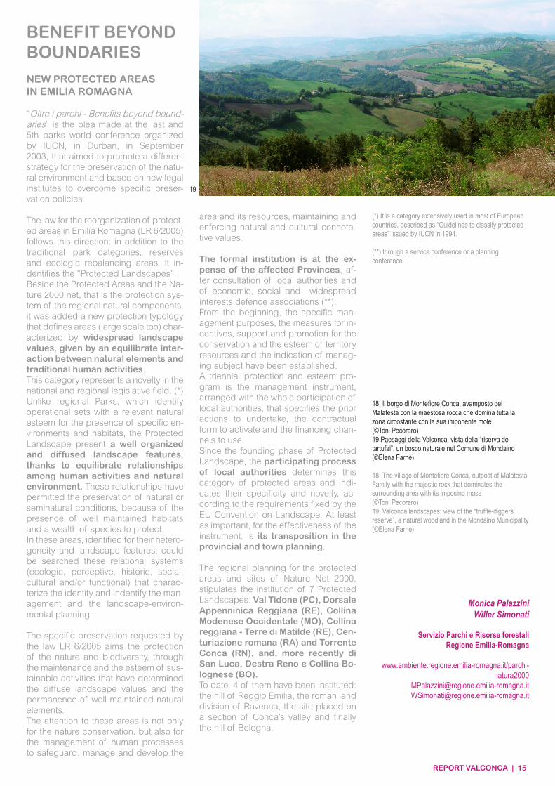
Il Programma regionale per le aree protette e i siti della Rete Natura 2000 prevede l’istituzione di 7 Paesaggi Na-turali e Seminaturali Protetti: Val Tidone (PC), Dorsale Appenninica Reggiana (RE), Collina Modenese Occidenta-le (MO), Collina reggiana - Terre di Matilde (RE), Centuriazione romana (RA) e Torrente Conca (RN) e più re-centemente Boschi di San Luca, De-stra Reno e Collina Bolognese (BO).Ad oggi sono 4 quelli istituiti: quello del-la collina reggiana, quello che interessa la centuriazione romana nella pianura ravennate, quello relativo ad un tratto della valle del Conca e da ultimo quello che interessa la collina bolognese.
(2) Si tratta invece di una categoria ampiamente utilizzata nella gran parte dei paesi europei, descritta dalle “Linee guida per la classificazione delle Aree protette” emanate dall’IUCN nel 1994.
(3) mediante la predisposizione di una conferenza di servizi o di una conferenza di pianificazione.18
REPORT VALCONCA | 15
18. Il borgo di Montefiore Conca, avamposto dei Malatesta con la maestosa rocca che domina tutta la zona circostante con la sua imponente mole(©Toni Pecoraro)19.Paesaggi della Valconca: vista della “riserva dei tartufai”, un bosco naturale nel Comune di Mondaino(©Elena Farnè)
18. The village of Montefiore Conca, outpost of Malatesta Family with the majestic rock that dominates the surrounding area with its imposing mass(©Toni Pecoraro)19. Valconca landscapes: view of the “truffle-diggers’ reserve”, a natural woodland in the Mondaino Municipality (©Elena Farnè)
“Oltre i parchi - Benefits beyond bound-aries” is the plea made at the last and 5th parks world conference organized by IUCN, in Durban, in September 2003, that aimed to promote a different strategy for the preservation of the natu-ral environment and based on new legal institutes to overcome specific preser-vation policies.
The law for the reorganization of protect-ed areas in Emilia Romagna (LR 6/2005) follows this direction: in addition to the traditional park categories, reserves and ecologic rebalancing areas, it in-dentifies the “Protected Landscapes”.Beside the Protected Areas and the Na-ture 2000 net, that is the protection sys-tem of the regional natural components, it was added a new protection typology that defines areas (large scale too) char-acterized by widespread landscape values, given by an equilibrate inter-action between natural elements and traditional human activities.This category represents a novelty in the national and regional legislative field. (*)Unlike regional Parks, which identify operational sets with a relevant natural esteem for the presence of specific en-vironments and habitats, the Protected Landscape present a well organized and diffused landscape features, thanks to equilibrate relationships among human activities and natural environment. These relationships have permitted the preservation of natural or seminatural conditions, because of the presence of well maintained habitats and a wealth of species to protect.In these areas, identified for their hetero-geneity and landscape features, could be searched these relational systems (ecologic, perceptive, historic, social, cultural and/or functional) that charac-terize the identity and indentify the man-agement and the landscape-environ-mental planning.
The specific preservation requested by the law LR 6/2005 aims the protection of the nature and biodiversity, through the maintenance and the esteem of sus-tainable activities that have determined the diffuse landscape values and the permanence of well maintained natural elements. The attention to these areas is not only for the nature conservation, but also for the management of human processes to safeguard, manage and develop the
area and its resources, maintaining and enforcing natural and cultural connota-tive values.
The formal institution is at the ex-pense of the affected Provinces, af-ter consultation of local authorities and of economic, social and widespread interests defence associations (**).From the beginning, the specific man-agement purposes, the measures for in-centives, support and promotion for the conservation and the esteem of territory resources and the indication of manag-ing subject have been established.A triennial protection and esteem pro-gram is the management instrument, arranged with the whole participation of local authorities, that specifies the prior actions to undertake, the contractual form to activate and the financing chan-nels to use. Since the founding phase of Protected Landscape, the participating process of local authorities determines this category of protected areas and indi-cates their specificity and novelty, ac-cording to the requirements fixed by the EU Convention on Landscape. At least as important, for the effectiveness of the instrument, is its transposition in the provincial and town planning.
The regional planning for the protected areas and sites of Nature Net 2000, stipulates the institution of 7 Protected Landscapes: Val Tidone (PC), Dorsale Appenninica Reggiana (RE), Collina Modenese Occidentale (MO), Collina reggiana - Terre di Matilde (RE), Cen-turiazione romana (RA) and Torrente Conca (RN), and, more recently di San Luca, Destra Reno e Collina Bo-lognese (BO).To date, 4 of them have been instituted: the hill of Reggio Emilia, the roman land division of Ravenna, the site placed on a section of Conca’s valley and finally the hill of Bologna.
BENEFIT BEYOND BOUNDARIES
NEW PROTECTED AREASIN EMILIA ROMAGNA
(*) It is a category extensively used in most of European countries, described as “Guidelines to classify protected areas” issued by IUCN in 1994.
(**) through a service conference or a planning conference.
Monica PalazziniWiller Simonati
Servizio Parchi e Risorse forestaliRegione Emilia-Romagna
www.ambiente.regione.emilia-romagna.it/parchi-natura2000
[email protected]@regione.emilia-romagna.it
19
MisanoAdriatico
Clemente
MontefioreConca
Montecolombo
Montescudo
Gemmano
San Giovanniin Marignano
Saludecio
Mondaino
Montegridolfo
Cattolica
Morcianodi Romagna
Comuni pianura / Flatland Municipality
Comuni collina / Hills Municipality
Torrente Conca / Conca River
Paesaggio Protetto / Protected Landscape
Riserva Naturale Onferno
16 | REPORT VALCONCA
Nel giugno 2013 è stato formalmente avviato il percorso per la gestione del Paesaggio Naturale Semiprotetto e Pro-tetto del Torrente Conca con la finalità di:• tutelare le caratteristiche di insie-me del paesaggio e promuoverne la riqualificazione con particolare riguardo al paesaggio rurale tradizio-nale;• proteggere e conservare gli am-bienti naturali e semi naturali con particolare attenzione a boschi e ce-spuglieti;• tutelare la flora e la fauna ed i loro habitat specifici, con particolare ri-guardo alle entità di interesse comuni-tario presenti;• assicurare la gestione del quadro conoscitivo ed il monitoraggio sullo stato di conservazione delle risorse paesaggistiche ed ambientali;• assicurare la salvaguardia e la va-lorizzazione delle attività agro-silvo-pastorali ambientalmente sostenibili e dei valori antropologici, storici, ar-cheologici e architettonici presenti;• organizzare e promuovere la fruizio-ne turistica compatibile, ricreativa e culturale del territorio e delle sue risor-se in funzione dello sviluppo delle co-munità locali.
Già in sede di istituzione, l’Ente provin-ciale aveva proposto di procedere ad una gestione in forma integrata con i Comuni interessati, per permetterne il coinvolgimento tempestivo nelle scelte di funzionamento e nella programma-zione. A questo proposito, gli ammini-stratori della Provincia di Rimini e dei Comuni interessati hanno sottoscrit-to una Convenzione per la gestione integrata del Paesaggio Protetto del Torrente Conca che ha previsto l’isti-tuzione di un Comitato di gestione articolato in una struttura direttiva con funzione di indirizzo e controllo, ed una struttura tecnica con funzioni ope-rative e attuative degli interventi. Si è pertanto costituito uno strumento importante che permetterà alle ammini-strazioni locali di mantenere un presidio costante ed integrato su tutto il territorio, indipendentemente dai singoli confini amministrativi di competenza.
Concretamente, gli obiettivi gestionali sono stati identificati con:
• azioni di conservazione della di-versità biologica;
• recupero, ripristino e riqualificazione degli ambienti naturali e degli asset-ti paesaggistici storici e culturali degradati;• promozione di attività di ricerca scientifica e culturale e di educa-zione ambientale;• mantenimento e valorizzazione di produzioni agricole tipiche di qua-lità;• valorizzazione dell’area a fini ricrea-tivi turistici compatibili.
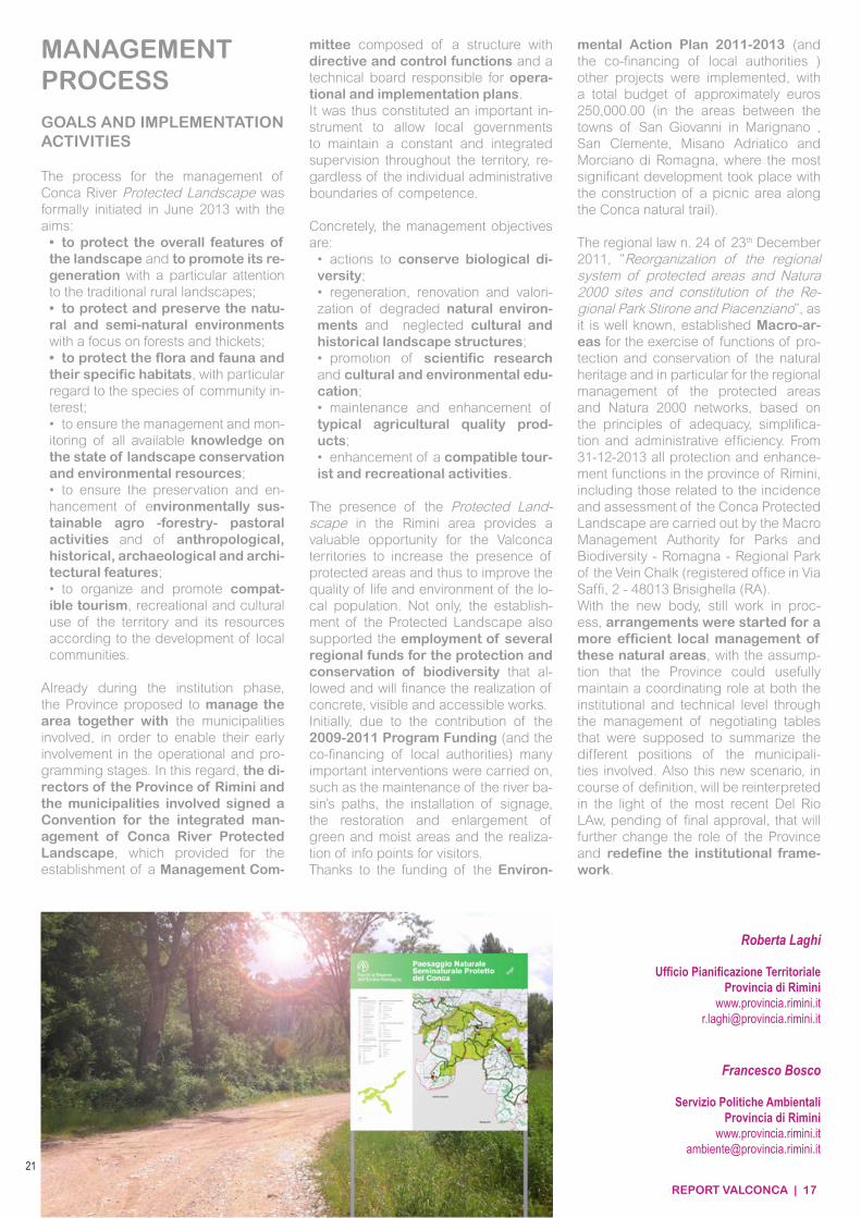
La presenza in territorio riminese del PNSP costituisce una preziosa oppor-tunità per i territori della Valconca di aumentare la presenza di aree protette e dunque di incrementare le qualità am-bientali e di vita della popolazione loca-le. Non solo, l’istituzione del paesaggio protetto ha inoltre permesso l’intercet-tazione di diversi finanziamenti stan-ziati dalla Regione per la tutela e la conservazione della biodiversità che hanno permesso e permetteranno di re-alizzare opere concrete, visibili e fruibili.Inizialmente, grazie al contributo del Programma finanziamenti 2009-2011 (ed al cofinanziamento degli Enti Loca-li) si sono realizzati importanti interven-ti come la manutenzione straordinaria della sentieristica del Torrente Conca, l’installazione di segnaletica e cartello-nistica, il ripristino e l’ampliamento delle aree verdi, umide e dei centri di acco-glienza visitatori del Paesaggio naturale del Torrente Conca. Grazie al finanziamento del Piano di Azione Ambientale 2011-2013 (ed al cofinanziamento degli Enti Locali) sono già stati realizzati in Valconca proget-ti per circa euro 250.000,00 (presso le aree territoriali comprese tra i Comuni di San Giovanni in Marignano, San Cle-mente, Misano Adriatico e Morciano di Romagna, ove si è avuto il più consi-stente progetto di riqualificazione con la realizzazione di un’area attrezzata lungo il percorso naturalistico sul Conca).
La legge regionale n.24 del 23 dicem-
bre 2011, “Riorganizzazione del siste-ma regionale delle aree protette e dei siti della rete natura 2000 e istituzione del Parco Regionale dello Stirone e del Piacenziano”, com’è noto, ha istituito per l’esercizio delle funzioni di tutela e conservazione del patrimonio naturale regionale ed in particolare per la ge-stione delle Aree protette e dei Siti della Rete natura 2000, sulla base dei principi di adeguatezza, semplificazione ed ef-ficienza amministrativa, le Macroaree. Dal 31-12-2013 tutte le funzioni di tutela e valorizzazione delle aree protette del-la provincia di Rimini, comprese quelle inerenti il Paesaggio Protetto e le valu-tazioni di incidenza, sono svolte dalla Macroarea Ente di Gestione per i Parchi e la Biodiversità - Romagna - Parco Re-gionale Della Vena Del Gesso (che ha Sede Legale in Via Saffi, 2 - 48013 Bri-sighella (RA). Con il nuovo ente, ancora in formazione, erano in corso accordi per rendere più efficiente a livello locale la ge-stione di queste aree naturali e si ipotiz-zava che la Provincia potesse utilmente mantenere un ruolo di coordinamento sia a livello istituzionale sia a livello tec-nico attraverso la gestione di tavoli che avrebbero dovuto portare a sintesi le diverse posizioni della amministrazio-ni comunali interessate. Anche questo nuovo scenario, in corso di definizione, andrà riletto alla luce del più recente di-segno di legge Del Rio che, in attesa di approvazione definitiva, potrà ulterior-mente cambiare il ruolo della Provincia e ridefinire il quadro istituzionale.
MODALITÀDI GESTIONE
OBIETTIVI ED AZIONIDI ATTUAZIONE
20
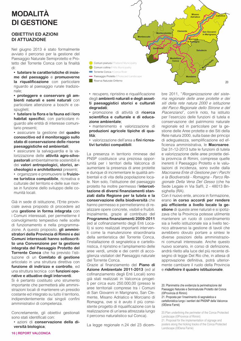
20. Planimetria che evidenzia la perimetrazione del Paesaggio Naturale e Seminaturale Protetto del Conca(©Provincia di Rimini)21. Proposta per l’inserimento di segnaletica e cartellonistica lungo i sentieri del PNSNP della Valconca(©Elena Farnè)
20.Plan underlining the perimeter of the Conca Protected Landscape (©Province of Rimini)21. Proposal for the implementation of signage and posters along the hicking tracks of the Conca Protected Landscape (©Elena Farnè)
REPORT VALCONCA | 17
The process for the management of Conca River Protected Landscape was formally initiated in June 2013 with the aims:• to protect the overall features of the landscape and to promote its re-generation with a particular attention to the traditional rural landscapes;• to protect and preserve the natu-ral and semi-natural environments with a focus on forests and thickets;• to protect the flora and fauna and their specific habitats, with particular regard to the species of community in-terest;• to ensure the management and mon-itoring of all available knowledge on the state of landscape conservation and environmental resources;• to ensure the preservation and en-hancement of environmentally sus-tainable agro -forestry- pastoral activities and of anthropological, historical, archaeological and archi-tectural features;• to organize and promote compat-ible tourism, recreational and cultural use of the territory and its resources according to the development of local communities.
Already during the institution phase, the Province proposed to manage the area together with the municipalities involved, in order to enable their early involvement in the operational and pro-gramming stages. In this regard, the di-rectors of the Province of Rimini and the municipalities involved signed a Convention for the integrated man-agement of Conca River Protected Landscape, which provided for the establishment of a Management Com-
mittee composed of a structure with directive and control functions and a technical board responsible for opera-tional and implementation plans. It was thus constituted an important in-strument to allow local governments to maintain a constant and integrated supervision throughout the territory, re-gardless of the individual administrative boundaries of competence.
Concretely, the management objectives are:
• actions to conserve biological di-versity; • regeneration, renovation and valori-zation of degraded natural environ-ments and neglected cultural and historical landscape structures; • promotion of scientific research and cultural and environmental edu-cation; • maintenance and enhancement of typical agricultural quality prod-ucts; • enhancement of a compatible tour-ist and recreational activities.
The presence of the Protected Land-scape in the Rimini area provides a valuable opportunity for the Valconca territories to increase the presence of protected areas and thus to improve the quality of life and environment of the lo-cal population. Not only, the establish-ment of the Protected Landscape also supported the employment of several regional funds for the protection and conservation of biodiversity that al-lowed and will finance the realization of concrete, visible and accessible works.Initially, due to the contribution of the 2009-2011 Program Funding (and the co-financing of local authorities) many important interventions were carried on, such as the maintenance of the river ba-sin’s paths, the installation of signage, the restoration and enlargement of green and moist areas and the realiza-tion of info points for visitors.Thanks to the funding of the Environ-
MANAGEMENTPROCESS
GOALS AND IMPLEMENTATION ACTIVITIES
mental Action Plan 2011-2013 (and the co-financing of local authorities ) other projects were implemented, with a total budget of approximately euros 250,000.00 (in the areas between the towns of San Giovanni in Marignano , San Clemente, Misano Adriatico and Morciano di Romagna, where the most significant development took place with the construction of a picnic area along the Conca natural trail).
The regional law n. 24 of 23th December 2011, “Reorganization of the regional system of protected areas and Natura 2000 sites and constitution of the Re-gional Park Stirone and Piacenziano”, as it is well known, established Macro-ar-eas for the exercise of functions of pro-tection and conservation of the natural heritage and in particular for the regional management of the protected areas and Natura 2000 networks, based on the principles of adequacy, simplifica-tion and administrative efficiency. From 31-12-2013 all protection and enhance-ment functions in the province of Rimini, including those related to the incidence and assessment of the Conca Protected Landscape are carried out by the Macro Management Authority for Parks and Biodiversity - Romagna - Regional Park of the Vein Chalk (registered office in Via Saffi, 2 - 48013 Brisighella (RA).With the new body, still work in proc-ess, arrangements were started for a more efficient local management of these natural areas, with the assump-tion that the Province could usefully maintain a coordinating role at both the institutional and technical level through the management of negotiating tables that were supposed to summarize the different positions of the municipali-ties involved. Also this new scenario, in course of definition, will be reinterpreted in the light of the most recent Del Rio LAw, pending of final approval, that will further change the role of the Province and redefine the institutional frame-work.
Roberta Laghi
Ufficio Pianificazione TerritorialeProvincia di Rimini
Francesco Bosco
Servizio Politiche AmbientaliProvincia di Rimini
www.provincia.rimini.it [email protected]
21
18 | REPORT VALCONCA
UN PICCOLO FIUME
NATURA E BIODIVERSITÀNEL PAESAGGIO PROTETTODEL CONCA
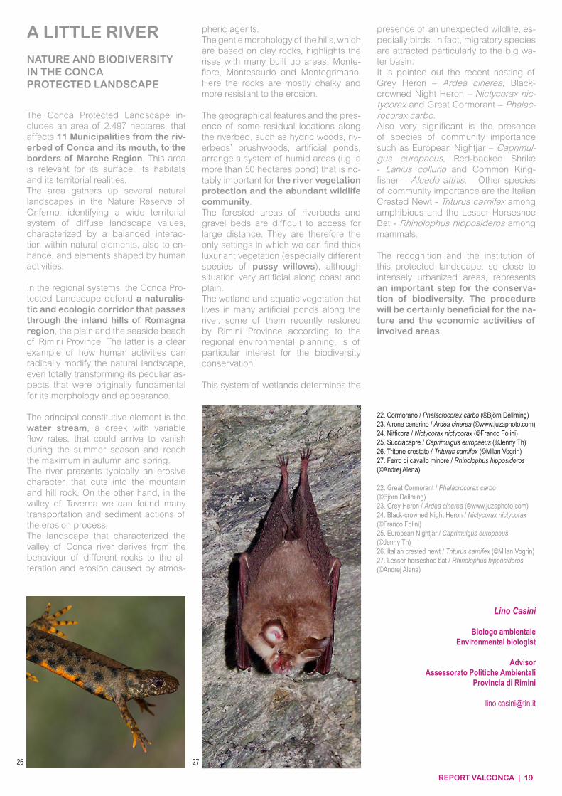
Il Paesaggio Naturale e Seminaturale Protetto del Conca comprende un’area di 2.497 ettari che interessa 11 Comuni tra l’alveo del torrente Conca, dalla foce fino al confine con la Regione Marche, assai rilevante per superficie, habitat contenuti e realtà territoriali coin-volte. L’area riunisce vari ambienti na-turali alla Riserva Naturale di Onferno individuando un ampio sistema di terri-torio con valori paesaggistici diffusi, ca-ratterizzati dall’equilibrata interazione di elementi naturali, anche da potenziare, e di elementi plasmati dalle tradizionali attività umane.
Nel sistema regionale, il Paesaggio Protetto del Conca tutela dunque un corridoio naturalistico ed ecologico tra le colline dell’entroterra roma-gnolo attraverso la pianura fino alla spiaggia balneare riminese, una delle espressioni più evidenti di come le at-tività umane abbiano potuto modificare profondamente il paesaggio naturale, fino a trasformare completamente gli aspetti peculiari che caratterizzavano un tempo la morfologia e la fisionomia del territorio.
L’elemento costitutivo principale è il corso d’acqua, un torrente con portate variabili che arrivano ad annullarsi per alcune settimane nel periodo estivo e con massime in autunno e in primavera.Il fiume presenta un carattere tipica-mente erosivo, incidendo le formazioni rocciose del tratto collinare e montano mentre a valle di Taverna cominciano a prevalere le azioni di trasporto e poi di deposito dei sedimenti precedentemen-te erosi.Dal comportamento delle diverse rocce
all’alterazione e all’erosione da parte degli agenti atmosferici deriva il pae-saggio che caratterizza la vallata del fiume Conca, infatti, la dolce morfologia delle colline, attestate su rocce preva-lentemente argillose, evidenzia le alture su cui sorgono gli abitati di Montefiore, Montescudo, Montegrimano, dove le rocce perlopiù calcarenitiche risultano più resistenti all’erosione.
Le caratteristiche geografiche e la pre-senza di alcuni ambienti residuali lungo l’alveo quali boschi igrofili, cespuglieti degli alvei fluviali, stagni artificiali, for-mano un sistema di zone umide – fra cui un invaso di oltre 50 ettari - di notevole importanza per la tutela della vegeta-zione fluviale e per la ricca comunità faunistica. Le fasce boscose degli alvei fluviali e dei greti risultano difficilmente accessi-bili per lunghi tratti; sono infatti gli unici ambienti nei quali, anche nelle situazio-ni fortemente antropizzate della pianura e della costa, rimangono fitti lembi di vegetazione lussureggiante, principal-mente salici arbustivi di diverse spe-cie. La vegetazione palustre e acquatica che popola i numerosi stagni artificiali presenti lungo il fiume, alcuni dei quali ripristinati recentemente dalla Provincia di Rimini nell’ambito del piano di azione
ambientale regionale, riveste interesse per la conservazione della biodiversità.
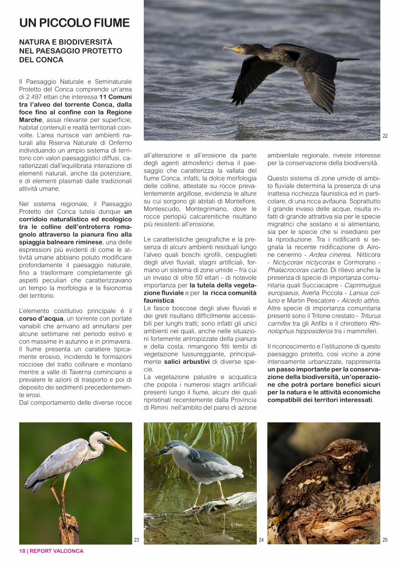
Questo sistema di zone umide di ambi-to fluviale determina la presenza di una inattesa ricchezza faunistica ed in parti-colare, di una ricca avifauna. Soprattutto il grande invaso delle acque, risulta in-fatti di grande attrattiva sia per le specie migratrici che sostano e si alimentano, sia per le specie che si insediano per la riproduzione. Tra i nidificanti si se-gnala la recente nidificazione di Airo-ne cenerino - Ardea cinerea, Nitticora - Nictycorax nictycorax e Cormorano - Phalacrocorax carbo. Di rilievo anche la presenza di specie di importanza comu-nitaria quali Succiacapre - Caprimulgus europaeus, Averla Piccola - Lanius col-lurio e Martin Pescatore - Alcedo atthis. Altre specie di importanza comunitaria presenti sono il Tritone crestato - Triturus carnifex tra gli Anfibi e il chirottero Rhi-nolophus hipposideros tra i mammiferi.
Il riconoscimento e l’istituzione di questo paesaggio protetto, così vicino a zone intensamente urbanizzate, rappresenta un passo importante per la conserva-zione della biodiversità, un’operazio-ne che potrà portare benefici sicuri per la natura e le attività economiche compatibili dei territori interessati.
23 24 25
22
REPORT VALCONCA | 19
Lino Casini
Biologo ambientaleEnvironmental biologist
AdvisorAssessorato Politiche Ambientali
Provincia di Rimini
26 27
A LITTLE RIVER
NATURE AND BIODIVERSITYIN THE CONCAPROTECTED LANDSCAPE
The Conca Protected Landscape in-cludes an area of 2.497 hectares, that affects 11 Municipalities from the riv-erbed of Conca and its mouth, to the borders of Marche Region. This area is relevant for its surface, its habitats and its territorial realities.The area gathers up several natural landscapes in the Nature Reserve of Onferno, identifying a wide territorial system of diffuse landscape values, characterized by a balanced interac-tion within natural elements, also to en-hance, and elements shaped by human activities.
In the regional systems, the Conca Pro-tected Landscape defend a naturalis-tic and ecologic corridor that passes through the inland hills of Romagna region, the plain and the seaside beach of Rimini Province. The latter is a clear example of how human activities can radically modify the natural landscape, even totally transforming its peculiar as-pects that were originally fundamental for its morphology and appearance.
The principal constitutive element is the water stream, a creek with variable flow rates, that could arrive to vanish during the summer season and reach the maximum in autumn and spring. The river presents typically an erosive character, that cuts into the mountain and hill rock. On the other hand, in the valley of Taverna we can found many transportation and sediment actions of the erosion process. The landscape that characterized the valley of Conca river derives from the behaviour of different rocks to the al-teration and erosion caused by atmos-
pheric agents. The gentle morphology of the hills, which are based on clay rocks, highlights the rises with many built up areas: Monte-fiore, Montescudo and Montegrimano. Here the rocks are mostly chalky and more resistant to the erosion.
The geographical features and the pres-ence of some residual locations along the riverbed, such as hydric woods, riv-erbeds’ brushwoods, artificial ponds, arrange a system of humid areas (i.g. a more than 50 hectares pond) that is no-tably important for the river vegetation protection and the abundant wildlife community.The forested areas of riverbeds and gravel beds are difficult to access for large distance. They are therefore the only settings in which we can find thick luxuriant vegetation (especially different species of pussy willows), although situation very artificial along coast and plain.The wetland and aquatic vegetation that lives in many artificial ponds along the river, some of them recently restored by Rimini Province according to the regional environmental planning, is of particular interest for the biodiversity conservation.
This system of wetlands determines the
presence of an unexpected wildlife, es-pecially birds. In fact, migratory species are attracted particularly to the big wa-ter basin.It is pointed out the recent nesting of Grey Heron – Ardea cinerea, Black-crowned Night Heron – Nictycorax nic-tycorax and Great Cormorant – Phalac-rocorax carbo.Also very significant is the presence of species of community importance such as European Nightjar – Caprimul-gus europaeus, Red-backed Shrike - Lanius collurio and Common King-fisher – Alcedo atthis. Other species of community importance are the Italian Crested Newt - Triturus carnifex among amphibious and the Lesser Horseshoe Bat - Rhinolophus hipposideros among mammals.
The recognition and the institution of this protected landscape, so close to intensely urbanized areas, represents an important step for the conserva-tion of biodiversity. The procedure will be certainly beneficial for the na-ture and the economic activities of involved areas.
22. Cormorano / Phalacrocorax carbo (©Björn Dellming)23. Airone cenerino / Ardea cinerea (©www.juzaphoto.com)24. Nitticora / Nictycorax nictycorax (©Franco Folini)25. Succiacapre / Caprimulgus europaeus (©Jenny Th)26. Tritone crestato / Triturus carnifex (©Milan Vogrin)27. Ferro di cavallo minore / Rhinolophus hipposideros(©Andrej Alena)
22. Great Cormorant / Phalacrocorax carbo(©Björn Dellming)23. Grey Heron / Ardea cinerea (©www.juzaphoto.com)24. Black-crowned Night Heron / Nictycorax nictycorax(©Franco Folini)25. European Nightjar / Caprimulgus europaeus(©Jenny Th)26. Italian crested newt / Triturus carnifex (©Milan Vogrin)27. Lesser horseshoe bat / Rhinolophus hipposideros(©Andrej Alena)
20 | REPORT VALCONCA
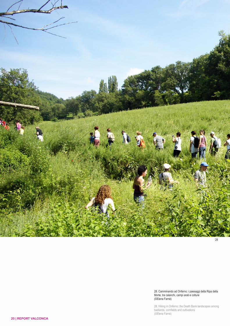
28. Camminando ad Onferno: i paesaggi della Ripa della Morte, tra calanchi, campi arati e colture(©Elena Farnè)
28. Hiking in Onferno: the Death Bank landscapes among badlands, cornfields and cultivations(©Elena Farnè)
28
REPORT VALCONCA | 21
22 | REPORT VALCONCA
29
30
31
32
34
33
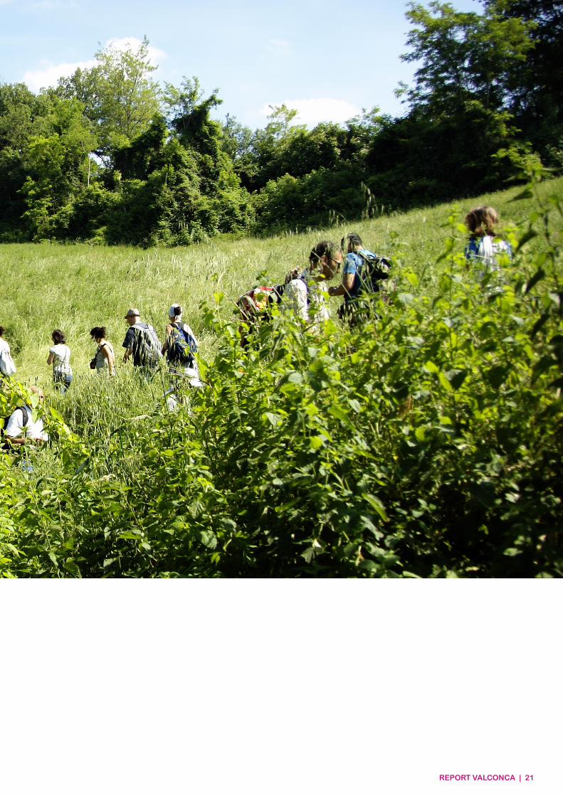
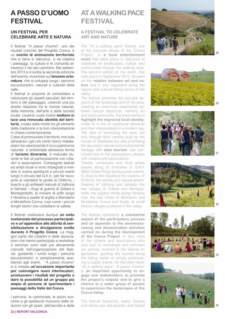
Il festival “A passo d’uomo”, uno dei risultati concreti del Progetto Conca, è un evento di animazione territoriale che si tiene in Valconca e ne celebra i paesaggi, la cultura e le comunità at-traverso il rito del cammino. Nel settem-bre 2013 si è svolta la seconda edizione dell’evento, incentrato sul binomio arte-natura, che si sviluppa lungo i percorsi escursionistici, naturali e culturali della valle.Il festival si propone di consolidare e valorizzare gli aspetti peculiari del terri-torio e del paesaggio, creando una più stretta relazione tra le risorse naturali, della memoria, dell’arte e della società locale. L’evento vuole inoltre mettere in luce una rinnovata identità del terri-torio, creata dalla mixitè tra gli elementi della tradizione e la loro interpretazione in chiave contemporanea.L’idea di promuovere il territorio, non solo attraverso i già noti centri storici malate-stiani ma valorizzando il ricco patrimonio naturale e ambientale attraverso forme di turismo itinerante, è maturata du-rante le fasi di partecipazione con citta-dini e associazioni. Compagnie teatrali ed artisti locali si sono impegnati a met-tere in scena spettacoli e piccoli eventi lungo il circuito del G.A.V., per far risco-prire ai viandanti le grotte di Onferno, i boschi e gli anfiteatri naturali di Valbona e Valmala, i rifugi di guerra di Zollara e Montegridolfo, le miniere di zolfo lungo il Ventena e quelle di argilla a Mondaino e Montefiore Conca, così come i piccoli borghi storici che costellano la vallata.
Il festival costituisce dunque un esito sostanziale del processo partecipati-vo e un’appendice alle attività di sen-sibilizzazione e divulgazione svolte durante il Progetto Conca. La mag-gior parte dei cittadini e delle associa-zioni che hanno partecipato a workshop e seminari sono stati poi attivamente coinvolti nell’organizzazione del festi-val, guidando i turisti lungo i percorsi escursionistici o semplicemente assi-stendo agli eventi. “A passo d’uomo” si è rivelata un’occasione importante per coinvolgere nuovi interlocutori, promuovere i risultati del progetto e dare la possibilità ad un gruppo più ampio di persone di sperimentare i paesaggi della Valle del Conca.
I percorsi, le camminate, le azioni sce-niche e gli spettacoli muovono dalle re-lazioni con gli spazi, dall’ascolto e dalle
A PASSO D’UOMO FESTIVAL
UN FESTIVAL PER CELEBRARE ARTE E NATURA
AT A WALKING PACEFESTIVAL
A FESTIVAL TO CELEBRATEART AND NATURE
The “At a walking pace” festival, one of the concrete results of the “Conca Project”, is a local entertainment event that takes place in Valconca to celebrate its landscapes, culture and communities through the walking ritual. The second edition of the event, that took place in September 2013, focused on the relation between art and na-ture and it was organized along the natural and cultural hiking tracks of the valley.The festival promotes the peculiar as-pects of the landscape and of the area, creating an innermost relationship be-tween natural resources, memory, art and local community. The event wants to highlight the improved local identity, made of a mix of traditional elements and their interpretation in a modern key. The idea of promoting the area, not only through town centres built by the House of Malatesta but also promoting the abundant natural and environmental heritage with slow tourism, was con-ceived due to the participatory phases with citizens and associations. Theatre companies and local artists played along all itineraries of G.A.V. (Main Green Ring) during public events, to show to the travellers the caverns of Onferno, the woods and natural amphi-theatres of Valbona and Valmala, the war refuges of Zollara and Montegri-dolfo, the sulphur mines along Ventena river, the clay mines of Mondaino and Montefiore Conca and finally all small historic villages scattered in the valley.
The festival represents a substantial aspect of the participatory process and an appendix to the awareness-raising and dissemination activities carried on during the development of the Conca Project. In fact, most of the citizens and associations who took part to workshops and seminars are actively involved in the festival or-ganization, guiding the tourists along the hiking tracks or simply participat-ing to public events. On the other hand, “At a walking pace - A passo d’uomo” is an important opportunity to en-gage new stakeholders, to promote the project’s outputs and to give a chance to a wider group of people to experience the landscapes of the Conca Valley.
The festival itineraries, walks, scenes and shows are site-specific and based
REPORT VALCONCA | 23
on their relations with the surrounding spaces, designed with the intention to listen and be inspired by the landscape. Every research and artistic produc-tion is designed as a cultural project to imagine the representation of natural scenes and to understand the dialogue between the project itself and the cul-ture of the places.
A theatre, dance, music, video, pho-tography, performance and instal-lation festival to connect and walk through the Conca Valley based on an annual laboratory of ideas and visions for the local development.
suggestioni dei paesaggi in cui si mani-festano, e sono pensati con l’intenzione di ascoltare ed essere ispirati dall’iden-tità specifica del luogo. Il festival è un progetto culturale che vuole proporre una rappresentazione della natura come scenografia di eventi artistici ma anche storici, e per poter comprendere il dialo-go tra la cultura dei luoghi e dei progetti che da tali luoghi possono scaturire.Una rassegna di teatro, danza, musi-ca, video, fotografia, performance e installazioni per collegare e attraver-sare la Valconca, che si propone come laboratorio annuale di idee e visioni, di sviluppo locale per la scena nazionale.
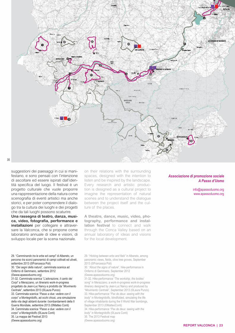
29. “Camminando tra le erbe ed campi” di Albereto, un percorso tra scorci panoramici di campi coltivati ed uliveti, settembre 2013 (©Francesca Poli)30. “Dei segni della natura”, camminata scenica ad Onferno di Gemmano, settembre 2012(©www.apassoduomo.org)31-32. Camminata scenica “L’adorazione, il canto dei Corpi” a Merazzano, un itinerario work-in-progress progettato da Jean-Luc Nancy e prodotto da “Movimento Centrale”, settembre 2013 (©Laura Punzo)33. Camminata scenica “Passo a due: vedere con il corpo” a Montegridolfo, ad occhi chiusi, una simulazione della vita degli abitanti durante i bombardamenti della II Guerra Mondiale, settembre 2013 (©Matteo Conti)34. Camminata scenica “Passo a due: vedere con il corpo” a Montegridolfo (©Laura Conti)35. La mappa del Festival 2013(©www.apassoduomo.org)
29. “Hicking between erbs and fiels” in Albereto, among panoramic views, fields, olive tree groves, September 2013 (©Francesca Poli)30. “About the signs of nature”, hike-performance in Onferno di Gemmano, September 2012(©www.apassoduomo.org)31-32. Hike-performance “The workship, the bodies’ song” in Merazzano, a work-in-progress work-in-progress itinerary designed by Jean-Luc Nancy and produced by “Movimento Centrale”, September 2013 (©Laura Punzo)33. Hike-performance “Pax de deux: seeing with the body” in Montegridolfo, blindfolded, simulating the life of village inhabitants during the II World War bombings, September 2013 (©MatteoConti)34. Hike-performance “Pax de deux: seeing with the body” in Montegridolfo (©Laura Conti)35. The 2013 Festival map(©www.apassoduomo.org)
35
Associazione di promozione socialeA Passo d’Uomo
[email protected] www.apassoduomo.org
24 | REPORT VALCONCA
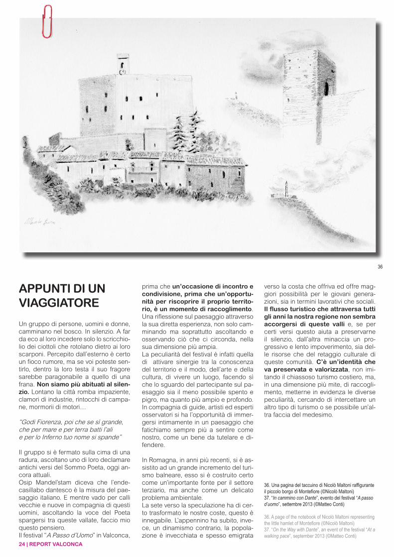
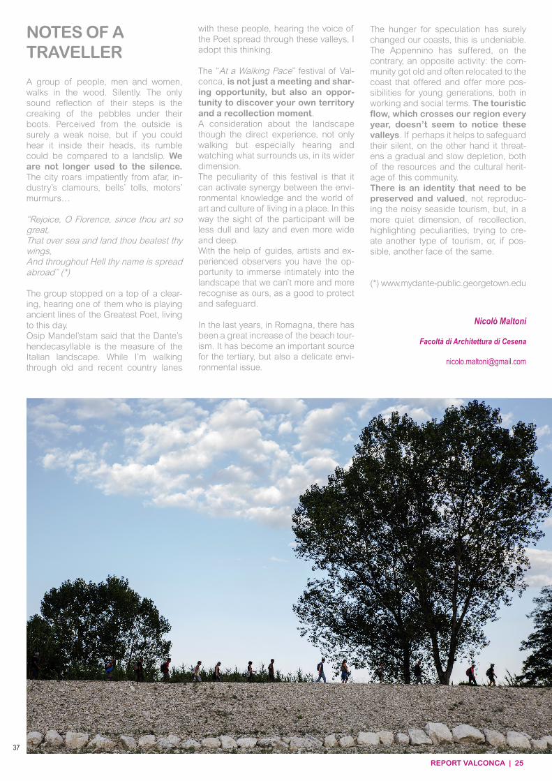
Un gruppo di persone, uomini e donne, camminano nel bosco. In silenzio. A far da eco al loro incedere solo lo scricchio-lio dei ciottoli che rotolano dietro ai loro scarponi. Percepito dall’esterno è certo un fioco rumore, ma se voi poteste sen-tirlo, dentro la loro testa il suo fragore sarebbe paragonabile a quello di una frana. Non siamo più abituati al silen-zio. Lontano la città romba impaziente, clamori di industrie, rintocchi di campa-ne, mormorii di motori…
“Godi Fiorenza, poi che se sì grande,che per mare e per terra batti l’alie per lo Inferno tuo nome si spande”
Il gruppo si è fermato sulla cima di una radura, ascoltano uno di loro declamare antichi versi del Sommo Poeta, oggi an-cora attuali.Osip Mandel’stam diceva che l’ende-casillabo dantesco è la misura del pae-saggio italiano. E mentre vado per calli vecchie e nuove in compagnia di questi uomini, ascoltando la voce del Poeta spargersi tra queste vallate, faccio mio questo pensiero.Il festival “A Passo d’Uomo” in Valconca,
prima che un’occasione di incontro e condivisione, prima che un’opportu-nità per riscoprire il proprio territo-rio, è un momento di raccoglimento. Una riflessione sul paesaggio attraverso la sua diretta esperienza, non solo cam-minando ma soprattutto ascoltando e osservando ciò che ci circonda, nella sua dimensione più ampia.La peculiarità del festival è infatti quella di attivare sinergie tra la conoscenza del territorio e il modo, dell’arte e della cultura, di vivere un luogo, facendo sì che lo sguardo del partecipante sul pa-esaggio sia il meno possibile spento e pigro, ma quanto più ampio e profondo. In compagnia di guide, artisti ed esperti osservatori si ha l’opportunità di immer-gersi intimamente in un paesaggio che fatichiamo sempre più a sentire come nostro, come un bene da tutelare e di-fendere.
In Romagna, in anni più recenti, si è as-sistito ad un grande incremento del turi-smo balneare, esso si è costruito certo come un’importante fonte per il settore terziario, ma anche come un delicato problema ambientale.La sete verso la speculazione ha di cer-to trasformato le nostre coste, questo è innegabile. L’appennino ha subito, inve-ce, un dinamismo contrario, la popola-zione è invecchiata e spesso emigrata
verso la costa che offriva ed offre mag-giori possibilità per le giovani genera-zioni, sia in termini lavorativi che sociali. Il flusso turistico che attraversa tutti gli anni la nostra regione non sembra accorgersi di queste valli e, se per certi versi questo aiuta a preservarne il silenzio, dall’altra minaccia un pro-gressivo e lento impoverimento, sia del-le risorse che del retaggio culturale di queste comunità. C’è un’identità che va preservata e valorizzata, non imi-tando il chiassoso turismo costiero, ma, in una dimensione più mite, di raccogli-mento, metterne in evidenza le diverse peculiarità, cercando di intercettare un altro tipo di turismo o se possibile un’al-tra faccia del medesimo.
APPUNTI DI UN VIAGGIATORE
36. Una pagina del taccuino di Nicolò Maltoni raffigurante il piccolo borgo di Montefiore (©Nicolò Maltoni)37. “In cammino con Dante”, evento del festival “A passo d’uomo”, settembre 2013 (©Matteo Conti)
36. A page of the notebook of Nicolò Maltoni representing the little hamlet of Montefiore (©Nicolò Maltoni)37. “On the Way with Dante”, an event of the festival “At a walking pace”, september 2013 (©Matteo Conti)
36
REPORT VALCONCA | 25
A group of people, men and women, walks in the wood. Silently. The only sound reflection of their steps is the creaking of the pebbles under their boots. Perceived from the outside is surely a weak noise, but if you could hear it inside their heads, its rumble could be compared to a landslip. We are not longer used to the silence. The city roars impatiently from afar, in-dustry’s clamours, bells’ tolls, motors’ murmurs…
“Rejoice, O Florence, since thou art so great,That over sea and land thou beatest thy wings,And throughout Hell thy name is spread abroad” (*)
The group stopped on a top of a clear-ing, hearing one of them who is playing ancient lines of the Greatest Poet, living to this day.Osip Mandel’stam said that the Dante’s hendecasyllable is the measure of the Italian landscape. While I’m walking through old and recent country lanes
with these people, hearing the voice of the Poet spread through these valleys, I adopt this thinking.
The “At a Walking Pace” festival of Val-conca, is not just a meeting and shar-ing opportunity, but also an oppor-tunity to discover your own territory and a recollection moment.A consideration about the landscape though the direct experience, not only walking but especially hearing and watching what surrounds us, in its wider dimension.The peculiarity of this festival is that it can activate synergy between the envi-ronmental knowledge and the world of art and culture of living in a place. In this way the sight of the participant will be less dull and lazy and even more wide and deep.With the help of guides, artists and ex-perienced observers you have the op-portunity to immerse intimately into the landscape that we can’t more and more recognise as ours, as a good to protect and safeguard.
In the last years, in Romagna, there has been a great increase of the beach tour-ism. It has become an important source for the tertiary, but also a delicate envi-ronmental issue.
The hunger for speculation has surely changed our coasts, this is undeniable. The Appennino has suffered, on the contrary, an opposite activity: the com-munity got old and often relocated to the coast that offered and offer more pos-sibilities for young generations, both in working and social terms. The touristic flow, which crosses our region every year, doesn’t seem to notice these valleys. If perhaps it helps to safeguard their silent, on the other hand it threat-ens a gradual and slow depletion, both of the resources and the cultural herit-age of this community. There is an identity that need to be preserved and valued, not reproduc-ing the noisy seaside tourism, but, in a more quiet dimension, of recollection, highlighting peculiarities, trying to cre-ate another type of tourism, or, if pos-sible, another face of the same.
(*) www.mydante-public.georgetown.edu
NOTES OF ATRAVELLER
37
Nicolò Maltoni
Facoltà di Architettura di Cesena
26 | REPORT VALCONCA
PARTECIPAZIONEE PRESIDIOQUANDO LA PARTECIPAZIONE FUNZIONA E CAMMINA CON LE PROPRIE GAMBE (O QUASI)
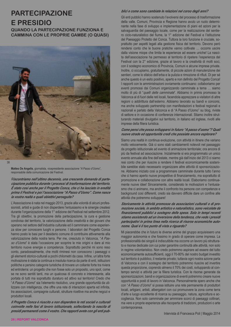
Riscontriamo nell’ultimo decennio, una crescente domanda di parte-cipazione pubblica durante i processi di trasformazione del territorio. È stato così anche per il Progetto Conca, che ci ha lasciato in eredità prima il Festival e poi l’associazione “A Passo d’Uomo”. Come nasce la vostra realtà e quali obiettivi perseguite?
L’Associazione è nata nel maggio 2013, grazie alla volontà di alcuni profes-sionisti, artisti e guide di non disperdere l’entusiasmo e le sinergie createsi durante l’organizzazione della 1° edizione del Festival nel settembre 2012. Tra gli obiettivi, la promozione della partecipazione, la cura e gestione condivisa del territorio, la valorizzazione della creatività e dei giovani che operano nel settore dell’industria culturale ed il camminare come esperien-za slow per conoscere luoghi e persone. I laboratori del Progetto Conca hanno posto le basi per il desiderio comune di contribuire attivamente alla valorizzazione della nostra terra. Per me, cresciuto in Valconca, “A Pas-so d’Uomo” è stata l’occasione per scoprire le mie origini e dare al mio territorio nuove energie e competenze. Soprattutto perché mi sono reso conto, paradossalmente, che molti riminesi non conoscono i paesaggi o gli elementi storico-culturali a pochi chilometri da casa. Infine, un’altra forte motivazione è stata la continua e insoluta ricerca da parte di enti, istituzioni politiche e persino categorie turistiche di trovare un collante forte tra riviera ed entroterra: un progetto che non fosse solo un proposito, uno spot, come se ne sono sentiti tanti, ma un qualcosa di concreto e interessante, alla portata di tutti ma soprattutto duraturo ed attivo sul territorio! Credo che “A Passo d’Uomo” sia l’elemento risolutivo, una grande opportunità da uti-lizzare con intelligenza, che offre una rete di interazioni aperta ed infinita, tra associazioni, compagnie culturali, strutture ricettive ma anche negozi e produttori locali.
Il Progetto Conca è riuscito a non disperdere le reti sociali e culturali coinvolte nelle fasi di lavoro istituzionale, sollecitando la nascita di presidi permanenti come il vostro. Che rapporti avete con gli enti pub-
blici e come sono cambiate le relazioni nel corso degli anni?
Gli enti pubblici hanno sostenuto l’evolversi del processo di trasformazione della valle. Comuni, Provincia e Regione hanno avuto un ruolo determi-nante nella fase di sviluppo e implementazione di piani ed azioni per la salvaguardia del paesaggio locale, come per la realizzazione del sentie-ro ciclo-naturalistico del fiume, la 1° edizione del Festival e l’istituzione del Paesaggio Protetto del Conca. Tuttora la loro funzione è cruciale, so-prattutto per aspetti legati alla gestione fisica del territorio. Devono però rendersi conto che le buone pratiche vanno coltivate … occorre uscire dalla visione miope che limita le esperienze ad essere uniche! La nasci-ta dell’associazione ha permesso al territorio di ripetere l’esperienza del Festival con la 2° edizione, grazie al lavoro e la creatività di molti soci, con il sostegno economico di Provincia, Comuni e alcune imprese private. Inoltre, ci occupiamo, gratuitamente, di piccole azioni di manutenzione dei sentieri, come lo sfalcio dell’erba e la pulizia e rimozione di rifiuti. Di per sé anche questo è un esito positivo, aperto e non definito del Progetto Conca! I rapporti con le amministrazioni ovviamente continuano: collaboriamo per eventi promossi dai Comuni organizzando camminate a tema … siamo molto di più di “quelli delle camminate”. Abbiamo in primis promosso la Valconca al di fuori delle reti locali, facendola apprezzare a visitatori di altre regioni o addirittura dall’esterno. Abbiamo lavorato su bandi e concorsi, ma anche sviluppato partnership con manifestazioni e festival regionali e nazionali e parlato della Valconca e di “A Passo d’Uomo” su blog, riviste di settore e in occasione di conferenze internazionali. Stiamo inoltre strut-turando materiali divulgativi sul territorio, in italiano ed inglese, rivolti alle imprese della filiera turistica.
Come pensi che possa svilupparsi in futuro “A passo d’uomo”? Quali nuove strade ed opportunità credi che possiate ancora esplorare?
Siamo una realtà in continua evoluzione, con attività in itinere che variano molto velocemente. Già ci sono stati cambiamenti notevoli nel passaggio da progetto istituzionale ad evento di animazione territoriale; ora ancora di più da festival ad associazione. Inizialmente si era programmato un unico evento annuale alla fine dell’estate, mentre già dall’inizio del 2013 ci siamo resi conto che per riuscire a rendere il festival economicamente sosteni-bile sarebbe stato necessario organizzare altre attività di sponsorizzazio-ne. Abbiamo iniziato così a programmare camminate durante tutto l’anno che ci hanno aperto nuove prospettive di finanziamento, ma soprattutto di promozione e collaborazione con altre realtà locali. Elaboriamo continua-mente nuove idee! Sinceramente, considerato le motivazioni e l’entusia-smo che ci animano, ma anche il confronto tra persone con competenze e background così differenti, credo sia davvero difficile dare un confine alle attività che potremmo sviluppare!
Storicamente le attività promosse da associazioni culturali o di pro-mozione sociale, in ambito artistico e naturalistico, sono veicolate da finanziamenti pubblici a sostegno delle spese. Solo in tempi recenti stiamo assistendo ad un inversione della tendenza, che vede i presidi partecipativi in prima linea nella ricerca di risorse economiche auto-nome. Qual è il tuo punto di vista a riguardo?
Mi piacerebbe che in futuro le diverse anime del gruppo acquisissero una maggior autonomia e che fossimo in grado di operare come impresa. La professionalità dei singoli è indiscutibile ma occorre un lavoro più struttura-to e risorse dedicate con cui poter garantire continuità alle attività, non solo in regime volontaristico. Non credo potremmo aspirare ad essere del tutto economicamente autosufficienti, oggi il 70-80% del nostro budget investito sul territorio è pubblico, il restante privato; tuttavia ogni nostra azione parla di Valconca e con il sostegno del territorio potremmo riuscire ad invertire questa proporzione, coprendo almeno il 70% dei costi, sviluppando al con-tempo servizi e attività per la filiera turistica. Con le risorse generate da sponsorizzazioni, bandi e organizzazione di eventi potremmo creare nuove opportunità e posti di lavoro in Valconca. Personalmente spero anche che con “A Passo d’Uomo” si possa istituire una rete permanente di produttori locali, artigiani, artisti, albergatori con cui promuovere la zona come terra d’arte e luogo eccellente di ricerca su paesaggio, natura, agricoltura e ac-coglienza. Non solo camminate per ammirare scorci di paesaggi collinari, ma vere e proprie esperienze alla riscoperta di tradizioni, produzioni o arte contemporanea.
Intervista di Francesca Poli | Maggio 2014
Matteo De Angelis, giornalista, vicepresidente associazione “A Passo d’Uomo”, responsabile della comunicazione del Festival.
38
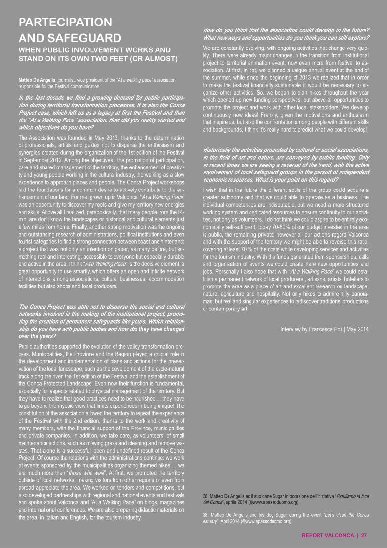
REPORT VALCONCA | 27
PARTECIPATIONAND SAFEGUARDWHEN PUBLIC INVOLVEMENT WORKS AND STAND ON ITS OWN TWO FEET (OR ALMOST)
In the last decade we find a growing demand for public participa-tion during territorial transformation processes. It is also the Conca Project case, which left us as a legacy at first the Festival and then the “At a Walking Pace” association. How did you reality started and which objectives do you have?
The Association was founded in May 2013, thanks to the determination of professionals, artists and guides not to disperse the enthusiasm and synergies created during the organization of the 1st edition of the Festival in September 2012. Among the objectives , the promotion of participation, care and shared management of the territory, the enhancement of creativi-ty and young people working in the cultural industry, the walking as a slow experience to approach places and people. The Conca Project workshops laid the foundations for a common desire to actively contribute to the en-hancement of our land. For me, grown up in Valconca, “At a Walking Pace” was an opportunity to discover my roots and give my territory new energies and skills. Above all I realized, paradoxically, that many people from the Ri-mini are don’t know the landscapes or historical and cultural elements just a few miles from home. Finally, another strong motivation was the ongoing and outstanding research of administrations, political institutions and even tourist categories to find a strong connection between coast and hinterland: a project that was not only an intention on paper, as many before, but so-mething real and interesting, accessible to everyone but especially durable and active in the area! I think “At a Walking Pace” is the decisive element, a great opportunity to use smartly, which offers an open and infinite network of interactions among associations, cultural businesses, accommodation facilities but also shops and local producers.
The Conca Project was able not to disperse the social and cultural networks involved in the making of the institutional project, promo-ting the creation of permanent safeguards like yours. Which relation-ship do you have with public bodies and how did they have changed over the years?
Public authorities supported the evolution of the valley transformation pro-cess. Municipalities, the Province and the Region played a crucial role in the development and implementation of plans and actions for the preser-vation of the local landscape, such as the development of the cycle-natural track along the river, the 1st edition of the Festival and the establishment of the Conca Protected Landscape. Even now their function is fundamental, especially for aspects related to physical management of the territory. But they have to realize that good practices need to be nourished ... they have to go beyond the myopic view that limits experiences in being unique! The constitution of the association allowed the territory to repeat the experience of the Festival with the 2nd edition, thanks to the work and creativity of many members, with the financial support of the Province, municipalities and private companies. In addition, we take care, as volunteers, of small maintenance actions, such as mowing grass and cleaning and remove wa-stes. That alone is a successful, open and undefined result of the Conca Project! Of course the relations with the administrations continue: we work at events sponsored by the municipalities organizing themed hikes ... we are much more than “those who walk”. At first, we promoted the territory outside of local networks, making visitors from other regions or even from abroad appreciate the area. We worked on tenders and competitions, but also developed partnerships with regional and national events and festivals and spoke about Valconca and “At a Walking Pace” on blogs, magazines and international conferences. We are also preparing didactic materials on the area, in Italian and English, for the tourism industry.
How do you think that the association could develop in the future? What new ways and opportunities do you think you can still explore?
We are constantly evolving, with ongoing activities that change very quic-kly. There were already major changes in the transition from institutional project to territorial animation event; now even more from festival to as-sociation. At first, in cat, we planned a unique annual event at the end of the summer, while since the beginning of 2013 we realized that in order to make the festival financially sustainable it would be necessary to or-ganize other activities. So, we began to plan hikes throughout the year which opened up new funding perspectives, but above all opportunities to promote the project and work with other local stakeholders. We develop continuously new ideas! Frankly, given the motivations and enthusiasm that inspire us, but also the confrontation among people with different skills and backgrounds, I think it’s really hard to predict what we could develop!
Historically the activities promoted by cultural or social associations, in the field of art and nature, are conveyed by public funding. Only in recent times we are seeing a reversal of the trend, with the active involvement of local safeguard groups in the pursuit of independent economic resources. What is your point on this regard?
I wish that in the future the different souls of the group could acquire a greater autonomy and that we could able to operate as a business. The individual competences are indisputable, but we need a more structured working system and dedicated resources to ensure continuity to our activi-ties, not only as volunteers. I do not think we could aspire to be entirely eco-nomically self-sufficient, today 70-80% of our budget invested in the area is public, the remaining private; however all our actions regard Valconca and with the support of the territory we might be able to reverse this ratio, covering at least 70 % of the costs while developing services and activities for the tourism industry. With the funds generated from sponsorships, calls and organization of events we could create here new opportunities and jobs. Personally I also hope that with “At a Walking Pace” we could esta-blish a permanent network of local producers , artisans, artists, hoteliers to promote the area as a place of art and excellent research on landscape, nature, agriculture and hospitality. Not only hikes to admire hilly panora-mas, but real and singular experiences to rediscover traditions, productions or contemporary art.
Interview by Francesca Poli | May 2014
Matteo De Angelis, journalist, vice president of the “At a walking pace” association, responsible for the Festival communication.
38. Matteo De Angelis ed il suo cane Sugar in occasione dell’iniziativa “Ripuliamo la foce del Conca”, aprile 2014 (©www.apassoduomo.org)
38. Matteo De Angelis and his dog Sugar during the event “Let’s clean the Conca estuary”, April 2014 (©www.apassoduomo.org)
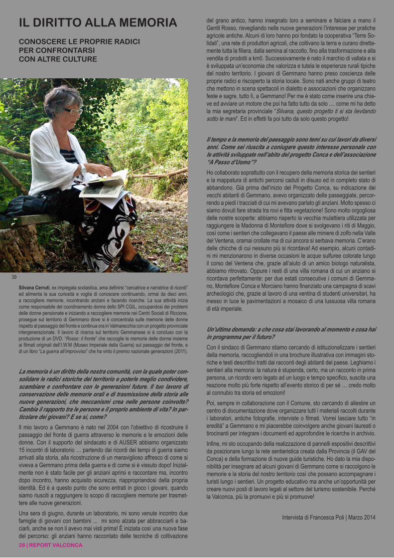
28 | REPORT VALCONCA
La memoria è un diritto della nostra comunità, con la quale poter con-solidare le radici storiche del territorio e poterle meglio condividere, scambiare e confrontare con le generazioni future. Il tuo lavoro di conservazione delle memorie orali e di trasmissione della storia alle nuove generazioni, che meccanismi crea nelle persone coinvolte? Cambia il rapporto tra le persone e il proprio ambiente di vita? In par-ticolare dei giovani? E se si, come?
Il mio lavoro a Gemmano è nato nel 2004 con l’obiettivo di ricostruire il passaggio del fronte di guerra attraverso le memorie e le emozioni delle donne. Con il supporto del sindacato e di AUSER abbiamo organizzato 15 incontri di laboratorio … partendo dai ricordi dei tempi di guerra siamo arrivati alla storia, alla ricostruzione di un meraviglioso affresco di come si viveva a Gemmano prima della guerra e di come si è vissuto dopo! Inizial-mente non è stato facile per gli anziani aprirsi e raccontare ma, incontro dopo incontro, hanno acquisito sicurezza, riappropriandosi della propria identità. Ed è a questo punto che sono entrati in gioco i giovani, quando siamo riusciti a raggiungere lo scopo di raccogliere memorie per trasmet-tere alle nuove generazioni.
Una sera di giugno, durante un laboratorio, mi sono venute incontro due famiglie di giovani con bambini ... mi sono alzata per abbracciarli e ba-ciarli, anche se non li avevo mai visti prima! È iniziata così una nuova fase del percorso: gli anziani hanno raccontato delle tecniche di coltivazione
IL DIRITTO ALLA MEMORIA
CONOSCERE LE PROPRIE RADICIPER CONFRONTARSICON ALTRE CULTURE
del grano antico, hanno insegnato loro a seminare e falciare a mano il Gentil Rosso, risvegliando nelle nuove generazioni l’interesse per pratiche agricole antiche. Alcuni di loro hanno poi fondato la cooperativa “Terre So-lidali”, una rete di produttori agricoli, che coltivano la terra e curano diretta-mente tutta la filiera, dalla semina al raccolto, fino alla trasformazione e alla vendita di prodotti a km0. Successivamente è nato il marchio di vallata e si è sviluppata un’economia che valorizza e tutela le esperienze rurali tipiche del nostro territorio. I giovani di Gemmano hanno preso coscienza delle proprie radici e riscoperto la storia locale. Sono nati anche gruppi di teatro che mettono in scena spettacoli in dialetto e associazioni che organizzano feste e sagre, tutto lì, a Gemmano! Per me è stato come inserire una chia-ve ed avviare un motore che poi ha fatto tutto da solo .... come mi ha detto la mia segretaria provinciale “Silvana, questo progetto ti si sta lievitando sotto le mani”. Ed in effetti fa poi tutto da solo questo progetto!
Il tempo e la memoria del paesaggio sono temi su cui lavori da diversi anni. Come sei riuscita a coniugare questo interesse personale con le attività sviluppate nell’abito del progetto Conca e dell’associazione “A Passo d’Uomo”?
Ho collaborato soprattutto con il recupero della memoria storica dei sentieri e la mappatura di antichi percorsi caduti in disuso ed in completo stato di abbandono. Già prima dell’inizio del Progetto Conca, su indicazione dei vecchi abitanti di Gemmano, avevo organizzato delle passeggiate, percor-rendo a piedi i tracciati di cui mi avevano parlato gli anziani. Molto spesso ci siamo dovuti fare strada tra rovi e fitta vegetazione! Sono molto orgogliosa delle nostre scoperte: abbiamo riaperto la vecchia mulattiera utilizzata per raggiungere la Madonna di Montefiore dove si svolgevano i riti di Maggio, così come i sentieri che collegavano il paese alle miniere di zolfo nella Valle del Ventena, oramai crollate ma di cui ancora si serbava memoria. C’erano delle chicche di cui nessuno più si ricordava! Ad esempio, alcuni contadi-ni mi menzionarono in diverse occasioni le acque sulfuree colorate lungo il corso del Ventena che, grazie all’aiuto di un amico biologo naturalista, abbiamo ritrovato. Oppure i resti di una villa romana di cui un anziano si ricordava perfettamente: per due estati consecutive i comuni di Gemma-no, Montefiore Conca e Morciano hanno finanziato una campagna di scavi archeologici che, grazie al lavoro di una ventina di studenti universitari, ha messo in luce le pavimentazioni a mosaico di una lussuosa villa romana di età imperiale.
Un’ultima domanda: a che cosa stai lavorando al momento e cosa hai in programma per il futuro?
Con il sindaco di Gemmano stiamo cercando di istituzionalizzare i sentieri della memoria, raccogliendoli in una brochure illustrativa con immagini sto-riche e testi descrittivi tratti dai racconti degli abitanti del paese. Leghiamo i sentieri alla memoria: la natura è stupenda, certo, ma un racconto in prima persona, un ricordo vero legato ad un luogo e tempo specifico, suscita una reazione molto più forte rispetto all’evento storico di per sé … credo molto al connubio tra storia ed emozioni!
Poi, sempre in collaborazione con il Comune, sto cercando di allestire un centro di documentazione dove organizzare tutti i materiali raccolti durante i laboratori, antiche fotografie, interviste o filmati. Vorrei lasciare tutto “in eredità” a Gemmano e mi piacerebbe coinvolgere anche giovani laureati o tirocinanti per integrare i documenti ed approfondire le ricerche in archivio.
Infine, mi sto occupando della realizzazione di pannelli espositivi descrittivi da posizionare lungo la rete sentieristica creata dalla Provincia (il GAV del Conca) e della formazione di nuove guide turistiche. Ho dato la mia dispo-nibilità per insegnare ad alcuni giovani di Gemmano come si raccolgono le memorie e la storia del nostro territorio così che possano accompagnare i turisti lungo i sentieri. Un progetto educativo ma anche un’opportunità per creare nuovi posti di lavoro legati al settore del turismo sostenibile. Perché la Valconca, più la promuovi e più si promuove!
Intervista di Francesca Poli | Marzo 2014
Silvana Cerruti, ex impiegata scolastica, ama definirsi “cercatrice e narratrice di ricordi” ed alimenta la sua curiosità e voglia di conoscere continuando, ormai da dieci anni, a raccogliere memorie, incontrando anziani e facendo ricerche. La sua attività inizia come responsabile del coordinamento donne dello SPI CGIL, occupandosi dei problemi delle donne pensionate e iniziando a raccogliere memorie nei Centri Sociali di Riccione, prosegue sul territorio di Gemmano dove si è concentrata sulle memorie delle donne rispetto al passaggio del fronte e continua ora in Valmarecchia con un progetto provinciale intergenerazionale. Il lavoro di ricerca sul territorio Gemmanese si è concluso con la produzione di un DVD: “Rosso: il fronte” che raccoglie le memorie delle donne insieme ai filmati originali dell’I.W.M (Museo Imperiale della Guerra) sul passaggio del fronte, e di un libro “La guerra all’improvviso” che ha vinto il premio nazionale generazioni (2011).
39
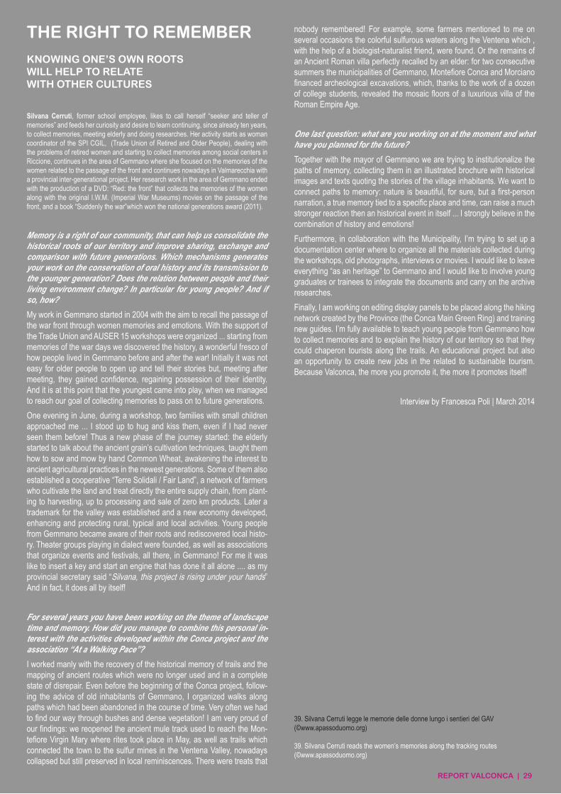
REPORT VALCONCA | 29
THE RIGHT TO REMEMBER
KNOWING ONE’S OWN ROOTSWILL HELP TO RELATEWITH OTHER CULTURES
Memory is a right of our community, that can help us consolidate the historical roots of our territory and improve sharing, exchange and comparison with future generations. Which mechanisms generates your work on the conservation of oral history and its transmission to the younger generation? Does the relation between people and their living environment change? In particular for young people? And if so, how?
My work in Gemmano started in 2004 with the aim to recall the passage of the war front through women memories and emotions. With the support of the Trade Union and AUSER 15 workshops were organized ... starting from memories of the war days we discovered the history, a wonderful fresco of how people lived in Gemmano before and after the war! Initially it was not easy for older people to open up and tell their stories but, meeting after meeting, they gained confidence, regaining possession of their identity. And it is at this point that the youngest came into play, when we managed to reach our goal of collecting memories to pass on to future generations.
One evening in June, during a workshop, two families with small children approached me ... I stood up to hug and kiss them, even if I had never seen them before! Thus a new phase of the journey started: the elderly started to talk about the ancient grain’s cultivation techniques, taught them how to sow and mow by hand Common Wheat, awakening the interest to ancient agricultural practices in the newest generations. Some of them also established a cooperative “Terre Solidali / Fair Land”, a network of farmers who cultivate the land and treat directly the entire supply chain, from plant-ing to harvesting, up to processing and sale of zero km products. Later a trademark for the valley was established and a new economy developed, enhancing and protecting rural, typical and local activities. Young people from Gemmano became aware of their roots and rediscovered local histo-ry. Theater groups playing in dialect were founded, as well as associations that organize events and festivals, all there, in Gemmano! For me it was like to insert a key and start an engine that has done it all alone .... as my provincial secretary said “Silvana, this project is rising under your hands” And in fact, it does all by itself!
For several years you have been working on the theme of landscape time and memory. How did you manage to combine this personal in-terest with the activities developed within the Conca project and the association “At a Walking Pace”?
I worked manly with the recovery of the historical memory of trails and the mapping of ancient routes which were no longer used and in a complete state of disrepair. Even before the beginning of the Conca project, follow-ing the advice of old inhabitants of Gemmano, I organized walks along paths which had been abandoned in the course of time. Very often we had to find our way through bushes and dense vegetation! I am very proud of our findings: we reopened the ancient mule track used to reach the Mon-tefiore Virgin Mary where rites took place in May, as well as trails which connected the town to the sulfur mines in the Ventena Valley, nowadays collapsed but still preserved in local reminiscences. There were treats that
nobody remembered! For example, some farmers mentioned to me on several occasions the colorful sulfurous waters along the Ventena which , with the help of a biologist-naturalist friend, were found. Or the remains of an Ancient Roman villa perfectly recalled by an elder: for two consecutive summers the municipalities of Gemmano, Montefiore Conca and Morciano financed archeological excavations, which, thanks to the work of a dozen of college students, revealed the mosaic floors of a luxurious villa of the Roman Empire Age.
One last question: what are you working on at the moment and what have you planned for the future?
Together with the mayor of Gemmano we are trying to institutionalize the paths of memory, collecting them in an illustrated brochure with historical images and texts quoting the stories of the village inhabitants. We want to connect paths to memory: nature is beautiful, for sure, but a first-person narration, a true memory tied to a specific place and time, can raise a much stronger reaction then an historical event in itself ... I strongly believe in the combination of history and emotions!
Furthermore, in collaboration with the Municipality, I’m trying to set up a documentation center where to organize all the materials collected during the workshops, old photographs, interviews or movies. I would like to leave everything “as an heritage” to Gemmano and I would like to involve young graduates or trainees to integrate the documents and carry on the archive researches.
Finally, I am working on editing display panels to be placed along the hiking network created by the Province (the Conca Main Green Ring) and training new guides. I’m fully available to teach young people from Gemmano how to collect memories and to explain the history of our territory so that they could chaperon tourists along the trails. An educational project but also an opportunity to create new jobs in the related to sustainable tourism. Because Valconca, the more you promote it, the more it promotes itself!
Interview by Francesca Poli | March 2014
Silvana Cerruti, former school employee, likes to call herself “seeker and teller of memories” and feeds her curiosity and desire to learn continuing, since already ten years, to collect memories, meeting elderly and doing researches. Her activity starts as woman coordinator of the SPI CGIL, (Trade Union of Retired and Older People), dealing with the problems of retired women and starting to collect memories among social centers in Riccione, continues in the area of Gemmano where she focused on the memories of the women related to the passage of the front and continues nowadays in Valmarecchia with a provincial inter-generational project. Her research work in the area of Gemmano ended with the production of a DVD: “Red: the front” that collects the memories of the women along with the original I.W.M. (Imperial War Museums) movies on the passage of the front, and a book “Suddenly the war”which won the national generations award (2011).
39. Silvana Cerruti legge le memorie delle donne lungo i sentieri del GAV(©www.apassoduomo.org)
39. Silvana Cerruti reads the women’s memories along the tracking routes(©www.apassoduomo.org)
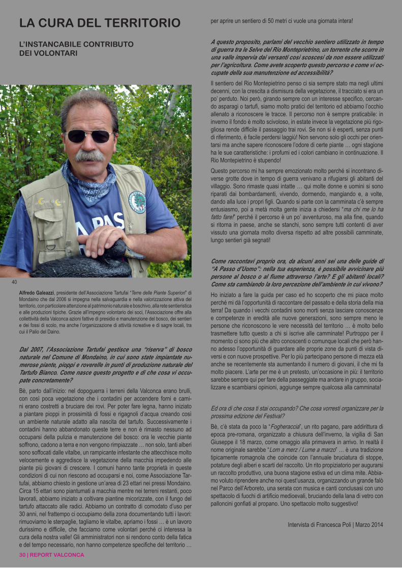
30 | REPORT VALCONCA
LA CURA DEL TERRITORIO
L’INSTANCABILE CONTRIBUTODEI VOLONTARI
40
Dal 2007, l’Associazione Tartufai gestisce una “riserva” di bosco naturale nel Comune di Mondaino, in cui sono state impiantate nu-merose piante, pioppi e roverelle in punti di produzione naturale del Tartufo Bianco. Come nasce questo progetto e di che cosa vi occu-pate concretamente?
Bè, parto dall’inizio: nel dopoguerra i terreni della Valconca erano brulli, con così poca vegetazione che i contadini per accendere forni e cami-ni erano costretti a bruciare dei rovi. Per poter fare legna, hanno iniziato a piantare pioppi in prossimità di fossi e rigagnoli d’acqua creando così un ambiente naturale adatto alla nascita del tartufo. Successivamente i contadini hanno abbandonato queste terre e non è rimasto nessuno ad occuparsi della pulizia e manutenzione del bosco: ora le vecchie piante soffrono, cadono a terra e non vengono rimpiazzate … non solo, tanti alberi sono soffocati dalle vitalbe, un rampicante infestante che attecchisce molto velocemente e aggredisce la vegetazione della macchia impedendo alle piante più giovani di crescere. I comuni hanno tante proprietà in queste condizioni di cui non riescono ad occuparsi e noi, come Associazione Tar-tufai, abbiamo chiesto in gestione un’area di 23 ettari nei pressi Mondaino. Circa 15 ettari sono piantumati a macchia mentre nei terreni restanti, poco lavorati, abbiamo iniziato a coltivare piantine micorizzate, con il fungo del tartufo attaccato alle radici. Abbiamo un contratto di comodato d’uso per 30 anni, nel frattempo ci occupiamo della zona documentando tutti i lavori: rimuoviamo le sterpaglie, tagliamo le vitalbe, apriamo i fossi … è un lavoro durissimo e difficile, che facciamo come volontari perché ci interessa la cura della nostra valle! Gli amministratori non si rendono conto della fatica e del tempo necessario, non hanno competenze specifiche del territorio …
per aprire un sentiero di 50 metri ci vuole una giornata intera!
A questo proposito, parlami del vecchio sentiero utilizzato in tempo di guerra tra le Selve del Rio Monteprietrino, un torrente che scorre in una valle impervia dai versanti così scoscesi da non essere utilizzati per l’agricoltura. Come avete scoperto questo percorso e come vi oc-cupate della sua manutenzione ed accessibilità?
Il sentiero del Rio Montepietrino penso ci sia sempre stato ma negli ultimi decenni, con la crescita a dismisura della vegetazione, il tracciato si era un po’ perduto. Noi però, girando sempre con un interesse specifico, cercan-do asparagi o tartufi, siamo molto pratici del territorio ed abbiamo l’occhio allenato a riconoscere le tracce. Il percorso non è sempre praticabile: in inverno il fondo è molto scivoloso, in estate invece la vegetazione più rigo-gliosa rende difficile il passaggio trai rovi. Se non si è esperti, senza punti di riferimento, è facile perdersi laggiù! Non servono solo gli occhi per orien-tarsi ma anche sapere riconoscere l’odore di certe piante … ogni stagione ha le sue caratteristiche: i profumi ed i colori cambiano in continuazione. Il Rio Montepietrino è stupendo!
Questo percorso mi ha sempre emozionato molto perché si incontrano di-verse grotte dove in tempo di guerra venivano a rifugiarsi gli abitanti del villaggio. Sono rimaste quasi intatte … qui molte donne e uomini si sono riparati dai bombardamenti, vivendo, dormendo, mangiando e, a volte, dando alla luce i propri figli. Quando si parte con la camminata c’è sempre entusiasmo, poi a metà molta gente inizia a chiedersi “ma chi me lo ha fatto fare!” perché il percorso è un po’ avventuroso, ma alla fine, quando si ritorna in paese, anche se stanchi, sono sempre tutti contenti di aver vissuto una giornata molto diversa rispetto ad altre possibili camminate, lungo sentieri già segnati!
Come raccontavi proprio ora, da alcuni anni sei una delle guide di “A Passo d’Uomo”: nella tua esperienza, è possibile avvicinare più persone al bosco o al fiume attraverso l’arte? E gli abitanti locali? Come sta cambiando la loro percezione dell’ambiente in cui vivono?
Ho iniziato a fare la guida per caso ed ho scoperto che mi piace molto perché mi dà l’opportunità di raccontare del passato e della storia della mia terra! Da quando i vecchi contadini sono morti senza lasciare conoscenze e competenze in eredità alle nuove generazioni, sono sempre meno le persone che riconoscono le vere necessità del territorio … è molto bello trasmettere tutto questo a chi si iscrive alle camminate! Purtroppo per il momento ci sono più che altro conoscenti o comunque locali che però han-no adesso l’opportunità di guardare alle proprie zone da punti di vista di-versi e con nuove prospettive. Per lo più partecipano persone di mezza età anche se recentemente sta aumentando il numero di giovani, il che mi fa molto piacere. L’arte per me è un pretesto, un’occasione in più: il territorio sarebbe sempre qui per fare della passeggiate ma andare in gruppo, socia-lizzare e scambiarsi opinioni, aggiunge sempre qualcosa alla camminata!
Ed ora di che cosa ti stai occupando? Che cosa vorresti organizzare per la prossima edizione del Festival?
Bè, c’è stata da poco la “Fogheraccia”, un rito pagano, pare addirittura di epoca pre-romana, organizzato a chiusura dell’inverno, la vigilia di San Giuseppe il 18 marzo, come omaggio alla primavera in arrivo. In realtà il nome originale sarebbe “Lom a merz / Lume a marzo” … è una tradizione tipicamente romagnola che coincide con l’annuale bruciatura di stoppe, potature degli alberi e scarti del raccolto. Un rito propiziatorio per augurarsi un raccolto produttivo, una buona stagione estiva ed un clima mite. Abbia-mo voluto riprendere anche noi quest’usanza, organizzando un grande falò nel Parco dell’Arboreto, una serata con musica e canti conclusasi con uno spettacolo di fuochi di artificio medioevali, bruciando della lana di vetro con palloncini gonfiati al propano. Uno spettacolo molto suggestivo!
Intervista di Francesca Poli | Marzo 2014
Alfredo Galeazzi, presidente dell’Associazione Tartufai “Terre delle Piante Superiori” di Mondaino che dal 2006 si impegna nella salvaguardia e nella valorizzazione attiva del territorio, con particolare attenzione al patrimonio naturale e boschivo, alla rete sentieristica e alle produzioni tipiche. Grazie all’impegno volontario dei soci, l’Associazione offre alla collettività della Valconca azioni fattive di presidio e manutenzione del bosco, dei sentieri e dei fossi di scolo, ma anche l’organizzazione di attività ricreative e di sagre locali, tra cui il Palio del Daino.
REPORT VALCONCA | 31
CARE FOR THE TERRITORY
THE TIRELESS WORKOF VOLUNTEERS
Alfredo Galeazzi, president of the Truffle Diggers Association “Lands of Higher Plants” of Mondaino which since 2006 is committed to an active safeguard and enhance of the region, with particular attention to the natural and forest heritage, the hiking tracks network and typical products. Thanks to the efforts of volunteer members, the Association offers to the Valconca community actions of proactive monitoring and maintenance of the forest, paths and ditches, but also the organization of recreational activities and local festivals, including the Deer Palio.
Since 2007, the Truffle Diggers Association manages a natural forest “reserve” in the Municipality of Mondaino, where numerous plants have been planted, poplars and oaks, in areas where White Truffle grows naturally. How did this project started and what do you actu-ally do?
Well, I start from the beginning: in the post-war, the lands in Valconca were barren, with so little vegetation that peasants had to burn bushes to turn on stoves and fireplaces. In order to gather firewood, they started to plant poplars nearby ditches and water streams, thus creating a natural environment where truffle could easily grow. Later, the farmers abandoned these properties and nobody was left to take care of the forest cleaning and maintenance: nowadays old plants suffer, fall to the ground and are not replaced ... not only that, many trees are choked because of Clematis vitalba, a climbing shrub which grows very quickly and attacks the scrub vegetation, preventing younger plants to grow. Municipalities own many estates in these conditions which fail to deal with and we, as Truffle Dig-gers Association, requested to take care of an area of 23 hectares near Mondaino. Approximately 15 acres are planted with scrubs while in the remaining land, scarcely treated, we began to cultivate mycorrhizal plants, with the truffle fungus attached to the roots. We have a loan for use for 30 years, in the meantime, we take care of area documenting all work: we remove underbrushes, cut clematis, open ditches ... it’s a very hard and difficult job, that we carry on as volunteers because we are interested in taking care of our valley! The administrators are not aware of the effort and time required, they do not have specific competences of the territory ... it takes a whole day to open a 50 meters pathway!
In this regard, tell me about the old trail used during the wartime along the Woodlands of the Monteprietrino Stream, a torrent flowing through a broken valley with very steep slopes, impossible to be used for agriculture. How did you discover this pathway and how do you deal with its maintenance and accessibility?
I think the Montepietrino Stream track has always been there but in the last decades, due to the vegetation’s enormous increase, the way got lost. We, however, always walking around with a specific interest, looking for asparagus or truffles, know this land very well and we are trained to rec-ognize tracks and traces. The path is not always accessible: in winter the ground is very slippery, in summer, instead, the lush vegetation makes it more difficult to walk through the shrubs. If one is not experienced, without reference points, it is easy to get lost in there! The eyes are not enough to orient, also the ability to recognize the smell of certain plants is important ... every season has its own features: scents and colors change constantly. The Montepietrino Stream is beautiful!
This route always excited me a lot because there are several caves used as refugees by the village inhabitants during the wartime. They remained almost intact ... here many women and men took shelter from the bomb-ing, living, sleeping, eating, and, sometimes, giving birth to their children. When the walk begins there is always excitement among participants, then half way through a lot of people start to wonder “who made me do this!” because the path is a bit adventurous, but at the end , when we return to town, even if tired, everybody is always happy to have lived a very different
experience compared to other hikes, along set paths!
As you just told now, for some years you have been one of the “A pas-so d’uomo” guides: in your experience, is it possible to get more peo-ple closer to the forest or the river through art? And the locals? How is their perception of the environment in which they live in changing?
I started to be a guide by chance and I found out that I really like it be-cause it gives me the opportunity to talk about the past and the history of my homeland! Since old farmers have died without leaving knowledge and skills as a legacy to the younger generations, there are less and less people able to recognize the real needs of the territory ... it’s very nice to transmit all this to those who participate to the walks! Unfortunately at the moment there are mainly acquaintances or anyway locals who have now the opportunity to look at their homeland from different points of view and new perspectives. Many of the participants are middle aged although recently there is an increasing number of young people, which makes me very happy. For me, art is only an excuse, a further chance: the territory would always be here to walk around but going in a group, socializing and exchanging points of views always adds something to the hiking!
And now what are you working on? What would you like to organize for the next edition of the Festival?
Well, we just had the “Fogheraccia” a pagan ritual, it seems even from pre-Roman times, organized at the end of wintertime, on St. Joseph’s eve on the 18th of March, as a tribute to the coming spring. In fact, the original name would be “Lom a merz / Light in March” ... it is a typical tradition of this part of the region (Romagna), which coincides with the annual burn-ing of oakum, trees’ pruning and crop wastes. A ceremony/atonement for a productive harvest, a good summer and a mild climate. We wanted to bring back this practice, organizing a large bonfire in the Arboreto Park, an evening with music and songs that ended with medieval fireworks show, burning glass wool with balloons filled with propane gas. Very fascinating!
Interview by Francesca Poli | March 2014
40. Alfredo Galeazzi in occasione della manifestazione “Giardini e paesaggi aperti sul Conca” nell’aprile 2014 (©www.apassoduomo.org)
40. Alfredo Galeazzi during the event “Open gardens and landscapes along the Conca river” in April 2014 (©www.apassoduomo.org)
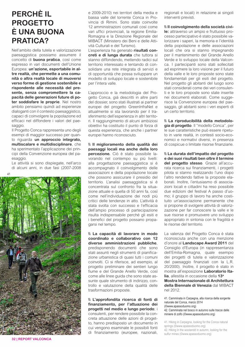
32 | REPORT VALCONCA
Nell’ambito della tutela e valorizzazione paesaggistica possiamo assumere il concetto di buona pratica, così come espresso in vari documenti dell’Unione Europea: un’azione, esportabile in al-tre realtà, che permette a una comu-nità o altra realtà locale di muoversi verso forme di gestione sostenibile e rispondente alle necessità del pre-sente, senza compromettere la ca-pacità delle generazioni future di po-ter soddisfare le proprie. Nel nostro ambito pensiamo quindi ad esperienze dialoganti con il contesto paesaggistico, capaci di coinvolgere la popolazione ed efficaci nel diffondere i valori del pae-saggio.Il Progetto Conca rappresenta uno degli esempi di maggior successo per quan-to riguarda un approccio integrato, multiscalare e multidisciplinare, che ha sperimentato l’applicazione dei prin-cipi della Convenzione europea del pa-esaggio. Le attività si sono dispiegate, nell’arco di alcuni anni, in due fasi (2007-2008
PERCHÈ IL PROGETTOÈ UNA BUONA PRATICA?
e 2009-2010) nei territori della media e bassa valle del torrente Conca in Pro-vincia di Rimini. Sono state coinvolte 12 amministrazioni comunali così come vari uffici provinciali, la regione Emilia-Romagna e la Direzione Regionale del MIBACT (Ministero dei Beni e delle Atti-vità Culturali e del Turismo). L’esperienza ha generato risultati con-creti e di lunga durata che tuttora si stanno diffondendo, mettendo radici sul territorio interessato e tentando di con-solidare una rete integrata di servizi e di opportunità che possa sviluppare un modello di sviluppo locale e sostenibile per l’intera valle.
L’approccio e la metodologia del Pro-getto Conca, già descritti in altre parti del dossier, sono stati illustrati ai partner europei del progetto GreenInfraNet e attualmente si sta lavorando per il tra-sferimento dell’esperienza in altri territo-ri. Il raggiungimento di alcuni ambiziosi obiettivi ha costituito il punto di forza di questa esperienza, che anche i partner europei hanno riconosciuto.
\\ Il miglioramento della qualità dei paesaggi locali ma anche della loro percezione. Ciò è stato possibile la-vorando nel contempo su più livelli: alla progettazione paesaggistica si è accompagnato il coinvolgimento delle associazioni e della popolazione locale che possono assicurare il presidio del territorio. L’analisi paesaggistica si è concentrata sul confronto fra la situa-zione attuale e quella di 50 anni fa, così come nell’individuazione dei nodi più critici delle tendenze in atto. L’attività è stata svolta con successo e l’efficacia dell’ampio processo di partecipazione risulta indispensabile perché gli esiti e i benefici del progetto possano propa-garsi nel tempo.
\\ La capacità di lavorare in modo coordinato e collaborativo con 12 diverse amministrazioni pubbliche, predisponendo documenti che sono stati assunti negli strumenti di pianifica-zione urbanistica di quasi tutti i comuni coinvolti. Ci si riferisce, ad esempio, al progetto preliminare dei sentieri lungo fiume e del Grande Anello Verde, così come alle linee guida che sono state as-sunte quale strumento di indirizzo, con-trollo e valutazione della qualità delle trasformazioni proposte.
\\ L’approfondita ricerca di fonti di finanziamento, per l’attuazione dei progetti nel medio e lungo periodo; i consulenti, per rendere possibile la con-creta attuazione delle azioni di proget-to, hanno predisposto un documento in cui vengono esaminate le possibili fonti di finanziamento (europee, nazionali,
regionali e locali) in relazione ai singoli interventi previsti.
\\ Il coinvolgimento della società civi-le: attraverso un ampio e fruttuoso pro-cesso partecipativo è stato possibile va-lorizzare i saperi, la memoria e l’identità della popolazione e delle associazioni locali che ora si stanno impegnando per il mantenimento del Grande Anello Verde e lo sviluppo locale della Valcon-ca. I partecipanti sono stati sollecitati ad esprimere la loro visione per il futuro della valle e le loro proposte sono state fondamentali per gli esiti del progetto. Nel progetto gli abitanti del luogo sono stati considerati come dei veri consulen-ti e le loro proposte sono state inserite nei documenti elaborati. Come sugge-risce la Convenzione europea del pae-saggio, gli abitanti sono i veri esperti di un certo territorio.
\\ La riproducibilità della metodolo-gia di progetto. Il “modello Conca”, per le sue caratteristiche può essere ripetu-to in varie realtà, in contesti socio-eco-nomici e normativi diversi, in presenza di cospicue o limitate risorse finanziarie.
\\ La durata dell’impatto del progetto e dei suoi risultati ben oltre il termine del progetto stesso. Grazie all’accu-rata ricerca sui finanziamenti, i progetti pilota si stanno realizzando l’uno dopo l’altro rendendo fattive la proposte ela-borati. Inoltre, l’entusiasmo di associa-zioni locali e cittadini ha reso possibile due edizioni del festival A passo d’uo-mo; il gruppo di lavoro ha anche costi-tuito un’associazione permanente che si propone di svolgere attività di valoriz-zazione per far conoscere la valle e le sue risorse e promuovere uno sviluppo appropriato in sintonia con le fragilità e le risorse del territorio.
La valenza del Progetto Conca è stata riconosciuta anche con una menzione d’onore al Landscape Award 2011 del Consiglio d’Europa (in rappresentanza dell’Emilia-Romagna, quale esempio dei progetti di tutela e valorizzazione del paesaggio finanziati con la L.R. 20/2000). Inoltre, il progetto è stato in mostra all’esposizione Laboratorio Ita-lia, allestita in occasione della 13a
Mostra Internazionale di Architettura della Biennale di Venezia dal MIBACT nel 2012.
41. Camminata in Carpegna, alla ricerca della sorgente naturale del Conca, marzo 2014(©www.apassoduomo.org) 42. Camminata nel bosco in autunno sulle tracce delle miniere di zolfo (©www.apassoduomo.org)
41. Hiking in Carpegna, looking for the Conca natural springs (©www.apassoduomo.org) 42. Hiking in the woolandd in autumn, looking for the sulfur mines (©www.apassoduomo.org)
41
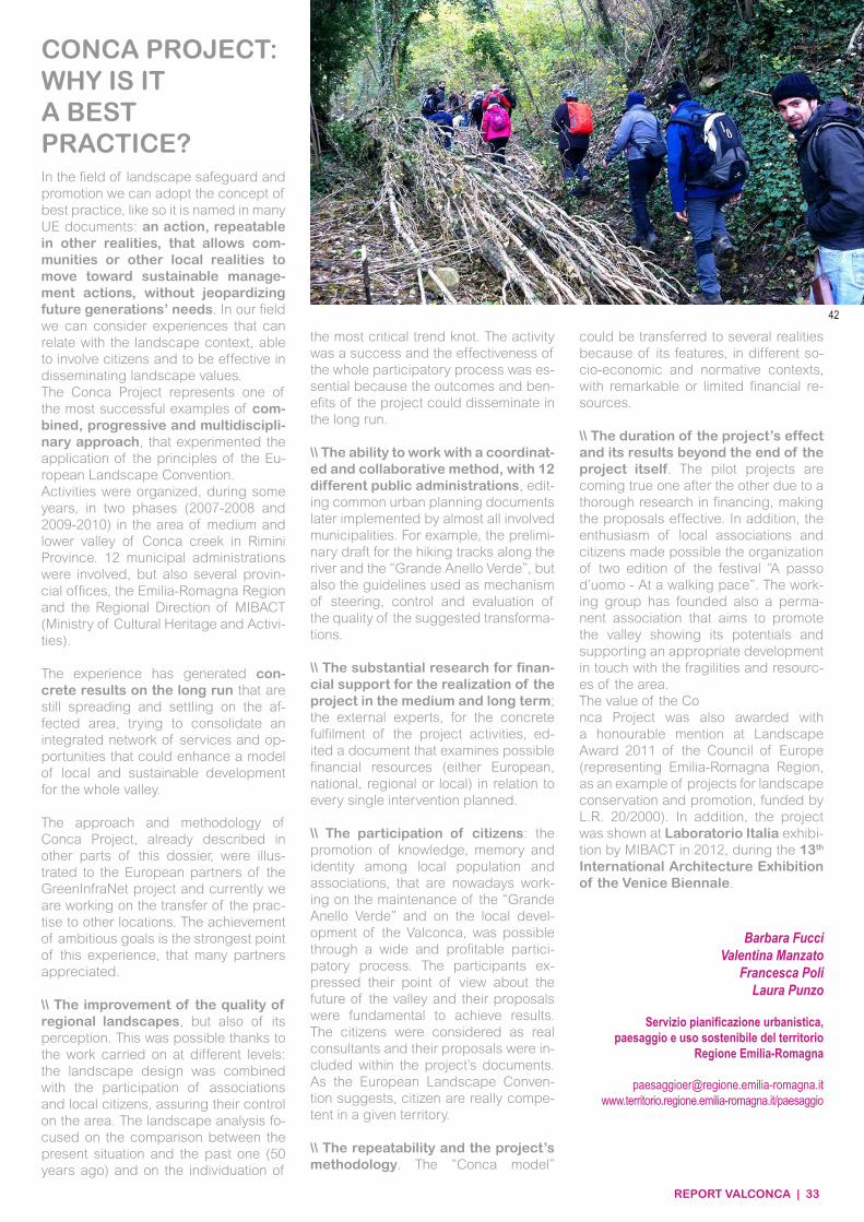
REPORT VALCONCA | 33
CONCA PROJECT: WHY IS ITA BEST PRACTICE? In the field of landscape safeguard and promotion we can adopt the concept of best practice, like so it is named in many UE documents: an action, repeatable in other realities, that allows com-munities or other local realities to move toward sustainable manage-ment actions, without jeopardizing future generations’ needs. In our field we can consider experiences that can relate with the landscape context, able to involve citizens and to be effective in disseminating landscape values.The Conca Project represents one of the most successful examples of com-bined, progressive and multidiscipli-nary approach, that experimented the application of the principles of the Eu-ropean Landscape Convention.Activities were organized, during some years, in two phases (2007-2008 and 2009-2010) in the area of medium and lower valley of Conca creek in Rimini Province. 12 municipal administrations were involved, but also several provin-cial offices, the Emilia-Romagna Region and the Regional Direction of MIBACT (Ministry of Cultural Heritage and Activi-ties).
The experience has generated con-crete results on the long run that are still spreading and settling on the af-fected area, trying to consolidate an integrated network of services and op-portunities that could enhance a model of local and sustainable development for the whole valley.
The approach and methodology of Conca Project, already described in other parts of this dossier, were illus-trated to the European partners of the GreenInfraNet project and currently we are working on the transfer of the prac-tise to other locations. The achievement of ambitious goals is the strongest point of this experience, that many partners appreciated.
\\ The improvement of the quality of regional landscapes, but also of its perception. This was possible thanks to the work carried on at different levels: the landscape design was combined with the participation of associations and local citizens, assuring their control on the area. The landscape analysis fo-cused on the comparison between the present situation and the past one (50 years ago) and on the individuation of
the most critical trend knot. The activity was a success and the effectiveness of the whole participatory process was es-sential because the outcomes and ben-efits of the project could disseminate in the long run.
\\ The ability to work with a coordinat-ed and collaborative method, with 12 different public administrations, edit-ing common urban planning documents later implemented by almost all involved municipalities. For example, the prelimi-nary draft for the hiking tracks along the river and the “Grande Anello Verde”, but also the guidelines used as mechanism of steering, control and evaluation of the quality of the suggested transforma-tions.
\\ The substantial research for finan-cial support for the realization of the project in the medium and long term; the external experts, for the concrete fulfilment of the project activities, ed-ited a document that examines possible financial resources (either European, national, regional or local) in relation to every single intervention planned.
\\ The participation of citizens: the promotion of knowledge, memory and identity among local population and associations, that are nowadays work-ing on the maintenance of the “Grande Anello Verde” and on the local devel-opment of the Valconca, was possible through a wide and profitable partici-patory process. The participants ex-pressed their point of view about the future of the valley and their proposals were fundamental to achieve results. The citizens were considered as real consultants and their proposals were in-cluded within the project’s documents. As the European Landscape Conven-tion suggests, citizen are really compe-tent in a given territory.
\\ The repeatability and the project’s methodology. The “Conca model”
could be transferred to several realities because of its features, in different so-cio-economic and normative contexts, with remarkable or limited financial re-sources.
\\ The duration of the project’s effect and its results beyond the end of the project itself. The pilot projects are coming true one after the other due to a thorough research in financing, making the proposals effective. In addition, the enthusiasm of local associations and citizens made possible the organization of two edition of the festival “A passo d’uomo - At a walking pace”. The work-ing group has founded also a perma-nent association that aims to promote the valley showing its potentials and supporting an appropriate development in touch with the fragilities and resourc-es of the area. The value of the Conca Project was also awarded with a honourable mention at Landscape Award 2011 of the Council of Europe (representing Emilia-Romagna Region, as an example of projects for landscape conservation and promotion, funded by L.R. 20/2000). In addition, the project was shown at Laboratorio Italia exhibi-tion by MIBACT in 2012, during the 13th International Architecture Exhibition of the Venice Biennale.
Barbara FucciValentina Manzato
Francesca Poli Laura Punzo
Servizio pianificazione urbanistica,paesaggio e uso sostenibile del territorio
Regione Emilia-Romagna
paesaggioer@regione.emilia-romagna.itwww.territorio.regione.emilia-romagna.it/paesaggio
42
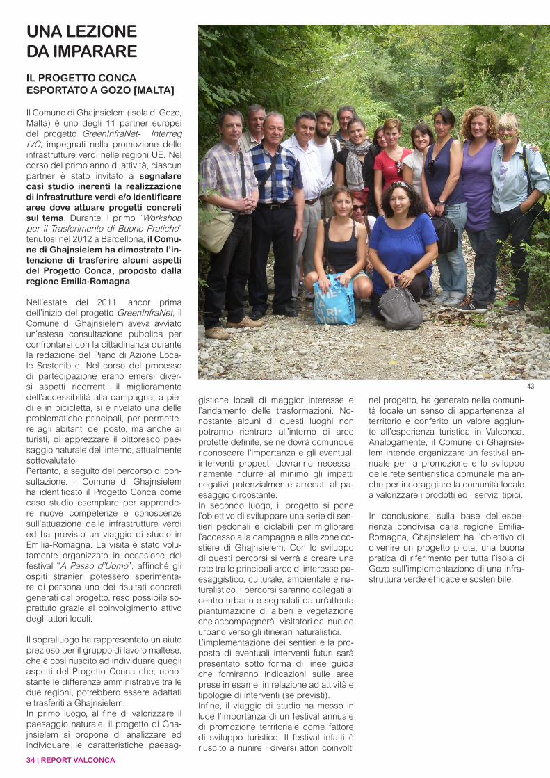
34 | REPORT VALCONCA
UNA LEZIONEDA IMPARARE
IL PROGETTO CONCA ESPORTATO A GOZO [MALTA]
Il Comune di Ghajnsielem (isola di Gozo, Malta) è uno degli 11 partner europei del progetto GreenInfraNet- Interreg IVC, impegnati nella promozione delle infrastrutture verdi nelle regioni UE. Nel corso del primo anno di attività, ciascun partner è stato invitato a segnalare casi studio inerenti la realizzazione di infrastrutture verdi e/o identificare aree dove attuare progetti concreti sul tema. Durante il primo “Workshop per il Trasferimento di Buone Pratiche” tenutosi nel 2012 a Barcellona, il Comu-ne di Ghajnsielem ha dimostrato l’in-tenzione di trasferire alcuni aspetti del Progetto Conca, proposto dalla regione Emilia-Romagna.
Nell’estate del 2011, ancor prima dell’inizio del progetto GreenInfraNet, il Comune di Ghajnsielem aveva avviato un’estesa consultazione pubblica per confrontarsi con la cittadinanza durante la redazione del Piano di Azione Loca-le Sostenibile. Nel corso del processo di partecipazione erano emersi diver-si aspetti ricorrenti: il miglioramento dell’accessibilità alla campagna, a pie-di e in bicicletta, si è rivelato una delle problematiche principali, per permette-re agli abitanti del posto, ma anche ai turisti, di apprezzare il pittoresco pae-saggio naturale dell’interno, attualmente sottovalutato.Pertanto, a seguito del percorso di con-sultazione, il Comune di Ghajnsielem ha identificato il Progetto Conca come caso studio esemplare per apprende-re nuove competenze e conoscenze sull’attuazione delle infrastrutture verdi ed ha previsto un viaggio di studio in Emilia-Romagna. La visita è stato volu-tamente organizzato in occasione del festival “A Passo d’Uomo”, affinché gli ospiti stranieri potessero sperimenta-re di persona uno dei risultati concreti generati dal progetto, reso possibile so-prattuto grazie al coinvolgimento attivo degli attori locali.
Il sopralluogo ha rappresentato un aiuto prezioso per il gruppo di lavoro maltese, che è così riuscito ad individuare quegli aspetti del Progetto Conca che, nono-stante le differenze amministrative tra le due regioni, potrebbero essere adattati e trasferiti a Ghajnsielem.In primo luogo, al fine di valorizzare il paesaggio naturale, il progetto di Gha-jnsielem si propone di analizzare ed individuare le caratteristiche paesag-
gistiche locali di maggior interesse e l’andamento delle trasformazioni. No-nostante alcuni di questi luoghi non potranno rientrare all’interno di aree protette definite, se ne dovrà comunque riconoscere l’importanza e gli eventuali interventi proposti dovranno necessa-riamente ridurre al minimo gli impatti negativi potenzialmente arrecati al pa-esaggio circostante.In secondo luogo, il progetto si pone l’obiettivo di sviluppare una serie di sen-tieri pedonali e ciclabili per migliorare l’accesso alla campagna e alle zone co-stiere di Ghajnsielem. Con lo sviluppo di questi percorsi si verrà a creare una rete tra le principali aree di interesse pa-esaggistico, culturale, ambientale e na-turalistico. I percorsi saranno collegati al centro urbano e segnalati da un’attenta piantumazione di alberi e vegetazione che accompagnerà i visitatori dal nucleo urbano verso gli itinerari naturalistici.L’implementazione dei sentieri e la pro-posta di eventuali interventi futuri sarà presentato sotto forma di linee guida che forniranno indicazioni sulle aree prese in esame, in relazione ad attività e tipologie di interventi (se previsti).Infine, il viaggio di studio ha messo in luce l’importanza di un festival annuale di promozione territoriale come fattore di sviluppo turistico. Il festival infatti è riuscito a riunire i diversi attori coinvolti
nel progetto, ha generato nella comuni-tà locale un senso di appartenenza al territorio e conferito un valore aggiun-to all’esperienza turistica in Valconca. Analogamente, il Comune di Ghajnsie-lem intende organizzare un festival an-nuale per la promozione e lo sviluppo delle rete sentieristica comunale ma an-che per incoraggiare la comunità locale a valorizzare i prodotti ed i servizi tipici.
In conclusione, sulla base dell’espe-rienza condivisa dalla regione Emilia-Romagna, Ghajnsielem ha l’obiettivo di divenire un progetto pilota, una buona pratica di riferimento per tutta l’isola di Gozo sull’implementazione di una infra-struttura verde efficace e sostenibile.
43

REPORT VALCONCA | 35
A LESSONTO LEARN
THE CONCA PROJECT EXPORTED TO GOZO [MALTA]
Ghajnsielem Local Council is one of 11 project partners from around Europe involved with the GreenInfraNet - Inter-reg IVC project, working together to promote the development and imple-mentation of green infrastructure in EU regions. In the project’s first year, all partners were asked to identify best practices from their region on green infrastructure and/or to identify ar-eas where they needed to improve in this respect. During the first “Best Practice Transfer Workshop” held in Barcelona 2012, Ghajnsielem Local Council identified an opportunity to develop a project based on the best practice described by the Emilia-Ro-magna region, Conca Project.
Prior to the commencement of the GreenInfraNet project, in the summer of 2011, the Ghajnsielem Local Council had carried out an extensive public consultation exercise in relation to the development of its Sustainable Locality Action Plan. During this com-munity engagement process, a number of recurring points emerged. One of the main issues related to the need to improve walking and cycling acces-sibility to the countryside so that lo-cals and visitors alike can appreciate the picturesque natural environment that lies within Ghajnsielem but is currently underappreciated.Based on the consultation exercise, therefore, Ghajnsielem Local Council identified the Conca Project as an ideal project from which to learn lessons and implement GI principles in the locality. As a result, Ghajnsielem Local Council planned a study visit to the Emilia-Ro-magna region. The journey purposely
coincided with the “At a walking pace” festival with the aim of showcasing the benefits of the Conca Project and how stakeholders have worked together to make this project a success.
The study visit was invaluable in helping the Maltese project team to identify those aspects of Conca Project that could be adapted and transferred to Ghajnsielem despite the differences in governance be-tween the two regions.Firstly, in order to have an increased appreciation for the natural landscape, Ghajnsielem’s project aims to ana-lyse and define the local landscape features of interest and transfor-mation trends. Whilst some of these landscape features may not lie within designated protected areas, their im-portance should be recognised and any proposed interventions need to acknowledge that potential negative im-pacts on these features should be kept to a minimum. Secondly, the project seeks to de-velop a number of pedestrian and cycle routes to improve access to the countryside and coast of Ghajn-sielem. The development of such routes will provide a network that links features of interest including landscape, cultural heritage and natural habitats. The routes will link also to the village and the urban environment will be enhanced through appropriate planting of trees and veg-etation that will mark the start and/or end of various routes. Development of routes and proposals of any interven-tions will be presented in the form of guidelines indicating the importance of the areas being visited in terms of their assets and the types of interventions that can be implemented there (if any).
Finally, the study visit illustrated that the organisation of an annual festi-val added value to the overall visitor product. The festival brought stakehold-ers together, created ownership within
the community and added value to the visitor’s experience of the Conca Val-ley. Similarly, the Ghajnsielem Local Council intends to develop an annual festival that will promote and support the Ghajnsielem trail network and also promote the local community together with the products and serv-ices they can provide.
In conclusion, based on the experience shared by Emilia-Romagna, Ghajn-sielem aims to serve as a pilot project of good practice in successful and sus-tainable implementation of GI for the rest of Gozo.
Krista Farrugia
Environmental consultant
Ghajnsielem Local Council
43. I partner del progetto GreenInfranet durante il viaggio studio in Valconca, settembre 2013. Foto di gruppo presso la sezione mediana del torrente Conca(©Francesca Poli)44. I partner del progetto GreenInfranet durante il viaggio studio in Valconca, settembre 2013. Il parco lineare di recente realizzazione nei pressi della foce del torrente Conca a Misano Adriatico (©Francesca Poli)
43. The GreenInfraNet project partners during the study visitin Valconca, September 2013. Group photo by the medium section of the Conca river (©Francesca Poli)44. The GreenInfraNet project partners during the study visitin Valconca, September 2013. The recently realized linear park by the Conca river estuary (©Laura Punzo)
44
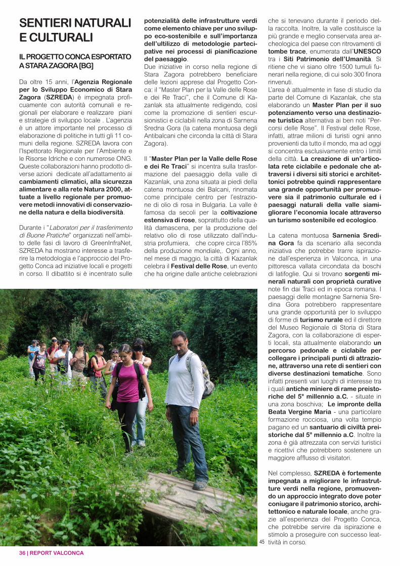
36 | REPORT VALCONCA
SENTIERI NATURALI E CULTURALI
IL PROGETTO CONCA ESPORTATO A STARA ZAGORA [BG]
Da oltre 15 anni, l’Agenzia Regionale per lo Sviluppo Economico di Stara Zagora (SZREDA) è impegnata profi-cuamente con autorità comunali e re-gionali per elaborare e realizzare piani e strategie di sviluppo locale . L’agenzia è un attore importante nel processo di elaborazione di politiche in tutti gli 11 co-muni della regione. SZREDA lavora con l’Ispettorato Regionale per l’Ambiente e le Risorse Idriche e con numerose ONG. Queste collaborazioni hanno prodotto di-verse azioni dedicate all’adattamento ai cambiamenti climatici, alla sicurezza alimentare e alla rete Natura 2000, at-tuate a livello regionale per promuo-vere metodi innovativi di conservazio-ne della natura e della biodiversità.
Durante i “Laboratori per il trasferimento di Buone Pratiche” organizzati nell’ambi-to delle fasi di lavoro di GreenInfraNet, SZREDA ha mostrano interesse a trasfe-rire la metodologia e l’approccio del Pro-getto Conca ad iniziative locali e progetti in corso. Il dibattito si è incentrato sulle
potenzialità delle infrastrutture verdi come elemento chiave per uno svilup-po eco-sostenibile e sull’importanza dell’ultilizzo di metodologie parteci-pative nei processi di pianificazione del paesaggio.Due iniziative in corso nella regione di Stara Zagora potrebbero beneficiare delle lezioni apprese dal Progetto Con-ca: il “Master Plan per la Valle delle Rose e dei Re Traci”, che il Comune di Ka-zanlak sta attualmente redigendo, così come la promozione di sentieri escur-sionistici e ciclabili nella zona di Sarnena Sredna Gora (la catena montuosa degli Antibalcani che circonda la città di Stara Zagora).
Il “Master Plan per la Valle delle Rose e dei Re Traci” si incentra sulla trasfor-mazione del paesaggio della valle di Kazanlak, una zona situata ai piedi della catena montuosa dei Balcani, rinomata come principale centro per l’estrazio-ne di olio di rosa in Bulgaria. La valle è famosa da secoli per la coltivazione estensiva di rose, soprattutto della qua-lità damascena, per la produzione del relativo olio di rose utilizzato dall’indu-stria profumiera, che copre circa l’85% della produzione mondiale,. Ogni anno, nel mese di maggio, la città di Kazanlak celebra il Festival delle Rose, un evento che ha origine dalle antiche celebrazioni
che si tenevano durante il periodo del-la raccolta. Inoltre, la valle costituisce la più grande e meglio conservata area ar-cheologica del paese con ritrovamenti di tombe trace, enumerata dall’UNESCO tra i Siti Patrimonio dell’Umanità. Si ritiene che vi siano oltre 1500 tumuli fu-nerari nella regione, di cui solo 300 finora rinvenuti.L’area è attualmente in fase di studio da parte del Comune di Kazanlak, che sta elaborando un Master Plan per il suo potenziamento verso una destinazio-ne turistica alternativa ai ben noti “Per-corsi delle Rose”. Il Festival delle Rose, infatti, attrae milioni di turisti ogni anno provenienti da tutto il mondo, ma ad oggi si concentra esclusivamente entro i limiti della città. La creazione di un’artico-lata rete ciclabile e pedonale che at-traversi i diversi siti storici e architet-tonici potrebbe quindi rappresentare una grande opportunità per promuo-vere sia il patrimonio culturale ed i paesaggi naturali della valle siami-gliorare l’economia locale attraverso un turismo sostenibile ed ecologico.
La catena montuosa Sarnenia Sredi-na Gora fa da scenario alla seconda iniziativa che potrebbe trarre ispirazio-ne dall’esperienza in Valconca, in una pittoresca vallata circondata da boschi di latifoglie. Qui si trovano sorgenti mi-nerali naturali con proprietà curative note fin dai Traci ed in epoca romana. I paesaggi delle montagne Sarnenia Sre-dina Gora potrebbero rappresentare una grande opportunità per lo sviluppo di forme di turismo rurale ed il direttore del Museo Regionale di Storia di Stara Zagora, con la collaborazione di esper-ti locali, sta attualmente elaborando un percorso pedonale e ciclabile per collegare i principali punti di attrazio-ne, attraverso una rete di sentieri con diverse destinazioni tematiche. Sono infatti presenti vari luoghi di interesse tra i quali antiche miniere di rame preisto-riche del 5° millennio a.C. - situate in una zona boschiva; Le impronte della Beata Vergine Maria - una particolare formazione rocciosa, una volta tempio pagano ed un santuario di civiltà prei-storiche dal 5° millennio a.C. Inoltre la zona è già attrezzata con servizi turistici e ricettivi che potrebbero sostenere un maggiore afflusso di visitatori.
Nel complesso, SZREDA è fortemente impegnata a migliorare le infrastrut-ture verdi nella regione, promuoven-do un approccio integrato dove poter coniugare il patrimonio storico, archi-tettonico e naturale locale, anche gra-zie all’esperienza del Progetto Conca, che potrebbe servire da ispirazione e stimolo a proseguire con successo leat-tività in corso.45
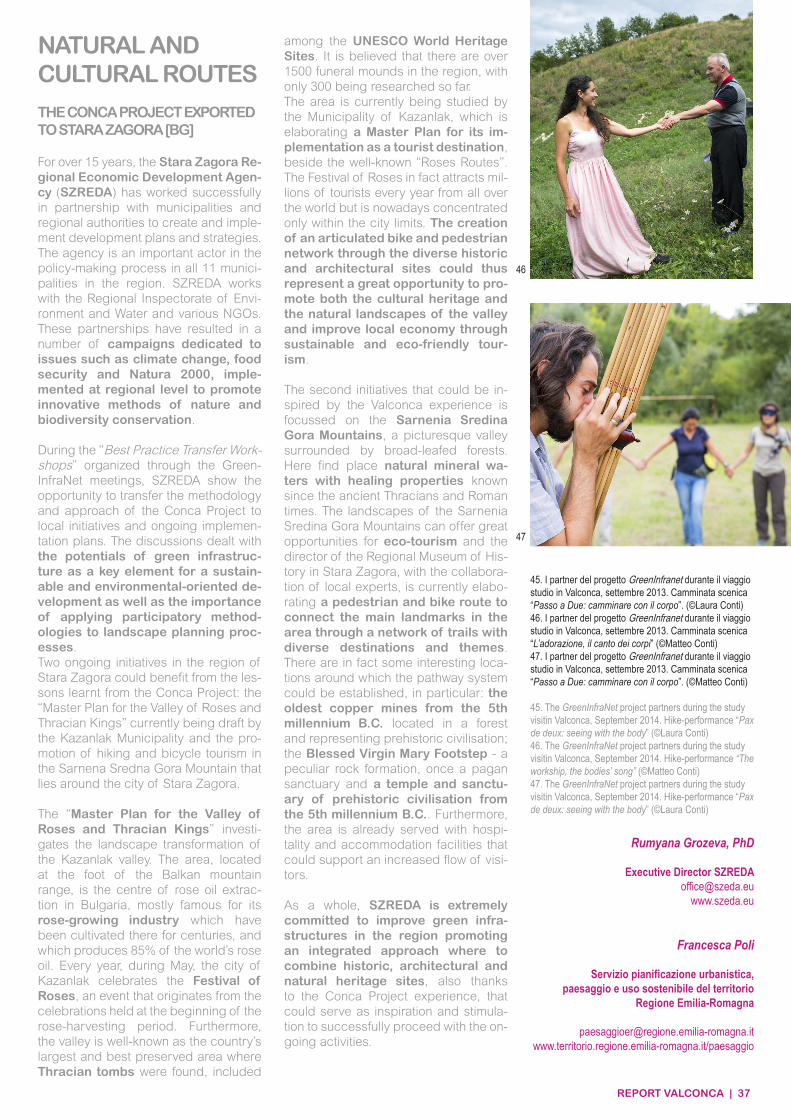
REPORT VALCONCA | 37
NATURAL AND CULTURAL ROUTES
THE CONCA PROJECT EXPORTED TO STARA ZAGORA [BG]
For over 15 years, the Stara Zagora Re-gional Economic Development Agen-cy (SZREDA) has worked successfully in partnership with municipalities and regional authorities to create and imple-ment development plans and strategies. The agency is an important actor in the policy-making process in all 11 munici-palities in the region. SZREDA works with the Regional Inspectorate of Envi-ronment and Water and various NGOs. These partnerships have resulted in a number of campaigns dedicated to issues such as climate change, food security and Natura 2000, imple-mented at regional level to promote innovative methods of nature and biodiversity conservation.
During the “Best Practice Transfer Work-shops” organized through the Green-InfraNet meetings, SZREDA show the opportunity to transfer the methodology and approach of the Conca Project to local initiatives and ongoing implemen-tation plans. The discussions dealt with the potentials of green infrastruc-ture as a key element for a sustain-able and environmental-oriented de-velopment as well as the importance of applying participatory method-ologies to landscape planning proc-esses.Two ongoing initiatives in the region of Stara Zagora could benefit from the les-sons learnt from the Conca Project: the “Master Plan for the Valley of Roses and Thracian Kings” currently being draft by the Kazanlak Municipality and the pro-motion of hiking and bicycle tourism in the Sarnena Sredna Gora Mountain that lies around the city of Stara Zagora.
The “Master Plan for the Valley of Roses and Thracian Kings” investi-gates the landscape transformation of the Kazanlak valley. The area, located at the foot of the Balkan mountain range, is the centre of rose oil extrac-tion in Bulgaria, mostly famous for its rose-growing industry which have been cultivated there for centuries, and which produces 85% of the world’s rose oil. Every year, during May, the city of Kazanlak celebrates the Festival of Roses, an event that originates from the celebrations held at the beginning of the rose-harvesting period. Furthermore, the valley is well-known as the country’s largest and best preserved area where Thracian tombs were found, included
Rumyana Grozeva, PhD
Executive Director [email protected]
www.szeda.eu
Francesca Poli
Servizio pianificazione urbanistica,paesaggio e uso sostenibile del territorio
Regione Emilia-Romagna
paesaggioer@regione.emilia-romagna.itwww.territorio.regione.emilia-romagna.it/paesaggio
among the UNESCO World Heritage Sites. It is believed that there are over 1500 funeral mounds in the region, with only 300 being researched so far.The area is currently being studied by the Municipality of Kazanlak, which is elaborating a Master Plan for its im-plementation as a tourist destination, beside the well-known “Roses Routes”. The Festival of Roses in fact attracts mil-lions of tourists every year from all over the world but is nowadays concentrated only within the city limits. The creation of an articulated bike and pedestrian network through the diverse historic and architectural sites could thus represent a great opportunity to pro-mote both the cultural heritage and the natural landscapes of the valley and improve local economy through sustainable and eco-friendly tour-ism.
The second initiatives that could be in-spired by the Valconca experience is focussed on the Sarnenia Sredina Gora Mountains, a picturesque valley surrounded by broad-leafed forests. Here find place natural mineral wa-ters with healing properties known since the ancient Thracians and Roman times. The landscapes of the Sarnenia Sredina Gora Mountains can offer great opportunities for eco-tourism and the director of the Regional Museum of His-tory in Stara Zagora, with the collabora-tion of local experts, is currently elabo-rating a pedestrian and bike route to connect the main landmarks in the area through a network of trails with diverse destinations and themes. There are in fact some interesting loca-tions around which the pathway system could be established, in particular: the oldest copper mines from the 5th millennium B.C. located in a forest and representing prehistoric civilisation; the Blessed Virgin Mary Footstep - a peculiar rock formation, once a pagan sanctuary and a temple and sanctu-ary of prehistoric civilisation from the 5th millennium B.C.. Furthermore, the area is already served with hospi-tality and accommodation facilities that could support an increased flow of visi-tors.
As a whole, SZREDA is extremely committed to improve green infra-structures in the region promoting an integrated approach where to combine historic, architectural and natural heritage sites, also thanks to the Conca Project experience, that could serve as inspiration and stimula-tion to successfully proceed with the on-going activities.
45. I partner del progetto GreenInfranet durante il viaggio studio in Valconca, settembre 2013. Camminata scenica “Passo a Due: camminare con il corpo”. (©Laura Conti)46. I partner del progetto GreenInfranet durante il viaggio studio in Valconca, settembre 2013. Camminata scenica “L’adorazione, il canto dei corpi” (©Matteo Conti)47. I partner del progetto GreenInfranet durante il viaggio studio in Valconca, settembre 2013. Camminata scenica “Passo a Due: camminare con il corpo”. (©Matteo Conti)
45. The GreenInfraNet project partners during the study visitin Valconca, September 2014. Hike-performance “Pax de deux: seeing with the body” (©Laura Conti)46. The GreenInfraNet project partners during the study visitin Valconca, September 2014. Hike-performance “The workship, the bodies’ song” (©Matteo Conti)47. The GreenInfraNet project partners during the study visitin Valconca, September 2014. Hike-performance “Pax de deux: seeing with the body” (©Laura Conti)
46
47
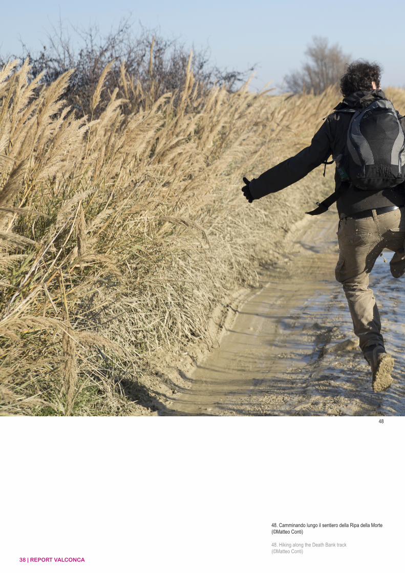
38 | REPORT VALCONCA
48. Camminando lungo il sentiero della Ripa della Morte(©Matteo Conti)
48. Hiking along the Death Bank track(©Matteo Conti)
48
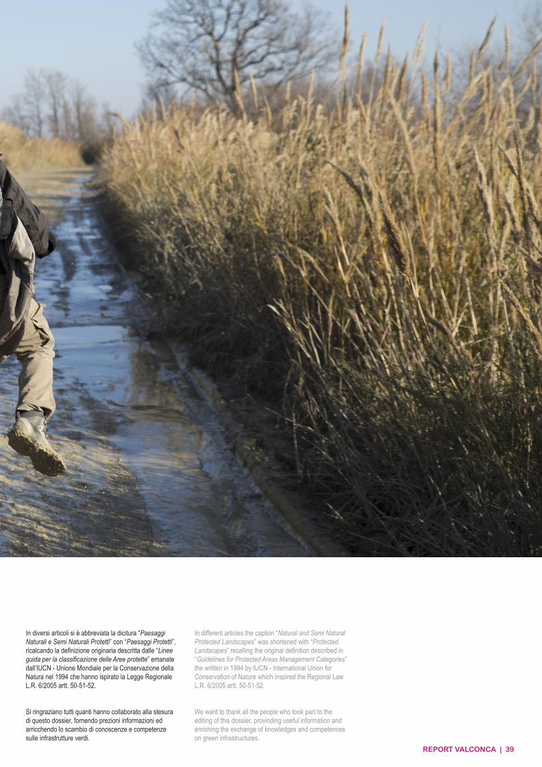
REPORT VALCONCA | 39
In diversi articoli si è abbreviata la dicitura “Paesaggi Naturali e Semi Naturali Protetti” con “Paesaggi Protetti”, ricalcando la definizione originaria descritta dalle “Linee guida per la classificazione delle Aree protette” emanate dall’IUCN - Unione Mondiale per la Conservazione della Natura nel 1994 che hanno ispirato la Legge Regionale L.R. 6/2005 artt. 50-51-52.
Si ringraziano tutti quanti hanno collaborato alla stesura di questo dossier, fornendo prezioni informazioni ed arricchendo lo scambio di conoscenze e competenze sulle infrastrutture verdi.
In different articles the caption “Natural and Semi Natural Protected Landscapes” was shortened with “Protected Landscapes” recalling the original definition described in “Guidelines for Protected Areas Management Categories” the written in 1994 by IUCN - International Union for Conservation of Nature which inspired the Regional Law L.R. 6/2005 artt. 50-51-52.
We want to thank all the people who took part to the editing of this dossier, provinding useful information and enriching the exchange of knowledges and competences on green infrastructures.
European UnionEuropean Regional Development Fund
European UnionEuropean Regional Development Fund


