32
| Date post: | 21-Dec-2015 |
| Category: |
Documents |
| View: | 217 times |
| Download: | 0 times |

Revolutionizing Our Understanding Of the Earth:
Implications for Global Public Health
Revolutionizing Our Understanding Of the Earth:
Implications for Global Public Health
Vice Admiral Conrad C. Lautenbacher, Jr. U.S. Navy (Ret.)Under Secretary of Commerce for Oceans and Atmosphere
Administrator, National Oceanic and Atmospheric Administration (NOAA)11th World Congress of Public Health • 8th Brazilian Congress of Collective Health
August 22, 2006 • Rio de Janeiro

Malaria Endemic Countries, 2003

Dr. John Snow’s Map – 1843London
Dr. Valentine Seaman’s 1796 map of yellow fever deaths in New York City
Broad Street Pump

“Whoever wishes to investigate medicine properly should consider the seasons of the year, and what effects each of them produces. They are not at all alike, but differ much from themselves in regard to their changes. Then the winds, the hot and the cold, especially as are common to all countries, and as peculiar to each locality. We must also consider the qualities of the waters, for as they differ from one to another in taste and weight, so also do they differ much in their qualities.”
Hippocrates: 400 BCAir, Water and Places

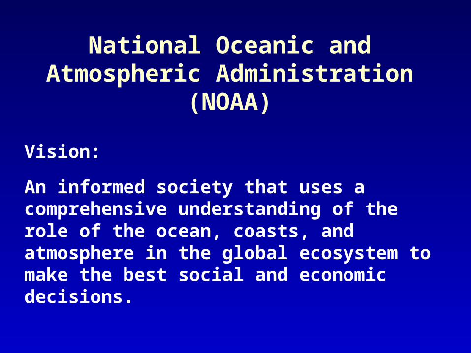
An informed society that uses a comprehensive understanding of the role of the ocean, coasts, and atmosphere in the global ecosystem to make the best social and economic decisions.
National Oceanic and Atmospheric Administration (NOAA)
Vision:

National Oceanic and Atmospheric Administration (NOAA)
National Integrated Drought Information System
NOAA National Weather Service Heat Index Program
Hydrologic Services Program
Storm Surge Model
Coral Reef Conservation Program
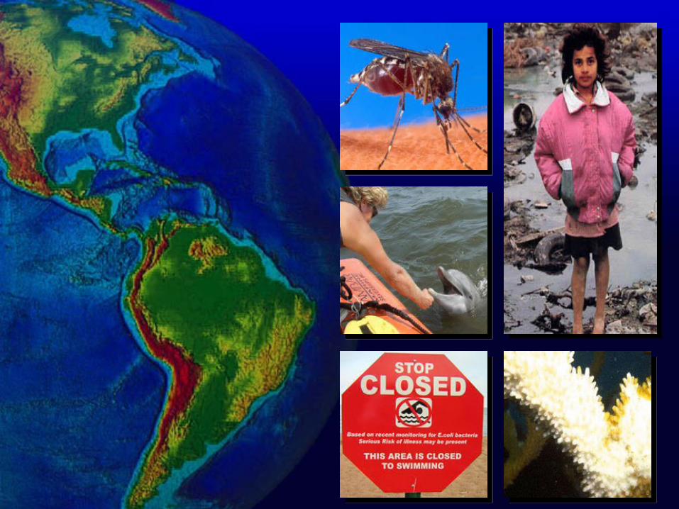
Oceans and Human Health Initiative

Rainfall and MalariaWeekly Cases in Niger from 2001 to 2003
Pre
cip
(mm
/day
)
0
5000
10000
15000
20000
25000
30000
35000
40000
45000
50000
2001 2002 2003

High Risk
Low Risk
June 2005 Predicted June 2006 Predicted
Hantavirus Predictive Risk Map
High Risk
Low Risk
June 2005 Predicted June 2006 Predicted
Several thousand cases annually in South America

UGANDA
CDCFort Collins
CDCAtlanta
TANZANIA
KENYASOMALIA
0 200 400
Kilometers
Ngong Hills
Torosei
Olkarimatian
Terrat
Olbalbal
Loita
Entasopia
02468
101214161820
1 2 3 4 5 6 7 8 9 10
Week Number (week 1 commenced Nov. 25, 1997)
Case
s
HF (n=84)
Managing Health and Economic Consequences
Cases in Kenya Related to Rift Valley Fever
• Health Barrier• Trade Barrier• Long-Term Nutritional Impact
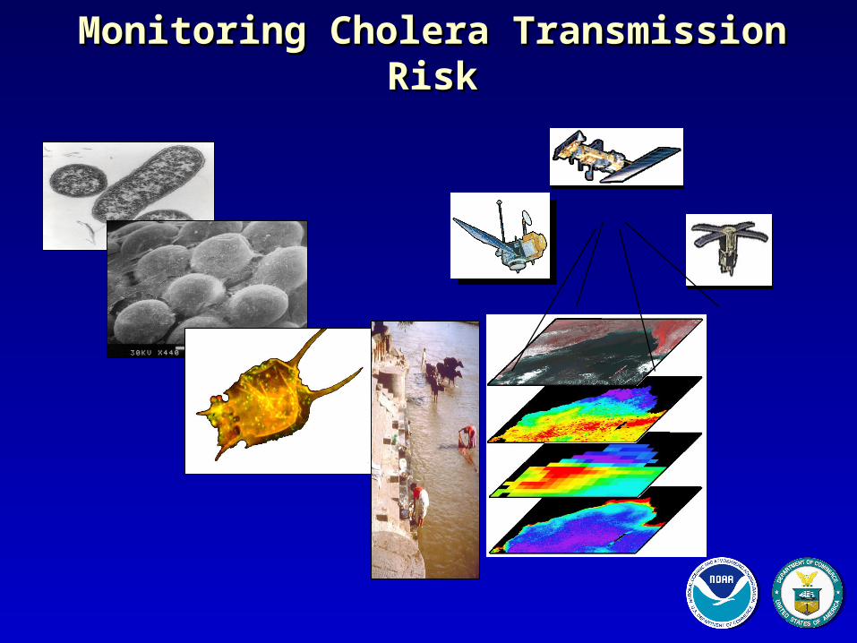
Monitoring Cholera Transmission RiskMonitoring Cholera Transmission Risk

Advanced Planning in Pohnpei

Emergency and Response: Behind the Curve
0
10
20
30
40
50
60
70
80
90
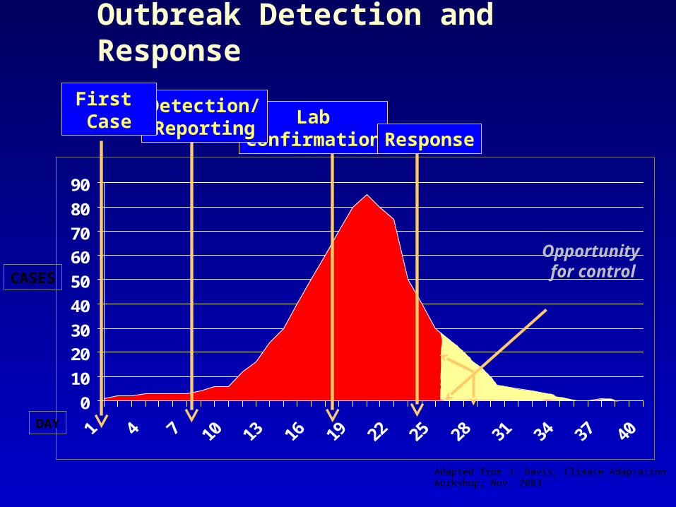
DAY
CASES
LabConfirmation
Outbreak Detection and Response
Response
Detection/Reporting
First Case
Adapted from J. Davis, Climate Adaptation Workshop, Nov. 2003
Opportunity for control
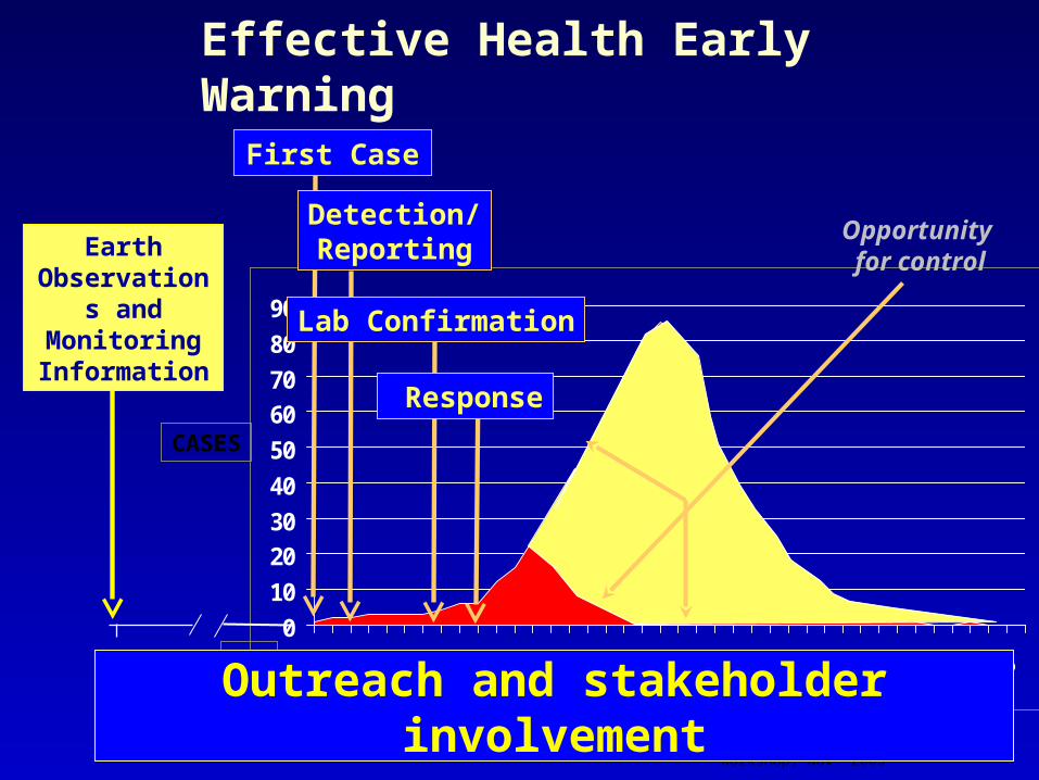
0
10
20
30
40
50
60
70
80
90
DAY
CASES
First Case
Detection/Reporting
Lab Confirmation
Response
Opportunity for control
Effective Health Early Warning
- 120
Earth Observations
and Monitoring Information
Adapted from J. Davis, Climate AdaptationWorkshop, Nov. 2003
Outreach and stakeholder involvement

Earth is a complex system of systems
Data is required from multiple observation networks . . . and systems . . .

A Global Earth Observation System of Systems
GEOSS

From Observation to ActionAchieving Comprehensive, Coordinated, and Sustained
Earth Observations for the Benefit of Humankind
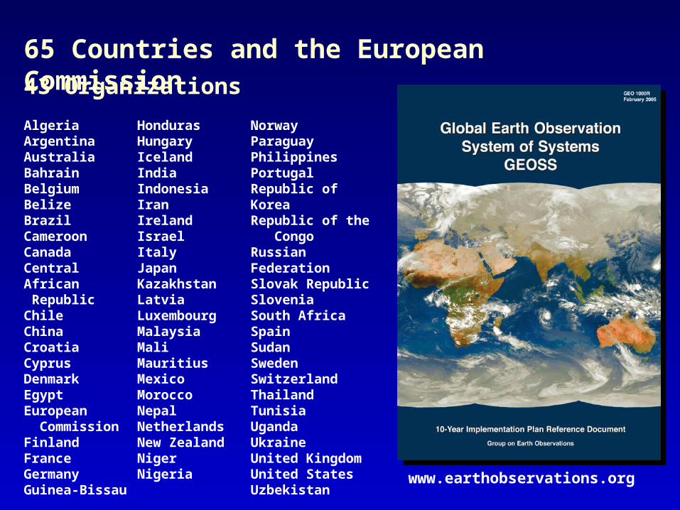
AlgeriaArgentinaAustraliaBahrainBelgiumBelizeBrazilCameroonCanadaCentral African RepublicChileChinaCroatiaCyprusDenmarkEgyptEuropean CommissionFinlandFranceGermanyGuinea-Bissau
HondurasHungaryIcelandIndiaIndonesiaIranIrelandIsraelItalyJapanKazakhstanLatviaLuxembourgMalaysiaMaliMauritiusMexicoMoroccoNepalNetherlandsNew ZealandNigerNigeria
NorwayParaguayPhilippinesPortugalRepublic of KoreaRepublic of the CongoRussian FederationSlovak RepublicSloveniaSouth AfricaSpainSudanSwedenSwitzerlandThailandTunisiaUgandaUkraineUnited KingdomUnited StatesUzbekistan www.earthobservations.org
65 Countries and the European Commission43 Organizations

www.noaa.gov/eos.html
U.S. Interagency Working Group on Earth Observations Membership
Department of Commerce
• National Oceanic and Atmospheric Administration• National Institute for Standards and Technology
Department of Defense
• U.S. Army Corps of Engineers• Navy• Air Force• National Geospatial-Intelligence Agency
Department of Energy
Department of Health and Human Services
• National Institute of Environmental Health Sciences
Department of Homeland Security
• Federal Emergency Management Agency
Department of the Interior
• U.S. Geological Survey
Department of State
Department of Transportation
Environmental ProtectionAgency
National Aeronautics andSpace Administration
National Science Foundation
Smithsonian Institution
Tennessee Valley Authority
U.S. Agency for InternationalDevelopment
U.S. Department of Agriculture
• Agriculture Research Service• U.S. Forest Service
White House Council onEnvironmental Quality
White House Office ofManagement and Budget
White House Office ofScience and Technology Policy

32
3
1
3
Americas Europe Africa Asia/Oceania
Commonwealth of Independent States
US (co-chair)Brazil
Honduras
EC (co-chair)Italy
Germany
SA (co-chair)Morocco
Russia
China (co-chair)Japan
Thailand
Group on Earth Observations Executive Committee (GEO)

GEO-NETCastReal-time Benefits for the Health and Other
Communities!
A real-time global data dissemination system to support a range of societal benefits.
Environmental in situ, airborne and space-based observations, products and services will be transmitted to users through satellites.
Built on existing dissemination systems with data collection and dissemination hubs around the globe.
Data will be divided into channels that user can select based on need.

GEOSS Operating Principles
Open and Transparent Process
Standardized Practices and Protocols
User-friendly Formats
Interoperable Components

Typical Receiver Station Configuration
- Dedicated personal computer (~ $1000)
Data analysis and processing should be done on separate computer(s)
- Satellite antenna dish (1-3 m) (~ $300-1200)
- DTH receiver card or box (~ $200)

Value-Added
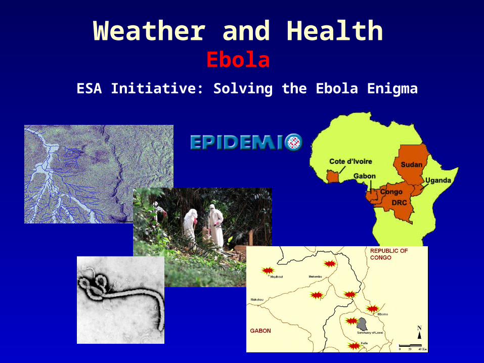
Weather and HealthEbola
ESA Initiative: Solving the Ebola Enigma

Sound Science for Sound Policy
Famine Early WarningSystems Network
Predicting Drought
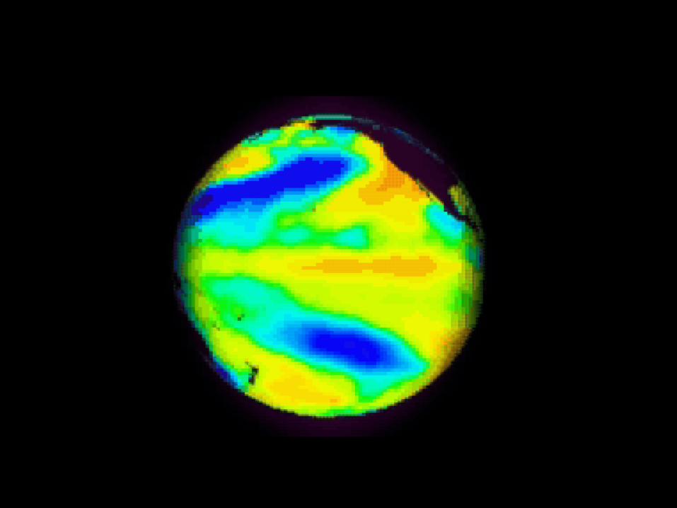
Understanding El NiñoPatterns
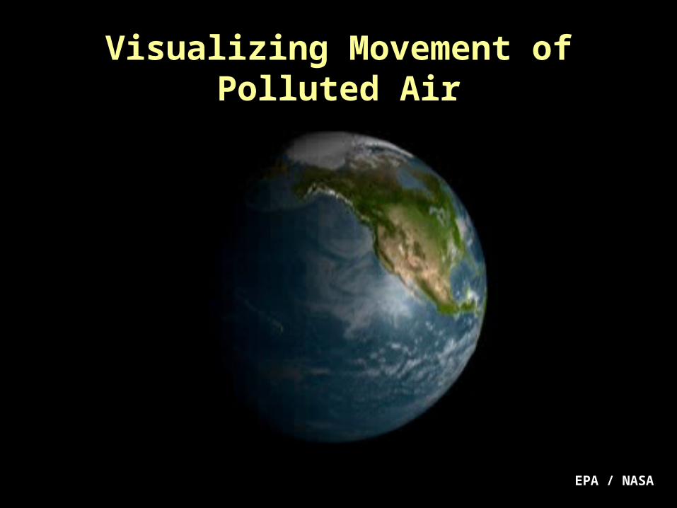
EPA / NASA
Visualizing Movement of Polluted Air

Projecting Impact of Smoke Plumes

www.earthobservations.org


