RRT - Aug 2011 The Essentials of Data Management Data Acquisition, Management and Dissemination Scribe Field Data Collection (Mobile GIS) Case Studies Deepwater Horizon Minot ND Floods Environmental Response Team
Transcript
RRT - Aug 2011
The Essentials of Data Management Data Acquisition, Management and Dissemination
Scribe Field Data Collection (Mobile GIS) Case Studies
Deepwater Horizon Minot ND Floods
Environmental Response Team
RRT - Aug 2011
The Essentials of Data Management Data Acquisition, Management and
Dissemination
Environmental Response Team
Environmental Response Team
Goals
Translate field work into electronic data, not reports!
Facilitate data capture and input Ease the burden of paper trail Consistent data management practices Consistent data dissemination
Environmental Response Team
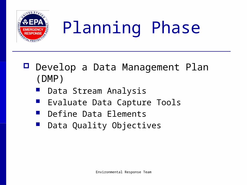
Planning Phase
Develop a Data Management Plan (DMP) Data Stream Analysis Evaluate Data Capture Tools Define Data Elements Data Quality Objectives
Environmental Response Team
On-site information workflow can range from the simple…
Scribe
MySite.MDB
XRF Soil Monitoring
Environmental Response Team
to the Complex…
Environmental Response Team
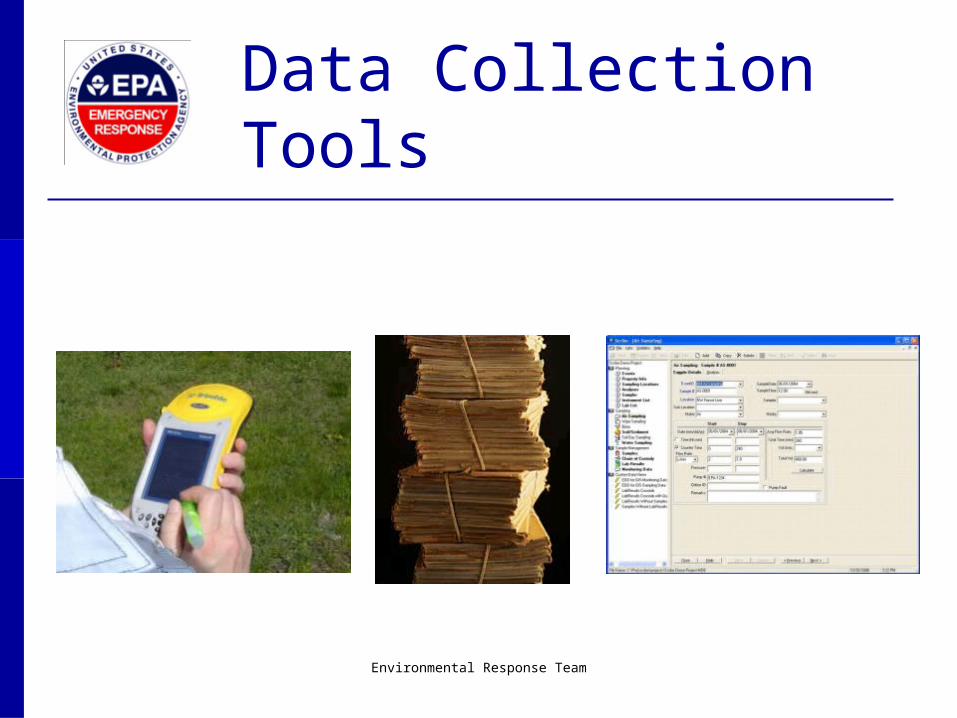
Data Collection Tools
Data Elements
Every piece of information you are capturing May be more than you realize
Information about a sample Location ID Matrix Date / Time Units Equipment type Calibration information etc…
Environmental Response Team
Data Quality Objectives
AKA: “ Reporting Requirements” Make sure the information you are capturing can
satisfy required reports and possibly future requests
May force you to re-evaluate your data elements and possibly your collection tools
RRT - Aug 2011
Scribe
Environmental Response Team
Environmental Response Team
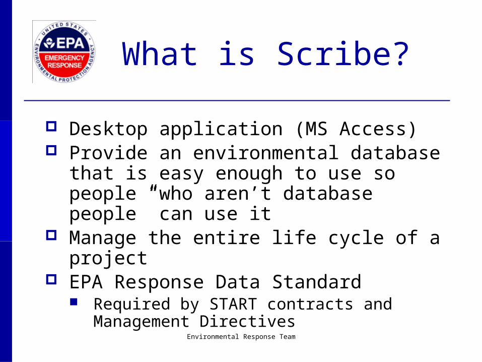
What is Scribe?
Desktop application (MS Access) Provide an environmental database that is easy
enough to use so people “who aren’t database people” can use it
Manage the entire life cycle of a project EPA Response Data Standard
Required by START contracts and Management Directives
Environmental Response Team
Why Use Scribe?
Flexibility and Functionality Data Integration Customizable
Queries Import Scripts Layouts Project Templates
Site Transition Deliverable
Environmental Response Team
Data Communication
When the scope of a job increases and the complexity level goes up, one local database is often not able to support the needs of the project
Geographic or functional separation Maintain local control over a dataset but be able to deliver
it, so it can be incorporated into the larger project data Scribe.NET allows you to maintain multiple projects for the
same site and then join that data in a master subscription A good way to accommodate multiple agencies, contractors
or roles on a large project
Environmental Response Team
Environmental Response Team
• Publish to Scribe.NET
• GIS• Reports
• Primary decision support
• Queries• Spatial analysis
• Initial QA• Import Data• Generate
Documentation (i.e. Labels and COCs)
Then the actual work begins...
Collect
Process
Communicate
Analyze
No matter the tool, the data needs to be in an electronic format suitable for Scribe
REPEAT
Publish
Scribe.NET Client
Enterprise
SubscribeData Communication
Using Scribe.Net
Publish
Scribe.NET Client / GIS
Enterprise / Google Earth
SubscribeMultiple-Project
Publication Model
Sampling
Analytical
RRT - Aug 2011
Field Data Collection
(Mobile GIS)
Environmental Response Team
Field Data Collection
(Mobile GIS)
ArcGIS mobile application configurable to an Agency’s ArcGIS server
View and navigate mobile maps Collect, edit, and update field data in real time and
disseminate information immediately Allows customization for specific field tasks or projects Integrate seamlessly into current workflows Integrate external hardware (range finder, camera, GPS)
Environmental Response Team
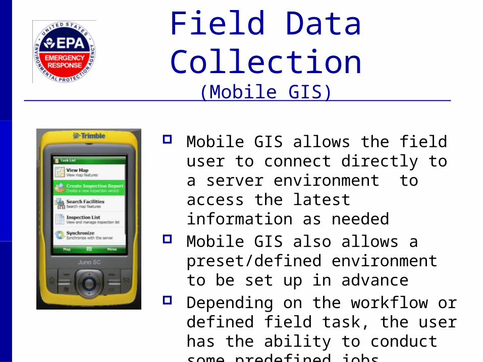
Field Data Collection
(Mobile GIS)
Mobile GIS allows the field user to connect directly to a server environment to access the latest information as needed
Mobile GIS also allows a preset/defined environment to be set up in advance
Depending on the workflow or defined field task, the user has the ability to conduct some predefined jobs
RRT - Aug 2011
Case Studies Deepwater Horizon Minot, ND floods
Environmental Response Team
Environmental Response Team
Deepwater Horizon
First Mission: Manage EPA Data Ensured consistency between EPA Regions (4 and 6)
Created an EPA DMP Coordinated field data management centers Published combined EPA dataset on a daily basis Ensured delivery of EPA data to local and enterprise
users Liaison between field data
management and EPA HQ
Environmental Response Team
Second Mission: Manage All Response Data Initial success put EPA in leadership role Established unified approach to data management
Unified DMP Served as SSCs to in both Houma and Mobile
Deepwater Horizon
Provided leadership and support to initiatives monitoring dispersant use and characterizing sub-surface plumes
Ensured access to non-EPA data
Monitoring and Sampling Activities
Air Monitoring AreaRAE MultiRAE DataRAM EBAM Fluorometer
Multi-media Sampling Surface Water Sediment Air Weathered Oil / Tar Balls Waste
Real-time Mobile Monitoring Trace Atmospheric Gas Analyzer
(TAGA) bus Airborne Spectral Environmental
Collection Technology System (ASPECT) Plane
Source: AreaRAE: (http://www.raesystems.com/) DataRAM: (http://www.environmental-expert.com/) SUMMA Canister (http://www.orbitingscientific.com/) EBAM: (http://www.geneq.com) TAGA Bus (http://www.epa.gov/) ASPECT: (http://www.epa.gov/)
Air VOCs, Semi Volatile Organic Compounds (SVOC), H2S
Sediment and Surface Water Mercury, Metals, PCB, Pesticides, VOCs, SVOCs, Dispersant Total Petroleum Hydrocarbons (TPH) for Gas Range Organics (GRO) TPH for Diesel Range Organics (DRO) and Oil Range Organics (ORO) Toxicity Waste TCLP for VOC , SVOC and Metals, ignitability, Paint Filter
Get trained and experienced people integrated early
Develop, maintain and enforce Data Management Plans
Develop a Regional / National approach to Data Acquisition, Management and Dissemination
Continue to build the relationships within the response community
Minot, ND Floods
Minot, ND Floods
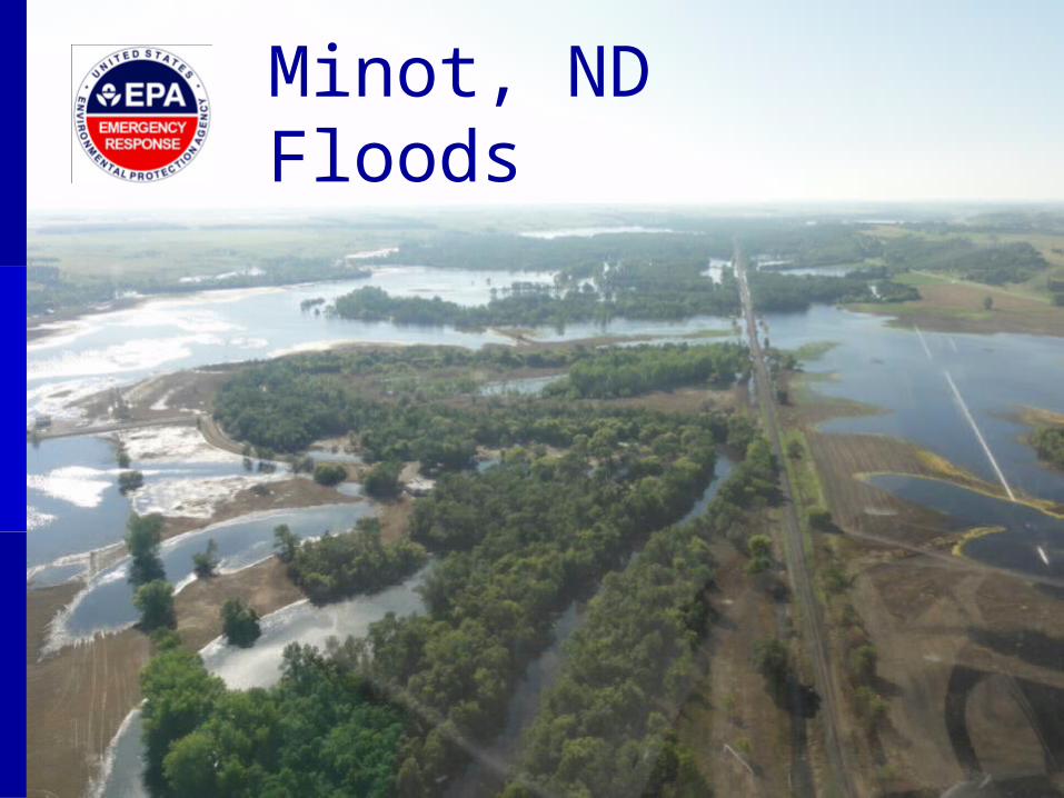
In late June 2011 the Souris River overtopped its banks causing extensive flooding in Ward and McHenry Counties in North Dakota.
In Minot, ND over 4000 homes and businesses were inundated with flood waters, with over 2000 structures completely submerged.
FEMA issued a Mission Assignment to EPA to accomplish four objectives: Remove household hazardous wastes from the impacted area; Decontaminate and prepare white goods and e-waste for recycling; Collect and process orphan containers; and Conduct environmental monitoring and sampling in impacted and
work areas.
EPA Mission Assignment
Household hazardous waste removal White goods and e-waste recycling
Environmental monitoring and samplingCollect and process orphan containers
Data Collection Methods
Logbook Chronological data
entry. Time-consuming for
large amounts of data. Data type consistency
is not guaranteed. Conversion to database,
and post-processing is required.
Electronic Field Sheet Custom data collection
form, does not require data post-processing.
Data manager compiles forms and converts data to tabulated format.
Requires manual association with site photos.
Site Specific Field Sheet Designed to record
specific data for a site. Narrows down data
requirements and domains.
Data entry to a database and quality check required.
Data entry errors may occur during transcription.
Field AssessmentMobile Application
Tool currently in use at Minot, ND to collect information on: Household hazardous waste Orphaned containers / Spills Vermiculite insulation
Configured as a series of electronic data collection forms for the Windows Mobile operating system.
Automatically associates location data, site photos, and assessment information.
Reduces data entry and post-processing. Eases data integration with other
databases. Allows quick data dissemination over the Internet through synchronization.
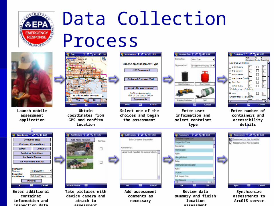
Launch mobile assessment application
Obtain coordinates from GPS and confirm
location
Select one of the choices and begin the assessment
Enter user information and select container
type
Enter number of containers and
accessibility details
Take pictures with device camera and
attach to assessment
Add assessment comments as
necessary
Review data summary and finish
location assessment
Synchronize assessments to ArcGIS server
Enter additional container
information and inspection data
Data Collection Process
When an assessment is completed, the data collected is
stored in the handheld device as
a series of XML files. These files are
stored in the “Assessments”
directory.
Data Synchronization
The device must be connected to
the Wireless Network (Wifi) or Phone Network
in order to transfer the
assessment files to the ArcGIS
server.
Once the network
connection is established, the
assessments can be selected
and synchronized
clicking on “Sync”.
When the assessments synchronize, they are no
longer visible at the Assessment Sync screen and they are moved to the “History”
directory.
Data DisseminationAfter synchronization is completed, assessment data can be
accessed online through a web mapping application.
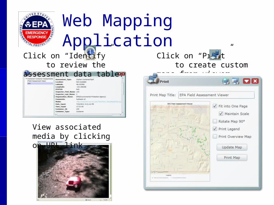
Web Mapping Application
View associated media by clicking on URL link.
Click on “Identify” to review the assessment data table.
Click on “Print” to create custom maps from viewer.
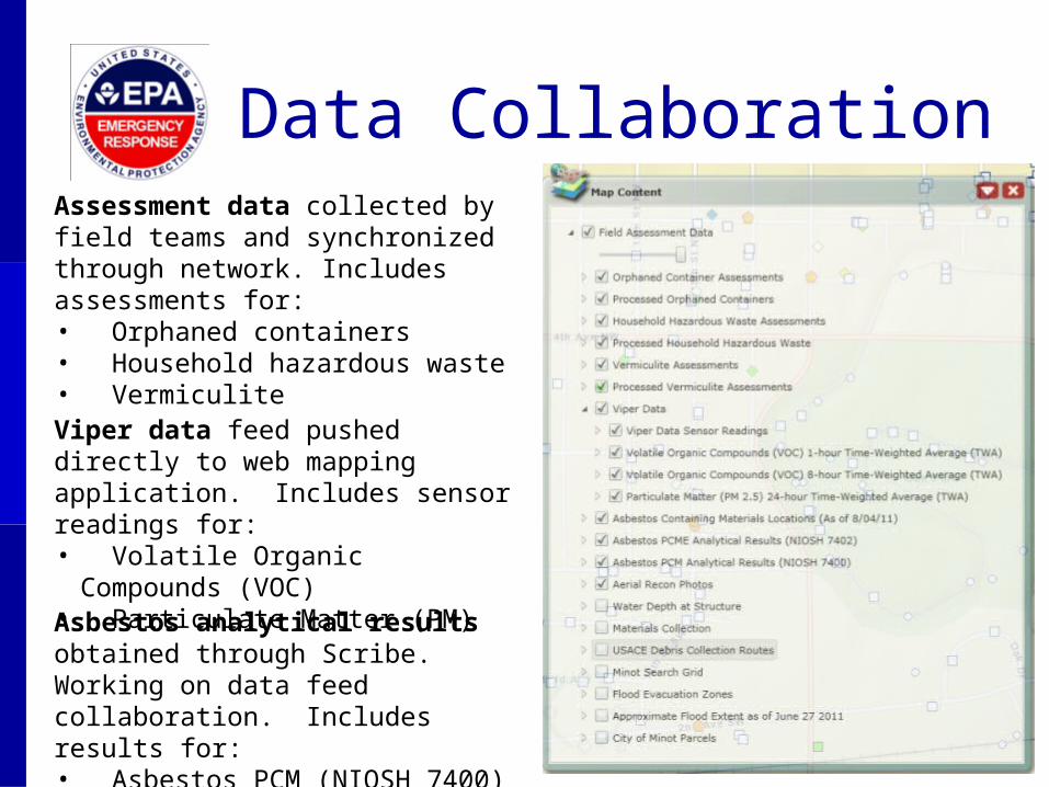
Data CollaborationAssessment data collected by field teams and synchronized through network. Includes assessments for:• Orphaned containers• Household hazardous waste• Vermiculite
Viper data feed pushed directly to web mapping application. Includes sensor readings for:• Volatile Organic Compounds (VOC)• Particulate Matter (PM)
Asbestos analytical results obtained through Scribe. Working on data feed collaboration. Includes results for:• Asbestos PCM (NIOSH 7400)• Asbestos PCME (NIOSH 7402)
Next Steps
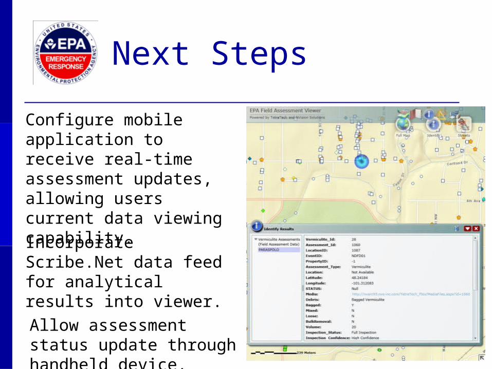
Configure mobile application to receive real-time assessment updates, allowing users current data viewing capability.
Incorporate Scribe.Net data feed for analytical results into viewer.
Allow assessment status update through handheld device.