Issue/Revision: 0.0 Reference: Status: ESA UNCLASSIFIED - For Official Use Jens Nieke ESA, European Space and Technology Centre, Noordwijk, The Netherlands Sentinels heading towards the Copernicus Expansion
Transcript
Issue/Revision: 0.0
Reference:
Status:
ESA UNCLASSIFIED - For Official Use
Jens Nieke ESA, European Space and Technology Centre, Noordwijk, The Netherlands
Sentinels heading towards the Copernicus Expansion
Slide 2
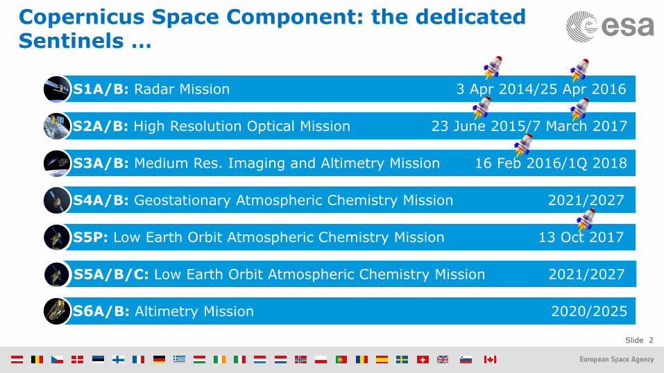
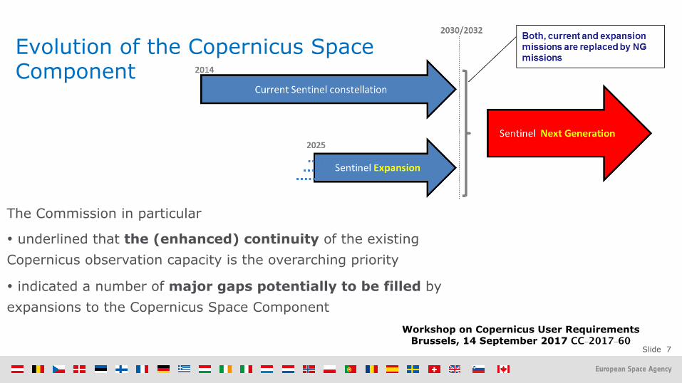
Copernicus Space Component: the dedicated Sentinels …
S1A/B: Radar Mission 3 Apr 2014/25 Apr 2016
S2A/B: High Resolution Optical Mission 23 June 2015/7 March 2017
S3A/B: Medium Res. Imaging and Altimetry Mission 16 Feb 2016/1Q 2018
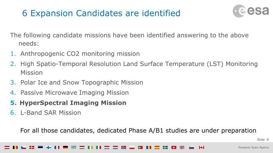
For all those candidates, dedicated Phase A/B1 studies are under preparation
Slide 9
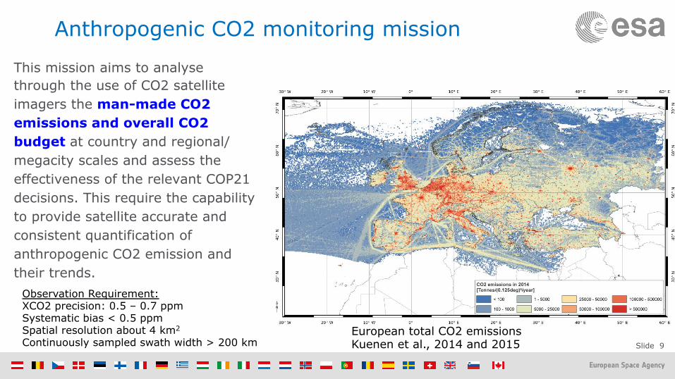
Anthropogenic CO2 monitoring mission
This mission aims to analyse through the use of CO2 satellite imagers the man-made CO2 emissions and overall CO2 budget at country and regional/megacity scales and assess the effectiveness of the relevant COP21 decisions. This require the capability to provide satellite accurate and consistent quantification of anthropogenic CO2 emission and their trends.
European total CO2 emissions Kuenen et al., 2014 and 2015
Observation Requirement: XCO2 precision: 0.5 – 0.7 ppm Systematic bias < 0.5 ppm Spatial resolution about 4 km2
Continuously sampled swath width > 200 km
Slide 10
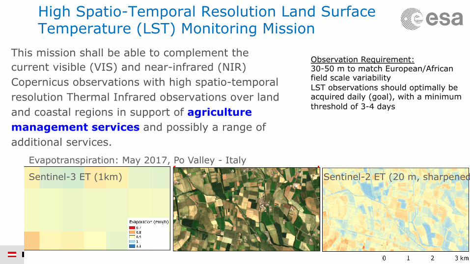
High Spatio-Temporal Resolution Land Surface Temperature (LST) Monitoring Mission
This mission shall be able to complement the current visible (VIS) and near-infrared (NIR) Copernicus observations with high spatio-temporal resolution Thermal Infrared observations over land and coastal regions in support of agriculture management services and possibly a range of additional services.
Observation Requirement: 30-50 m to match European/African field scale variability LST observations should optimally be acquired daily (goal), with a minimum threshold of 3-4 days
Sentinel-3 ET (1km) Sentinel-2 ET (20 m, sharpened)
Evapotranspiration: May 2017, Po Valley - Italy
Slide 11
… and 3 SAR / Microwave missions … Polar Ice and Snow Topographic Mission This mission shall provide enhanced of land ice elevation and sea ice thickness measurements implementing higher spatial resolution for improved lead detection and additional capability to determine snow loading on sea ice. Passive Microwave Imaging Mission This mission shall provide improved continuity of sea ice concentration monitoring missions, in particular in terms of spatial resolution (<15 km), temporal resolution (sub-daily) and accuracy (in particular near the ice edges). L-Band SAR Mission This mission is responding to the requirements expressed by both the Land Monitoring and the Emergency Management services. Its target applications are: soil moisture, crop type discrimination, forest type/forest cover (in support to biomass estimation), food security and precision farming. In addition the mission will contribute to the monitoring of ice extent in the polar region. Other emerging applications will be possible by the synergetic and complementary observations with C band and X band SAR systems
Slide 12
… last-but not Least The Hyper Spectral Imaging Mission This mission aims to complement Copernicus observations with an imaging spectroscopy observational capability for products, applications and services supporting the management of natural resources and related policies by providing detailed observations of key properties of terrestrial surface, inland water bodies and coastal regions. For raw material resources applications, only a hyperspectral imager with contiguous bands can provide the spectral signatures in the Visible, Near Infrared and Short Wave Infrared (VNIR and SWIR), needed to identify and separate observed minerals, rocks and soils and their chemical composition. This is also the case for identifying and monitoring of mining operations and mine-waste management activities. The hyperspectral imaging mission thus aims to augment the Copernicus space component with precise spectroscopic measurements to derive quantitative surface characteristics supporting the monitoring, implementation and improvement of a range of policies in the domain of raw materials, agriculture, soils, food security, biodiversity, environmental degradation and hazards, inland and coastal waters, snow, forestry and the urban environment.
Slide 13
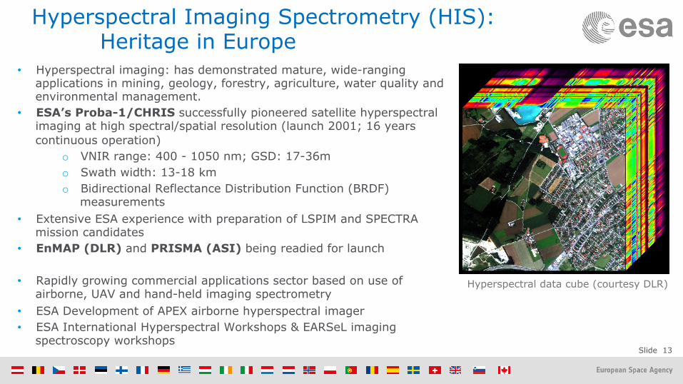
Hyperspectral Imaging Spectrometry (HIS): Heritage in Europe
• Hyperspectral imaging: has demonstrated mature, wide-ranging applications in mining, geology, forestry, agriculture, water quality and environmental management.
• ESA’s Proba-1/CHRIS successfully pioneered satellite hyperspectral imaging at high spectral/spatial resolution (launch 2001; 16 years continuous operation)
o VNIR range: 400 - 1050 nm; GSD: 17-36m o Swath width: 13-18 km o Bidirectional Reflectance Distribution Function (BRDF)
measurements • Extensive ESA experience with preparation of LSPIM and SPECTRA
mission candidates • EnMAP (DLR) and PRISMA (ASI) being readied for launch
• Rapidly growing commercial applications sector based on use of airborne, UAV and hand-held imaging spectrometry
• ESA Development of APEX airborne hyperspectral imager • ESA International Hyperspectral Workshops & EARSeL imaging
spectroscopy workshops
Hyperspectral data cube (courtesy DLR)
Slide 14
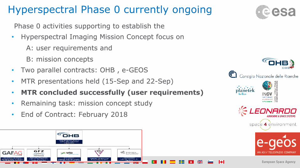
Hyperspectral Phase 0 currently ongoing Phase 0 activities supporting to establish the • Hyperspectral Imaging Mission Concept focus on
A: user requirements and B: mission concepts
• Two parallel contracts: OHB , e-GEOS • MTR presentations held (15-Sep and 22-Sep) • MTR concluded successfully (user requirements) • Remaining task: mission concept study • End of Contract: February 2018
Slide 15
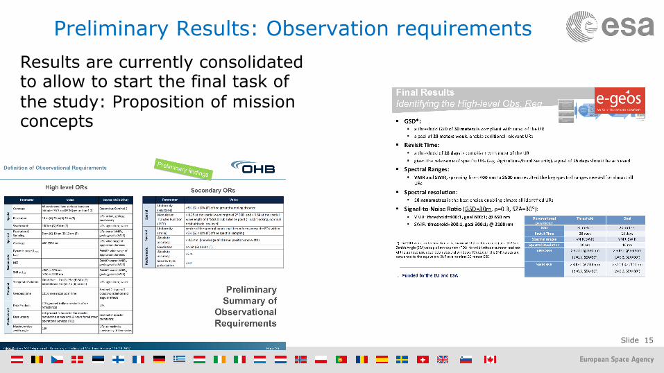
Preliminary Results: Observation requirements Results are currently consolidated to allow to start the final task of the study: Proposition of mission concepts
Slide 16
Name Company/Department Address Phone E-mail Fax
Guanter, Luis Dr. Helmholtz Centre Potsdam, Department for Geodesy and Remote Sensing, German Centre for Geosciences (GFZ)
Rum, Giovanni 'r. 9LD�GHOOH�0XUD�*LDQLFROHQVL��,��������5RPH��,WDO\
JLRYDQQL�UXP#JPDLO�FRP
Skidmore, Andrew K. Prof. Dr. ITC, Natural Resources Department (NRS-ITC), Faculty of Geo-Information, Science & Earth Observation of the University of Twente
Hengelosestraat 99, 7514 AE Enschede, The Netherlands
Colombo, Roberto Mr. University Milano Bicocca(UNIMIB), Earth & Environmental Sciences Department (DISAT), Laboratory Telerilevamento Dinamiche Ambientali (LDTA)
Hyperspectral Imaging Mission Expert Group (HIMEG) Scope: Establish High Level Requirements and Mission Requirements traceable to user needs. A set of critical user requirements in raw materials, agriculture, soils and food security are currently not met by the Copernicus space component (e.g. soil- and plant chemistry, mineralogy and related environmental impacts). A hyperspectral natural resources mission can fulfill these key user requirements and address specific ecosystem. Main Mission Objective: To complement Sentinel observation capabilities with high spectral resolution VIS-SWIR observations over land and coastal areas in support of natural resources management, (agricultural services, including food security biodiversity and a range of additional services by addressing in-land water quality, forestry and snow).
Science Coordinator: Michael Rast
Slide 17
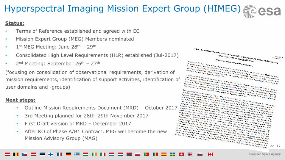
Hyperspectral Imaging Mission Expert Group (HIMEG) Status: • Terms of Reference established and agreed with EC • Mission Expert Group (MEG) Members nominated • 1st MEG Meeting: June 28th – 29th
• Consolidated High Level Requirements (HLR) established (Jul-2017)
• 2nd Meeting: September 26th – 27th
(focusing on consolidation of observational requirements, derivation of mission requirements, identification of support activities, identification of user domains and -groups)
Next steps:
• Outline Mission Requirements Document (MRD) – October 2017 • 3rd Meeting planned for 28th–29th November 2017 • First Draft version of MRD – December 2017 • After KO of Phase A/B1 Contract, MEG will become the new
Mission Advisory Group (MAG)
Slide 18
In Parallel: Preparation of Phase A/B1 Industrial Contract
Current work-plan: • October Publication in EMITS (ESA's System for Tendering And Registration)*
• Feb/Mar-2018 KO of two contracts in parallel of Phase A/B1 system activity • End 2018 Preliminary Requirement Review (PRR), i.e., End Phase A
• Jun 2019 Intermediate System Requirement Review (ISRR), i.e., End Phase B1 • Q42019 Release of ITT for Phase B2/C/D/E1 • Late 2019 Ministerial Council => Programme implementation approval?
* CSC expansion is financed under EOEP-5 programme
Slide 19
Conclusion Copernicus Space Component (CSC) Expansion: The CSC is ready to prepare a sound baseline to fill a number of major observation gaps:
1. Anthropogenic CO2 monitoring mission 2. High Spatio-Temporal Resolution Land Surface Temperature Monitoring Mission
6. L-Band SAR Mission Hyperspectral: • User Requirements are well advanced and considered as solid,
• Observation requirements are clear, only spatial dimension (revisit, spatial resolution) needs further assessment in a mission concept study, • Data continuity and long-term planning is considered as top requirements by all parties.
![INAS 342 - the Flying Sentinels [Indian Navy]](https://static.documents.pub/doc/80x56/577d1cf51a28ab4e1e8b4993/inas-342-the-flying-sentinels-indian-navy.jpg)


