Petrosys 17.8 Release Notes SOFTWARE RELEASE NOTES Version 17.8 Petrosys v17.8 focuses on improved mapping and editing of data. In this release, the spatial editor now incorporates a powerful new grid editor that updates surfaces as the nodes or associated contours and faults are edited. A new dynamic location map and new method of placing map elements further improve the mapping experience.
Transcript
Petrosys 17.8 Release Notes
SOFTWARE RELEASE NOTES Version 17.8
Petrosys v17.8 focuses on improved mapping and editing of data.
In this release, the spatial editor now incorporates a powerful new grid editor that updates surfaces as the nodes or associated contours and faults are edited. A new dynamic location map and new method of placing map elements further improve the mapping experience.
Petrosys 17.8 Release Notes
New Grid Editor Improving the Quality of Geological Maps
The spatial editor now includes a powerful new grid editor replacing previous grid editing functionality. A quick and easy way to improve the quality of geological maps without the need for re-interpretation, it also allows easy creation of surfaces from digitised data.
Edit grid nodes, or the associated contours and faults
Real time updating of grids following editing – localized re-gridding
Generate a grid from a few contours digitised on a scanned image. Add more detail and re-grid if required
New grid editing tools including interactive interpolation and smoothing
Petrosys 17.8 Release Notes
Map Element Positioning Enhancements
Map elements, such as the scale bar, legend, title block and north arrow, can now be anchored to a corner of the map sheet.
Map elements will remain in the same relative location regardless of the area of interest selected.
The preferred configuration can be saved to a Petrosys .dbm file and subsequently merged into other display lists make it easier to produce consistently formatted maps.
Dynamic Location Map
A new option Location Map option has been added to the Display/Map Elements menu.
This location map is dynamic and will automatically show the current area of interest superimposed on a World Map. The current AOI can be used for the coordinate system or a suitable World projection can be selected.
The location map can be anchored to a corner of the AOI or placed in the map sheet title bar. Symbology for the bounding box and underlying World map is controllable.
Custom location maps saved as rasters or CGM files can still be placed in the map sheet border.
Petrosys 17.8 Release Notes
Formation Top Substitution in Automatic Map Generation
The Draw Map now allows well formation tops to be automatically substituted. The Surface Modelling Draw Map task lists allows automatic generation of families of maps, typically substituting grids and contours for different horizons over the same area of interest. This has been extended to support formation tops from both the well data file and 3rd party connections.
Looping Over 3rd Party Data
Surface modelling workflows have been enhanced by the addition of looping over horizon and formations from 3rd party data sources, negating the need for import to Petrosys formats for looping. All the applications currently supported by Petrosys are included.
Petrosys 17.8 Release Notes
Volumetrics – Output Depth/Area Pairs to CSV
The Volumetrics Reports tab now includes an option to export depth/area pairs as a comma delimited text file (CSV format) which opens directly in Excel. This simplifies import of result to risking packages for further analysis. If volumes are being calculated in multiple polygons, then one file is exported for each polygon using the polygon name as the file name.
Petrosys 17.8 Release Notes
Version 17.7 Features
In case you missed them, below are some of the great features from the previous 17.7 release.
Create Fault Polygons from Fault Sticks
Petrosys users can automatically calculates fault polygons from fault sticks and horizon data – this is a major time saving over manual workflows. The output polygons can identify problems with the source interpretation and are an excellent QC tool for the fault sticks themselves. The output polygons can be edited if required in the Spatial Editor. Fault sticks are supported from Petrel, DecisionSpace, Paradigm and DUG Insight.
When using fault sticks in gridding, fault polygons are calculated using the estimated horizon/fault stick contacts. These fault polygons are embedded within the output grid file and may optionally be saved to a separate fault file. The fault polygons may also be smoothed spatially if requested by the user and their Z-values are populated so that they tie to the output grid surface.
One of the major advantages of the Petrosys algorithm is that there is no pre-requisite surface framework modeling required to run this option, other than to make sure the fault sticks are all assigned to their corresponding fault surface. This means the workflow for generating fault polygons from interpretation data becomes much simpler than in other packages.
To select this option, set the "Fault type" to "Fault sticks" under the "Faults" tab in the "Grid/Create Grid" option.
The output grid and automatically generated fault polygons for the Gulfaks data set (top ness horizon) are displayed below:
Fault sticks can be displayed in the Petrosys 3D Viewer application.
Petrosys 17.8 Release Notes
Improvements to Presentation Quality Mapping
Display GIS Directional Annotation Enhancements: GIS data with an orientation can now have annotation aligned with that orientation. This allows symbols that have an angular direction to have annotation that plots at that directional value. Directional GIS arrows and better labelling are useful for geological dip and azimuth maps, plotting micro-seismic parameters, displaying current data, or mapping anything with a directional component.
Petrosys 17.8 Release Notes
Directly Connected Subsurface Data Footprint Continues to Grow
Building on the established footprint of subsurface data types supported by Petrosys direct connections across a wide spectrum of E&P applications, Petrosys 17.7 provides a stronger than ever tool for the exchange of data.
Import seismic to SDF and dbMap from Trango, KDM, Finder and OpenWorks.
Import 3D seismic surfaces from GeoFrame in the Surface Exchange tool.
Export grids to OpenWorks and IHS Petra in the Grid Exchange tool.
Import spatial data from MapInfo file into any GIS supported format in the Spatial Data Translator tool.
CRS Point Conversion Tool for Bulk Conversion of Coordinates
A new option to allow CRS conversion of a selected XY coordinate pairs is available in the Launcher under the menu option /CRS/Text File CRS Conversion. It is also available in the Surface Modeling application under the menu /File/Exchange/Text File CRS Conversion where it can be added to workflows and scripted for automation purposes
A rich set of options allow full control over the output file format. The output format can be explicitly defined or it can be set to match the input format file.
Online Help – How to Videos
Petrosys online help now contains hyperlinks to a selection of “how to” videos, hosted on the Petrosys YouTube channel, along with a range of contents updates. Look for this video playback button in the help:
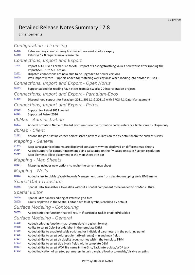
37 entries
Detailed Release Notes Summary 17.8Enhancements
Configuration - Licensing57375 Extra warning about expiring licenses at two weeks before expiry57050 Petrosys 17.8 requires new license file
Connections, Import and Export53764 Import ASCII Fixed Format File to SDF - Import of Easting/Northing values now works after running the
Import/SEGP1 to SDF option53751 Dispatch connections are now able to be upgraded to newer versions60359 Well import wizard - Support added for matching wells by alias when loading into dbMap PPDM3.8
Connections, Import and Export - OpenWorks60193 Support added for reading Fault sticks from SeisWorks 2D interpretation projects
Connections, Import and Export - Paradigm-Epos54489 Discontinued support for Paradigm 2011, 2011.1 & 2011.2 with EPOS 4.1 Data Management
Connections, Import and Export - Petrel60080 Support for Petrel 2012 ceased53464 Supported Petrel 2016
dbMap - Administration58602 Added Formation Name to the list of columns on the formation codes reference table screen - Origin only
dbMap - Client52722 dbMap Bin grid 'Define corner points' screen now calculates on the fly details from the current survey
Mapping - General41733 Map cartographic elements are displayed consistently when displayed on different map sheets49541 Added support for contour increment being calculated on the fly based on scale / screen resolution55277 Map Elements allow placement in the map sheet title bar
Mapping - Map Sheets58054 Mapping includes new options to resize the current map sheet
Mapping - Wells59383 Added a link to dbMap/Web Records Management page from desktop mapping wells RMB menu
Spatial Data Translator58718 Spatial Data Translator allows data without a spatial component to be loaded to dbMap culture
Spatial Editor36730 Spatial Editor allows editing of Petrosys grid files58259 Faults displayed in the Spatial Editor have fault symbols enabled by default
Surface Modeling - Contouring58285 Added scripting function that will return if particular task is enabled/disabled
Surface Modeling - General51150 Added scripting function that returns date in a given format59068 Ability to script ColorBar axis label in the template DBM57169 Added ability to enable/disable scripting for individual parameters in the scripting panel57195 Added ability to script color gradient (fixed range) min and max fields57194 Added ability to script displaylist group names within the template DBM57193 Added ability to script title block fields within template DBM58887 Added ability to script WDF file name in the Grid/Back Interpolate/WDF task57172 Added indication of scripted parameters in task panels, allowing to enable/disable scripting
Petrosys Release Notes
57177 Added scripting function returning user name(ID)59134 Added scripting function that translates searched values to replaced values59319 Added scripting function to return WDF units58287 Added scripting support for enabling/disabling template DBM groups58658 Added task to create well attribute for given WDF57199 Added Time Depth Trend conversion task60229 Exposed contour and grid increments to be scriptable fields in Tools/DrawMap
Surface Modeling - Gridding57188 Added cross plot data analysis to KED
Surface Modeling - Volumetrics44121 Volumetrics report exports depth and area pairs to separate CSV files based on the report file name and the
selected polygon names
Petrosys Release Notes
28 entries
Detailed Release Notes Summary 17.8Bug Fixes
Application - General56572 Automated Crash Reporting - Windows - Added support for CrashRpt52032 Well Import Wizard process launched from WDF editor is now in the Launcher session
Application - User Interface54429 Grid browser default size is dynamically adjusted to accommodate its content as fully as possible
Connections, Import and Export60450 WDF import - Tobin import improvements53538 Seismic Import: Output SDF selection is not lost any more when importing a new horizon
Connections, Import and Export - IHS52185 Kingdom Grids - data type being read correctly now
Connections, Import and Export - OpenWorks59784 Added optional environment variable to disable OpenWorks grid list caching
Connections, Import and Export - Paradigm-Epos59008 Paradigm fault sticks with data types containing space in between can now be read successfully
dbMap - Administration59128 Fixed incorrect filename listed in error dialog when unable to write sqltype.plf or rpttype.plf51947 MAPPING List/Well does not crash on dynamic mapsheet (with clip filter) any more
dbMap - Client60167 dbMap 3D bin grid dialog label states the angle is relative to true north60184 Improved accuracy when creating 3D seismic bin grids in dbMap59576 Primary database now available on first selection for Petrosys-dbMap well data selection
Mapping - General54746 Colorbar now displays correctly when changing to a map sheet with a different scale53796 Map elements can now be moved only within the visible mapping canvas
Mapping - GIS, Spatial and Culture60860 Mapping report export to Excel now correctly writes numbers as numeric data in Excel28700 Drawing Tools Lines - Arrow heads drawing improved when using thick line styles
Mapping - Grids, Surfaces and Sampled Data Files56821 Contour label drawing checking and progress bar improved
Mapping - Wells58552 Well monthly production graphing now allows to filter years greater than 2000
Surface Modeling - Exchange26839 Import of XYZ points to grid option re-written with more powerful scanning engine
Surface Modeling - General60001 Tools DrawMap - map sheet list is now updated when mapsheet file changed during interactive prompt52447 Scripting function getFilePath returns correct path delimiter on Windows and Linux59854 Added tooltips for scripted parameters in task panels57437 Grid intersections are now calculated when both well track start and end points are outside the grid extent59972 Grid/Statistics now returns correct values when run without opening the task60064 Long scripting prompts are displayed in full length60734 Surface Modeling no longer crashes after File/New or File/Quit is selected
Surface Modeling - Gridding
Petrosys Release Notes
55995 Grid/Create/[Grid|WellTie|Phantom] tasks have BOTH fault type option available on fault tab
Petrosys Release Notes
65 entries
Petrosys Release 17.8Detailed Release Notes
Application - General Bug Fixes
Automated Crash Reporting - Windows - Added support for CrashRpt56572
On Windows crash information is now able to be automatically sent to Petrosys for detailed analysis and logging.
When a crash is detected a dialog will popup that will ask if you would like to send the details of the crash directly to Petrosys. The dialog will then ask for your email and any other information relevant to the crash you might want to provide, these details are optional. The crash information contains process information, a stack dump, a copy of the site configuration file, diagnostic log files as well as a screenshot of just the Petrosys application at the time of the crash.
Optionally, a video of the last 60 seconds of activity can be recorded and sent with the crash report. This is turned on using the /File/Preferences/Diagnostics dialog. The video only shows Petrosys application windows, and can be previewed before itis sent.
The crash report is only sent if you explicitly press OK.
The details of the crash report and exactly what is going to be sent to Petrosys are able to be viewed by clicking on the 'What does this report contain' link in the dialog.
The information is sent using http protocol to a server run by Petrosys where the crash information can be analysed and usedto improve the software. If this server is not accessible due to internet access restrictions the set of files can be exported to a zip file and manually sent to Petrosys support using another means.
This reporting mechanism can also be used to capture the exact state of the application at any point, even if the application does not crash. This can be triggered using a button on the Help/About screen or using the hotkey shortcut Ctrl+Shift+R. This might be useful of the application is behaving badly but not crashing, the information sent can help diagnose the problem quicker.
Well Import Wizard process launched from WDF editor is now in theLauncher session 52032
Previously when launching well import wizard from WDF editor the Surface Modeling process is not part of the session even the launcher is running. Now it is.
Application - User Interface Bug Fixes
Grid browser default size is dynamically adjusted to accommodate itscontent as fully as possible 54429
Grid browser width will be increased dynamically to display all columns if possible without a horizontal scrollbar
Configuration - Licensing Enhancements
Extra warning about expiring licenses at two weeks before expiry 57375
An extra warning for expiring licenses has been added to allow more time to renew the license.
Warnings are now issued at 14 days out, and every day from 5 days up until expiry,
Warnings are only issued once for that day per user.
Petrosys Release Notes
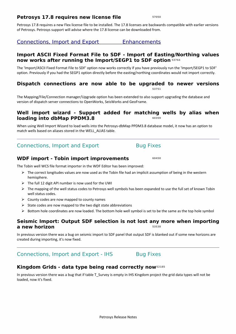
Petrosys 17.8 requires new license file 57050
Petrosys 17.8 requires a new Flex license file to be installed. The 17.8 licenses are backwards compatible with earlier versionsof Petrosys. Petrosys support will advise where the 17.8 license can be downloaded from.
Connections, Import and Export Enhancements
Import ASCII Fixed Format File to SDF - Import of Easting/Northing valuesnow works after running the Import/SEGP1 to SDF option 53764
The 'Import/ASCII Fixed Format File to SDF' option now works correctly if you have previously run the 'Import/SEGP1 to SDF' option. Previously if you had the SEGP1 option directly before the easting/northing coordinates would not import correctly.
Dispatch connections are now able to be upgraded to newer versions53751
The Mapping/File/Connection manager/Upgrade option has been extended to also support upgrading the database and version of dispatch server connections to OpenWorks, SeisWorks and GeoFrame.
Well import wizard - Support added for matching wells by alias whenloading into dbMap PPDM3.8 60359
When using Well Import Wizard to load wells into the Petrosys-dbMap PPDM3.8 database model, it now has an option to match wells based on aliases stored in the WELL_ALIAS table.
Connections, Import and Export Bug Fixes
WDF import - Tobin import improvements 60450
The Tobin well WCS file format importer in the WDF Editor has been improved:
➢ The correct longitudes values are now used as the Tobin file had an implicit assumption of being in the western hemisphere.
➢ The full 12 digit API number is now used for the UWI➢ The mapping of the well status codes to Petrosys well symbols has been expanded to use the full set of known Tobin
well status codes.➢ County codes are now mapped to county names➢ State codes are now mapped to the two digit state abbreviations➢ Bottom hole coordinates are now loaded. The bottom hole well symbol is set to be the same as the top hole symbol
Seismic Import: Output SDF selection is not lost any more when importinga new horizon 53538
In previous version there was a bug on seismic import to SDF panel that output SDF is blanked out if some new horizons are created during importing, it's now fixed.
Connections, Import and Export - IHS Bug Fixes
Kingdom Grids - data type being read correctly now52185
In previous version there was a bug that if table T_Survey is empty in IHS Kingdom project the grid data types will not be loaded, now it's fixed.
Petrosys Release Notes
Connections, Import and Export - OpenWorks Enhancements
Support added for reading Fault sticks from SeisWorks 2D interpretationprojects 60193
It is now possible to use fault sticks from SeisWorks 2D interpretation project connections for all options supported. e.g. Exchange/Fault sticks, Surface Modeling, 3D Viewer.
Previously you had to select a 3D seismic survey, which meant fault sticks were restricted to being read from SeisWorks 3D projects only.
Connections, Import and Export - OpenWorks Bug Fixes
Added optional environment variable to disable OpenWorks grid listcaching 59784
The PS_DISABLE_OW_GRID_CACHE environment variable is now checked when determining whether or not to re-query OpenWorks for the list of grids. If the PS_DISABLE_OW_GRID_CACHE exists, the grid list cache will be cleared each time Petrosys queries for the list of grids. This can be useful when working with OpenWorks data and wanting to work with the same new data in Petrosys.
Note: There is no change in the default behavior. By default, the grid list is still cached.
Connections, Import and Export - Paradigm-Epos Enhancements
Discontinued support for Paradigm 2011, 2011.1 & 2011.2 with EPOS 4.1Data Management 54489
Support for importing and direct display of Paradigm 2011, 2011,1 and 2011.2 with Epos 4.1 Data Management by Petrosys has been discontinued.
Currently supported versions of Paradigm are Paradigm 2011.3, 14, 14.1, 15 (Enterprise Linux 5+, Windows 7+) and 15.5 (Enterprise Linux 6+, Windows 7+).
Connections, Import and Export - Paradigm-EposBug Fixes
Paradigm fault sticks with data types containing space in between cannow be read successfully 59008
Paradigm fault sticks with data type names having space in it such as 'Time Migrated' can now be read.
Connections, Import and Export - Petrel Enhancements
Support for Petrel 2012 ceased 60080
Petrel 2012 is no longer supported. Petrosys continues to maintain support for Petrel 2013 through to Petrel 2016.
Supported Petrel 2016 53464
Petrosys connectivity to Schlumberger's Petrel now supports direct interaction with Petrel 2016.1.
Support for Petrel 2016.1 includes the ability to:
➢ Import Model grid horizons and 3D seismic interpretation horizons to a Petrosys grid file➢ Import faults from Model grids to a Petrosys fault file➢ Import 2D and 3D seismic navigation and horizon interpretation data to a Petrosys SDF➢ Directly display Model grid horizons, Input surface grids and 3D seismic interpretation horizons in Mapping
Petrosys Release Notes
➢ Directly contour Model grid horizon data and Input surface grids in Surface Modeling➢ Directly grid 2D and 3D seismic horizon interpretation data in Surface Modeling➢ Directly display, grid and import well data.➢ Directly display 2D seismic navigation and horizon interpretation in Mapping➢ Directly display 3D seismic bin grids in Mapping➢ Directly display Structural Model fault surfaces in 3DViewer➢ Directly display fault sticks in 3DViewer➢ Export Petrosys and other third party grids to Petrel
Petrosys continues to maintain support for connections to Petrel 2013.x., 2014.x, 2015.x
dbMap - Administration Enhancements
Added Formation Name to the list of columns on the formation codesreference table screen - Origin only 58602
Now display a Formation Name column in the admin panel for PPDM Formation Codes.
dbMap - Administration Bug Fixes
Fixed incorrect filename listed in error dialog when unable to writesqltype.plf or rpttype.plf 59128
When using the query administration tools and the system is unable to write either the sqltype.plf or rpttype.plf file, the error dialog now shows the correct file name.
MAPPING List/Well does not crash on dynamic mapsheet (with clip filter)any more 51947
In previous version there was a bug that Mapping crashed when list wells from a connection it's now fixed.
dbMap - Client Enhancements
dbMap Bin grid 'Define corner points' screen now calculates on the flydetails from the current survey 52722
Previously the dbMap Bin grid 'Define corner points' screen showed the values that were last entered by a user. Those numbers could have related to a different bin grid survey. The 'Define corner points' screen has been updated to now compute the corner points on the fly based on the current survey.
dbMap - Client Bug Fixes
dbMap 3D bin grid dialog label states the angle is relative to true north60167
On the dbMap bin grid header screen, the label for the rotation angle field has been updated to make clear the angle is relative to True north (as opposed to Grid north).
Improved accuracy when creating 3D seismic bin grids in dbMap 60184
When creating a 3D seismic bin grid in dbMap using the Define corner points option it now produces a more accurate result, as it takes the decimal places of the Easting/Northing values into consideration, and the storage of the origin latitude/longitude has been increased from 6 to 7 decimal places.
Petrosys Release Notes
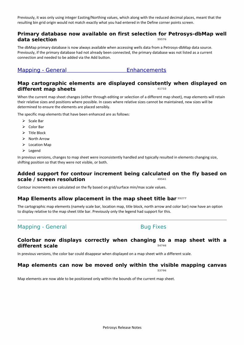
Previously, it was only using integer Easting/Northing values, which along with the reduced decimal places, meant that the resulting bin grid origin would not match exactly what you had entered in the Define corner points screen.
Primary database now available on first selection for Petrosys-dbMap welldata selection 59576
The dbMap primary database is now always available when accessing wells data from a Petrosys-dbMap data source. Previously, if the primary database had not already been connected, the primary database was not listed as a current connection and needed to be added via the Add button.
Mapping - General Enhancements
Map cartographic elements are displayed consistently when displayed ondifferent map sheets 41733
When the current map sheet changes (either through editing or selection of a different map sheet), map elements will retain their relative sizes and positions where possible. In cases where relative sizes cannot be maintained, new sizes will be determined to ensure the elements are placed sensibly.
The specific map elements that have been enhanced are as follows:
➢ Scale Bar➢ Color Bar➢ Title Block➢ North Arrow➢ Location Map➢ Legend
In previous versions, changes to map sheet were inconsistently handled and typically resulted in elements changing size, shifting position so that they were not visible, or both.
Added support for contour increment being calculated on the fly based onscale / screen resolution 49541
Contour increments are calculated on the fly based on grid/surface min/max scale values.
Map Elements allow placement in the map sheet title bar 55277
The cartographic map elements (namely scale bar, location map, title block, north arrow and color bar) now have an option to display relative to the map sheet title bar. Previously only the legend had support for this.
Mapping - General Bug Fixes
Colorbar now displays correctly when changing to a map sheet with adifferent scale 54746
In previous versions, the color bar could disappear when displayed on a map sheet with a different scale.
Map elements can now be moved only within the visible mapping canvas53796
Map elements are now able to be positioned only within the bounds of the current map sheet.
Petrosys Release Notes
Mapping - GIS, Spatial and Culture Bug Fixes
Mapping report export to Excel now correctly writes numbers as numericdata in Excel 60860
A bug was introduced in 17.7sp3 where exporting to Excel from a list or a report was writing numbers formatted as string data. This is now fixed and numeric data in Petrosys is now correctly interpreted by Excel as numeric data.
Drawing Tools Lines - Arrow heads drawing improved when using thick linestyles 28700
The Mapping 'Display/Drawing Tools/Curve' option renders arrow heads with thick lines in a much improved manner. Previously the arrow head point could have had the line extend through it making the arrow head look blunted or just look very odd.
Mapping - Grids, Surfaces and Sampled Data FilesBug Fixes
Contour label drawing checking and progress bar improved 56821
Contour display includes some processing to determine the optimum position for the contour labels, which can take a little time depending on how many labels need to be positioned and drawn. This has been improved:
➢ invalid parameters now produce an error (such as a label size of 0)➢ the progress bar includes a hint that contour label and/or size may have an impact on processing time
Mapping - Map Sheets Enhancements
Mapping includes new options to resize the current map sheet 58054
Mapping includes new options to resize the current map sheet:
➢ increase by 10%➢ increase by 100%➢ resize to an interactively selected sub-region of the current map sheet
These options are available under the Mapping/Map Sheet/Resize menu.
Mapping - Wells Enhancements
Added a link to dbMap/Web Records Management page from desktopmapping wells RMB menu 59383
For dbMap/Web clients, a link has now been added to the desktop mapping application's context-sensitive menu for wells which will open the dbMap/Web records management page for the given well.
Mapping - Wells Bug Fixes
Well monthly production graphing now allows to filter years greater than2000 58552
When filtering production data in the monthly production chart using View/Preferences, the date filter now allows years greater than 2000.
Petrosys Release Notes
Spatial Data Translator Enhancements
Spatial Data Translator allows data without a spatial component to beloaded to dbMap culture 58718
In previous versions, the Spatial Data Translator only supported importing data that contained a spatial component (i.e. a valid point, line or polygon). This restriction has been removed when dbMap culture is selected as the output.
The Excel and Text file input sources, include a new checkbox ("This data source does not have coordinate columns") in the "Define Format" dialog to indicate that the source file does not have any spatial data.
Spatial Editor Enhancements
Spatial Editor allows editing of Petrosys grid files 36730
The Spatial Editor has been enhanced to allow editing of Petrosys grid files. This includes editing of corresponding contours, faults and clipping polygons, which are linked together with the grid.
Two different methodologies of editing are supported:
➢ Direct manipulation of grid nodes - including smoothing, adjusting grid values via edit circle or polygon and interpolation of missing values by regridding
➢ Contour based editing - contours are generated on the fly from the grid and can then be edited using exist means. The areas that have been modified are automatically tracked and the change portion of the grid can be updated via a localised regrid.
In both methods, faults and clipping polygons can be edited and applied to the grid when required
This new functionality supercedes the grid editor available in previous versions.
Faults displayed in the Spatial Editor have fault symbols enabled bydefault 58259
In previous versions, faults symbol display had to be enabled manually for each new fault layer displayed.
Surface Modeling - Contouring Enhancements
Added scripting function that will return if particular task isenabled/disabled 58285
Added scripted function that returns whether a particular task is enabled/disabled.
Surface Modeling - Exchange Bug Fixes
Import of XYZ points to grid option re-written with more powerfulscanning engine 26839
Scanning algorithm has been optimized to make it more robust, tolerant to data variations.
Also accuracy of estimates is increased, and also there is some mild increase of performance.
Surface Modeling - General Enhancements
Added scripting function that returns date in a given format 51150
Added scripting function that returns date and time strings. The output format is configurable by the user.
Petrosys Release Notes
Ability to script ColorBar axis label in the template DBM 59068
Tools DrawMap option allows scripting of axis for Color Bar map elements layers.
Added ability to enable/disable scripting for individual parameters in thescripting panel 57169
Added ability to enable/disable field scripting without the need to delete the script.
Added ability to script color gradient (fixed range) min and max fields57195
Tools DrawMap option allows scripting of color gradient (fixed range) min and max range for Grid/Colorfill layers.
Added ability to script displaylist group names within the template DBM57194
Tools DrawMap option allows scripting of group names that appear in the display list.
Added ability to script title block fields within template DBM 57193
Tools DrawMap option allows scripting of title block mapping element layers.
Added ability to script WDF file name in the Grid/Back Interpolate/WDFtask 58887
Grid/Back Interpolate/WDF makes the WDF file name available for scripting.
Added indication of scripted parameters in task panels, allowing toenable/disable scripting 57172
Added scripting parameters indication on task panels with colored highlighting box. The scripting status (enabled/disabled) can be altered via CTRL+SHIFT plus mouse left click on the field. The highlighting line width can be set via Tools/Configurationunder Surface Modeling.
Added scripting function returning user name(ID) 57177
Added scripting function returning user ID on the system.
Added scripting function that translates searched values to replacedvalues 59134
Added scripting function 'translate' that allows to substitute a single string into another single string based on a one-to-one substitution list.
Added scripting function to return WDF units 59319
Added scripting function that returns the well data file (WDF) units.
Added scripting support for enabling/disabling template DBM groups58287
Tools DrawMap option allows scripting of group names activities that appear in the display list. That is the group can be scripted to be ON or OFF.
Added task to create well attribute for given WDF 58658
Added new menu option for creating WDF attributes for a given WDF file. The option is under Tools/Create WDF Attributes.
Petrosys Release Notes
Added Time Depth Trend conversion task 57199
Time Depth Trend Conversion method has been added. It is located under /Velocities/Well Time Depth Trend Conversion menu option. The method creates a trend based on the input data points from time grid and well data. The trend can be thenused for time-depth conversion.
Exposed contour and grid increments to be scriptable fields inTools/DrawMap 60229
Tools DrawMap option allows scripting of grid and contour increments for Grid/Colorfill layers.
Surface Modeling - General Bug Fixes
Tools DrawMap - map sheet list is now updated when mapsheet filechanged during interactive prompt 60001
The Tools/DrawMap task updates the list of map sheet names when the map sheet file is changed during interactive prompt screen.
Scripting function getFilePath returns correct path delimiter on Windowsand Linux 52447
Scripting function getFilepath returns correct 'slash' in the file path string.
Added tooltips for scripted parameters in task panels 59854
The scripted task parameters generate tool tips with scripting information on task panels if the user hover over a scripted field for a prolonged time.
Grid intersections are now calculated when both well track start and endpoints are outside the grid extent 57437
When calculating well path or fault sticks intersections with grids, no intersection was calculated when both the beginning and end of the intersecting path segment was located outside the grid extents. A valid intersection is now returned.
Grid/Statistics now returns correct values when run without opening thetask 59972
Grid statistics task returns correct values when run without opening the task.
Long scripting prompts are displayed in full length60064
Long prompt labels for interactively scripted fields are fully displayed across multiple lines.
Surface Modeling no longer crashes after File/New or File/Quit is selected60734
Surface Modeling does not crash when running File/New or File/Quit menu options.
Surface Modeling - Gridding Enhancements
Added cross plot data analysis to KED 57188
Kriging with external drift has been extended with a cross plot data analysis.
Petrosys Release Notes
Surface Modeling - Gridding Bug Fixes
Grid/Create/[Grid|WellTie|Phantom] tasks have BOTH fault type optionavailable on fault tab 55995
Grid/Create Grid, WellTie, Phantom tasks have fault type BOTH available on fault tab when using faults for gridding.
Surface Modeling - Volumetrics Enhancements
Volumetrics report exports depth and area pairs to separate CSV filesbased on the report file name and the selected polygon names 44121
Volumetrics reporting offers export of depth and area pairs in .CSV format.