Page 1
12�
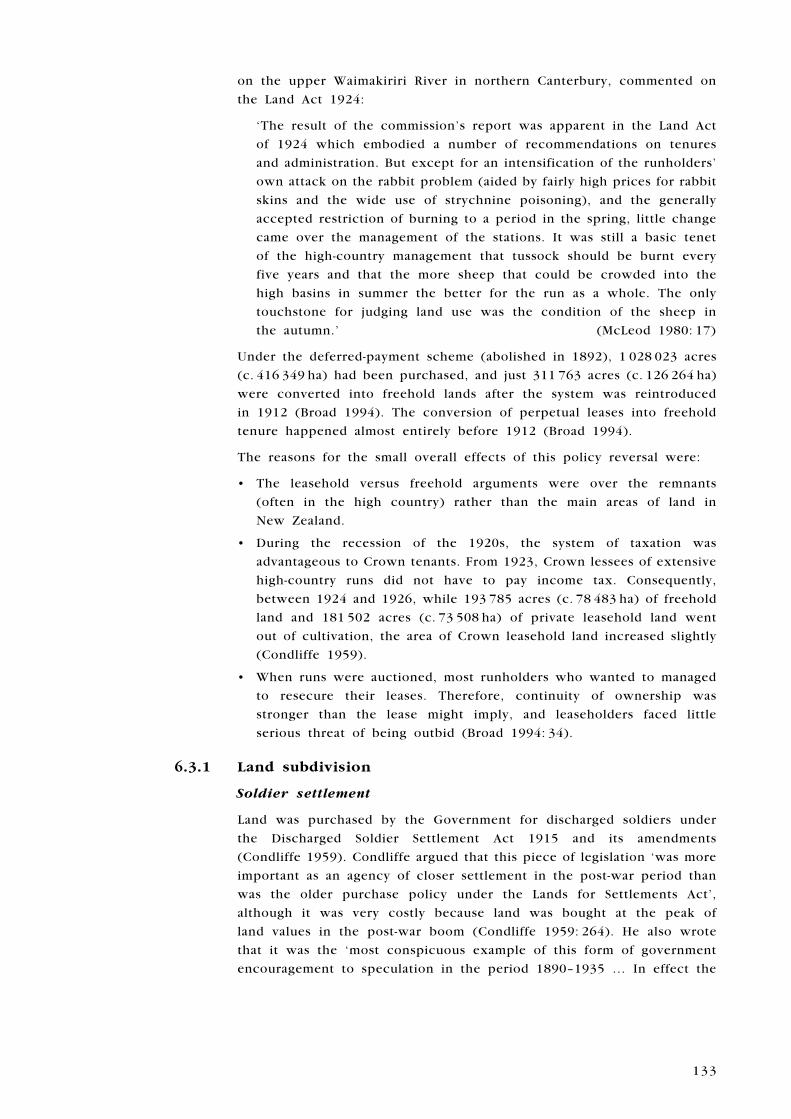
soon to go as well (Pinney 1981). The stations that would evolve out
of Benmore and the Otago part of Lake Ohau Station by 1976 were:
Benmore, Peak Valley, Ben Omar, Totara Peak, Glencairn, Glenbrook,
Buscot, Willowburn, Riverside, Gleneyrie, Ohau Downs, Shelton
Downs, Tarnbrae, Bendhu, Quailburn Downs, Claycliffs, Ahuriri Downs,
Birdwood, Ribbonwood, Quailburn, Avoca, Lake Ohau and Huxley Gorge
(Pinney 1981) (Fig. 21).
6.2.8 Tourism
High-country recreation began in the 1880s (with the construction of
the Hermitage Hotel) and gradually expanded through to the years of
the Second World War (Historic Resources Directorate 1997). Visitors
from New Zealand and overseas began travelling to remote areas to
sightsee or to go tramping, mountaineering, skiing or hunting. The
Government became involved in the formation of national parks, private
businesses sprang up specialising in backcountry recreation and clubs
were established (Historic Resources Directorate 1997). Specialist facilities
such as hotels, huts, tracks and bridges were built to foster tourism in
the high country.
���������
����������
������������
�������
�����������
�����������
����
���
�����
�����������
����������
��������
���� �����
���������
���
���
�����
���
����
�����
�����������
������
������ ���������
���������
���������
�������
�����
��������
��
��
��
�����������
���������
� �����
Figure 21. Some subdivisions of Benmore
Station, after Pinney (1981).
Page 2
130
In 1895, the Government bought out the Hermitage Hotel and operated
it until 1922 (Grey 1994). In 1910, skiing was introduced to glacier
excursions (Grey 1994). exotic game animals, such as chamois and
Himalayan tahr, were introduced for hunting (Grey 1994). In 1922, the
Government rented the hotel to the Mount Cook Motor Company, and
in 1935 an airstrip was built (Grey 1994).
Milford Track in Fiordland was built in the early 1890s (Historic Resources
Directorate 1997). Benches, bridges and huts were constructed and the
Government operated boat services to provide access (Historic Resources
Directorate 1997). Glade House was built there in 1896 (Historic Resources
Directorate 1997). At Mount Cook, Ball Hut was built c. 1890, and Malte
Brun Hut, at a higher altitude, in 1898 (Historic Resources Directorate
1997). The only remains of the original Ball Hut, which was swept away
by an avalanche in 1925, is a floor slab on the hillside slightly above the
present-day shelter (Historic Resources Directorate 1997).
6 . 3 L A N D T e N U R e
Possibly the first major debate over water rights in New Zealand took
place between 1900 and 1919 (Roche 1994). This was directly relevant to
the Central Otago high country. Geographer Michael Roche wrote that:
‘More capital-intensive gold-mining, using dredges, was pouring sieved
river gravels back into the stream bed, disrupting channel flows and
discolouring water for downstream farm users. On one side of the
debate were the miners, their rights backed up by a raft of state
legislation which facilitated resource exploitation; on the other side
were the farmers, whose common law riparian rights the courts tended
to uphold.’ (Roche 1994: 17)
The economic decline of the mining industry was matched by a decline
in its political and legal power.
The River Commission of 1919–20 investigated the issue of damage caused
by mining, which still affected the Taieri, Maerewhenua and Clutha Rivers
(Roche 1994). The value of gold extracted was now far below the costs
incurred through flooding, and the mining industry bore none of the
costs. Until the Mining Act 1926 was passed, water rights legislation
was piecemeal and drawn up in response to problems as they occurred
(Roche 1994).
William Massey, who was the Reform Prime Minister from 1912 until
his death in 1925, was elected on a platform of granting the freehold
option to Crown tenants, many of whom were on South Island high-
country land (Condliffe 1959). He immediately picked up the portfolio
of Lands and soon carried the Land Laws Amendment Act 1912, which
made lease-in-perpetuity lands purchasable on terms favourable to the
tenants (Condliffe 1959).
Almost every year through to 1935, the principle of the freehold was
gradually extended by amending the Land Act (Condliffe 1959). With
Page 3
131
some restrictions, the National endowment Lands on the eastern side
of the South Island high country were also opened to purchase by the
tenants over that period (Condliffe 1959). Simultaneously, the Government
attempted to liberalise the conditions of the pastoral leasehold tenures
that affected much of the high country.
Predatory farming (encouraged by short leases) and insufficient
compensation for improvements attracted heavy political and public
criticism (Condliffe 1959). Both production and value of pastoral
runs, most of which were in the high country, had declined. Almost
10 million acres (4.05 million ha) of land were currently returning on
average only 2.32 pence per acre (Condliffe 1959). Leasehold lands
were overstocked, rabbits ran rampant, pastures were in poor condition,
burning off was done at the wrong times of the year, and erosion and
denuding of the hillsides occurred (Condliffe 1959). Otago had the largest
area of high-country pastoral leasehold land, and population growth there
was slow (Condliffe 1959).
The Royal Commission of 1920, which investigated the problem of
deteriorating pasture, made a number of recommendations with regard
to the Land Laws Amendment Act 1907 and subsequent amending acts,
advising that they be reconstructed as they had indirectly caused the
deterioration of high-country pastures ‘to the detriment of both the State
and the lessees’ (Sadd et al. 1920: 9). According to Sadd et al. (1920),
the Commission strongly suggested that:
The 21-year tenure provided by the 1907 Act was too short to make
improvements and develop pasture, and should be increased to
35 years with the right of renewal
After 7 years had passed, the lessee might have the option of acquiring
the fee simple (land with unrestricted rights of disposal)
National endowment Lands should not be converted to freehold land
unless an equivalent piece of land was substituted
All leases of pastoral land should be offered for selection by ballot in
order to put the residential obligations of pastoral runs on the same
basis as those for small grazing runs
Suitable properties should be subdivided
These conditions should apply to all renewals or licenses, and all the
Land Acts should be consolidated
With regard to occupation, cultivation, stocking and improvement of
Crown pastoral lands, the commissioners advised that none should be
held by any public or private registered companies or absentees: ‘Personal
residence where possible … is absolutely essential to true settlement,
and also ensures better management and greater productivity of the
pastoral holdings’ (Sadd et al. 1920: 10). They also recommended that the
land should be ‘spelled’ when necessary and no more than three crops
should be taken from the same land in succession. At the time, very
little was known about the actual regrassing or improving of depleted
and deteriorated lands, and the commissioners urged that experiments be
conducted in these areas (Sadd et al. 1920). At that time, the Department
•
•
•
•
•
•
Page 4
132
of Agriculture was studying grasslands on a small scale to understand
their destruction and restoration. The commisioners thought that this
work should be expanded (Sadd et al. 1920).
The commissioners gave specific advice on getting rid of rabbits and
surface sowing. For disposing of rabbits, they recommended: rabbit
netting provided at cost price by the Government; poisoning; the use of
dogs, ferrets and guns; digging out; the protection by law of all natural
enemies; the breeding and liberation of ferrets and cats; and fumigation
(Sadd et al. 1920). Few data were available concerning surface sowing
on mountains above 500–700 m in altitude. Although the Department of
Agriculture was conducting experiments to find out if it was possible to
regrass extremely denuded country at 300–700 m, it was too early to offer
suggestions (Sadd et al. 1920). The commissioners felt that far more could
done with regard to growing winter crops on high-country sheep stations,
and they suggested that cocksfoot, red clover and probably lucerne should
be grown (Sadd et al. 1920). Tussock burning should continue in order to
provide a seed bed (in the ashes)—but only in the spring. They stressed
that ‘in supporting burning, it must be understood that we are altogether
opposed to indiscriminate burning. Burning, indeed, requires carrying
out with the utmost discretion’ (Sadd et al. 1920: 20). They observed that
spelling and exclusion experiments were being conducted in the depleted
lowlands of Central Otago, and within special enclosures ‘in the plantations
at Galloway and Omarama, and in the Agricultural Department’s earnscleugh
experimental area near Clyde, there has been truly remarkable regeneration’
(Sadd et al. 1920: 19). In advocating the use of introduced predators
and even limited burning, they revealed themselves to be men of their
times, with their focus on pragmatic farming considerations rather than
environmental issues.
Geographer Michael Roche commented that:
‘Like many commissions of inquiry, the investigation of the Southern
pastoral Lands Commission had only limited impact. However, it
reflected prevailing attitudes, especially the denial that fire was really
a problem. Indiscriminate burning was rejected, but on balance the
commissioners accepted farmers’ arguments that burning improved and
sustained the tussock grasslands, despite the views of Cockayne and
others. The affirmation of farming practice reflects the vested position
and political influence of pastoralists at this time; it also conceals the
financial imperatives they faced for maintaining production, in that
some mortgage agreements specified the retention of high stocking
levels as a condition of the loan.’ (Roche 1994: 27)
Based on this report, legislation was introduced in 1921 and 1922,
extending the right of freehold purchase to all South Island high country
held under short-term leases, but ironically little advantage was taken of
this legislation (Condliffe 1959). economic circumstances had changed.
The Land Act 1924 introduced 35-year renewable terms for pastoral
leases, extending the 1913 provisions for 21-year renewable terms
(Broad 1994). David McLeod, runholder at Grasmere and Cora Lynn Stations
Page 5
133
on the upper Waimakiriri River in northern Canterbury, commented on
the Land Act 1924:
‘The result of the commission’s report was apparent in the Land Act
of 1924 which embodied a number of recommendations on tenures
and administration. But except for an intensification of the runholders’
own attack on the rabbit problem (aided by fairly high prices for rabbit
skins and the wide use of strychnine poisoning), and the generally
accepted restriction of burning to a period in the spring, little change
came over the management of the stations. It was still a basic tenet
of the high-country management that tussock should be burnt every
five years and that the more sheep that could be crowded into the
high basins in summer the better for the run as a whole. The only
touchstone for judging land use was the condition of the sheep in
the autumn.’ (McLeod 1980: 17)
Under the deferred-payment scheme (abolished in 1892), 1 028 023 acres
(c. 416 349 ha) had been purchased, and just 311 763 acres (c. 126 264 ha)
were converted into freehold lands after the system was reintroduced
in 1912 (Broad 1994). The conversion of perpetual leases into freehold
tenure happened almost entirely before 1912 (Broad 1994).
The reasons for the small overall effects of this policy reversal were:
The leasehold versus freehold arguments were over the remnants
(often in the high country) rather than the main areas of land in
New Zealand.
During the recession of the 1920s, the system of taxation was
advantageous to Crown tenants. From 1923, Crown lessees of extensive
high-country runs did not have to pay income tax. Consequently,
between 1924 and 1926, while 193 785 acres (c. 78 483 ha) of freehold
land and 181 502 acres (c. 73 508 ha) of private leasehold land went
out of cultivation, the area of Crown leasehold land increased slightly
(Condliffe 1959).
When runs were auctioned, most runholders who wanted to managed
to resecure their leases. Therefore, continuity of ownership was
stronger than the lease might imply, and leaseholders faced little
serious threat of being outbid (Broad 1994: 34).
6.3.1 Land subdivision
Soldier settlement
Land was purchased by the Government for discharged soldiers under
the Discharged Soldier Settlement Act 1915 and its amendments
(Condliffe 1959). Condliffe argued that this piece of legislation ‘was more
important as an agency of closer settlement in the post-war period than
was the older purchase policy under the Lands for Settlements Act’,
although it was very costly because land was bought at the peak of
land values in the post-war boom (Condliffe 1959: 264). He also wrote
that it was the ‘most conspicuous example of this form of government
encouragement to speculation in the period 1890–1935 … In effect the
•
•
•
Page 6
134
Government turned loose in the real estate market 22,792 new purchasers
armed with £23,570,491 of borrowed money’ (Condliffe 1959: 276).
Land speculation that had begun with the return of prosperity in the
mid-1890s had been spurred further by the decline of leasehold tenure.
During the First World War, speculation became a form of gambling
(Brooking 1996). The last attempt at closer settlement in the South Island
high country took place in the Mackenzie Basin, which has some very
dry areas. Between 1910 and 1920, several ambitious subdivisions were
established, including those for soldier settlements (Broad 1994). The
original 24 runs swelled to 45, but eventually, through amalgamation and
partition, the Mackenzie Basin would revert to containing close to the
original number of runs (Broad 1994).
The property market
Between 1890 and 1935, there was a strong trend among freeholders
towards subdivision and closer settlement (Condliffe 1959). In times
of escalating prices, speculation in land became frenzied—few farmers
or runholders could resist the lure of rising prices. Condliffe wrote:
‘In the Dominion it was the trafficking in rural land which was the
outstanding characteristic of rural organisation on the freehold tenure’
(Condliffe 1959: 275). During the time of rising prices before, throughout
and immediately following the First World War, speculation was more
pronounced than after 1921, when land values began to fall:
‘The inevitable result was that in a time of violent speculation, such
as followed the First World War, there was a clear tendency for the
creditor class to take an increasing share of the returns from farming.
The freeholder, under such circumstances, exchanged the landlord for
the mortgagee … Only those who had viewed farming as a permanent
productive business and the rise and fall of land values as windfall
gains and losses were on a sound economic basis.’
(Condliffe 1959: 277–278)
6.3.2 Kai Tahu
The First World War of 1914–18 stopped any further consideration of the
Kai Tahu Claim. In 1918, Judge W.e. Rawson of the Native Land Court
completed a report announcing that, in order to qualify for a grant of
land under the South Island Landless Natives Act 1906, claimants had to
be landless descendants of those Maori who had ceded their land to the
Crown, and to have been born before 31 August 1896 (evison 1993: 482).
More than 100 Kai Tahu proved they were eligible and applied for land,
but did not receive any because all available and suitable blocks were
used for soldier settlement. Instead, claimants were paid an average of
13 shillings and threepence per acre (evison 1993). Kai Tahu historian
Harry evison wrote:
‘The Government thus revealed the true market value of the 1906
South Island Landless Natives Act grants to Ngai Tahu. It was tacitly
acknowledged that after more than thirty years of parliamentary
campaigning for the Ngai Tahu Claim, and an official acknowledgement
Page 7
135
that a substantial grant of land was justified, all that the average
landless adult Ngai Tahu had got for his claim was £33/2s/6d or its
equivalent in wasteland—enough perhaps to buy five or six acres of
average farmland.’ (evison 1993: 482)
In 1921, Kemp’s Purchase was again investigated by a Royal Commission.
The Commission’s report criticised the inadequacy of Mantell’s reserves
and the 1868 proceedings of Chief Judge Fenton, and declared that the
South Island Landless Natives Act had been no solution to the Kai Tahu
claim (evison 1993). Since no land was available, not even in the high
country, it recommended a payment of £354,000 as compensation for
the unfulfilled promises in Kemp’s Deed, based on the price per acre
that had been paid for the Otago Purchase in 1844, as well as 72 years’
interest at 5% (evison 1993).
However, by this time few Pakeha New Zealanders took Maori claims
seriously (evison 1993). The Kai Tahu claim made no progress for
20 years after the Royal Commission’s Report of 1921 (evison 1993).
6 . 4 S U M M A R y
6.4.1 General historical features
Depredation of high-country tussock land by rabbits
Invasion of high-country tussock land by indigenous and exotic plants
unpalatable to stock
Spread of pests such as the grass grub
Burning off of mountain tussock
erosion of mountain slopes and formation of shingle slips because of
burning off, depredation by rabbits, over stocking, continuous grazing
and short-term leases
Desertification of driest high-country areas
Declining sheep returns
Development of crossbred flocks and relative decline in the merino
Declining productivity from the 1920s
Planting of orchards and plantations on depleted areas
Construction of irrigation systems and use of old mining water races
for irrigation
Irrigation schemes made dairying possible in some areas
expansion of close settlement
establishment of soldier settlements after the First World War
Setting up of experimental plots and plantations by the State and
private enterprise to assist the farming industry
Sowing of exotic grasses
Initiation of hydroelectric power network
Cultivation of crops such as oats, turnips and lucerne for animal feed
and/or to replenish the soil
•
•
•
•
•
•
•
•
•
•
•
•
•
•
•
•
•
•
Page 8
136
Continuing expansion of road and rail grids, and metalling of some
roads
Increasing use of traction engines, water-powered mechanical devices,
internal combustion engine and electricity
Further subdivision of high-country estates
Growing State involvement in high-country recreation, and construction
of huts, hotels, tracks and bridges
Declining importance of extractive industries
6.4.2 Key physical resources
Traction engines
Cars, lorries and tractors
Water-powered shearing machines, chaff cutters and saws
Hydroelectric plants
Hydroelectric dams
experimental farms and plantations
Subdivided estates
High-country huts, hotels, tracks and bridges
•
•
•
•
•
•
•
•
•
•
•
•
•
Page 9
13�
7. 1935–1948: High-country management and the soil conservation movement
7 . 1 L A N D S C A P e M O D I F I C A T I O N
Problems caused by burning, overstocking and continuous grazing of
sheep without improvement, rabbits, and insecurity of tenure persisted
in the high country. In addition, there were concerns over damage to
pastoral grasslands by introduced weeds and noxious animals, and the
intrusion of wilding trees into the landscape (Dominy 2001). In the early
1940s, historical geographer K.B. Cumberland observed that occupation of
the South Island tussock high country had accelerated normal geological
soil creep in regions of high frequency of freeze and thaw and induced
landslides. In Central Otago, the diggers’ hydraulic sluices had ‘shifted
the matted tussock cover and with it the surface soil to give birth to
ever-extending gullies’ and, in areas of lowest precipitation, tussock
grassland had been reduced to semi-desert dominated by scabweed
(Cumberland 1944: 159). He explained that:
‘... the tussock ranges were stocked with increasing intensity while their
carrying capacity decreased. In addition, annual haphazard burning,
rabbit infestation, and the spread of tussock insects have assisted in
depleting, if not destroying, tussock species. Surface organic waste
has often disappeared. Wind velocity is no longer effectively restricted
at the soil surface. Moisture conservation by vegetation is reduced
and the ground bared. Humus content of soil is diminished. On open
plains and sunny hill faces this has led to accelerated wind and frost
erosion and on higher mountain slopes to increased down-hill creep
of “shingle slips” and mantles of wasting Steinfelder.’
(Cumberland 1944: 160)
Canterbury runholder David McLeod, with C.L. Orbell, bought the
Grasmere and Cora Lynn Stations on the upper Waimakariri River in
1930. He wrote that when he took over Grasmere in May 1930, he:
‘... had no other task than to perpetuate the traditional system of
management, making use of every available square yard, however
rugged or inaccessible, and of every plant that sheep would eat, no
matter what its value might be to the environment as a whole. In this
endeavour I spent the first ten years, struggling against the economic
disasters of the early thirties and slowly coming to realise the part
that depletion and nutrition played in that struggle.
‘The following thirty years passed in a slow readjustment to the realities
of the situation not only in the case of my own treasured home but
in the wider sphere of the high country as a whole, where our own
situation was duplicated all down the Southern Alps from Marlborough
to Southland. During this time our knowledge slowly increased, not
Page 10
13�
only through studies of the soil, plant and animal relationships of the
present and future but through searching back through the past for
the history of our country.’ (McLeod 1980: 17–18)
7.1.1 Rabbits
In Kaikoura at the time of the First World War, runholders had already
been losing the battle against rabbits in the back country, particularly
on Kekerengu Station (Sherrard 1966). The situation worsened with the
shortage of labour and the abandonment of Bluff Station to the scourge.
In 1920, a full-scale eradication programme was resumed and, although
on Clarence Reserve gangs were destroying 100 000 rabbits each year,
they could not wipe them out (Sherrard 1966). Annual rabbit skin returns
exceeded those from wool (Sherrard 1966). Simultaneously, across the
river, W.S. Bennett, A.J. Murray and P.J. Halligan attempted to recover
Bluff Station (Sherrard 1966). Rabbits had turned the land into a desert,
except for matagouri bushes, and even these had been stripped of
their bark. Nine men rabbited, fenced and sowed seed, and pack teams
carted food, fencing material and tons of grass seed up the 50-mile
(c. 80.5-km) track (Sherrard 1966). The seed was mixed on site and
sown by hand, and between 1921 and 1930, 8000 acres (3240 ha) were
regrassed. Unfortunately, just as rabbit numbers began to decline, the
economic depression of the 1930s and the Second World War (1939–45)
forced retrenchment (Sherrard 1966).
At Grasmere and Cora Lynn during the war, McLeod also struggled:
‘With most able-bodied countrymen away at the war the labour-
intensive job of rabbiting became almost impossible and the catchment
boards were well aware that they could never cure depletion and
erosion as long as large areas of the country were overrun with this
insidious pest. It was not until the Killer Rabbit Boards were formed
and the trade in skin and carcase abolished that any progress was
made and that was against the bitter opposition of a lot of people—
runholders among them—who had had a very satisfactory income from
the vermin.’ (McLeod 1980: 47)
The three ‘killer boards’ that speeded rabbit destruction were: the
Marlborough east Coast Rabbit District (1926); the Kekerengu Board
(1946); and the Conway Rabbit Board (1949). The Conway Board
especially achieved dramatic results by poisoning, fumigating, trapping,
and the use of dogs and guns. In the first 2.5 years, 51 469 rabbits
were killed above ground and probably three times that number were
fumigated (Sherrard 1966).
The rabbit population was finally reduced to manageable numbers
with the use of the aeroplane and 1080 poison after the war (McLeod
1980). In the dry areas of the Mackenzie Country and Central Otago,
this combination was the most effective means of restoring the land
(McLeod 1980). By 1956, the prohibition of the sale and export of rabbit
skins was to put another nail in the rabbit coffin (McCaskill 1973).
Page 11
13�
7.1.2 Other pests
Wild cattle, deer, pigs, goats and Canadian geese also caused problems
on the South Island high-country stations (McCaskill 1973). In the late
1920s, botanist Leonard Cockayne pointed out that, whereas deer and
forests in other parts of the world had been closely associated for a
long time, in New Zealand the forests had developed in the absence of
grazing and browsing mammals. Deer were a new and destructive pest to
New Zealand, and beech forests in the high country were in danger of
being turned into fields of debris and barren ground. As a consequence,
water would cascade down the bare slopes after each rainstorm, taking
with it masses of stone, gravel and clay to smother the fertile, arable
lands below and causing flooding in the rivers. He asked whether the
protection of deer and other pests should be allowed to cause such havoc
(Cockayne 1926, 1928, cited in McCaskill 1973: 178).
By 1935, Lake Coleridge Station was ‘infested’ with wild cattle, and in
spring the musterers Peter Newton and Jim Binnie were hired to ‘clean
them out’:
‘Our agreement was to get what we could out alive and shoot the rest.
They were cattle that had been hounded about many times in abortive
attempts to muster them in, and they were as wild as deer. Living as
they did in bush-bound country up rough creeks, it was no easy task
and as Jim and I had had no experience of real wild cattle, we had
to learn by our mistakes as we went. The cattle of course were fifty
per cent. bulls, some of them hoary and crusty old gentlemen who
had to be given a fairly wide berth unless one was astride a pretty
good sort of horse.’ (Newton 1953: 97)
In November that year, Newton went over to Mount White Station. He
described the wildlife in this ‘way back’ station:
‘I had never seen deer in such numbers and the esk Valley harboured
hundreds of wild pigs. The headwaters of all the rivers were the
haunts of wild cattle, and the Lochinvar lagoons were prolific breeding
grounds for Canadian geese. And even the nimble little chamois were
then working their way north over those tops.’ (Newton 1953: 108)
Newton stayed at Mount White for 3 years and while he was there
government deer cullers came for a season. Although the weather was
bad, the cullers killed 3000 deer. One of them stayed on for a further
year and killed another 1200 (Newton 1953).
Mona Anderson explained the problem posed by Canadian geese at Mount
Algidus Station in the 1940s:
‘At that time it was illegal to kill them, but we caught them in dozens.
They bred on the station in hundreds and were an absolute pest. A
forty-acre paddock of turnips would be stripped bare by them as if
sheep had been feeding there for months. Besides eating the winter
feed, they polluted the paddocks so that the stock did not care to
feed where they had been.’ (Anderson 1963: 79)
Soon it became legal to kill geese, and the Government sent in cullers
to smash the eggs and shoot nesting birds (Anderson 1963).
Page 12
140
7.1.3 Weather
Weather was the perpetual wild card in the high country. At St Helens,
Marlborough, 11 000 sheep were lost during a disastrous snow storm that
blew in from the northwest during the winter of 1939, representing a
27% loss (McCaskill 1970). The Canterbury high country and foothills
were blanketed with snow. In 1945, another snowstorm came from the
southwest, covering the entire province of Canterbury (McLeod 1980).
The years 1946, 1947 and 1948 were very poor for lambing. The main
reason was bad weather in winter and spring, and in 1947 the Canterbury
high country was subjected to a freak summer storm (McLeod 1980). At
Grasmere, 1400 sheep were lost (McLeod 1980). Anthropologist Michèle
Dominy contended that runholders often made the link between weather
and market as:
‘... external forces against which control is futile and minor modification
possible, and speculate that the high country copes better than most
New Zealanders with economic crises because the are “geared for”
uncontrollable factors that characterize high-country history, such
as variable mountain-weather conditions, and boom-and-bust market
cycles.’ (Dominy 2001: 192)
7.1.4 Molesworth Station
The Crown took over Molesworth Station in 1938 because it had become
an ecological disaster area and uneconomic to run (McCaskill 1970). The
question of seeding the bare country was immediately considered, because
of the success at Bluff Station. experimental plots revealed that spring
sowing was best, and that cocksfoot was the main grass, with ryegrass,
white clover and red clover also present (McCaskill 1970). A programme
of sowing was initiated in September 1940, with 3622 pounds (c. 1643 kg)
of seed delivered to Molesworth. In 1940, the sheep were taken off, and
the station was restocked with 788 head of Angus-Aberdeen and Hereford
cattle (McCaskill 1970). (Lance McCaskill (1970) pointed out that this was
a case of history repeating itself, as in the early days of Molesworth and
Tarndale, only cattle were run.)
Wild deer, pigs and goats continued to denude Molesworth. In 1939, a
private shooter killed at least 700 deer, and there were large numbers
of goats in the Saxton and Severn Valleys and in the yeo Creek Block
(McCaskill 1970). Pigs were prolific in the Lake McRae-elliott Block.
The position became so serious that at the end of the war, when men
were released from duty, the Department of Internal Affairs made a
full onslaught on the problem using ex-soldiers as marksmen (McCaskill
1970). As every shooter got tallies of up to 1000, deer numbers receded,
to the extent that by 1946 it was possible to stock the Saxton country
with cattle (McCaskill 1970).
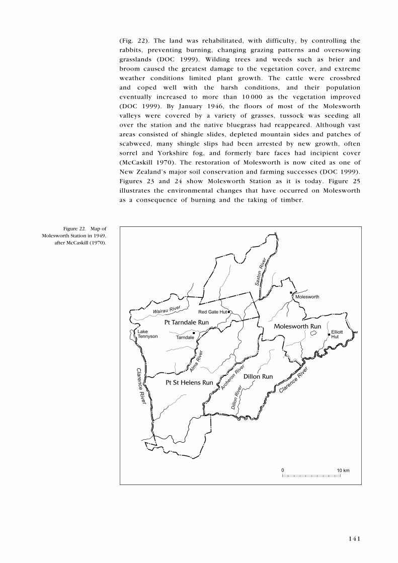
Between 1938 and 1949, Molesworth was amalgamated with Tarndale,
Dillon and St Helens Stations, when their leases were also surrendered
for similar reasons, to form one vast, remote station called ‘Molesworth’
Page 13
141
(Fig. 22). The land was rehabilitated, with difficulty, by controlling the
rabbits, preventing burning, changing grazing patterns and oversowing
grasslands (DOC 1999). Wilding trees and weeds such as brier and
broom caused the greatest damage to the vegetation cover, and extreme
weather conditions limited plant growth. The cattle were crossbred
and coped well with the harsh conditions, and their population
eventually increased to more than 10 000 as the vegetation improved
(DOC 1999). By January 1946, the floors of most of the Molesworth
valleys were covered by a variety of grasses, tussock was seeding all
over the station and the native bluegrass had reappeared. Although vast
areas consisted of shingle slides, depleted mountain sides and patches of
scabweed, many shingle slips had been arrested by new growth, often
sorrel and yorkshire fog, and formerly bare faces had incipient cover
(McCaskill 1970). The restoration of Molesworth is now cited as one of
New Zealand’s major soil conservation and farming successes (DOC 1999).
Figures 23 and 24 show Molesworth Station as it is today. Figure 25
illustrates the environmental changes that have occurred on Molesworth
as a consequence of burning and the taking of timber.
Figure 22. Map of Molesworth Station in 1949,
after McCaskill (1970).
������������ ��������
������������
����������
����������
������
����
���
��������������������������
��������������
��������
�����
���������������
������ �����
���
�������
���������
����
����
�����
������
�����
� �����
Sax
ton
Page 14
142
Figure 24. Aerial oblique of Molesworth Station: close view of station homestead
and other buildings. Photo courtesy of
Kevin L. Jones, DOC.
Figure 23. Aerial oblique of Molesworth Station: distant
view looking southwest. Photo courtesy of
Kevin L. Jones, DOC.
7 . 2 P H y S I C A L R e M A I N S
Canterbury historian W.H. Scotter (1965) believed that the years
1935–48 were a separate period in the history of New Zealand because
of the new developments in farming and industry and the election of
the first Labour Government, and that these changes were intensified by
the Second World War of 1939–45. In the high country, differences were
made by the increasing use of jeeps, motor lorries and limespreaders.
Topdressing began from vehicles in 1945 and from aeroplanes in 1949
(Scotter 1965).
Page 15
143
7.2.1 Population decline
Mechanisation and soil deterioration contributed to the loss of rural
inhabitants, who were also attracted to expanding urban centres by
job opportunities in the tertiary sector. For example, in Otago and
Southland, the population declined by c. 10 000 between 1936 and 1945
(McLintock 1975). While the population in urban areas rose by 3500,
that in rural areas actually fell by 13 500 (McLintock 1975). Historian
A.H. McLintock contended that ‘the decline in the rural population of
Otago indicates the gradual but steady exhaustion and deterioration of
the soil fertility’ and that ‘much of the wide expanse of Central Otago
has suffered by reason of soil deterioration’ (McLintock 1975: 752, 756).
7.2.2 Experimental plots
In 1920 and 1921, botanist Leonard Cockayne, a member of the 1920
Southern Pastoral Lands Commission, had fenced 12 rabbit-proof plots
on depleted country at an altitude of 300–1000 m between Cromwell
and Lowburn Ferry, and sown them with seed of various species of
pasture plants (McCaskill 1973). A committee of runholders and an
officer from the Department of Agriculture assessed the results and
found that no improvement of the high-country soil was possible without
subdivision, exclusion of rabbits and a regular system of spelling the land
(McCaskill 1973). His lead was followed in 1938, when the Department
of Agriculture began to supervise plant introduction trials on a 30-acre
(12.15-ha) area at Pisa Flat (McCaskill 1973). Through to 1951, a total of
350 species and strains were tested for their suitability for revegetating
semi-arid land (McCaskill 1973). In 1944, the Botany Division of the
DSIR started a project of observation and experiment at Molesworth
and Tarndale Blocks in Marlborough to discover which grasses and
legumes were useful in renovating the grasslands and to propagate them
(McCaskill 1973). Further experimental fenced enclosures were set up
Figure 25. Aerial oblique of Bush Gully on Molesworth
Station. In this western valley, rainfall was sufficient to
sustain a natural forest cover. The pattern of beech forest,
which was partially destroyed by fire and the taking of
timber, is still graphically marked on the landscape.
Photo courtesy of Kevin L. Jones, DOC.
Page 16
144
by the North Canterbury Board in 1948. These showed that where the
land was above c. 1000 m and/or the slope exceeded 30° and bare ground
exceeded 40% of the area, vegetation was unable to cover the bare ground
if sheep grazing continued (McCaskill 1973).
7.2.3 Sheep
The Government’s acquisition of phosphate-rich Nauru Island in 1919
and the mixing of sulphuric acid with the phosphate at fertiliser
plants dramatically boosted the supply of superphosphate to farmers
(Brooking et al. 2002). However, South Island high-country runholders
did not use superphosphate on any scale until aerial topdressing was
introduced in 1949 (Brooking et al. 2002). Consequently, there was not
a great increase in production between 1900 and 1950. While North
Island sheep numbers increased from 12.9 million to 19 million between
1910 and 1950, those in the South Island rose from 11.3 million to
14.8 million (Brooking et al. 2002).
In spite of the general increase in the number of sheep, merino
flocks declined. A government report stated that the substitution of
heavier and less hardy sheep
for merinos led to a fall in
the number of sheep in the
foothills of Canterbury (Scotter
1965). Half-breds declined too,
but crossbred flocks stayed
at around 3 000 000 (Scotter
1965). The main feature of the
years 1935–45 was the swift
rise in the number of Romneys
(Table 1).
BReeD 1935 1945
Romney 92 000 342 000
Merino 465 000 367 000
Corriedale 746 000 797 000
Half-bred 1 207 000 1 129 000
Crossbred 2 848 000 2 767 000
TABLe 1. NUMBeR OF SHeeP IN
CANTeRBURy IN 1935 AND 1945. DATA
TAKeN FROM SCOTTeR (1965) .
7.2.4 Wool
During the Second World War, the price of wool was controlled at what
was, according to farmers, a low level, averaging 12 pence to 14 pence
a pound (Scotter 1965). After the war, farmers returned to the auction
system of wool selling (McLeod 1980). World prices rose quickly for
all wools, and the demand for merino and fine crossbred wool after
years of restraint drove their relative value to a considerable premium
over coarser wools (McLeod 1980). The high country experienced its
most prosperous period yet. Timaru doubled its wool exports from
6000 tons in 1938 to 12 000 tons in 1950 (Scotter 1965). Maintenance
and development had been neglected for many years because of the war,
and much of the profit was spent on buildings, fences, manures and
seeds (McLeod 1980). Some runholders, like McLeod, built power plants
(McLeod 1980). The boom lasted for several years, until the Korean War
of 1950 escalated the demand further and prompted the Prime Minister
at the time, Sid Holland, to freeze a third of farmers’ wool receipts as a
hedge against inflation (McLeod 1980). The price of wool remained fairly
high throughout the 1950s (McLeod 1980).
Page 17
145
Higher wool and stock prices, new techniques, and the research services
provided by the Department of Agriculture and Lincoln College helped
to improve the management of the high country (Scotter 1965).
7.2.5 Woolsheds
Dominy (2001) wrote that the woolshed encapsulates the history of
the high-country sheep station, fusing farm and homesite. It was the
communal site for social activities, such as dog trials, family reunions,
dances and weddings. She suggested that:
‘The cultural significance of the woolshed may also derive from
the role it plays, like the yards and tailing yards, as a physical and
conceptual intermediate space between uncultivated pastoral land and
the homestead: as the ultimate container for the expansiveness of
stock activity and human labor, it is the physical site for harvesting
a product, the fleece, and for concentrating the labor force (farmers,
family, shearers and classer); and it is the conceptual site for distilling
the landscape and pastoral activities of the year into fleece.’
(Dominy 2001: 189)
The function of the woolshed as the station nexus did not change, and
during the post-war period of prosperity, many old woolsheds were
improved and new ones built.
7.2.6 Mustering
Mustering also continued throughout this period with little change.
Dominy studied the high-country tradition:
‘The seasonal use of extensive back-country tussock grasslands with
their low-carrying capacity most distinguishes high-country merino
farming from hill- and down-country farming. In autumn—either April
or May depending on a property’s altitude and latitude—sheep are
“mustered in,” brought from remote summer grazing country into
the station’s front country. Autumn-muster narratives predominate in
station and family histories, autobiographies, short stories, station and
farm verse, and novels… Such accounts tell us how essential mustering
is to the distinctiveness of high-country farming.’
(Dominy 2001: 167)
Dominy noticed that Canterbury runholder Peter ensor began his mustering
narratives by describing the front faces of Double Hill, Glenrock and
Glenariffe on the upper Rakaia River and also the back country, which
encompassed two-thirds of the combined properties (Dominy 2001).
He gave the altitudes of the main peaks and the two most significant
saddles—Macintosh’s at 1000 m, and Turtons at 1300 m. He and his two
brothers mustered in together. Later, their sons and other relatives and
neighbours did the same (Dominy 2001).
The traditional Double Hill autumn muster of the 1940s took six or
seven men with a packman and four horses 6 days to complete. ensor’s
narratives outlined familiar routes, which often followed streams or
ridgelines, altitudes and distances, mustering hut locations, and the
Page 18
146
long hard journey faced by the packman with his heavily laden horses
(Dominy 2001). At erewhon, before the advent of helicopters, the muster
took 35 days. Much of the Double Hill country was to be closed up after
the last big muster in 1968 (Dominy 2001).
Dominy concluded that:
‘For Rakaia families, the autumn muster persists as a focal point of
back-country pastoral activity. Because topography does not change
much, the mustering beats remain constant over the years, as do
the paths taken by sheep and men; such physical traces provide
unexpected degrees of continuity with the past. Property and fencing
subdivision may change the routes slightly, as may scrub growth or
unstable scree slopes, but even these transformations depend on the
contour of the land and predetermined beats and, most important,
they must consider sheep movement or else the stock will smother
against new fences.’ (Dominy 2001: 168–169)
Distances covered were vast, and ‘taking a beat’ (or horizontal section)
meant finding one’s way across scree slopes, above or below sheer rock
faces and gullies, along ridges, and down spurs (Dominy 2001). Beats
could be up to 1.5 km wide and 16 km long. In assigning a beat, the
runholder or head shepherd gauged a man’s ability, the calibre and
mix of his dogs, and the steepness and difficulty of the country. He
tried to be fair in giving each a turn at top, middle and bottom beats
(Dominy 2001). Mustering huts were still virtually the only dwellings to be
found in the remote back country (Historic Resources Directorate 1997).
Mona Anderson described the four huts she sheltered in while mustering
on Mount Algidus Station in the late 1930s: ‘The four huts, More-rain,
Mistake, Manuel’s and Moa had all been very well built. All had thick
concrete walls with corrugated iron on the outside and a lining of tin
inside’ (Anderson 1963: 46–47). Mistake had two rooms: a living room
with a wide fireplace at one end and a bunkroom with eight bunks.
The living room had kitchen utensils, a big table and two long forms,
and an armchair that had probably been made with a pocket knife by
a musterer on a wet day (Anderson 1963). Manuel’s hut also had two
rooms, and the others had one. Their colourful names referred to past
events, characters and relics. Verses, ditties and anecdotes were scribbled
on the walls (Anderson 1963). Further up the Wilberforce Gorge, dating
from gold rush days, were the remains of Miners’ and Dynamite Huts, a
large blacksmith’s shop, an accommodation house, and the beginnings of
a road across Browning Pass that was littered with rusting metal tools
(Anderson 1963).
In the early 20th century, gangs stayed longer on a station than they
do today, in the early 21st century (Dominy 2001). They played cricket
and golf, and held dances. A stronger sense of community and kinship
was created (Dominy 2001). The high-country population rose while the
men were mustering, as it did during shearing. Class distinctions between
runholders and shepherds were bridged, but at the same time class lines
were strengthened, as one man’s son would apprentice to his father’s
old classmates (Dominy 2001).
Page 19
14�
7.2.7 Transport and communication
High-country runs carried on using packhorses despite the advent of
motor vehicles, and some runs were still extremely isolated. For example,
the musterer Peter Newton wrote that in the late 1930s, Mount White
in northern Canterbury had the finest team of packhorses that he had
ever seen, ‘all light draughts and bred on the place’ (Newton 1953: 113).
He recalled the time that he and his mate ‘Honey’ Richards went to a
dance:
‘At Mt. White we were truly shut off from the rest of the world.
Honey and I did once venture out to a dance, but it was a trip we
would not care to make every day in the week. We left the homestead
at 4 p.m., rode twenty miles to Cass in four inches of snow, left our
hacks in the railway yards, and caught a goods train to Springfield
thirty-five miles away. At 2 a.m. we boarded another goods train on
the return journey to Cass, and arrived back at the homestead just in
time for breakfast. In all, we travelled seventy miles by goods train
and just on forty per pig skin—and thought it worth it.’
(Newton 1953: 120)
In 1936, the inter-island air service began, rail cars started to run to
schedule on the Midland line to Greymouth and the Bealey Bridge was
opened. In 1937, the Lewis Pass road was opened, and in 1939 the
Rakaia traffic bridge opened up that area. By the late 1930s, the number
of private motorcars had increased, and a new trend of weekend and
holiday motoring was evident. The earliest motor lorries began carrying
loads from some of the most remote stations in the 1930s. Sheep were
driven across narrow suspension bridges (Fig. 26).
Mona Anderson gave her first impression of ‘the dreaded Wilberforce’
River on her arrival at Mount Algidus Station as a young bride in the
late 1930s:
‘The waters of the Wilberforce were locked up for the winter in the
heavy matrices of snow and ice that rested on the mountains. Months
later I was to see it with the spring thaw on its back—brown, ugly
and raging, a killer river that no man in his senses would cross. Now
it was a gentle murmuring stream.’ (Anderson 1963: 13)
During the thaw, the river became ‘an impassable barrier’ to the world
outside (Anderson 1963: 39). Stores were taken in only once a year
because of problems of access and transport, and sometimes they had
to sit on the iron store across the river for days while the river subsided
(Anderson 1963).
Betty Dick, who lived on Lilybank Station at the head of Lake Tekapo in
Canterbury, wrote that all river crossings there were by horse or horse-
drawn transport until 1949, when she and her husband, Allan, invested in
a large four-wheel-drive ex-army vehicle (Dick 1964). Lorries fording the
Macaulay River with sheep, stores, hay or wool all experienced difficulty
when rapidly rising snow-fed rivers suddenly prevented access, sometimes
within half an hour: ‘The horse has been, and still is, a faithful friend
for river crossings’ (Dick 1964: 40). years after the war, she continued to