South-East Industrial Area Outline Plan – Office Consolidation South-East Industrial Area Outline Plan Office Consolidation September 2020 Prepared by: Development Services Urban Planning and Economy City of Edmonton The South-East Industrial Area Outline Plan was approved by resolution by Council in March 1975. In September 2020, this document was consolidated by virtue of the incorporation of the following amendments: March 18, 1975 Approved by Resolution (to adopt the South-East Industrial Area Outline Plan) April 19, 2000 Approved by Resolution (to add the Roper Business Park) December 13, 2000 Approved by Resolution (to relocate commercial service centre sites and amending the natural area sites) January 22, 2001 Approved by Resolution (to amend the land use designations in the Roper Business Park) May 1, 2001 Approved by Resolution (to create two Industrial / Commercial Service Centres) November 19, 2001 Approved by Resolution (to create the City View Business Park) December 6, 2001 Approved by Resolution (to redesignate a parcel in Roper Industrial from Heavy Industrial to Medium Industrial development) September 10, 2002 Approved by Resolution (to redesignate a parcel in Davies Industrial East from Heavy Industrial to Medium Industrial development) December 5, 2002 Approved by Resolution (to increase the amount of High Standard Business Industrial in Roper Industrial) March 19, 2003 Approved by Resolution (to expand the protected area of the Mill Creek Ravine north of Roper Road) November 18, 2003 Approved by Resolution (to redesignate a parcel in Roper Industrial from Heavy Industrial and High Standard Industrial development to Medium Industrial development) August 25, 2004 Approved by Resolution (to facilitate the expansion of Casino Edmonton) June 27, 2005 Approved by Resolution (to redesignate a parcel in Roper Industrial from Heavy Industrial and High Standard Industrial development to Medium Industrial development) April 2, 2007 Approved by Resolution (to add clause regarding abandoned railway leads and spurs) February 25, 2008 Approved by Resolution (to facilitate industrial development south of 68 Avenue and east of 75 Street in Davies Industrial) October 29. 2012 Approved by Resolution (to redesignate land from “High Standard Industrial Development” to “Proposed Recreation Areas, Facilities or Natural Areas to be Preserved” for an area in Roper Industrial, located east of Mill Creek and south of 51 Avenue NW) September 3, 2013 Approved by Resolution (to redesignate land from industrial development to “Stormwater Management Facility”, for an area in Morris Industrial, located south of 92 Avenue NW and west of 34 Street NW) July 6, 2015 Approved by Resolution (to redesignate land from “High Standard Industrial Development”, “Medium Standard Industrial Development”, and “Proposed Recreation Areas, Facilities or Natural Areas to be Preserved” to “Urban Transit Facility”; replace Map “C” Southeast Industrial Area Outline Plan) May 2, 2016 Approved by Resolution (to introduce Transit-Oriented Services Centres as a land use designation with locational criteria, and designated land for this use; to show the alignment of
Transcript
South-East Industrial Area Outline Plan – Office Consolidation
South-East Industrial Area Outline Plan
Office Consolidation September 2020 Prepared by:
Development Services Urban Planning and Economy
City of Edmonton
The South-East Industrial Area Outline Plan was approved by resolution by Council in March 1975. In September 2020, this document was consolidated by virtue of the incorporation of the following amendments:
March 18, 1975 Approved by Resolution (to adopt the South-East Industrial Area Outline Plan)
April 19, 2000 Approved by Resolution (to add the Roper Business Park)
December 13, 2000 Approved by Resolution (to relocate commercial service centre sites and amending the natural area sites)
January 22, 2001 Approved by Resolution (to amend the land use designations in the Roper Business Park)
May 1, 2001 Approved by Resolution (to create two Industrial / Commercial Service Centres)
November 19, 2001 Approved by Resolution (to create the City View Business Park)
December 6, 2001 Approved by Resolution (to redesignate a parcel in Roper Industrial from Heavy Industrial to Medium Industrial development)
September 10, 2002 Approved by Resolution (to redesignate a parcel in Davies Industrial East from Heavy Industrial to Medium Industrial development)
December 5, 2002 Approved by Resolution (to increase the amount of High Standard Business Industrial in Roper Industrial)
March 19, 2003 Approved by Resolution (to expand the protected area of the Mill Creek Ravine north of Roper Road)
November 18, 2003 Approved by Resolution (to redesignate a parcel in Roper Industrial from Heavy Industrial and High Standard Industrial development to Medium Industrial development)
August 25, 2004 Approved by Resolution (to facilitate the expansion of Casino Edmonton)
June 27, 2005 Approved by Resolution (to redesignate a parcel in Roper Industrial from Heavy Industrial and High Standard Industrial development to Medium Industrial development)
April 2, 2007 Approved by Resolution (to add clause regarding abandoned railway leads and spurs)
February 25, 2008 Approved by Resolution (to facilitate industrial development south of 68 Avenue and east of 75 Street in Davies Industrial)
October 29. 2012 Approved by Resolution (to redesignate land from “High Standard Industrial Development” to “Proposed Recreation Areas, Facilities or Natural Areas to be Preserved” for an area in Roper Industrial, located east of Mill Creek and south of 51 Avenue NW)
September 3, 2013 Approved by Resolution (to redesignate land from industrial development to “Stormwater Management Facility”, for an area in Morris Industrial, located south of 92 Avenue NW and west of 34 Street NW)
July 6, 2015 Approved by Resolution (to redesignate land from “High Standard Industrial Development”, “Medium Standard Industrial Development”, and “Proposed Recreation Areas, Facilities or Natural Areas to be Preserved” to “Urban Transit Facility”; replace Map “C” Southeast Industrial Area Outline Plan)
May 2, 2016 Approved by Resolution (to introduce Transit-Oriented Services Centres as a land use designation with locational criteria, and designated land for this use; to show the alignment of
South-East Industrial Area Outline Plan – Office Consolidation
the Valley Line LRT; and replace Map “C” Southeast Industrial Area Outline Plan)
November 4, 2019 Approved by Resolution (to create three Industrial / Commercial Service Centres)
November 25, 2019 Approved by Resolution (to redesignate land from "Urban Services" to "High Standard Industrial Development)
September 22, 2020 Approved by Resolution (to change the designation of land east of 50 Street and south of 72 Avenue from High Standard Industrial Development to Medium Industrial Development)
Editor’s Note: This is an office consolidation edition of the South-East Industrial Area Outline Plan as approved by resolution by City Council on March 18, 1975. This edition contains all amendments and additions to the Outline Plan.
For the sake of clarity, new maps and a standardized format were utilized in this Plan. All names of City departments have been standardized to reflect their present titles. Private owners’ names have been removed in accordance with the Freedom of Information and Protection of Privacy Act. Furthermore, all reasonable attempts were made to accurately reflect the original Outline Plan. All text changes are noted in the right margin and are italicized where applicable.
This office consolidation is intended for convenience only. In case of uncertainty, the reader is advised to consult the original plan, available at the office of the City Clerk.
City of Edmonton Urban Planning and Economy
South-East Industrial Area Outline Plan – Office Consolidation
Amended by Resolution September 22, 2020 SOUTHEAST INDUSTRIAL AREA OUTLINE PLAN RESOLUTION
South-East Industrial Area Outline Plan – Office Consolidation
CITY OF EDMONTON
SOUTHEAST INDUSTRIAL AREA OUTLINE PLAN CITY PLANNING DEPARTMENT
APPROVED BY COUNCIL ON MARCH 18, 1975
South-East Industrial Area Outline Plan – Office Consolidation
TABLE OF CONTENTS (Amended by Editor)
I. Introduction and Recommendations 4
A. Introduction 4 B. Recommendations 4
II. Area Survey and Analysis 10
A. General Setting 10 B. Existing Access 12
1. Roads 12 (a) Metropolitan Road Network 12 (b) City and Internal Road System 12
2. Railways 12
C. Existing Land Use 13 1. Industrial 13 2. Storage Areas 14 3. Commercial 14 4. Residential 14 5. Open Space and Recreational 14 6. Utility Installations 14 7. Institutional 14
D. Area and Ownership 15 E. Topography and Natural Features 16 F. Soil Conditions 17 G. Existing Utilities and Rights-of-Way 17
1. Utilities 17 2. Power and Pipeline Rights-of-Way 17
H. Existing Zoning 18 1. City 18 2. Regional 19
South-East Industrial Area Outline Plan – Office Consolidation
III. The Plan 23
A. Development Concept 23 1. General 23 2. Development Concept 23
B. Outline Plan 25 1. General Distribution of Industrial Land Use 25 2. Detail Plan Structure 26
4. Public Transportation 42 5. Open Space, Recreation, and Landscaping 45 6. Service Centres 46 7. Transit-Oriented Service Centres 47 8. Industrial / Commercial Service Centres 49 9. Industrial Business Park 49 10. Utilities and Servicing 49 11. Fire Protection 50
C. Special Considerations 51
1. Existing Development and Zoning in Relation to Outline Plan Proposals 50
2. Approach Roads to Mill Woods 53 3. Vista Preservation and Low Profile Development Zone 54 4. Joint Rail Service 54 5. Consolidation of Fragmented Properties 54
D. Outline Plan Implementation 55
1. Staging of Development 55 2. Subdivision Planning 55 3. Development Control 55
South-East Industrial Area Outline Plan – Office Consolidation 3
1 INTRODUCTION AND RECOMMENDATIONS
South-East Industrial Area Outline Plan – Office Consolidation 4
I. INTRODUCTION AND RECOMMENDATIONS
A. Introduction
In attempting to expand its economic base and grow as an industrial centre, a city must have available sites to satisfy current and future industrial requirements. Such sites, however, must be more than vacant land zoned for industrial use. It is important that properly planned and serviced industrial districts, which identify how, when and where new industry is to be accommodated, form key elements in a City's total industrial development program.
It is in this context that the Outline Plan for the South-East Industrial Area has been prepared. Although many of the considerations encountered in formulating this plan are similar to those for other industrial sectors of the city, the South-East Industrial Area also contains a number of unique features which offer the opportunity to create an attractive and efficient industrial environment. Furthermore, the area is situated adjacent to major residential districts which, although offering many advantages, necessitates that the pattern and distribution of future industrial development in this area be carefully studied.
The success of the Outline Plan will ultimately be based on the willingness of all parties involved in the development process - the City, land owners, developers, and industrial firms locating in the area, to accept the development concept and basic planning principles which form the backbone of the Outline Plan.
B. Recommendations
1. That the South-East Industrial Outline Plan be approved in principle as a guide for subdivision and development of the area and that future industrial development be located in accordance with the principles of distribution of M-1, M-2, and M-3 uses as shown on Map C (Map C is located at the back of the document).
2. That in accordance with the March 23, 1973, policy report on the approach roads to Mill Woods, special emphasis be placed by the Planning and Development Department on the upgrading of properties and existing development along 99 Street, 91 Street, 86 Street, 75 Street, 50 Street, 34 Street, and 51 Avenue by encouraging the removal of front yard storage, relocation of auto wreckers to interior sites, provision of suitable buffering and landscaping and general improvement and rehabilitation of the appearance of buildings with exposure to these major roadways.
3. That Mill Creek and Fulton Creek, south of the railway mainline, be preserved in their natural state below the top of bank, including a twenty-five (25) foot (7.6 metres) upland setback, and that certain areas adjoining these creeks, as designated on Map C, be retained for open space, recreation and preservation of natural features to reinforce the concept of open space corridors in the area.
4. That future industrial development adjoining the creek areas be restricted to high quality M-1 uses. Local roadways would be provided between development and creek, and open space areas enabling a large proportion of the creek area to be both visually and physically accessible. Where this is not possible, the demarcation between industrial properties and green areas would be distinguished by “marker” posts to prevent industrial overspill and vehicular access on public land and, furthermore, that no visible open storage areas be permitted on properties adjacent to creek areas or open space.
Amended by Editor
Amended by Editor
Amended by Editor
South-East Industrial Area Outline Plan – Office Consolidation 5
5. That no storm or sanitary sewers be constructed below the top of bank of Mill Creek and Fulton Creek, and where possible, such lines be relocated around major treed areas adjoining these water courses to prevent destruction of natural vegetation.
6. That, where deemed feasible, presently deteriorated sections of Mill Creek and Fulton Creek, north of a private corporations’ railway mainline be rehabilitated and any sources of pollution eliminated.
7. That the concept of a walkway/bikeway along Fulton Creek, Mill Creek, and certain road rights-of-way as designated on Map C be supported and that additional walkway/bikeways be provided within road rights-of-way in the area should demand warrant these.
8. That areas in the Outline Plan containing natural features or concentrations of pipeline rights-of-way be reserved for either open space, recreation sites or public view points.
9. That the concept of sites for recreation facilities or open space adjoining service centers be supported and that some of the reserves arising from subdivision of land be utilized for this purpose.
10. That future industrial development in the areas north of 51 Avenue between 91 Street and 75 Street, as indicated on Map C, be designated as “low profile development zones” in order to enhance the viewpoint, and open space site proposed to be established in this vicinity.
11. That the concept of one major, and two smaller service centers for the area, to accommodate retail and other commercial uses of a size and type necessary to satisfy the needs generated by, and at the time of industrial development, be approved and encouraged to locate in the order of preference as shown on Map C.
12. That no direct access to parcels adjoining major arterial roadways be permitted once such roadways are developed to their ultimate standard.
13. That adequate public transportation services be extended into the South-East Industrial Area after a detailed study of the demand for such service, as well as possible routes, type of vehicles to be employed, and schedules required to service the area effectively.
14. That the principle of extending rail service throughout the Outline Plan area, by designing rights-of-way for rail spurs into plans of subdivision, where possible, be supported.
In order to maximize to the fullest the rail potential in the area, the City encourage both railway companies to co-operate in order to provide joint rail service in the area where it is physically possible.
15. That in the future, overhead power and telephone lines on major roads in the South-East Industrial Area be placed underground or encouraged to relocate at the rear of properties in either lanes or utility lots.
Amended by Editor
South-East Industrial Area Outline Plan – Office Consolidation 6
16. That where areas are fragmented by past subdivision, consolidation of parcels occur either by private land assembly or replot in order to effect suitable industrial subdivision, unless the existing subdivision or size of properties involved are considered by the Planning and Development Department as appropriate for industrial development.
17. That the City co-operate with the Edmonton Regional Planning Commission in the planning of land outside the City limits and adjacent to the eastern and northern boundary of the Outline Plan area to ensure that there is co-ordination and compatibility of land uses in this general area.
Amended by Editor
South-East Industrial Area Outline Plan – Office Consolidation 7
Figure 1: Location of South-East Industrial Area (March 18, 1975)
South-East Industrial Area Outline Plan – Office Consolidation 8
2 AREA SURVEY AND ANALYSIS
South-East Industrial Area Outline Plan – Office Consolidation 9
Figure 2: Outline Plan Boundary and Adjoining Areas (March 18, 1975)
South-East Industrial Area Outline Plan – Office Consolidation 10
II. AREA SURVEY AND ANALYSIS
This Chapter describes the outline plan in terms of a number of variables and examines the implications of these for the plan itself.
A. General Setting
The South-East Industrial Area comprises those lands
- east of the Calgary Trail (Highway 2);
- adjacent to, and south of 63 Avenue, Argyll Road, and south of 92 Avenue;
- west of the City Limits at 34 Street;
- and north of the proposed eastern extension of the Whitemud Drive (generally running between 45th and 51st Avenues).
It includes within these boundaries a large number of existing industrial districts: Rosedale, Hazeldean, Coronet (Speedway), Papaschase, Coronet Addition, Girard, Davies, McIntyre, Gainer, King Edward Industrial and Lambton Park.
Most of these areas are well established and either fully developed or semi-developed. Some areas such as Coronet, McIntyre, West Davies, and Papaschase, though partially developed, are still undergoing detail subdivision planning or replotting.
The South-East Industrial Area is unique in a number of respects, not the least of which is its location between major residential areas of Mill Woods to the south, and the established neighbourhoods of Hazeldean, Argyll, Avonmore, Kennilworth. Ottewell, and King Edward Park on the north.
The residential areas north of 63 Avenue - Argyll Road, are fully developed and are well established communities while the Mill Woods residential area which abutts the South-East Industrial Area between 91 Street and 34 Street is still under-going development. It should also be noted that the South Industrial Area is adjacent to the South-East Industrial Outline Plan on its south boundary between Highway 2 and 91 Street.
To the east of the area, and outside the City boundaries are largely agricultural lands with a scattering of low density industrial uses and small holdings.
Analysis:
In the South-East Industrial Area special attention should be paid to the type, quality and distribution of land uses allowed into the area as a result of its proximity to two residential areas. This means taking the normal steps to ensure that any noxious effects of industries located in this area are either eliminated or minimized. However, it also makes feasible the introduction of land uses and functions other than industrial in the industrial area proper, e.g. special uses to serve these residential areas. This becomes particularly evident when one examines the major access routes through the industrial area which generally tend to connect major residential areas and the industrial area.
South-East Industrial Area Outline Plan – Office Consolidation 11
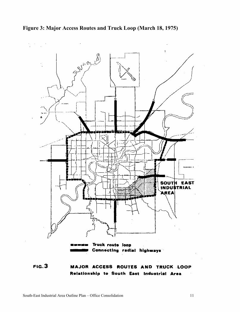
Figure 3: Major Access Routes and Truck Loop (March 18, 1975)
South-East Industrial Area Outline Plan – Office Consolidation 12
B. Existing Access
1. Roads
(a) Metropolitan Road Network
The South-East Industrial Area is excellently located in terms of access to the major provincial highway network in the Edmonton region - both existing and proposed. It is bordered by, and has convenient access to, the Calgary Trail (for transport to points south) and the Sherwood Park Freeway to the north. The latter provides an eastern high-way access route and, as well, connects with other major roads in the region such as Highway 16A and the Yellowhead Highway.
With the future completion of the Whitemud Drive along the southern boundary of the outline plan area, the South-East Industrial Area will have direct access to the westward portion of the Yellowhead Highway and, as well, the Sherwood Park Freeway to the eastern leg of the Outer Ring (Anthony Henday Drive).
As with the other major industrial areas, the South-East Industrial Outline Plan is favourably situated in relation to the proposed truck route loop recently approved by City Council. Both 50 Street and a portion of the Whitemud Drive form part of this truck loop.
(b) City and Internal Road System
Immediate access to and within the South-East Industrial Area is largely provided by the north-south street system within, and outside, the South-East Industrial Area. Major arterials in this system include 34, 50, 75, 91, and 99 Streets. North-south arterials serving the function of internal circulation are 86 and 97 Streets, the latter two terminating at Argyll Road.
At present, there are only three east-west roadway routes into the area. 63 Avenue/ Argyll Road link the area with Highway 14 East. Of lesser importance are 51 and 45 Avenues which are improved gravel roads east of 91 Street. Both of these routes fall within the most southerly portion of the outline plan.
All other existing east-west arterials serve as internal collectors for the major north-south arterials.
Complicating circulation on these roadways is the large amount of parking which frequently occurs on them. While the problems engendered are not chronic, on occasion these vehicles do impede the proper flow of traffic, particularly trucks.
2. Railways
Rail access to the South-East Industrial Area is potentially excellent because of the presence of main lines of two private rail companies. At present, however, beyond these main lines there are only a limited number of spurs directly serving industries in the area. Most of these are located west of 75 Street although both the private corporation’s rail lines east of this line are served by spur trackage. The interswitching limit on both main lines in the area is located west of 50 Street, as indicated on Map B (Not included in this document). This point defines the limit to the area within which customers may receive reduced rates for transferring goods between the two rail lines.
Amended by Editor
Amended by Editor
South-East Industrial Area Outline Plan – Office Consolidation 13
Analysis
(a) Present internal access to the area emphasizes the north-south arterials, while the east-west access potential is rather limited. There is the need for a major east-west arterial to link the industrial districts in the area. Although 51 Avenue could be considered the logical road to be designated because of the proposed alignment of the Whitemud Drive the present 51 Avenue east of 86 Street would become redundant. In order to maintain its continuity as well as to provide an east-west arterial between Whitemud Drive and Sherwood Park Freeway, a diversion of 51 Avenue is planned for that portion of the South-East Outline Plan Area east of 75 Street.
(b) Some problems may develop as a result of the mixed modes and circulation types on the major north-south arterials. For example, they will be used both by autos en route to and from the adjacent residential areas and by truck traffic. In terms of circulation types, these routes would serve both as major collectors for such industrial traffic (to Argyll Road and Whitemud Drive) and as through routes (especially 50, 75, and 99 Streets) for both industrial and the residential districts.
(c) While the South-East Industrial area may presently appear to be favourably located in terms of rail service, further industrial development in the area will not be so advantages. For example, the private railway corporations’ lands to the north are virtually isolated from lands on which new industrial development might occur. As well, large portions of the undeveloped land lie outside the four mile interswitching limit. This poses serious problems for the proper distribution of industrial uses in the outline plan area by limiting economical rail access to a relatively small area.
C. Existing Land Use
The South-East Industrial Area is presently characterized by two districts of marked contrast in terms of land use and level of development. These two are separated by the railway right-of-way which runs approximately parallel to, and one-half mile south of 63 Avenue and Argyll Road. The portion south of this line has largely retained its rural character although there are some large scale land uses existing in the central sector of this district near 75 Street. The portion north of the railway right-of-way is dominated by light and medium industrial development with small pockets of heavier industrial uses.
Map B (Not included in this document) indicates the general distribution of the various land uses found in the area. The following is a brief summary of these.
1. Industrial
As already indicated, industrial development is largely confined to those lands north of the railway right-of-way. The bulk of this development is comprised of small and medium scale distribution outlets. Historically this has also been the location for oilfield supply offices and related firms which have required large areas for storage purposes. More recent development has included major uses such as those of the Alberta Department of Highways, as well as, medium size ware-houses or distribution outlets. As well, the South-East Industrial Area contains the major steel fabrication plants in the Edmonton area including two private corporations. There are also a considerable number of metal fabrication plants in this area. An example of a larger plant of this nature is a private corporation on 75 Street, south of the railway line. Recently, light manufacturing industries (two private corporations) have also located in the area.
Amended by Editor
Amended by Editor
Amended by Editor
Amended by Editor
South-East Industrial Area Outline Plan – Office Consolidation 14
The wide variety of industrial types located in the area is paralleled by a similar divergence in the qualities of these developments. They range from high performance operations (private corporation) to operations consisting mainly of poor quality outdoor storage.
2. Storage Areas
Many of the industries throughout the South-East Industrial Area have open storage areas on their properties. While most of these are connected with the operation of the industries and are located in the rear of properties, there are several large properties given over almost exclusively to storage yards of rather poor visual quality. These are generally concentrated along 51 Avenue or adjacent to 91 Street, as well as in the area between 75 and 50 Streets. There are also isolated storage yards on 51 Avenue east of 50 Street and groups of such uses on 50 Street in the vicinity of the two private railway corporations tracks.
Within this general category it is also significant to note that there are a number of “auto wreckers” situated within the area. These are primarily concentrated along 51 Avenue between 99 and 91 Streets and adjacent to the Sherwood Park Freeway between Argyll Road and 50 Street.
3. Commercial
While other types of commercial development exist in small numbers in the area, the most prominent commercial establishments are the motor hotels located along major arterials (i.e. 63 Avenue, Argyll Road, Sherwood Park Freeway, etc.). Also present in the area is a co-operative shopping centre at 71 Street and the Sherwood Park Freeway. Scattered in various locations are numerous restaurants, catering outlets, drive-ins, banks, and other firms primarily catering to the industrial area.
4. Residential
There are no significant residential developments within the South-East Industrial Area. The type of residential uses evident in the area are a mobile home park on 76 Avenue between 50 and 34 Streets, a few farm buildings and independent “mobile homes” on industrial sites comprising the remainder of the residential development. These are scattered throughout the area.
5. Open Space and Recreational
These areas include a municipal camp site on 56 Avenue west of 99 Street, the campus of the W. P. Wagner Trade School, a privately operated “go-cart” track on 51 Avenue and 91 Street, and the lands adjacent to the Mill and Fulton Creeks. The latter are discussed in more detail below. A riding academy is situated on the east side of 50 Street, south of the railway tracks.
6. Utility Installations
A number of utility installations have located in this area in the past. Included are the Edmonton Transit System and Edmonton Telephone operations at 86 Street and 58 Avenue, and the City Water Tanks at 51 Avenue and 75 Street. A private corporation’s maintenance facility is located north of the Sherwood Park Freeway between 75 and 50 Streets. In addition to these major utility developments, there are smaller installations throughout the area comprised of Edmonton and Calgary Power transformer sites, etc.
7. Institutional
The only institutional land use in the South-East Industrial Area is the W. P. Wagner
Amended by Editor
Amended by Editor
Amended by Editor
Amended by Editor
South-East Industrial Area Outline Plan – Office Consolidation 15
Vocational Trade School which accommodates students from across the city.
Analysis
(a) The major land use factor to be considered in planning the South-East Industrial Area is the relatively established character of the northern portion of the plan area. Further, it is in this established area east of 75 Street that presents the greatest problems due to the unplanned scattered, and low quality industrial development which has occurred there.
(b) The variety of industrial types locating in the South-East Industrial Area complicates the planning of the area by virtue of the different requirements of the individual industries. These industries place different demands on the parcel size and shape, generate varying numbers of employees, require differing degrees of accessibility by truck and rail, and vary according to the type and capacity of services essential to their operation. All this necessitates that the area be planned, and industries located, in such as way that the most efficient use is made of the service infrastructure available.
(c) While it would be unreasonable to assume that all outdoor storage be banned from the area, some consideration should be given to the general upgrading of this type of land use in the area especially in view of the major north- south routes. These routes are being utilized in part as links between residential districts to the north and south of the outline plan area. It is recognized that some industries require storage areas as integral parts of their operations and these should be permitted, providing that appropriate measures (buffering, screening) are taken to ensure that no adverse effects result from them. Operations of a strictly storage nature are of more questionable merit not only because of their generally poor visual quality, but because they constitute an inefficient use of serviced or potentially serviceable land.
D. Area and Ownership
The South-East Industrial Area encloses an area of nine (9) square miles (23 square kilometres) and comprises approximately 1,900 acres (769 hectares) of developable land; that is, that are vacant of any type of structure or permanent use. A large part of the northern portion has already been subdivided and developed, and lands here are under title to many different owners. Included among these are properties in the Coronet and Davies districts originally subdivided for residential speculation in the past (see Map B – Not included in this document). The southern portion of the area (south of the railway right-of-way) though fragmented by multiple ownership, does contain a number of larger holdings as yet unsubdivided. Most of these lands, except for a small number of large scale uses, remain vacant. Map A (Not included in this document) illustrates the extent of subdivision in the Outline plan area.
Analysis
Ownership and land fragmentation are key factors in determining whether an area can be developed with a minimum number of problems, and therefore, has a bearing on the successful implementation of the outline plan. In the South-East Industrial Area, no major difficulties should be encountered in the portion generally south of the railway right-of-way where there are relatively few land holders with the exception of the east half of Section 14-52-24-W4 and other isolated areas. The undeveloped portion north of this line, however, is largely composed of subdivided parcels of irregular shape and different sizes and this fragmentation is likely to cause problems when and if replots are required to ensure subdivision and development compatible with the objectives of the outline plan. This is particularly true of the affected
Amended by Editor
Amended by Editor
South-East Industrial Area Outline Plan – Office Consolidation 16
lands in the Coronet, Papaschase, and Davies districts.
E. Topography and Natural Features
The land in the South-East Industrial Area rises gently from the north-west to the south-east passing through a change in elevation of approximately sixty to seventy feet (18-21 metres). Several prominent elevations are evident in the area, the most spectacular of which is located approximately at the intersection of 51 Avenue and 75 Street. The Department of Highways Maintenance Garage sits on a major knoll in the area, while other high elevations exist in the far south-east corner along 51 Avenue. Other than these topographical features, the balance of the area is either flat or gently undulating with incisions where the Mill and Fulton Creeks traverse the area.
The actual watercourses of these two creeks (especially Fulton Creek) are generally small - tending to be seasonally intermittent. The ravine of the Mill Creek is somewhat more distinct than that of the Fulton Creek although both creeks are significant features of the landscape, owing to the substantial stands of trees along them. In addition to these creeks, there is also the remnant of a creek bed running from south-west to north-east through the Papaschase and Coronet districts but its present channel is little more than a drainage ditch.
Owing to the historically agricultural nature of most developable land in the area, much of the tree cover of the area has been removed. As already mentioned, there are, however, substantial stands of deciduous trees along the two creeks. The Parks and Recreation Department (now Asset Management and Public Works Department) has indicated that these stands are generally mature with little replacement stock developing in them as a result of the grazing of livestock. Beyond this treeing, the only other significant stands in the area are isolated wood lots along 51 Avenue between 34 and 50 Streets.
Analysis
(a) The South-East Industrial Area offers the most variety in terms of general topography and natural features of any industrial district in the City of Edmonton. In recognition of this, proper planning should be undertaken to best utilize the topography and natural features as advantages to the area.
(b) The topography of the area does not appear to present any major problems for industrial development. Industries requiring relatvley flat sites for development will find such locations in the area. As well, lighter industries will easily adapt to the slightly rolling terrain of the majority of the area as interval changes in elevation area no abrupt.
(c) As a result of the rise in elevation to the south-east, this area contains several points for panoramic views of the skyline of the city. The most attractive of these viewpoints , a potential reserve site, is located at the north-west corner of the intersection of 75 Street and 51 Avenue.
(d) The watercourses and treed areas of the Mill Creek and Fulton Creek are outstanding features of the South-East Industrial Outline Plan Area and, as such, they should be retained. They offer the potential not only of green “breaks” in the industrial character of the area but, by virtue of their proximity to the Mill Woods area, they also provide opportunities for the attractive location of various types of public recreational facilities. Also, the Mill Creek forms one segment of a potential open space connection between the Mill Woods area and the downtown of the City.
South-East Industrial Area Outline Plan – Office Consolidation 17
F. Soil Conditions
Owing to its topography and the type of soil, the South-East Industrial Area is generally well drained, although there-are some low areas and wet spots in the extreme north-east, as well as in the area between 50 and 75 Streets.
For the most part, the soils in the area are a chernozemic type which have good drainage characteristics, good load bearing capacity, and low to medium salinity. The lands in the extreme north-east and south-west corners of the area are composed of a solonetzic soil which exhibits moderate drainage ability with high salinity. With proper precautions, the latter characteristic should not cause-serious construction problems to future industrial development in the area.
Analysis
No difficulties are foreseen for industrial development as a result of the soil or drainage of the areas. Where necessary, draining of land should be easily accomplished especially as new storm systems are expanded into the area.
G. Existing Utilities and Rights-of-Way
1. Utilities
In the South-East Industrial Area, present services by utilities is limited to those properties west of, or adjacent to, 75 Street. Thus, while present gas, power and telephone facilities are limited, no problems are foreseen in extending these systems when development warrants such expansion (see Chapter 3, Section B7). However, because of the difficulties involved in their installation and capacity limitations, the same is not true of water and sewage facilities in the South-East Industrial. These utilities are presently operating at or near capacity with the result that new industrial development will necessitate extensive alteration to the delivery systems of these utilities (see Chapter 3, Section B7). In terms of water, most of the area is served by ten or twelve inch mains, an eighteen (18) inch (45.7 centimeter) main along 51 Avenue, west of 75 Street, and one major main of thirty (30) inches(76.2 centimeter) which runs along 75 Street from the water tanks. With this restricted capacity, only limited expansion could be contemplated in the lands west of 75 Street while such expansion is virtually precluded elsewhere in the outline plan area. The situation for the sewage system is even more critical. Limited storm and sanitary capacities are now available in the lands west of 75 Street, however, in the remainder of the South-East Industrial Area, the major trunks required have only barely penetrated south of the Sherwood Park Freeway, being concentrated around 50 Street and 76 Avenue. Before sewage facilities can be extended to this area, major trunks and tunnels must be constructed.
2. Power and Pipeline Rights-of-Way
Being located south-west of the major refineries in the metropolitan Edmonton area, a considerable number of pipelines cross the south-easterly portion of the outline plan area. All generally converge around the point where Mill Creek crosses the present 51 Avenue (between 50 and 75 Streets).
The largest of these right-of-way corridors is 160 feet (48.8 metres) wide and includes three private corporations’ pipe lines which carry crude oil and liquid hydrocarbons. This corridor runs diagonally to the north-east across the plan area south of the railway right-of-way.
Amended by Editor
Amended by Editor
South-East Industrial Area Outline Plan – Office Consolidation 18
There are also two smaller rights-of-way for the pipelines of a private corporation (66 feet, reducing to 35 feet/20 metres, reducing to 11 metres) which run north-south between 50 and 75 Streets and a private corporation’s (33 feet) which runs south of, but generally parallel to the large right-of-way. These two carry natural gas, and butane and propane respectively.
In addition to these pipe lines, there is a major Calgary Power Line right-of-way which occupies a peripheral position in the outline plan area. This corridor is 200 feet (70 metres) wide and runs between 34 and 50 Streets abutting the present 51 Avenue right-of-way. At the intersection of 50 Street and 51 Avenue, it turns in a south-west direction.
Several other smaller pipelines and power rights-of-way also cross through the area, generally adjoining roadways.
Analysis
(a) While existing utility service is limited to the developed portions of the area, no difficulty is foreseen in providing required gas, telephone and power services to the area because of their relative ease of installation.
(b) Because present sewage and water facilities are operating close to, or at, capacity, substantial expansion of the major trunks and mains must be completed before future development can be adequately serviced.
(c) The pipeline rights-of-way do not generally pose insurmountable problems for industrial planning, subdivision and development except in the general area where they tend to converge. Here the density of the rights-of-way virtually precluded developments of any type. Plans for this area should recognize this constraint while also taking into account the natural attractiveness of the adjacent Mill Creek ravine.
(d) In other areas where pipelines exist, subdivision plans must take into account the difficulties involved in crossing them and the restrictions in the type of development allowed adjacent to it.
(e) Because its future alignment is uncertain, the Calgary Power right-of-way south of 51 Avenue, between 50 and 34 Streets may cause some difficulties in future detail plans for the area. Although removal is likely, realignment of the lines depends upon an appropriate decision to realign these high voltage lines in the Mill Woods area.
H. Existing Zoning
1. City
The South-East Industrial Outline Plan Area is unique in that it is already zoned for industrial use under the Zoning Bylaw and the Land Use Classification Guide. Particularly important is the fact that the undeveloped portions of the plan area already designated "AG-MRl", industrial reserve. Some of this land has already been subdivided. The developed portions of the area are zoned for a variety of industrial uses (M-1 to M-3 in the Zoning Bylaw). The lands of the ravines of the Mill and Fulton Creeks are zoned "A", metropolitan recreational, while a small parcel north-east of W. P. Wagner School is zoned "AP", public parks. Finally, there is a small amount of land around Argyll Road zoned “C-2”, commercial district, under the City's Zoning Bylaw. See Figure 4 for the locations of the various zones.
Amended by Editor
Amended by Editor
South-East Industrial Area Outline Plan – Office Consolidation 19
2. Regional
Except for the Mill and Fulton Creeks (zoned Metropolitan Recreational) and the private corporation’s shopping centre site (zoned General Urban), the Edmonton Regional Planning Commission has indicated the area involving the South-East Industrial for “General Industrial” (see Figure 5).
Analysis
The existing zoning is in conformity with both the intended use of the area and the Edmonton Preliminary Regional Plan (Metropolitan Part). While this may appear at first to be an advantage, it does create problems by increasing development pressures in the area prior to the completion of the usual planning process. There is a danger, therefore, that some development may occur in a manner which is incompatible with the outline plan concept.
Amended by Editor
South-East Industrial Area Outline Plan – Office Consolidation 20
Figure 4: Existing Zoning – City (March 18, 1975)
South-East Industrial Area Outline Plan – Office Consolidation 21
South-East Industrial Area Outline Plan – Office Consolidation 22
3 DEVELOPMENT CONCEPT AND PLAN
South-East Industrial Area Outline Plan – Office Consolidation 23
III. The Plan
A. Development Concept
1. General
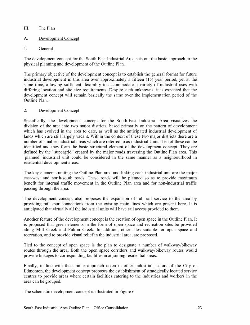
The development concept for the South-East Industrial Area sets out the basic approach to the physical planning and development of the Outline Plan.
The primary objective of the development concept is to establish the general format for future industrial development in this area over approximately a fifteen (15) year period, yet at the same time, allowing sufficient flexibility to accommodate a variety of industrial uses with differing location and site size requirements. Despite such unknowns, it is expected that the development concept will remain basically the same over the implementation period of the Outline Plan.
2. Development Concept
Specifically, the development concept for the South-East Industrial Area visualizes the division of the area into two major districts, based primarily on the pattern of development which has evolved in the area to date, as well as the anticipated industrial development of lands which are still largely vacant. Within the context of these two major districts there are a number of smaller industrial areas which are referred to as industrial Units. Ten of these can be identified and they form the basic structural element of the development concept. They are defined by the “supergrid” created by the major roads traversing the Outline Plan area. This "planned" industrial unit could be considered in the same manner as a neighbourhood in residential development areas.
The key elements uniting the Outline Plan area and linking each industrial unit are the major east-west and north-south roads. These roads will be planned so as to provide maximum benefit for internal traffic movement in the Outline Plan area and for non-industrial traffic passing through the area.
The development concept also proposes the expansion of full rail service to the area by providing rail spur connections from the existing main lines which are present here. It is anticipated that virtually all the industrial units will have rail access provided to them.
Another feature of the development concept is the creation of open space in the Outline Plan. It is proposed that green elements in the form of open space and recreation sites be provided along Mill Creek and Fulton Creek. In addition, other sites suitable for open space and recreation, and to provide visual relief in the industrial area, are proposed.
Tied to the concept of open space is the plan to designate a number of walkway/bikeway routes through the area. Both the open space corridors and walkway/bikeway routes would provide linkages to corresponding facilities in adjoining residential areas.
Finally, in line with the similar approach taken in other industrial sectors of the City of Edmonton, the development concept proposes the establishment of strategically located service centres to provide areas where certain facilities catering to the industries and workers in the area can be grouped.
The schematic development concept is illustrated in Figure 6.
South-East Industrial Area Outline Plan – Office Consolidation 24
Figure 6: Development Concept Map (Map “C”)
Amended by Resolution September 22, 2020
South-East Industrial Area Outline Plan – Office Consolidation 25
B. Outline Plan
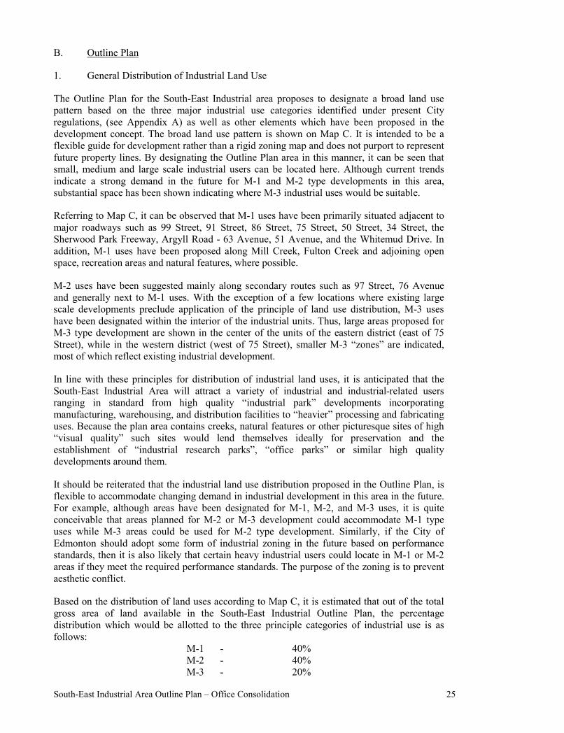
1. General Distribution of Industrial Land Use
The Outline Plan for the South-East Industrial area proposes to designate a broad land use pattern based on the three major industrial use categories identified under present City regulations, (see Appendix A) as well as other elements which have been proposed in the development concept. The broad land use pattern is shown on Map C. It is intended to be a flexible guide for development rather than a rigid zoning map and does not purport to represent future property lines. By designating the Outline Plan area in this manner, it can be seen that small, medium and large scale industrial users can be located here. Although current trends indicate a strong demand in the future for M-1 and M-2 type developments in this area, substantial space has been shown indicating where M-3 industrial uses would be suitable.
Referring to Map C, it can be observed that M-1 uses have been primarily situated adjacent to major roadways such as 99 Street, 91 Street, 86 Street, 75 Street, 50 Street, 34 Street, the Sherwood Park Freeway, Argyll Road - 63 Avenue, 51 Avenue, and the Whitemud Drive. In addition, M-1 uses have been proposed along Mill Creek, Fulton Creek and adjoining open space, recreation areas and natural features, where possible.
M-2 uses have been suggested mainly along secondary routes such as 97 Street, 76 Avenue and generally next to M-1 uses. With the exception of a few locations where existing large scale developments preclude application of the principle of land use distribution, M-3 uses have been designated within the interior of the industrial units. Thus, large areas proposed for M-3 type development are shown in the center of the units of the eastern district (east of 75 Street), while in the western district (west of 75 Street), smaller M-3 “zones” are indicated, most of which reflect existing industrial development.
In line with these principles for distribution of industrial land uses, it is anticipated that the South-East Industrial Area will attract a variety of industrial and industrial-related users ranging in standard from high quality “industrial park” developments incorporating manufacturing, warehousing, and distribution facilities to “heavier” processing and fabricating uses. Because the plan area contains creeks, natural features or other picturesque sites of high “visual quality” such sites would lend themselves ideally for preservation and the establishment of “industrial research parks”, “office parks” or similar high quality developments around them.
It should be reiterated that the industrial land use distribution proposed in the Outline Plan, is flexible to accommodate changing demand in industrial development in this area in the future. For example, although areas have been designated for M-1, M-2, and M-3 uses, it is quite conceivable that areas planned for M-2 or M-3 development could accommodate M-1 type uses while M-3 areas could be used for M-2 type development. Similarly, if the City of Edmonton should adopt some form of industrial zoning in the future based on performance standards, then it is also likely that certain heavy industrial users could locate in M-1 or M-2 areas if they meet the required performance standards. The purpose of the zoning is to prevent aesthetic conflict.
Based on the distribution of land uses according to Map C, it is estimated that out of the total gross area of land available in the South-East Industrial Outline Plan, the percentage distribution which would be allotted to the three principle categories of industrial use is as follows:
M-1 - 40% M-2 - 40% M-3 - 20%
South-East Industrial Area Outline Plan – Office Consolidation 26
A more detailed description of industrial and other uses proposed for the Outline Plan area is spelled out more fully in the following section.
2. Detail Plan Structure
As previously indicated, the South-East Industrial Outline Plan can be organized into two distinct but closely related components. These are referred to as the western and eastern districts.
(a) Western District
The western district of the Outline Plan is defined by the following primary traffic arteries - 75 Street on the east, 63 Avenue - Argyll Road on the north, 103 Street on the west, and the proposed Whitemud Drive on the south.
A sizeable portion of this area is already developed or has been largely committed to development by virtue of subdivision approvals or projects currently being prepared or processed. In the past, this area has been developed for a variety of M-2 and M-3 uses. Future industrial expansion in this district will consist of infilling, redevelopment of properties presently occupied by low intensity uses and new development on vacant lands in the southern part of this district.
Broadly speaking, the Outline Plan proposes that in this district, future development be primarily in the M-1 and M-2 categories and that a considerable number of the M-3 users be phased out of the area over the long run. It is also proposed that many of the existing developments along the major routes through this area be upgraded. Some open space and establishment of a service centre for this district is proposed.
In the western district, four separate industrial units can be identified.
(i) The first unit is bounded by 103 Street, 63 Avenue, 91 Street, and 51 Avenue. It is comprised of the older industrial districts of Rosedale, Hazeldean, and Coronet. At the present time, this area is zoned primarily for M-2 and M-3 type development with a small strip of M-1 south of 63 Avenue and west of 91 Street.
On the basis of the land use distribution proposed in the Outline Plan, it is intended that future development in this area consist of M-1 uses along 51 Avenue between 103 Street and 91 Street, along 99 Street from 51 to 63 Avenues, and along 63 Avenue. Because sites on 99 Street and 63 Avenue are presently zoned M-2, no changes are immediately proposed or expected. However, future development in these areas would be monitored by the Planning Department so that when changes in use of properties or redevelopment occur, development applications would be thoroughly scrutinized to ensure that front yards and general appearance of sites are visually attractive. Special emphasis would be placed on property along these routes designated for upgrading as shown on Map C. It is also proposed that
South-East Industrial Area Outline Plan – Office Consolidation 27
Figure 7: Western District – Plan Structure (March 18, 1975)
South-East Industrial Area Outline Plan – Office Consolidation 28
the City contribute to the visual improvement along these routes by providing more boulevard planting and landscaping, control of weeds, removal of unnecessary wires, and sign clutter and provide better maintenance of all City property including streets, lands and boulevards. In conjunction with such upgrading, the requirement for buffering specific properties on 99 Street and 91 Street are illustrated on Map C.
As shown on the Outline Plan, the interior of this unit would be utilized for M-2 and M-3 uses. At the present time the only areas which are largely undeveloped are Coronet (Speedway) west and east, located north of 51 Avenue between 91 and 99 Streets. Once current replot plans for these areas are finalized and registered, resulting in the reorganization of subdivision and holdings, servicing and more intensive development will follow. Apart from these two areas, the only further development which would occur in this area would consist of redevelopment of existing industrial sites and infilling on either vacant or partially developed properties.
(ii) Bounded by 63 Avenue - Argyll Road, 75 Street, 51 Avenue, and 91 Street, the second industrial unit in the western district consists of the Coronet Addition and the western portion of Davies Industrial subdivisions and includes a portion of McIntyre Industrial north of 51 Avenue. Some of this area, particularly a portion of Davies Industrial, between 86 and 75 Streets, north of the railway line and most of Coronet Addition, is largely developed. With the exception of some isolated uses, the remainder of the area is vacant. Much of this land, however, is presently undergoing subdivision as servicing to the area is available.
In compliance with the Outline Plan proposals, this industrial unit would be “ringed” by M-1 uses along its perimeter. In addition, M-1 uses are proposed adjoining the entire length of 86 Street. Large areas in the interior of this unit have been identified for M-2 development with M-3 in the centre. No major problems are anticipated in implementing these proposals for this area in as the present zoning is either generally compatible with the proposals or the opportunity exists to ensure that future subdivision plans follow the suggested land use distribution.
In the meantime, however, it is advocated that the existing storage yards on the east side of 91 Street be upgraded, unless the owners indicate that future development here is imminent pending completion of the replot and that the exposure of such development onto 91 Street will be adequately screened and buffered in the future. Smaller pockets of existing storage uses such as in the area immediately south of Argyll Road and west of 75 Street would also be required to be upgraded. Also, the existing development on the west side of 75 Street between Wagner Road and the railway line should also be adequately screen and buffered.
This industrial unit also contains other key elements to make the entire Outline Plan function. Two walkway/bikeway routes penetrate into this area. They are located on the east side of 86 Street and within the interior of the area between 86 and 75 Streets which is subdivided and developed. Both routes would start in Mill Woods and merge north of the Wagner school site, then pass through Coronet Addition and across Argyll Road. Additional rail spurs are also proposed for this area as indicated on Map C. Furthermore, land north and
Amended by Editor
Amended by Editor
South-East Industrial Area Outline Plan – Office Consolidation 29
west of the proposed 51 Avenue diversion is indicated as being within a “low profile development zone” in order to enhance the view of the distant city skyline from the view point area to be developed south of the 51 Avenue diversion and west of 75 Street.
(iii) The third industrial unit in the western district is comprised of the entire Papachase Industrial subdivision and has 51 Avenue, 91 Street, 103 Street, and the proposed Whitemud Drive as its boundary. This industrial unit is considerably smaller than the previous two and also less intensively developed than the areas to the north, though a limited amount of subdivision has been under-taken here-in the past year. The bulk-of-the area east of 99 Street, however, still requires replotting.
The proposed land use distribution in this unit would see M-1 development adjacent to the major roadways (i.e. 99 Street, 91 Street, 51 Avenue, and the Whitemud Drive) and M-2 uses located in the interior. Most of the undeveloped area is presently zoned AG-MR1, therefore, no problems are anticipated in implementing these proposals. Care is required, however, in assessing development proposals on the east side of 99 Street between 51 and 45 Avenues as this area is presently zoned M-2. Upgrading or redevelopment of industrial properties is recommended in three major areas on the south side of 51 Avenue while landscaping and buffering is proposed on the west side of 91 Street and north of the proposed Whitemud Drive as shown on Map C. On the basis of the preferred location for a service centre at 97 Street and 51 Avenue, part or all of such a facility could be located within this industrial unit. It is also anticipated that some open space with or without a recreation facility could be established in this unit once all subdivision planning is finalized. Due to existing development along 51 Avenue, no extension of rail services to this area is foreseen from the north.
(iv) The final industrial unit in the western district includes the southern part of McIntyre Industrial as defined by the alignment of the proposed Whitemud Drive, 51 Avenue, 75 Street, and 91 Street. This area is the smallest industrial unit in the western district and is largely undeveloped to date.
With the exception of a small “zone” proposed for M-2 use, virtually the entire unit would be utilized for M-1 development. Because it is not fragmented by previous subdivision, industrial development would occur in this unit after subdivision plans are approved and servicing undertaken.
In addition to the industrial uses, a triangular area in the north-east corner of this unit would be utilized for a combined view point, open space and recreation site. Two separate walkway/bikeway routes would also be provided for in the area. These would follow 86 Street and 51 Avenue and connect to the system proposed for the entire Outline Plan, as well as the local viewpoint site. A rail spur from the railway line in the north across 51 Avenue to the western portion of this industrial unit is also contemplated. Insofar as further controls on development are concerned, screening and buffering requirements would be mandatory along the northern boundary of the proposed Whitemud Drive. Part of the existing 51 Avenue in this area would be retained and incorporated into the future local road system.
Amended by Editor
South-East Industrial Area Outline Plan – Office Consolidation 30
(b) Eastern District
The eastern district of the Outline Plan consists of those areas lying between 75 and 34 Streets, the proposed Whitemud Drive to the south and portions of Argyll Road, 82 Avenue, 50 Street and 92 Avenue in the north.
This area is considerably less intensively developed than the western district. Existing industrial and other uses are primarily concentrated in the north central portion of the district and along existing access routes such as 75 Street, 50 Street, Argyll Road and on both sides of the Sherwood Park Freeway. With the exception of several major industrial developments, the interior of this district is predominantly vacant at this time. Some subdivision on a larger scale is being proposed for areas within this district and it is expected that development of this area will proceed steadily after approval of subdivision plans and provision of services.
It is proposed in the outline plan that considerable M-1 and M-2 uses locate in this area. M-3 development would be confined to four major interior locations. Full rail service to the area is also being recommended. Two major and a number of smaller open space and recreation areas are suggested. Some upgrading of existing development will be required in this district. A smaller service centre is also designated for this area.
The eastern district is composed of six industrial units of varying size.
(i) The first of these and the smallest industrial unit in the district and entire outline plan is Gainer Industrial , a narrow triangular wedge situated west of 50 Street and between the Sherwood Park Freeway and 82 Avenue. A sizeable portion of this area is already developed, although further subdivision and development will likely occur here in the future.
Because of the size of this area and its being situated between major traffic routes and existing residential development, the Outline Plan proposes that this entire unit be subject to M-1 standards in the future. Upgrading, therefore, will be required when redevelopment, new development or subdivision occurs here. It is also being proposed that development adjoining the freeway be adequately buffered and landscaped. Particular attention should be paid to screening the open storage uses as indicated on Map C. Part of the walkway/bikeway from Fulton Creek would also be located on the edge of this area along 50 Street.
(ii) To the east of Gainer Industrial is another industrial unit bounded by 50 Street, the Sherwood Park Freeway, 34 Street, and 92 Avenue. The portion of this area north of the railway line is known as Lambton Park. With the exception of a small piece in the north-west corner, this unit is zoned industrial reserve (AG-MR1). Present development consists of scattered industrial and commercial uses concentrated primarily along 50 Street and in the central part of the unit. Although there has been some subdivision in this area, there are still many large vacant parcels remaining.
Amended by Editor
South-East Industrial Area Outline Plan – Office Consolidation 31
Figure 8: Eastern District – Plan Structure (March 18, 1975)
South-East Industrial Area Outline Plan – Office Consolidation 32
Detail planning for the area envisages establishing M-1 uses along 50 Street, the Sherwood Park Freeway, 92 Avenue and 34 Street. Because of its proximity to Ottewell, the bank of M-2 uses proposed next to the M-1 zone east of 50 Street has been widened to extend the distance between M-3 uses proposed for the interior of this unit, and the residential area to the west. It is also proposed that special screening and landscaping be provided along the part of this unit which is bounded by the Sherwood Park Freeway. In addition, a "pocket" of existing development, on 50 Street north of the railway line would require upgrading. Rail spur service to this area would be provided from the railway line as required.
(iii) Girard Industrial, the eastern portion of Davies Industrial and a part of Roper Industrial, constitutes the third industrial unit in this district. This unit is bounded by Argyll Road, the Sherwood Park Freeway, the proposed Whitemud Drive, 50 Street, and the proposed 51 Avenue diversion. Except for a strip of land west of 50 Street, north of the railway line, the area north of the most northerly railway line, and a private corporations’ property, all of this area is zoned AG-MR1 at present. Even so, there is considerable development in the AG-MR1 areas, particularly along 50 Street and 75 Street. The interior of this area, however, does contain large vacant parcels.
The broad land use pattern proposed for this unit again observes the principle of locating M-1 development along major roadways and reserving the interior for M-2 and M-3 uses. Three major industrial collector roads are also proposed to provide access to the interior of the unit. One would see the southerly extension of 76 Avenue at the railway tracks then connecting to a second collector road which would be on an east-west alignment at approximately 68 Avenue linking 50 Street with 75 Street. The third collector would provide a connection between 75 Street and the 51 Avenue diversion. Full rail service is also expected to be provided to this unit with rail spur extensions from both the private railway lines proposed.
An Industrial Business Park will be located east of 75 Street, and north and south of Roper Road. The Industrial Business Park will offer several forms of development catering to a broad market sector ranging form 2.5 to 5.0 acres and 10 to 25 acre parcels.
A commercial/industrial parcel is also located along Argyll Road, east of 75 Street to facilitate the expansion of the Casino.
The lands located south of 68 Avenue between 75 Street and the railway was redesignated from Heavy Industrial Development to the High Standard and Medium Industrial Development land use categories to enable the redevelopment of these lands to business and light industrial types of uses.
An important element through the south-western part of this area is the Mill Creek open space corridor. All industrial development adjoining this corridor would be restricted to M-1 standards with no local roads being permitted to cross the creek. In the area south of 68 Avenue adjacent to the railway and the Mill Creek ravine where additional buffering of the ravine has been implemented, Medium Industrial Development is permitted. Certain locations in this district have been designated for upgrading. These are along 75 Street,
Amended by Editor
Amended by Editor
Amended by Editor
Resolution January 22, 2001
Resolution November 19, 2001
Resolution August 25, 2004
Amended by Editor
Resolution February 25, 2008
South-East Industrial Area Outline Plan – Office Consolidation 33
50 Street, and along the freeways as shown on Map C. It is proposed that the fronts and general appearance of a number of existing developments be improved by means of buffering and landscaping. These include open storage sites and auto wreckers along the freeway, as well as a private corporation and Department of Highways and Transport complex. Part of the walkway/bikeway route will also penetrate the south-west corner of this industrial unit. Also, some of the service centre facilities could be included in this area at the intersection of 50 Street and the 51 Avenue diversion.
(iv) The area lying between 50 Street, 34 Street, the proposed 51 Avenue diversion, and the Sherwood Park Freeway is the largest of the industrial sub-units. The portion of this unit south of the southerly railway line is named Pylypow Industrial. With the exception of strip development on both sides of 76 Avenue and east of 50 Street, this area is largely undeveloped and unsubdivided. This area is presently zoned AG-MRI.
According to the Outline Plan, development in this unit is proposed for M-1 on the periphery with substantial areas reserved for M-2 uses. A major M-3 area is suggested in the interior of the portion of the unit north of the railway line. Most of the undeveloped area is expected to be subdivided in the future. Some replotting will be encountered between 76 Avenue and the railway line. Two collector roads, as shown on Map C, would provide access to the interior of this unit.
Another major consideration in this industrial unit which is pertinent to the plan is the Fulton Creek watercourse which together with adjoining open space and natural features, is proposed as a green corridor here. Development along this green area is to be restricted to M-1 uses. Also, no local roads would be permitted to cross the creek. Major lead spur extensions north and south of the railway line are proposed within the area. Another requirement is that an Edmonton Power substation be constructed at 50 Street, north of the 51 Avenue diversion. A 100' (30.5 metre) powerline right-of-way as shown on Map C is also required in this general location.
A walkway/bikeway route is proposed through this unit. It would primarily follow Mill Creek but would also connect to the industrial units to the westward, south along the planned collector roads. The only areas requiring upgrading in this industrial unit would be the strip of development on 50 Street north of the railway line and another pocket along 51 Street between 76 Avenue and the Sherwood Park Freeway. The entire length of the Freeway in this area would require buffering and landscaping.
Because of the presence of numerous pipelines in the area, detail plans of subdivision should ensure that road crossings are kept to a minimum.
(v.) The City adopted a new Transportation Master Plan in 2009. A key element of the Transportation Master Plan is the expansion of LRT to all sectors of the City using low-floor LRT vehicles.
Council approved the concept plan for the Southeast to West LRT (Valley Line) in October 2009; and further amended the plan in 2012. The corridor of the Valley Line transects the central portion of the Roper Industrial plan area and contains associated infrastructure, including an Operations and Management Facility (OMF) north of Whitemud Drive and east of 75 Street.
Amended by Editor
Amended by Editor
Amended by Editor
Resolution July 6, 2015
South-East Industrial Area Outline Plan – Office Consolidation 34
The purpose of the OMF is to provide a central yard for the cleaning, storing and maintenance of LRT vehicles.
The corridor of the Valley Line transects the Davies Industrial plan area and includes associated infrastructure, including a transit centre west of 75 Street, south of Wagner Road. The transit centre will be developed with park and ride facilities and an elevated LRT station, on-site stormwater management and a traction power substation.
The subject sites are designated as Urban Transit Facility on Map C – Southeast Industrial Area Outline Plan. This designation is intended to support public utility infrastructure related to the City’s transit services, facilities and operations.
(vi) The southern portion of Roper Industrial is a fifth industrial unit in the eastern district. It is bounded by the Whitemud Drive, 75 Street, 50 Street, and the 51 Avenue diversion. To date only a portion of this unit is subdivided and developed. It is zoned AG-MR1 except for the creek area.
It is anticipated that this area will be exclusively devoted to M-1 and M-2 uses with the M-1 sites situated along the major traffic routes and M-2 in two interior pockets. The central part of this industrial unit will be reserved for open space in association with Mill Creek as shown on Map C. A substantial area crisscrossed by pipeline rights-of-way on the west side of the creek is intended for open space, natural features, sports fields, and picnic areas. On the east side of Mill Creek a narrow band of open space would separate the top-of-the-bank and adjoining roadways or property lines. One segment of the walkway/ bikeway route would traverse along this open space corridor. Another route would follow the 51 Avenue diversion connecting Mill Creek with the viewpoint area west of 75 Street. Rail service could be extended into the eastern part of this area if considered feasible by the railway companies following more detail study.
It is recommended that certain storage uses in this industrial unit, fronting 73 Street north of 51 Avenue, be upgraded. Furthermore, it is proposed that another storage site on 51 Avenue nearer 75 Street be properly screened and buffered. That part of the industrial unit west of the creek could be subdivided in the normal manner while the area to the east will require replotting. Part of the existing 51 Avenue right-of-way would be utilized and incorporated into plans of subdivision in the future, though the connection to 50 Street will likely be changed.
Because of the significant number of pipelines crossing this industrial unit, careful planning at the detail design stage will be required. As with the adjacent industrial sub-units, it is proposed that appropriate buffering and landscaping be provided on the north side of the proposed Whitemud Drive.
(vii) The last industrial unit in the eastern district encompasses the southern part of Pylypow and is bounded by the proposed Whitemud Drive, 50 Street, and 34 Street. This area is almost rectangular in shape. It is zoned AG-MR1 and is virtually unsubdivided or developed.
The general land use distribution in this unit proposes M-1 type development along the major arterials with M-2 and M-3 uses in the interior. A lead spur
Amended by Editor
Amended by Editor
South-East Industrial Area Outline Plan – Office Consolidation 35
crossing 51 Avenue could also be provided to serve this area with rail. In addition, a north-south collector road linking Mill Woods with the Fulton Creek open space and the industrial area to the north would also be required. A walkway/bikeway would be included within the right-of-way of this collector through the area.
Since there are clusters of substantial trees in this unit, it is proposed that some of these could be retained and utilized as part of the open space system in the future industrial subdivision. It is assumed that the existing 200' (61 metre) Calgary Power right-of-way north of the Whitemud Drive will be abandoned and utilized as developable land. The amount of land "disturbed" by pipeline rights-of-way here is minimal, therefore, no major difficulties are expected in this regard. It should be noted that most of the existing 51 Avenue could be retained in subsequent subdivision, planning, though ultimate connections to 50 Street, and 34 Street would likely be changed.
Finally, it is suggested that the front of the isolated storage yard on 51 Avenue, east of 50 Street, be landscaped and buffered. Also, future buffering and landscaping will be required along the northern boundary of the proposed Whitemud Drive.
3. Circulation
In order to make the South-East Industrial area function effectively in terms of moving people and goods into and through the area, three major circulation networks are proposed. These are the roadway system, rail trackage, and separate pedestrian - cyclist routes.
(a) Roads
Because industry generates considerable traffic, it requires major thoroughfares, not only for convenience of access, but also because the type of vehicles and volume of traffic generated combined with the weight carried, requires streets which are built to high standards and which can cope with extra heavy wear. In addition to these considerations, which apply to all industrial areas, the South-East Industrial Area will be penetrated by additional traffic to and from Mill Woods.
In view of this, the major north-south routes through the Outline Plan which will be upgraded to high standard arterial routes are 99 Street, 91 Street, 75 Street, and 50 Street. 103 Street and 34 Street will provide additional north-south access on the westerly and easterly perimeters of the Outline Plan area. In addition to these major routes, secondary level north-south access will be provided by 97 Street, 86 Street, and collectors east of 75 Street as shown on Map C.
At the present time the Outline Plan area is devoid of any major east-west routes within the area, other than the Sherwood Park Freeway and this facility has a function not directly related to the outline plan area through which it passes. Furthermore, the only other major east-west routes, 63 Avenue - Argyll Road and the proposed Whitemud Drive would not serve the interior of the Outline Plan area. Because of the lack of major interior east-west routes, the inadequacy of 51 and 45 Avenues to serve the total area adequately, and the fact that the proposed Whitemud Drive would make the presence of 51 and 45 Avenues redundant by virtue of its future alignment, the Outline Plan proposes the north-easterly diversion of the present 51 Avenue east of
Amended by Editor
South-East Industrial Area Outline Plan – Office Consolidation 36
86 Street. Insofar as secondary level through routes in the Outline Plan, 76 Avenue and the east-west portions of the collector roadways in the eastern district would be utilized for this purpose. The only other east-west road of any significance in the Outline Plan area is 58 Avenue between 97 and 86 Streets, within Coronet and Davies.
The purpose of the primary east-west and north-south arterial network would be two-fold. These routes would provide access into the industrial area for workers and industrial traffic by connecting the secondary or collector roadways within each industrial unit. Secondly, the primary routes would provide uninterrupted access to traffic destined for adjoining residential areas or industrial traffic passing through the area. The second level road network would connect with the primary network and bring industrial destined traffic into each industrial unit. These roads would in turn be connected to local industrial roadways.
Since the major north-south routes in the Outline Plan area will likely carry both truck and private automobile traffic and to enable these roads to properly carry out their function as through routes, it will be necessary to minimize conflicts between through traffic and turning traffic. This will be achieved by restricting the number of intersections along these routes to a minimum and making these well controlled to ensure safe traffic flow. Furthermore, it is proposed that direct access to developments on these major routes not be permitted. Such developments would be required to make provision for the ultimate construction of service roads for access. As a further aid to circulation, on-street parking on all major arterials would be prohibited and kept to a minimum on secondary routes.
In order to further facilitate the free flow of traffic on both the north-south and east-west routes, several grade separations are planned at points where these streets intersect major rail lines. These grade separations, proposed along 91 Street, 75 Street, 50 Street, 34 Street, and 51 Avenue are shown on Map C.
Within the framework of the major road network a local road system is proposed to provide internal access within the industrial sub-units. This local road system will be connected to the major grid but will be purposely designed to eliminate the opportunity for industrial and other traffic to utilize the local streets as through routes throughout the Outline Plan area. The design and layout of the local road system within the industrial sub-units will depend on the type and intensity of industrial development which occurs in that area. However, for purposes of consistent planning, the local road system of the industrial sub-units will have to subscribe to the principles set forth in Figure 9.
Two of the major roads within and adjoining the Outline Plan have been designated specifically for truck traffic and will form part of the Truck Route Loop for the City of Edmonton (see Figure 3). This facility was approved by City Council in February, 1974, and is expected to be completed by 1980. The segment relevant to this Outline Plan, i.e., the Whitemud Drive between the Calgary Trail and 50 Street within the Outline Plan have a relatively high priority for construction with some work being anticipated within two to five years on the 50 Street section. The Whitemud Drive portion of the Truck Loop is not expected to be built to full standard for some time. This truck route loop will provide vital road connections between the South-East and other major industrial sectors of the city, as well as providing a link to the primary highway network.
It should also be noted that the former South-East Freeway, which was originally planned to utilize the Mill Creek Ravine north of 63 Avenue is proposed to be
South-East Industrial Area Outline Plan – Office Consolidation 37
terminated at 63 Avenue resulting in a "T" intersection here. Further-more, the freeway portion of this route will end at Whitemud Drive. Between Whitemud Drive and 63 Avenue, this route will be reduced to a lower standard penetration permitting access from 91 Street to West Davies Industrial to the east and Coronet (Speedway) Industrial to the west.
(b) Rail Transportation
Although it is no longer considered absolutely necessary that every industrial site or user have access to spur trackage in industrial areas, the provision of rail service is still a salient planning consideration. The availability of rail in an industrial district provides an additional measure of flexibility; and flexibility is vital to successful development of industrial areas.
Because the South-East Industrial Area contains both railway mainlines, it is proposed to provide rights-of-way for future rail service to most of the undeveloped portions of the Out-line Plan. Leads and spur lines would serve both the eastern and western districts and penetrate virtually all the industrial units.
The majority of the spur leads would be provided for in the undeveloped lands between 75 and 34 Streets. Additional spur trackage is also proposed for the areas west of 75 Street.
Amended by Editor
South-East Industrial Area Outline Plan – Office Consolidation 38
Figure 9: Planning Principle for Planned Industrial Unit
(March 18, 1975)
South-East Industrial Area Outline Plan – Office Consolidation 39
Due to the fact that there is existing development along 51 Avenue west of 91 Street, spur lines are not expected to be established through the industrial units north and south of 51 Avenue and west of 91 Street. Because both railway lines traverse the Outline Plan area in a north-easterly fashion, the length of the spur lines in the eastern district would be considerably longer than those in the western district. Although the Outline Plan area contains some land which is topographically unsuited for development of railway trackage, the spur system proposed attempts to maximize rail service to all areas not affected by steep contours.
It is recommended that where land is being subdivided in the future, either as an industrial unit or as part of a larger plan area, that rights-of-way for spur trackage be designed into the plan of subdivision where this is economically feasible and physically possible. Once these rights-of-way are legally connected to the main line, construction of the spur leads would be undertaken as required.
In regard to design standards for rail spurs, it is proposed that spur tracks cross 51 Avenue only once between major arterials to minimize rail and road traffic conflicts.
With respect to the internal road system, provision should also be made for the free flow of truck traffic to and from industrial sites without interference with rail freight switching. In addition, street axis should be laid out in such a manner that spur leads can reach a maximum number of sites yet cross a minimum number of streets. Where rail spurs cannot be provided to all sites, the establishment of team track facilities should be considered.
The magnitude of this industrial area may also dictate the establishment of support service tracks within the outline plan area in the future. Even though present rail traffic may not be sufficient to justify such a facility and to identify its location, it is suggested that the railway companies be consulted at an early date to determine when and where support tracks would be located.
Should railway right-of-way (leads and spur lines) be abandoned, the Planning and Development Department will review and analyze the impact, compatibility and/or transition between land uses and surrounding areas at the rezoning stage.
The following principles will be applied to rezoning and subdivision applications:
• High standard industrial development will be limited along arterial roadways to provide for high quality development and minimal industrial nuisances.
• Medium industrial development will be limited to interior blocks which are intended to reduce the impact of industrial development on arterial roadways.
Rezoning applications may required environmental site assessments, transportation impact analysis reports (trip generation, capacity requirements, access & egress), drainage reports or any other information that the Planning and Development Department, Transportation Department or Asset Management and Public Works Department (i.e. Drainage Services, Parkland Services) considers necessary.
(c) Walkway/Bikeway System
In addition to the proposed road system and expansion of rail trackage contemplated
Amended by Editor
Resolution April 2, 2007
South-East Industrial Area Outline Plan – Office Consolidation 40
for the area, the South-East Industrial Outline Plan also provides for a network of walkways and bikeways to facilitate pedestrian and bicycle circulation within and through the industrial area.
Basically the walkway/bikeway routes would serve three purposes. Firstly, they would provide the opportunity for alternate modes of transportation for those working in the industrial area who live in residential areas adjacent to the outline plan area or within cycling distance of work. Secondly, the walkway/bikeways in the South-East Industrial areas would provide a convenient access route through the industrial area for those who reside in Mill Woods and wish to travel to and from other parts of the city by utilizing such routes.
Thirdly, the bike route and walkway system through the South-East Industrial area, particularly the principal one along Mill Creek, would be a southerly extension of similar proposals envisaged for that portion of the Mill Creek Ravine north of Argyll Road. The routes through the industrial area, therefore, would serve as interconnecting links between major residential districts.
The walkway/bikeways proposed in the Outline Plan and illustrated on Map C, would follow the specific alignments although it should be stressed that if future demand warrants the creation of additional routes through the industrial areas, these could be accommodated and developed with no major problem, either within the rights-of-way of arterial roadways or by utilizing local industrial roads in the interior of the industrial sub-units.
The major walkway/bikeway through the South-East Industrial Area would follow Mill Creek for a considerable part of its course. Commencing from the south, this route would utilize the pedestrian and cycle connection from Mill Woods and underpass the Whitemud Drive. From this point it would traverse the open space areas to be created west of Mill Creek and north of the existing 51 Avenue, in a slight north-westerly direction, and return to the left bank of the creek once more. At a location north of the 51 Avenue diversion, the primary walkway/bikeway route would turn to the west, across 75 Street, continuing along and follow 83 Street to the Wagner Vocational School site. Here one branch would go around the east side of the complex, while the other branch would follow Wagner Road and 86 Street. The crossing of the northerly railway mainline would be accomplished via a culvert underpass north of the Wagner School site. After crossing these tracks, the walkway/bikeway would traverse the City owned land between the railway line and Argyll Road and connect with the present open space and park development at approximately Argyll Road and 81 Avenue.
From this point on, the walkway/bikeway would utilize Mill Creek and proceed to the river valley and city centre. The secondary walkway/bikeway routes proposed for the central portion of the Outline Plan would utilize 86 Street, 75 Street, and 51 Avenue to provide connection between Mill Woods and the Mill Creek ravine north of Argyll Road. These routes would also link the service centre proposed for the intersection of 51 Avenue and 75 Street and the viewpoint area south-west of it.
Amended by Editor
South-East Industrial Area Outline Plan – Office Consolidation 41
Figure 10: Bike Route Along Mill Creek (March 18, 1975)
South-East Industrial Area Outline Plan – Office Consolidation 42
The other walkway/bikeway connection within the industrial area which would also link Mill Woods with other residential districts, the river valley and Rundle Park to the north, is proposed along the north-south collector road between 50 Street and 34 Street connecting to a recreation area. This route would join with Fulton Creek and travel along its left bank for some distance. South of the southerly railway line the route would turn westward to 50 Street from where it would proceed northward to the river valley.
4. Public Transportation
Since accessibility to public transportation is a definite factor in industrial site selection, it is of great advantage to have public transportation available in industrial areas.
The provision of public transportation is a relatively new concept in industrial planning and is presently undergoing review by various departments of the Civic Administration. While the need for such service has been recognized, the manner in which it will be met can be determined only after further study. Consequently, it is impossible to state definitively the role of this public service in the South-East Industrial Area and to designate all public transportation routes in the outline plan.
One of the inherent problems in attempting to provide such service to industrial areas is that industrial development rarely occurs in an orderly, incremental fashion. Development tends to be scattered as a result of site and access requirements of individual industries, as well as the readiness of land owners to place their properties on the market for industrial development. In addition, it is difficult to predict in advance which types of industries, by virtue of the type of employees they hire, will generate greatest demand for public transportation even if one knew where they were to locate. Thus, while it is relatively easy to meet demand after an area has been developed, it is considerably more difficult to serve the area properly before or while it is developing.
Planning for public transportation in industrial areas, therefore, requires both short and long term solutions. The first meets the immediate demands of the area. The second, longer term solutions essentially create demand by proving attractive as an alternate to the private auto. This is accomplished through the quality of the service and the fact that high passenger generating industries have been encouraged to locate near bus routes.
Even with these general problems, the South-East Industrial Area is in a favourable position to receive transit service in both short and long term situations. It is located between two residential areas which will themselves require bus service - some of these routes should logically pass through the South-East Industrial Area. Other short-range routes are shown on Figure 11.
Based on what is presently known, and with some insight into the future industrial development of the area, it is possible to establish a strategy for servicing the South-East Industrial Area with public transportation.
Initially the bus service would be extensions of existing bus routes (as shown in Figure 11), with transfer points outside the industrial area. When demand warrants additional public transportation service to the area, a terminal in the industrial area would be appropriately located in the main service centre at 75 Street and 51 Avenue. In this instance, the terminal would become the transfer point between the main and feeder bus route. Similarly, if demand requires additional service, the feeder route could be expanded, frequency of service increased or route location changed. If demand is fairly heavy, additional feeder routes could be serviced from the terminal location in the Outline Plan area.
Amended by Editor
South-East Industrial Area Outline Plan – Office Consolidation 43
Figure 11: Possible Bus Routes (March 18, 1975)
South-East Industrial Area Outline Plan – Office Consolidation 44
Figure 11A: Schematic Concept for Public Transportation Service (March 18, 1975)
South-East Industrial Area Outline Plan – Office Consolidation 45
5. Open Space Recreation and Landscaping
Because the South-East Industrial Area is so vast and since a number of undisturbed natural features are still present in the undeveloped portions of the area, it is proposed that the Outline Plan Area be adequately provided with open space, recreational sites and landscaping.
City policy in line with current thinking, has recently been revised with regard to the acceptance of recreational and open spaces in industrial areas.∗ Previously, no need was seen for such facilities within these areas and, as one consequence, the 10% reserve which the City obtains in subdivision and replot schemes was usually taken in money as permitted under the Planning Act. This policy, while understandable, did not recognize the shorter work week and increase in leisure time of employees and that industrial areas can contribute in an important way to the total open space and parks system of the City. Such spaces in industrial areas can serve any number of functions; they can preserve distinctive natural features, help to complete walkway and bikeway systems, enhance the landscaping and thus the visual quality of the area, and provide recreational opportunities not only for workers in the area, but for residents of surrounding neighbourhoods because certain types of active sports or the demand for recreational facilities in peak periods cannot easily be accommodated in residential areas.
In this context, the South-East Industrial Area proposes the creation of green “fingers” along the two creeks present in this area, as well as preserving other areas where substantial natural features are present.
Besides the existing athletic field and treed area at W. P. Wagner School which already provides open space in the area, three such major open space elements are planned for the South-East Industrial Area. The first of these is a viewpoint on the north-west corner of the intersection of 75 Street and 51 Avenue. This viewpoint would preserve for the public an excellent vista of the city sky-line and would comprise approximately fifteen acres (6 hectares) of landscaped grounds and recreation space to enhance surrounding development.
The major green feature to be included in the South-East Industrial Area is the Mill Creek Ravine which would provide building sites and or space for a number of active and passive recreational facilities. The ravine and adjacent treed lands up to the “top-of-the-bank” line will be treated as undevelopable lands and will thus be preserved in their present state, or, where necessary, upgraded. Furthermore, a 25' (7.6 metre) setback will be established from the top-of-the-bank line to the property line or roadway, whichever is present. Incorporated along the length of the Mill Creek will be a walkway in the form of a nature trail and a bikeway. As well, those lands which are adjacent to the ravine and are criss-crossed by pipelines will be taken as part of the reserve dedication and developed to include a sports field, possible indoor facilities, and picnic areas, and natural preserve where tree cover exists.
The third major green area planned for the South-East Industrial area primarily encompasses the Fulton Creek water shed. Most of these lands will also be considered undevelopable and will be treated in the same manner as the Mill Creek Ravine by the provision of a walkway and bikeway. Adjoining the creek will be open space, recreation and picnic sites. At the same time, individual developers and industries will be encouraged to provide recreational facilities for their employees. These may include small landscaped spaces for passive activities or for eating lunch - when weather permits; or industries may wish to provide larger areas and facilities for more active recreation. Such policies are gaining popularity among industrial concerns in other parts of Canada and in other countries and it is hoped industries locating in Edmonton will
∗ Refer to Interim Guidelines on Reserve Land in Industrial Areas as approved by the Municipal Planning Commission, October, 1973.
Amended by Editor
Amended by Editor
South-East Industrial Area Outline Plan – Office Consolidation 46
recognize their merit.
A Significant Natural Area (SE 5098) is also located west of 43 Street and north of Whitemud Drive. Pursuant to the “Conservation of Natural Sites in Edmonton’s Table Lands” (City Policy C-467), a natural area site assessment will be undertaken for site SE 5098 as part of a future amendment of the South-East Industrial Area Outline Plan.
In addition to the major “green” areas proposed in the Outline Plan, it is proposed that individual industries will provide sufficient landscaping on the fronts of their properties, especially where these are located on major arterial routes.
To summarize, it is intended to protect areas associated with natural drainage and vegetation. This would be accomplished by encouraging industrial site design which incorporates and protects natural drainage systems, vegetation, and open space areas which could be used for industrial employee recreation programs. Furthermore, in those areas where natural features have been neglected or destroyed, it is suggested that these be restored where possible.
6. Service Centres
In this Outline Plan, as in those for the other industrial areas in the city, it is being recommended that service commercial uses in the South-East Industrial Area be concentrated in developments known as “service centres”. In the past, natural market forces have attracted a variety of commercial uses to industrial areas. These individual developments have often been scattered and limited in the type of service that has been offered.
The service centre concept essentially attempts to co-ordinate the various commercial uses by encouraging comprehensive developments at key locations which provide a more complete range of services to the industrial area. As proposed, these service centres would cater to the needs of both the industries and the workers of the area. Thus they might include outlets and facilities geared toward the industrial functions such as printing and stationery shops, drafting supply outlets, a post office, temporary employment services, gas stations, and catering services. For individual workers, they might include convenience grocery stores, restaurants, banks, dry cleaning outlets, etc. Parking facilities for the service centre must be adequate to meet not only demands of private autos but also those of light and heavy trucks.
While it is important to allow a sufficient scale and range of commercial uses in these service centres, and to locate them in places of good accessibility, in no circumstances should they become “shopping centres”. Their total clientelle should be drawn from the industrial area only. This is necessary to prevent any intrusion of commercial uses into the area by traffic which has -a basic purpose not related to the industrial function of the area.
In the South-East Industrial Area, the general location for a major service centre complex is on the 51 Avenue extension in the area of 75 Street. This siting takes advantage of a central focal point on a major internal industrial access route (51 Avenue) and the 75 Street arterial. Also, a walkway/bikeway route would connect here. This facility is shown on Map C and would serve the total South-East Industrial Area.
Resolution December 13, 2000
South-East Industrial Area Outline Plan – Office Consolidation 47
7. Transit-Oriented Service Centres
A. Transit-Oriented Service Centres shall be located: a. Adjacent to an arterial road or collector road; and
b. Within 400 metres of any existing or proposed LRT stop or station, transit terminal, or any other mass rapid transit facility.
B. Transit-Oriented Service Centres shall meet all the following criteria:
a. Provide services which primarily support the surrounding employment
area and industrial businesses;
b. Not be designed to be stand-alone retail destinations with customer catchments outside the employment area;
c. Are not "big box" style commercial development that utilize significant amounts of surface parking;
d. Comply with City of Edmonton Transit-Oriented Development (TOD) Guidelines; and
e. Proposed uses shall be deemed acceptable through the review of an applicable Catastrophic Risk Assessment if required by Fire Rescue Services (FRS) or the Industrial Planning Unit (IPU). The Catastrophic Risk Assessment may be requested with either Rezoning or Development Permit.
Resolution May 2, 2016
South-East Industrial Area Outline Plan – Office Consolidation 48
Figure 12: Suggested Development Adjoining Creek Area (March 18, 1975)
South-East Industrial Area Outline Plan – Office Consolidation 49
Additional general locations for four smaller service centres would be on 51 Avenue and 97 Street, the east and west sides of 50 Street north of Whitemud Drive and the west side of 34 Street north of Whitemud Drive (shown as (A) on Map C). The purpose and function of these service centers would be identical to that of the major facility but they would be smaller in scale. These would primarily serve the eastern and western districts. Should the suggested locations not be utilized for service centres, additional sites, although not as preferable for the smaller service centre located at 51 Avenue and 97 Street, is shown as (B) on Map C.
It is also suggested that some open space could be provided either within the major site or in the immediate vicinity of the two smaller service centres.
8. Industrial / Commercial Service Centre
Three Industrial / Commercial Service Centres will be located at 76 Avenue at 50 Street and 34 Street, and along 68 Avenue at 75 Street. This designation will support future commercial rezonings and could result in a mix of commercial uses with industrial business and medium industrial uses in the delineated areas surrounding the two arterial intersections. The Industrial / Commercial Service Centre designation does not diminish the current development opportunities of the existing Outline Plan designations of High Standard Industrial (e.g. light industrial or industrial business) and Medium Industrial Development identified for these intersections.
9. Industrial Business Park
An Industrial Business Park will be located east of 75 Street, and north and south of Roper Road. The Industrial Business Park will offer several forms of development catering to a broad market sector ranging form 2.5 to 5.0 acres and 10 to 25 acre parcels. Commercial warehouse sales (i.e. “big box” retail) uses are restricted to locations designated commercial/industrial (warehouse sales) as indicated on the development concept map. The serviced parcels along 75 Street can accommodate general and “big box” retailers, with operations ranging from food services, financial institutions to smaller general retailers. Within the interior of the business/industrial lands, and along Roper Road, warehouse sales “big box” retailers are prohibited in order to provide more opportunities for light industrial and office/warehouse operations.
Interior sites not adjacent to Roper Road or Mill Creek Ravine shall be developed for industrial business purposes. Larger parcels have the flexibility to be sub-divided into smaller parcels as per the user requirements. Further subdivision of these larger parcels is feasible under a conventional plan of subdivision or a Bareland Condo procedure that allows for unique parcel sizes and development. All servicing and local roadways within condo sites will be privately owned. These parcels will also facilitate development under a cooperation approach amongst the end users.
10. Utilities and Servicing
Full services and utilities in the South-East Industrial Area are presently limited largely to those lands west of 75 Street. Many industries east of 75 Street are operating with partial servicing. Little difficulty is foreseen in extending a full complement of services to the area - other than for constraints of time.
(a) Edmonton Power has already begun construction of its Lambton Park Substation at 50 Street, one mile north of 45 Avenue. This substation, scheduled for completion late in 1974, will service the whole of the presently undeveloped portions of the South-
Resolution December 13, 2000
Resolution January 22, 2001
Resolution May 1, 2001
Resolution May 2, 2016
Resolution May 2, 2016
Resolution May 2, 2016
Resolution November 4, 2019
South-East Industrial Area Outline Plan – Office Consolidation 50
East Industrial Area.
(b) Edmonton Telephones plans no major construction for the area in the near future. Development in the South-East Industrial Area will be served by the Mill Woods and Bonnie Doon wire centres.
(c) Most new development in the South-East Industrial Area will be provided with water from the storage tanks located at 51 Avenue and 75 Street (a third tank is planned to further increase storage capacity). Major feeder mains will extend from this point along 75 Street, and then along the 51 Avenue diversion.
(d) Storm and sanitary sewer systems in the area are presently available only in the portions of the area which are already developed, although limited capacities are available along 50 Street. Extension of sewers to the area will generally follow the major arterials, including the 51 Avenue diversion. However, in order to provide complete servicing, a number of tunnels will be required to be constructed. The largest of these will generally follow the Mill Creek Ravine with a combined facility up to the railway right-of-way. Here the tunnel will split, sanitary sewer continuing north to meet an existing tunnel along 71 Street and storm sewer feeding into facilities on 75 Street.
One portion of the area north of the Sherwood Park Freeway, between 34 and 50 Streets, will be difficult to service. Contours indicate that the eastern portion of Section 25-52-24-falls to the east and thus will not be serviceable by existing sewer trunks which drain generally to the north-west. A new system, perhaps in conjunction with that required for adjacent lands in the County of Strathcona, will be required in order to provide storm and sanitary sewers to the area
(e) No major problems are envisioned in the provision of natural gas to the area. A private corporation has indicated that it may require up to three new gate stations in addition to the one already existing near 58 Avenue and 86 Street. It is not likely, however, that the first of these gate station (on the 51 Avenue extension and the Northwest Utilities pipeline in the N.W. 1/4 of Section 14 52-25-W4), would be in operation until late in 1974.
With respect to the City provided services, the developers will have the option of having the City undertake the work and amortizing the cost over a period of time, or of installing their own services to the specifications of the City.
11. Fire Protection
Because of the high capital investment in sites buildings and materials, the importance of fire protection in an industrial district cannot be overstressed. Also, in order to attract development into an industrial district, potential users in an area should be able to determine the extent of available fire protection and to establish the location of future fire halls. The South-East Industrial Area is rather fortunate in respect to fire protection as it is not isolated and can utilize the services of fix fighting equipment which will be stationed in adjoining residential areas.
A new fire hall has been constructed in the western district at 97 Street and 51 Avenue in proximity to the proposed service centre for the area. Depending on the pattern of development, additional stations could be constructed in the eastern district in the future. It will be some time, however, before final decisions will be made in this regard.
Amended by Editor
Amended by Editor
Resolution May 2, 2016
South-East Industrial Area Outline Plan – Office Consolidation 51
C. Special Considerations and Zoning in Relation to Outline Plan Proposals
1. Existing Development
In the Outline Plan area, there are certain developments which either by their nature or their size and location would conflict with the land use proposals for the South-East Industrial Area. Primarily these are industrial developments located on existing or future major roadway and contain front yard storage or independent storage yard uses and auto wrecking establishment which are exposed to public view.
Since the western district contains a large part of the industrial development in the Outline Plan, the majority of these uses are found here. A section of 99 Street between 51 Avenue and 62 Avenue would require the up-grading of several of these types of establishments. 51 Avenue between 99 Street and 91 Street is particularly untidy with storage yards and auto wreckers “sandwiched” between newer developments. The portion of 91 Street between 51 and 63 Avenue has the rear yards of M-1 development exposed on the west side and open storage sites on the east side.
In addition to these major strips requiring upgrading, there are some isolated developments throughout the area which are also incompatible with the Outline Plan proposals.
With respect to the eastern district, there are three concentrations of existing development which do not comply with the Outline Plan proposals. These are located on both sides of 50 Street between the southern railway line and 76 Avenue, a strip along 75 Street north of the southern railway line, and development on the south side of the Sherwood Park Freeway between Argyll Road and 50 Street. Pockets of open storage and untidy development are also distributed throughout the eastern district.
In addition to industrial or industrial-commercial uses, there are individual residential developments in the Outline Plan area as well as a large “trailer” court. These developments will be treated as non-conforming uses in the Outline Plan. It is expected that the houses and individual mobile home units will be gradually phased out of the area as higher economic use of land warrants such redevelopment. Insofar as the “trailer court” on 76 Avenue is concerned, this use is also expected to remain for some time. It is hoped that as newer and additional “mobile home parks” are developed in the Edmonton area, the older type “trailer courts” will be reduced in number. In this particular case, the site would eventually be utilized for industrial development.
The last group of uses are those which, although not in conflict with the land use proposals of the outline plan, may by virtue of their size and location create problems when subdivisions adjacent to them are planned. Of particular concern are the large operations of the Department of Highways and a private corporation which may complicate road design, rail access and lot shapes and sizes in any subsequent industrial subdivisions in the south half of section 23-52-24-W4. The problems engendered by these major developments are likely to be resolved only through close co-operation, compromise on the part of both the City and the enterprises involved.
In all of the instances where “non conforming uses” are located on major roadways, the Outline Plan indicates that M-1 standards will be apply to them. Those developments presently located the vicinity of the proposed “green zones” would also be required to be upgraded while other existing uses in the interior of the Outline Plan, not compatible with the land use distribution as proposed, would be required to adequately screen and buffer their sites. All sites
Amended by Editor
Amended by Editor
South-East Industrial Area Outline Plan – Office Consolidation 52
needing upgrading and buffering in the Outline Plan are shown on Map C.
South-East Industrial Area Outline Plan – Office Consolidation 53
Figure 13: Principle of Land Use Planning (March 18, 1975)
South-East Industrial Area Outline Plan – Office Consolidation 54
Where there is existing development which is of a lesser standard than indicated on the Outline Plan or where the existing zoning is at variance with the Outline Plan, it is anticipated that no action will be initiated by the City unless the developments are extremely prejudicial to Outline Plan proposals. In most cases, the City would encourage existing uses in this area to voluntarily upgrade their sites whenever plans for expansion or modernization of the developments are brought to the City for approval. Special consideration would be given toward utilizing performance standards in these cases rather than emphasizing rigid zoning classification criteria.
2. Approach Roads to Mill Woods
Although a general upgrading of development along the existing and future major roadways throughout the area is being advocated, particular emphasis in this regard would be placed on the approach roads to Mill Woods which will penetrate the South-East Industrial Outline Plan.
Initially, 91, 86, and 75 Streets are being considered as primary access routes to and from the Mill Woods Area. Special attention, therefore, is required to upgrade these routes. The Zoning Branch of the City Planning Department undertook a comprehensive study of the approach roads to Mill Woods in 1971. Specific uses which require attention and enforcement of the original conditions of approval of development permits are identified in this report specifically 91 Street will require better buffering of a private corporation’s property at 51 Avenue and the cleaning up or removal of the go-cart facility on the north-west corner of the inter-section. The abandoned farm house and yard on the north-east corner and the remnants of a storage yard operation on the south-west corner also require cleaning up. Further north, both sides of 91 Street require immediate attention. All owners of properties fronting on this roadway should be requested to co-operate with the City in undertaking improvements here.
With respect to 86 Street, no major improvements of existing development are required since all buildings and yards are of a relatively high standard. There is one exception, however, the property immediately north of the northern railway line and west of 86 Street, A large storage area is presently located here and it is recommended that it be suitably screened and landscaped. In the future, special attention will also be required in processing development applications for new development on sites which are presently vacant on 86 Street.
Properties on both sides of 75 Street, north of the southern railway line will require upgrading and buffering. Especially important is the oil equipment firm, which contains a large storage area on the west side of 75 Street, immediately north of the tracks, as well as a number of smaller firms across the road which include crane, heavy equipment and construction materials on their sites. It is suggested that additional buffering also be provided along the front of the private corporation’s property. The cluster of storage uses around the junction of the northern railway line and 75 Street are also proposed for general upgrading and redevelopment.
Wherever existing subdivision permits, new development adjacent to the approach roads to Mill Woods will be high standard M-1 uses, either fronting on the approach road or its service road; or flanking the approach road and fronting on a connecting collector roadway. “Backing on” development would not be permitted.
It is suggested that a special task force consisting of representatives of the Planning and Development Department, Mill Woods Project, Asset Management and Public Works Department, Communications Branch of the Corporate Services Department, and the Transportation Department be set up to implement the upgrading and improvement of the approach roads to Mill Woods, based on an overall design scheme and the recommendations put forth in this document and the aforementioned Zoning Branch study. The first priority of
Amended by Editor
Amended by Editor
Amended by Editor
Amended by Editor
South-East Industrial Area Outline Plan – Office Consolidation 55
this group would be to concentrate on the initial approach roads and then to deal with those roadways such as 50 Street and 34 Street which will be utilized as major roads into Mill Woods during the latter part of development of the residential area.
3. Vista Preservation and Low Profile Development
An additional control which will be exercised on future industrial development in the area concerns the-land north of the viewpoint area proposed at 51 Avenue and 75 Street. The Outline Plan recommends that all future uses in the area designated for such control on Map C be restricted to low profile developments in order to preserve the panorama of the city skyline which is visible from the viewpoint area. This means that development here would consist of one or two storey structures.
In addition, it is proposed that industry wishing to locate in this “low profile development zone” make special efforts to ensure that any storage yards, offensive uses, loading bays and parking areas are .properly screened in order that the view of this area is not marred by unsightly development.
The Planning and Development Department would closely scrutinize proposals at the development application stage; to review in detail building appearance, site planning, parking, screening, landscaping, and general layout of all developments in this area.
4. Joint Rail Service
Of particular concern to the City in this area is the fact that the eastern portion of the Outline Plan is beyond the four mile interswitching limit (see Map C). This problem might be resolved by a mutual agreement between the railways extending the four mile interswitching limit, or by providing a joint rail spur between the two private railway lines in the area. This will serve to benefit both the industrial area as a whole and prospective industries wishing to locate here.
A joint rail track could be located somewhere between 75 Street and 50 Street connecting the two railways' main lines in the area. An alignment has been proposed parallel to and east of the existing 71 Street and is shown on Map C. From the City's point of view, it is important that this alignment is integrated with future roadway plans and subdivision of this area. It is presumed that once agreement is reached between the railway companies on the need for such a facility, detail studies will be undertaken to establish its actual alignment.
5. Consolidation of Fragmented Properties
In some instances, previous subdivisions in the South-East Industrial Area have resulted in parcels of an insufficient size for efficient industrial development or of a shape so irregular as to make economical servicing near impossible. In such cases, a physical “reshaping” or replotting of the existing subdivision is necessary in order to rectify this situation. This replotting must ensure that present landholders receive fair treatment in the new subdivision. However, where there are large numbers of small parcels owned by different landholders, some form of land assembly (private or public) should be undertaken before the replot process can be initiated.
In the South-East Industrial Area, there are a number of existing subdivisions which require replots. The areas most affected in this manner are the Coronet, Papaschase and Davies districts and in these, several replot negotiations are already underway. Critical among the lands involved are those adjacent to 51 Avenue between 103 Street and 91 Street where a successful replot is necessary to ensure that development along the avenue will be upgraded.
Amended by Editor
Amended by Editor
South-East Industrial Area Outline Plan – Office Consolidation 56
Another area which eventually will also require replotting, to produce a subdivision form suitable for further industrial development, lies between 75 and 50 Streets, north of the C.N.R. right-of-way. Without a replot,' the irregular shapes and arrangements of parcels in this vicinity would make future servicing and access problematic. And finally, with the proposed diversion of 51 Avenue, the existence of Mill Creek in the area, the many pipeline rights-of-way, and the irregular and fragmented properties, those lands in the north half of Section 14-52-24-W4 are also likely to require a replot to make the land available for development.
D. Outline Plan Implementation
1. Staging of Development
It is proposed that plans for the South-East Industrial area be staged in conjunction with the extension and availability of services to the area. The vacant land within the western district can be serviced either at the present time or in the near future pending subdivision plan approvals or replot negotiations. It is anticipated, therefore, that East and West Coronet, McIntyre, West Davies and Papaschase will be serviced in that order.
The eastern district requires major trunk facility extensions, i.e. water, storm and sanitary sewers to be constructed prior to any detail staging for the area. Once these are constructed, it would appear that development could occur in the following sequence. The area between 76 Avenue and 51 Avenue east of 50 Street could be developer initially. The remainder of land between 50 and 75 Streets, and the land east of 50 Street and south of 51 Avenue, would be developed as the next stage. The remainder of the eastern district, i.e. the area east of 50 Street north of 76 Avenue will be the last area to be developed.
2. Subdivision Planning
Although subdivision planning has been occurring in the areas zoned for industrial reserve within the Outline Plan for the past two years, once the plan is approved, there will be an official, basis upon which to process subdivision plans.
Detail planning for the area would consist of subdivision plans being submitted by the private sector for processing and approval by the Municipal Planning Commission. Where lands are municipally owned, the same procedure would apply. In the case of areas where previous haphazard subdivision has been created, it will be recommended that the area be replotted.
In order to facilitate detail subdivision planning for the area, particularly for the western district, it will be recommended that applications for large parcels be preceded by Outline Plans of the larger industrial units. In this manner all factors pertinent to the general area can be considered by the department and agencies to whom the plan is circulated.
3. Development Control
Development control in the Outline Plan area will be based on the recommendations set forth in this report, the regulations contained within the City's Zoning Bylaw and by provincial legislation governing subdivision and development of land in the vicinity of water courses and other natural features.
Applications for development in the area will be processed according to the Outline Plan and plans of subdivision proposed by developers and owners in the area. Each development will be examined to determine if it meets the requirements of the Zoning Bylaw pertaining to uses
South-East Industrial Area Outline Plan – Office Consolidation 57
permitted, appearance, site coverage, setbacks, heights of buildings, floor area ratio, permitted signs, etc.
Certain developers, in preparing plans for “industrial parks” may also stipulate regulations over and above the City Zoning Bylaw in order to further control the location, siting, height and appearance of buildings. This will normally be done under special agreements with tenants and purchasers of sites or by protective covenants.
In addition to all of these controls, development in the area is required to observe the Provincial legislation pertaining to industrial uses as spelled out in the Department of the Environment Act, the Clean Air Act, the Clear Water Act and the Water Resources Act.