X SEMINÁRIO DOCOMOMO BRASIL ARQUITETURA MODERNA E INTERNACIONAL: conexões brutalistas 1955-75 Curitiba. 15-18.out.2013 - PUCPR Sowing the Oil: Brutalist Urbanism – Ciudad Guayana, Venezuela 1951-2012 Carlos Brillembourg Columbia University, Graduate School of Architecture, Planning and Preservation Carlos Brillembourg Architects, 611 Broadway #612, New York, United States of America, [email protected]
Transcript
X SEMINÁRIO DOCOMOMO BRASIL ARQUITETURA MODERNA E INTERNACIONAL: conexões brutalistas 1955-75
Curitiba. 15-18.out.2013 - PUCPR
Sowing the Oil: Brutalist Urbanism – Ciudad Guayana, Venezuela 1951-2012
Carlos Brillembourg Columbia University, Graduate School of Architecture, Planning and Preservation Carlos Brillembourg Architects, 611 Broadway #612, New York, United States of America,
Political, cultural and economic networks between the United States and Latin America from 1940-1990
stimulated the construction of large scale projects that were a testing ground for new urban and
developmental theories. As a consequence of FDR’s “Good Neighbor Policy” to counter the Axis influence
throughout Latin America, Town Planning Associates (Josep Lluis Sert and Paul Lester Weiner) were hired
in Brazil in 1944 to design Ciudad dos Motores, a city dedicated to manufacturing tractors and airplanes.
New principles of “Urban Design”, the concept of an urban core, were refined by Sert and Weiner together
with the young Venezuelan architects Moises Benacerraf, Carlos Guinand when they were hired in 1951 by
the Orinoco Mining Company (US Steel) to design two new industrial towns Puerto Ordaz and Ciudad Piar.
In 1961 a larger scale of investment by Corporacion Venezolana de Guayana, modeled after the Tennesse
Valley Authority, founded the new city of Ciudad Guayana and hired The Joint Center for Urban Studies of
MIT and Harvard to work on a large scale regional plan that absorbed both Puerto Ordaz and the small
colonial settlement of San Felix to form a new industrial city parallel to the Orinoco River. Like Buffalo, New
York in its heyday, the new city of “Ciudad Guayana” on the Lower Orinoco valley of Venezuela combined
good of river transportation with abundant hydroelectric power required for basic industries on the river and a
“planned” new city for the workers and managers involved in the production of steel and aluminum products.
This paper will show how three very different approaches to city building were applied in a short period of
time: First, Sert’s urban core/patio “Heart of the City”, Second the Joint Center’s “Brutalist Urbanism” for a
new linear city twenty miles long and Third,“Participatory Planning” in the 1990’s. Fifty years after its
founding, Ciudad Guayana is a city of the approx.1,300,000 inhabitants still in search of a coherent identity.
Keywords: Brutalist Urbanism. Venezuela. Ciudad Guayana.
⏐ 3
Sowing the Oil: Brutalist Urbanism-- Ciudad Guayana, Venezuela 1951-2012
Carlos Brillembourg 8/5/2013
“Today modern architects know that buildings cannot be conceived as isolated units, that they
have to be incorporated into the vaster urban schemes. There are no frontiers between
architecture and town planning, just as there are no frontiers between the city and the region.
Correlation between them is necessary. Monuments should constitute the most powerful accents in
these vast schemes.”
Nine Points on Monumentality—J.L. Sert, F. Leger & S.Giedeon 1943
“Since 1950, South America – in particular Mexico, Brazil, and Venezuela – has made architectural
news with talented variations of the design revolutions that had started in Europe thirty years
earlier. The avant-garde architects of these countries did not content themselves with individual
buildings. They revolutionized the academic heritage of their profession through a new concept of
multiplicity. Whole new towns, such as Belo Horizonte, Ciudad Dos Motores, and Brasilia, vast
housing projects, and new university cities, put emphasis on a complex harmony of urban design
and individual requirement. This blending of architecture and planning is not matched anywhere on
earth. It represents a new interpretation of the architect’s mission which, by the quality of its
results, is worth studying.”
Carlos Raul Villanueva---- Moholy-Nagy, Sibyl, Stuttgart: Verlag Gerd Hatje, 1964.
Introduction
Brasilia the new capital of Brazil in 1960 and Chandigarh the new capital of the state of
Punjab and in India in 1954 are the best known examples of architects and planners fulfilling the
ambitions of a new political leadership that invested in the creation of a modern capital that
represents the cultural renovation of the modern State. At the same time, another modern city was
rising on the shores of the Orinoco of Venezuela not as a capital but as a new industrial city on the
site of the crossing of the Caroni and Orinoco rivers. Ciudad Guayana in Venezuela is new city
⏐ 4
planned and built in stages from the 1952 to the 1990’s. It is a case study for the history 20th
century urbanism and the successive application of these theories on this large and spectacular
site.
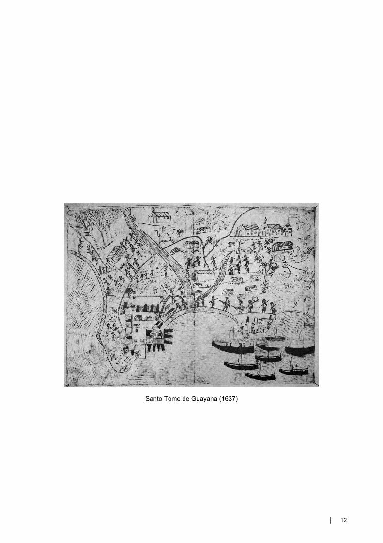
Santo Tome de Guayana was founded on the eastern bank of the Caroni River in the 17th
Century along with a fort that controlled the flow of ships from the Orinoco and Caroni rivers built to
discourage pirates from exploiting the gold mines in the Venezuelan Amazon. Santo Tome de
Guayana changed its name to San Feliz in the 18th Century when mineral wealth became scarce
and was substituted by agricultural exports of coffee and cacao.
San Feliz was a very small village for two hundred years until 1950 when the “Orinoco
Mining Company” found large deposits of Iron Ore nearby and decided to establish two new towns:
Puerto Ordaz at the site of the new steel mill to be built next to the Orinoco river, and Ciudad Piar
at the site of extraction. Three young Venezuelans were hired to design these cities, architects,
Carlos Guinand Baldo and Moises Benacerraf and civil engineer Tomas Carrillo-Batalla.
1: Puerto Caroni, the Orinoco Mining Company and Town Planning Associates: From a Company Town to an Integrated City, 1951-1961
On December 7, 1950 Town Planning Associates (Wiener and Sert) were invited to
participate in two new towns as consultants to Carlios Guinand Baldo, Moises Benacerraf, and
Francisco Carrillo Batalla (two Venezuelan architects and one civil engineer) who were
commissioned by the Orinoco Mining Company (OMC).The two new towns: would begin the
“sowing of the oil” policies of the Venezuelan goverment in collaboration with American
Corporations. Guinand and Benacerraf prepared all the documentary material and started to
negotiate their collaboration on these projects with Town Planning Associates (TPA).
When TPA sent the first “pilot plan” for Puerto Ordaz to their Venezuelan partners, Moises
Bennacerraf and Carlos Guinand Baldo criticised them for planning two civic centers as contrary to
the idea of an integrated city and also the proposed patio housing for a floor to ceiling height of
only 2.4 meters, an exterior corridor for access to the apartments and the lack of exterior stairwells,
about the fact that the duplex apartments were proposed. Faced with these criticisms TPA
modified their proposal and offered a new plans. This “pilot plan” took three years to develop,
beginning in 1951.
Puerto Ordaz was planned following the precedent of Ciudad Dos Motores with the combination of
patio housing medium and low rise and the focus on a central civic space that was pedestrian. This
approach was in line with Sert’s argument of the “heart of the city” presented to the 7th and 8th
CIAM congresses, and it was also a reaction against planning that lost sight of their essential aims
⏐ 5
to satisfy people’s needs. For Sert the city was not only a matter of shape, and architecture could
not be divorced from its urban roots. Paul Lester Wiener writes in 1952:
"In the last years a greater awareness of the human factors, as against the predominant physical-functional ones, is to be noted. The investigation of the “Core of the Cities” is testimony of the search for broader cultural interpretations, The presente preoccupation to interelate the free arts within the “Core of the Cities” raises CIAM’s work to the moral and cultural responsibility which the new era demands.” ( The Heart of the City p. 86) 2:Town Planning Associates In 1938, Paul Lester Wiener was commissioned by the governments of Ecuador and Brazil to
organize and design interiors and exhibits for these countries' pavilions at the New York World's
Fair. The war years found him working with the U.S. Office of Production and Research
Development as well as in his own company, Ratio Structures, Inc., to develop prefabricated and
demountable housing, suitable for post war housing construction and retail marketing. Town
Planning Associates was originally founded by Paul Lester Weiner who was married at the time to
the Alma Morgenthau the sister Henry Morgenthau, the secretary of the treasury in the FDR
administration. Wiener was responsible for the American Pavilion at the Paris Exhibition of 1937
and probably met Jose Luis Sert and Luis Lacasa while they were supervising the construction of
the radical Spanish Pavilion. The architecture of the Pavilion for the Republican government of
Spain influenced Carlos Raul Villanueva who was in Paris at this time working on the Venezuelan
Pavilion with Luis Malausena. In 1939 while he was assisting Costa and Neimeyer with the
interiors of the Brazilian Pavilion of the New York Worlds’ Fair. Jose Luis Sert arrived exiled in New
York and by 1940 had joined Paul Lester Wiener as a partner of Town Planning Associates. In
1942 when at the request of the Secretary of State, Cordell Hull, they embarked on a lecture tour in
South America acting as ambassadors for FDR’s “Good Will Policy” and discussing Designing-
Planning for industry with lectures such as: Public works for a peaceful growth, Modern theories to
plan at territorial scale, New technologies for South American building industry, New materials,
Social services (hospitals, schools).
The assumptions of the Athens Congress to a nascent idea of “Urban Design” with an emphasis on
the creation of a pedestrian city center and opposing the car dominated city of Le Corbusier’s
earlier CIAM.– Sert and Weiner’s’s experience in Latin American was crucial. They were able to
implement some of these ideas against the actual conditions of Latin American cities, a process of
contextualization which purged them of their most dogmatic aspects. For Sert and Wiener the city
is the result of a collection of neighborhood units surrounding a civic center: two urban devices
intended to give a “human scale” to the city. Jose Luis Sert writes in 1952:
“For in truth the most accurate definition of the urbs and the polis is very like the comic definition of a cannon. You take a hole,wrap some steel wire tightly around it, and that’s your cannon. So the urbs or the polis starts by being an empty space, the fórum, the agora,and all the rest are just a means of fixing that empty space, of limiting its outlines.”
⏐ 6
TPA’s first proposal for the Cidade dos Motores was for a city for 25,000 people conceived as an
industrial community to house workers and supervisors of a huge wartime airplane and truck
factory. The pilot plan was completed in 1949 and was exhibited at the Museum of Modern Art.
The city was divided into functional zones linked by a hierarchical system of roads. The building
pattern was totally independent of streets and realized with a series of a high density housing
estates. Empty space took the form of a continuous park, was the dominant landscape of the town.
Although Cidade dos Motores was not built, TPA continued to work on urban projects throughout
Latin America for next ten years.
3: Santo Tomé de Guayana and the Joint Center: Economic Development and Urban Planning at a Regional Scale, 1961-1970
• City as growth pole
• Planning a City at a distance.
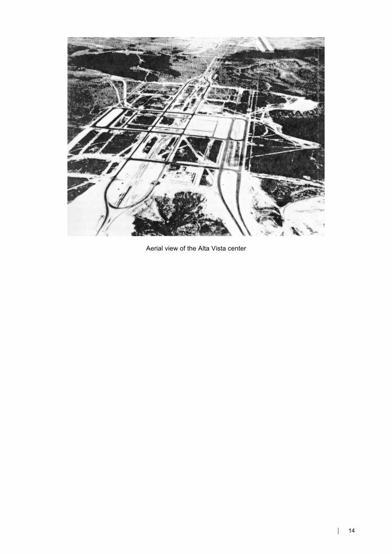
• Isolated Urban Functions along a Linear City: Brutalist Urbanism
On Sunday July 2, 1961, the president of the republic of Venezuela Romulo Betancourt
signed the foundational act for the new city of Santo Tome de Guayana along with the Vice-
President of the Congress, The president of the Supreme Court, the commissioner of the
Corporacion Venezolana de Guayana (CVG), the Governor of the State of Bolivar as the
Archbishop of Ciudad Bolivar Juan Jose Bernal blessed the foundation stone of the new city. This
act formalized the intentions of the newly elected democratic government to continue the efforts of
industrialization that had been started in the 1950’s and the desire to create a new city as a growth
pole that would diversify Venezuela’s economy with the establishment of modern factories for the
production of raw Steel, and Aluminum, as well as finished goods such as I-Beams, re-bars, and
extruded Aluminum sections. In 1969 the first stage of the Guri dam and hydroelectric plant on the
Caroni River was completed and this provided abundant electricity for these industries to thrive.
The Corporacion Venezolana de Guayana ( modeled after the Tennesse Valley Authority) is a
Federal Agency that controls all the investment and management of all the new state owned
industries as well as in charge of overseeing the planning of the new city. CVG hired Venezuelan
architects and planners such as Juan Andres Vegas and worked for five years withThe Joint
Center of MIT and Harvard directed at the time by Daniel P. Moynihan as advisors to Venezuela’s
Guayana Development Corporation (CVG) for all phases of city and regional development. Lloyd
Rodwin, the Chairman of the Faculty Committee of the Joint Center for Urban Studies and the
director of the Guayana project, called this “the largest new city development program in Latin
America—and perhaps the world.” In Rodwin’s later assessment, the joint effort along the Orinoco
proved successful:
“One of the general benefits that may emerge from the Ciudad Guayana project is the demonstration that the political leaders and builders of cities can profit from the formal enlistment of the skills and resources of knowledge available in universities...Perhaps the outstanding lesson
⏐ 7
of the Veneauelan ezperience will be a demonstration of the value of creating the appropriate mechanisms with which to asses and link the growth potentials of the city and region with the national goals for development.”(Planning Urban Growth and Regional Development, P.26) In 1962 Lisa Peattie was appointed “Project Anthropologist” for the Ciudad Guayana venture. She,
her husband and her children lived for 2-1/2 years in an earth-walled house in the shantytown of
Barrio La Laja. She wrote two books critical of her experience in the Joint Center’s planning of
Ciudad Guayana and comments:
“There has always been a Utopian strain in the urban design profession...The planners of Ciudad guayana though of themselves as paractical persons, anything but Utopian, and they would have energetically disavoid the suggestion that they might be environmental determinists. But the evidence is that the planning enterprise has relied on comprehensive planning to humanize thje projects of economic growth. The city planners called on urban design to create a humane world around projects and to generate a sense of community in a setting of economic competition and class conflict.” ( Planning: Rethinking Ciudad Guayana, Peattie P.39)
4: The Corporation Venezolana de Guayana: Industrial Expansion and Urban
Implementation and Architecture, 1970-1986
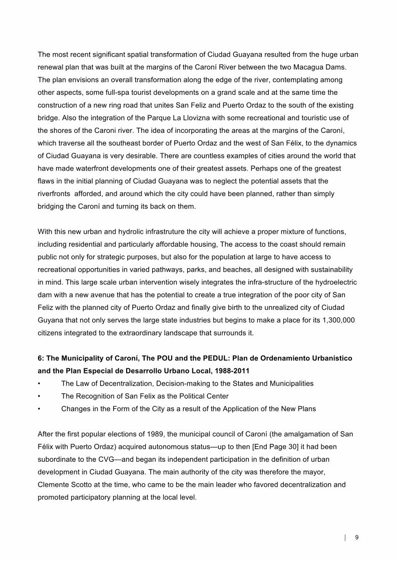
• Jesús Tenreiro’s CVG Building as a Foundational Symbol of the New City
• Architecture for the Basic Industries, Services, sports facilities and cultural programs for the
Workers in Sidor, Venalum, Interalumina and Carbonorca
To understand the magnitude of this Project we can see that The Caroni District in 1950 had a total
of 5,358 inhabitants, and in 2001 had 646,541 inhabitants, in 2007 had 777,283 inhabitants. The
four leaders of the CVG during this period of immense growth were: Rafael Alfonso Ravard,
Argenis Gamboa, Andrés Sucre y Leopoldo Sucre Figarella.It is important to look at Ciudad
Guyana as the fulfillment of the idea of “sowing the oil wealth” by establishing a cheap source of
hydroelectric power for the entire nation as well as the creation of new Steel and Aluminum
industries that would diversify the exports of this oil producing nation. In 1974 with the approval of
Plan IV for Sidor (the steel mill) Venezuela went from producing 47,000 tons of steel in 1960 to
close to 2,000,000 tons in 1980. By 2007 Sidor was producing 4,300,000 tons of steel. By 2012
this production fell to less than 2,000,000 and is still in decline due to serious disputes with the
unions.Willo von Molke, the chief urban designer for the Joint Center writes in 1969:
"A Linear city with a series of nodes connected by a central transportation spine would be the form that would best fulfill the goals of efficient and memorable physical develoment. Only a linear city could tie together the existing developments, scattered over a distance of seventeen miles, and thus help to overcome the site’s major physical problems---the extreme dispersion of existing facilities...Finally, it would increase visual unity and provide continuity of experiences within the city. ” ( Rodwin, op. Cit P. 135-136)
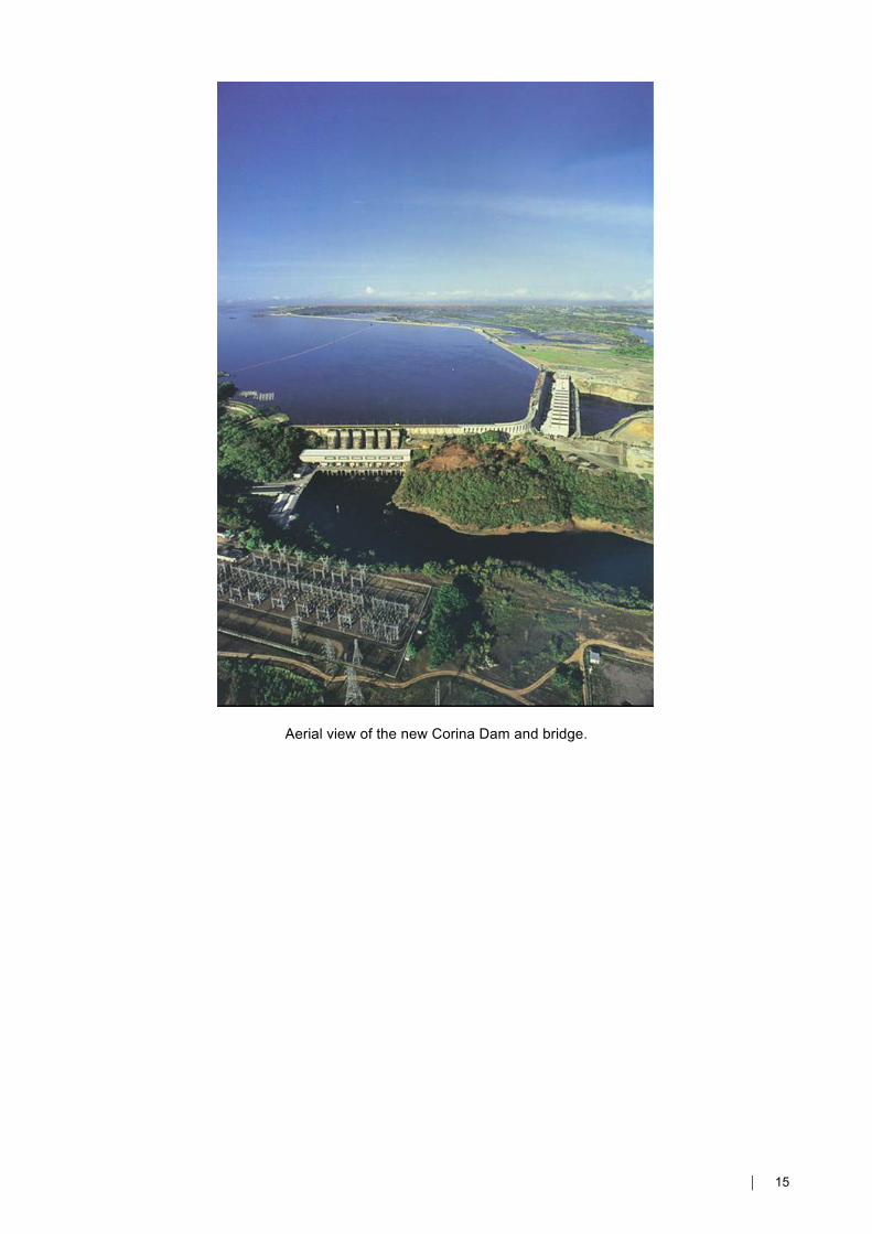
Von Molke’s memorable Brutalist urban images of the city centered on the Avenida
Guayana and Alta Vista--- the core of the new city that never came to be.Although Ciudad
Guayana was meant to become the physical embodiment of the ideas of progress and modernity,
75% of the population still live in San Félix, whereas a similar percentage of jobs are in Puerto
⏐ 8
Ordaz, causing great transportation inefficiencies—long commutes, and severe bottlenecks over
the Caroní River bridge. San Félix lacks basic amenities: many squatters go without paved roads,
drainage, sewerage, water, and schools. Puerto Ordaz, on the other hand, despite its housing of
more enfranchised classes, is not pedestrian friendly, and lacks articulation and plazas, parks, and
green areas. There is conspicuous lack of human scale, and the visual structure offered by the
planners was not realized due to a decision by the CVG to abandon the contruction of the lots
adjacent to the Avenida Guayana to private developers who reproduced the model of isolated
“propiedad horizontal” residental condos without repecting Von Molke’s urban design guidelines.
Ciudad Guayana continues to be an ideological construction---a city that exists in the mind of
planners and government officials, but that has failed to establish a coherent identity for its
inhabitants.The identity of Ciudad Guyana is still tenuous and citizens and visitors continue to refer
to the distinct settlements of Puerto Ordaz and San Felix.These two towns, on either side of the
Orinoco river. have developed further apart from each other—in terms of their level of urban
services and amenities—as a result of the design and implementation of the Ciudad Guayana’s
planning.Despite the Joint Center’s planners idealistic intentions to diminish inequalities in the new
planned city, the planning decision taken caused this economic and spatial polarization through
their allocation of land uses and their failure to understand and engage the creation of the city as a
political process. In addition, the CVG played a major role at perpetuating and exacerbating the
dualism between Puerto Ordaz and San Félix by the differential way in which it allocated
investments for urban services.
Another significant spatial problem in the planning Ciudad Guayana that cannot be ignored is the
40 kilometers distance from San Feliz along the Caroni river in the East to the West paralell to the
Orinoco river where the major state-owned Industries are located. This resulted in extensive urban
sprawl and the city continues to expand with low densities towards the west and the south. The
western extension poses severe problems of pollution, because this zone is where most of the
heavy, polluting industry is located. The expansion to the south invades areas of protection for the
Caroní river basin, undermining the source of water for the city, and causing other environmental
problems. Furthermore,the low densities also have a negative incidence in the costs of urban
service provision, and the efficiency of the public transportation system.
5: EDELCA, New Urban Landscape Associated with Hydroelectrically Development, 1986-
1999
• The City Ring, A New Road Acompanning Macagua Dam
• Environmental Plan Associated With the Construction Of Macagua II
• Humanizing the Industry, Architecture and Landscape for the people
• Development of Parque la Llovizna
⏐ 9
The most recent significant spatial transformation of Ciudad Guayana resulted from the huge urban
renewal plan that was built at the margins of the Caroní River between the two Macagua Dams.
The plan envisions an overall transformation along the edge of the river, contemplating among
other aspects, some full-spa tourist developments on a grand scale and at the same time the
construction of a new ring road that unites San Feliz and Puerto Ordaz to the south of the existing
bridge. Also the integration of the Parque La Llovizna with some recreational and touristic use of
the shores of the Caroni river. The idea of incorporating the areas at the margins of the Caroní,
which traverse all the southeast border of Puerto Ordaz and the west of San Félix, to the dynamics
of Ciudad Guayana is very desirable. There are countless examples of cities around the world that
have made waterfront developments one of their greatest assets. Perhaps one of the greatest
flaws in the initial planning of Ciudad Guayana was to neglect the potential assets that the
riverfronts afforded, and around which the city could have been planned, rather than simply
bridging the Caroní and turning its back on them.
With this new urban and hydrolic infrastruture the city will achieve a proper mixture of functions,
including residential and particularly affordable housing, The access to the coast should remain
public not only for strategic purposes, but also for the population at large to have access to
recreational opportunities in varied pathways, parks, and beaches, all designed with sustainability
in mind. This large scale urban intervention wisely integrates the infra-structure of the hydroelectric
dam with a new avenue that has the potential to create a true integration of the poor city of San
Feliz with the planned city of Puerto Ordaz and finally give birth to the unrealized city of Ciudad
Guyana that not only serves the large state industries but begins to make a place for its 1,300,000
citizens integrated to the extraordinary landscape that surrounds it.
6: The Municipality of Caroní, The POU and the PEDUL: Plan de Ordenamiento Urbanistico
and the Plan Especial de Desarrollo Urbano Local, 1988-2011
• The Law of Decentralization, Decision-making to the States and Municipalities
• The Recognition of San Felix as the Political Center
• Changes in the Form of the City as a result of the Application of the New Plans
After the first popular elections of 1989, the municipal council of Caroní (the amalgamation of San
Félix with Puerto Ordaz) acquired autonomous status—up to then [End Page 30] it had been
subordinate to the CVG—and began its independent participation in the definition of urban
development in Ciudad Guayana. The main authority of the city was therefore the mayor,
Clemente Scotto at the time, who came to be the main leader who favored decentralization and
promoted participatory planning at the local level.
⏐ 10
During his six-year mandate (1989-1995), Scotto emphasized four management goals for the
municipality: to widen and deepen democracy; to enhance the quality of life of citizens; to have an
honest and transparent government; and to modernize the institution. One important way in which
these policies were concretized was the creation of parroquias (political divisions of the social and
physical structure) in Ciudad Guayana. The criteria followed for the definition of 10 parroquias
respected history, social processes, natural and built barriers, number of inhabitants, and more
importantly, the will of the communities involved. Within the municipality were created the Unit of
Community Development and the Unit of Urban Regularization, which consisted of one team—
composed of professionals, technicians, and community representatives—per parroquia, some of
which had internal neighborhood modules.
Scotto promoted an unprecedented empowerment of the local government, and opened the
municipal governance model to significant public participation. These plans were coordinated by
the Unit of Municipal Planning, which had the general goal of "achieving a better quality of life for
the inhabitants of the Caroní municipality, through service conferment and the promotion of
massive participatory and democratic processes, which enable the formation of a citizen
responsible of searching for the satisfaction of her needs".He also helped to construct a better
relationship between the CVG and the municipality. He started to slowly build up the institutional
infrastructure within the municipality to support the incremental transfer of some planning and
managerial responsibilities from the CVG to the local government. He also negotiated some
appropriate partnership between the two instances of government for them to share resources and
duties, aiming to increase decentralization without provoking either a traumatic change of power
and representation, or a potential void of accountability. The empowerment of the local government
was expressed in the construction of a new, bigger building for the municipality, and the urban
revitalization of the surroundings, in particular, the central plaza of San Félix (Plaza Bolívar), the
buildings around it, and the immediate scenic coastal area at the margins of the confluence of the
Caroní and Orinoco rivers.
The preliminary version of the Plan de Ordenamiento Urbano of Ciudad Guayana was presented in
1995, after significant consultation with experts and the incipient civic society in the city. This new
plan marks a radical departure from the planning ideas of the 1960s and 1970s, calling for a more
democratic, participatory transformation of the city, and the promotion of a more inclusive,
pluralistic society. Now, the city is in deep conflict as a failed state has appointed for the past
fifteen years corrupt managers that have drained the resources for all the state owned industries
and created conflicts and violence against the unions that represent the workers. Unemployment is
at an all time high as is violent crime. The contemporary Ciudad Guayana represents both the
failures of an Informal State that has caused bankrupcy to both the private and public investments
⏐ 11
of the past fifty years and the potential for the a city that is not just the product of large state owned
industries but develops an autonomous identity within its extraordinary natural setting.
Jesús Tenreiro-Degwitz, Architect: Corporación Venezolana de Guayana, Ciudad Guayana,
1967–68.
⏐ 12
Santo Tome de Guayana (1637)
⏐ 13
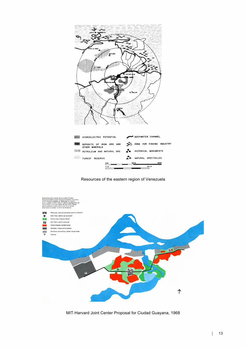
Resources of the eastern region of Venezuela
MIT-Harvard Joint Center Proposal for Ciudad Guayana, 1968
⏐ 14
Aerial view of the Alta Vista center
⏐ 15
Aerial view of the new Corina Dam and bridge.
⏐ 16
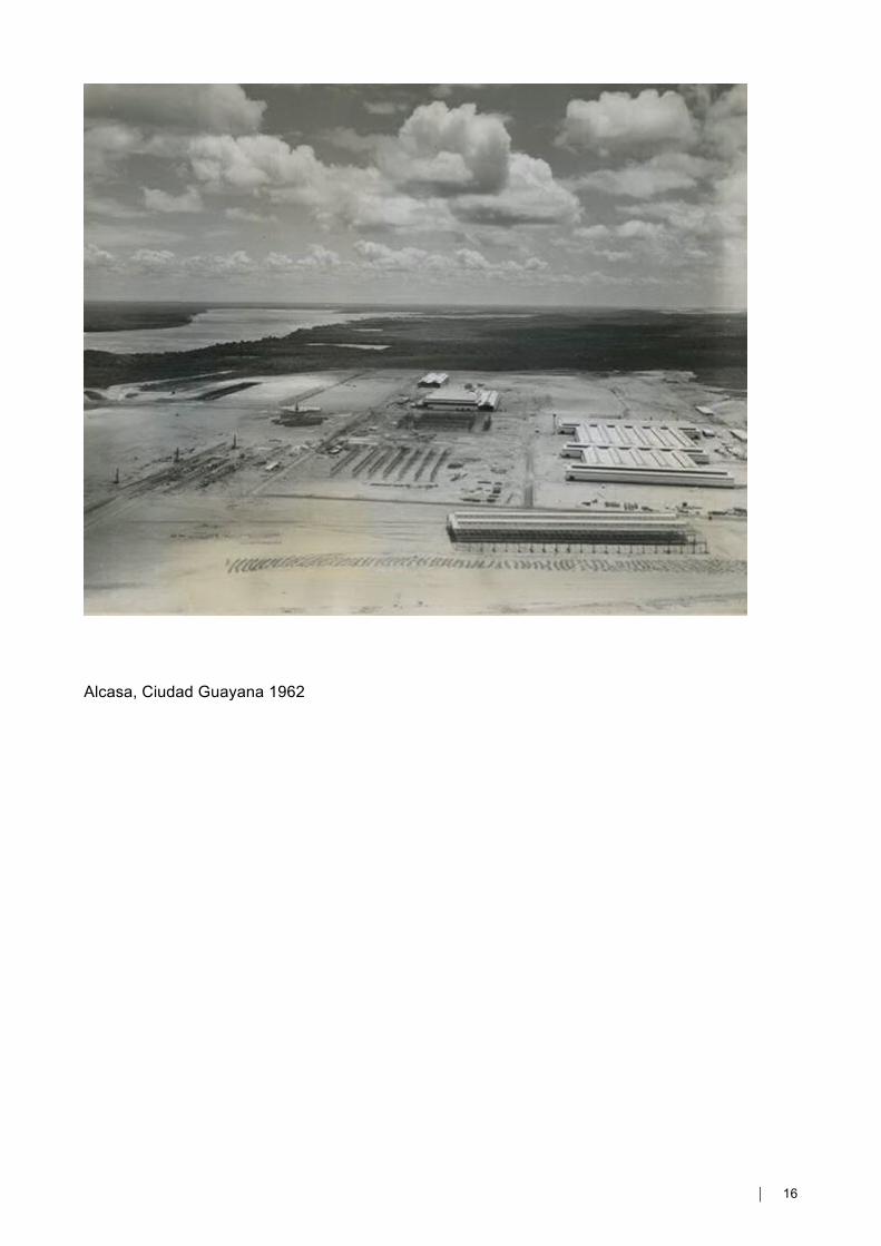
Alcasa, Ciudad Guayana 1962
⏐ 17
BIBLIOGRAPHY
Almandoz, Arturo, edit. Planning Latin America’s Capital Cities 1850-1950. London; New York:
Routledge, 2002.
Appleyard, Donald. Planning a Pluralist City: Conflicting Realities in Ciudad Guayana.
Cambridge, Mass.: The MIT Press, 1976.
Brillembourg, Carlos. “Caracas: Towards a New City 1938-1958.” In Caribbean Modernist
Architecture (Archivos de Arquitectura Antillana 034), edited by Gustavo Luis Moré and Barry
Bergdoll, 101-113. New York: Museum of Modern Art, 2008.
Brillembourg, Carlos, edit., Latin American Architecture 1929-1960: Contemporary
Reflections. New York: Monacelli Press, 2004.
Bullrich, Francisco. New Directions in Latin American Architecture. New York: G. Braziller,
1969.
Castellanos, Patricia Schnitter. José Luis Sert y Colombia: de la Carta de Atenas a una Carta
del Hábitat. Medellín: Universidad Pontificia Bolivariana: Area Metropolitana del Valle de Aburra,
2007
Mumford, Eric Paul, and Hashim Sarkis, edit. Joseph Lluis Sert The Architecture of Urban
Design 1953-1969. New Haven: Yale University Press, 2008.
Mumford, Eric Paul. Defining Urban Design CIAM Architects and the Formation of a
Discipline, 1937-69. New Haven: Yale University Press, 2009.
_____. The CIAM Discourse on Urbanism, 1928-1960. Cambridge, Mass.: The MIT Press,
2000.
Peattie, Lisa Redfield. Thinking about Development. New York: Plenum Press, 1981.
_____. Planning: Rethinking Ciudad Guayana. Ann Arbor: The University of Michigan Press,
1987
_____. The View from the Barrio. Ann Arbor: The University of Michigan Press, 1968.
⏐ 18
Rovira i Gimeno, Josep M., José Lluis Sert: 1901-1983. Milano: Electa Architecture distributed by
Phaidon Press, 2003.
Rodwin, Lloyd and associates. Planning Urban Growth and Regional Development: The
Experience of the Guayana Program of Venezuela. Cambridge, Mass.: The MIT Press, 1969
Semper, Gottfried. The Four Elements of Architecture And Other Writings. Translated by Harry
Francis and Wolfgang Herrmann. Cambridge, England; New York, NY, USA: Cambridge University
Press, 1989.
Sert, Jose L. and C.I.A.M.. Can our Cities Survive?. Cambridge: The Harvard University Press,
1942.
Sert: Arquitecto en Nueva York. Edited by Xavier Costa and Guido Hartray. Barcelona: Actar,
1997. Published in conjunction with the exhibition “Sert: Arquitecto en Nueva York” shown at
Museu d’Art Contemporani de Barcelona, Barcelona, Spain.