The features of the mid-mountain temperate fluvial system (a case study from Sudetes Mts and Carpathians) Piotr Owczarek University of Silesia, Faculty of Earth Sciences, Bdziska 60, 41-200 Sosnowiec, Poland [email protected]Introduction: The fluvial system consists of drainage basin slopes and its river system with flat valley bottoms (Schumm 1977). Its functioning is determined by the following variables: geology, climate, morphology and human impact. They decide about the flow of water and mineral material within the fluvial system, and thus about the degree of coupling/connection of all components of slope and river channel (Schumm 1977, Teisseyre 1991). In the longitudinal section of the fluvial system, three zones can be distinguished: sediment production (I), domination of transport and deposition/redeposition (transfer zone) (II), and permanent accumulation (zone of sediment sink) (III). The erosional, transportation and sedimentation processes of mineral material takes place in each of the zones mentioned above, but with different intensity. Thus, they form the open systems, differing either in volume of transported material and hydrological conditions, as well as availability/reachability of hillslope deposits for fluvial processes. The mid-mountain fluvial system of temperate climate differs from other systems, developing in different climatic conditions, by the ranges of particular zones. It is related primarily with the presence of permanent forest cover and fossil periglacial deposits, as a potential bed load for the rivers, as well as with hydrological regime characterized by seasonal floods, especially during spring and summer periods. Study area: Eastern Sudetes and Beskidy Mts, situated within temperate–intermediate climatic zone, belong to the mid-mountains (500 – 1500 m a.s.l.). The characteristic feature of these massifs is permanent forest cover, which primarily consisted of Sudetic and Carpathian beech-wood, passing upward in spruce-woods. Only the highest culminations of the massifs rise above the upper forest boundary, where sub-alpine plant communities occur (Pradd 1491m, Vysoká hole 1464m, Keprnik 1423m Pilsko 1557m, Babaia Góra 1725m). In the Beskidy and Eastern Sudetes, despite differences in their geological structure, the periglacial transformation of the relief in the Pleistocene had the same character (Klimaszewski 1948, Czudek 1997). The mid-mountains of the temperate climate, in contrast to mountain areas located in different climates, were covered by the thick mantle of the periglacial covers in the Pleistocene. Formation of the slope covers, their displacement along the slope and deposition, first of all were dependent on lithological conditions and local form of terrain. The intensive debris production during cool seasons, at its ease displacement down the slope, favoured the agradational uplift of the valley bottoms. These fossil slope covers, fixed by vegetation, are currently a potential bed load for the rivers, supplied to channels in the zones of direct contact of valley slope with river channel. The northern slopes of the Beskidy and Eastern Sudetes, are dissected by the deep valleys, drained by the Upper Odra and Upper Vistula drainage basins. The catchments of Strni Opava (Eastern Sudetes Mts – Hrubý Jesenik), Koszarawa and Mostysza (Western Carpathians – Beskidy Mts) have been investigated (Fig. 1). In the investigated drainage basins, the character of the vegetation cover, the course of floods in annual cycle were analyzed, and the dominant fluvial processes occurring within the main rivers of drainage basins were determined. Annual cycle of floods and regolith input: Climatic conditions form the hydrological regime of the rivers, which is one of the most important factors deciding about mass and energy exchange within the fluvial system. In the Middle European mid-mountains of temperate climate, the rivers are supplied mainly by the rainfalls and melting of snow covers. In the Eastern Sudetes (Strni Opava) and western part of the Carpathians (Koszarawa), the rivers are characterized by moderate regime with equal spring (melt-snow) and summer (rain) floods. Toward the east (Mostysza), the summer floods are weakly marked; however, spring floods start to dominate.Maximal flows, forming the river channel morphology, are marked twice per year in the analyzed drainage basins. Summer floods, in contrast to snow-melts, commonly are short-lasting; however, they are characterized by rapid and sudden water rise. The water rises decide about the entrainment of coarse clasts, supplied to river channels. In that time, the enhanced supply of slope material into the river channels is observed. The relic Pleistocene regolith, covering the slopes of the Sudetes and Carpathians with thick mantle, is then easily incorporated to the channel subsystem in consequence of lateral and subterranean erosion of the water- courses. During the floods periods, especially caused by rainfalls, the enhanced supply of the colluvial material by the mass movements occur. The slope material is also introduced to the channel subsystem during the inter- flood periods. Especially important seems to be an early spring period, during which the effects of lateral termoerosion and river ice are observed. During the whole year, on the other hand, the material falling either from regolith and rocky-regolith cut-banks occur. The course of the fluvial and slope processes in the analyzed drainage basins of the mid-mountains of temperate climate, characterized by seasonal variability during the
Transcript
The features of the mid-mountain temperate fluvial system (a case study from Sudetes Mts and Carpathians)
Piotr Owczarek
University of Silesia, Faculty of Earth Sciences, B�dzi�ska 60, 41-200 Sosnowiec, Poland
Introduction: The fluvial system consists of drainage basin slopes and its river system with flat valley bottoms (Schumm 1977). Its functioning is determined by the following variables: geology, climate, morphology and human impact. They decide about the flow of water and mineral material within the fluvial system, and thus about the degree of coupling/connection of all components of slope and river channel (Schumm 1977, Teisseyre 1991). In the longitudinal section of the fluvial system, three zones can be distinguished: sediment production (I), domination of transport and deposition/redeposition (transfer zone) (II), and permanent accumulation (zone of sediment sink) (III). The erosional, transportation and sedimentation processes of mineral material takes place in each of the zones mentioned above, but with different intensity. Thus, they form the open systems, differing either in volume of transported material and hydrological conditions, as well as availability/reachability of hillslope deposits for fluvial processes. The mid-mountain fluvial system of temperate climate differs from other systems, developing in different climatic conditions, by the ranges of particular zones. It is related primarily with the presence of permanent forest cover and fossil periglacial deposits, as a potential bed load for the rivers, as well as with hydrological regime characterized by seasonal floods, especially during spring and summer periods.
Study area: Eastern Sudetes and Beskidy Mts, situated within temperate–intermediate climatic zone, belong to the mid-mountains (500 – 1500 m a.s.l.). The characteristic feature of these massifs is permanent forest cover, which primarily consisted of Sudetic and Carpathian beech-wood, passing upward in spruce-woods. Only the highest culminations of the massifs rise above the upper forest boundary, where sub-alpine plant communities occur (Prad�d 1491m, Vysoká hole 1464m, Keprnik 1423m Pilsko 1557m, Babaia Góra 1725m). In the Beskidy and Eastern Sudetes, despite differences in their geological structure, the periglacial transformation of the relief in the Pleistocene had the same character (Klimaszewski 1948, Czudek 1997). The mid-mountains of the temperate climate, in contrast to mountain areas located in different climates, were covered by the thick mantle of the periglacial covers in the Pleistocene. Formation of the slope covers, their displacement along the slope and deposition, first of all were dependent on lithological conditions and local form of terrain. The intensive debris production during cool seasons, at its ease displacement down the slope, favoured the agradational uplift of the valley bottoms. These fossil slope covers, fixed by vegetation, are currently a potential bed load for the rivers, supplied to channels in the zones of direct contact of valley slope with river channel.
The northern slopes of the Beskidy and Eastern Sudetes, are dissected by the deep valleys, drained by the Upper Odra and Upper Vistula drainage basins. The catchments of Str�ni Opava (Eastern Sudetes Mts – Hrubý Jesenik), Koszarawa and Mostysza (Western Carpathians – Beskidy Mts) have been investigated (Fig. 1). In the investigated drainage basins, the character of the vegetation cover, the course of floods in annual cycle were analyzed, and the dominant fluvial processes occurring within the main rivers of drainage basins were determined.
Annual cycle of floods and regolith input: Climatic conditions form the hydrological regime of the rivers, which is one of the most important factors deciding about mass and energy exchange within the fluvial system. In the Middle European mid-mountains of temperate climate, the rivers are supplied mainly by the rainfalls and melting of snow covers. In the Eastern Sudetes (Str�ni Opava) and western part of the Carpathians (Koszarawa), the rivers are characterized by moderate regime with equal spring (melt-snow) and summer (rain) floods. Toward the east (Mostysza), the summer floods are weakly marked; however, spring floods start to dominate.Maximal flows, forming the river channel morphology, are marked twice per year in the analyzed drainage basins. Summer floods, in contrast to snow-melts, commonly are short-lasting; however, they are characterized by rapid and sudden water rise. The water rises decide about the entrainment of coarse clasts, supplied to river channels. In that time, the enhanced supply of slope material into the river channels is observed. The relic Pleistocene regolith, covering the slopes of the Sudetes and Carpathians with thick mantle, is then easily incorporated to the channel subsystem in consequence of lateral and subterranean erosion of the water-courses. During the floods periods, especially caused by rainfalls, the enhanced supply of the colluvial material by the mass movements occur. The slope material is also introduced to the channel subsystem during the inter-flood periods. Especially important seems to be an early spring period, during which the effects of lateral termoerosion and river ice are observed. During the whole year, on the other hand, the material falling either from regolith and rocky-regolith cut-banks occur. The course of the fluvial and slope processes in the analyzed drainage basins of the mid-mountains of temperate climate, characterized by seasonal variability during the
successive seasons, may “remind the changes, that caused large climatic fluctuations in the fluvial system during the Pleistocene and Holicene” (Teisseyre 1984). The range of the fluvial system zones: The degree of coupling between the all components of the drainage basin, crucial for dominant processes occurring in the river channel, let us distinguish the mid-mountain fluvial system zones (Fig. 2). The supply zone (zone I) in the distinguished fluvial system is confined to the upper sectors of the analyzed catchments. They comprise the spring funnels cut out in the periglacial debris cover (Str�ni Opava) or in landslide niches (Koszarawa, Mostysza); and narrow, V-shaped, valley sectors (Fig. 3). In this zone, the direct contact of the river channels with valley slopes is observed. Despite the intense forestation of those parts of the fluvial system, debris material is quite easy introduced to the channel subsystem due to mass movements or fluvial processes. Streams, flowing within narrow valleys, characteristic for this zone, possess channels that are stuffed with colluvial material, pulsatory activated during the high-energy hydrological events.
Together with extending of valley bottoms and their transformation into flat-bottom ones, the contact of the channel with slope is restricted.Continuous supply of slope material, characteristic for the zone 1, is confined only to the short intervals, so called HSD (�Hillslope Sediment Delivery) zones (Paepke & Schmidt 1998, Owczarek 2004). The slope material is supplied to the river channels due to mass movements or erosional undercuts of the slopes (Fig. 4). The dominant or equivalent processes occurring in the rivers flowing within the flat bottom valleys are, on the other hand, transport and redeposition of bed load. In the thought of Schumm’s fluvial system, the sectors of analyzed drainage basins are situated on the boundary of supply zone (zone 1) and transport zone (zone 2). This transitional zone, in which either debris production and its drain off and deposition processes occur, is the longest zone within the mid-mountain, temperate fluvial system (Fig. 2). The valley slopes still restrict the natural development of the river channels, influencing their structure and pattern.
The characteristic feature of the analyzed mid-mountain fluvial systems of temperate climate, is a lack of the third zone (the zone of permanent accumulation). The zone II, on the other hand, is confined to the short, mouth sectors. In the analyzed systems, the longest transfer zone has the Kaszarawa River. Certainly, it is related with large surface area of the drainage basin, in comparison to Mostysza and Str�ni Opava rivers, and greater loading carried by the river (Fig. 1).
The zones ranges of the analyzed drainage basins differ from those observed in fluvial systems occurring in different climatic conditions. In the fluvial systems of dry and semi-dry areas, as well as in high-mountain and periglacial systems, the zone I is the most developed (Davies et al. 1990, Krzemie� 1991, McEwen & Matthews 1998, Gramis & Schmidt 1999, Webb & Griffiths 2001). Here, the lack of permanent forest cover influences on intensive and easy supply of slope material to the channels. On the other hand, in the mid-mountain tropical systems, as well as in glacial and sandur lowlands, the transport and deposition processes dominate (zone II) (Klimek 1972, Cenzo & Luk 1997).
Conclusions: The selected features of the mid-mountain fluvial system of temperate climate presented above, especially the presence of fossil debris covers, permanent forest cover and hydrological regime with seasonal (spring and summer) floods, stay in contrast not only with systems formed in different climatic conditions, but also with system of temperate upland areas. The characteristic feature of the mid-mountain temperate fluvial systems is a lack of zone III, and restriction of zones I and II at very developed and long transitional zone between the supply and transport/deposition zones. The periodical regolith and colluvial material supply from the HSD zones, shape the courses of fluvial processes in the river channels, but on the short intervals. This process stays in strong dependence with transporting energy of the river and deposition of the bed load derived from the upper sections of the drainage basin.
References: Cenzo P., Luk S. (1997): Gully erosion and sediment transport in a small subtropical catchment, South China.
Catena, 29, 161 – 176. Czudek T. (1997): Reliéf Moravy a Slezska v kvartéru. SURSUM, Tišnov, 213 s. Davies D,A., Berrisford M.S., Matthews J.A. (1990): Boulder-paved river channels: a case study of a fluvio-
periglacial landform. Z. Geomorph. N. F, 34: 213 – 231. Gramis P.E., Schmidt J.C. (1999): Geomorphology of the Green River in the Eastern Uinta Mountains, Dinosaur
National Monument, Colorado and Utah. [in:] A.J. Miller i A. Gupta (eds.) Varietes of Fluvial Form, Wiley & Sons: 81 – 111.
Klimaszewski M. (1948): Polskie Karpaty Zachodnie w okresie dyluwialnym. Prace Wroc. Tow. Naukowego, 7, 233 s.
Klimek K. (1972): Współczesne procesy fluwialne i rze�ba równiny Skeidararsandur (Islandia). Prace Geogr. IG PAN, 94, 138 s.
Krzemie� K. (1991): Dynamika wysokogórskiego systemu fluwialnego na przykładzie Tatr Zachodnich., Rozpr. hab. UJ nr 215, 160 s.
McEwen L.J., Matthews J.A. (1998): Channel form, bed material and sediment sources of of the Sprongdøla, southern Norway: evidence for a distinct periglacio-fluvial system. Geogr. Ann., 80 A (1): 17 – 36.
Owczarek P. (2004): Evolution of alluvial channel forms under the influence of hillslope sediment delivery (S Poland). [in:] M. Mikoš & D. Gutknecht (eds.) INTERPRAEVENT 2004 – Changes within Natural and Cultural Habitat and Consequences. Tagungspublikation Band 4, 225 – 232.
Paepke B.E., Schmidt J.C. (1998): Spatial distribution and character of hillslope sediment delivery sites and influences on channel morphology, South fork Sheep Creek, Uinta Mountains, Utah. Proceedings of the American Geophysical Union Spring Meeting - Boston, 105 – 106.
Schumm S.A. (1977): The fluvial system. Wiley, New York, 338 s. Teisseyre A.K. (1984): Procesy fluwialne i rozwój koryta górnego Bobru na odcinku badawczym w Bła�kowej
(1967-1982). Geologia Sudetica 19 (1): 7 – 65. Teisseyre A.K. (1991): Klasyfikacja rzek w �wietle analizy systemu fluwialnego i geometrii hydraulicznej. Prace
Geologiczno-Mineralogiczne, 22, Wrocław, 210 s. Webb R.H., Griffiths P.G. (2001): Monitoring of coarse sediment inputs to the Colorado River in Grand Canyon.
U.S. Geological Survey Fact Sheet 019-01: 1 – 7.
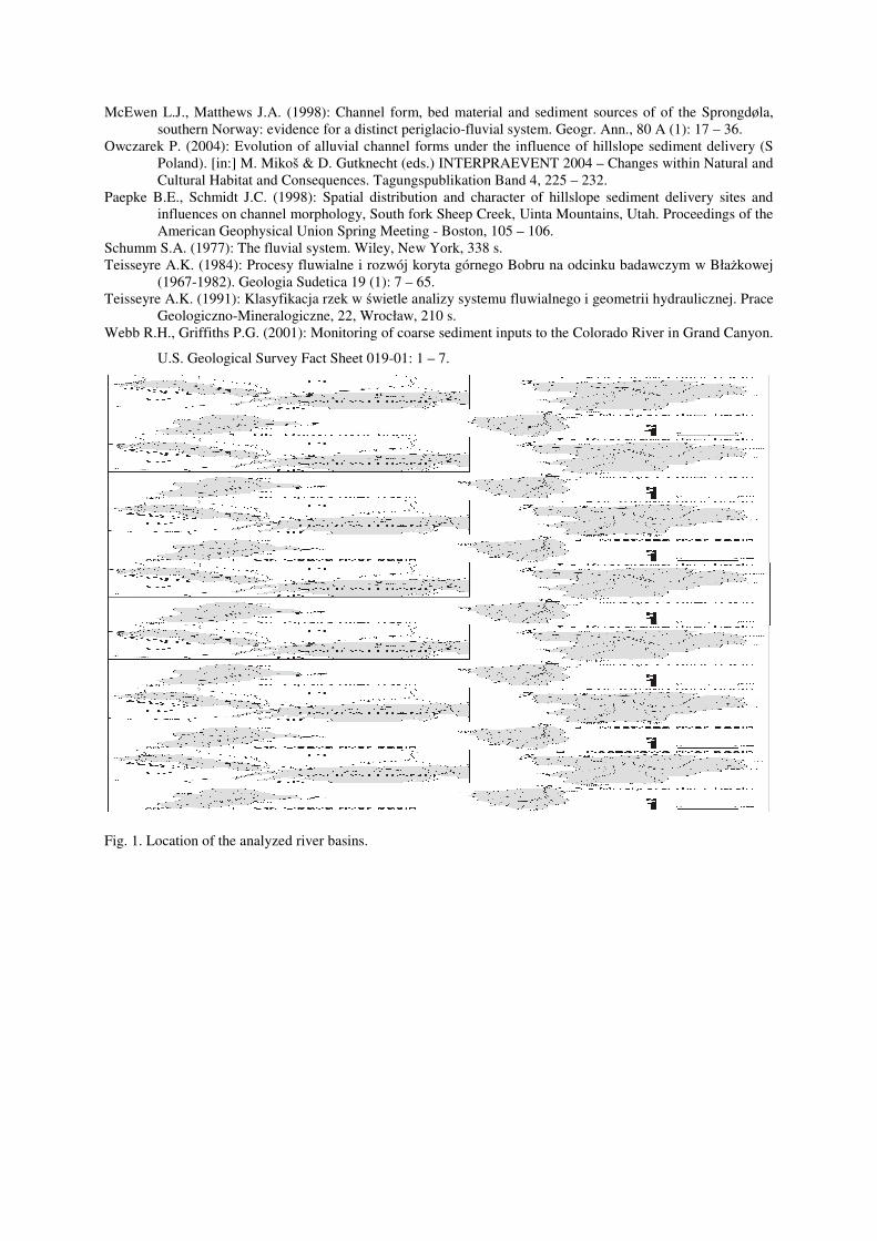
Fig. 1. Location of the analyzed river basins.
Fig. 2. Range of the zones of the mid-mountain temperate fluvial system.
Fig. 3. Upper section of the Koszarawa River; input of the Pleistocene hillslope deposits into the river channel within V-shaped valley.
Fig. 4. Middle section of the Str�ni Opava River; hillslope sediment delivery zone.