31
Th e importance of cycling data within mobility data Julie Mariën, Department of Mobility and Public Works 19.02.2020

The import ance o f cycling da t a wit hin mobilit y da t a Julie Mariën, Department of Mobility and Public Works19.02.2020
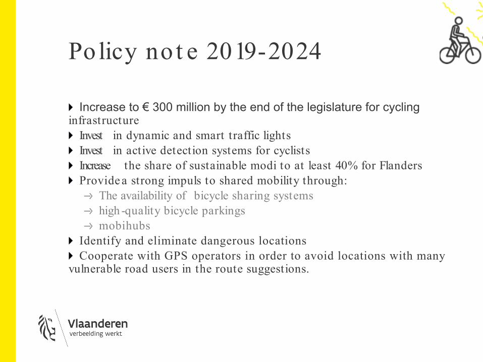
Policy no t e 2019-2024
Increase to € 300 million by the end of the legislature for cycling infrastructure
Invest in dynamic and smart traffic lightsInvest in active detection systems for cyclistsIncrease the share of sustainable modi to at least 40% for FlandersProvide a strong impuls to shared mobility through:
The availability of bicycle sharing systemshigh -quality bicycle parkingsmobihubs
Identify and eliminate dangerous locationsCooperate with GPS operators in order to avoid locations with many
vulnerable road users in the route suggestions.

Different init ia t ives focussing on (cycling) da t a
ITS-action planRegulatory framework open dataMobility centralMobihubsNAP MMTIS (and other European obiligations)Geoaccess point bicycle3.0Mobilidataprogramme…
NAP MMTIS Regula t o ryframework

Direct ive 2010/ 40/ EU: Framework fo r t he Deployment o f Int elligent Transport Syst ems
ContextFast technological developmentFragmented and uncoordinated deploymentLow degree of intermodalityPatchwork of national, regional and local solutions
=> ITS directive and action plan:Establishing a framework for coordinated and effective deployment and use of ITSSetting common prioritiesDevelopment of specifications and standards

4 priority areas
Optimal Use of Road,Traffic and Travel Data
Road Safetyand Security
Continuity ofTraffic and
Freight Management
Linking Vehicle andTransport Infrastructure

6 prio rit y act ions
A: EU-wide Mult i-Modal TravelInfo rmat ion
- Availability and accessibility of traffic data
- Cross-border electronic data exchange
- Updating the available road and traffic data
- Updating the multimodal travel information

6 prio rit y act ions
B: Real-time traffic information servicesC: Safety -related minimum universal traffic
informationD: Interoperable EU-wide eCallE: Truck parking informationF: Reservation Services for Truck Parking

Nat iona l Access Po int s
Digital architecture with open and common standards and interfaces and an efficient, but secure data ecosystem
Need for National Access PointsMultimodalTravel Information ServicesSafety -related Minimum Universal Traffic Information ServicesReal -time Traffic Information ServicesTruck Parking

Delega t ed Regula t ion (EU) 2017/ 1926
What?EU regulation supplementing the ITS Directive
Why?For the provision of EU-wide multimodal travel information services (MMTIS)
How?NAP for all data related to the transport of persons
Facilitate data accessImprove interoperability through the use of standardsStimulate the use and re-use of dataObligation for all data owners to provide transport related data, at least static, but we also recommend dynamic data

Nat iona l Access Po int MMTIS
Static (& dynamic) data of different transport modesData -updatesMetadataInformation on the quality of the data
The access point may take various forms, such as a database, data warehouse, data marketplace, repository, register,web portal.

Nat iona l access po int MMTIS
DATA
PROVIDERSERVICE
PROVIDER
public and privat e nat ional and int ernat ional
Provide met a-dat a Provide a descript ive list of exist ing
dat a in Belgium
Exchange
Cont ract / service/ dat a
NAP

Which “modes o f t ransport ” and which da t a a re concerned?
ScheduledAir, rail including high speed rail, conventional rail, light rail, long-distance coach, maritime including ferry, metro, tram, bus, trolley-bus
Demand-responsiveShuttle bus, shuttle ferry, taxi, car-sharing, car-pooling, car-hire, bike-sharing, bike-hire
PersonalCar, motorcycle, bicycle
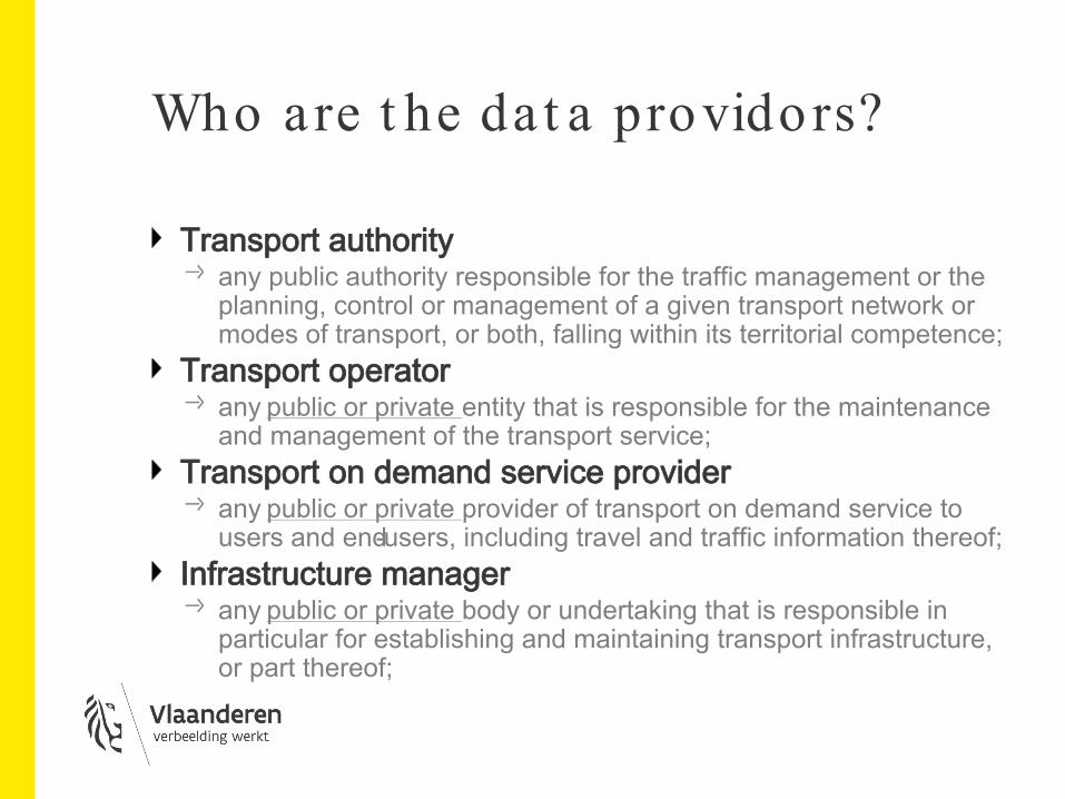
Who are t he da t a providors?
Transport authorityany public authority responsible for the traffic management or the planning, control or management of a given transport network or modes of transport, or both, falling within its territorial competence;
Transport operatorany public or private entity that is responsible for the maintenance and management of the transport service;
Transport on demand service providerany public or private provider of transport on demand service to users and end-users, including travel and traffic information thereof;
Infrastructure managerany public or private body or undertaking that is responsible in particular for establishing and maintaining transport infrastructure, or part thereof;

Who are the “users”?
Any public or private entity which uses the NAP such as:
Transport authorities, Transport operators, Transport on demand service providers,Infrastructure managersTravel information service providers, Digital map producers,

Det a iled t imet able
01.12.2019 -> service level 1 Location (point of departure & point of arrival), travel plans, calculation of route schedule for organized transport & for personal transport, networks, time tables, facilities, accessibility, ...
01.12.2020 -> service level 2P&R locations, bike- & car sharing stations, refueling stations, information on how & where tickets are sold …
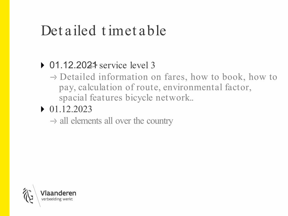
Det a iled t imet able
01.12.2021 -> service level 3Detailed information on fares, how to book, how to pay, calculation of route, environmental factor, spacial features bicycle network..
01.12.2023all elements all over the country
What will be t he obliga t ions o f st akeho lders?
Data providers will have toRegister on the NAP: https:/ / www.transportdata.be/Fill in the data catalogue with mandatoryinformations

Data users will have to:
Use the data in a neutral manner and without discrimination or bias
Indicate the source of data and the date and time of last update
Provide the possibility of reuse of the dataRespect the license agreement
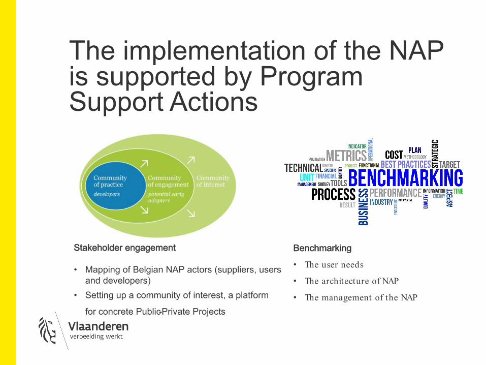
The implementation of the NAP is supported by Program Support Actions
Stakeholder engagement
• Mapping of Belgian NAP actors (suppliers, users and developers)
• Setting up a community of interest, a platform
for concrete Public-Private Projects
Benchmarking
• The user needs
• The architecture of NAP
• The management of the NAP
Geo access po int bicycle 3.0

Object ives
1. Locationof the supra-local functional byciclenetwork andcollect and report data on the cyclepath and network
2. Inventory of conformity parameters for bicycle infrastructure & Calculate conformity score
3. Collect and publish information about infrastructural projects
4. Collecting and publishing cycling data5. Publishbicycleaccident data
The result will consist of 5 different GIS layers in one GIS viewer that can be consolidated by end users in their own GIS desktop environment.
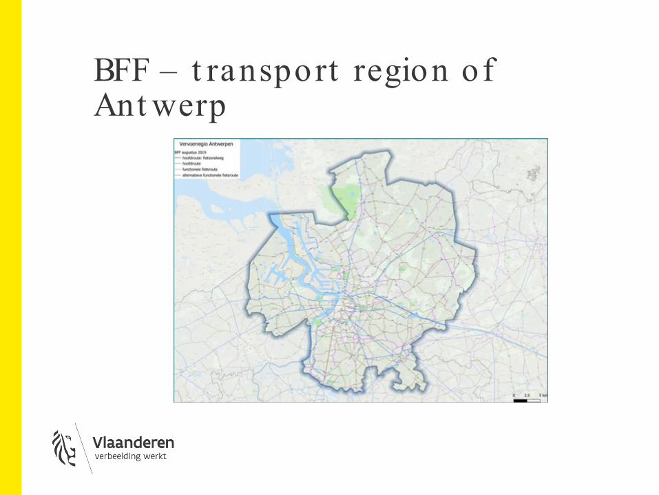
BFF – t ransport region of Ant werp
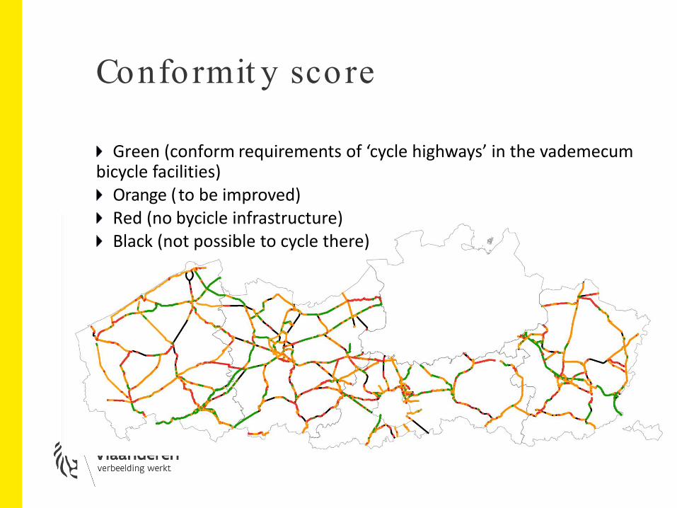
Conformit y score
Green (conform requirements of ‘cycle highways’ in the vademecum bicycle facilities)
Orange (to be improved)Red (no bycicle infrastructure)Black (not possible to cycle there)

Mobilida t a
for safer, smart er and more sust a inablet ra ffic
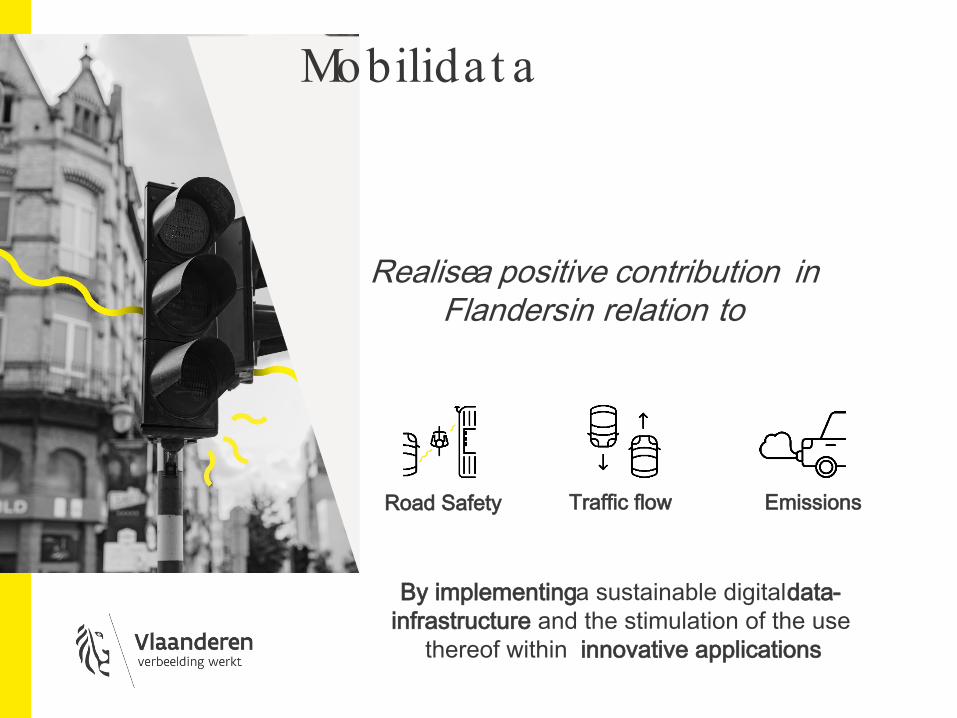
Road Safety Traffic flow Emissions
By implementing a sustainable digital data-infrastructure and the stimulation of the use
thereof within innovative applications
Realisea positive contribution in Flandersin relation to
Mobilida t a

Innova t ive so lut ions in 4 domains
Roll-out otherC-ITS
applications
R&D next-gen smart
mobility applications
Public policy supportingapplications
Roll-out of C-ITS applications with intelligent traffic
light control systems
Innovate technologies A smart (add-on) device for cyclists Wild ideas to facilitate cycling A platform to share data Looking for pilot testing/studies Gain more insights about VRU
Join forces for


