101
The Upper Verde River: A Wild and Scenic River Study Prepared by Cacia McClain as a Senior Project In conjunction with the Arizona Wilderness Coalition April 2004

The Upper Verde River: A Wild and Scenic River Study
Prepared by Cacia McClain as a Senior Project
In conjunction with the Arizona Wilderness Coalition April 2004

Upper Verde River Wild and Scenic River Proposal Table of Contents
Overview Map…………………………………………………………………………….1 Glossary…………………………………………………………………………………...2 Summary of Document…………………………………………………………………..3
I. Introduction and Background……………………………………….………4 A. The National Wild and scenic Rivers Act…………………..………….4 B. The Purpose of a Citizen’s Proposal for a
Wild and Scenic River Study of the upper Verde River…..…………….5 C. The Study Report……………………………………………..………….6 D. Methods and study process……………………………………………...8
II. Description of the Study Area……………………………………………….8 A. Regional Setting……………………………………………….…………8 B. Access………………………………………………………….….…......10 C. Climate……………………………………………………………....…..10 D. Geology/ Hydrology/ Geomorphology……………………………..…11 E. Ecology and Vegetative Characteristics…………………………....….13 F. Wildlife………………………………………………………………..….16 G. Fish…………………………………………………………………...….29 H. Cultural………………………………………………………………......33 I. Historic…………………………………………………………………..34 J. Recreation…………………………………………………………….....36 K. Scenic………………………………………………………………..…...37
III. Basis for Eligibility Evaluation………………………………………….….38 A. Free-flowing Character…………………………………………….……39 B. Outstanding Remarkable Values of the upper Verde River……….….39 C. Eligibility Findings……………………………………………………...46
IV. Classification………………………………………………………………...46 V. Suitability………………………………………………………………….…49
A. Forest Planning Process – Other Factors Affecting WSR Designation……………………………………………………………...49
B. Coordinated Studies and Other Planning Processes……………….…52 VI. Existing Assessment………………………………………………………..53 VII. Conclusion……………………………………………..……………………53 VIII. Works Cited………………………………………………………………….55 IX. Appendices…………………………………………………………………..58
A. Geology, Hydrology, Morphology Photos……………………………..58 B. Ecology and Vegetation Photos………………………………………..63 C. Wildlife Photos……………………………………………………….....67 D. Cultural Photos………………………………………………………….71 E. Historic Photos………………………………………………………….75 F. Route Photos…………………………………………………………….79 G. Impact Photos…………………………………………………………...86 H. Scenic Photos……………………………………………………………91 I. Field Data Photopaths………………………………………………….98
Arizona Wilderness Coalition 2004 Upper Verde River Wild and Scenic River Study

Overview Map
Arizona Wilderness Coalition 2004 Upper Verde River Wild and Scenic River Proposal
1

Glossary
Wild river areas -- Those rivers or sections of rivers that are free of impoundments
and generally inaccessible except by trail, with watersheds or shoreline essentially
primitive and waters unpolluted. These represent vestiges of primitive America.
Scenic river areas -- Those rivers or sections or rivers that are free of impoundments,
with shorelines or watersheds still largely primitive and shorelines largely
undeveloped, but accessible in places by roads.
Recreational river areas -- Those rivers or sections of rivers that are readily accessible by road or
railroad, that may have some development along their shorelines, and that may have
undergone some impoundment or diversion in the past (U.S. Congress 1968).
Eligibility --Qualification of a river for inclusion in the national system through determination
that it is free-flowing and with its adjacent land area possesses at least one outstandingly
remarkable value (NPS and USFS 1982).
Classification -- The process of determining which of the classes outlined in section 2(b) of the
Act (wild, scenic, or recreational) best fit the river or its various segments (NPS and USFS
1982).
Suitability – suitability includes the determination of whether eligible rivers are appropriate
for designation based upon the environmental and economic consequences of designation
and the manageability of the designated river (USFS, NPS & BLM 1996).
Arizona Wilderness Coalition 2004 Upper Verde River Wild and Scenic River Proposal
2

Summary
This study report evaluates the eligibility, classification, and suitability for the upper Verde
River to be designated as part of the National Wild and Scenic Rivers System (NWSRS). The
determinations are based on evaluations of the natural and cultural resource values of the
area. Through this study 18.5 miles of the 19-mile study river have been found eligible for
inclusion into the NWSRS. The criteria used determine this inclusion were the existing free-
flowing character of the river and the presence of outstanding remarkable river-related
values. These values that are found within the study area are: ecology, wildlife, fish, cultural,
historical, and scenic. The Wild and Scenic Rivers Act provides a classification system for
eligible river segments based on the degree of human development on the river and adjacent
shorelines. The three possible classifications are wild, scenic, or recreational. This study
determined that the nineteen-mile perennial length of the upper Verde River would best be
protected by being divided into three segments. The upper segment from the Prescott
National Forest Boundary to the western edge of the Verde Ranch property should be
designated Wild. The middle segment, from the eastern boundary of the Verde Ranch to
about 2 miles upstream of Bear Siding where the 500 kv power line crosses the river canyon,
should be designated Wild. The third segment, from the 500kv power line to the Perkinsville
Bridge is proposed as a Scenic river area. The upper Verde’s suitability for inclusion in the
NWSRS was determined based on the Utah state office of the Bureau of Land Management
“Wild and Scenic Rivers Direction for Identification, Evaluation, and Management Manual”.
Note about GIS data:
The CD included with this proposal contains GIS shapefiles for all photopoints and
proposed river segments. The CD also includes all the digital photos. The photo points in
the appendices are hot linked to the photos taken at these locations. For this option to work,
the photos must have a file path of c:\GIS\upperverde\photos.
Arizona Wilderness Coalition 2004 Upper Verde River Wild and Scenic River Proposal
3

I. Introduction and Background
A. The National Wild and Scenic Rivers Act
The Wild and Scenic Rivers Act (WSRA), (Public Law 90-54289 as amended; 16 U.S.C.
1271-1287) was enacted by Congress in October 1968 to provide federal protection for
selected outstanding free-flowing rivers. Congress recognized the need to preserve natural
conditions along some of the nation’s remaining unimpounded rivers because of the
dramatic degradation and modification caused by dams, diversions, and over-development
of many rivers and segments of rivers. The purpose of the WSRA of 1968 is stated in section
1(b):
It is herby declared to be the policy of the United States that certain selected rivers of the Nation which, with their immediate environments, possess outstandingly remarkable scenic, recreational, geologic, fish and wildlife, historic, cultural, or other similar values, shall be preserved in free-flowing condition, and that they and their immediate environments shall be protected for the benefit and enjoyment of present and future generations. The Congress declares that the established national policy of dam and other construction at appropriate sections of the rivers of the United States needs to be complemented by a policy that would preserve other selected rivers or sections thereof in their free-flowing condition to protect the water quality of such rivers and to fulfill other vital national conservation purposes.
As of 2003, 11,304 miles of river have been designated in the National Wild and Scenic
River System (NPS 2004). One river in Arizona has been included, a 40-mile segment of the
Verde. Under Section 7(a), the WSRA provides legislative protection for designated free
flowing rivers from any “dam, water conduit, reservoir, powerhouse, transmission line, or
other project works under the Federal Power Act (41 Stat. 1063), as amended (16 U.S.C.
791a et seq.)”. Furthermore, under the same section, the Forest Service cannot recommend
any water resources project that would adversely affect the values for which the Wild and
Scenic River (WSR) was established. There are also unyielding restrictions against any
development of lands within the quarter mile adjacent to each stream bank that might
compromise or detract from existing outstandingly remarkable values (P.L. 90-542 Section
7(a)). This protection may also be provided to rivers that have received legislative
authorization from Congress for study as potentially eligible for the NWSRS. Temporary
Arizona Wilderness Coalition 2004 Upper Verde River Wild and Scenic River Proposal
4
protection for study lasts a maximum of three years after Congress has received the final
study report from an agency (P.L. 90-542 Section 7(b)).
Rivers can be added to the NWSRS only through an Act of Congress. It is this act of
Congress that makes the WSRA so strong. Once Congress has designated a river wild,
scenic, or recreational, the managing agency must manage for the protection of the
outstandingly remarkable value for which the river was designated (P.L. 90-542 Section 10
(a). A WSR study is conducted by the federal agency (within the Department of Agriculture
[USDA] or Department of the Interior [USDI]) responsible for management. The study
report is reviewed and commented on by other state and federal agencies, conservation
organizations, and the public. If the river is found to be eligible and suitable for designation,
a final report is then sent to the President who recommends specific action to Congress.
Another approach for designating a WSR is addressed in section 2(a)(ii) of the WSRA. A
given state may designate a river wild, scenic, or recreational through legislation and
administer the river as a component of the state’s preservation system. A Governor has the
ability to then request that the Secretary of the Interior add the river to the National System.
The National Park Service evaluates the river, and if criteria for federal inclusion have been
met, the Secretary of the Interior has the authority to designate the river on the condition
that the state assumes funding and management responsibilities. In this case, Congress is not
involved, but the resource values of the river are still protected from degradation (P.L. 90-
542 Section 2 (a) (ii)).
B. The Purpose of a Citizen’s Proposal for a Wild and Scenic River Study of the
Upper Verde River
The purpose of a WSR study for the upper Verde River is to determine if the stream is
eligible for inclusion in the national system based on criteria of the Act and United States
Department of Agriculture and the United States Department of the Interior Interagency
Guidelines. Any group or individual may submit a WSR study report, which is sometimes
called a citizen’s proposal. This WSR citizen proposal, Upper Verde River Wild and Scenic River
Proposal, presents information that has not before been considered and augments the earlier
federal agency WSR study report; it also provides information to the public, federal and state
Arizona Wilderness Coalition 2004 Upper Verde River Wild and Scenic River Proposal
5
agencies, conservation organizations, Congress, and the President to support the upper
Verde River’s inclusion into the NWSRS.
The importance of citizen action cannot be emphasized enough! Citizens have the power to
comment on federal agency proposals in most cases and also have the opportunity to
volunteer their efforts toward protecting the places they value, such as the upper Verde
River. There are endless opportunities for citizens to create partnerships with the local
government agencies to help enforce agency guidelines, clean up local areas of interest, and
help with data collection, such as recreational impacts or species accounts. Not only does a
citizen’s proposal of this kind act as a cooperative effort between local land/river users,
federal agencies, and private land owners, but it also voices concern and care for out public
lands. This proposal is meant to be clear, concise, and thorough, allowing the common
person-with no exceptional knowledge of policy or the designation process-to understand
and influence the fate of their public lands.
C. The Study Report
In Section 4(a) of the WSRA, the affected land management agency is required to create a
report that includes:
…maps and illustrations, shall show among other things the area included within the report; the characteristics which do or do not make the area a worthy addition to the system; the current status of land ownership and use in the area; the reasonably foreseeable potential uses of the land and water which would be enhanced, foreclosed or curtailed if the area were included in the national wild and scenic rivers system.
The study process and report includes three sections: eligibility, classification and suitability.
Specific requirements must be met for a river to qualify as a WSR through section 2(b) of
the WSRA. Primarily, the river or river segment must meet eligibility criteria. The eligibility
report describes the area’s natural and cultural resource values through descriptions, maps,
and photos of the river area. It must be free-flowing, and the river corridor and related
adjacent land area must possess one or more “outstanding remarkable values” (P.L. 90-
54289 Section 16). From this paragraph on, the phrase “Outstanding Remarkable Values” in
this proposal will be capitalized to emphasize the importance of these values; however, in
Arizona Wilderness Coalition 2004 Upper Verde River Wild and Scenic River Proposal
6

the WSRA these words are not capitalized. Potential Outstanding Remarkable Values
include: geology, ecology, fish, wildlife, historic, cultural, scenic, recreation or other similar
values that are deemed regionally or nationally significant. Interagency guidelines clarify that
“other similar values”, i.e. Native American use or educational importance, can justify
eligibility. Outstanding Remarkable Values must be directly river related and their
significance is evaluated nationally and within the context of a regional physiographic
province and of the nation. Because neither the Act nor Interagency Guidelines provide
specific criteria to evaluate the remarkable values, determination is based on regional agency
standards, and educated judgment of the WSR study team. Basis for judgment must be
documented in the study report.
Section 2(b) of the Act requires that eligible river segments be classified as Wild, Scenic or
Recreational. The classification criteria depend on the level of shoreline development and
access to the river corridor. Government agencies use these classifications to guide their
management plans and decisions with regard to development and use along certain segments
of the river.
The suitability study addresses whether WSR designation is in the public’s interest, and if
designation is the most appropriate conservation measure for the river. Factors involved in
the consideration include politics, management, land ownership, costs, conflicting water
projects, and other development proposals. Strong public support is needed from
landowners along the river corridor, local communities, conservation organizations, and state
and federal agencies. Management must also be directed toward protecting the free-flowing
conditions and Outstanding Remarkable Values of the river. Prior to suitability
determination it is necessary to have convincing evidence that the relevant land regulations
are aimed at conservation. WSR designation would add legislation and management
requirements that would support existing management practices (Dupperrault 2003).
Arizona Wilderness Coalition 2004 Upper Verde River Wild and Scenic River Proposal
7

D. Methods and Study Process
Methods and criteria from the Wild and Scenic River Review in the State of Utah primarily
because it is the most in-depth description of the process, the WSRA of 1968, and USDI
/USDA Interagency WSR Guidelines were used to determine eligibility for the upper Verde
River to be classified under the WRSA of 1968.Through inventory, research, and
communication with the USFS, Cacia McClain was able to complete this proposal for the
Arizona Wilderness Coalition. The Outstanding Remarkable Values have been identified
based on the regional values within the Central Arizona Highlands and on the significant
resource values recognized nationally.
II. Description of the Study Area
A. Regional Setting
The upper Verde River is one of the last perennial rivers in Arizona. The Verde River
drainage basin is 14,000km² and the study section contains 5,568 km² or 40 percent of this
area. The study section is 18.7 miles long, reaching from the Prescott National Forest
boundary west of the old Morgan Ranch property at UTM coordinates 372688E, 3860203N
to the Perkinsville Bridge that crosses the
Verde River at UTM coordinates 390243E
3862098N. The Verde River watershed is
bordered on the west by the Big Chino
Fault and Chino Valley, to the east by the
Coconino National Forest, to the north by
the Mogollon Rim and the Kaibab National
Forest, and to the south by the town of
Jerome. The Sycamore Canyon Wilderness
lies just northeast of the southern end of the
river segment (see Figure 1) and the
Woodchute Wilderness lies south of the
river. The river segment is located entirely
in Yavapai County and is east of the town of Pa
Arizona WildernesUpper Verde River Wild an
8
Figure 1. View to north from study area, Sycamore Canyon Wilderness.
(Direction N, photo P1010094)
ulden.
s Coalition 2004 d Scenic River Proposal

The only private land on this stretch of the river is the Verde Ranch, an 83-acre ranch that
the Prescott National Forest and The Nature Conservancy are working collaboratively with
the landowners to acquire (Carrie Christman, USFS, personal communication 2004). The
river flows for about ½ mile through this land at mile 4.7.
The river segment flows southeast through a diverse canyon that is characterized in places by
majestic vertical sandstone, limestone or volcanic walls up to about 200 feet high, forming a
narrow, deep river channel. In other places the river has gently sloping walls and wide
riverbanks that form a meandering, more shallow river channel. The diverse geology of the
study segment allows the river user to have many perspectives within the river ecosystem;
one feels minute and uninfluential when hiking through the narrow canyon walls and more
like an elemental part of the river when hiking through the wider sections.
Numerous archaeological sites and cliff dwellings have been recorded and mapped along the
upper Verde River. Many of the sites are located on ridges above the river placed defensively
and safely with a view of the entire Verde Valley; see photo 017_16. The prehistoric sites
along the canyon rim and the floodplain of the Verde suggest the river corridor was used for
trade, travel, and agriculture for thousands of years. The prehistoric cultures documented
have been the Pueblo I to Pueblo IV people, Prescott Culture and the Sinagua people
(Lopez and Springer, no date; Rice and LeBlanc 2001). Miners traveled through the river in
the early 19th Century and were looking for gold and copper (Sheridan 1998) they left behind
tailings, old mine shafts, and ruins like the one in Figure 6.
Because the Verde River is one of the last perennial rivers in the desert Southwest it
represents critical habitat for many riparian-obligate species of fish, mammals, and birds
such as the spikedace (Meda fulgida), Bald eagle (Haliaeetus leucocephalus), Yuma clapper rail
(Rallus longirostris yumaensis), and southwestern willow flycatcher (Empidonax traillii extimus)
(USDA 2003d). The riparian vegetation is dominated by cottonwood (Populus spp.), willow
(Baccharis spp.), (Salix sp.), (Chilopsis sp.), Ash (Fraxinus sp.), cattails (Typha spp.), reeds, and
sedges. The habitat is somewhat affected by invasive vegetation, such as Tamarisk, as well as
over thirty introduced non-native fish species (see Table 2), but has maintained its natural
character well despite these disturbances.
Arizona Wilderness Coalition 2004 Upper Verde River Wild and Scenic River Proposal
9
Today, the river is used widely for recreation. Local visitors enjoy hiking along the river,
swimming in it, and fishing and camping along its banks. The legal Forest Service routes that
access the river are also important recreational routes for Off Road Vehicles (ORVs) to
recreate in the area.
B. Access
State Route 89 is the main road that runs north-south perpendicular to the Verde Canyon.
County Roads 71, 70 and 137 in Chino Valley all turn east off of State Route 89 into the
Prescott National Forest and lead to various Forest Service Routes that can be confusing to
follow and sometimes are not well-marked. The upper section of the study area can be
accessed from Forest Service Route (FR) 638 with a high clearance vehicle, which can be
accessed by either County Road 137 (now marked Verde Ranch Road) north of the study
area or County Road 70 (also called Perkinsville Road) south of the study area by a high
clearance, 4-wheel drive vehicle. The Perkinsville Bridge is an access point to the river from
the downstream end of the study area and does not require high clearance or 4-wheel drive.
County Road 70 leads to FR 9112J, FR 164, and FR 9110R, which all lead to the river
corridor and require a high clearance, sometimes four-wheel drive vehicle. County Road 71
leads to a few access points from the north of the river. FR 492A, FR 9115W, and FR 182
(which turns into FR 9711K and then into FR 9010) all turn south off of County Road 71
and access the river corridor.
C. Climate
The upper Verde River climate is affected by the regional topography of the Mogollon Rim
to the north-northeast and the Black Hills to the southwest. Moisture-laden air rises and
cools when it meets these features and creates precipitation. The precipitation in the entire
Verde Valley ranges from 12 to 17 inches per year and occurs mostly in the form of rain.
Runoff is highest during March and April because of snowmelt from the Colorado Plateau
(Owen-Joyce and Bell 1983). The summer season typically has the highest precipitation
when monsoon rains occur and cause flash flooding. Temperatures range from 102º F in the
summer to 2º F in the coldest winter months, according to the Childs, Arizona weather
records.
Arizona Wilderness Coalition 2004 Upper Verde River Wild and Scenic River Proposal
10

D. Geology/ Hydrology/ Geomorphology
The Verde River flows through the Central
Mountain Highlands of Arizona, which are
characterized by high mountain ranges and
alluvial basins. The Central Mountains are mostly
made up of granitic rocks with relatively young
basalt and lava flows on the surface. The geology
of the Central Mountain region is distinguished by
a Transition Zone between the Colorado Plateau
and the Basin and Range (Pearthree 1996) (Figure
2). This geographic province is nationally unique.
The Transition Zone between the Mogollon Rim
and the Basin and Range topography is about fifty
miles wide and runs southeast. Faulting and
erosion that have occurred since the Tertiary
period are what separated this area from the
Colorado Plateau. Headwater erosion from
tributaries of significant rivers in the areas, such as the Gila and Salt, has carved out deep
canyons, valleys, and steep mountains. The three greatest valleys in this Transition Zone are
the Chino, Verde, and Tonto (Wilson 1962). The Verde Valley we know of today is defined
by the Verde River. Sedimentary layers found in the bottom of the Grand Canyon are similar
to those found on the surface throughout the Verde Valley and the Mogollon Rim country
below the Colorado Plateau (Arizona Wilderness Coalition 2004). The Verde River
developed into its current form about 2 to 2.5 million years ago.
Figure 2. Physiography of Arizona. (Chronic 1983)
In the upper Verde watershed the basement rocks are mostly Paleozoic limestone.
Limestone and sandstone layers and granitic basement rocks are exposed in the walls or
floodplains of the Verde River canyon and can be easily identified (see photos 010_9;
P1010188; P1010089). The Big Chino Fault lies 26 miles northwest of Paulden, just north of
the study area. This fault is a central component in the formation of the Verde River canyon
and is composed of late Cenozoic sedimentary and volcanic deposits (Wirt and Hjalmarson
2000). Because of possible regional uplift during the late Miocene (5-10 million years ago)
Arizona Wilderness Coalition 2004 Upper Verde River Wild and Scenic River Proposal
11

downcutting by the Verde River has occurred. This downcutting was slowed about 8 to 2
million years ago because of volcanic activity and faulting when the Verde Valley was
naturally dammed with sediments. The downcutting began again about 2.5 million years ago
when the natural basaltic dam was broken. This long-term downcutting has formed terrace
deposits that can be mapped historically. The terraces are thin layers that have been
deposited on carved out rock types of the region that could also have formed during periods
when the river eroded laterally and created a broader floodplain composed of alluvial
deposits of fine sands and coarse gravel bars (Pearthree 1996). The study area is
distinguished by Martin limestone, usually layered on top of the Tapeats sandstone. In places
where the river has eroded these two layers, the granitic basement rock, the layer beneath the
Tapeats sandstone, can be seen. (Photos P1010089; P1010187; P2190094).
The Verde River flows year-round and is supplied by groundwater discharge, ephemeral
tributaries, and perennial tributaries. The regional aquifers that feed the river are the Big and
Little Chino Aquifers, both of which are in danger of being pumped by the surrounding
cities for human water consumption. Currently, the base flow of the Verde is fairly steady
annually but changes seasonally, with a maximum flow in January and February and a
minimum flow in July and August. It is important to note that changes in the base flow of
the Verde may represent changes in the Big and Little Chino Aquifers (Lopez and Springer,
no date)
The base flow of the upper Verde River has shown increasing flow trends over the past
thirty years. Neary and Rinne (2001) found that the mean daily minimum flow of the upper
Verde River at the Paulden gage increased over the three decades prior to 1997. Mean daily
minimums ranged from 15 to 25 ft³/sec at the Paulden gage and from 60 to 82 ft³/sec at the
Clarkdale gaging station. The USGS water flow gage 9503700 near Paulden showed that
between 1964 and 1994 the maximum monthly discharge was 1,440 ft³/second in February
and the minimum monthly discharge was 27 ft³/second in June. The mean annual discharge
for the twenty-year span was 46 ft³/second (USGS 2004).
Although the base flow has increased over this short period of time, it is not yet protected
from diversion of consumptive extraction. Threats to the base flow are apparent with the
Arizona Wilderness Coalition 2004 Upper Verde River Wild and Scenic River Proposal
12

recent proposal by the City of Prescott to pump up to 17 million m³ (45 billion gallons) of
groundwater from the Big Chino Basin could adversely affect the base flow of the upper
Verde (Neary and Rinne 2001). From April 1, 1964 through July 15, 1964 groundwater
pumping from the Big Chino Basin of 6,500 gallons per minute decreased the flow at the
Paulden gage by 25 percent (Neary and Rinne 2001). The amount pumped in 1964 is only
two-thirds of the proposed amount today. Base flow is obviously important for the existence
of endangered riparian habitat and the wildlife that depend upon this habitat.
E. Ecology and Vegetative Characteristics
The upper Verde River provides a diverse vegetative ecosystem that is supported by a
significant perennial base flow. Riparian areas in Arizona represent some of the most
significant habitat in the Southwest. Arizona and New Mexico’s landscapes are composed of
less than 2% of riparian ecosystems, but are the most biodiverse areas in the Southwest and
90% of these have been degraded from grazing, logging, mining and impacts from urban
development (USFWS 1995). Riparian areas provide the harsh desert climate and arid
environment with water, cover, shade, and travel corridors for hundreds of species.
The upper Verde’s surface water has enabled an ecologically important corridor to exist.
This corridor is currently functioning in relatively pristine, intact conditions. These waters
create an oasis in the arid lands of central Arizona and support a high percentage of species
richness and biodiversity. In 1991 and 1992 the Verde River was listed as the thirteenth most
threatened river in the U.S. and in 1987 it was the fifth most endangered river in the U.S.
(American Rivers 2004). In 1980 the Forest Service found that twenty percent of the river
corridor from the National Forest Boundary near the old Morgan Ranch to Tangle Creek
Junction is capable of having quality productive vegetation (USDA 1980).
The riparian corridor of the upper Verde River is dominated by mixed-age classes of a
diverse array of deciduous tree species, including Freemont cottonwood (Populus fremontii),
velvet ash (Fraxinus velutina), netleaf hackberry (Celtis reticulata), burrobrush (Ambrosia spp.),
desert willow (Chilopsis linearis), coyote willow (Salix exigua), and velvet mesquite (Prosopis
velutina). These species create a dispersed canopy allowing enough sunlight to reach the
ground for a mixed understory to develop. These species provide wildlife such as beaver,
Arizona Wilderness Coalition 2004 Upper Verde River Wild and Scenic River Proposal
13

(Castor canadensis), and elk, (Cervus elaphus), with abundant and diverse habitat, forage, and
breeding area. See Figure 3 for a picture illustrating the vegetative zones of the upper Verde
River.
The understory species in the
riparian corridor are mostly
wetland species such as willow
species (Baccharis sp.). Some
unidentified burrs are present,
and in places overtake the
riverbanks. Russian thistle,
(Salsola tragus), is common in
places and desert cliffrose,
(Cowania mexicana), is abundant
throughout the segment. The
groundcover species in the
riparian area consist mostly of
Figure 2. Vegetative community zones from riparian to upland at Bear Siding.
(Direction SE, photo P2190084)
unidentified grasses and somesmall flowering plants. The aquatic vegetation is consistently made up of watercress, green,
hair-like algae, and marsh species, creating yet another diverse microhabitat for many aquatic
fauna and bird species. The predominant aquatic species are cattails (Typha latifolia), reeds
(Phragmites spp.), sedges (Carex spp.), watercress (Rorippa nasturum-aquaticum), and a species of
green algae that is common throughout the segment.
Southwestern riparian areas are some of the most productive ecosystems that contribute to
the health and species diversity of the land. These ecosystems act as nutrient sinks for runoff
from uplands. Much energy is exchanged between upland terrestrial ecosystems, riparian,
and aquatic ecosystems through seasonal flooding and runoff into the aquatic environment,
resulting in a highly productive ecosystem (Mitsch and Gosselink 1993). Flooding provides
adequate water supply to support vegetation, nutrients are supplied and varied soil chemistry
occurs because of the nutrients coming into the riparian environment from upland areas,
and higher water flows result in oxygenating root systems and flushing waste products
Arizona Wilderness Coalition 2004 Upper Verde River Wild and Scenic River Proposal
14
(Mitsch and Gosselink 1993). The Forest Service currently has management guidelines in
place to protect this productivity from degradation. Directive 2522.02 in the Forest Service
Manual requires Forest Service employees to restore and protect degraded watershed
conditions through stabilizing soil conditions, improve long-term soil productivity, and limit
erosion. Through protection of these watershed conditions, the upper Verde River can
remain one of the most productive river systems that supports high density and diversity of
species.
The river corridor has maintained its natural character throughout time despite the historic
grazing that has occurred on the upper Verde River. There are small sections of the upper
Verde that are closed to grazing, but because the fencing surrounding a closure to protect
the watershed and wildlife has been breached on the Prescott National Forest boundary at
FR 638, and other closures are ineffective, the upper Verde River is still grazed by cattle (see
Figure 4). Although grazing has occurred along the river for almost a century, the riparian
habitat has persisted and the vegetation is predominantly composed of native species such as
cottonwood (Populus spp.), seep willow (Baccharis salicifolia), cattails (Typha spp.), reeds
(Phragmites spp.), sedges (Carex spp.), and watercress (Rorippa nasturtium-aquaticum).
The surrounding vegetative community beyond the riparian corridor consists of pinyon-
juniper woodlands, mixed with a shrub understory and grassland groundcover. Pinyon pine
(Pinus edulis), Utah juniper (Juniperus osteosperma), and Oneseed juniper (Juniperus monosperma)
are the primary components of this woodland. The shrubby species are mesquite (Prosopis
velutina), catclaw acacia (Acacia greggii), scrub oak (Quercus turbinella), prickly pear (Opuntia sp.),
and creosote (Larrea tridentata). The dominant grasses include dropseed (Sporobolus heterolepis),
three-awn species (Aristida spp), galleta, blue grama (Bouteloua gracilis), and sideoats grama
(Bouteloua curtipendula) (USDA 1980).
The upper Verde River is an important corridor link in a system of riparian corridors in
central Arizona used for mammal migration. Riparian ecosystems are the most rare and most
threatened community types in the Southwest and must be preserved for the best interest of
humans as well as other biota (USFWS 1995). The flow of the upper Verde is less than that
of its downstream channel and still it is an important segment for a diverse number of flora
Arizona Wilderness Coalition 2004 Upper Verde River Wild and Scenic River Proposal
15

and fauna. Vegetation here is dependent upon a perennial, unpolluted water flow, which in
turn supports a multitude of wildlife species.
A common invasive species is Tamarisk (Tamarix ramosissima). These trees are very successful
in the desert southwest because they can tolerate drought more than the native species they
tend to occur with, such as Fremont cottonwood (Populus fremontii), coyote willow (Salix
exigua), and Goodding's willow (Salix gooddinggii). Tamarisk also reproduces incredibly fast
and depends on wind and flood to disperse seeds (Warren and Turner 1975, Stevens and
Waring 1985, and Stevens, in press, as referenced in Stevens, no date). Because of the free-
flowing character upstream, Tamarisk here has not become dominant (Moser and Crisp, no
date).
F. Wildlife
The upper Verde River provides habitat to innumerable wildlife species in the riparian
environment and the transition zone between the aquatic and terrestrial habitats. It provides
habitat for wildlife migrating through the river corridor or for wildlife that seasonally visit
the river for mating, nesting, foraging, or caring for young. Some of these species, such as
the Bald eagle (Haliaeetus leucocephalus), observed on the upper Verde multiple times in the
spring 2004, are of special concern and require specific management and protection by the
managing agency under the Endangered Species Act.
The upper Verde River provides exceptional opportunities for wildlife-viewing.
Wildlife that can be commonly seen either on the drive through the valley or in the riparian
corridor range from the American pronghorn (Antilocapra americana), to birds such as Clapper
rails, robins (Turdus sp.), mallards (Anas platyrhynchos), mammals such as coyotes (Canis
latrans), and evidence of river otter (Lontra Canadensis), beaver (Castor canadensis), mountain
lion (Felis concolor), and elk (Cervus elaphus).
The beaver is an important part of this riparian habitat because it creates diversity in the flow
regime of the river, allowing for more diverse aquatic habitat and therefore permits a higher
species richness throughout the whole riparian corridor (Meffe and Carroll et al. 1997). Their
dams help reduce streambank erosion, counteracting the impacts f cattle grazing on the river
Arizona Wilderness Coalition 2004 Upper Verde River Wild and Scenic River Proposal
16

corridor and stability. The ponds formed create habitat for many lifeforms such as insects,
fishes, waterfowl, and mammals (National Audubon Society 1996). Evidence of beavers
inhabiting the upper Verde River within the past year has been documented in photos
DSCF0024 and DSCF0025.
There are federally listed as threatened or endangered species that inhabit the river either
seasonally or year-round (see Table 1). Bald eagles are federally listed as threatened and
occur within the Verde River year-round. Bald eagles are threatened by the long-term loss
habitat quality along the Verde River as mature cottonwood trees become less abundant.
Within the downstream Verde WSR, recreational-related disturbance has the highest
potential to affect reproduction and fledging success (Prescott National Forest 2002).
The Mexican spotted owl (Strix occidentalis lucida), also federally listed as threatened, is
connected with conifer stands near the Mogollon Rim, and nests in rocky canyons like those
found in the Verde River Canyon. It winters in lowland riparian areas and may use these
areas as travelways between nesting sites (Prescott National Forest 2002). Although the
habitat quality is exceptional here, there are no known nesting sites on the upper Verde River
for the Mexican spotted owl. The Prescott National Forest, (2002), has explained that
management implications for the species restrict grazing because of potential removal of
habitat for the prey species of the Mexican spotted owl and an increases in recreational use
and the development of campgrounds can also adversely affect the owl.
The Southwestern willow flycatcher (Empidonax traillii extimus) is federally endangered and
may possibly occur on the upper Verde River. Current estimates show that only 300 - 500
nesting pairs remain within the southwestern United States. Habitat occupied by breeding
pairs of this species occurs above and below the Verde WSR in the Verde Valley (Prescott
National Forest 2002).
The Southwestern river otter (Lontra canadensis sonora) is a federal species of concern and is an
historic inhabitant of the Verde River watershed. Otters feed on fish, amphibians, turtles,
crayfish, and other aquatic animals. In 1981 and 1982 the Arizona Game and Fish (AZGF)
Department introduced river otters from Louisiana into Fossil Creek and the Verde River
Arizona Wilderness Coalition 2004 Upper Verde River Wild and Scenic River Proposal
17

near the Fossil Creek and East Verde confluences. This species may have interbred with any
southwestern otters that remained in the river (Prescott National Forest 2002). Because there
have been sightings of this species in the upper Verde River within the past two years, it
seems that this species could have migrated into the upper Verde River to expand its habitat.
According to University of New Mexico Research Associate Professor Paul Pochela, “The
Southwestern river otter is one of the most endangered mammals in North America, even
more so that the Mexican gray wolf. There is no captive population and no one has
identified an existing population in the wild”. He also stated that, “Otters are indicators of
good water quality for humans. They are also a great model for the health of the aquatic
environment” (University of New Mexico 2004).
Table 1 shows special status species of the Verde Watershed. It contains federally listed
species and some sensitive species and wildlife of special concern for USFS, BLM, NPS and
species of concern for the Arizona Game and Fish Department.
Arizona Wilderness Coalition 2004 Upper Verde River Wild and Scenic River Proposal
18

Table 1: Arizona Game and Fish Department Heritage Data Management System, April 5, 2004 Special Status Species within the Upper Verde Buffer Area
Scientific Name Common Name ESA BLM USFS WSCA NPLGila robusta Roundtail chub SC S WSC Meda fulgida Spikedace LT S WSC Rhinichthys osculus Speckled dace SC S Aquila chrysaetos Golden eagle Buteogallus anthracinus Common black-hawk S WSC Coccyzus americanus occidentalis Western yellow-billed Cuckoo C S WSC Haliaeetus leucocephalus Bald eagle LT S WSC Bat colony Myotis thysanodes Fringed myotis SC S Thamnophis rufipunctatus Narrow-headed gartersnake SC S WSC Bufo microscaphus microscaphus Arizona toad SC S Eriogonum ripleyi Ripley wild-buckwheat SC S SR Salvia dorrii ssp. mearnsii Verde Valley sage SC S SR *Critical Habitats for the spikedace and loach minnow (Tiaroga cobitis) in the project area
Federal Statu1. ESA End
Lis ed tLT
CandidaC
SC
2. USFS U Sens 3. BLM U
S
State Status: 1. NPL Ariz
SR 2. WSCA W
WSC
Continuation of Table 1: AZ Game and Fish Special Status Species Definitions s: angered Species Act (1973 as amended) USDI, USFWS
Listed Threatened: imminent jeopardy of becoming Endangered. te (Notice of Review: 1999)
Candidate. Species for which USFWS has sufficient information on biologicalvulnerability and threats to support proposals to list as Endangered or Threatened underESA. Species of Concern. describes the entire realm of taxa whose conservation status may beof concern to the US Fish and Wildlife Service, but neither term has official status
S Forest Service USDA, USFS itive: those taxa occurring on National Forests in Arizona which are considered sensitive by
the Regional Forester. S Bureau of Land Management (2000 Animals, 2000 Plants)
USDI, BLM, Arizona State Office Sensitive: those taxa occurring on BLM Field Office Lands in Arizona which areconsidered sensitive by the Arizona State Office.
ona Native Plant Law (1999), AZ Department of Agriculture Salvage Restricted: collection only with permit.
ildlife of Special Concern in Arizona AZGF Wildlife of Special Concern in Arizona. Species whose occurrence in Arizona is or may
be in jeopardy, or with known or perceived threats or population declines, as describedby the Arizona Game and Fish Department's listing of Wildlife of Special Concern inArizona (WSCA, in prep). Species indicated on printouts as WSC are currently the sameas those in Threatened Native Wildlife in Arizona (1988).
Arizona Wilderness Coalition 2004 Upper Verde River Wild and Scenic River Proposal
19

The following wildlife list is compiled from the AZGF website, the AZGF Heritage Data
Management System special status species listing, field documentation provided by Sue
Schuhardt at the Prescott National Forest Chino Valley Ranger District, and personal field
documentation. Species with “(?)” next to their common names may possibly be found in
the upper Verde study area, but have not been confirmed.
Birds of the upper Verde River
Common Name Scientific Name
Family Ardeidae Great Blue Heron Ardea herodias Green Heron Butorides virescens Family Anatidae Mallard Duck Anas platyrhynchos Bufflehead Bucephala albeola Common Merganser Mergus merganser Family Accipitridae Bald Eagle Haliaeetus leucocephalus Golden Eagle Aquila chrysaetos Coopers Hawk Accipiter cooperii Northern Harrier Circus cyaneus Osprey Pandion haliaetus Common Black-hawk Buteogallus anthracinus Ferruginous Hawk Buteo regalis Red-tailed Hawk Buteo jamaicensis Swainson's Hawk Buteo swainsoni Zone-tailed Hawk Buteo albonotatus Family Cathartidae Turkey Vulture Cathartes aura Family Falconidae American Kestrel Falco sprverius American Peregrine Falcon Falco peregrinus anatum Family Odontophoridae Gambel's Quail Callipepla gambelii Family Rallidae Clapper Rail Rallus longirostris Virginia Rail Rallus limicola Family Scolopacidae Kildeer Charadrius vociferus
Arizona Wilderness Coalition 2004 Upper Verde River Wild and Scenic River Proposal
20

Least Sandpiper Calidris minutilla Family Columbidae Mourning Dove Zenaida macroura White-winged Dove Zenaida asiatica Band-tailed Pigeon Columba fasciata Family Cuculidae Western yellow-billed Cuckoo Coccyzus americanus occidentalis Family Psittacidae Roadrunner Geococcyx californianus Family Strigidae Great Horned Owl Bubo virginianus Mexican Spotted Owl (maybe) Strix occidentalis lucida Common Screech Owl Otus asio Family Caprimulgidae Common Nighthawk Chordeiles minor Lesser Nighthawk Chordeiles minor Family Apodidae White-throated Swift Aeronautes saxatilis Family Trochilidae Black-chinned Hummingbird Archilochus alexandri Broad-tailed Hummingbird Selasphorus platycercus Rufous Humminingbird Selasphorus rufus Family Alcedinidae Belted Kingfisher Megaceryle alcyon Family Picidae Acorn Woodpecker Melanerpes formicivorus GilaWoodpecker Centurusuropygialis Yellow-bellied Sapsucker Sphyrapicus varius Red-shafted Flicker Colaptes auratus Ladder-backed Woodpecker Dendrocopus scalaris Family Tyrannidae Western Wood Pewee Contopus sordidulus Hammond's Flycatcher Empidonax hammondii Southwestern Willow Flycatcher Empidonax traillii extimus Gray Flycatcher Empidonax wrightii Black Phoebe Sayornis nigricans Vermillion Flycatcher Pyrocephalus rubinus Ash-throated Flycatcher Myiarchus cinerascens
Arizona Wilderness Coalition 2004 Upper Verde River Wild and Scenic River Proposal
21

Brown-crested Flycatcher Myriarchus tyrannulus Cassion Kingbird Tyrannus vociferans Western Kingbird Tyrannus verticalis Family Laniidae Loggerhead Shrike Lanius ludovicianus Family Vireonidae Arizona Bell's Vireo Vireo belliiarizonae Plumbeous Vireo Vireo plumbeus Family Corvidae Scrub Jay Aphelocoma coerulescens Common Raven Corvus corax Family Alaudidae Horned Lark Eremophilia alpestris Family Hirundinidae Violet-green Swallow Tachycineta thalassina Northern Rough-winged Swallow Stelgidopteteryx serripennis Cliff Swallow Petrochelidon pyrrhonota Family Paridae Bridled Titmouse Parus wollwebri Family Remizidae Verdin Auriparus flaviceps Family Aegithalidae Bushtit Psaltriparus minimus Family Sittidae White-breasted Nuthatch Sitta carolinensis Family Troglodytidae Bewicks Wren Thryomanes bewickii House Wren Troglodityes aedon Canyon Wren Catherpes mexicanus Rock Wren Salpinctes obsoletus Family Slyviidae Blue-gray Gnatcatcher Polioptila caerula Family Turdidae Robin Turuds migratorius Family Regulidae Ruby-crowned Kinglet Regulus calendula Family Mimidae Mockingbird Mimus polyglottos
Arizona Wilderness Coalition 2004 Upper Verde River Wild and Scenic River Proposal
22

Family Sturnidae Starling Sturnus vulgaris Family Ptilogonatidae Phainopepla Phainopepla nitens Family Parulidae Yellow Warbler Dendroica petechia Black-throated Gray Warbler Dendrioca nigrescens Yellow-rumped Warbler Dendroica coronata Lucy's Warbler Vermivora luciae Orange-crowned Warbler Vermivora celata Worm-eating Warbler Helmitheros vermivorus Common Yellowthroat Geothlypis trichas Yellow-breasted Chat Icteria virens Family Thraupidae Summer Tanager Piranga rubra Western Tanager Piranga ludoviciana Family Cardinalidae Northern Cardinal Cardinalis cardinalis Indigo Bunting Passerina cyanea Lazuli Bunting Passerina amoena Black-headed Grosbeak Pheuticus melanocephalus Rose-breasted Grosbeak Pheucticus ludovicianus Family Emberizidae Abert's Towhee Pipilo aberti Brown Towhee Pipilo fuscus Canyon Towhee Pipilo fuscus Rufous-sided Towhee Pipilo erythrophthalmus Chipping Sparrow Spizella passerina Lark Sparrow Chondestes grammacus Dark-eyed Junco Junco hyemalis White-crowned Sparrow Zonotrichia leucophrys Song Sparrow Melospiza melodia Lincoln's Sparrow Melospiza lincolnii Family Icteridae Meadowlark Sturnella neglecta Bronzed Cowbird Molothrus aeneus Brown-headed Cowbird Molothrus ater Red-winged Black Bird Agelaius phoeniceus
Arizona Wilderness Coalition 2004 Upper Verde River Wild and Scenic River Proposal
23

Great-tailed Grackle Quiscalus mexicanus Hooded Oriole Icterus cucllatus Bullock's Oriole Icterus bullockii Northern Oriole Icterus sp. Family Fringillidae House Finch Carpodacus mexicanus American Goldfinch Spinus tristis Lesser Goldfinch Spinus psaltria
Arizona Wilderness Coalition 2004 Upper Verde River Wild and Scenic River Proposal
24

Mammals of the upper Verde River
Common Name Scientific Name
American beaver Castor canadensis
Arizona Myotis Myotis occultus
Badger Taxidea taxus
Big Brown Bat Eptesicus fuscus
Black bear Ursus americanus
Black-tailed jack rabbit Lepus californicus
Bobcat Lynx rufus
Brazilian free-tailed bat Tadarida brasiliensis
California myotis Myotis californicus
Cliff chipmunk Tamias dorsalis
Coyote Canis latrans
Deer mouse Peromyscus maniculatus
Desert cottontail (?) Sylvilagus audubonii
Desert shrew Notiosorex crawfordi
Eastern cottontail Sylvilagus floridanus
Elk Cervus elaphus
Fringed Myotis Myotis thysanodes
Gopher Thomomys
Gray fox Urocyon cinereoargenteus
Hog-nosed skunk Conepatus mesoleucus
Javelina Pecari tajacu
Long-legged myotis (?) Myotis volans
Mexican Free-tailed Bat Tadarida brasiliensis
Mexican Free-tailed Bat (likely) Tadarida brasiliensis
Mountain lion Felis concolor
Mule deer Odocoileus hemionus
Muskrat (?) Ondatra zibethicus
Northern grasshopper mouse (?) Onychomys leucogaster
Arizona Wilderness Coalition 2004 Upper Verde River Wild and Scenic River Proposal
25

Pale Townsend's Big-eared Bat Corynorhinus townsendii pallescens
Pallid bat Antrozous pallidus
Pinon mouse Peromyscus truei
Pocketed free-tailed bat (?) Nyctinomops femorosaccus
Porcupine Erethizon dorsatum
Raccoon Procyon lotor
Ringtail Bassariscus astutus
Rock pocket mouse Perognathus intermedius
Rock squirrel Spermophilus variegatus
Silky pocket mouse Perognathus flavus
Small-footed myotis Myotis leibii
Sonoran pronghorn Antilocapra americana sonoriensis
Southwestern myotis (?) Myotis auriculus
Southwestern river otter Lontra canadensis sonora
Spotted bat (?) Euderma maculatum
Spotted skunk Spilogale putorius
Striped skunk Mephitis mephitis
Wapiti (?) Cervus elaphus
Western pipistrelle Pipistrellus hesperus
Western Red Bat Lasiurus blossevillii
White-footed mouse (?) Peromyscus leucopus
White-throated woodrat Neotoma albigula
Arizona Wilderness Coalition 2004 Upper Verde River Wild and Scenic River Proposal
26

Amphibians and Reptiles of the upper Verde River
Common Name Scientific Name
Arizona alligator lizard (?) Gerrhonotus kingii
Arizona Toad Bufo microscaphus microscaphus
Black-necked garter snake Thamnophis cyrtopsis
Black-tailed rattlesnake Crotalus molossus
Bullfrog Rana catesbeiana
Canyon Treefrog Hyla arenicolor
Canyon treefrog (?) Hyla arenicolor
Collared lizard Crotaphytus collaris
Common kingsnake Lampropeltis getulus
Desert spiny lizard (?) Sceloporus magister
Eastern fence lizard Sceloporus undulatus
Gila spotted whiptail Cnemidophorus flagellicaudus
Glossy snake Arizona elegans
Ground snake Sonora semiannulata
Lesser earless lizard Holbrookia maculata
Little striped whiptail (?) Cnemidophorus inornatus
Long-nosed leopard lizard Gambelia wislizenii
Mexican Garter Snake Thamnophis eques megalops
Mexican spadefoot Scaphiopus multiplicatus
Mohave rattlesnake (?) Crotalus scutulatus
Narrow-headed Garter snake Thamnophis rufipunctatus
Night snake Hypsiglena torquata
Northern Leopard Frog (?) Rana pipiens
Plateau striped whiptail (?) Cnemidophorus velox
Ring-necked snake Diadophis punctatus
Short-horned lizard Phrynosoma douglassii
Side-splotched lizard Uta stansburiana
Sonoran mountain kingsnake (?) Lampropeltis pyromelana
Arizona Wilderness Coalition 2004 Upper Verde River Wild and Scenic River Proposal
27

Southwestern black-head snake Tantilla hobartsmithi
Striped whipsnake (?) Masticophis taeniatus
Tree lizard Urosaurus ornatus
Western patch-nosed snake Salvadora hexalepis
Western rattlesnake (?) Crotalus viridis
Western terrestrial garter snake (?) Thamnophis elegans
Western whiptail Cnemidophorus tigris
Yavapai leopard frog Rana yavapaiensis
Arizona Wilderness Coalition 2004 Upper Verde River Wild and Scenic River Proposal
28

G. Fish
E.O. Wilson, in his book, The Diversity of Life (1999), emphasizes the importance of
protecting fish and wildlife habitat and the existence of native species:
In the United States, Canada, and Mexico, 1,033 species of fishes are known to have lived entirely in fresh water within recent historical times. Of these, 27 or 3 percent have become extinct within the past hundred years, and another 256 or 26 percent are liable to extinction…The changes that forced them into decline are: destruction of physical habitat, 73% of species; displacement by introduced species, 68% of species; alteration of habitat by chemical pollutants, 38% of species; hybridization with other species and subspecies, 38% of species; overharvesting, 15% of species. (p 254)
The upper Verde River fishes are some of the many species that have been affected by these
changes, especially from introduced species. The upper Verde used to be home to native
fishes such as the spikedace (Meda fulgida), the speckled dace (Rhinichthys osculus), and longfin
dace (Agosia chrysogaster), which are all threatened species and have inhabited the upper Verde
River within the past ten years (Neary and Rinne 1997). As shown in Table 2, the percent of
native fishes has been decreasing over the past ten years in the upper Verde River. However,
the Verde River is still a significant source of diverse river conditions for the existence of
loach minnow. The spikedace and loach minnow are two species that have been federally
listed as threatened fish species since 1986. Critical habitat for these species was designated
on sections of the upper Verde in April of 2000 (U.S. Fish and Wildlife Service 2003). These
species of fishes are historically significant to the upper Verde area. The U.S. Fish and
Wildlife Service, in its Final Designation of Critical Habitat Report (2000) explain that:
Critical habitat is defined in the section 3(5)(A) of the Endangered Species Act of 1973 as – (i) the specific areas within the geographic area occupied by a species, at the time it is listed in accordance with the Act, on which are found those physical or biological features (I) essential to the conservation of the species and (II) that may require special management considerations or protection; and (ii) specific areas outside the geographic area occupied by a species at the time it is listed, upon a determination that such areas are essential for the conservation of the species.
Arizona Wilderness Coalition 2004 Upper Verde River Wild and Scenic River Proposal
29

The upper Verde is especially significant
currently because of the historical range
of these two species. Spikedace have
been present throughout Arizona on
additional rivers such as the Gila, Salt,
and San Pedro since the 1880s.
However, the upper Verde River has
not shown viable populations since
1994 (Albert Sillas, personal
communication 2004). The critical
habitat that is necessary for the survival
of spikedace populations consists of
zones where rapid flow meets slow
flow, sand and gravel bars where
spawning can occur, a natural flood regime
depending on time of day and season, and m
interdependent (U.S. Fish and Wildlife Serv
Neary and Rinne (1997) found that longfin
upper reaches of the Verde River. They fou
a decrease in native fish species abundance
Because the upper Verde River is so wild, it
than do the lower reaches toward the town
found in only four river systems of Arizona
from this study area. In 1997 no individuals
species (Rinne 1999). The historical range o
upper Verde but is no longer present in this
are remnant populations in the neighboring
River, despite the absence of populations o
species and maintains the qualities necessar
minnow (U.S. Fish and Wildlife Service 200
Service (2000):
Arizona WildeUpper Verde River Wi
Table 2. Fish community composition at seven sampling sites in the upper Verde River, 1994-1999. (Rinne 1999) 1994 1995 1996 1997 1998 1999Native Spp. Longfin dace 1319 12 282 21 13 2 Desert sucker 2644 328 471 231 126 167Sonora sucker 1810 322 654 240 125 118Roundtail chub 776 341 259 50 64 25 Spikedace 428 72 140 0 0 0 Speckled dace 171 25 68 1 12 2 Nonnative Spp. Yellow bullhead 31 29 9 40 33 15 Common carp 23 6 13 19 9 4 Red shiner 1473 97 275 2238 1047 545Channel catfish 5 2 0 1 0 0 Mosquito fish 0 0 0 3 6 59 Flathead catfish 0 1 1 1 1 0 Green sunfish 4 29 6 8 21 49 Smallmouth bass 14 10 32 35 66 104Flathead minnow 7 0 0 0 0 0
Total fishes 8750 1274 2210 2288 1523 1090Percent native 82 86 85 19 2 29
, water temperatures ranging from 35-85° F
any other constituents that are all
ice 2003).
dace and speckled dace are most abundant in the
nd that with increased in human impacts, there is
and an increase in exotic species abundance.
contains higher populations of native species
s of Clarkdale and Cottonwood. The spikedace is
and New Mexico, and is most likely extirpated
were found following a six-year census of the
f loach minnow also includes portions of the
area (U.S. Fish and Wildlife Service 2003). There
Gila River, which are fairly isolated. The Verde
f loach minnow, is still critical habitat for this
y for the existence of either spikedace or loach
3). According to the U.S. Fish and Wildlife
rness Coalition 2004 ld and Scenic River Proposal
30

The relatively stable hydrologic and thermal regimes of the Verde River complex (including the Verde River upstream of Fossil Creek and sections from the confluences of the Verde-Fossil Creek, Verde-West Clear Creek, Verde-Dry/Wet Beaver Creek) are unique compared to other river systems for the arid southwestern United States,
and show a significant possibility for successful reintroduction efforts of both species on
the upper Verde River as well as a regionally significant characteristic.
Furthermore, because the establishment of secure, self-sustaining populations is necessary
for species conservation, it has been stated that the areas where these species have been
extirpated or depleted are essential to their recovery and conservation (U.S. Fish and Wildlife
Service 2000). Protection and restoration of native species is essential to maintaining the wild
quality of the upper Verde River. See Table 3 for Native, Extirpated, and Nonnative species
in the Verde Watershed (U.S. Fish and Wildlife Service 1998).
Arizona Wilderness Coalition 2004 Upper Verde River Wild and Scenic River Proposal
31

Spikedace (Gila Chub Roundtail CLongfin dacSpeckled daSonora suckDesert Suck
Threadfin shRainbow troCutthroat trBrown troutNorthern piCarp Goldfish Red shiner Golden ShinFathead minFlathead catChannel catBlack bullhE- endangerC- species oCH- criticalR- reintrodu
Table 3. Native, extirpated, reintroduced, and nonnative fishes of the Verde Watershed (USFWS 1998)
Natives Extirpated Natives
T) Meda filgida Gila Trout (E) Onochrynchus gilae Gila intermedia Bonytail Chub (E) Gila elegans
hub (C) Gila robusta Woundfin (E) Plagopterus argentissumus e (C) Agosia chrysogaster Loach minnow (T) Tiaroga cobitis ce (C) Rhininchthys osculus Desert pupfish (E) Cyprinodan macularius er (C) Catostomus insignis Flannelmouth sucker Catostomus latipinnis er (C) Catostomus clarki
Extirpated Natives That Have Been Reintroduced Colorado squawfish (R,D) Ptychocheilus lucius Razorback sucker (E,CH) Xyrauchen texanus Gila topminnow (E) Poeciliopis occidentalis
Nonnative Species ad Dorosoma petenense Yellow bullhead Ameiurus natalis ut Oncorhynchus mykiss Mosquitofish Gambusia affinis
out Oncorhynchus clarki Smallmouth bass Micropterus doloe Salmo trutta Largemouth bass Micropterus salmonides ke Esox lucius Spotted bass Micropterus punctulatus
Cyprinus carpio Green sunfish Lepomis cyanellus Carassius auratus Bluegill Lepomis macrochirus Cyprinella lutrensis White crappie Pomoxis annularis
er Notemigonus chrysoleucus Black crappie Pomoxis nigromaculatus now Pimephales promelas Walleye Stizostedion nigromaculatusfish Pylodictis olivaris Yellow perch Perca flavescens fish Ictalurus puntatus Tilapia Tilapia mossambica ead Ameiurus melas ed T- threatened f concern D- delisted in Verde Watershed habitat in Verde Watershed ced as experimental, nonessential population
Arizona Wilderness Coalition 2004 Upper Verde River Wild and Scenic River Proposal
32

H. Cultural
The upper Verde River had much to offer prehistoric peoples traveling through central
Highlands of Arizona. The water offered a chance to sustain life and the high canyon walls
and diverse topography provided ultimate protection from other peoples in the area. The
following information was found clearly presented in Tellman, Yarde and Wallace (1997).
The first inhabitants of the Verde River between 2,000 – 10,000 years ago were nomadic.
After these people came the Sinagua, from about 700 – 1425 A.D. The Sinagua were
believed to have traded with the Ancestral Pueblan to the north and used dry farming
techniques on the mesas and grew corn on the floodplains. These people are responsible for
the construction of Tuzigoot, Montezuma’s Castle, and other pueblo archaeological sites in
the area. The Verde River sustained the Pueblo I to Pueblo IV people, Prescott Culture, and
the Sinagua people (Lopez and Springer, no date; Rice and LeBlanc 2001). By the date 1425
A.D., it is assumed that something like drought, war, overpopulation, depletion of resources,
or loss of trade networks happened and the Verde Valley was abandoned. The people
moved north to find a better life there (Tellman, Yarde, and Wallace 1997).
The prehistoric people of the upper Verde were agricuilturalists and inhabited almost every
high hilltop. Because of the limestone geology of the region, cliff-dwellings and cave
habitations predominate. Extensive archaeological sites have been found on terraces and
riverbanks where agriculture was a
possibility; see Figure 4 (Fewkes 1913). Sites
of cliff-dwellings and stone structures called
“corrals” by ranchmen occur in this section
of he river. There is a site that sits atop a
300-400’ volcanic cliff as a large fort. The
site is of aboriginal creation and is said to
give the appearance of a castle “towering
above and commanding a view of the
stream” (Fewkes 1913). Prehistoric artifacts
like potsherds and arrowheads can be found
around these sites, which suggests that the
prehistoric people were not only passing
Figure 4. Overgrown archaeological site on mesa above study area.
(Direction NW, photo P1010007)
Arizona Wilderness Coalition 2004 Upper Verde River Wild and Scenic River Proposal
33

through, but inhabited the area for periods of time. See photos P1010010; P1010015; and
P1010144.
Preserving the many archaeological sites will provide future generations the opportunity to
gain insight into prehistoric cultures and learn to appreciate human history through direct
experience of a place of prehistoric habitation. Being an observer of these sites is an
exquisite opportunity that is not common in the U.S. As I hiked this part of the river in my
inventory, I felt a sense of place that allowed me to imagine what the river was like when
these people were here. Was the vegetation different? Was there more water? Would it be
possible to farm here today? What kind of relationship did the people at this site have with
those at a site downstream only a few miles? The questions and wonder I experienced
connected me to the area in a way not many places have in the past. The value of this type of
experience where one is allowed to connect to their prehistoric ancestry is one that should
be protected.
I. Historic
After the Sinagua people abandoned the Verde Valley in 1425 A.D., the Apache and Yavapai
peoples moved into the area. When miners arrived in central Arizona in the 1860’s, they
observed the Native Americans practicing agriculture, hunting, gathering, and some ditch
irrigation. The Spanish were said to have moved through the Valley without much interest
(Tellman, Yarde, and Wallace 1997). The largest impact the Spaniards had on the natives was
the introduction of horses. Americans entered the Verde Valley for the first time in the
1850’s and trapped beaver in the Verde River, but didn’t explore it much. In the 1860’s
miners entered the valley looking for copper, silver and gold. The Verde River was likely a
place of battle between the Yavapai, Apache, and the U.S. Army in their efforts to claim the
southwest as their own and protect the miners from the natives (Prescott National Forest
2002; Tellman, Yarde and Wallace 1997). The Army was successful in resettling the Yavapai
and Apache tribes onto reservation lands.
In the 1860’s Fort Whipple and Fort McDowell were established to protect settlers and
miners in the Verde and Salt River Valleys. This allowed for mining prospectors to claim
land, and in the late 1880’s a man named Clark decided to buy a mine that had revealed gold.
Arizona Wilderness Coalition 2004 Upper Verde River Wild and Scenic River Proposal
34

Clarkdale was established and populated. This mine was one of the most profitable in the
U.S., but also one of the most impactful on the surrounding landscape. The open mines
devastated the air quality and vegetation in the Verde Valley. Agriculture and grazing
developed along the river and also had impacts on the water quality and ecology of the
Verde Valley (Tellman, Yarde and Wallace 1997). The Verde River played an
important part in the survival of
many prehistoric cultures and
later enabled the first modern
settlers to graze cattle, mine, and
farm the southwest. Without
riparian areas such as the Verde
River, the southwest would still
be mostly uninhabited. Within
the upper Verde River there are
a few historic corrals dotting the
river corridor and historic
mining camps, like the one in
Figure 5, to remind us of the histor
Michael King has written a passage
importance of protecting this value
More than just the landscapRiver provide evidence of wremarkable history of culturof travel, trade, and migratioriver eventually became the transcended mere topograp(undoubtedly quite a story idistance trade and travel rougeographic territories of culwhose boundaries crossed iand represented by the archoutstanding contribution toArizona. (Prescott National
ArizonUpper Verde R
Figure 5. Historic mining site.
(Direction NE, photo P2250034)
y of the southwest’s settlement.
on the Verde River’s history, emphasizing the
in order to learn from it:
e, though, the heritage resources of the Verde hat we are only now beginning to recognize as a al development. Initially one of several corridors n between northern and southern Arizona, the scene of historical and cultural events that hy. Before it was abandoned prehistorically n itself), the river ceased to function as a long te. Instead, it was incorporated into the
tural groups that spanned it from east to west and t north to south. The information contained in aeological sites present here can make an the reconstruction of prehistoric lifeways in Forest 2002)
a Wilderness Coalition 2004 iver Wild and Scenic River Proposal
35

These archaeological sites, both prehistoric and historic, can be protected from unnatural
degradation from ORVs and cattle grazing if the river corridor can be protected as Wild and
Scenic. This protection will stress the value Americans place on learning from the historical
occurrences of the past and from confrontations with other cultures.
J. Recreation
The unique cultural, historic, wildlife, geological,
and scenic qualities have given reason for the
Verde River to become a widely appreciated
escape from the desert heat. It has become a place
to take the family fishing, and a place to camp,
kayak, canoe, and view wildlife such as Bald eagles
and other bird species. Because of its hidden
location it is a place where local people are able to
access the riparian corridor without encountering
many other recreationists. The natural landscape is filled with vegetation that is uncommonly
lush in Arizona and is surrounded by the arid pinyon juniper environment. This contrast of
ecosystem and temperature regime almost forces one to appreciate the riparian environment.
Many people also visit the Verde River to bird watch, day-hike, backpack, take photographs,
and explore the wild nature of the Verde River hoping to have a wilderness experience (see
Figure 6). Because of the remote nature of the upper Verde, a wilderness experience is not
hard to attain.
Figure 6. People recreating in the study area.
(Photo 027_26)
Another form of recreation is one that is more detrimental to the health of the riparian
ecosystem, off road travel. Off Road Vehicles (ORVs) often illegally use closed routes to
access and cross the river, like the one in Figure 7. This misuse of the river corridor causes
more damage to the vegetation and wildlife in the river corridor than any other activity on
the upper Verde River. The closed Forest Service Routes do not effectively protect the river
corridor from ORV destruction of vegetation, wildlife habitat, and riverbank stability. The
increase in these extended illegal routes has negative impacts on wildlife such as Bald eagles.
Havlick (2002) explains that bald eagle reproduction has been known to diminish with
proximity to roads. He continues to show adverse effects o roads by stating that “illegal,
Arizona Wilderness Coalition 2004 Upper Verde River Wild and Scenic River Proposal
36
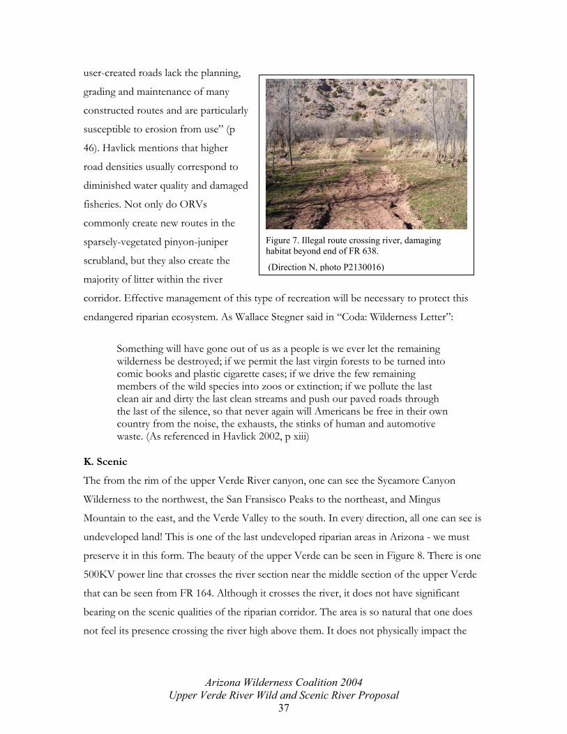
user-created roads lack the planning,
grading and maintenance of many
constructed routes and are particularly
susceptible to erosion from use” (p
46). Havlick mentions that higher
road densities usually correspon
diminished water quality and damaged
fisheries. Not only do ORVs
commonly create new routes in the
sparsely-vegetated pinyon-juniper
scrubland, but they also create the
majority of litter within the river
corridor. Effective management of this type of recreation will be necessary to protect this
endangered riparian ecosystem. As Wallace Stegner said in “Coda: Wilderness Letter”:
Figure 7. Illegal route crossing river, damaging habitat beyond end of FR 638.
(Direction N, photo P2130016)
d to
Something will have gone out of us as a people is we ever let the remaining wilderness be destroyed; if we permit the last virgin forests to be turned into comic books and plastic cigarette cases; if we drive the few remaining members of the wild species into zoos or extinction; if we pollute the last clean air and dirty the last clean streams and push our paved roads through the last of the silence, so that never again will Americans be free in their own country from the noise, the exhausts, the stinks of human and automotive waste. (As referenced in Havlick 2002, p xiii)
K. Scenic
The from the rim of the upper Verde River canyon, one can see the Sycamore Canyon
Wilderness to the northwest, the San Fransisco Peaks to the northeast, and Mingus
Mountain to the east, and the Verde Valley to the south. In every direction, all one can see is
undeveloped land! This is one of the last undeveloped riparian areas in Arizona - we must
preserve it in this form. The beauty of the upper Verde can be seen in Figure 8. There is one
500KV power line that crosses the river section near the middle section of the upper Verde
that can be seen from FR 164. Although it crosses the river, it does not have significant
bearing on the scenic qualities of the riparian corridor. The area is so natural that one does
not feel its presence crossing the river high above them. It does not physically impact the
Arizona Wilderness Coalition 2004 Upper Verde River Wild and Scenic River Proposal
37

river or its ½ mile corridor in any way, as the towers holding up the cable are outside the
corridor.
The geology and vegetation of the Verde River enhance its scenic beauty and allow for a
sense of isolation. A visitor may be aware of the unique vegetative community that serves as
a good contrast to the vegetation of the surrounding deserts of the Central Highlands and
the pine forests of the Colorado Plateau as these geographic provinces are very different
from one another. The Verde River is a place where visitors commonly find rest from their
routine lives and can take in the scenic beauty of the riparian corridor.
Figure 8. Scenic view of the study river.
(Direction SE, photo P1010085)
III. Basis for Eligibility Evaluation
To determine the eligibility of classifying the Upper Verde River as Wild, Scenic, or
Recreational, the river must be free-flowing, defined in Section 16 of the Wild and Scenic
Rivers Act of 1968:
Applied to any river or section of a river, means existing or flowing in natural condition without impoundment, diversion, straightening, rip-rapping, or other modification of the waterway. The existence, however, of low dams, diversion works, and other minor structures at the time any river is proposed for inclusion in the national wild and scenic rivers system shall not automatically bar its consideration for such inclusion,
Arizona Wilderness Coalition 2004 Upper Verde River Wild and Scenic River Proposal
38

and must possess one or more regionally or nationally significant outstanding and
remarkable scenic, recreational, geologic, fish and wildlife, historic, cultural, or other similar
value.
A. Free-flowing Character
The upper Verde River is one of the last undammed perennial rivers in the Southwest. It is
completely free-flowing. Protection of the river is necessary for the existence of this
endangered riparian ecosystem.
B. Outstanding Remarkable Values
The framework and criteria used to evaluate the upper Verde River’s resource values were
taken from Wild and Scenic River Review in the State of Utah- Process and Criteria for
Interagency Use (July 1996). Under the Utah criteria, a river segment can be evaluated based
on eight resources: scenic, recreation, geologic, fish, wildlife, historic, cultural and ecological.
The Utah WSR document states the resource values are ORVs if they are rare, unique or
exemplary on a regional, national or global scale. Outstanding Remarkable Values are
identified based on an analysis of the upper Verde River’s resource values within the Central
Arizona Highlands. The Central Mountains/Sonoran region encompasses two biologically
rich and unique eco-regions. The Central Mountains encompasses almost the entire
watershed of the Verde River. With the beautiful slot canyons of the Mogollon Rim to the
north and the Sonoran Desert to the south, this region has it all. Phoenix and Tucson have
over 4 million people and they are continuously growing outward. The upper Verde River,
as the transition between the threatened Sonoran Desert and the highlands of the Mogollon
rim, is one of the most important links between these two ecosystems as well as an
endangered ecosystem on its own. This area is still unprotected from the pressures of off
road vehicle use, water diversion, and consumptive water mining threats from the
surrounding cities. The designation of the upper Verde River as Wild, Scenic, or Recreational
will surely help protect its unique resources and regionally significant values. Eligibility
criteria from the Outstanding Remarkable Value standards were applied to the upper Verde
River’s resources and if elements from the criteria definitions were met it provided a basis
for regional and national assessment.
Arizona Wilderness Coalition 2004 Upper Verde River Wild and Scenic River Proposal
39

Geology The river corridor contains an example of a geologic feature, process, or phenomena that is rare or unique to
the geographic region, or an outstanding example of a commonly occurring feature. The feature may be in an
unusually active stage of development, represent a “textbook” example and/or represent a rare or unique
combination of geologic features (erosional, volcanic, glacial, etc.) (USFS, NPS & BLM 1996).
The upper Verde River is characterized by a diverse canyon which allows for a diverse range
of wildlife and river morphology. The Verde Valley, one of the three great valleys in the
Transition Zone, is regionally significant in its existence as a separate physiographic feature
from the Colorado Plateau and the Basin and Range province. A visitor may find joy in
observing the beautiful geologic diversity of the canyon and possibly wondering about the
geologic history of the Verde Valley. This, however, is not enough to qualify as regionally or
nationally significant. Although the geologic formations in the upper Verde River are of local
importance and scenic beauty, they are not outstanding in comparison to those geologic
formations in the nearby red rocks of Oak Creek Canyon, the travertine formations of Fossil
Creek, or the nationally significant scale of the Grand Canyon.
Ecology
The river corridor constitutes an important element of a regional plan to conserve biological diversity or other
specific ecological resources. Examples of important elements include rare communities or ecosystems,
watersheds with special values or that are the focus of special management, essential corridors for species
migration and genetic interactions, and other values of importance (USFS, NPS & BLM 1996).
The upper Verde River provides one of the most diverse ecosystems found in Arizona and is
supported by a significant perennial base flow. Riparian areas in Arizona represent some of
the most significant habitat in the Southwest. Arizona’s landscapes are composed of less
than 1% of streams and riparian ecosystems, and 90% of these have been degraded from
grazing, logging, mining and impacts from urban development (USFWS 1995). The upper
Verde River is one of the rivers that comprises this 1% and can be referenced as an
endangered ecosystem.
Riparian areas provide the harsh desert climate with water, cover, shade, and travel corridors
for hundreds of species. The upper Verde’s surface water has maintained an ecologically
Arizona Wilderness Coalition 2004 Upper Verde River Wild and Scenic River Proposal
40

important corridor functioning in relatively pristine, intact conditions. These waters create an
oasis in the arid lands of central Arizona and support a high percentage of species richness
and biodiversity. Today, the biodiversity of the upper Verde River can be protected by
allowing the riparian area to remain connected to other protected areas in the region, such as
the Sycamore Canyon Wilderness. Not only is the river an important corridor for animal
migration, but it provides linkages between core habitat areas for these animals on a larger
scale. It provides animals in the Woodchute Wilderness with a place to find forage and water
before reaching the Mogollon Rim or the Sycamore Canyon Wilderness. The regional
importance of this riparian corridor qualifies the ecology of the upper Verde River as an
Outstanding Remarkable Value.
Wildlife
Wildlife values shall be judged on the relative merits of either populations, habitat, Native American cultural
use, or a combination of these factors.
Populations: The river corridor contains nationally or regionally important populations of indigenous
wildlife species. Of particular interest are species considered to be unique or rare species (federally
listed, state listed or candidate threatened or endangered species). Diversity of species is an important
consideration and could in itself, lead to a determination of outstandingly remarkable.
Habitat: The river corridor provides exceptionally high quality habitat for wildlife of national or
regional significance, or may provide unique habitat or a critical link in habitat conditions for rare
species (federally listed, state listed or candidate threatened or endangered species). Contiguous habitat
conditions are such that the biological needs of the species are met. Diversity of species is an
important consideration and could, in itself, lead to a determination of outstandingly remarkable value
(USFS, NPS & BLM 1996).
The upper Verde River supports one of the most diverse areas of Arizona, with recorded
sightings of many migratory and year-round birds, including the Western Yellow-billed
Cuckoo (Coccyzus americanus occidentalis), a candidate for federal listing on the Endangered
Species List, sighted nesting on the Verde River in 1998, and 1999; many local and migratory
mammals including mountain lion (Felis concolor), river otter (Lontra canadensis), and elk (Cervus
elaphus); amphibians and reptiles such as the Arizona toad (Bufo microscaphus microscaphus) and
the Narrow-headed garter snake (Thamnophis rufipunctatus); and 16 sensitive species or
Federally listed species of concern such as the Golden eagle (Aquila chrysaetos), and the Bald
Arizona Wilderness Coalition 2004 Upper Verde River Wild and Scenic River Proposal
41

eagle (Haliaeetus leucocephalus). The Verde River supports a diverse vegetative community as
well, consisting of sensitive plant species, including the Verde Valley sage (Salvia dorrii ssp.
Mearnsii) and the endangered Desert cliffrose (Cowania mexicana), which may be found in the
upper Verde River. The biodiversity found in the upper Verde River is so regionally and
nationally significant that its wildlife character qualifies as an Outstanding Remarkable Value.
Fish
Fish values may be judged on the relative merits of fish populations, habitat, Native American cultural use, or a
combination of these factors. Consideration shall be given to potential as well as existing values.
Populations: The river is internationally, nationally or regionally an important producer of resident
and or anadromous fish species. Of particular significance is the presence of wild stocks or rare
species (federally listed, state listed or candidate threatened or endangered species). Diversity of
species is an important consideration and could, in itself, lead to a determination of outstandingly
remarkable value.
Habitat: The river provides exceptionally high quality habitat for fish species indigenous to the region.
Of particular significance is habitat for wild stocks or rare species (federally listed, state listed or
candidate threatened or endangered species). Diversity of habitats is an important consideration and
could, in itself, lead to a determination of an outstandingly remarkable value (USFS, NPS & BLM
1996).
The aquatic habitat of the upper Verde River is so wild and pristine that it has been
designated critical habitat for the spikedace and loach minnow by the U.S. Fish and Wildlife
service in 2000. The upper Verde River is the only place where small, isolated populations of
spikedace have been recently detected. The critical habitat that is necessary for the survival
of spikedace populations. Although loach minnow no longer inhabit the river, reintroduction
can revitalize this river with native populations of these fish. Critical habitat designation may
require specific management actions, such as reintroduction or habitat restoration. Before
the introduction of cattle and nonnative fishes, the upper Verde River was home to more
than seven native species of fishes, most of which now are either threatened, endangered,
species of concern, or have been nationally extirpated.
Because of the past abundance of native fishes, there are possibilities of prehistoric Native
American cultures finding them useful for survival. The quality of habitat for wildlife and
Arizona Wilderness Coalition 2004 Upper Verde River Wild and Scenic River Proposal
42

fishes, combined with the abundance of water in a desert ecosystem is most likely what
allowed Natives to inhabit the Area.
The abundance of base flow and the diverse stream morphology of the upper Verde River
create a river channel that is advantageous to the existence of healthy populations of these
historically known native fishes. This quality, combined with the abundance and diversity in
wildlife species, such as beaver, which create a more diverse stream character, further
enhances the regional significance of this river. The presence of native fish diversity together
with the potential to restore the upper Verde River to a natural, completely native and highly
productive habitat is extremely important for the continuing existence of riparian habitats in
the American Southwest. The national significance of these qualities reminds us of the
importance of labeling this aquatic environment as an Outstanding Remarkable Value that
we must protect and restore.
Cultural
The river corridor contains a site where there is evidence of occupation or use by Native Americans or some
other prehistoric culture. Sites must have unusual characteristics or exceptional human interest values. Sites
may have national or regional importance for interpreting prehistory; may be rare or represent an area where a
culture or cultural period was first identified and described; may have been used by cultural groups for rare or
sacred purposes. Of particular significance are sites or features listed in or eligible for inclusion in, the National
Register of Historic Places (USFS, NPS & BLM 1996).
The upper Verde River and its watershed, which cover 14,000 km², possess an extremely
high density of Native American archaeological sites. Because of the regional and local
topography surrounding and within the Verde River canyon are so isolated and undisturbed,
these cultural sites have remained intact and naturally preserved. Many more ruins are
believed to have existed where natural preservation did not occur – on the terraces where
flooding may have washed them away. The cliff dwelling documented in this proposal (see
photo 017_16) has been preserved well because of the natural geologic protection of a rock
roof above it. This dwelling is of regional and national interest in understanding and further
studying prehistoric cultures of the American Southwest. The abundance and quality of
archaeological sites and the potential for educational research of them qualifies the upper
Arizona Wilderness Coalition 2004 Upper Verde River Wild and Scenic River Proposal
43

Verde River cultural resources as nationally and regionally Outstanding and Remarkable
Values.
History
The river corridor contains a site or feature associated with a significant event, an important person, or a
cultural activity of the past that was rare, unusual or unique in the region. An historic site and/or feature in
most cases is 50 years old or older. Of particular significance are National Historic Landmarks, or sites or
features listed in, or eligible for inclusion in, the National Register of Historic Places (USFS, NPS & BLM
1996).
The upper Verde River is dotted with historical evidence, from historic mining ruins to
historic railways that used to travel the river canyon transporting cattle and other
merchandise. The story of the southwest’s settlement is one of historical importance and
helps to define the southwest lifestyle today. The prehistoric sites lead to historic
inhabitation, as some of the cultures that inhabited the Verde Valley were pushed out by
westerners or Mexicans in their efforts to politically control the southwest and California.
The presence of ranching as a way of life for over one hundred years is represented in this
river by the numerous historic corrals, now rusted and hidden by overgrown vegetation.
Grazing permits are still sold for these ranching families who have been in the Verde Valley
for generations. Although the impacts of grazing can be detrimental to the riparian
vegetation and aquatic habitat and may need to be phased out in the near future, it is
important to recognize the role these families have played in the historic settlement of
Arizona. It is important to appreciate their way of life and understand that partly because of
them, and partly because of mining history and the Santa Fe Railway, the history of the
upper Verde River is an Outstanding Remarkable Value.
Recreation
Recreational opportunities are, or have the potential to be, unique enough to attract visitors from outside of the
geographic region. Visitors would be willing to travel long distances to use the river resources for recreational
purposes. River-related opportunities could include, but are not limited to, sightseeing, wildlife observation,
photography, hiking, fishing, hunting and boating. Interpretive opportunities may be exceptional and attract, or
have the potential to attract, visitors from outside the geographic region. The river may provide or have the
potential to provide settings for national or regional usage or competitive events. Consider evaluating specific,
high use recreation activities (e.g. whitewater boating) separately (USFS, NPS & BLM 1996).
Arizona Wilderness Coalition 2004 Upper Verde River Wild and Scenic River Proposal
44

There are many recreational opportunities along the upper Verde River, such as hiking,
wildlife viewing, swimming, camping, fishing, and interpretation or observation of geological
features, cultural features, and ecological features. However important these recreational
activities are, they are unfortunately not regionally significant. The one recreational activity
that would qualify this section of the Verde River as Outstandingly Remarkable is the
opportunity for whitewater boating. Although this section of the river can be canoed, the
water level is not high enough to allow for outstanding whitewater boating opportunities.
Much of this section of the river must be portaged because the maximum flows do not
exceed 100 ft³/sec. Because there are other rivers in the regions that allow for similar
recreational activities, recreation cannot be said to be an Outstanding Remarkable Value
here.
Scenic
The landscape elements of landform, vegetation, water, color, and related factors result in notable or exemplary
visual features and/or attractions within the region. When analyzing scenic values, additional factors such as
seasonal variations in vegetation, scale of cultural modifications, and the length of time negative intrusions are
viewed may be considered. Scenery and visual attractions may be highly diverse over the majority of the river or
river segment. Existing agency procedures for evaluating scenery may be used to identify rivers with
outstanding scenic resources (USFS, NPS & BLM 1996).
The Verde Valley is the Transition Zone between the Mogollon Rim and the most
threatened ecosystem in Arizona – the Sonoran Desert. Because this valley lies in between
two completely opposite eco-regions, it is one of the most beautiful areas in the state of
Arizona. When standing on any point on the rim of the upper Verde River, one can look
north across the pinyon-juniper scrubland at the snowcapped 12,000-foot Mount
Humphrey’s in Flagstaff, Arizona, northeast of the river at the red rocks of Sedona, east of
the river at Mingus Mountain toward the historic town of Jerome, west of the river at the
Sycamore Canyon Wilderness, and south of the river into the Sonoran Desert ecoregion.
The placement of this river canyon is perfectly set in between a diverse array of geologic
features that form the Central Arizona Highlands Region.
Arizona Wilderness Coalition 2004 Upper Verde River Wild and Scenic River Proposal
45

The cultural sites in this section of river are of scenic quality. The cliff dwellings and mesa
archaeological sites allow one to gaze into the past and imagine what life must have been like
before modern civilization. A pastime that can only be undertaken while immersed in the
area of habitation, this journey into the prehistoric ways of life, is certainly one of the upper
Verde River’s scenic values.
In addition to its geological and cultural features, the scenic quality of the upper Verde River
itself is regionally significant and is an Outstanding Remarkable Value. The presence of the
perennial river is in and of itself a treasure found in the desert Southwest that needs to be
protected from exploitation. The amount of water available in this ecosystem allows for
beautiful seasonal changes in vegetation. For Arizona, the seasonal cycles in this river are
comparable in beauty to those that occur in the northeast. The summer is lush and busy with
wildlife; the autumn sees the coloring and loss of deciduous leaves; the winter hosts quiet,
calm dormant life and snow-touched hillsides; and the spring energizes the dormant wildlife
and is one of the most enlivening times to be witness to one of the largest bird migrations in
the western United states. All this is right here in our backyard!
C. Eligibility Findings
Of this 19-mile segment, 18.5 miles of the upper Verde River is eligible for inclusion in the
National Wild and Scenic Rivers System (see Overview Map). It is one of the last free-
flowing, perennial rivers in the Southwest and sustains several Outstanding Remarkable
Values. It meets the criteria for these six Outstanding Remarkable Values: ecology, wildlife,
fish, cultural, historical, and scenic.
IV. Classification
Each classification has distinct qualities and must be managed accordingly so as to protect
the Outstanding Remarkable Values observed in the river area. The levels of classification
are determined with the intent of preserving the present quality of the river. Under section
2(b) of the Wild and Scenic Rivers Act of 1968, the river must be classified as one of these
three types: wild, scenic, or recreational (see Glossary for definitions).
Arizona Wilderness Coalition 2004 Upper Verde River Wild and Scenic River Proposal
46

Based upon the guidelines for these three classification types, it has been determined that the
nineteen-mile segment of the upper Verde River be classified in three segments.
Segment One: The National Forest Boundary to the western boundary of the Verde
Ranch*, 4 miles: Wild (see overview map)
This segment can only be accessed by one road, FR 638, which is about a mile downstream
of the National Forest boundary. This road requires a high-clearance, 4WD vehicle and on
the southern access point is closed at the Arizona Game and Fish permanent concrete
closure. This closure lies just under ¼ mile from the river and has been illegally bypassed.
The access point of FR 638 from the northern side of the river is ineffectively closed off
about ¼ mile from the river’s edge. This section of the river segment is free of
impoundments. There are no man-made structures in this segment of the upper Verde River
that are in current use. There is an old corral that is falling into disrepair and is set back from
the river’s edge about one hundred feet. The presence of cattle is insignificant until one
reaches the active Verde Ranch property. Upstream of the ranch, there is no recent evidence
of cattle and cows are not usually seen in this segment. This segment is not impacted by
timber harvesting and the watersheds or shorelines are essentially primitive. Most
importantly, because this segment is closest to a pristine water source, the Verde Springs,
native fishes inhabit the river. This segment is a prime area for human activity that leaves
little or no human evidence, such as hiking, camping, and fishing.
*Note: Under the Wild and Scenic Rivers Act, Section 6(a)(2):
When a tract of land lies partially within and partially outside the boundaries of a component of the national wild and scenic rivers system, the appropriate Secretary may, with the consent of the landowners for the portion outside the boundaries, acquire the entire tract.
If the Verde Ranch can be mostly acquired by the National Forest, this segment of river
within the property has the potential to be classified as Wild. Restoration of the river
corridor would be necessary. Cattle would need to be removed from the river corridor. The
old concrete road and culvert that lie on each side of the riverbank and the old living
structures and new house would most likely be kept in a Conservation Easement with The
Nature Conservancy; these buildings would not be an issue.
Arizona Wilderness Coalition 2004 Upper Verde River Wild and Scenic River Proposal
47

Segment Two: The eastern boundary of the Verde Ranch to about 2 miles upstream of
Bear Siding where the 500 kv power line crosses the river canyon, 7 miles: Wild
This segment is only accessible by one road, FR 9097U, which requires a high-clearance
vehicle. This road ends at an effective closure more than ¼ mile from the river. The
topography of this segment is diverse and in the middle contains multiple cultural sites and
steep cliffs over two hundred feet high. This segment is also free of impoundments. Cattle
have historically been grazed and corralled here, as there are two old corrals that are falling
apart. One lies at the confluence of Verde Canyon and Bull Basin Canyon and the other is
located at Duff Spring, downstream of Bull Basin Canyon. Because the corrals are no longer
in use and are in disrepair, they present a feeling of history to the river segment rather than
the presence of adverse human impact. Although there is weathered evidence of cattle, this
segment is not impacted by the current presence of cattle or timber harvesting and the
watersheds or shorelines are essentially primitive. The base flow and water quality of this
segment suggest that it can support populations of native fishes. This segment seems to be
the most wild of the upper Verde because of its steep cliff walls and inaccessibility. The
opportunity for solitude here is outstanding.
Segment Three: From the 500kv power line to the Perkinsville Bridge, 7.5 miles:
Scenic
Although presence of the power line is insignificant to anyone within the river corridor, the
Wild and Scenic Rivers Act states that watersheds or shorelines should be free of power lines
to qualify as Wild. This segment is more impacted by man’s historical uses of the upper
Verde River. Recreational uses are the most concentrated at Bear Siding, downstream of the
power line. The end of the road leading to the river corridor, FR 492A, lies less than one
hundred feet from the river’s edge. This is a popular camping area as qualifies for Scenic
designation. There is a quarry here that is in current use that lies just outside the river
corridor by barely ½ mile. However, the shorelines and the immediate river environment still
present an overall natural character and are largely primitive and undeveloped. About three
miles downstream of FR 492A, there is an old corral and rusted metal cable that runs across
the river, becomes buried underground, and surfaces again, attaching to a large metal three-
sided post. There are two coils of unused barbed-wire rusting on the ground at the entrance
Arizona Wilderness Coalition 2004 Upper Verde River Wild and Scenic River Proposal
48

of the old corral. It is indiscernible what this cable’s purpose was in the past. Between this
access point and the Perkinsville Bridge, the river becomes fairly wild and lacks human
impact. From the Perkinsville Bridge upstream about ¼ mile, the river corridor is used
heavily for camping. Above this camping area, the river is essentially unvisited by humans.
V. Suitability
The upper Verde River is a suitable river segment for WSR designation based upon the
Outstandingly Remarkable Values outlined in this proposal. The goal of WSR designation is
to protect these Values.
A. Forest Planning Process – Other Factors Affecting WSR Designation
The characteristics which make the river suitable for designation were outlined in the
Eligibility section of this proposal. The factors that adversely affect the river currently and
lead to the demand for its protection and better management are important to note here.
The illegal use of ORVs within the river corridor leads to erosion of stream banks, potential
damage to archaeological sites unknown to the ORV user, disturbance of nesting or sensitive
wildlife, and degradation of the scenic values of the river corridor. Overgrazing of cattle can
cause damage to a riparian corridor. Of these, the most harmful are habitat fragmentation
and disturbance to threatened, endangered or sensitive wildlife species. Impacts from
recreational camping are devastating in places to the vegetation that immediately surrounds
the river. Bear Siding and the area at the Perkinsville Bridge are the areas within the upper
Verde River that need better management. Both areas have been stripped of vegetation at
dispersed campsites and degraded from user-created looping routes leading to the campsites.
The accumulation of trash at these campsites is common as well. In the Forest Service
Directives, under directive 2350.2 (3) Objectives, the management guidelines require the
Forest Service to “mitigate adverse impacts of users on the natural resources, cultural and
historical resources, and on other users” (USFS 2004). The camp sites at Bear Siding
obviously adversely impact the natural vegetative resources through live cutting of juniper
trees for firewood. Carrie Christman (personal communication)at the Prescott National
Forest noted that near the Bear Siding camping area there is an archaeological site that may
be degraded from users as well.
Arizona Wilderness Coalition 2004 Upper Verde River Wild and Scenic River Proposal
49

Land ownership affects the WSR designation of the upper Verde River. All but just over ½
mile of the river segment lies on National Forest lands, and the ½ mile that does not is
privately owned. The Forest Service and The Nature Conservancy are currently working to
acquire most of this land and out the rest into a conservation easement. This would
potentially allow the private land to fall under Forest Service management, and allow Wild
designation, merging segments One and Two to create one Wild segment that runs from the
National Forest boundary at the western end of the upper Verde River segment all the way
to where the 500 kv power line crosses the river. There is one mine located at Bear Siding on
the Scenic segment, segment Three. This is an active rock quarry and runs into the ¼ mile
river corridor. However, the boundary does not have to be exactly ¼ mile from each side of
the riverbank- it can be more or less, but must total the same acreage.
If the river were included in the NWSRS, the protection it would offer could help safeguard
this river from consumptive extraction or diversion. If the Big Chino aquifer helps feed the
upper Verde River and if pumping from this aquifer lowered the flow of this river, there
could be conflicting resource demands on the river. The Outstandingly Remarkable Values
that demand protection within the river corridor would be devastated from lowering of the
river flow by consumptive diversion. There would be no chance for wildlife or vegetation to
exist as they do in this endangered ecosystem. Lowering or diverting the river flow would be
disastrous for this river and all the migrating, seasonal, and year-round wildlife that depend
upon this river for survival, as well as disastrous for the vegetation that supports this wildlife
and acts as a transition between the higher elevation pine forests of the Mogollon Rim and
the lower elevation incredibly biodiverse Sonoran Desert.
The upper Verde River runs almost completely through the Prescott National Forest.
Agricultural crops and/or timber harvesting are not issues within the river corridor.
However, cattle grazing is a use that would be affected by designation. The river corridor is
affected by the Chino Grazing Project China Dam, Muldoon, Sand Flat, and Perkinsville
Allotments, as well as on the private inholding. The new 10-year Environmental Assessment
that includes guidelines for the grazing permits on these allotments, which include the entire
upper Verde River, are currently in the planning process. The desired conditions for the
Chino Grazing Project, which covers part of the Prescott National Forest, are (1) a diverse
Arizona Wilderness Coalition 2004 Upper Verde River Wild and Scenic River Proposal
50

vegetative community that provides for watershed health, wildlife habitat, and forage for
herbivores” (p 1-4); (2) adequate vegetative ground cover to “provide biological productivity
and maintain environmental quality” (p 1-4); and (3) “soil conditions that sustain long-term
productivity” (p 1-4) (USFS 2004). The area has not been managed to meet these draft
criteria, and if these criteria become part of the final Environmental Assessment, grazing
may have to be excluded from the river corridor. To meet these criteria more strict
enforcement will have to be taken in keeping cattle out of the river corridor to allow a buffer
zone along the river to re-vegetate and regulate itself. Under Section 10(a) of the Wild and
Scenic Rivers Act any part of a river in the NWSRA must be managed to “enhance the
values which caused it to be included”, and the management emphasis should be placed on
protecting these values.
The upper Verde River is a very popular river in the region because of its importance to
wildlife and its regional significance as being one of the last perennial streams in Arizona.
There are a few local citizen-based organizations that have invested time and energy into its
protection and may possibly be able to help the tightly budgeted Forest Service to enforce
the protection under WSR designation. The Verde Watershed Association (VWA) strives to
educate the public about the forums, conferences and upcoming decisions about the
watershed that the public has a voice in. They state on their internet site,
http://vwa.southwest-water.org, that the “VWA strives to preserve and manage the Verde
River watershed with local direction while encouraging long term, productive use of natural
resources”. The VWA is based out of Camp Verde and has meetings every third Tuesday of
the month. There is also a group of partners of the Verde Nature Tourism Alliance which
support local events such as the Verde Valley Birding and Nature Festival that will occur
April 23-25, 2004. A few of these partners, who have shown interest in the protection and
celebration of the magnificent wildlife the Verde attracts to the Verde Valley, are the
Northern Arizona Audubon Society, Arizona State Parks, Arizona Game & Fish, the
Yavapai-Apache Nation, Montezuma Castle & Tuzigoot National Monuments, the Prescott
and Coconino National Forests, Yavapai College, the Bureau of Land Management, and the
Verde Natural Resources Conservation District (Verde Watershed Association). Other
organizations that may be great volunteers or do volunteer projects already to support the
Arizona Wilderness Coalition 2004 Upper Verde River Wild and Scenic River Proposal
51
Verde watershed are the Cattlemen’s Association, Backcountry Horsemen, and the Citizen’s
Water Advisory Group (CWAG).
These organizations are key to the education of water use and awareness as well as important
groups that can coordinate local volunteers to help physically protect or manage the river.
There are endless opportunities for volunteer service work for the Forest Service such as
trash pick-up, patrolling of closed vehicle routes within the corridor, help taking wildlife and
vegetation and fish censuses, and general local citizen education of WSR designation and
what its management entails. The potential here for the regional community to work
together with the local Forest Service to find common ground and cooperation is enormous
and potentially a saving grace for the wild rivers of Arizona. WSR designation can lead to
this method of building community in the “Land of Many Uses” where resource and land
uses often have conflicting interests.
B. Coordinated Studies and Other Planning Processes
Because the upper Verde River is almost completely on National Forest land it is easier to
assess the management implications of wild and scenic designation. In November of 1980,
the Forest Service completed a Draft Environmental Statement and Wild and Scenic River
Study for the entire Verde River. In this study, the upper Verde River was contained in
Segment A, which ran 38.5 miles from Sullivan Lake to the town of Clarkdale. Within this
segment, there were ninety-four private inholdings. This segment met some of the criteria
for WSR eligibility, however, the Forest Service found that Alternative A did not meet the
criteria of protecting free-flowing conditions and outstandingly remarkable characteristics of
the river. In this document, the classification that was suggested as meeting the eligibility
criteria was recreational, “After evaluating the combined impacts of the shoreline
improvements and numerous access routes, the study team determined that this section of
the river does not meet the criteria for wild or scenic classification. However, is could be
classified as recreation” (USDA 1980 p 36).
This segment, because it covered so many miles and covered over 12,000 acres, had many
diversions, inholdings, developments, and other impacts to keep it from meeting the wild or
scenic classification. Following the Draft Statement and Study of 1980, in September 1982
Arizona Wilderness Coalition 2004 Upper Verde River Wild and Scenic River Proposal
52

the Forest Service completed the Verde River Wild and Scenic River Study Report and
Environmental Impact Statement. The “preferred alternative” in this statement was that
Segment A have no designation, even though it met the recreational designation criteria.
VI. Existing Assessment
Because the upper Verde River segment in this proposal is shorter, and land ownership has
changed. See overview map. This citizen’s proposal focuses directly on an unimpacted
section of the upper Verde River that was dropped from designation in 1982 as part of
Segment A. It includes new land ownership information and new information based on
sensitive species and the importance of protecting one of Arizona’s few last perennial rivers
and riparian corridors. Because there have been changes in the land ownership of the study
area, the upper Verde River needs to be reassessed by the Forest Service. The study area
now meets the criteria for wild and scenic designation.
VII. Conclusion
Healthy riparian areas and streams are extremely rare in Arizona representing only 1% of the
landscape. Riparian environments of the American Southwest have been lost, modified, or
face severe degradation from recreation, grazing, logging, mining, and other impacts from
development. In addition, 90% of Arizona’s rivers no longer run year round due to
diversions, withdrawals, and dams. Water is a critical resource in the arid southwest; it is
needed for livestock and agriculture, some hydroelectric projects, drinking water, and
recreation. Water is also an essential aspect to maintaining ecosystem health in arid
landscapes. Often when riparian areas face development or multiple use impacts, the health
of the overall landscape suffers serious consequences. Both state and federal agencies have a
responsibility to preserve the ecosystem integrity and natural conditions of the upper Verde
River, as it is a vestige river of the American Southwest. This river has a great opportunity to
be protected and thrive as an undisturbed, intact, natural riparian ecosystem. The Wild and
Scenic Rivers Act was designed to protect places exactly like this, places that are endangered
ecosystems, places that have clean water that is demanded for many purposes. My hopes for
this project are to heighten local awareness of the upper Verde River and its related
resources, and lead the Forest Service to assess this segment of wild river for potential
inclusion to the NWSRS, while providing temporary protection from any development or
Arizona Wilderness Coalition 2004 Upper Verde River Wild and Scenic River Proposal
53

recreational uses that might impact the identified resource values. The proposed WSR
designation for the 18.5 of the nineteen-mile length of the upper Verde River is based on the
Outstanding Remarkable ecology, wildlife, fish, cultural, historical, and scenic Values.
This proposal for WSR designation of the upper Verde River represents an important
opportunity to protect and restore critical riparian and aquatic habitat as well as the natural
and cultural resource values this river possesses. It is a milestone for the reversal of riparian
degradation in Arizona and the American Southwest. Wild and Scenic River designation is
the most effective way to preserve the unique, rare, and exemplary conditions that thrive on
the upper Verde River.
Arizona Wilderness Coalition 2004 Upper Verde River Wild and Scenic River Proposal
54

VIII. Works Cited American Rivers website. Accessed March 27th, 2004. http://www.amrivers.org/index.php?module=HyperContent&func=display&cid=1359 Arizona Wilderness Coalition. 2004. Geologic significance. http://www.azwild.org/regions/central_sonoran.php Christman, Carrie. 2004. Prescott National Forest Land Management Planner. Personal Communication. Chronic, Halka. 1983. Roadside geology of Arizona. Mountain Press Publishing: Missoula. Dupperault, M. 2003. Fossil Creek Wild and Scenic River study. Arizona Wilderness Coalition: Prescott. Fewkes, J.W. 1913. Antiquities of the Upper Verde River and Walnut Creek Valleys, Arizona. Washington Government Printing Office: Washington D.C. Havlick, D.G. 2002. No Place Distant: roads and motorized recreation on America’s public lands. Island Press: Washington D.C. p xiii. Lopez, S.M. and A.E. Springer. No date. Assessment of human influence on riparian change in the Verde Valley, Arizona. Department of Geology, Northern Arizona University. NAU: Flagstaff, AZ. Meffe, G.K., Carroll, C.R. and Contributors.1997. Principles of conservation biology, Second Edition. Sinauer Associates, Inc.: Sunderland, Massachusetts. p.238. Mitsch, W.J. and J.G. Gosselink. 1993. Wetlands. Van Nostrand Reinhold: New York. Moser, L and D. Crisp. No date. San Francisco Peaks weed management area fact sheet on Tamarix ramosissima. Coconino National Forest. National Audubon Society. 1996. Field guide to mammals. Chanticleer Press, Inc.: New York. Neary, G.N. and J.N. Rinne. 1997. Base flow trends in the Upper Verde River relative to fish habitat requirements. In: Arizona-Nevada Academy of Science, editor. Hydrology and water resources in Arizona and the Southwest. Las Vegas: University of Nevada. p 57-63. Neary, G.N. and J.N. Rinne. 2001. Base flow trends in the Upper Verde revisited. In: Arizona-Nevada Academy of Science, editor. Hydrology and water resources in Arizona and the Southwest. Las Vegas: University of Nevada. p 37-41. NPS 2004. River mileage classifications for components of the National Wild & Scenic Rivers System. Accessed April 20, 2004. http://www.nps.gov/rivers/wildriverstable.html
Arizona Wilderness Coalition 2004 Upper Verde River Wild and Scenic River Proposal
55

NPS & USFS. 1982. Wild and Scenic Rivers Guidelines. USDA & USDI: Washington D.C. http://www.nps.gov/rivers/guidelines.html Owen-Joyce, S.J. and C.K. Bell. 1983. Appraisal of water resources in the upper Verde River area, Yavapai and Coconino counties, Arizona. Arizona Dept. of Water Resources: Phoenix. Pearthree, P.A. 1996. Historical geomorphology of the Verde River. Arizona Geological Survey Open File Report 96-13.Tucson, AZ. Prescott National Forest. 2001. The watershed condition assessment for select Verde River 5th code Watersheds Report. USDA: Washington D.C. Prescott National Forest. 2002. Verde Wild & Scenic River comprehensive river management plan scoping report. Prescott National Forest: Prescott. Rice, G.E. and S.A. Leblanc. 2001. Deadly Landscapes: case studies in prehistoric Southwestern warfare. Salt Lake City: the University of Utah Press. Rinne, J.N. 1999. The status of spikedace in the Verde River, 1999: implications for management and research. In: Arizona-Nevada Academy of Science, editor. Hydrology and water resources in Arizona and the Southwest. Flagstaff: Northern Arizona Universitry. p 57-64. Sheridan, T.E. 1998. A History of the Southwest: the land and its people. Southwest Parks and Monuments Association: Tucson, AZ. Sillas, Albert. 2004. Personal communication. Stevens, L.E. No date. Exotic tamarisk on the Colorado Plateau. Accessed on March 27th, 2004. http://www.cpluhna.nau.edu/Biota/tamarisk.htm Tellman, B., R. Yarde, and M.G. Wallace. 1997. Arizona’s changing rivers: how people have affected the rivers. Water Resources Research Center, College of Agriculture. University of Arizona: Phoenix. University of New Mexico. 2003. UNM biologist searches for rare elusive southwestern river otter. University of New Mexico: Albuquerque. http://www.unm.edu/news/Releases/03-06-19otter.htm U.S. Congress. 1968. National Wild and Scenic Rivers Act of 1968. P.L. 90-542, as amended; 16 U.S.C. 1271-1287. Washington D.C. USDA. 1980. Draft environmental statement and wild and scenic river study for the entire Verde River. USDA: Washington, D.C.
Arizona Wilderness Coalition 2004 Upper Verde River Wild and Scenic River Proposal
56

USFS, NPS & BLM. 1996. Wild and scenic river review in the state of Utah: process and criteria for interagency use. USDI: Washington D.C. USFS. 2004. Forest Service directives. Accessed April 2004. http://www.fs.fed.us/im/directives/ USFWS. 1995. Field notes: riparian habitat in the Southwest. Albuquerque. USFWS. 1998. Fishes of the Verde watershed. USDA: Washington, D.C. USFWS. 2000. 50 CFR Part 17, Part V: endangered and threatened wildlife and plants; final designation of critical habitat for the spikedace and the loach minnow; final rule. USDI: Washington D.C. USFWS. 2003. Biological opinion to Ms. Cindy Lester of the Army Corps of Engineers, Regulatory Branch. USDI: Phoenix, AZ. USFS. 2004. Chino grazing project environmental assessment. USDA: Washington, D.C. USGS. 2004. USGS Realtime streamflow data. Accessed February 10th, 2004. http://www.verde.org/gauges/vpaul.html Verde Watershed Association. Accessed April 2004. http://vwa.southwest-water.org Wilson, E.D. 1962. A resume of the geology of Arizona. The University of Arizona Press: Tucson. Bulletin 171. Wilson, E.O. 1999. The diversity of life. W.W. Norton and Company: New York. P 254. Wirt, L. and H.W. Hjalmarson. 2000. Sources of springs supplying base flow to the Verde River headwaters, Yavapai County, Arizona. USGS Open File Report. USGS: Denver, CO.
Arizona Wilderness Coalition 2004 Upper Verde River Wild and Scenic River Proposal
57

IX. Appendices
Appendix A
Arizona Wilderness Coalition 2004 Upper Verde River Wild and Scenic River Proposal
58

Geology, Hydrology, Morphology Photos
Photo CM-016c: Tapeats sandstone
Photo CM-014c: Tapeats sandstone spire
Arizona Wilderness Coalition 2004 Upper Verde River Wild and Scenic River Proposal
59

Photo JW-084: Basaltic rock, distributed from upstream canyons
Photo JW-089: Martin limestone layered above Tapeats sandstone layer
Arizona Wilderness Coalition 2004 Upper Verde River Wild and Scenic River Proposal
60

Photo CM-184: Tapeats sandstone
Photo CM_7a: Redwall limestone cave
Arizona Wilderness Coalition 2004 Upper Verde River Wild and Scenic River Proposal
61

Photo CM-188: Granite basement rock of the Great Unconformity
Photo TC-0094: Redwall limestone cave in canyon wall
Arizona Wilderness Coalition 2004 Upper Verde River Wild and Scenic River Proposal
62

Appendix B
Arizona Wilderness Coalition 2004 Upper Verde River Wild and Scenic River Proposal
63
Arizona Wilderness Coalition 2004 Upper Verde River Wild and Scenic River Proposal
63

Ecology and Vegetation Photos
Photo JW-0087: Cattails and seep willow
Photo CM_4a: Even-aged stand of cottonwoods and seep willow, burrs in foreground, river on left side of photo
Arizona Wilderness Coalition 2004 Upper Verde River Wild and Scenic River Proposal
64

Photo CM_3a: Marsh species, overstory species, and upland species transitions
Photo CM_2a: Cottonwoods surrounding a meadow, ~1/2 mile upstream of Perkinsville Bridge
Arizona Wilderness Coalition 2004 Upper Verde River Wild and Scenic River Proposal
65
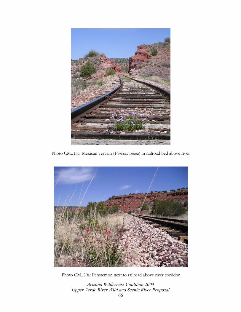
Photo CM_15a: Mexican vervain (Verbena ciliata) in railroad bed above river
Photo CM_20a: Penstemon next to railroad above river corridor
Arizona Wilderness Coalition 2004 Upper Verde River Wild and Scenic River Proposal
66

Appendix C
Arizona Wilderness Coalition 2004 Upper Verde River Wild and Scenic River Proposal
67

Wildlife Photos
Photo DSCF-0024: Fresh, wet, beaver-chewed stick
Photo CM-0077: Fish caught by bird and partly eaten
Arizona Wilderness Coalition 2004 Upper Verde River Wild and Scenic River Proposal
68

Photo CM_1a: Small lizard
Photo CM-019c: Javelina skull
Arizona Wilderness Coalition 2004 Upper Verde River Wild and Scenic River Proposal
69
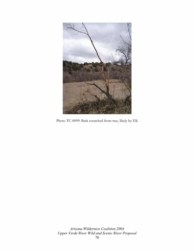
Photo TC-0099: Bark scratched from tree, likely by Elk
Arizona Wilderness Coalition 2004 Upper Verde River Wild and Scenic River Proposal
70

Appendix D
This map has been left out to protect cultural sites.
Arizona Wilderness Coalition 2004 Upper Verde River Wild and Scenic River Proposal
71

Cultural Photos
Photo CM-008c: Cliff dwelling high up the side of the canyon
Photo CM-006b: Middle room of archaeological site
Arizona Wilderness Coalition 2004 Upper Verde River Wild and Scenic River Proposal
72

Photo CM-010b: Arrowhead and stone flakes
Photo CM-013b: Overgrown ruin wall, ~2 ft high
Arizona Wilderness Coalition 2004 Upper Verde River Wild and Scenic River Proposal
73
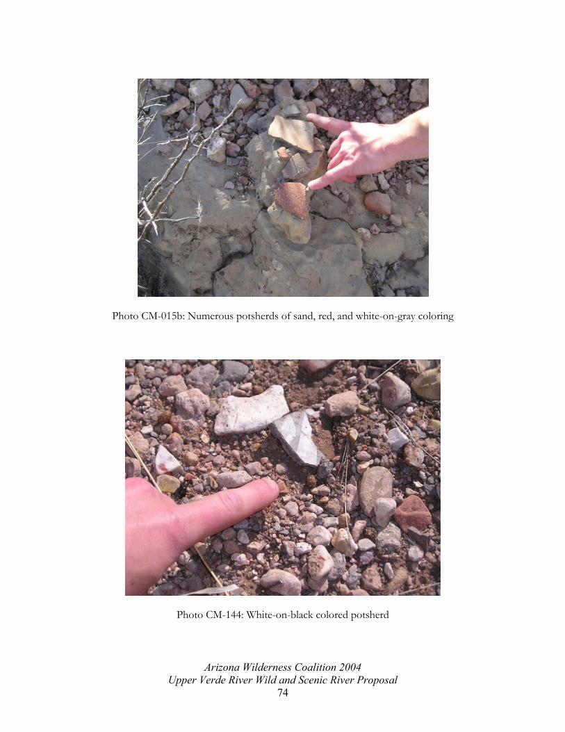
Photo CM-015b: Numerous potsherds of sand, red, and white-on-gray coloring
Photo CM-144: White-on-black colored potsherd
Arizona Wilderness Coalition 2004 Upper Verde River Wild and Scenic River Proposal
74

Appendix E
Arizona Wilderness Coalition 2004 Upper Verde River Wild and Scenic River Proposal
75

Historic Photos
PhotoCM-0035: Historic mining site, made with 4x4s and metal nails
Photo CM-0049: Historic railroad
Arizona Wilderness Coalition 2004 Upper Verde River Wild and Scenic River Proposal
76

Photo CM-0054: Cable across river, leading to this short, steel tripod
Photo CM-0062: Historic railroad bed, eroding underneath it
Arizona Wilderness Coalition 2004 Upper Verde River Wild and Scenic River Proposal
77
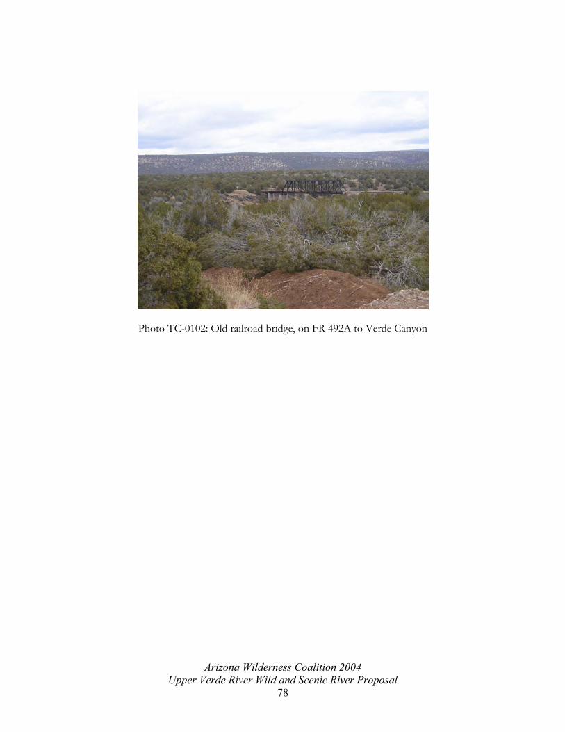
Photo TC-0102: Old railroad bridge, on FR 492A to Verde Canyon
Arizona Wilderness Coalition 2004
Upper Verde River Wild and Scenic River Proposal 78

Appendix F
Arizona Wilderness Coalition 2004 Upper Verde River Wild and Scenic River Proposal
79

Route Photos
Photo CM-016: Illegal extension of FR 638 from south access, crossing Verde River
Arizona Wilderness Coalition 2004 Upper Verde River Wild and Scenic River Proposal
80
Photo CM-022c: Illegal route continuing from end FR 9097U, passes by an archaeological site
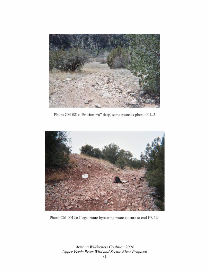
Photo CM-021c: Erosion ~6” deep, same route as photo 004_3
Photo CM-0019a: Illegal route bypassing route closure at end FR 164
Arizona Wilderness Coalition 2004 Upper Verde River Wild and Scenic River Proposal
81

Photo CM-0018a: Average conditions of illegal route extension of FR164
Photo CM-0024: Illegal 4WD tracks on closed FR 164
Arizona Wilderness Coalition 2004 Upper Verde River Wild and Scenic River Proposal
82

Photo CM-069: Illegal driving in wash, accessed from end FR 9110R
Photo TC-086: Bear Siding camping area, end FR 492A, extensive vegetation damage and soil erosion, many user-created routes
Arizona Wilderness Coalition 2004 Upper Verde River Wild and Scenic River Proposal
83

Photo CM-072: Illegal extension of FR9110R crosses Verde River
Photo CM-0029: Illegal extension of closed FR 164 crossing Verde River
Arizona Wilderness Coalition 2004 Upper Verde River Wild and Scenic River Proposal
84

Photo CM-0022: Average conditions closed FR 638 from southern access
Photo CM_26a: Perkinsville Bridge crossing Verde River
Arizona Wilderness Coalition 2004 Upper Verde River Wild and Scenic River Proposal
85

Appendix G
Arizona Wilderness Coalition 2004 Upper Verde River Wild and Scenic River Proposal
86

Impact Photos
Photo CM-006: FS Route closure at end FR638 from south access
PhotoTC-0078: Rock quarry at Bear Siding, FR 492A
Arizona Wilderness Coalition 2004 Upper Verde River Wild and Scenic River Proposal
87

Photo TC-0091: Man-made dam at Bear Siding for swimming hole
Photo ED-115: Power line in distance from side of Verde Canyon, near Bear Siding
Arizona Wilderness Coalition 2004 Upper Verde River Wild and Scenic River Proposal
88

Photo CM-181: Old, unused concrete road leading to the river’s edge to the old Verde Ranch buildings, Verde Ranch private property
Photo CM_17a: Railroad ties near railroad grade, ~1 mile upstream of Perkinsville Bridge
Arizona Wilderness Coalition 2004 Upper Verde River Wild and Scenic River Proposal
89

Photo CM_27a: Camping impacts at Perkinsville Bridge
Photo ED-111: Wooden survey marker on hillside
Arizona Wilderness Coalition 2004 Upper Verde River Wild and Scenic River Proposal
90

Appendix H
Arizona Wilderness Coalition 2004 Upper Verde River Wild and Scenic River Proposal
91

Scenic Photos
Photo CM-030: Verde River, near end FR 164
Photo CM_23a: Verde River corridor, looking southeast toward Mingus Mountain
Arizona Wilderness Coalition 2004 Upper Verde River Wild and Scenic River Proposal
92

Photo CM-0040: Red rocks near Sedona, from FR 492A, sunset
Photo 9918230-R1-030-13A: Verde River below Verde Ranch
Arizona Wilderness Coalition 2004 Upper Verde River Wild and Scenic River Proposal
93
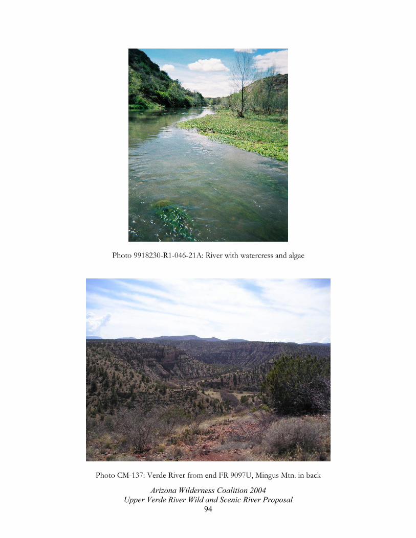
Photo 9918230-R1-046-21A: River with watercress and algae
Photo CM-137: Verde River from end FR 9097U, Mingus Mtn. in back
Arizona Wilderness Coalition 2004 Upper Verde River Wild and Scenic River Proposal
94

Photo CM-023: Verde River and San Francisco Peaks from end FR 164
Photo CM-159: Verde River and 100’ cliff wall near end FR 9110R
Arizona Wilderness Coalition 2004 Upper Verde River Wild and Scenic River Proposal
95

Photo CM-152: Verde Valley overview, looking north toward Bill Williams Mountain
Photo CM-09: Overhanging cliffs
Arizona Wilderness Coalition 2004 Upper Verde River Wild and Scenic River Proposal
96

Photo CM_28a: Verde River corridor and sandstone cliffs
Arizona Wilderness Coalition 2004 Upper Verde River Wild and Scenic River Proposal
97

Appendix I
Field Data Photopaths
All photos can be accessed from the included CD by referencing the last characters in the
potopath column and looking in the Photo folder on the included CD. This table included
photo paths for only the photographs shown in the previous appendices. This table has been
imported into ArcView GIS to create points and shapefiles that show the photo locations.
The photos have been hotlinked and can be viewed by using the hotlinking extension in
ArcView. The author hopes that this data can serve as a reference point for future studies
and comparisons as the Forest service creates the new Management Plan for this portion of
the Prescott National Forest.
easting northing photi_id photo_path description 9918230-R1-030-13A 9918230-R1-046-21A 380395 3859675 CM-022c C:\GIS\upperverde\photos\004_3.jpg average conditions FR 9097U 380395 3859675 CM-021c C:\GIS\upperverde\photos\005_4.jpg old road, erosion 6" deep, 386792 3862859 CM-09 C:\GIS\upperverde\photos\009_6A.jpg scenic- nest 25' higgh in cliff 374550 3861535 CM-0019a C:\GIS\upperverde\photos\010_7A.jpg user-created road around FSR 638 382225 3860386 CM-016c C:\GIS\upperverde\photos\010_9.jpg scenic, sandstone cliffs and river 374812 3860909 CM-0018a C:\GIS\upperverde\photos\011_8A.jpg average FSR 638 conditions 381259 3860080 CM-008c C:\GIS\upperverde\photos\017_16.jpg cliff welling from riverbank, vertical 375174 3860966 CM-0007a C:\GIS\upperverde\photos\022_19A.jpg road closed sign on floodplain 388520 3862699 CM_15a C:\GIS\upperverde\photos\CM_15a.jpg flowers in middle of RR tracks 388380 3862964 CM_17a C:\GIS\upperverde\photos\CM_17a.jpg Blue bins near RR 389239 3861708 CM_1a C:\GIS\upperverde\photos\CM_1a.jpg small lizard 388380 3862964 CM_20a C:\GIS\upperverde\photos\CM_20a.jpg red flowers next to RR 389980 3863864 CM_23a C:\GIS\upperverde\photos\CM_23a.jpg scenic, full view of Mingus and river 389980 3863864 CM_27a C:\GIS\upperverde\photos\CM_27a.jpg camping impacts, Perkinsville Bridge 389980 3863864 CM_28a C:\GIS\upperverde\photos\CM_28a.jpg scenic, perkins ranch and river 389317 386171 CM_2a C:\GIS\upperverde\photos\CM_2a.jpg cottonwoods and meadow, river on right 389130 3861709 CM_3a C:\GIS\upperverde\photos\CM_3a.jpg upstream vegetation and scenic 389130 3861709 CM_4a C:\GIS\upperverde\photos\CM_4a.jpg cottonwood and willow, even-aged stand 388530 3862170 CM_7a C:\GIS\upperverde\photos\CM_7a.jpg cave and water 389125 3861704 DSCF-0027 C:\GIS\upperverde\photos\DSCF0027.jpg Beaver dam 389941 3861893 DSCF-0028 C:\GIS\upperverde\photos\DSCF0028.jpg flood evidence, inexact GPS location 379345 3860243 CM-010b C:\GIS\upperverde\photos\P1010010.jpg arrowhead? Rockshards next to it 379345 3860243 CM-013b C:\GIS\upperverde\photos\P1010013.jpg middle room between E and W rooms 379345 3860243 CM-015b C:\GIS\upperverde\photos\P1010015.jpg potsherds below CM-014b, ~5 pieces 386369 3863871 CM-0049 C:\GIS\upperverde\photos\P1010049.jpg RR grade above river, saw 3 RTHa here 386602 3864107 CM-0054 C:\GIS\upperverde\photos\P1010054.jpg cable corner post, looking across river 379345 3860243 CM-006b C:\GIS\upperverde\photos\P101006.jpg ruins, laura in westmost room 386639 3864056 CM-0062 C:\GIS\upperverde\photos\P1010062.jpg RR bed closer up
Arizona Wilderness Coalition 2004 Upper Verde River Wild and Scenic River Proposal
98
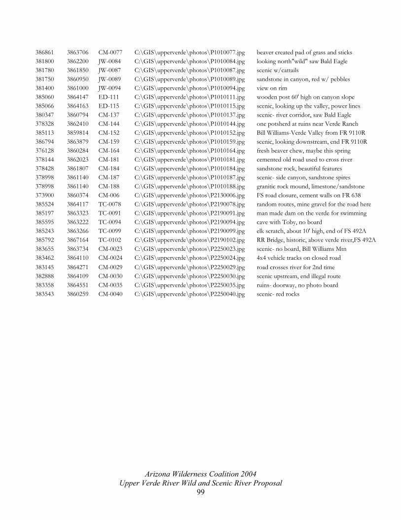
386861 3863706 CM-0077 C:\GIS\upperverde\photos\P1010077.jpg beaver created pad of grass and sticks 381800 3862200 JW-0084 C:\GIS\upperverde\photos\P1010084.jpg looking north"wild" saw Bald Eagle 381780 3861850 JW-0087 C:\GIS\upperverde\photos\P1010087.jpg scenic w/cattails 381750 3860950 JW-0089 C:\GIS\upperverde\photos\P1010089.jpg sandstone in canyon, red w/ pebbles 381400 3861000 JW-0094 C:\GIS\upperverde\photos\P1010094.jpg view on rim 385060 3864147 ED-111 C:\GIS\upperverde\photos\P1010111.jpg wooden post 60' high on canyon slope 385066 3864163 ED-115 C:\GIS\upperverde\photos\P1010115.jpg scenic, looking up the valley, power lines 380347 3860794 CM-137 C:\GIS\upperverde\photos\P1010137.jpg scenic- river corridor, saw Bald Eagle 378328 3862410 CM-144 C:\GIS\upperverde\photos\P1010144.jpg one potsherd at ruins near Verde Ranch 385113 3859814 CM-152 C:\GIS\upperverde\photos\P1010152.jpg Bill Williams-Verde Valley from FR 9110R 386794 3863879 CM-159 C:\GIS\upperverde\photos\P1010159.jpg scenic, looking downstream, end FR 9110R 376128 3860284 CM-164 C:\GIS\upperverde\photos\P1010164.jpg fresh beaver chew, maybe this spring 378144 3862023 CM-181 C:\GIS\upperverde\photos\P1010181.jpg cemented old road used to cross river 378428 3861807 CM-184 C:\GIS\upperverde\photos\P1010184.jpg sandstone rock, beautiful features 378998 3861140 CM-187 C:\GIS\upperverde\photos\P1010187.jpg scenic- side canyon, sandstone spires 378998 3861140 CM-188 C:\GIS\upperverde\photos\P1010188.jpg granitic rock mound, limestone/sandstone 373900 3860374 CM-006 C:\GIS\upperverde\photos\P2130006.jpg FS road closure, cement walls on FR 638 385524 3864117 TC-0078 C:\GIS\upperverde\photos\P2190078.jpg random routes, mine gravel for the road here 385197 3863323 TC-0091 C:\GIS\upperverde\photos\P2190091.jpg man made dam on the verde for swimming 385595 3863222 TC-0094 C:\GIS\upperverde\photos\P2190094.jpg cave with Toby, no board 385243 3863266 TC-0099 C:\GIS\upperverde\photos\P2190099.jpg elk scratch, about 10' high, end of FS 492A 385792 3867164 TC-0102 C:\GIS\upperverde\photos\P2190102.jpg RR Bridge, historic, above verde river,FS 492A383655 3863734 CM-0023 C:\GIS\upperverde\photos\P2250023.jpg scenic- no board, Bill Williams Mtn 383462 3864110 CM-0024 C:\GIS\upperverde\photos\P2250024.jpg 4x4 vehicle tracks on closed road 383145 3864271 CM-0029 C:\GIS\upperverde\photos\P2250029.jpg road crosses river for 2nd time 382888 3864109 CM-0030 C:\GIS\upperverde\photos\P2250030.jpg scenic upstream, end illegal route 383358 3864551 CM-0035 C:\GIS\upperverde\photos\P2250035.jpg ruins- doorway, no photo board 383543 3860259 CM-0040 C:\GIS\upperverde\photos\P2250040.jpg scenic- red rocks
Arizona Wilderness Coalition 2004 Upper Verde River Wild and Scenic River Proposal
99


