Page 1
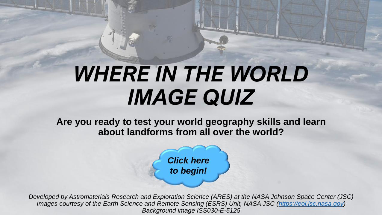
WHERE IN THE WORLD IMAGE QUIZ
Are you ready to test your world geography skills and learn about landforms from all over the world?
Click here
to begin!
Developed by Astromaterials Research and Exploration Science (ARES) at the NASA Johnson Space Center (JSC) Images courtesy of the Earth Science and Remote Sensing (ESRS) Unit, NASA JSC (https://eol.jsc.nasa.gov)
Background image ISS030-E-5125
Page 2
WHERE IN THE WORLD
IS THIS?
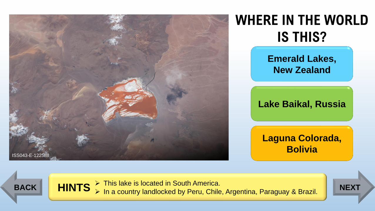
ISS043-E-122588
Emerald Lakes,
New Zealand
Lake Baikal, Russia
Laguna Colorada,
Bolivia
➢ This lake is located in South America.
➢ In a country landlocked by Peru, Chile, Argentina, Paraguay & Brazil. HINTSBACK NEXT
Page 3
WHERE IN THE WORLD
IS THIS?
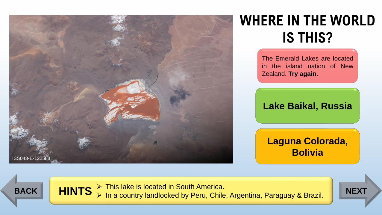
ISS043-E-122588
The Emerald Lakes are located
in the island nation of New
Zealand. Try again.
Lake Baikal, Russia
Laguna Colorada,
Bolivia
➢ This lake is located in South America.
➢ In a country landlocked by Peru, Chile, Argentina, Paraguay & Brazil. HINTSBACK NEXT
Page 4
WHERE IN THE WORLD
IS THIS?
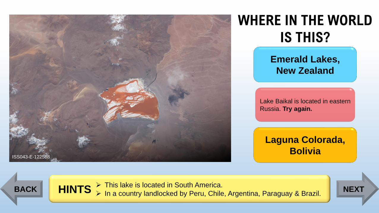
ISS043-E-122588
Emerald Lakes,
New Zealand
Lake Baikal is located in eastern
Russia. Try again.
Laguna Colorada,
Bolivia
➢ This lake is located in South America.
➢ In a country landlocked by Peru, Chile, Argentina, Paraguay & Brazil. HINTSBACK NEXT
Page 5
WHERE IN THE WORLD
IS THIS?
ISS043-E-122588
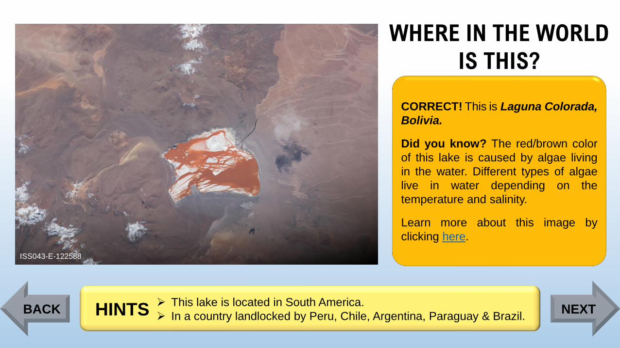
CORRECT! This is Laguna Colorada,
Bolivia.
Did you know? The red/brown color
of this lake is caused by algae living
in the water. Different types of algae
live in water depending on the
temperature and salinity.
Learn more about this image by
clicking here.
➢ This lake is located in South America.
➢ In a country landlocked by Peru, Chile, Argentina, Paraguay & Brazil. HINTSBACK NEXT
Page 6
WHERE IN THE WORLD
IS THIS?
ISS045-E-89403
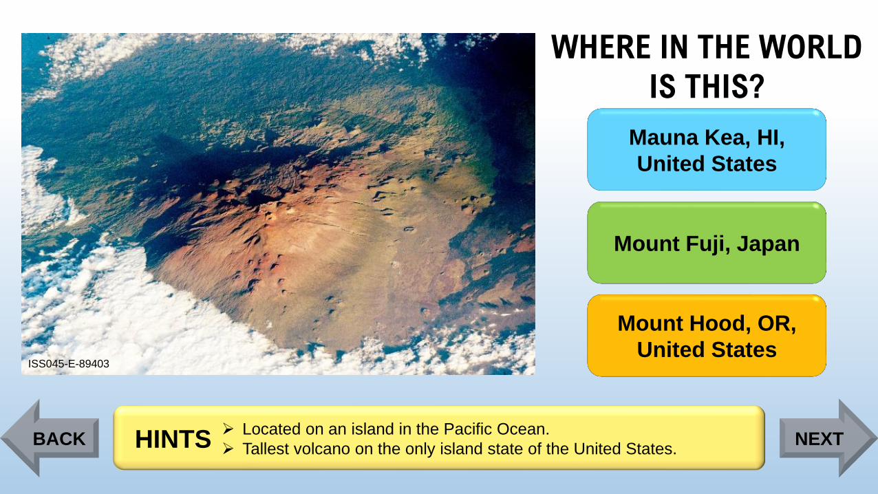
Mauna Kea, HI,
United States
Mount Fuji, Japan
Mount Hood, OR,
United States
➢ Located on an island in the Pacific Ocean.
➢ Tallest volcano on the only island state of the United States. HINTSBACK NEXT
Page 7
WHERE IN THE WORLD
IS THIS?
ISS045-E-89403
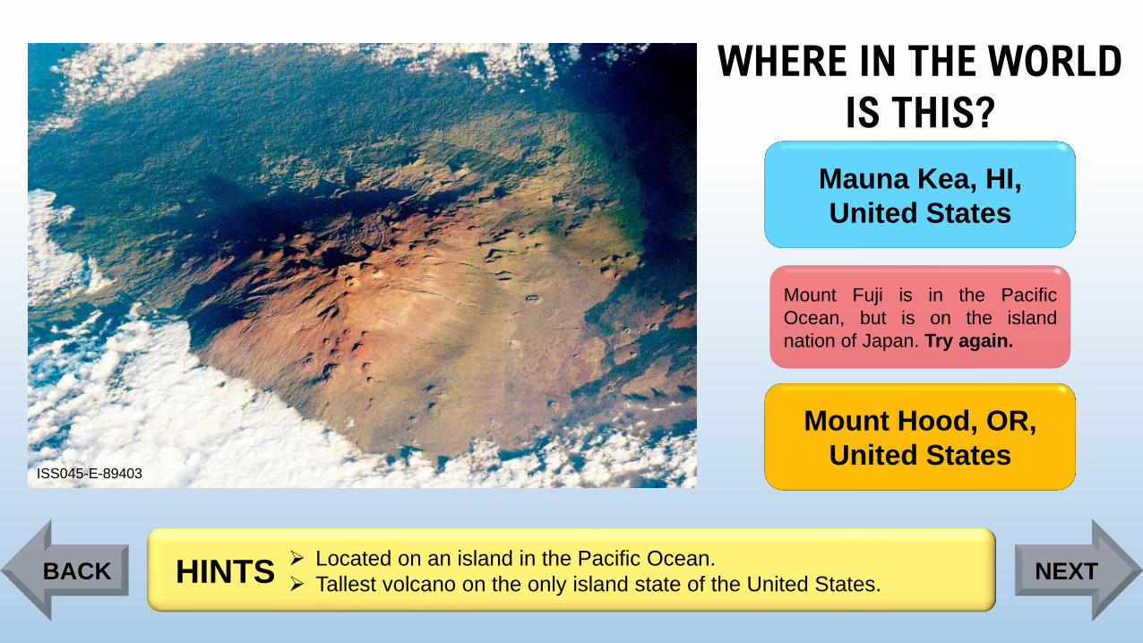
Mauna Kea, HI,
United States
Mount Fuji is in the Pacific
Ocean, but is on the island
nation of Japan. Try again.
Mount Hood, OR,
United States
➢ Located on an island in the Pacific Ocean.
➢ Tallest volcano on the only island state of the United States. HINTSBACK NEXT
Page 8
WHERE IN THE WORLD
IS THIS?
ISS045-E-89403
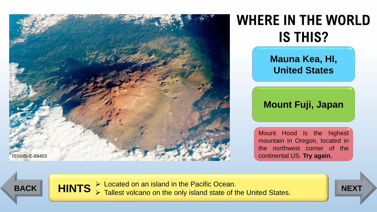
Mauna Kea, HI,
United States
Mount Fuji, Japan
Mount Hood is the highest
mountain in Oregon, located in
the northwest corner of the
continental US. Try again.
➢ Located on an island in the Pacific Ocean.
➢ Tallest volcano on the only island state of the United States. HINTSBACK NEXT
Page 9
WHERE IN THE WORLD
IS THIS?
ISS045-E-89403
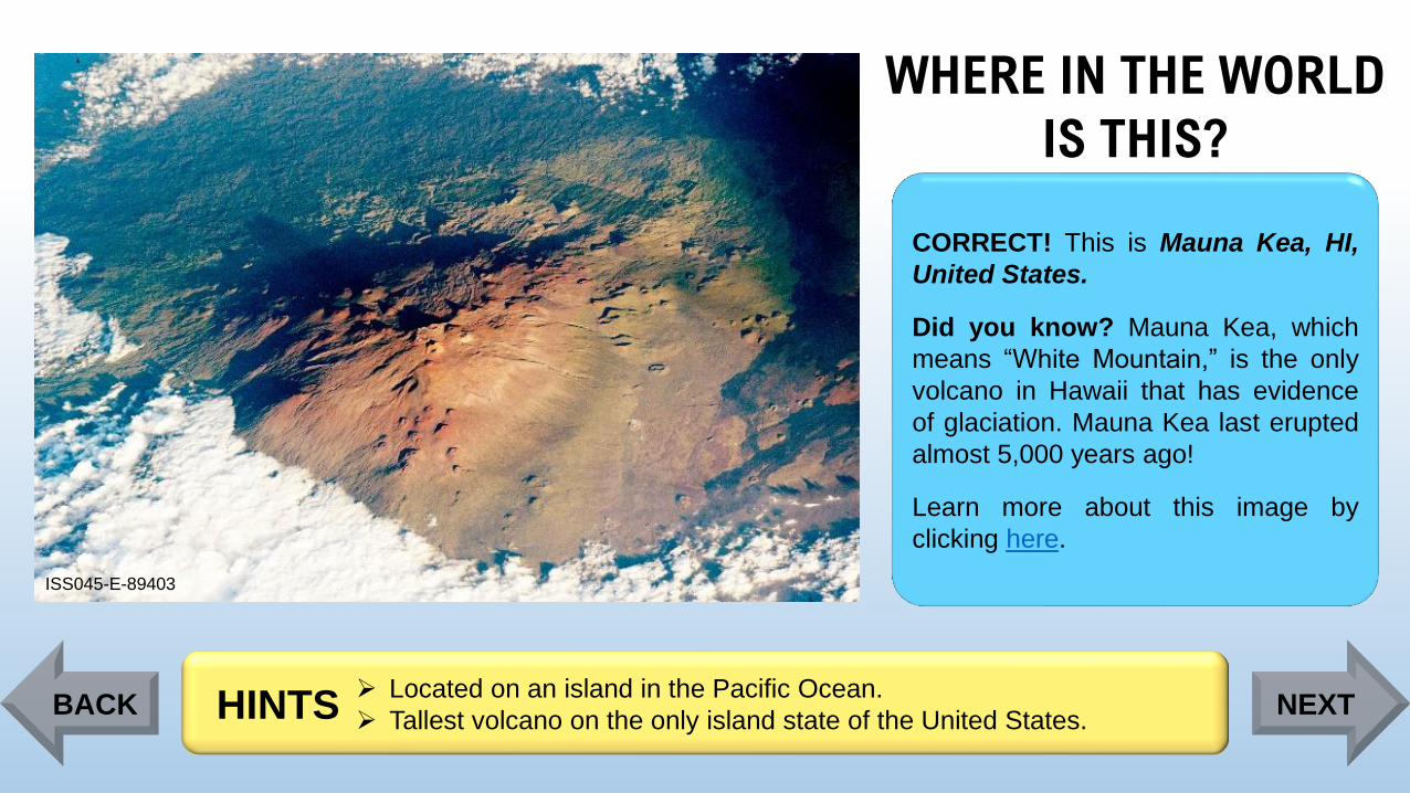
CORRECT! This is Mauna Kea, HI,
United States.
Did you know? Mauna Kea, which
means “White Mountain,” is the only
volcano in Hawaii that has evidence
of glaciation. Mauna Kea last erupted
almost 5,000 years ago!
Learn more about this image by
clicking here.
➢ Located on an island in the Pacific Ocean.
➢ Tallest volcano on the only island state of the United States. HINTSBACK NEXT
Page 10
WHERE IN THE WORLD
IS THIS?
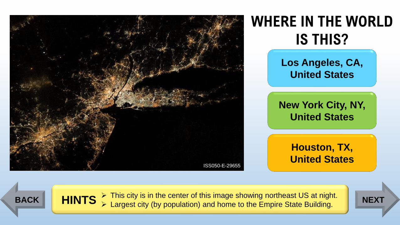
ISS050-E-29655
Los Angeles, CA,
United States
New York City, NY,
United States
Houston, TX,
United States
➢ This city is in the center of this image showing northeast US at night.
➢ Largest city (by population) and home to the Empire State Building. HINTSBACK NEXT
Page 11
WHERE IN THE WORLD
IS THIS?
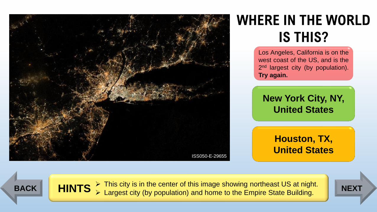
ISS050-E-29655
Los Angeles, California is on the
west coast of the US, and is the
2nd largest city (by population).
Try again.
New York City, NY,
United States
Houston, TX,
United States
➢ This city is in the center of this image showing northeast US at night.
➢ Largest city (by population) and home to the Empire State Building.HINTSBACK NEXT
Page 12
WHERE IN THE WORLD
IS THIS?
ISS050-E-29655
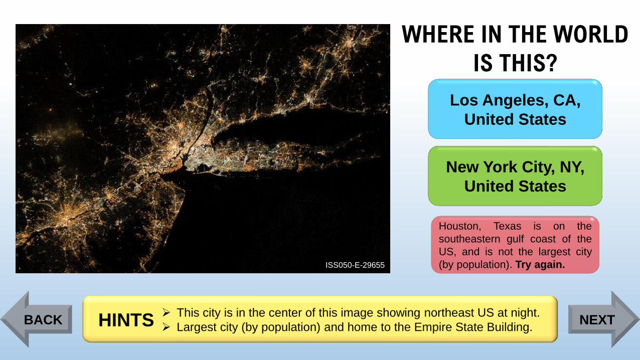
Los Angeles, CA,
United States
New York City, NY,
United States
Houston, Texas is on the
southeastern gulf coast of the
US, and is not the largest city
(by population). Try again.
➢ This city is in the center of this image showing northeast US at night.
➢ Largest city (by population) and home to the Empire State Building.HINTSBACK NEXT
Page 13
WHERE IN THE WORLD
IS THIS?
ISS050-E-29655
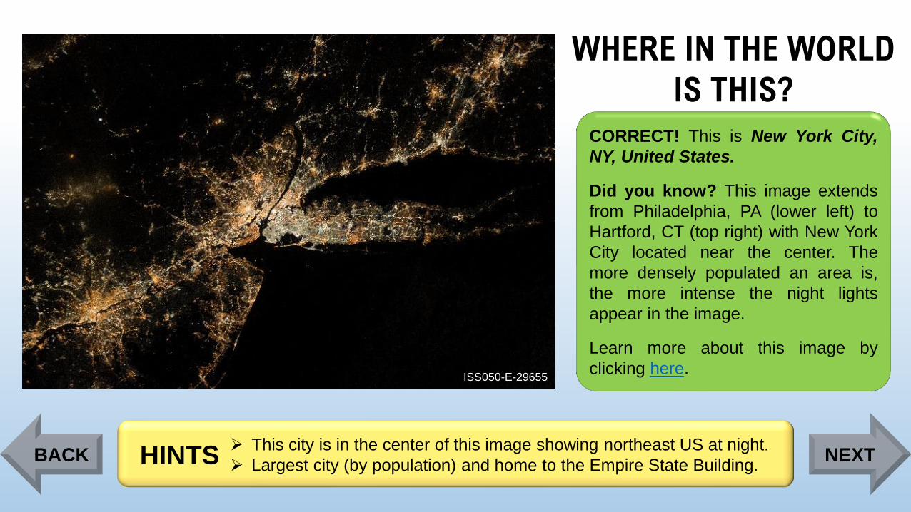
CORRECT! This is New York City,
NY, United States.
Did you know? This image extends
from Philadelphia, PA (lower left) to
Hartford, CT (top right) with New York
City located near the center. The
more densely populated an area is,
the more intense the night lights
appear in the image.
Learn more about this image by
clicking here.
➢ This city is in the center of this image showing northeast US at night.
➢ Largest city (by population) and home to the Empire State Building.HINTSBACK NEXT
Page 14
WHERE IN THE WORLD
IS THIS?
ISS059-E-78303
Yucatán Peninsula,
Mexico
Cape Peninsula,
South Africa
Nicoya Peninsula,
Costa Rica
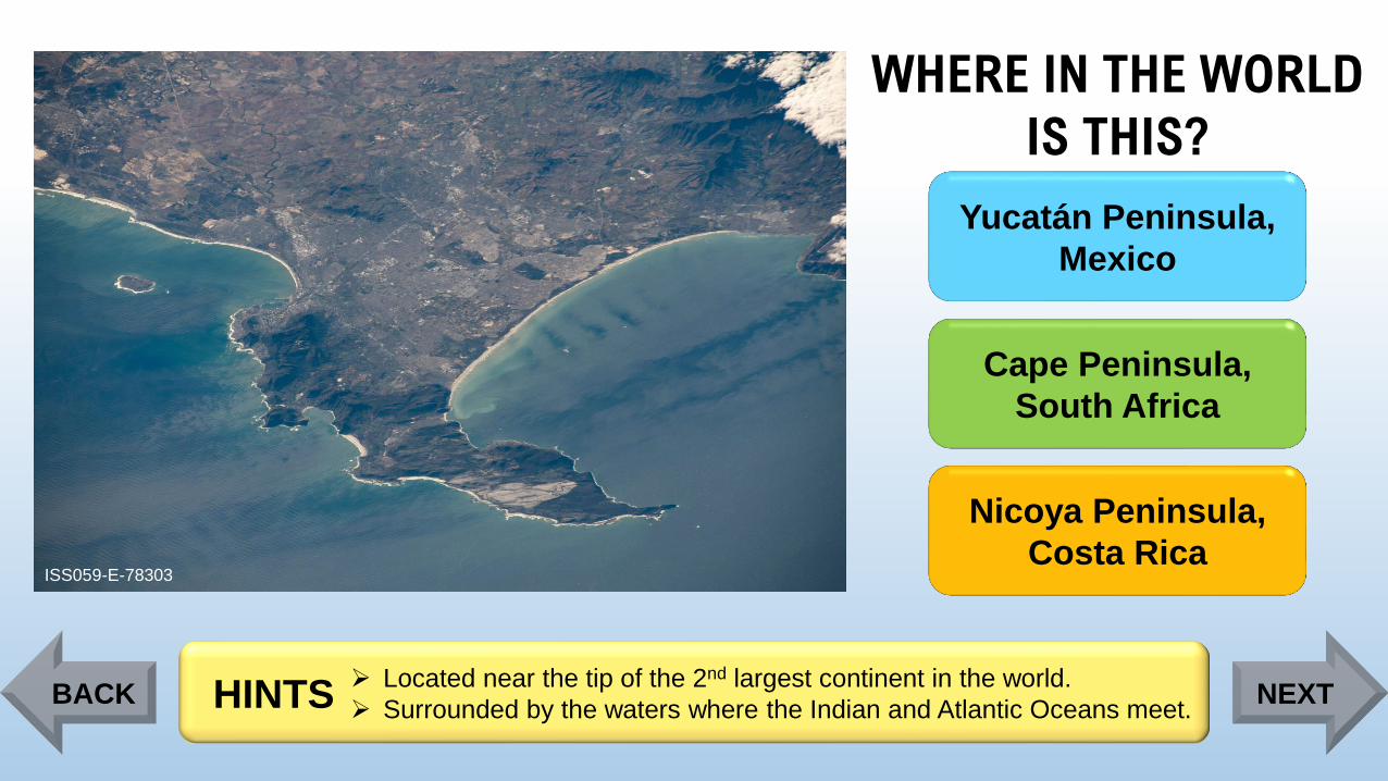
➢ Located near the tip of the 2nd largest continent in the world.
➢ Surrounded by the waters where the Indian and Atlantic Oceans meet. HINTSBACK NEXT
Page 15
WHERE IN THE WORLD
IS THIS?
ISS059-E-78303
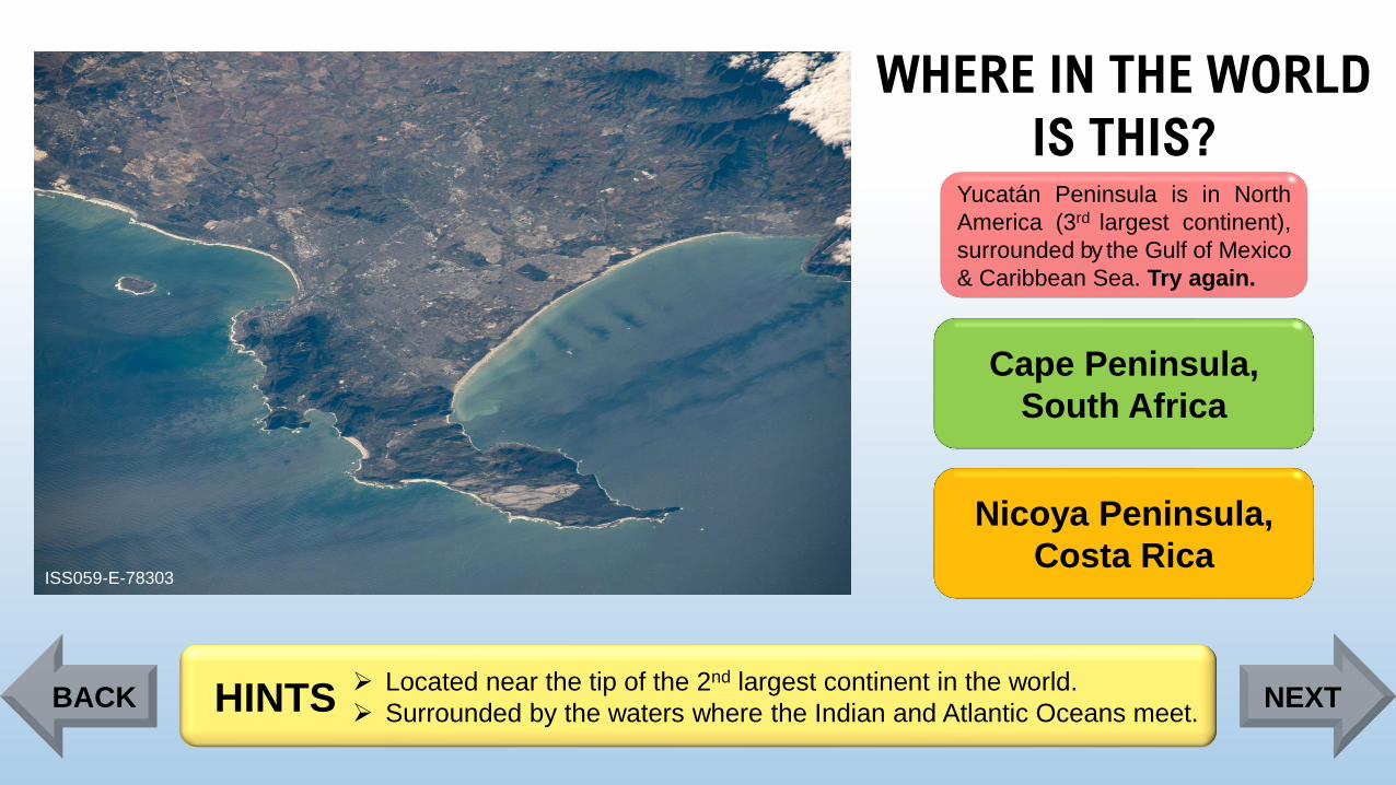
Yucatán Peninsula is in North
America (3rd largest continent),
surrounded by the Gulf of Mexico
& Caribbean Sea. Try again.
Cape Peninsula,
South Africa
Nicoya Peninsula,
Costa Rica
➢ Located near the tip of the 2nd largest continent in the world.
➢ Surrounded by the waters where the Indian and Atlantic Oceans meet. HINTSBACK NEXT
Page 16
WHERE IN THE WORLD
IS THIS?
ISS059-E-78303
Yucatán Peninsula,
Mexico
Cape Peninsula,
South Africa
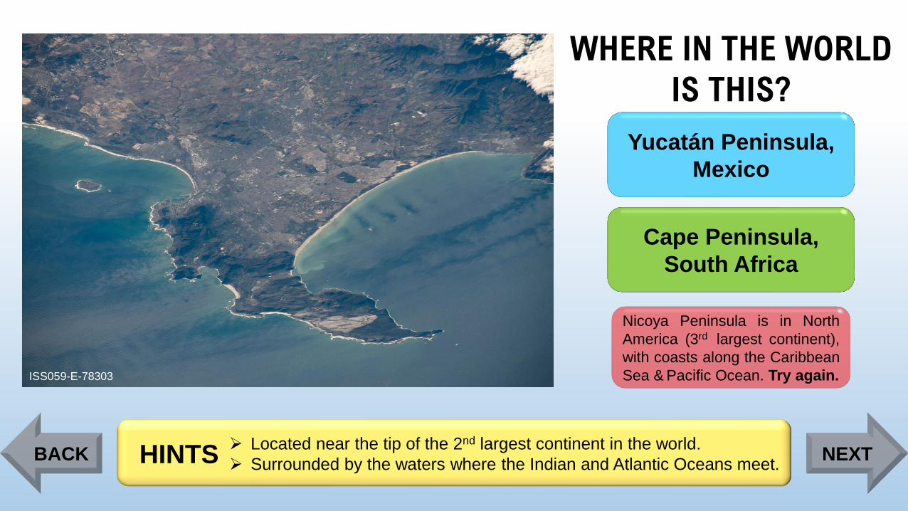
Nicoya Peninsula is in North
America (3rd largest continent),
with coasts along the Caribbean
Sea & Pacific Ocean. Try again.
➢ Located near the tip of the 2nd largest continent in the world.
➢ Surrounded by the waters where the Indian and Atlantic Oceans meet. HINTSBACK NEXT
Page 17
WHERE IN THE WORLD
IS THIS?
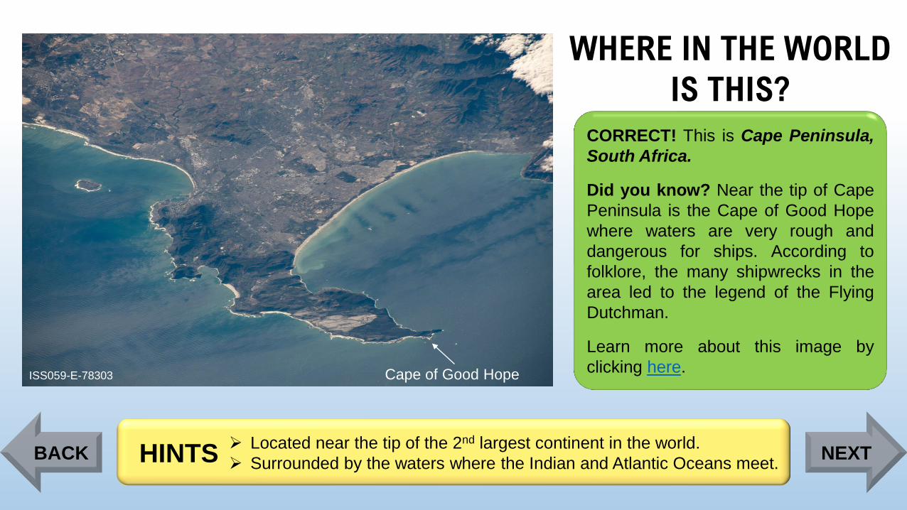
ISS059-E-78303 Cape of Good Hope
CORRECT! This is Cape Peninsula,
South Africa.
Did you know? Near the tip of Cape
Peninsula is the Cape of Good Hope
where waters are very rough and
dangerous for ships. According to
folklore, the many shipwrecks in the
area led to the legend of the Flying
Dutchman.
Learn more about this image by
clicking here.
➢ Located near the tip of the 2nd largest continent in the world.
➢ Surrounded by the waters where the Indian and Atlantic Oceans meet. HINTSBACK NEXT
Page 18
WHERE IN THE WORLD
IS THIS?
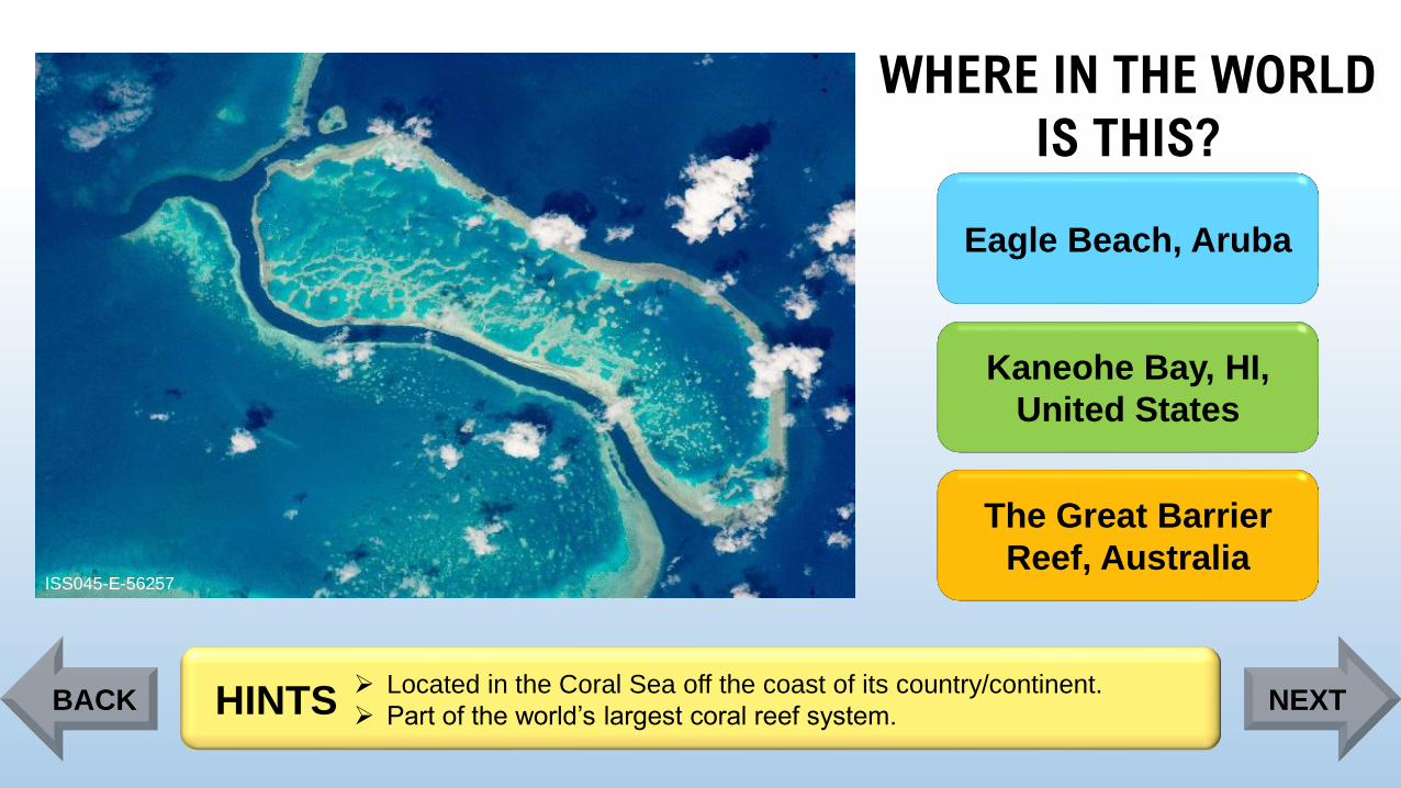
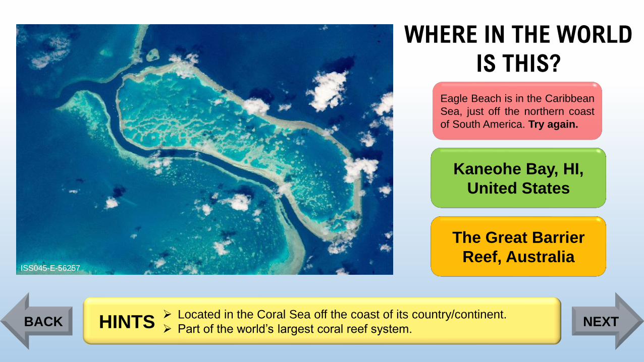
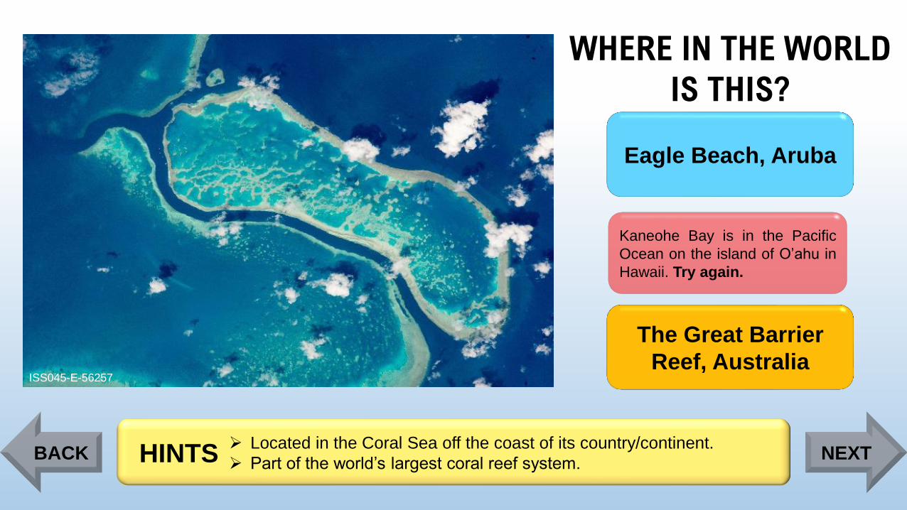
ISS045-E-56257
Eagle Beach, Aruba
Kaneohe Bay, HI,
United States
The Great Barrier
Reef, Australia
➢ Located in the Coral Sea off the coast of its country/continent.
➢ Part of the world’s largest coral reef system. HINTSBACK NEXT
Page 19
WHERE IN THE WORLD
IS THIS?
ISS045-E-56257
Eagle Beach is in the Caribbean
Sea, just off the northern coast
of South America. Try again.
Kaneohe Bay, HI,
United States
The Great Barrier
Reef, Australia
➢ Located in the Coral Sea off the coast of its country/continent.
➢ Part of the world’s largest coral reef system. HINTSBACK NEXT
Page 20
WHERE IN THE WORLD
IS THIS?
ISS045-E-56257
Eagle Beach, Aruba
Kaneohe Bay is in the Pacific
Ocean on the island of O’ahu in
Hawaii. Try again.
The Great Barrier
Reef, Australia
➢ Located in the Coral Sea off the coast of its country/continent.
➢ Part of the world’s largest coral reef system. HINTSBACK NEXT
Page 21
WHERE IN THE WORLD
IS THIS?
ISS045-E-56257
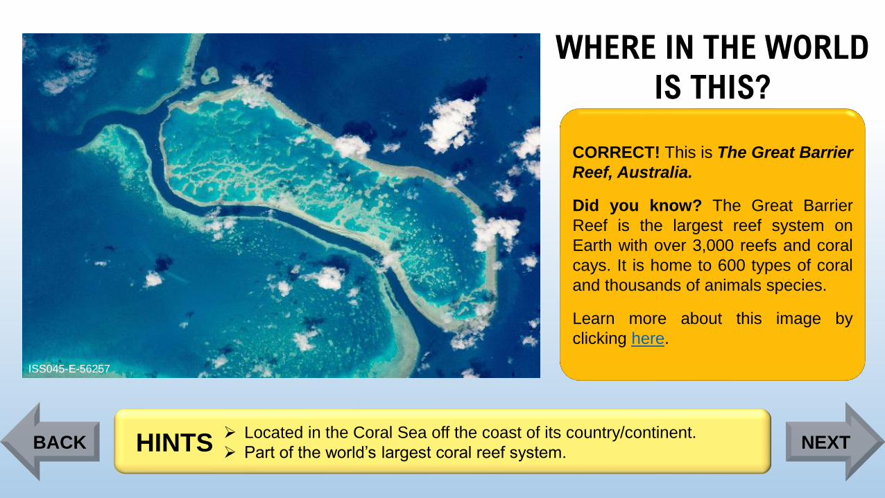
CORRECT! This is The Great Barrier
Reef, Australia.
Did you know? The Great Barrier
Reef is the largest reef system on
Earth with over 3,000 reefs and coral
cays. It is home to 600 types of coral
and thousands of animals species.
Learn more about this image by
clicking here.
➢ Located in the Coral Sea off the coast of its country/continent.
➢ Part of the world’s largest coral reef system. HINTSBACK NEXT
Page 22
WHERE IN THE WORLD
IS THIS?
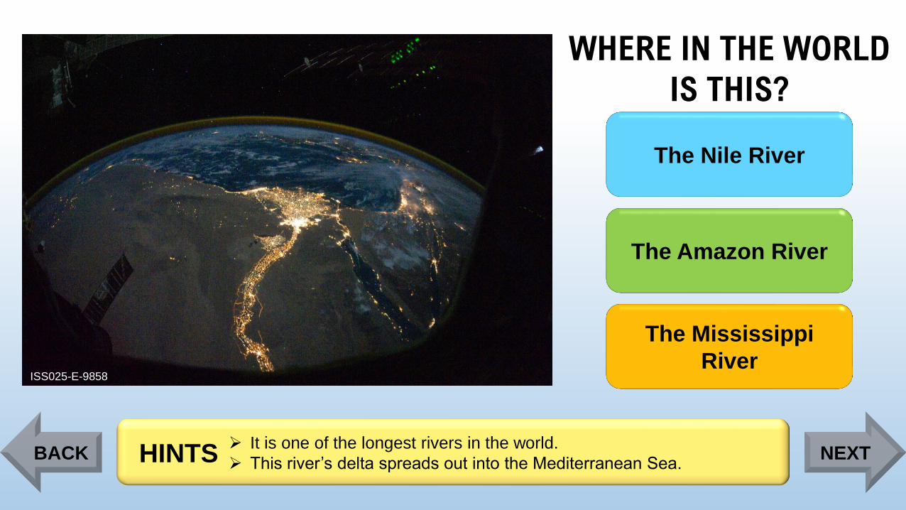
ISS025-E-9858
The Nile River
The Amazon River
The Mississippi
River
➢ It is one of the longest rivers in the world.
➢ This river’s delta spreads out into the Mediterranean Sea. HINTSBACK NEXT
Page 23
WHERE IN THE WORLD
IS THIS?
ISS025-E-9858
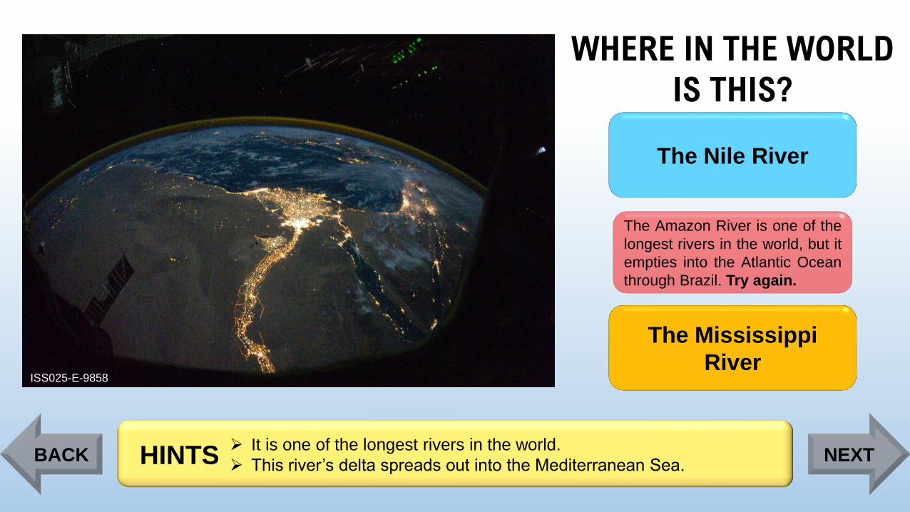
The Nile River
The Amazon River is one of the
longest rivers in the world, but it
empties into the Atlantic Ocean
through Brazil. Try again.
The Mississippi
River
➢ It is one of the longest rivers in the world.
➢ This river’s delta spreads out into the Mediterranean Sea. HINTSBACK NEXT
Page 24
WHERE IN THE WORLD
IS THIS?
ISS025-E-9858
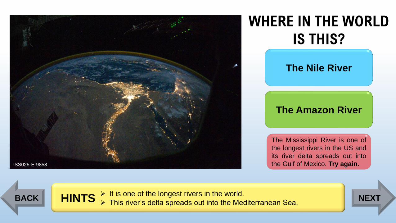
The Nile River
The Amazon River
The Mississippi River is one of
the longest rivers in the US and
its river delta spreads out into
the Gulf of Mexico. Try again.
➢ It is one of the longest rivers in the world.
➢ This river’s delta spreads out into the Mediterranean Sea. HINTSBACK NEXT
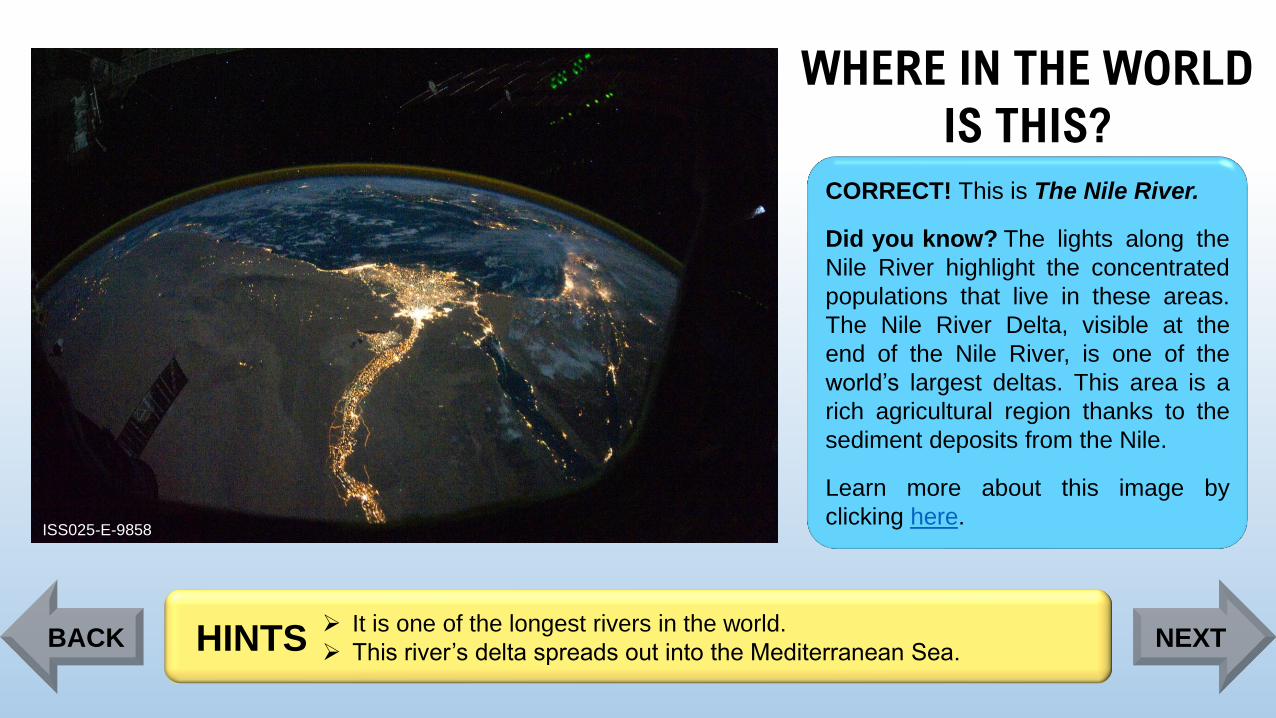
Page 25
WHERE IN THE WORLD
IS THIS?
ISS025-E-9858
CORRECT! This is The Nile River.
Did you know? The lights along the
Nile River highlight the concentrated
populations that live in these areas.
The Nile River Delta, visible at the
end of the Nile River, is one of the
world’s largest deltas. This area is a
rich agricultural region thanks to the
sediment deposits from the Nile.
Learn more about this image by
clicking here.
➢ It is one of the longest rivers in the world.
➢ This river’s delta spreads out into the Mediterranean Sea. HINTSBACK NEXT
Page 26
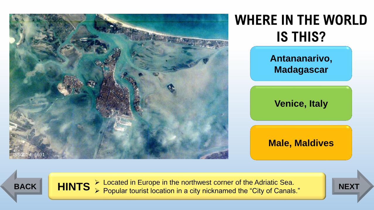
WHERE IN THE WORLD
IS THIS?
ISS001-E-6691
Antananarivo,
Madagascar
Venice, Italy
Male, Maldives
➢ Located in Europe in the northwest corner of the Adriatic Sea.
➢ Popular tourist location in a city nicknamed the “City of Canals.”HINTSBACK NEXT
Page 27
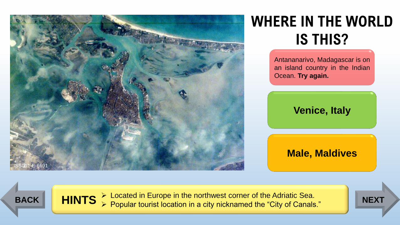
WHERE IN THE WORLD
IS THIS?
ISS001-E-6691
Antananarivo, Madagascar is on
an island country in the Indian
Ocean. Try again.
Venice, Italy
Male, Maldives
➢ Located in Europe in the northwest corner of the Adriatic Sea.
➢ Popular tourist location in a city nicknamed the “City of Canals.”HINTSBACK NEXT
Page 28
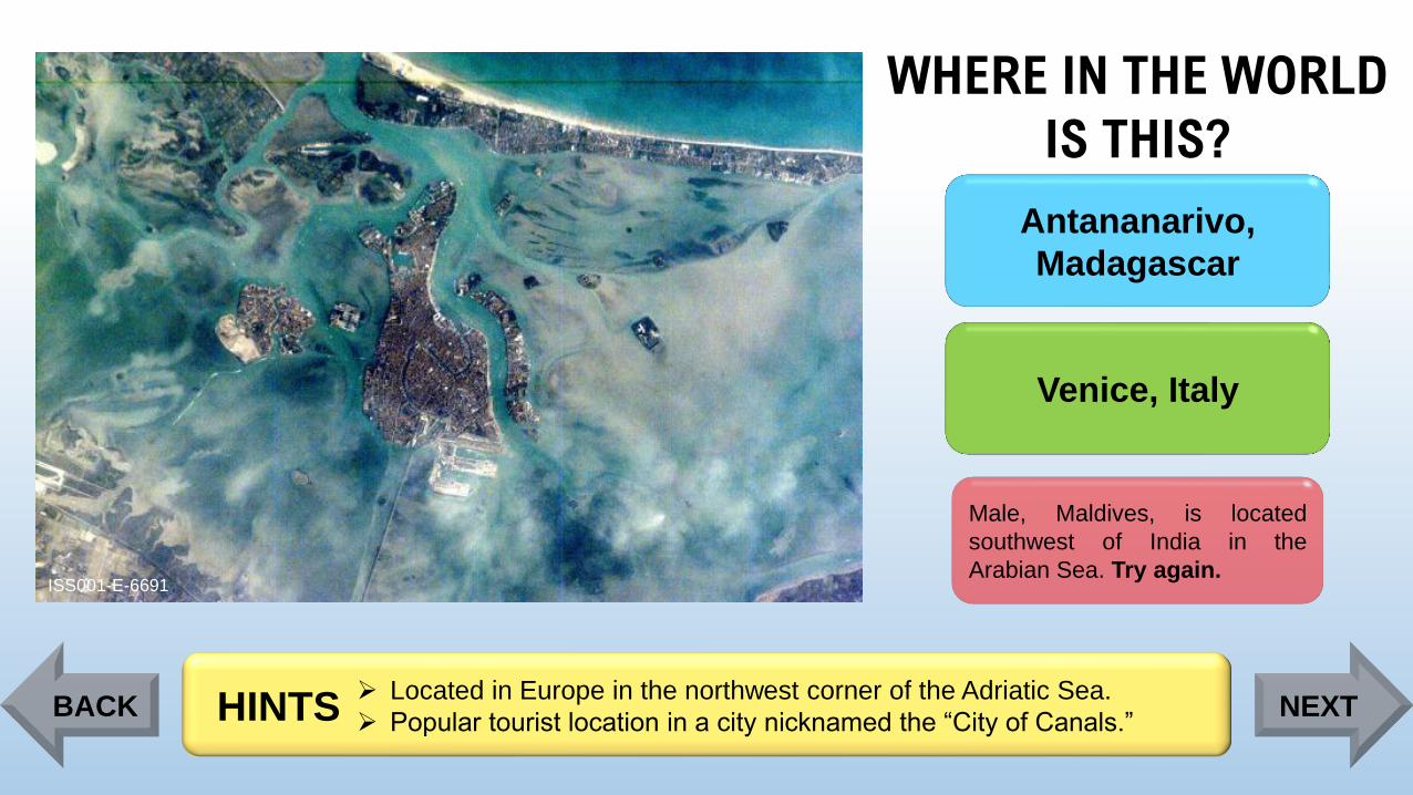
WHERE IN THE WORLD
IS THIS?
ISS001-E-6691
Antananarivo,
Madagascar
Venice, Italy
Male, Maldives, is located
southwest of India in the
Arabian Sea. Try again.
➢ Located in Europe in the northwest corner of the Adriatic Sea.
➢ Popular tourist location in a city nicknamed the “City of Canals.”HINTSBACK NEXT
Page 29
WHERE IN THE WORLD
IS THIS?
ISS001-E-6691
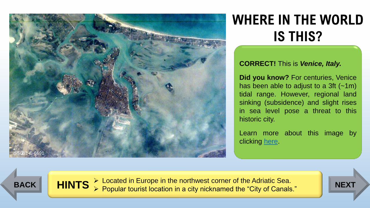
CORRECT! This is Venice, Italy.
Did you know? For centuries, Venice
has been able to adjust to a 3ft (~1m)
tidal range. However, regional land
sinking (subsidence) and slight rises
in sea level pose a threat to this
historic city.
Learn more about this image by
clicking here.
➢ Located in Europe in the northwest corner of the Adriatic Sea.
➢ Popular tourist location in a city nicknamed the “City of Canals.”HINTSBACK NEXT
Page 30
WHERE IN THE WORLD
IS THIS?
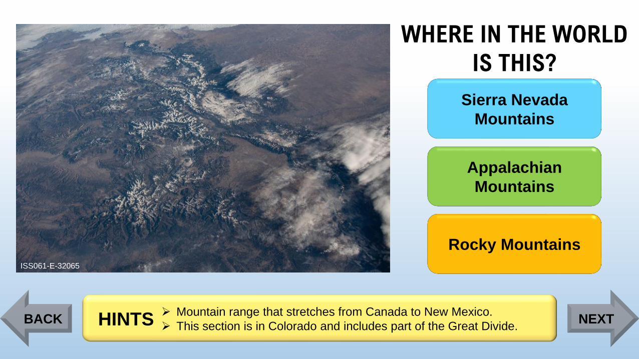
ISS061-E-32065
Sierra Nevada
Mountains
Appalachian
Mountains
Rocky Mountains
➢ Mountain range that stretches from Canada to New Mexico.
➢ This section is in Colorado and includes part of the Great Divide. HINTSBACK NEXT
Page 31
WHERE IN THE WORLD
IS THIS?
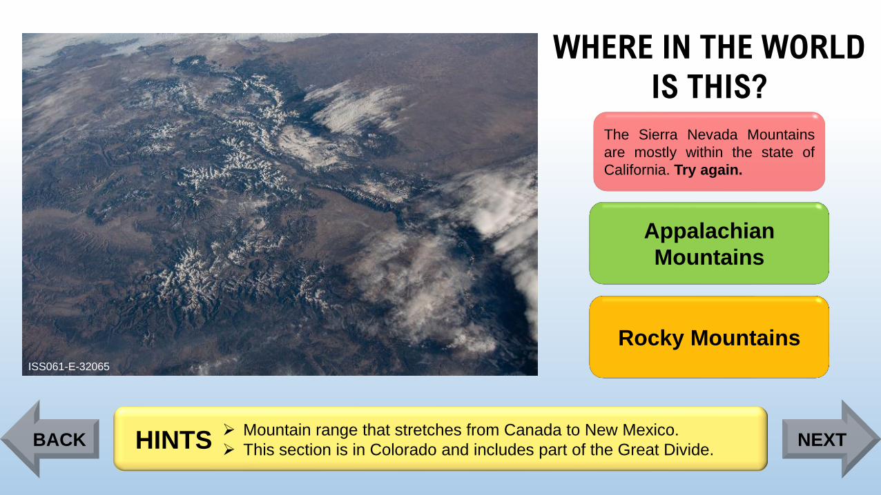
ISS061-E-32065
The Sierra Nevada Mountains
are mostly within the state of
California. Try again.
Appalachian
Mountains
Rocky Mountains
➢ Mountain range that stretches from Canada to New Mexico.
➢ This section is in Colorado and includes part of the Great Divide. HINTSBACK NEXT
Page 32
WHERE IN THE WORLD
IS THIS?
ISS061-E-32065
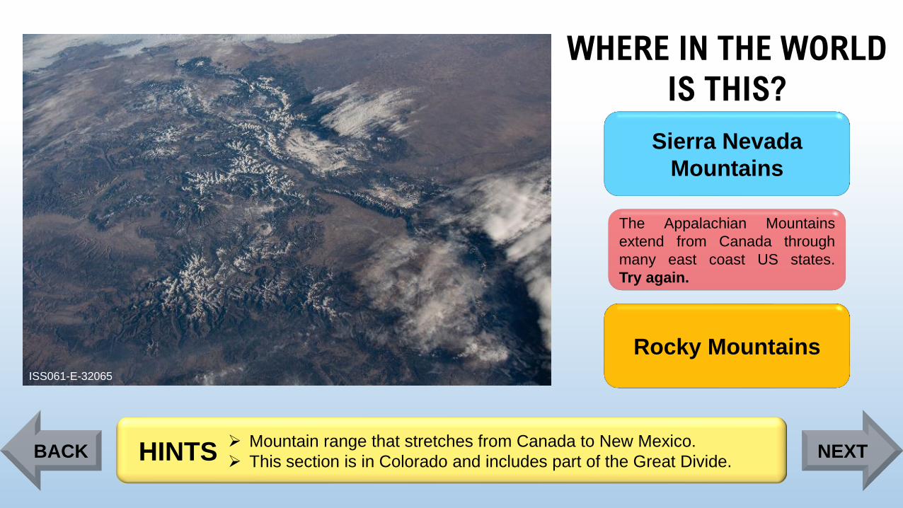
Sierra Nevada
Mountains
The Appalachian Mountains
extend from Canada through
many east coast US states.
Try again.
Rocky Mountains
➢ Mountain range that stretches from Canada to New Mexico.
➢ This section is in Colorado and includes part of the Great Divide. HINTSBACK NEXT
Page 33
WHERE IN THE WORLD
IS THIS?
ISS061-E-32065
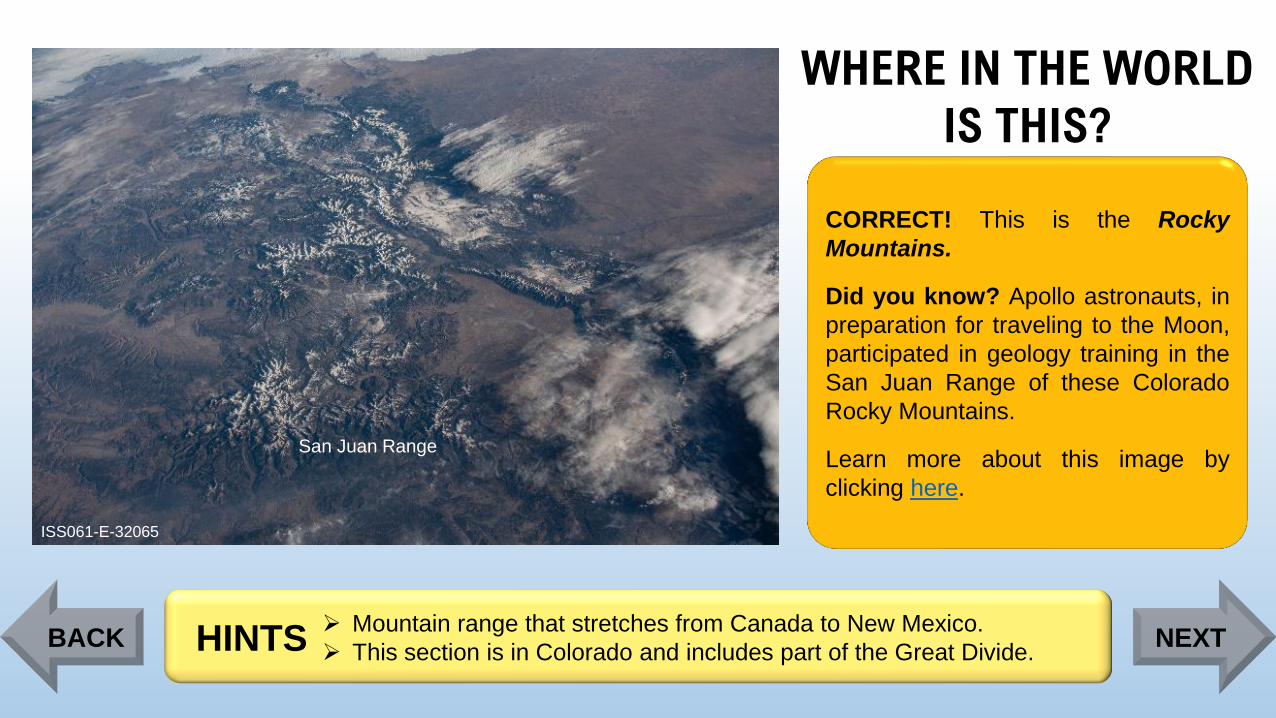
San Juan Range
CORRECT! This is the Rocky
Mountains.
Did you know? Apollo astronauts, in
preparation for traveling to the Moon,
participated in geology training in the
San Juan Range of these Colorado
Rocky Mountains.
Learn more about this image by
clicking here.
➢ Mountain range that stretches from Canada to New Mexico.
➢ This section is in Colorado and includes part of the Great Divide. HINTSBACK NEXT
Page 34
WHERE IN THE WORLD
IS THIS?
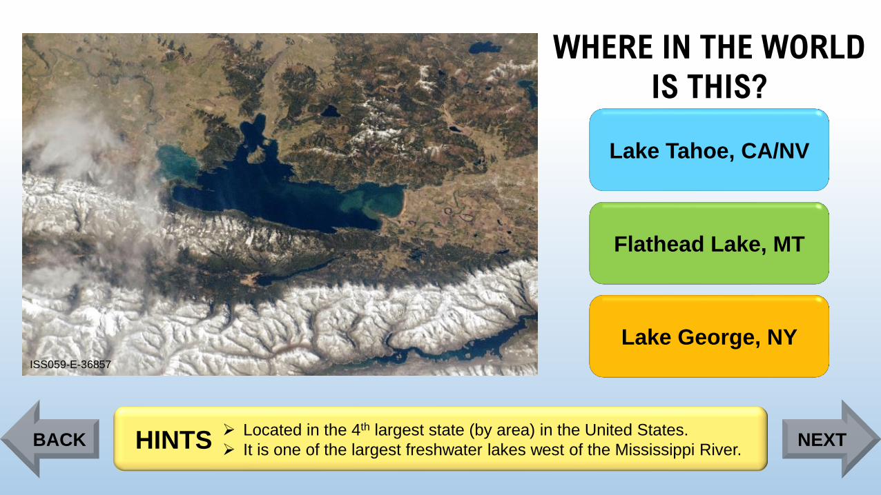
ISS059-E-36857
Lake Tahoe, CA/NV
Flathead Lake, MT
Lake George, NY
➢ Located in the 4th largest state (by area) in the United States.
➢ It is one of the largest freshwater lakes west of the Mississippi River.HINTSBACK NEXT
Page 35
WHERE IN THE WORLD
IS THIS?
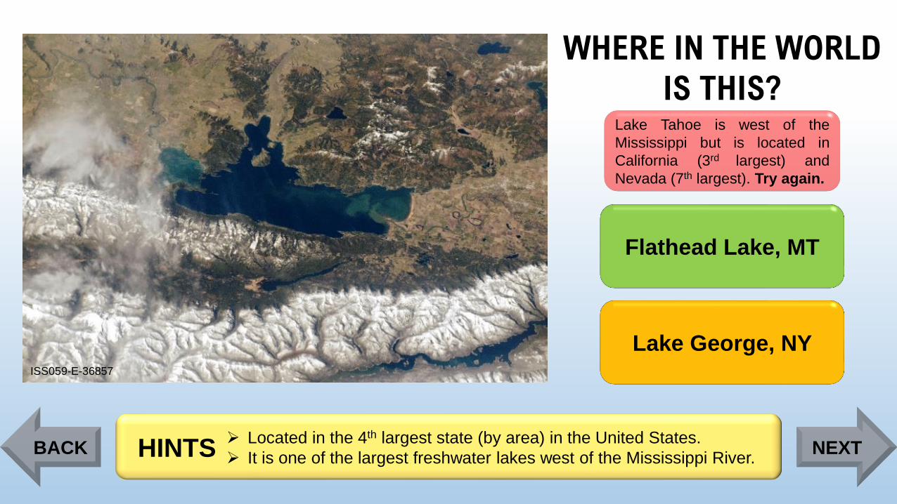
ISS059-E-36857
Lake Tahoe is west of the
Mississippi but is located in
California (3rd largest) and
Nevada (7th largest). Try again.
Flathead Lake, MT
Lake George, NY
➢ Located in the 4th largest state (by area) in the United States.
➢ It is one of the largest freshwater lakes west of the Mississippi River.HINTSBACK NEXT
Page 36
WHERE IN THE WORLD
IS THIS?
ISS059-E-36857
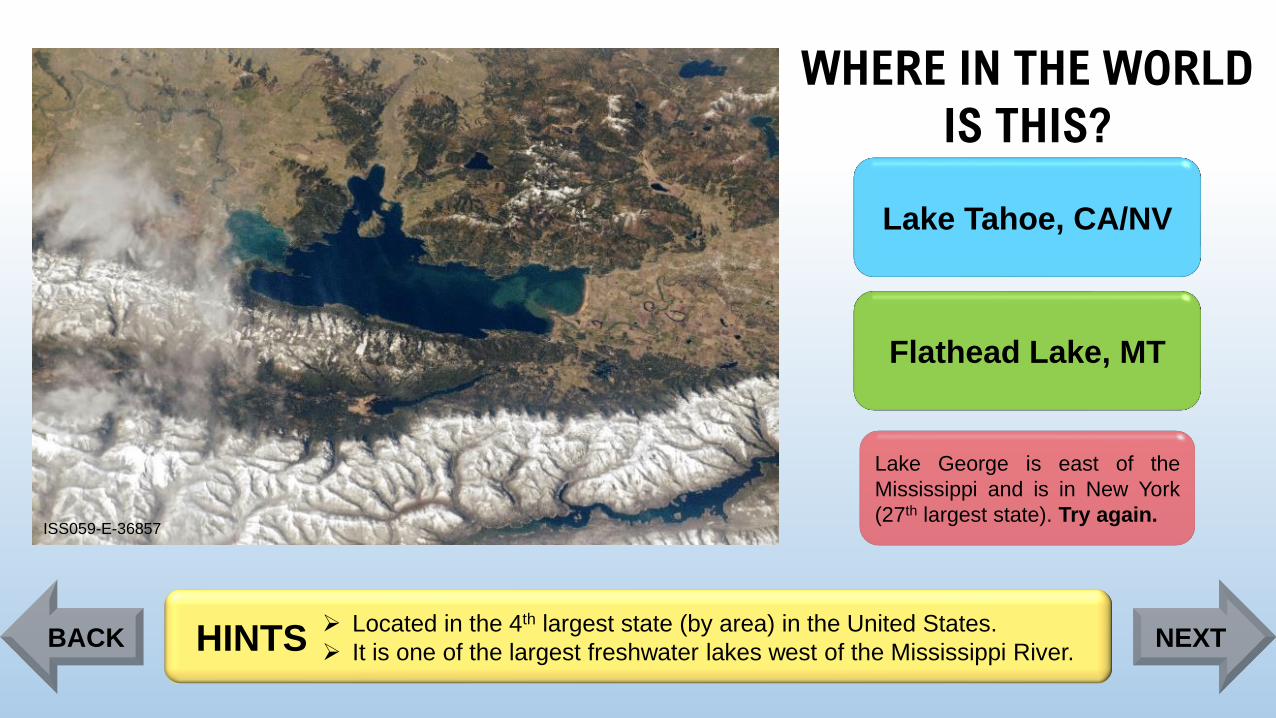
Lake Tahoe, CA/NV
Flathead Lake, MT
Lake George is east of the
Mississippi and is in New York
(27th largest state). Try again.
➢ Located in the 4th largest state (by area) in the United States.
➢ It is one of the largest freshwater lakes west of the Mississippi River.HINTSBACK NEXT
Page 37
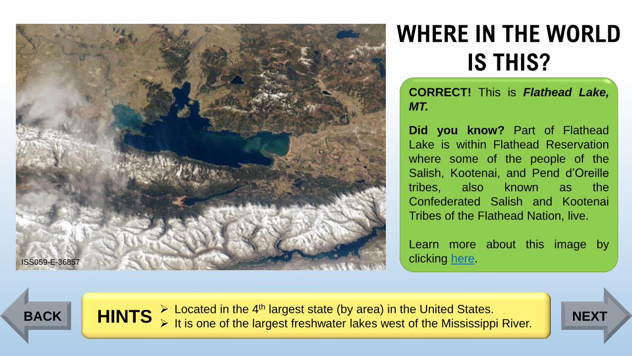
WHERE IN THE WORLD
IS THIS?
ISS059-E-36857
CORRECT! This is Flathead Lake,
MT.
Did you know? Part of Flathead
Lake is within Flathead Reservation
where some of the people of the
Salish, Kootenai, and Pend d’Oreille
tribes, also known as the
Confederated Salish and Kootenai
Tribes of the Flathead Nation, live.
Learn more about this image by
clicking here.
➢ Located in the 4th largest state (by area) in the United States.
➢ It is one of the largest freshwater lakes west of the Mississippi River.HINTSBACK NEXT
Page 38
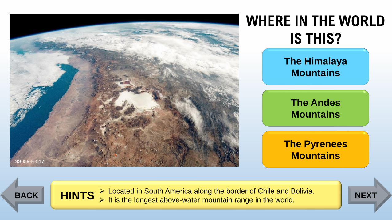
WHERE IN THE WORLD
IS THIS?
ISS059-E-517
The Himalaya
Mountains
The Andes
Mountains
The Pyrenees
Mountains
➢ Located in South America along the border of Chile and Bolivia.
➢ It is the longest above-water mountain range in the world. HINTSBACK NEXT
Page 39
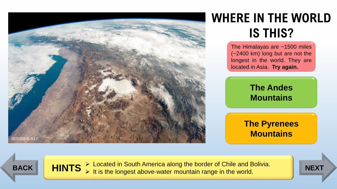
WHERE IN THE WORLD
IS THIS?
ISS059-E-517
The Himalayas are ~1500 miles
(~2400 km) long but are not the
longest in the world. They are
located in Asia. Try again.
The Andes
Mountains
The Pyrenees
Mountains
➢ Located in South America along the border of Chile and Bolivia.
➢ It is the longest above-water mountain range in the world. HINTSBACK NEXT
Page 40
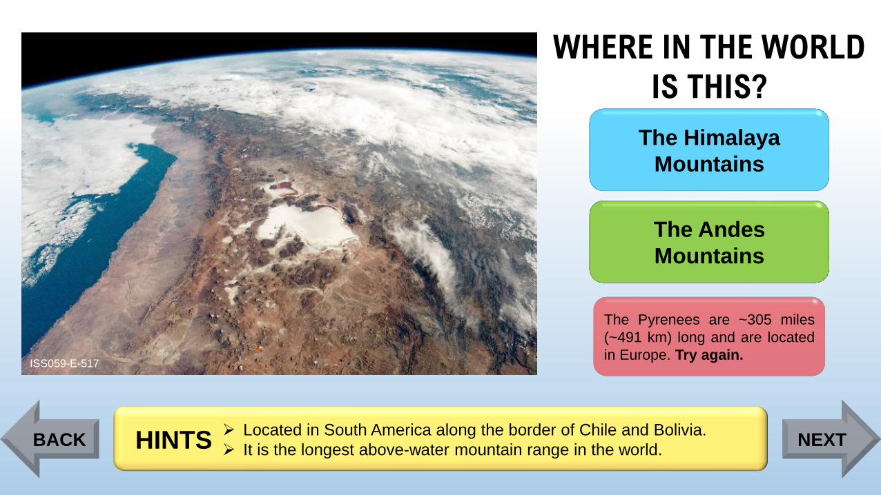
WHERE IN THE WORLD
IS THIS?
ISS059-E-517
The Himalaya
Mountains
The Andes
Mountains
The Pyrenees are ~305 miles
(~491 km) long and are located
in Europe. Try again.
➢ Located in South America along the border of Chile and Bolivia.
➢ It is the longest above-water mountain range in the world. HINTSBACK NEXT
Page 41
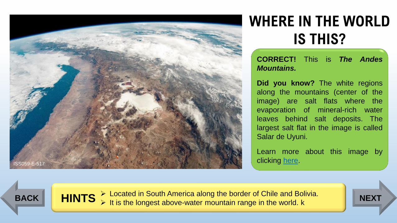
WHERE IN THE WORLD
IS THIS?
ISS059-E-517
CORRECT! This is The Andes
Mountains.
Did you know? The white regions
along the mountains (center of the
image) are salt flats where the
evaporation of mineral-rich water
leaves behind salt deposits. The
largest salt flat in the image is called
Salar de Uyuni.
Learn more about this image by
clicking here.
➢ Located in South America along the border of Chile and Bolivia.
➢ It is the longest above-water mountain range in the world. kHINTSBACK NEXT
Page 42
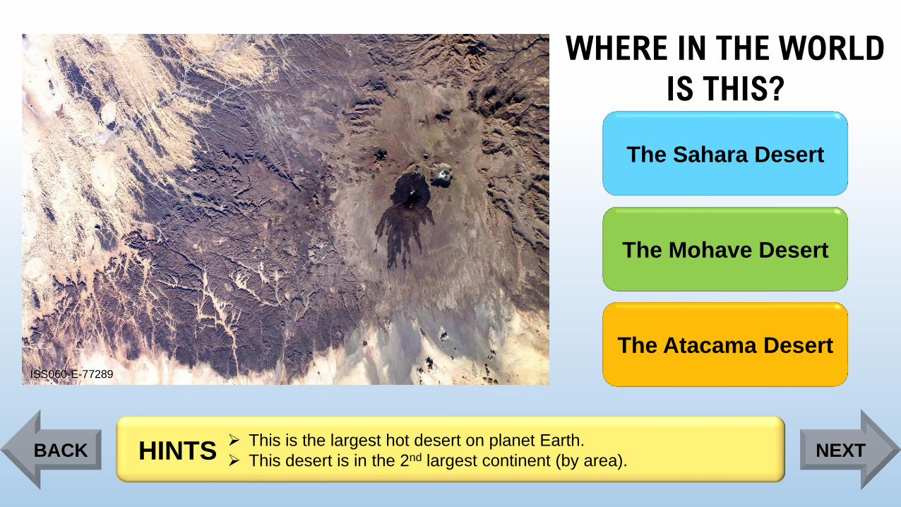
WHERE IN THE WORLD
IS THIS?
ISS060-E-77289
The Sahara Desert
The Mohave Desert
The Atacama Desert
➢ This is the largest hot desert on planet Earth.
➢ This desert is in the 2nd largest continent (by area).HINTSBACK NEXT
Page 43
WHERE IN THE WORLD
IS THIS?
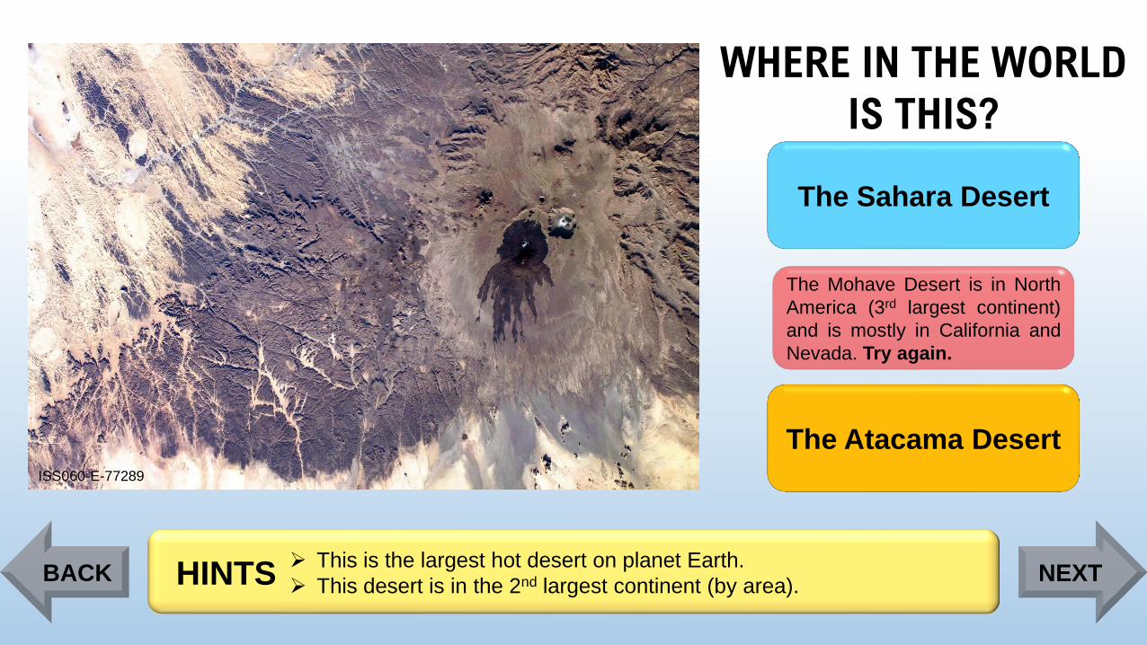
ISS060-E-77289
The Sahara Desert
The Mohave Desert is in North
America (3rd largest continent)
and is mostly in California and
Nevada. Try again.
The Atacama Desert
➢ This is the largest hot desert on planet Earth.
➢ This desert is in the 2nd largest continent (by area).HINTSBACK NEXT
Page 44
WHERE IN THE WORLD
IS THIS?
ISS060-E-77289
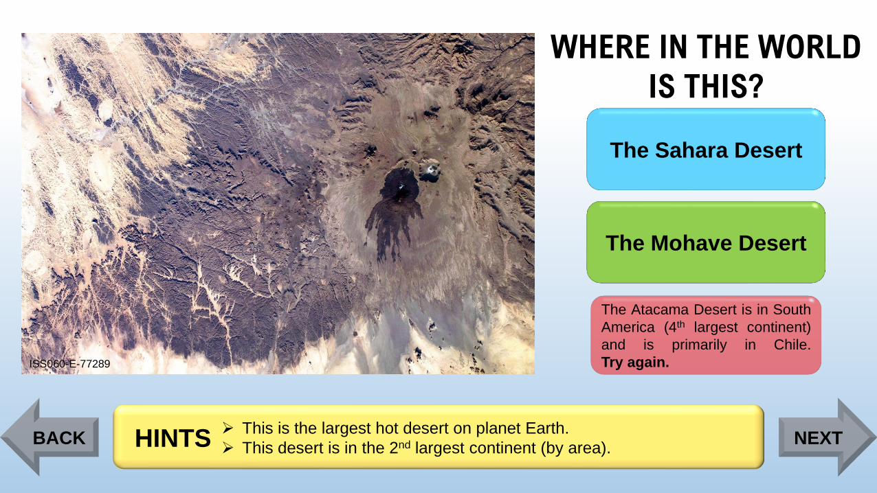
The Sahara Desert
The Mohave Desert
The Atacama Desert is in South
America (4th largest continent)
and is primarily in Chile.
Try again.
➢ This is the largest hot desert on planet Earth.
➢ This desert is in the 2nd largest continent (by area).HINTSBACK NEXT
Page 45
WHERE IN THE WORLD
IS THIS?
ISS060-E-77289
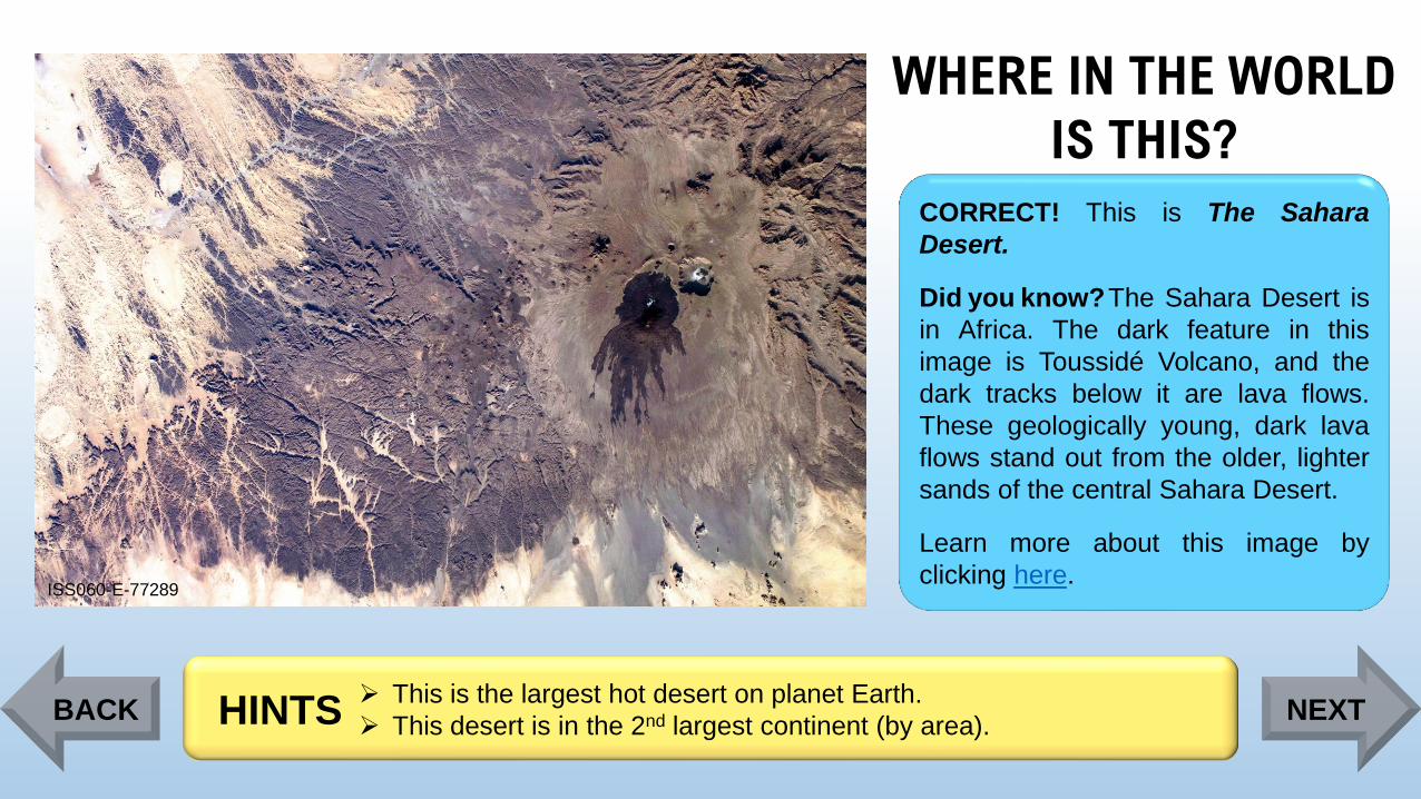
CORRECT! This is The Sahara
Desert.
Did you know?The Sahara Desert is
in Africa. The dark feature in this
image is Toussidé Volcano, and the
dark tracks below it are lava flows.
These geologically young, dark lava
flows stand out from the older, lighter
sands of the central Sahara Desert.
Learn more about this image by
clicking here.
➢ This is the largest hot desert on planet Earth.
➢ This desert is in the 2nd largest continent (by area).HINTSBACK NEXT
Page 46
WHERE IN THE WORLD
IS THIS?
ISS030-E-12516
Colca Canyon,
Peru
Grand Canyon, AZ,
United States
Richat Structure,
Mauritania
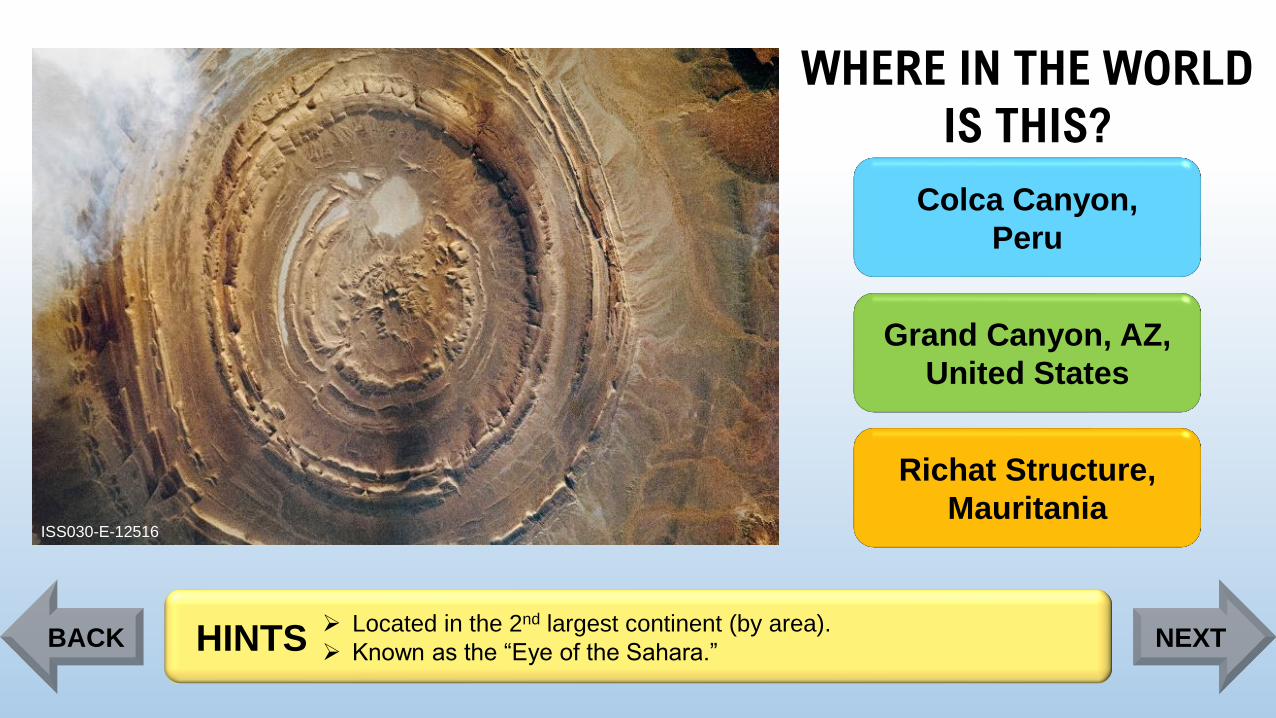
➢ Located in the 2nd largest continent (by area).
➢ Known as the “Eye of the Sahara.”HINTSBACK NEXT
Page 47
WHERE IN THE WORLD
IS THIS?
ISS030-E-12516
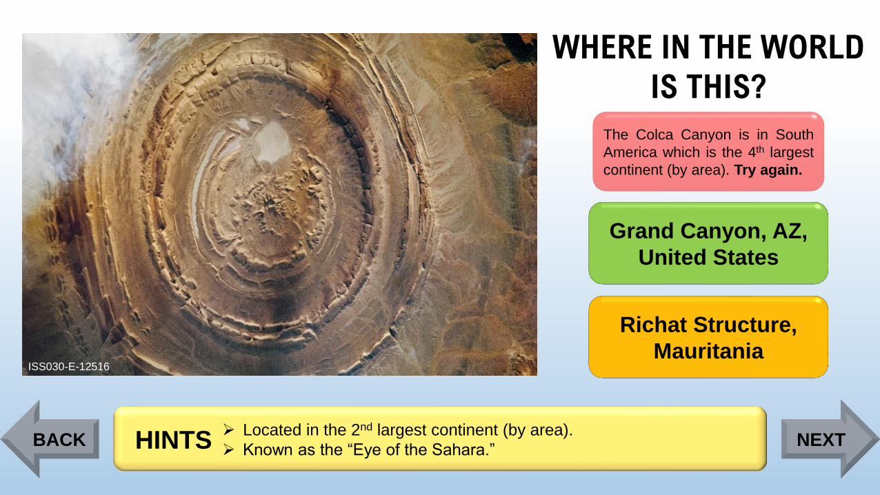
The Colca Canyon is in South
America which is the 4th largest
continent (by area). Try again.
Grand Canyon, AZ,
United States
Richat Structure,
Mauritania
➢ Located in the 2nd largest continent (by area).
➢ Known as the “Eye of the Sahara.”HINTSBACK NEXT
Page 48
WHERE IN THE WORLD
IS THIS?
ISS030-E-12516
Colca Canyon,
Peru
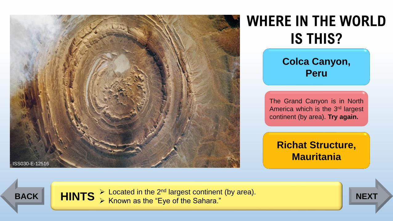
The Grand Canyon is in North
America which is the 3rd largest
continent (by area). Try again.
Richat Structure,
Mauritania
➢ Located in the 2nd largest continent (by area).
➢ Known as the “Eye of the Sahara.”HINTSBACK NEXT
Page 49
WHERE IN THE WORLD
IS THIS?
ISS030-E-12516
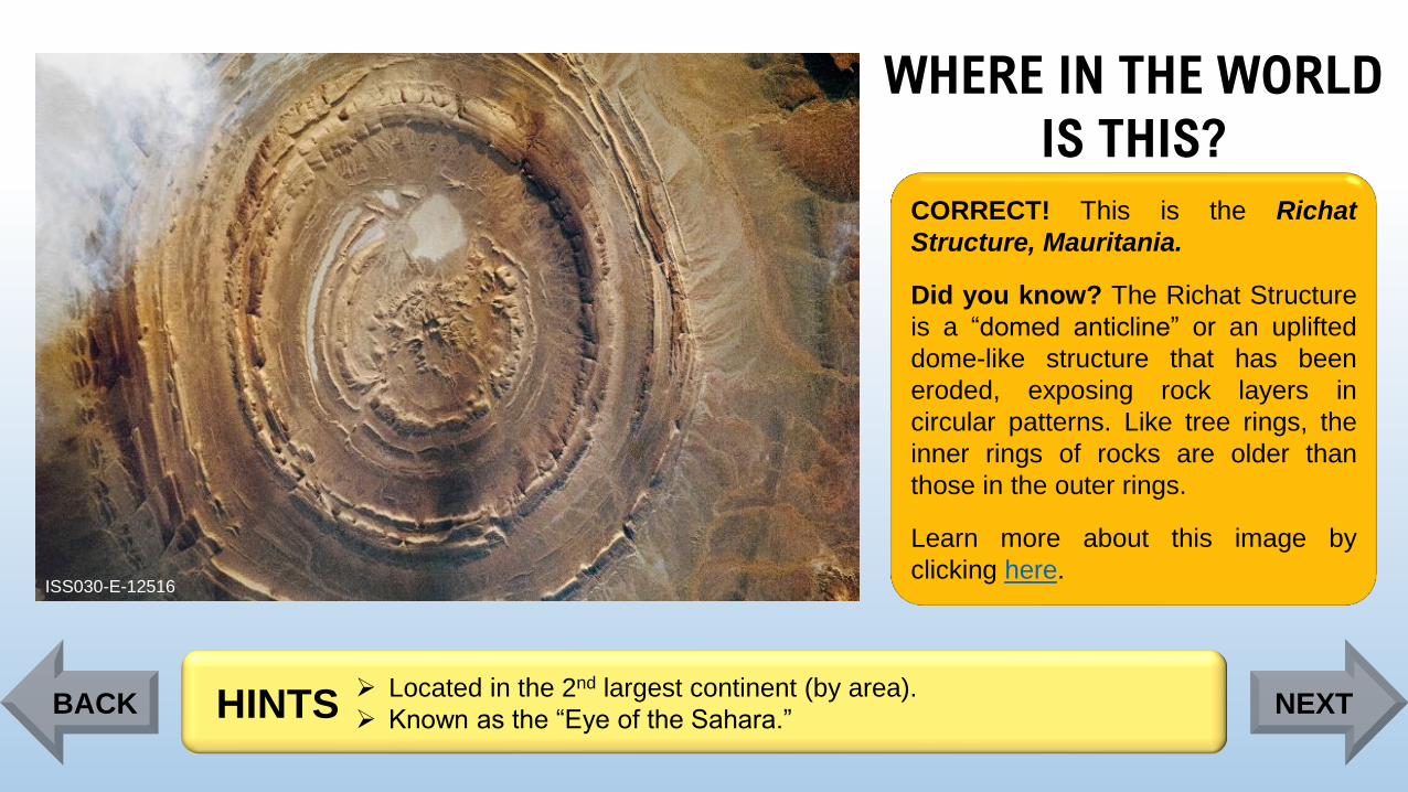
CORRECT! This is the Richat
Structure, Mauritania.
Did you know? The Richat Structure
is a “domed anticline” or an uplifted
dome-like structure that has been
eroded, exposing rock layers in
circular patterns. Like tree rings, the
inner rings of rocks are older than
those in the outer rings.
Learn more about this image by
clicking here.
➢ Located in the 2nd largest continent (by area).
➢ Known as the “Eye of the Sahara.”HINTSBACK NEXT
Page 50
WHERE IN THE WORLD
IS THIS?
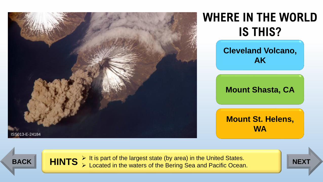
ISS013-E-24184
Cleveland Volcano,
AK
Mount Shasta, CA
Mount St. Helens,
WA
➢ It is part of the largest state (by area) in the United States.
➢ Located in the waters of the Bering Sea and Pacific Ocean.HINTSBACK NEXT
Page 51
WHERE IN THE WORLD
IS THIS?
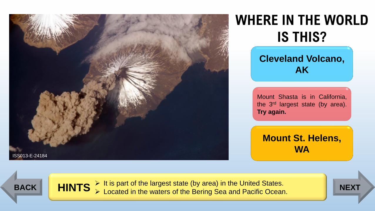
ISS013-E-24184
Cleveland Volcano,
AK
Mount Shasta is in California,
the 3rd largest state (by area).
Try again.
Mount St. Helens,
WA
➢ It is part of the largest state (by area) in the United States.
➢ Located in the waters of the Bering Sea and Pacific Ocean.HINTSBACK NEXT
Page 52
WHERE IN THE WORLD
IS THIS?
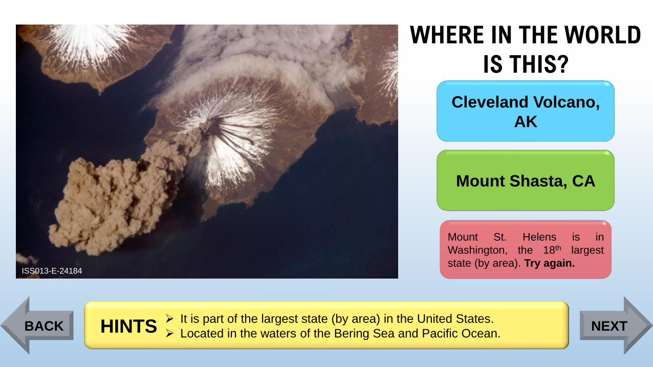
ISS013-E-24184
Cleveland Volcano,
AK
Mount Shasta, CA
Mount St. Helens is in
Washington, the 18th largest
state (by area). Try again.
➢ It is part of the largest state (by area) in the United States.
➢ Located in the waters of the Bering Sea and Pacific Ocean.HINTSBACK NEXT
Page 53
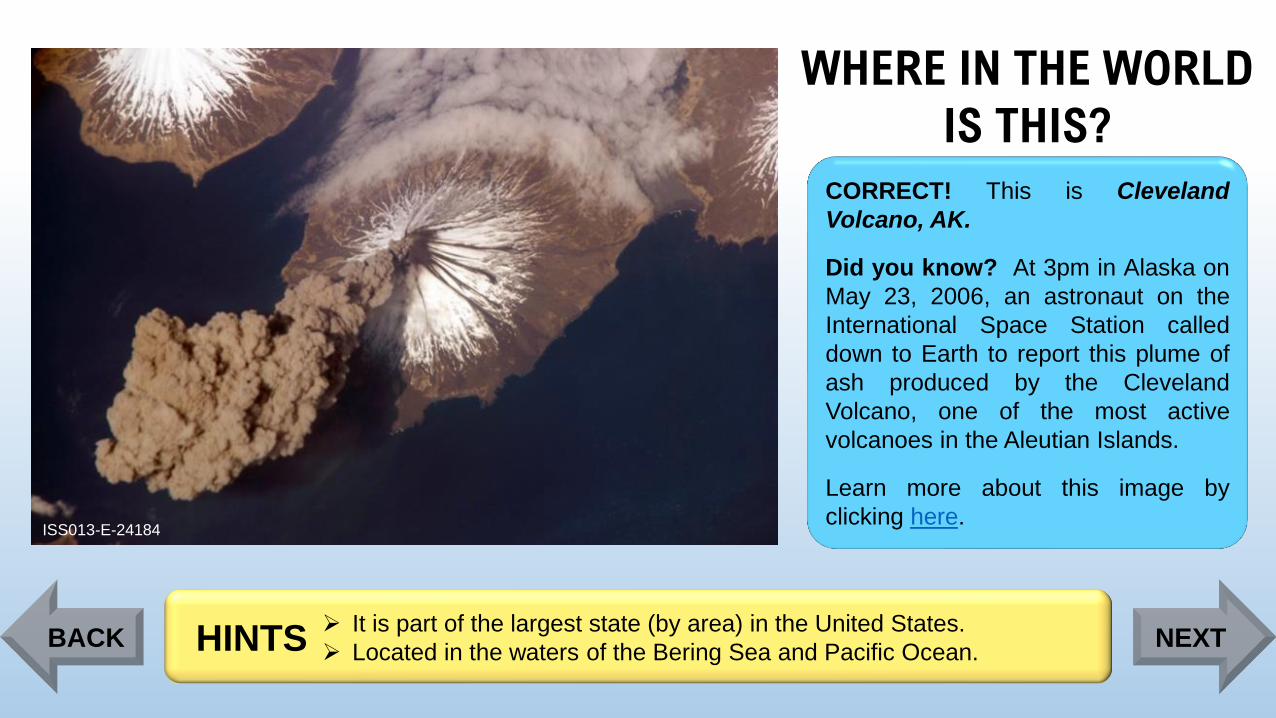
WHERE IN THE WORLD
IS THIS?
ISS013-E-24184
CORRECT! This is Cleveland
Volcano, AK.
Did you know? At 3pm in Alaska on
May 23, 2006, an astronaut on the
International Space Station called
down to Earth to report this plume of
ash produced by the Cleveland
Volcano, one of the most active
volcanoes in the Aleutian Islands.
Learn more about this image by
clicking here.
➢ It is part of the largest state (by area) in the United States.
➢ Located in the waters of the Bering Sea and Pacific Ocean.HINTSBACK NEXT
Page 54
WHERE IN THE WORLD
IS THIS?
ISS044-E-610
Cape Horn, Chile
Cape Cod, MA,
United States
Cape of Good Hope,
South Africa
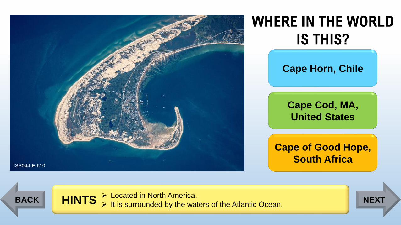
➢ Located in North America.
➢ It is surrounded by the waters of the Atlantic Ocean.HINTSBACK NEXT
Page 55
WHERE IN THE WORLD
IS THIS?
ISS044-E-610
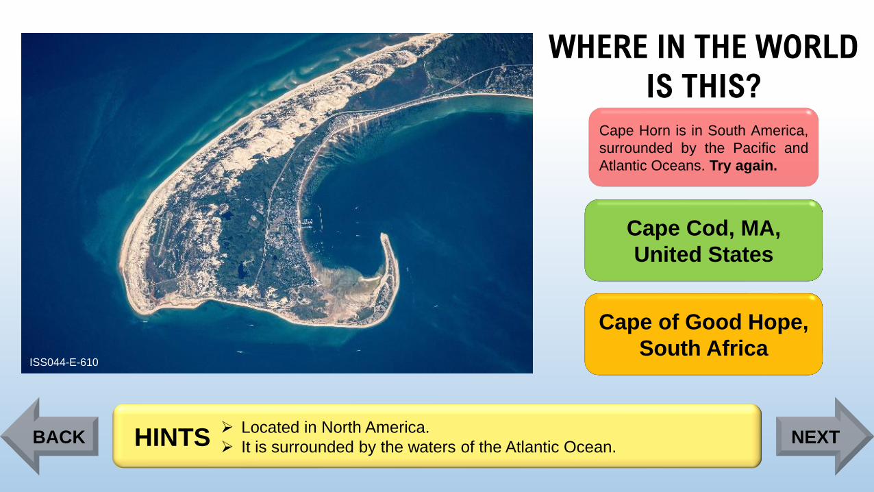
Cape Horn is in South America,
surrounded by the Pacific and
Atlantic Oceans. Try again.
Cape Cod, MA,
United States
Cape of Good Hope,
South Africa
➢ Located in North America.
➢ It is surrounded by the waters of the Atlantic Ocean.HINTSBACK NEXT
Page 56
WHERE IN THE WORLD
IS THIS?
ISS044-E-610
Cape Horn, Chile
Cape Cod, MA,
United States
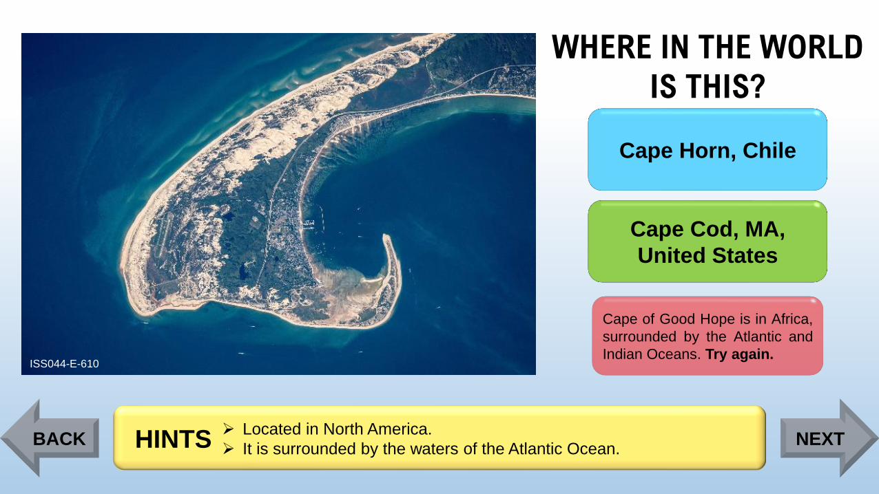
Cape of Good Hope is in Africa,
surrounded by the Atlantic and
Indian Oceans. Try again.
➢ Located in North America.
➢ It is surrounded by the waters of the Atlantic Ocean.HINTSBACK NEXT
Page 57
WHERE IN THE WORLD
IS THIS?
ISS044-E-610
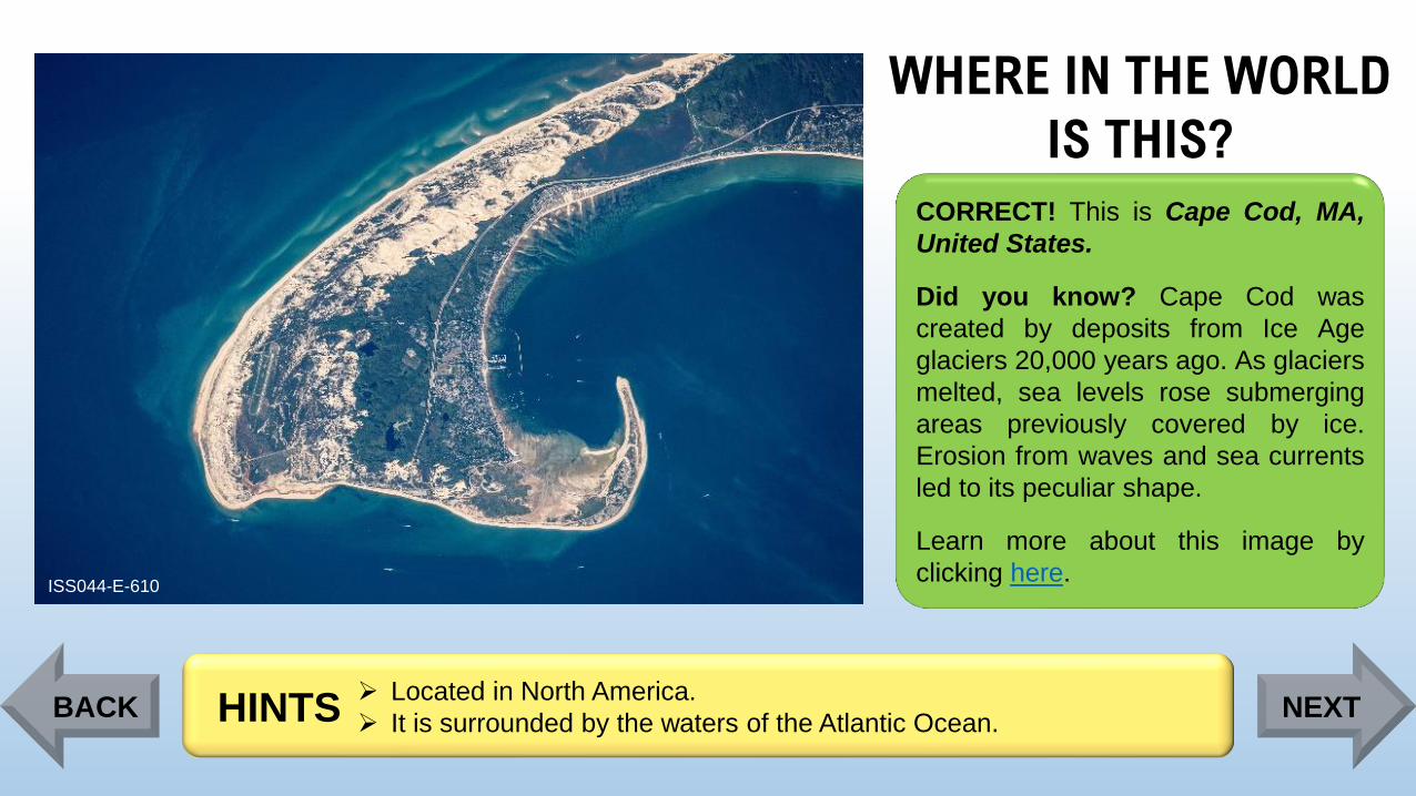
CORRECT! This is Cape Cod, MA,
United States.
Did you know? Cape Cod was
created by deposits from Ice Age
glaciers 20,000 years ago. As glaciers
melted, sea levels rose submerging
areas previously covered by ice.
Erosion from waves and sea currents
led to its peculiar shape.
Learn more about this image by
clicking here.
➢ Located in North America.
➢ It is surrounded by the waters of the Atlantic Ocean.HINTSBACK NEXT
Page 58
WHERE IN THE WORLD
IS THIS?
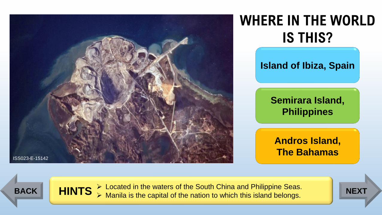
ISS023-E-15142
Island of Ibiza, Spain
Semirara Island,
Philippines
Andros Island,
The Bahamas
➢ Located in the waters of the South China and Philippine Seas.
➢ Manila is the capital of the nation to which this island belongs.HINTSBACK NEXT
Page 59
WHERE IN THE WORLD
IS THIS?
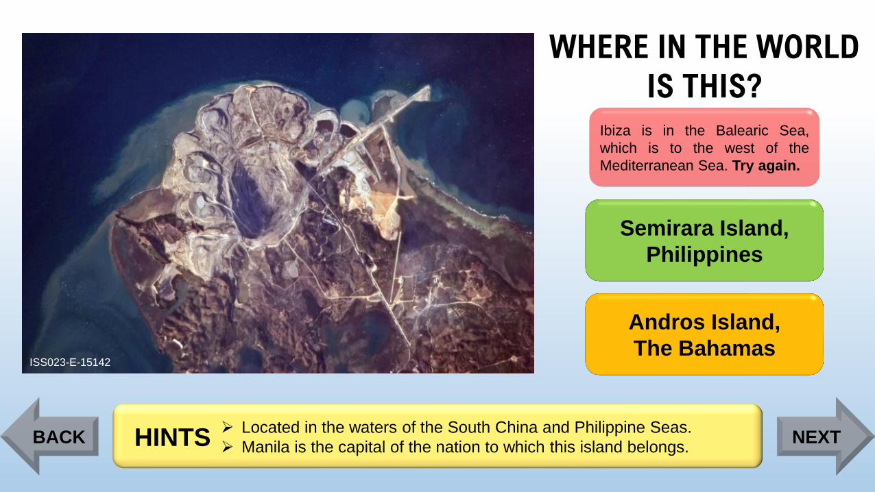
ISS023-E-15142
Ibiza is in the Balearic Sea,
which is to the west of the
Mediterranean Sea. Try again.
Semirara Island,
Philippines
Andros Island,
The Bahamas
➢ Located in the waters of the South China and Philippine Seas.
➢ Manila is the capital of the nation to which this island belongs.HINTSBACK NEXT
Page 60
WHERE IN THE WORLD
IS THIS?
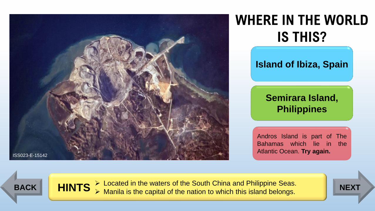
ISS023-E-15142
Island of Ibiza, Spain
Semirara Island,
Philippines
Andros Island is part of The
Bahamas which lie in the
Atlantic Ocean. Try again.
➢ Located in the waters of the South China and Philippine Seas.
➢ Manila is the capital of the nation to which this island belongs.HINTSBACK NEXT
Page 61
WHERE IN THE WORLD
IS THIS?
ISS023-E-15142
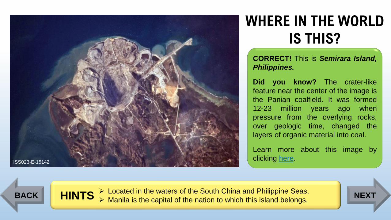
CORRECT! This is Semirara Island,
Philippines.
Did you know? The crater-like
feature near the center of the image is
the Panian coalfield. It was formed
12-23 million years ago when
pressure from the overlying rocks,
over geologic time, changed the
layers of organic material into coal.
Learn more about this image by
clicking here.
➢ Located in the waters of the South China and Philippine Seas.
➢ Manila is the capital of the nation to which this island belongs.HINTSBACK NEXT
Page 62
WHERE IN THE WORLD
IS THIS?
ISS030-E-254011
Lonar Crater,
India
Manicouagan Crater,
Canada
Ouarkziz Crater,
Algeria
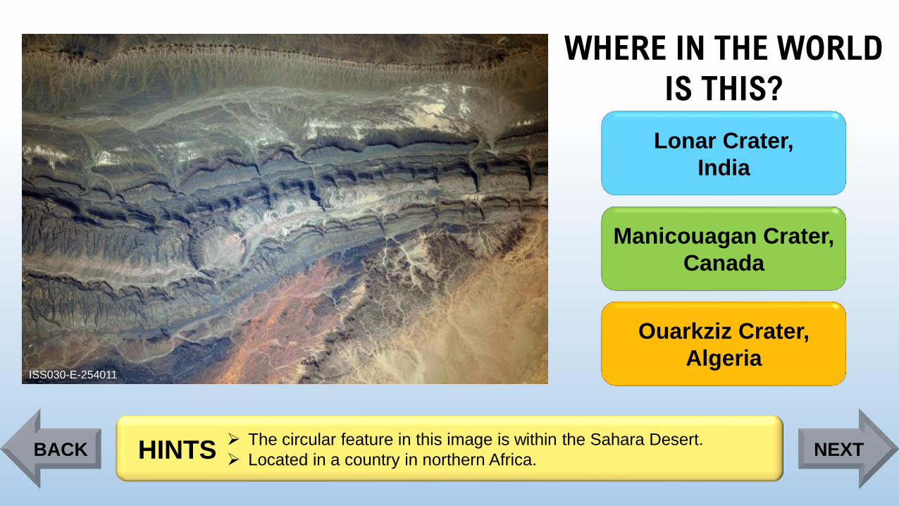
➢ The circular feature in this image is within the Sahara Desert.
➢ Located in a country in northern Africa. HINTSBACK NEXT
Page 63
WHERE IN THE WORLD
IS THIS?
ISS030-E-254011
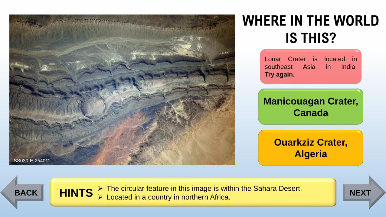
Lonar Crater is located in
southeast Asia in India.
Try again.
Manicouagan Crater,
Canada
Ouarkziz Crater,
Algeria
➢ The circular feature in this image is within the Sahara Desert.
➢ Located in a country in northern Africa. HINTSBACK NEXT
Page 64
WHERE IN THE WORLD
IS THIS?
ISS030-E-254011
Lonar Crater,
India
Manicouagan Crater is located
in North America in Canada.
Try again.
Ouarkziz Crater,
Algeria
➢ The circular feature in this image is within the Sahara Desert.
➢ Located in a country in northern Africa. HINTSBACK NEXT
Page 65
WHERE IN THE WORLD
IS THIS?
ISS030-E-254011
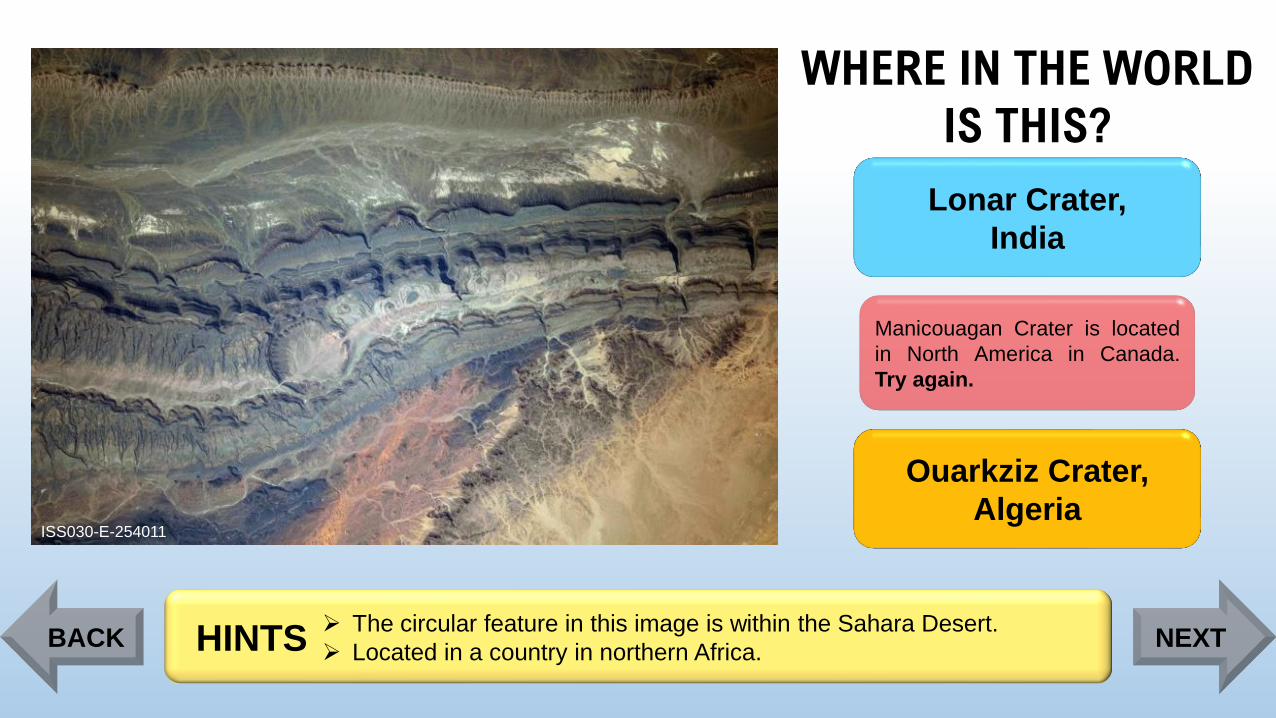
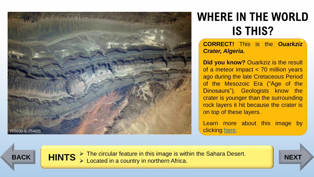
CORRECT! This is the OuarkzizCrater, Algeria.
Did you know? Ouarkziz is the result
of a meteor impact < 70 million years
ago during the late Cretaceous Period
of the Mesozoic Era (“Age of the
Dinosaurs”). Geologists know the
crater is younger than the surrounding
rock layers it hit because the crater is
on top of these layers.
Learn more about this image byclicking here.
➢ The circular feature in this image is within the Sahara Desert.
➢ Located in a country in northern Africa. HINTSBACK NEXT
Page 66
WHERE IN THE WORLD
IS THIS?
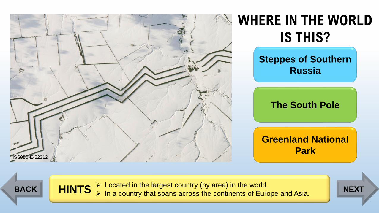
ISS050-E-52312
Steppes of Southern
Russia
The South Pole
Greenland National
Park
➢ Located in the largest country (by area) in the world.
➢ In a country that spans across the continents of Europe and Asia.HINTSBACK NEXT
Page 67
WHERE IN THE WORLD
IS THIS?
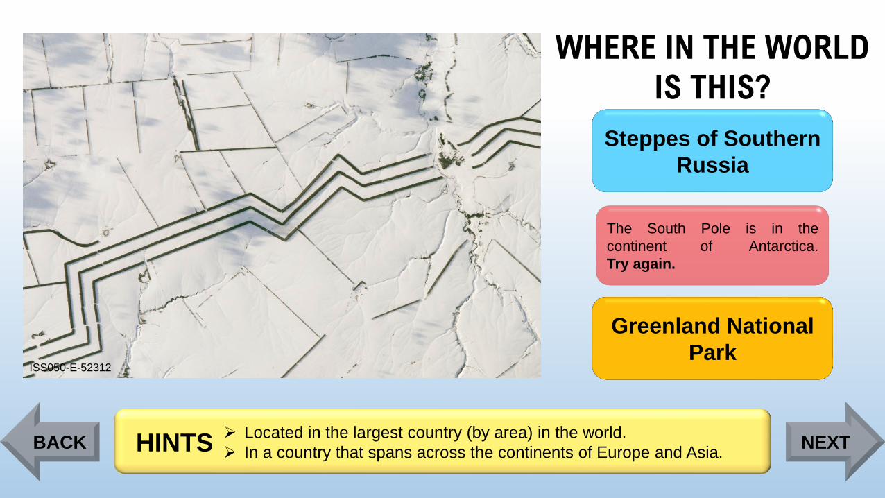
ISS050-E-52312
Steppes of Southern
Russia
The South Pole is in the
continent of Antarctica.
Try again.
Greenland National
Park
➢ Located in the largest country (by area) in the world.
➢ In a country that spans across the continents of Europe and Asia.HINTSBACK NEXT
Page 68
WHERE IN THE WORLD
IS THIS?
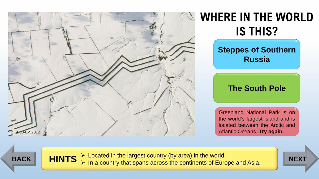
ISS050-E-52312
Steppes of Southern
Russia
The South Pole
Greenland National Park is on
the world’s largest island and is
located between the Arctic and
Atlantic Oceans. Try again.
➢ Located in the largest country (by area) in the world.
➢ In a country that spans across the continents of Europe and Asia.HINTSBACK NEXT
Page 69
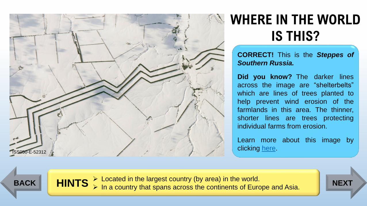
WHERE IN THE WORLD
IS THIS?
ISS050-E-52312
CORRECT! This is the Steppes of
Southern Russia.
Did you know? The darker lines
across the image are “shelterbelts”
which are lines of trees planted to
help prevent wind erosion of the
farmlands in this area. The thinner,
shorter lines are trees protecting
individual farms from erosion.
Learn more about this image by
clicking here.
➢ Located in the largest country (by area) in the world.
➢ In a country that spans across the continents of Europe and Asia.HINTSBACK NEXT
Page 70
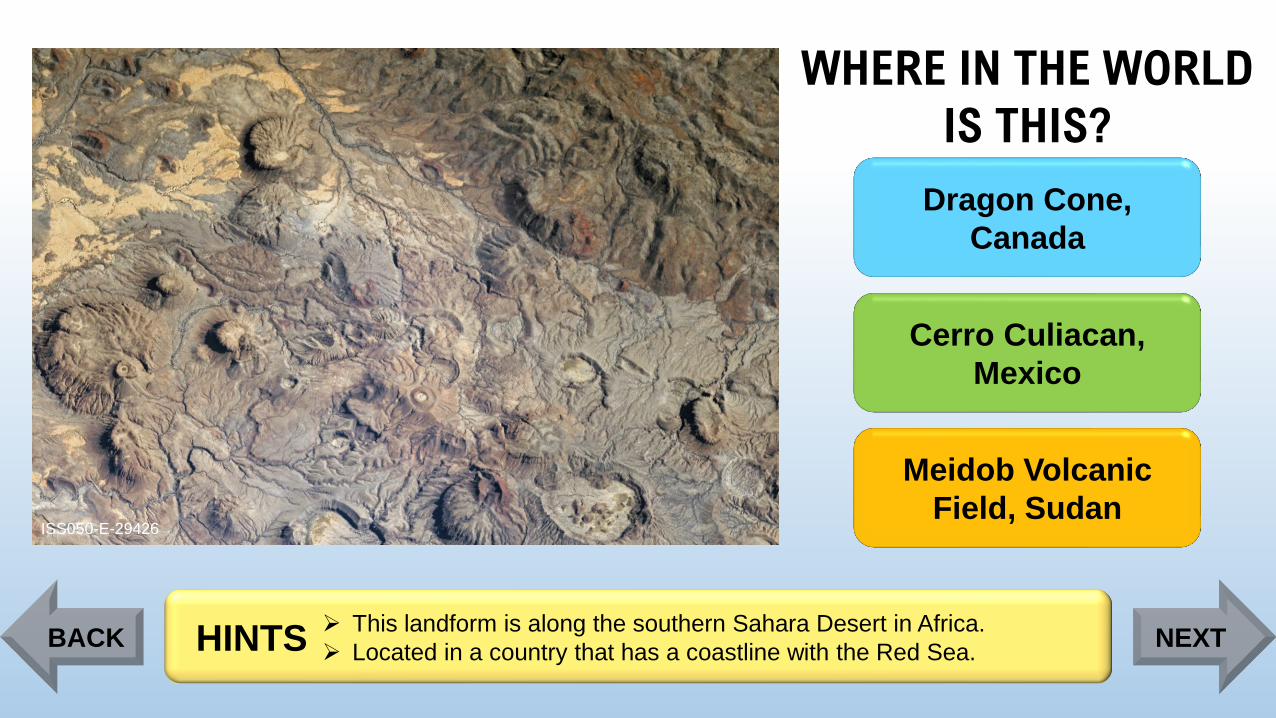
WHERE IN THE WORLD
IS THIS?
ISS050-E-29426
Dragon Cone,
Canada
Cerro Culiacan,
Mexico
Meidob Volcanic
Field, Sudan
➢ This landform is along the southern Sahara Desert in Africa.
➢ Located in a country that has a coastline with the Red Sea. HINTSBACK NEXT
Page 71
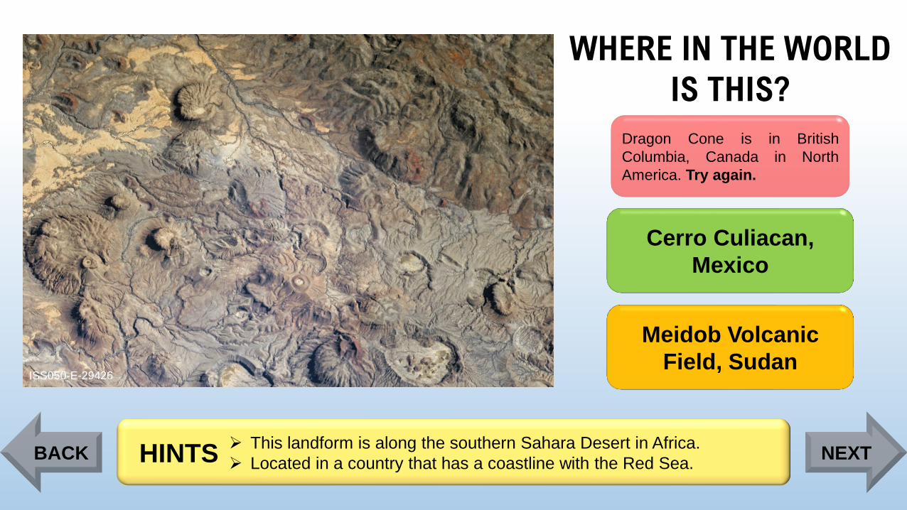
WHERE IN THE WORLD
IS THIS?
ISS050-E-29426
Dragon Cone is in British
Columbia, Canada in North
America. Try again.
Cerro Culiacan,
Mexico
Meidob Volcanic
Field, Sudan
➢ This landform is along the southern Sahara Desert in Africa.
➢ Located in a country that has a coastline with the Red Sea. HINTSBACK NEXT
Page 72
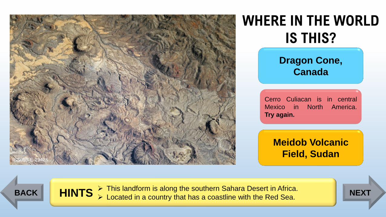
WHERE IN THE WORLD
IS THIS?
ISS050-E-29426
Dragon Cone,
Canada
Cerro Culiacan is in central
Mexico in North America.
Try again.
Meidob Volcanic
Field, Sudan
➢ This landform is along the southern Sahara Desert in Africa.
➢ Located in a country that has a coastline with the Red Sea. HINTSBACK NEXT
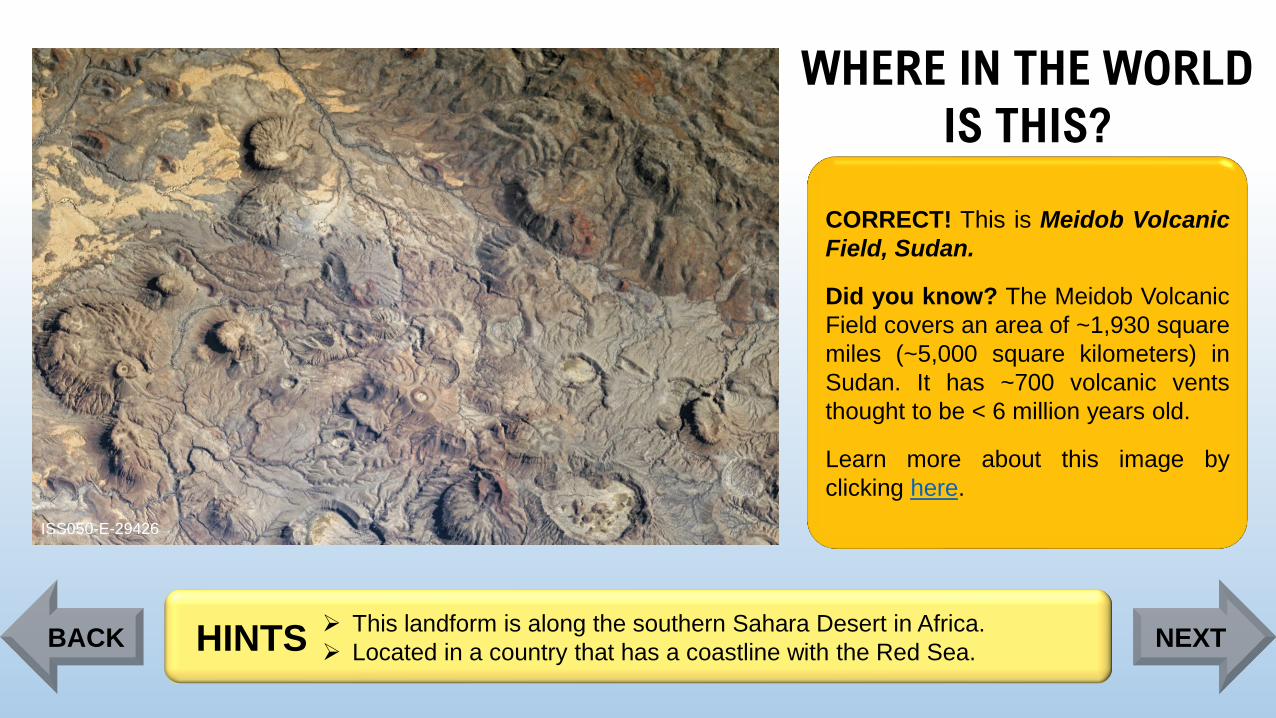
Page 73
WHERE IN THE WORLD
IS THIS?
ISS050-E-29426
CORRECT! This is Meidob Volcanic
Field, Sudan.
Did you know? The Meidob Volcanic
Field covers an area of ~1,930 square
miles (~5,000 square kilometers) in
Sudan. It has ~700 volcanic vents
thought to be < 6 million years old.
Learn more about this image by
clicking here.
➢ This landform is along the southern Sahara Desert in Africa.
➢ Located in a country that has a coastline with the Red Sea. HINTSBACK NEXT
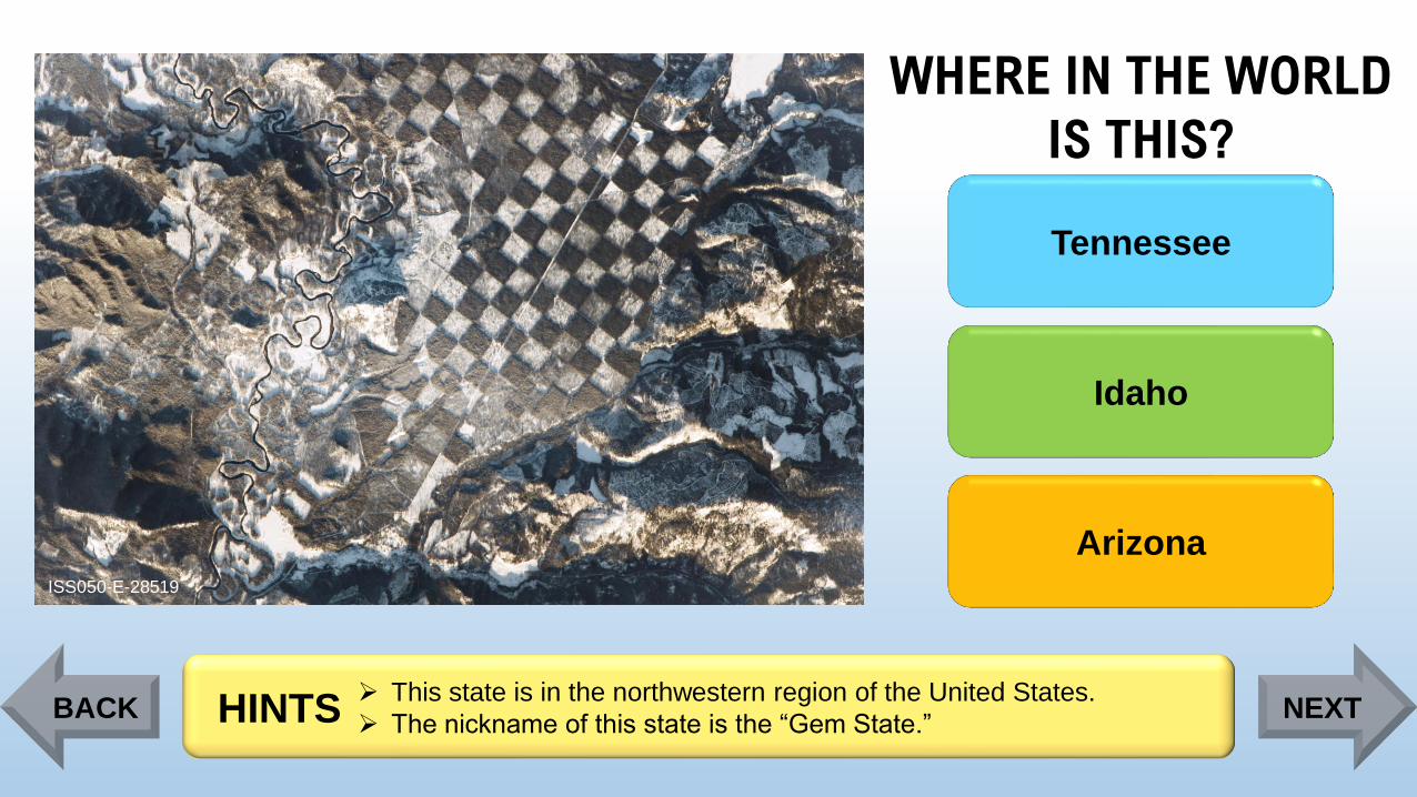
Page 74
WHERE IN THE WORLD
IS THIS?
ISS050-E-28519
Tennessee
Idaho
Arizona
➢ This state is in the northwestern region of the United States.
➢ The nickname of this state is the “Gem State.”HINTSBACK NEXT
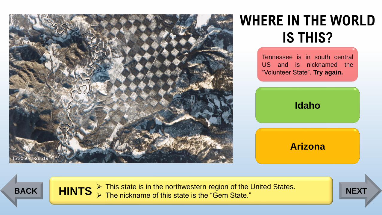
Page 75
WHERE IN THE WORLD
IS THIS?
ISS050-E-28519
Tennessee is in south central
US and is nicknamed the
“Volunteer State”. Try again.
Idaho
Arizona
➢ This state is in the northwestern region of the United States.
➢ The nickname of this state is the “Gem State.”HINTSBACK NEXT
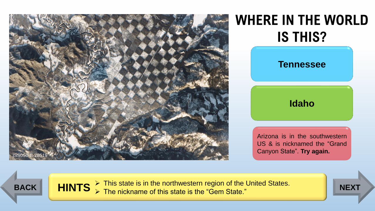
Page 76
WHERE IN THE WORLD
IS THIS?
ISS050-E-28519
Tennessee
Idaho
Arizona is in the southwestern
US & is nicknamed the “Grand
Canyon State”. Try again.
➢ This state is in the northwestern region of the United States.
➢ The nickname of this state is the “Gem State.”HINTSBACK NEXT
Page 77
WHERE IN THE WORLD
IS THIS?
ISS050-E-28519
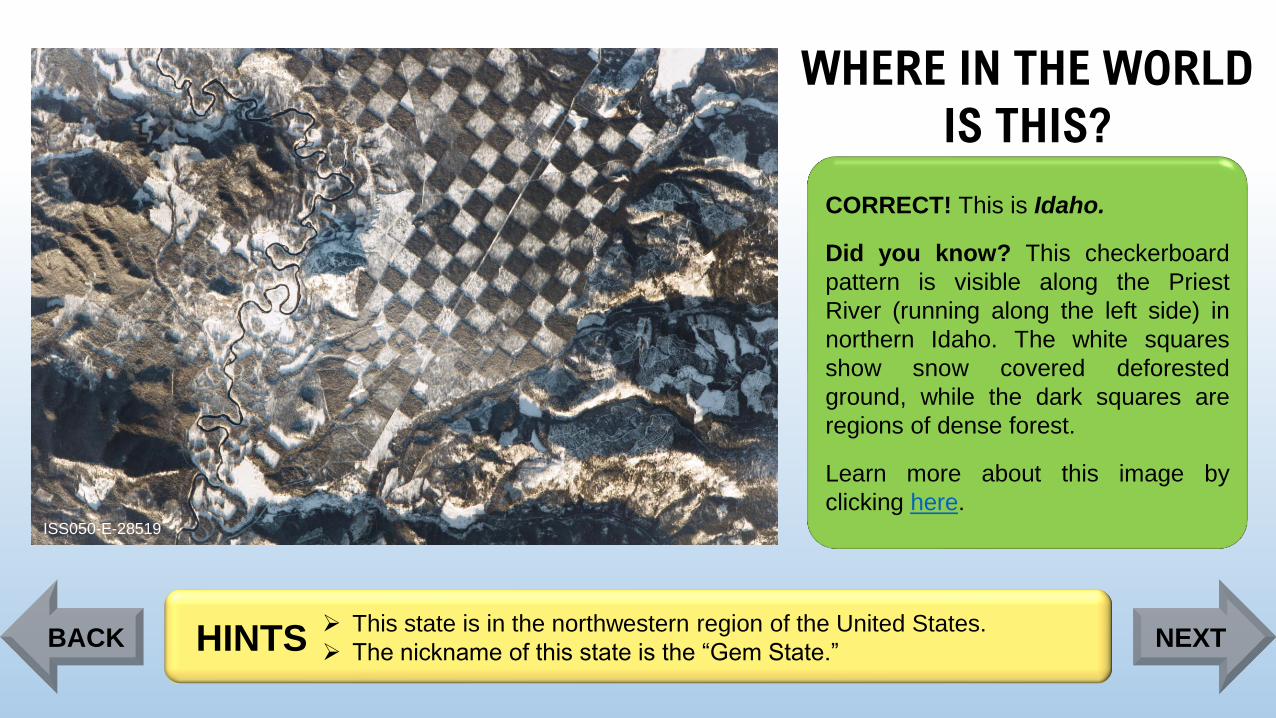
CORRECT! This is Idaho.
Did you know? This checkerboard
pattern is visible along the Priest
River (running along the left side) in
northern Idaho. The white squares
show snow covered deforested
ground, while the dark squares are
regions of dense forest.
Learn more about this image by
clicking here.
➢ This state is in the northwestern region of the United States.
➢ The nickname of this state is the “Gem State.”HINTSBACK NEXT
Page 78
WHERE IN THE WORLD
IS THIS?
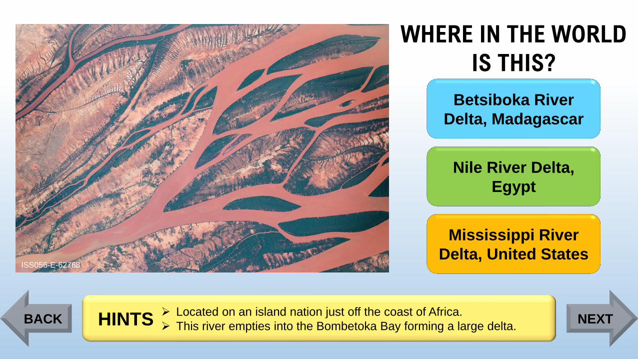
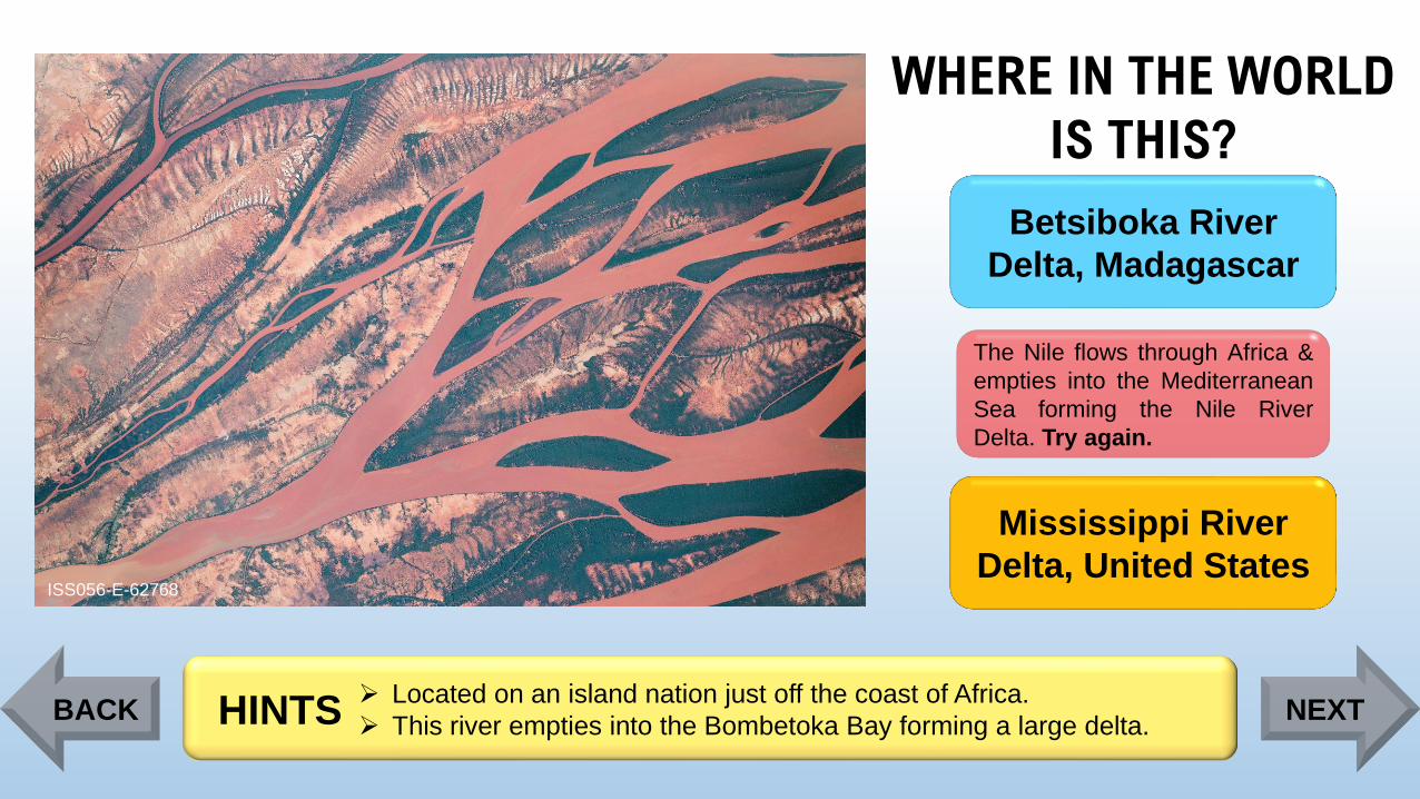
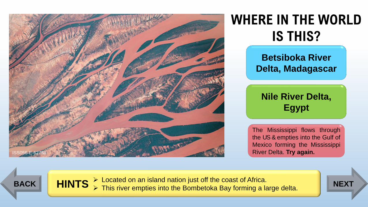
ISS056-E-62768
Betsiboka River
Delta, Madagascar
Nile River Delta,
Egypt
Mississippi River
Delta, United States
➢ Located on an island nation just off the coast of Africa.
➢ This river empties into the Bombetoka Bay forming a large delta. HINTSBACK NEXT
Page 79
WHERE IN THE WORLD
IS THIS?
ISS056-E-62768
Betsiboka River
Delta, Madagascar
The Nile flows through Africa &
empties into the Mediterranean
Sea forming the Nile River
Delta. Try again.
Mississippi River
Delta, United States
➢ Located on an island nation just off the coast of Africa.
➢ This river empties into the Bombetoka Bay forming a large delta. HINTSBACK NEXT
Page 80
WHERE IN THE WORLD
IS THIS?
ISS056-E-62768
Betsiboka River
Delta, Madagascar
Nile River Delta,
Egypt
The Mississippi flows through
the US & empties into the Gulf of
Mexico forming the Mississippi
River Delta. Try again.
➢ Located on an island nation just off the coast of Africa.
➢ This river empties into the Bombetoka Bay forming a large delta. HINTSBACK NEXT
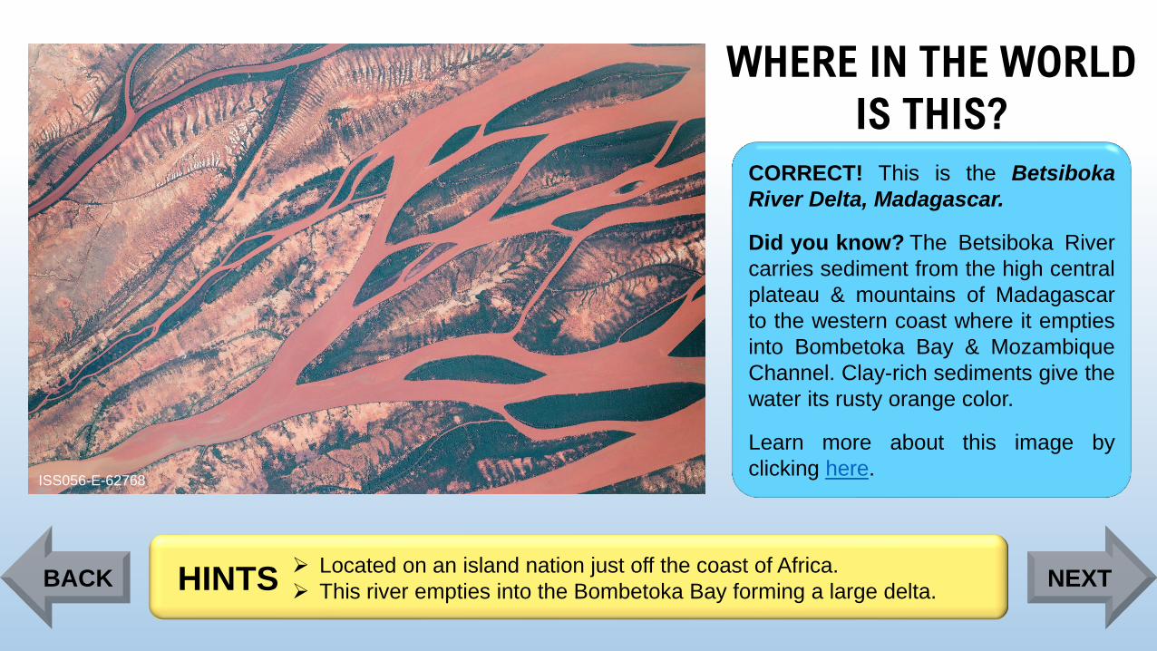
Page 81
WHERE IN THE WORLD
IS THIS?
ISS056-E-62768
CORRECT! This is the Betsiboka
River Delta, Madagascar.
Did you know? The Betsiboka River
carries sediment from the high central
plateau & mountains of Madagascar
to the western coast where it empties
into Bombetoka Bay & Mozambique
Channel. Clay-rich sediments give the
water its rusty orange color.
Learn more about this image by
clicking here.
➢ Located on an island nation just off the coast of Africa.
➢ This river empties into the Bombetoka Bay forming a large delta. HINTSBACK NEXT
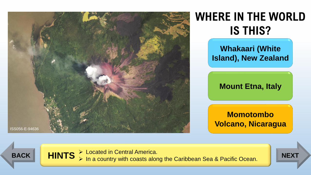
Page 82
WHERE IN THE WORLD
IS THIS?
ISS056-E-94636
Whakaari (White
Island), New Zealand
Mount Etna, Italy
Momotombo
Volcano, Nicaragua
➢ Located in Central America.
➢ In a country with coasts along the Caribbean Sea & Pacific Ocean. HINTSBACK NEXT
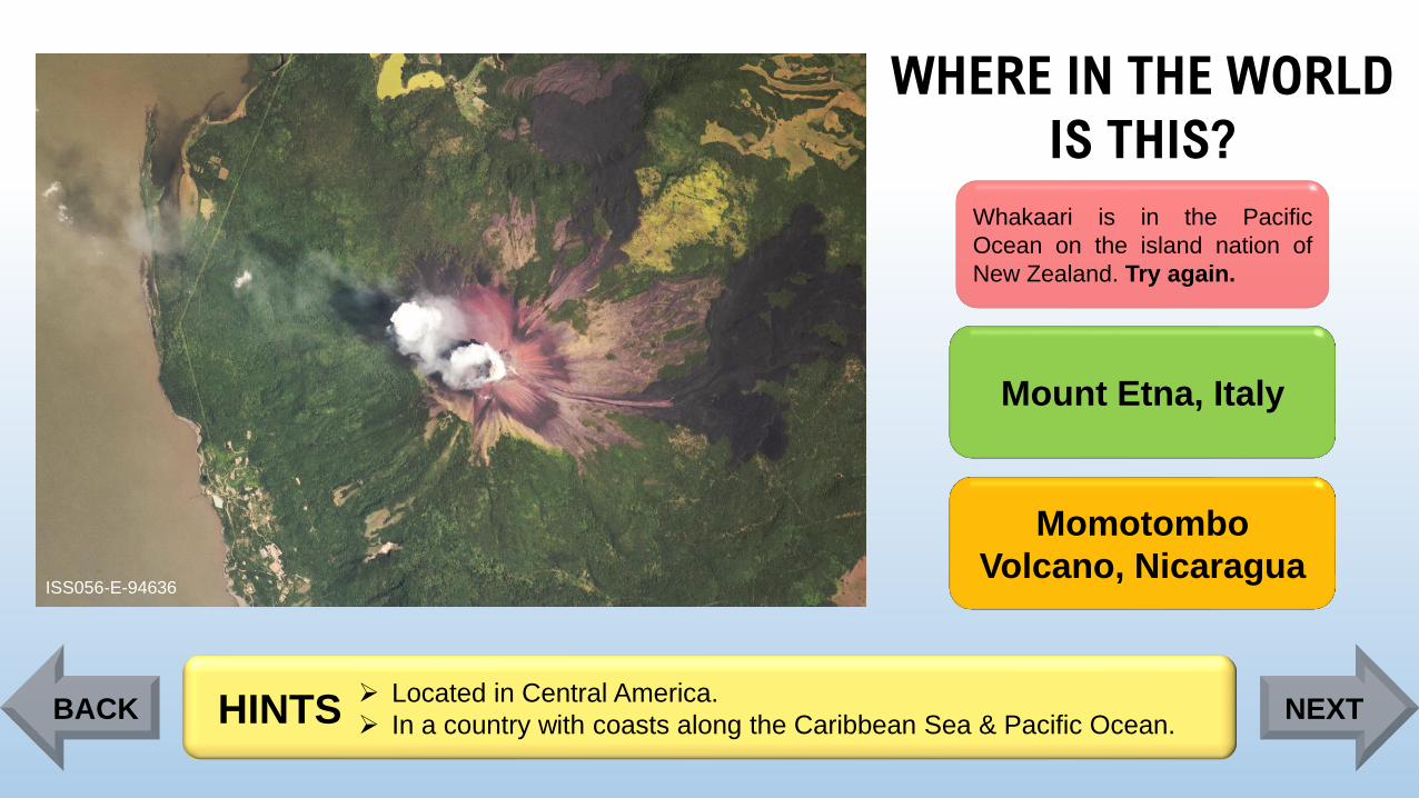
Page 83
WHERE IN THE WORLD
IS THIS?
ISS056-E-94636
Whakaari is in the Pacific
Ocean on the island nation of
New Zealand. Try again.
Mount Etna, Italy
Momotombo
Volcano, Nicaragua
➢ Located in Central America.
➢ In a country with coasts along the Caribbean Sea & Pacific Ocean. HINTSBACK NEXT
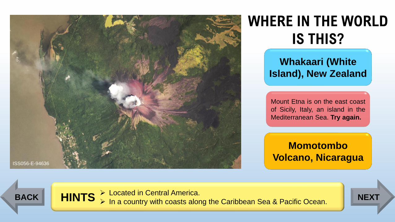
Page 84
WHERE IN THE WORLD
IS THIS?
ISS056-E-94636
Whakaari (White
Island), New Zealand
Mount Etna is on the east coast
of Sicily, Italy, an island in the
Mediterranean Sea. Try again.
Momotombo
Volcano, Nicaragua
➢ Located in Central America.
➢ In a country with coasts along the Caribbean Sea & Pacific Ocean. HINTSBACK NEXT
Page 85
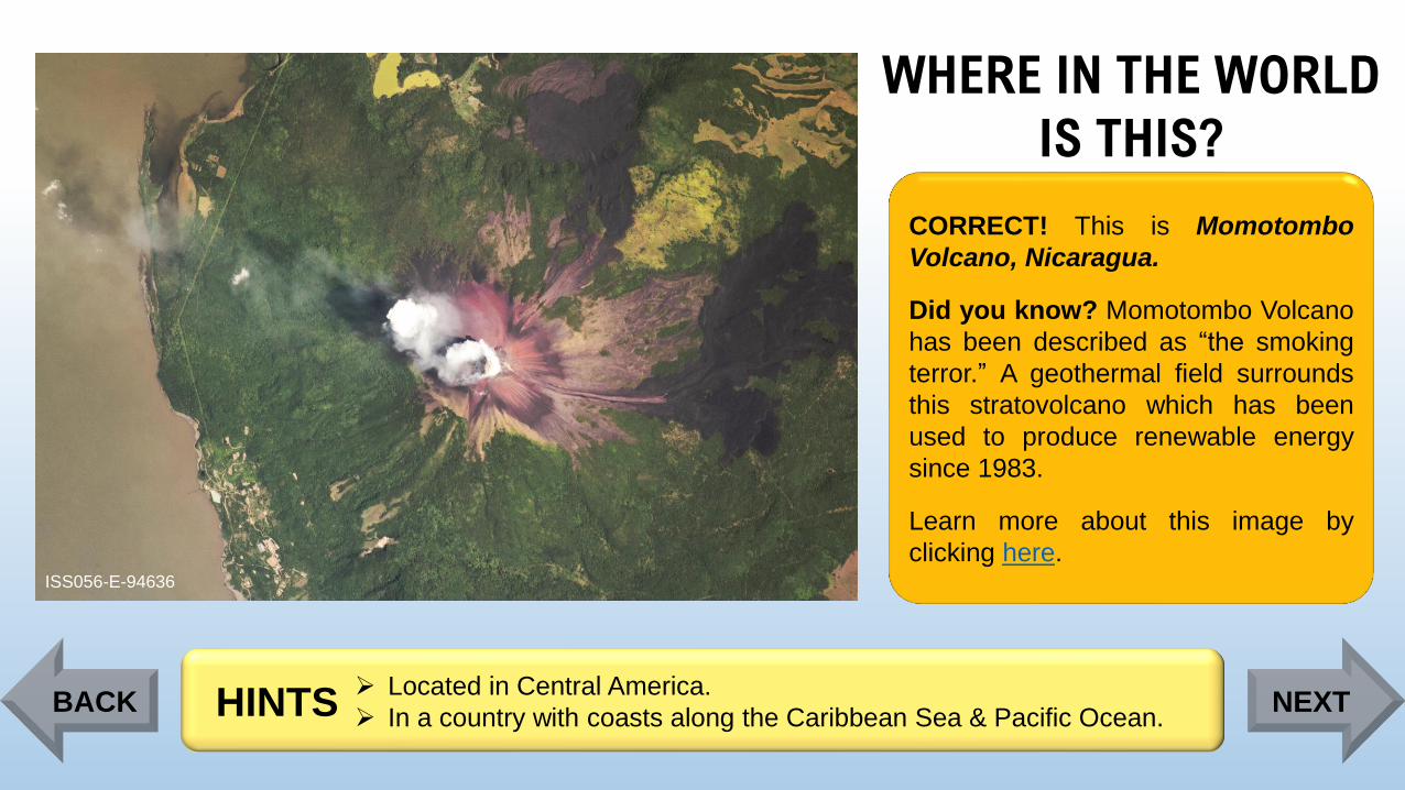
WHERE IN THE WORLD
IS THIS?
ISS056-E-94636
CORRECT! This is Momotombo
Volcano, Nicaragua.
Did you know? Momotombo Volcano
has been described as “the smoking
terror.” A geothermal field surrounds
this stratovolcano which has been
used to produce renewable energy
since 1983.
Learn more about this image by
clicking here.
➢ Located in Central America.
➢ In a country with coasts along the Caribbean Sea & Pacific Ocean. HINTSBACK NEXT
Page 86
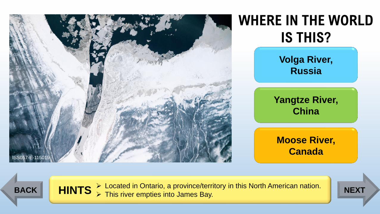
WHERE IN THE WORLD
IS THIS?
ISS057-E-115019
Volga River,
Russia
Yangtze River,
China
Moose River,
Canada
➢ Located in Ontario, a province/territory in this North American nation.
➢ This river empties into James Bay. HINTSBACK NEXT
Page 87
WHERE IN THE WORLD
IS THIS?
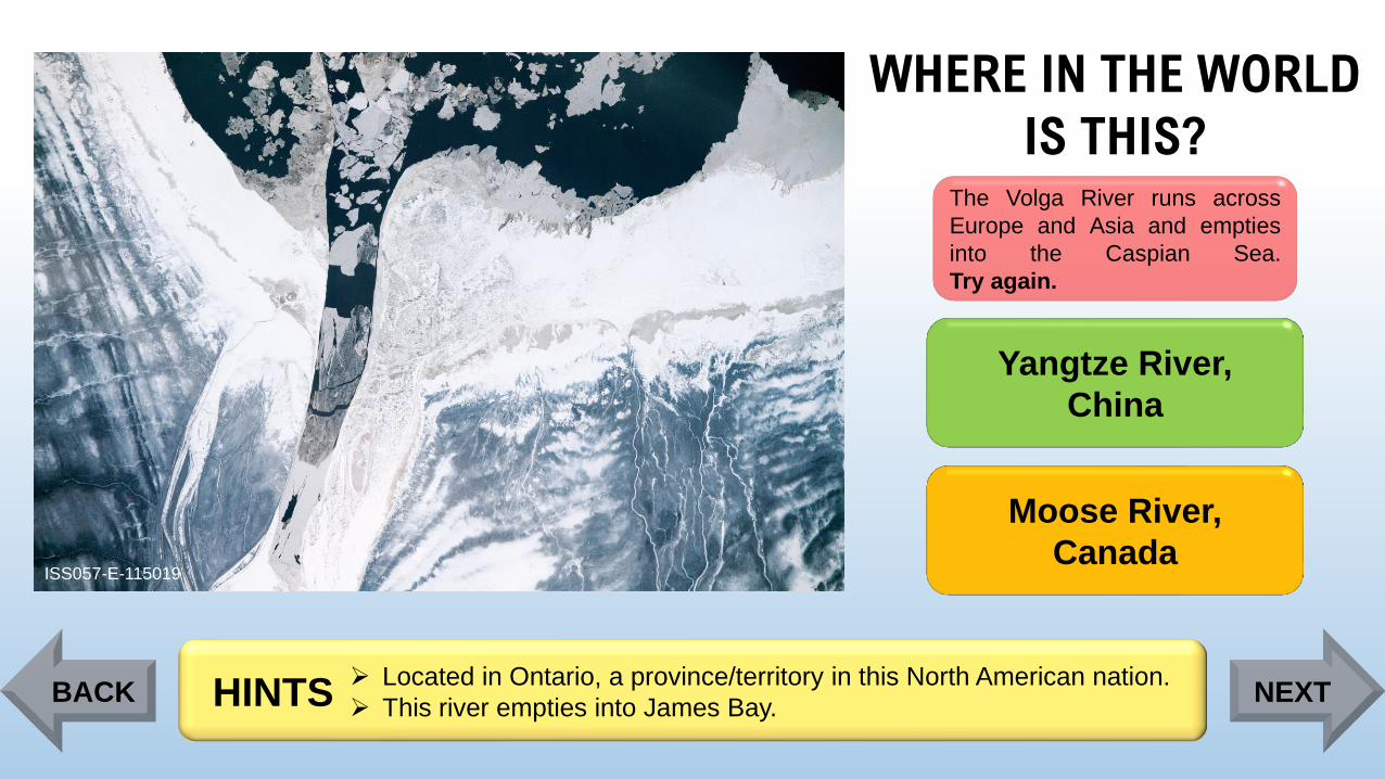
ISS057-E-115019
The Volga River runs across
Europe and Asia and empties
into the Caspian Sea.
Try again.
Yangtze River,
China
Moose River,
Canada
➢ Located in Ontario, a province/territory in this North American nation.
➢ This river empties into James Bay. HINTSBACK NEXT
Page 88
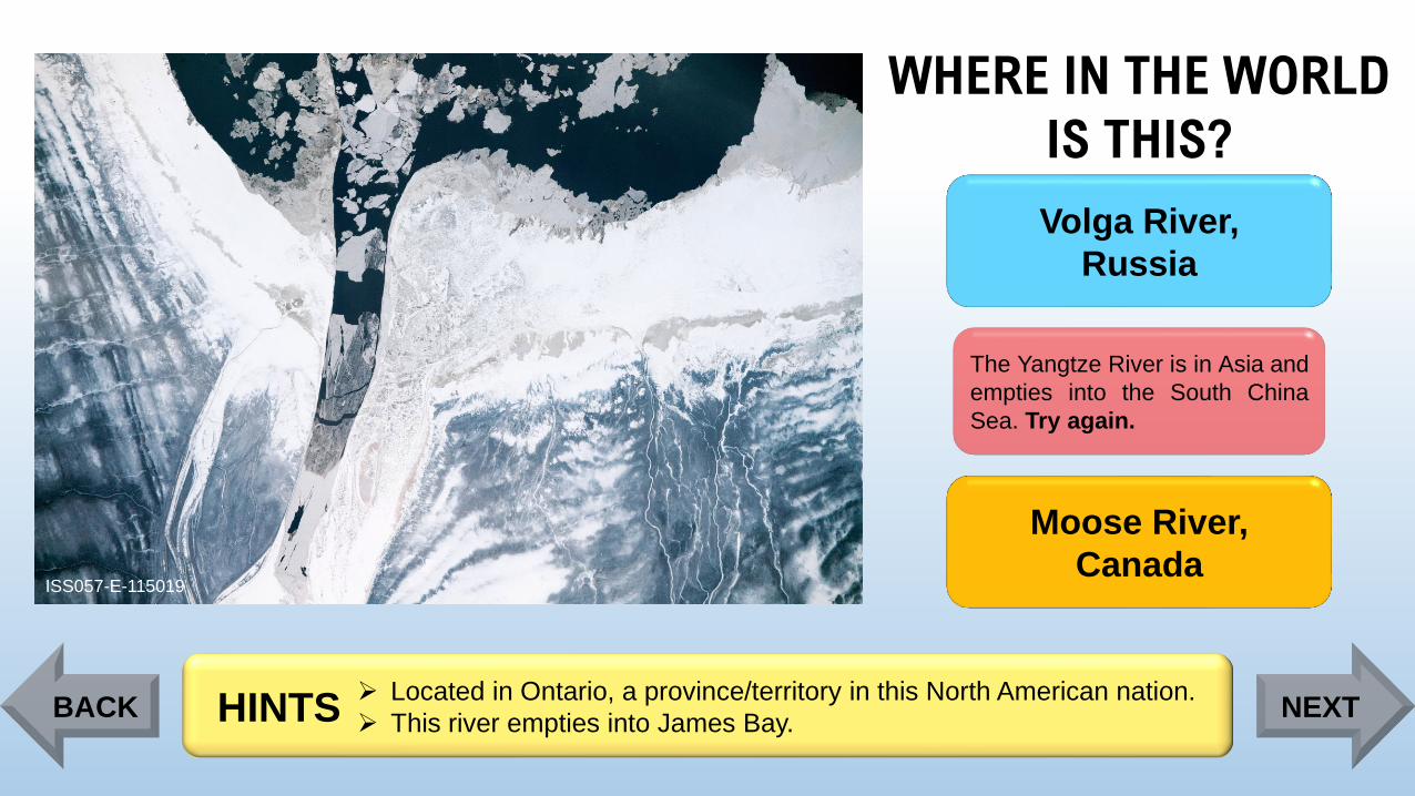
WHERE IN THE WORLD
IS THIS?
ISS057-E-115019
Volga River,
Russia
The Yangtze River is in Asia and
empties into the South China
Sea. Try again.
Moose River,
Canada
➢ Located in Ontario, a province/territory in this North American nation.
➢ This river empties into James Bay. HINTSBACK NEXT
Page 89
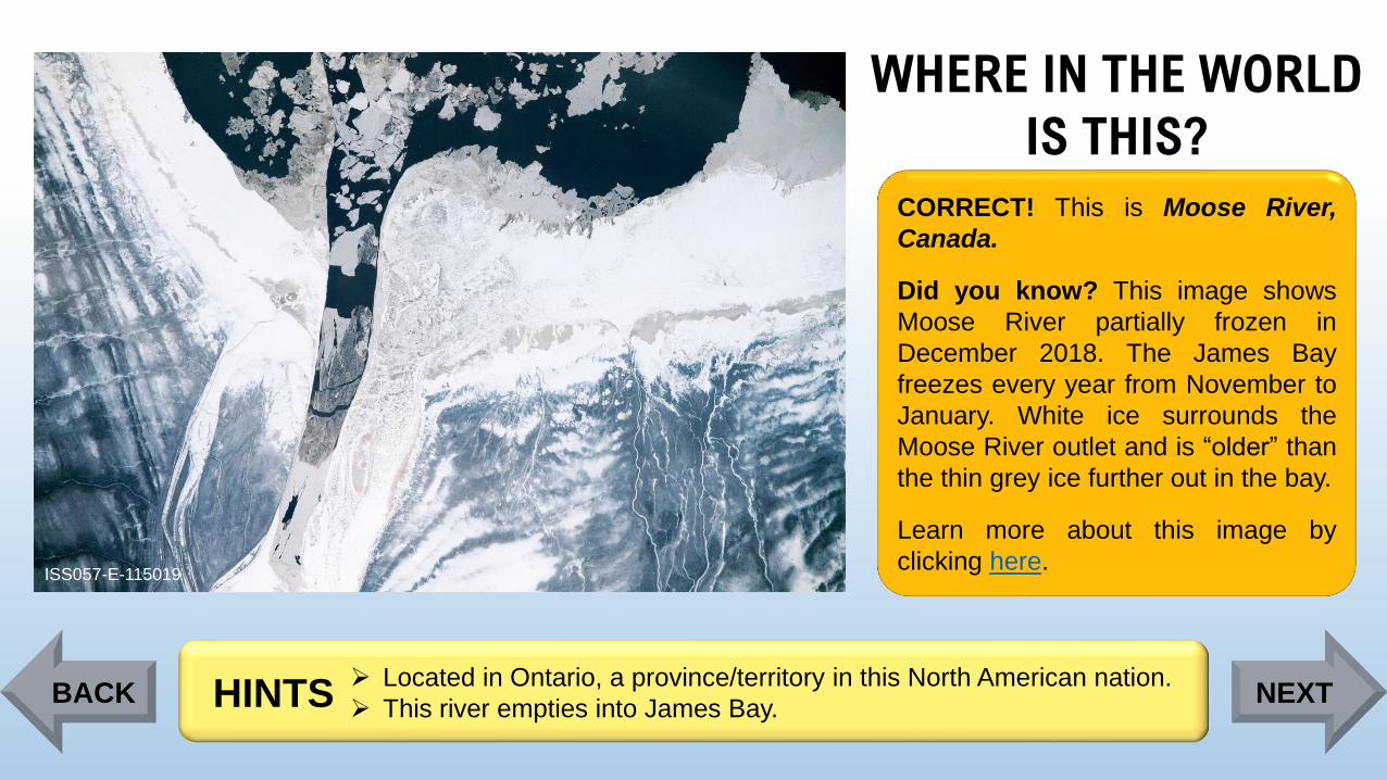
WHERE IN THE WORLD
IS THIS?
ISS057-E-115019
CORRECT! This is Moose River,
Canada.
Did you know? This image shows
Moose River partially frozen in
December 2018. The James Bay
freezes every year from November to
January. White ice surrounds the
Moose River outlet and is “older” than
the thin grey ice further out in the bay.
Learn more about this image by
clicking here.
➢ Located in Ontario, a province/territory in this North American nation.
➢ This river empties into James Bay. HINTSBACK NEXT
Page 90
WHERE IN THE WORLD
IS THIS?
ISS008-E-6150
The Eastern Rift
Mountains, Africa
The Himalaya
Mountains, Asia
The Alaska Range,
North America
➢ This mountain range is located along the Tibetan Plateau.
➢ The world’s tallest mountain (image center) borders Nepal and China.HINTSBACK NEXT
Page 91
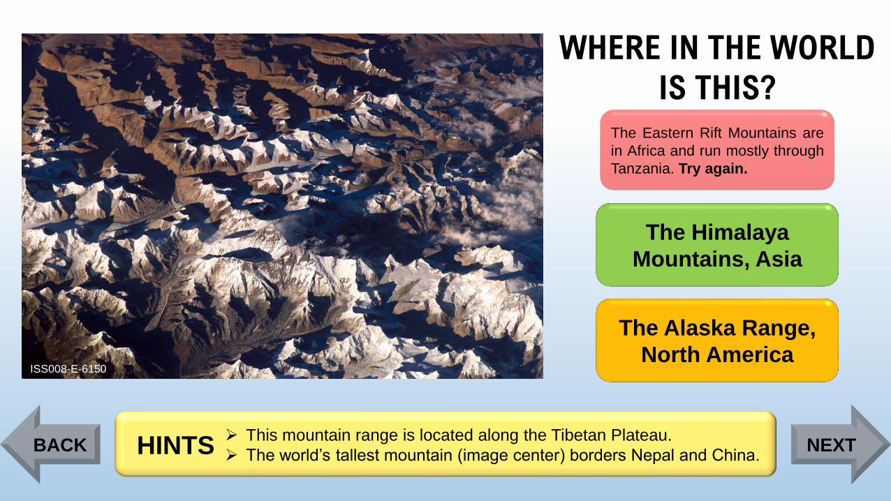
WHERE IN THE WORLD
IS THIS?
ISS008-E-6150
The Eastern Rift Mountains are
in Africa and run mostly through
Tanzania. Try again.
The Himalaya
Mountains, Asia
The Alaska Range,
North America
➢ This mountain range is located along the Tibetan Plateau.
➢ The world’s tallest mountain (image center) borders Nepal and China.HINTSBACK NEXT
Page 92
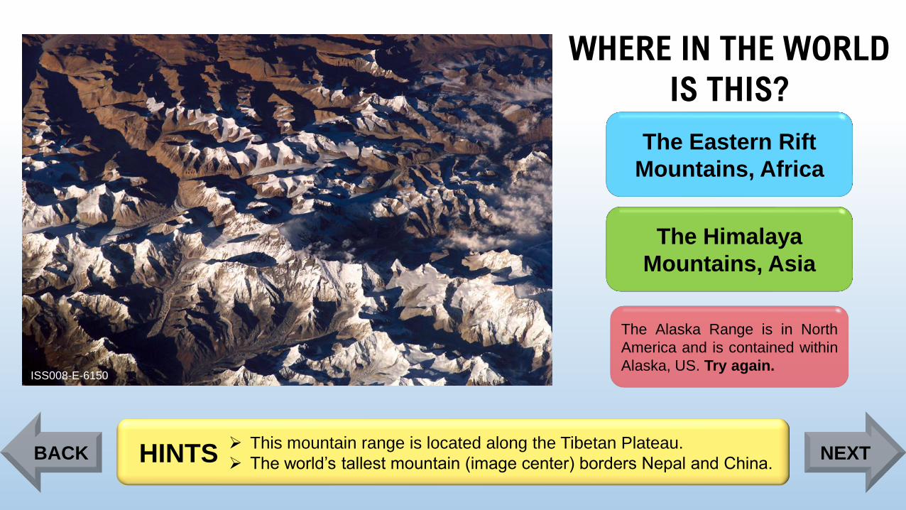
WHERE IN THE WORLD
IS THIS?
ISS008-E-6150
The Eastern Rift
Mountains, Africa
The Himalaya
Mountains, Asia
The Alaska Range is in North
America and is contained within
Alaska, US. Try again.
➢ This mountain range is located along the Tibetan Plateau.
➢ The world’s tallest mountain (image center) borders Nepal and China.HINTSBACK NEXT
Page 93
WHERE IN THE WORLD
IS THIS?
ISS008-E-6150
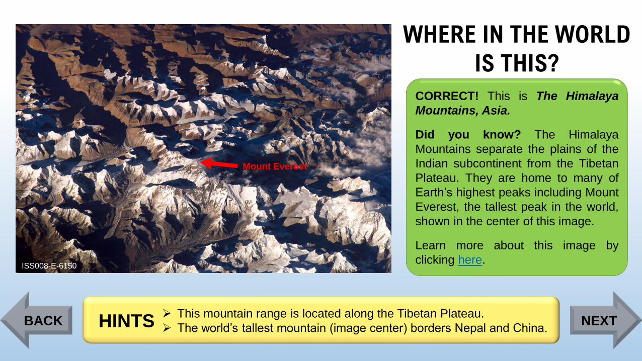
Mount Everest
CORRECT! This is The Himalaya
Mountains, Asia.
Did you know? The Himalaya
Mountains separate the plains of the
Indian subcontinent from the Tibetan
Plateau. They are home to many of
Earth’s highest peaks including Mount
Everest, the tallest peak in the world,
shown in the center of this image.
Learn more about this image by
clicking here.
➢ This mountain range is located along the Tibetan Plateau.
➢ The world’s tallest mountain (image center) borders Nepal and China.HINTSBACK NEXT
Page 94
WHERE IN THE WORLD
IS THIS?
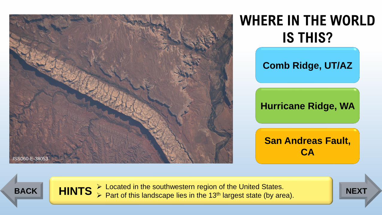
ISS060-E-38053
Comb Ridge, UT/AZ
Hurricane Ridge, WA
San Andreas Fault,
CA
➢ Located in the southwestern region of the United States.
➢ Part of this landscape lies in the 13th largest state (by area).HINTSBACK NEXT
Page 95
WHERE IN THE WORLD
IS THIS?
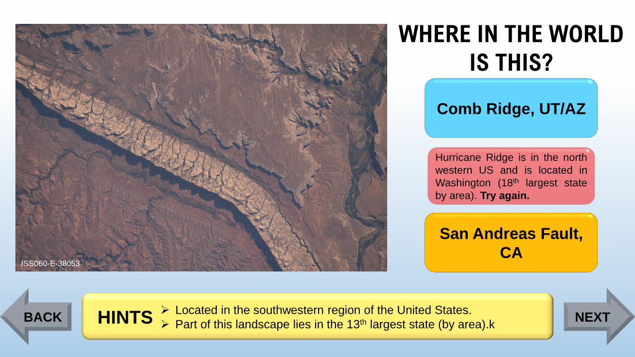
ISS060-E-38053
Comb Ridge, UT/AZ
Hurricane Ridge is in the north
western US and is located in
Washington (18th largest state
by area). Try again.
San Andreas Fault,
CA
➢ Located in the southwestern region of the United States.
➢ Part of this landscape lies in the 13th largest state (by area).kHINTSBACK NEXT
Page 96
WHERE IN THE WORLD
IS THIS?
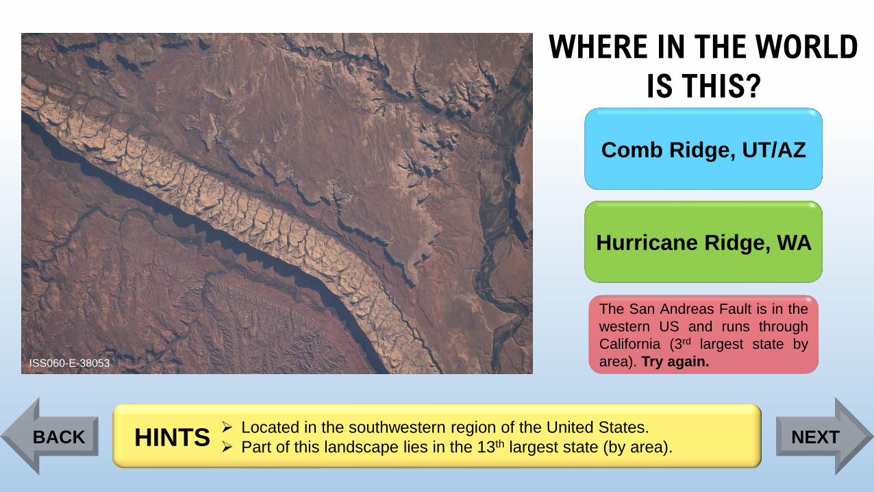
ISS060-E-38053
Comb Ridge, UT/AZ
The San Andreas Fault is in the
western US and runs through
California (3rd largest state by
area). Try again.
Hurricane Ridge, WA
➢ Located in the southwestern region of the United States.
➢ Part of this landscape lies in the 13th largest state (by area).HINTSBACK NEXT
Page 97
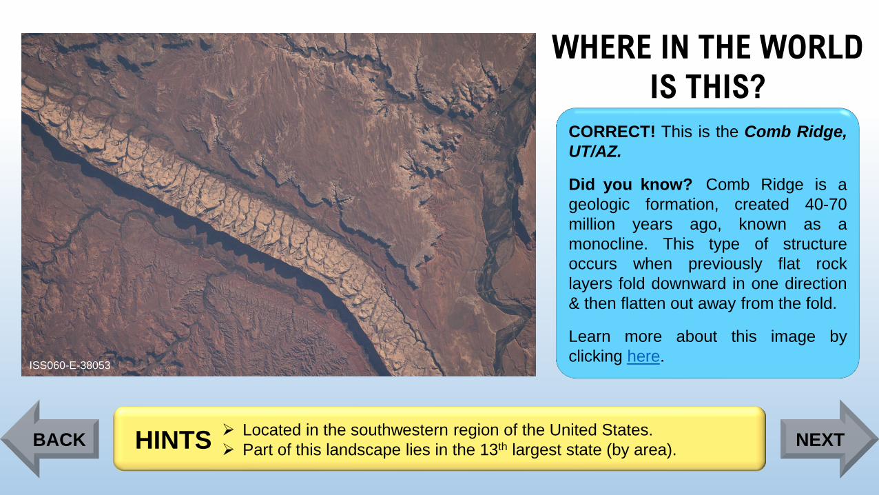
WHERE IN THE WORLD
IS THIS?
ISS060-E-38053
CORRECT! This is the Comb Ridge,
UT/AZ.
Did you know? Comb Ridge is a
geologic formation, created 40-70
million years ago, known as a
monocline. This type of structure
occurs when previously flat rock
layers fold downward in one direction
& then flatten out away from the fold.
Learn more about this image by
clicking here.
➢ Located in the southwestern region of the United States.
➢ Part of this landscape lies in the 13th largest state (by area).HINTSBACK NEXT
Page 98
WHERE IN THE WORLD
IS THIS?
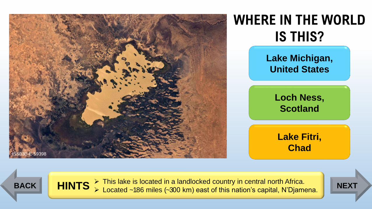
ISS030-E-59398
Lake Michigan,
United States
Loch Ness,
Scotland
Lake Fitri,
Chad
➢ This lake is located in a landlocked country in central north Africa.
➢ Located ~186 miles (~300 km) east of this nation’s capital, N’Djamena. HINTSBACK NEXT
Page 99
WHERE IN THE WORLD
IS THIS?
ISS030-E-59398
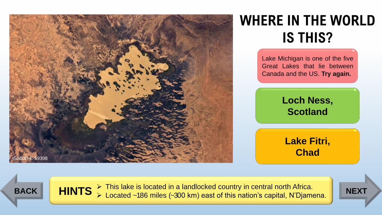
Lake Michigan is one of the five
Great Lakes that lie between
Canada and the US. Try again.
Loch Ness,
Scotland
Lake Fitri,
Chad
➢ This lake is located in a landlocked country in central north Africa.
➢ Located ~186 miles (~300 km) east of this nation’s capital, N’Djamena. HINTSBACK NEXT
Page 100
WHERE IN THE WORLD
IS THIS?
ISS030-E-59398
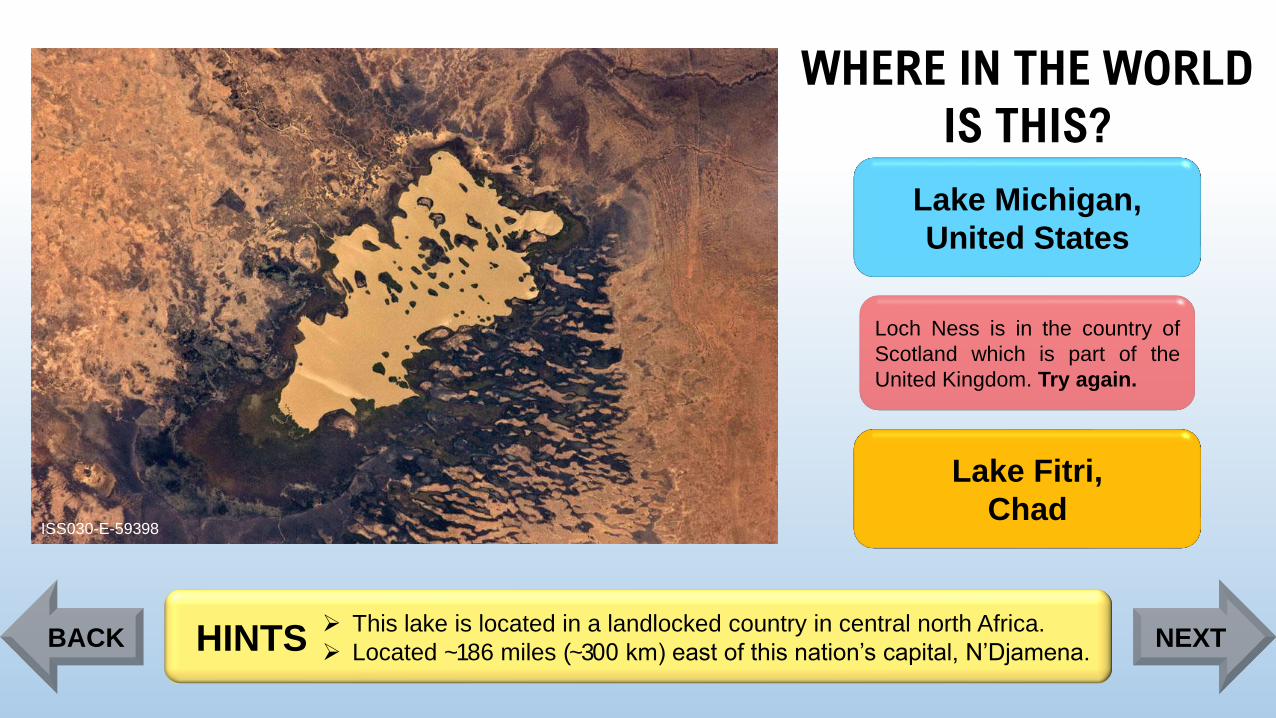
Lake Michigan,
United States
Loch Ness is in the country of
Scotland which is part of the
United Kingdom. Try again.
Lake Fitri,
Chad
➢ This lake is located in a landlocked country in central north Africa.
➢ Located ~186 miles (~300 km) east of this nation’s capital, N’Djamena. HINTSBACK NEXT
Page 101
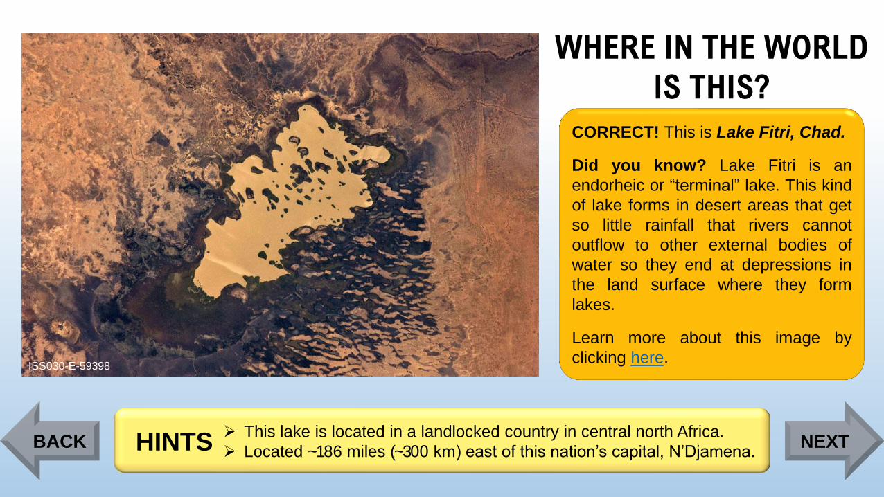
WHERE IN THE WORLD
IS THIS?
ISS030-E-59398
CORRECT! This is Lake Fitri, Chad.
Did you know? Lake Fitri is an
endorheic or “terminal” lake. This kind
of lake forms in desert areas that get
so little rainfall that rivers cannot
outflow to other external bodies of
water so they end at depressions in
the land surface where they form
lakes.
Learn more about this image by
clicking here.
➢ This lake is located in a landlocked country in central north Africa.
➢ Located ~186 miles (~300 km) east of this nation’s capital, N’Djamena. HINTSBACK NEXT
Page 102
Thanks for completing theWHERE IN THE WORLD IMAGE QUIZ!
Visit https://eol.jsc.nasa.gov/ to view more astronaut photography.
Developed by Astromaterials Research and Exploration Science (ARES) at the NASA Johnson Space Center (JSC) Images courtesy of the Earth Science and Remote Sensing (ESRS) Unit, NASA JSC (https://eol.jsc.nasa.gov)
Background image ISS024-E-14587