Workshop on Rural Moderate (R2) and Western Region Rural Moderate (RW2) Zones Found Non-Compliant and Invalid Responding to Non-Compliance and Invalidity Ruling of Western Washington Growth Management Hearing Board (WWGMHB) Case No. 07-2-0018c, Dry Creek Coalition & Futurewise vs. Clallam County Presented at: Planning Commission Meeting, August 27, 2008 Clallam County Department of Community Development
Transcript
Workshop on Rural Moderate (R2) and Western Region Rural Moderate (RW2) Zones Found Non-Compliant and Invalid
Responding to Non-Compliance and Invalidity Ruling of Western Washington Growth Management Hearing Board (WWGMHB) Case No. 07-2-0018c, Dry Creek Coalition & Futurewise vs. Clallam County
Presented at: Planning Commission Meeting, August 27, 2008
Clallam County Department of Community Development
Background• Comprehensive plans (CP) and development regulations (DR) are subject to continuing
evaluation under the Growth Management Act (GMA), RCW 36.70A.
• By Dec 2004, and every 7-years thereafter, the County must take legislative action to review and, if needed, revise its’ CP and DR to ensure continued compliance with the GMA. RCW 36.70A.130 (1).
• In 2005 , Futurewise first challenged the County’s 7-year review to the Western Washington Growth Management Hearing Board (WWGMHB).
• In response, Clallam County: – Completed three major planning reports: 1) 2007 Urban Growth Area (UGA) Analysis and 10-
year review; 2) 2006 Rural Lands Report; and 3) 2006 LAMIRDs Report– Resolution 77, 2007, affirming county review and update of the CP and DR’s for continued
GMA compliance.– Ordinance 827, 2007, which formerly recognized 46 existing areas and related zoning as
limited areas of more intensive rural development (LAMIRDS) under the GMA.
• Res. 77 and Ord. 827 were challenged by Futurewise and Dry Creek Coalition to the WWGMHB.
– Res. 77 or Ord. 827 did not change zoning.– The petition challenged pre-existing, and long-standing CP and DR provisions as no longer
compliant with the GMA.
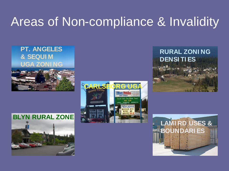
Areas of Non-compliance & Invalidity
BLYN RURAL ZONE
CARLSBORG UGA
RURAL ZONINGDENSITIES
LAMIRD USES &BOUNDARIES
PT. ANGELES & SEQUIM UGA ZONING
Compliance and AppealParallel compliance and appellate ‘tracks’:
• Dry Creek Coalition & Futurewise vs. Clallam County, Western Washington Growth Mgt. Hearings Bd.
q Upon a finding of non-compliance, “…the board shall remand the matter to the …county…” to comply within “…a reasonable time not in excess of one hundred eighty days.” RCW 36.70A.300(3)(b)
• Clallam Cty. vs. Wstrn Wa. Growth Mgt. Hrgs. Board,Clallam County Superior Court
q “Any party aggrieved by a final decision of the hearings board may appeal the decision to superior court…”. RCW 36.70A.300(5)
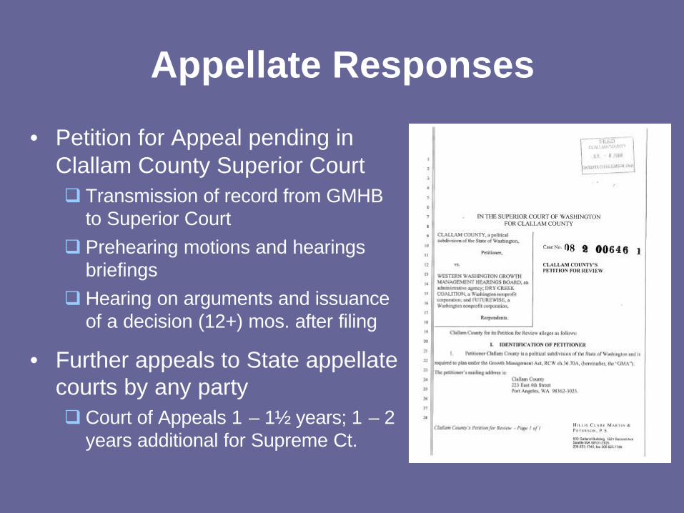
Appellate Responses
• Petition for Appeal pending in Clallam County Superior Courtq Transmission of record from GMHB
to Superior Courtq Prehearing motions and hearings
briefings q Hearing on arguments and issuance
of a decision (12+) mos. after filing
• Further appeals to State appellate courts by any partyq Court of Appeals 1 – 1½ years; 1 – 2
years additional for Supreme Ct.
Rural DensitiesWhat was Challenged?
• County rural zones that allowed rural densities greater than 1 dwelling unit (du) per 5 acres.– Crux of Petitioners argument is that densities of
greater than 1 du per five acres is not rural and therefore must be prohibited outside of Urban Growth Areas or LAMIRDs.
– Affected 81,122 acres, or 88%, of County rural zoning districts.
• 59,196 acres of the challenged zoning deemed compliant.• 21,926 acres of Rural Moderate (R2) and Western Region
Rural Moderate (RW2) zoning deemed non-compliant and invalid.
– R2 and RW2 allow 1 dwelling unit per 2.4 acres
Rural Zoning - Compliance IssuesWhat Must County Address?
Rural Density within former R2 and RW2 Zones is the Compliance Issue
NOT
Rural Allowed, Conditional or Prohibited Uses
2006 Clallam County Rural Lands Report
Extent of R2 & RW2 Lands
• County-wide [21,926 ac., 2% of County]– Rural Moderate (R2): [19,047 ac. (1.7%)]– W. Region Rural Moderate (RW2): [2,879 ac.; (0.3%)]
• By Planning Region– Sequim-Dungeness [13,730 ac. or 8.9% of Region]– Port Angeles [4,134 ac.; 5.6% of Region]– Straits [1,183 ac.; 0.4% of Region]– Western [2,879 ac.; 1.0% of Region]
2006 Rural Lands Report
• Regional circumstances and differences• Land Use Patterns
– Parcel Size– Build-out potential (i.e., ability to divide)– Land Use/Cover– Farm inventory– Infrastructure/Rural Governmental Services– Other
• GMA Requirements for Rural Lands– Variety of densities and uses– Rural character analysis– Local circumstances
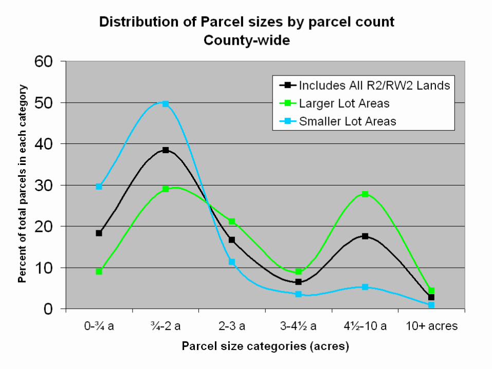
• Approximately 19,050 acres• Approximately 7,500 parcels
– 65% had existing residential use.– 31% vacant– 80% unlikely to further divide.– 16% had potential to divide.
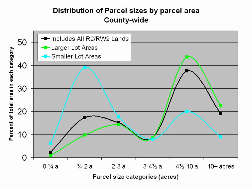
• Average parcel size = 2.4 acres• 17% of parcels had lot sizes 4.81 acres, or larger.
– Represents 50% of R2-zoned land acreage county-wide
2006 Rural Lands ReportR2 Characteristics – By Planning Region
72%• 2.4 ac. or less (41%)• 2.41 to 4.8 ac. (22%)• > than 4.81 ac (37%)
4.5 ac.Straits
48%• 2.4 ac. or less (54.4%)• 2.41 to 4.8 ac. (23.6%)• > than 4.81 ac (22%)
2.8 ac.Port Angeles
48%• 2.4 ac. or less (70.5%)• 2.41 to 4.8 ac. (14.6%)• > than 4.81 ac. (14.8%)
2.2 ac.Sequim
% of land associated with
lots 4.81 acres or greater in size
Parcel SizesAverage Lot Size
Region
2006 Rural Lands ReportRW2 Characteristics – Western Region Only
Forks-Beaver-Quillayute River Vicinity
• Approximately 2,880 acres• Approximately 400 parcels
– 36% had existing residential use.– 62% vacant– 14.5% unlikely to further divide.– 85% had potential to divide.
• Average parcel size = 6.5 acres• 44.5% of parcels had lot sizes 4.81 acres, or larger.
– Represents 85% of RW2-zoned land acreage.
Growth Hearing Board Order of Non-Compliance and Invalidity
R2 & RW2 Zoned Lands
WWGMHB Finding of Non-Compliance
• R2 and RW2 zoning violates RCW 36.70A.110, 36.70A.020(1) and, 36.70.020 (2) because these zoning districts permit urban, not rural, densities outside of an urban growth area.– R2 and RW2 zoning allows for a maximum residential
density of 1 dwelling unit per 2.4 acres.
• All comprehensive plan policies and map designations related to R2 and RW2 zoning are non-compliant.
WWGMHB Order of Invalidity
• WWGMHB also found the non-compliant R2 and RW2 zoning densities and related comprehensive plan provision invalid. – Invalidity is imposed where the WWGMHB
determines a serious risk of significant inconsistent development vesting before the date on which the local jurisdiction is expected to achieve compliance.
WWGMHB Order of Non-Compliance and Invalidity - Findings
“…the existing rural landscape and the rural character of Clallam County is a rural density of one dwelling unit per five acres. By authorizing densities that do not reflect the existing landscape or economy of the area, the County has failed to maintain traditional rural lifestyles of the residents of Clallam County as required by the GMA.”
WWGMHB Final Decision and Order (Page 2)
WWGMHB - Findings
• More than 50% of the County’s eight rural land zoning districts outside of LAMIRDS is comprised of parcels greater than 4.81 acres.
• Typical farm size in County rural lands is five acres or larger.
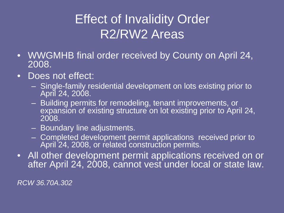
Effect of Invalidity OrderR2/RW2 Areas
• WWGMHB final order received by County on April 24, 2008.
• Does not effect:– Single-family residential development on lots existing prior to
April 24, 2008.– Building permits for remodeling, tenant improvements, or
expansion of existing structure on lot existing prior to April 24, 2008.
– Boundary line adjustments.– Completed development permit applications received prior to
April 24, 2008, or related construction permits. • All other development permit applications received on or
after April 24, 2008, cannot vest under local or state law.
RCW 36.70A.302
Response to Invalidity OrderR2 & RW2 Zoned Lands
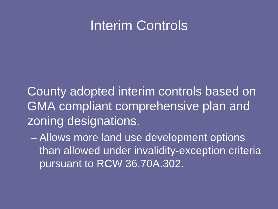
Interim Controls
County adopted interim controls based on GMA compliant comprehensive plan and zoning designations.– Allows more land use development options
than allowed under invalidity-exception criteria pursuant to RCW 36.70A.302.
Interim Controls
• Emergency Ordinance 832 (adopted May 27, 2008) Establishing Interim Controls– Effective for 60 days
• Replaced Emergency Ordinance with Interim Official Controls [Ordinance 833, July 22, 2008] – Expires within 6 months, unless County Board
rescinds, extends, or modifies.
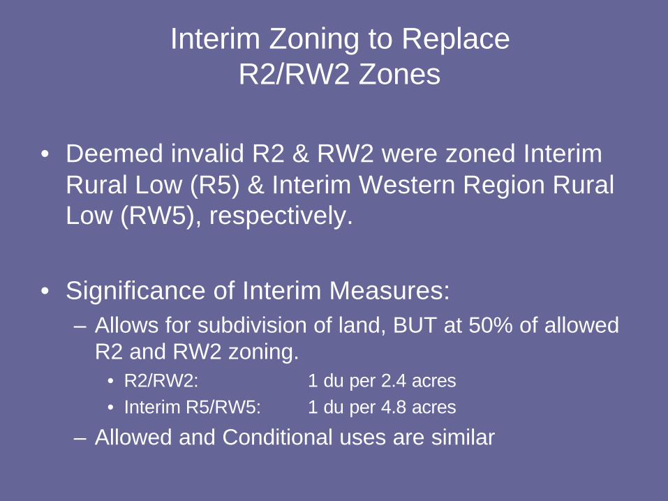
Interim Zoning to ReplaceR2/RW2 Zones
• Deemed invalid R2 & RW2 were zoned Interim Rural Low (R5) & Interim Western Region Rural Low (RW5), respectively.
• Significance of Interim Measures:– Allows for subdivision of land, BUT at 50% of allowed
R2 and RW2 zoning.• R2/RW2: 1 du per 2.4 acres• Interim R5/RW5: 1 du per 4.8 acres
– Allowed and Conditional uses are similar
RecommendationsR2 & RW2 Areas
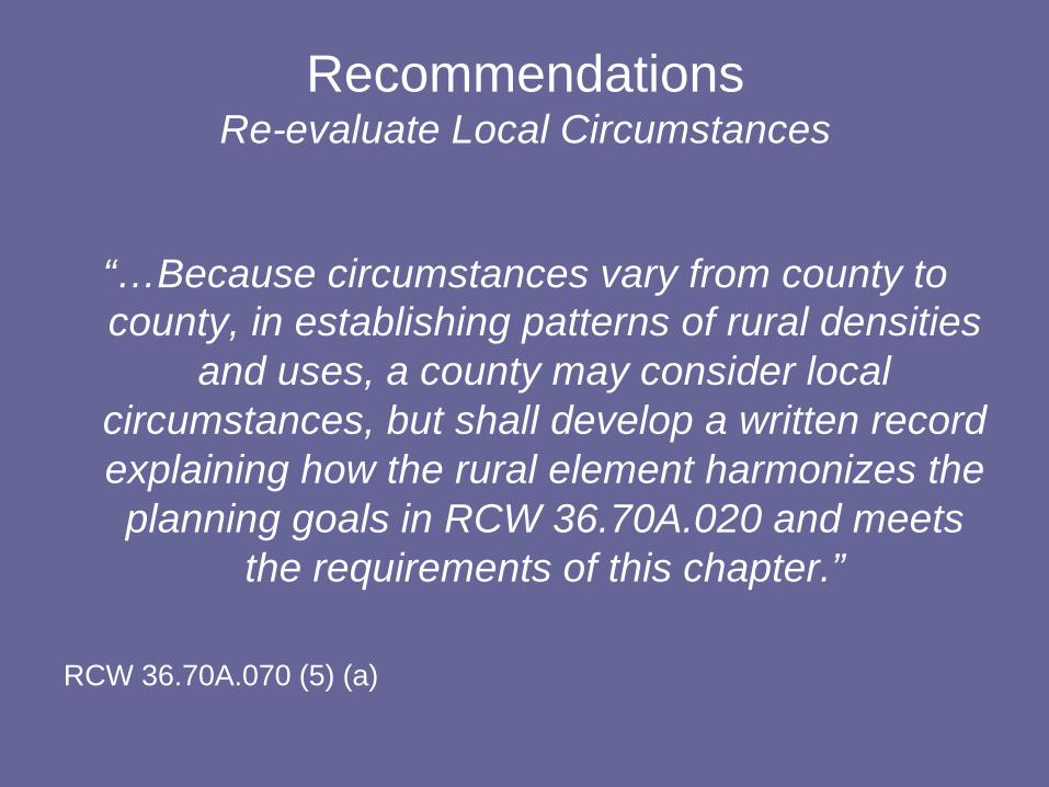
RecommendationsRe-evaluate Local Circumstances
“…Because circumstances vary from county to county, in establishing patterns of rural densities
and uses, a county may consider local circumstances, but shall develop a written record explaining how the rural element harmonizes the planning goals in RCW 36.70A.020 and meets
the requirements of this chapter.”
RCW 36.70A.070 (5) (a)
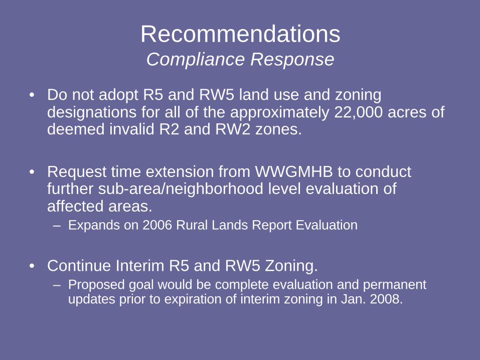
RecommendationsCompliance Response
• Do not adopt R5 and RW5 land use and zoning designations for all of the approximately 22,000 acres of deemed invalid R2 and RW2 zones.
• Request time extension from WWGMHB to conduct further sub-area/neighborhood level evaluation of affected areas. – Expands on 2006 Rural Lands Report Evaluation
• Continue Interim R5 and RW5 Zoning. – Proposed goal would be complete evaluation and permanent
updates prior to expiration of interim zoning in Jan. 2008.
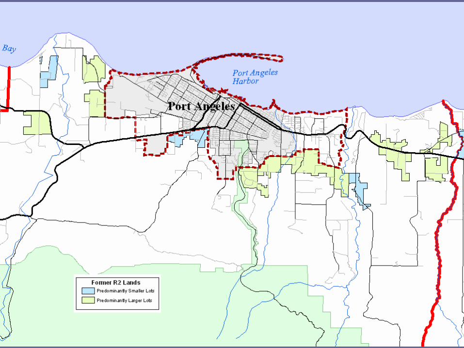
• First phase has been to re-evaluate lot size, land use, and ownership patterns.– Determine pre-dominate residential lot size
pattern in a given sub-area/neighborhood.
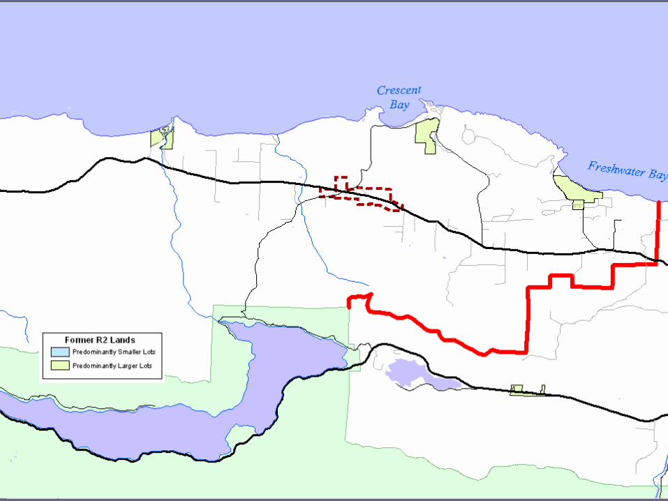
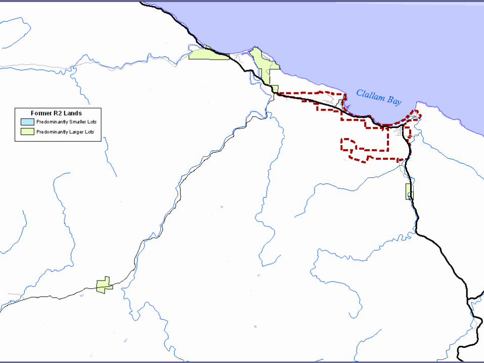
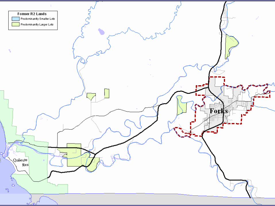
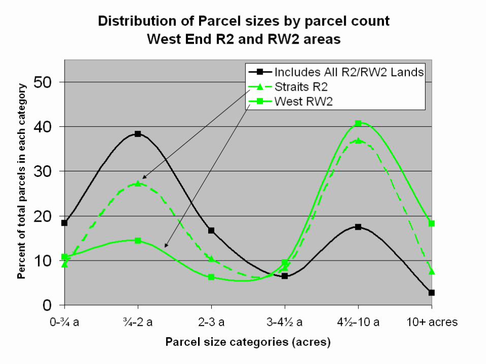
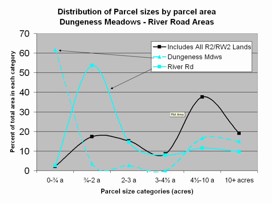
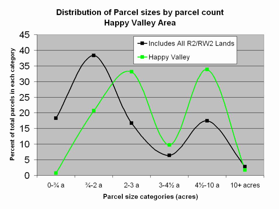
Regional MapsLot size patterns
Clallam Bay-Sekiu Urban Growth Area
NEIGHBORHOODEXAMPLES
Public Participation Process How Can I Provide Input?
•Provide Public Comments at:–Planning Commission Meetings and Workshops –Planning Commission & County Board Public Hearings
•Send written comments to:Clallam County Department of Community DevelopmentRE: GMA Compliance Comments223 E. 4th Street, Suite 5Port Angeles, WA 98362
Public Participation Process How Can I Provide Input?
•Written comments are welcome through the close of the Board of Commissioners public hearing(s).
•Commissioner public hearings are scheduled for October 14 and 15.
Public Participation Process How Will Public be Notified?
•Public Meeting & Hearing Agendas posted at: www.clallam.net(Click on “2008 Growth Management Compliance Proceeding” link
under Current Issues)
•To request to be placed on mailing or email list:–Provide us contact information on meeting sign-up sheet.–By Email: [email protected]–By Phone: (360) 417-2277 –By Mail: Clallam County Department of Community Development
RE: GMA Compliance Mailing List223 E. 4th Street, Suite 5Port Angeles, WA 98362
(Please include name and mailing and/or email address)
Public Participation Process How can I become more informed?
•Clallam County Website: www.clallam.net(Click on “2008 Growth Management Compliance Proceeding”
link under Current Issues)
•Visit the Clallam County Department of Community Development located at the Clallam County Courthouse at 223 E. 4th Street, Port Angeles, Washington, during regular-business hours (8:30 a.m. to 4:30 p.m.)
•Questions about upcoming meetings or want to speak to a County Planner phone: (360) 417-2277 (Staff Assistant)
Relationship to Rural Land Density Issues Addressed in Recent