
A Sustainable Action Plan for
TORONTO

A Sustainable Action Plan for TORONTO
Location & History Previous Planning Efforts Current Planning Efforts Growth Future Needs A New Plan for Toronto
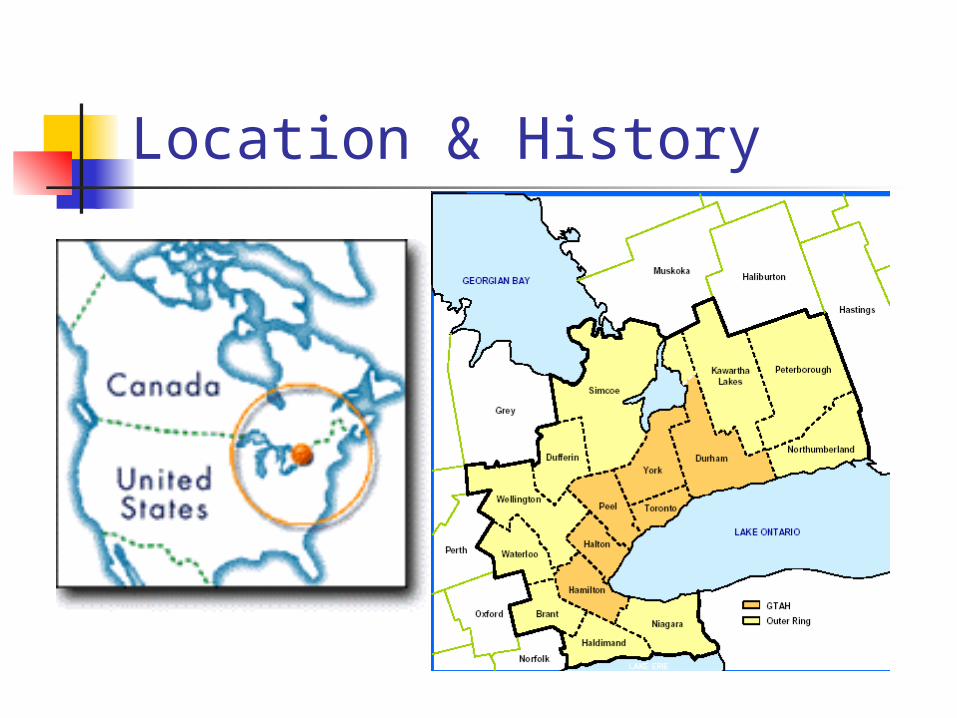
Location & History Toronto is located in the Great Lakes
Region of Southern Ontario, Canada Founded as the Town of York in 1793 Surpassed Montreal as Canada’s largest
city in the 1980s Regional Municipality amalgamated in
1997 to become 5th largest in N America
Location & History
Previous Planning For past 50 years, regional land use
planning and transportation have been coordinated by the Province Metropolitan Toronto Planning Area – 1953 MTARTS – Choices for a Growing Region –
1967 Design for Development – 1968 Toronto-Centred Region Plan – 1970 Central Ontario Lakeshore Urban Corridor –
1975 Central Ontario Smart Growth – 2002 Places to Grow – 2004

1960s Plan for Development
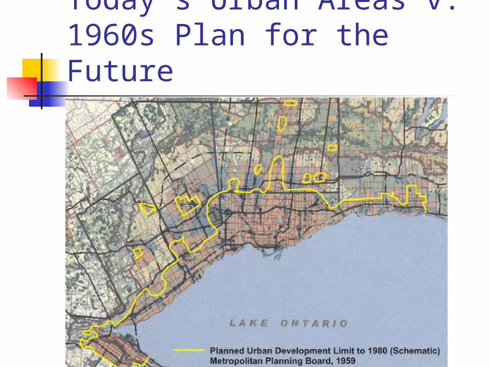
Today’s Urban Areas v. 1960s Plan for the Future
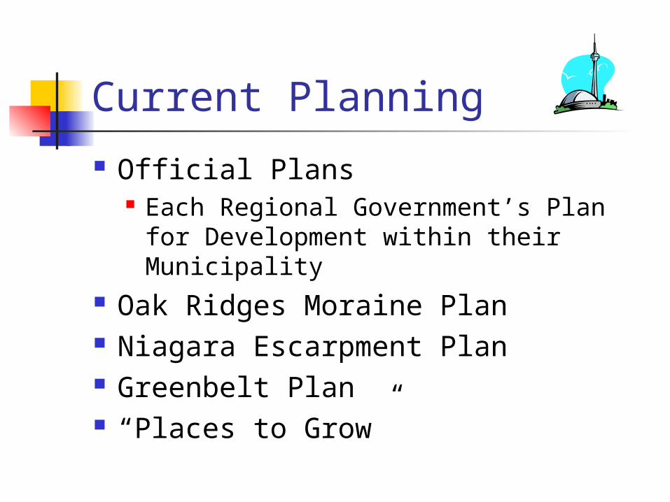
Current Planning
Official Plans Each Regional Government’s Plan for
Development within their Municipality Oak Ridges Moraine Plan Niagara Escarpment Plan Greenbelt Plan “Places to Grow”

Greater Toronto Area
Niagara Escarpmen
t
Lake Simcoe
Lake Ontario
Oak RidgesMoraine
CITY of TORONTO
HALTON
PEEL YORK
DURHAM

Greenbelt Plan A broad band of protected countryside that
Provides for a diverse range of rural communities, agriculture, tourism, recreation, and resource uses
Gives permanent protection to the natural systems, and
forms an environmental framework around which major urbanization in Ontario will be organized
complements existing Niagara Escarpment Plan and Oak Ridges Moraine Plan
is not a “park” – permits existing uses, promotes agricultural and rural uses, and limits urban uses to existing Settlement Areas

Greenbelt Plan
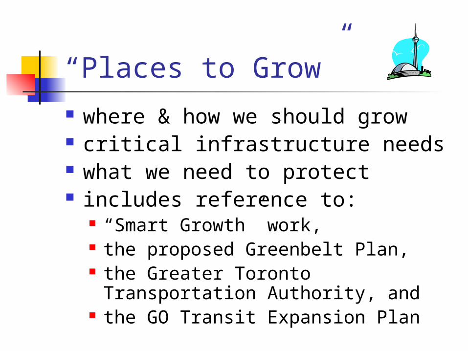
“Places to Grow” where & how we should grow critical infrastructure needs what we need to protect includes reference to:
“Smart Growth” work, the proposed Greenbelt Plan, the Greater Toronto Transportation
Authority, and the GO Transit Expansion Plan

“Places to Grow” key themes
30 year planning and infrastructure strategy focus on strategic investment, growth in
“Priority Urban Centres”, “Emerging Urban Centres”, and “Future Growth Areas”
minimum 40% growth to be accommodated through intensification
greater investment in transit and economic corridors for goods movement
streamlining environmental assessment process

“Places to Grow”
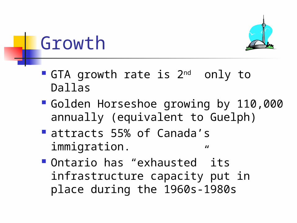
Growth GTA growth rate is 2nd only to Dallas Golden Horseshoe growing by 110,000
annually (equivalent to Guelph) attracts 55% of Canada’s immigration. Ontario has “exhausted” its
infrastructure capacity put in place during the 1960s-1980s

Growth The problems facing Ontario today
are similar to the late 1960s Strong economic growth and high
immigration levels Planning/investment for infrastructure Environmental protection (Niagara
Escarpment/Oak Ridges/Greenbelt) Solution was comprehensive super-
regional planning.
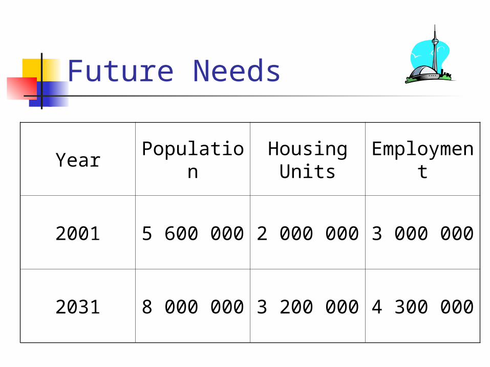
Future Needs
Year PopulationHousing
UnitsEmployme
nt
2001 5 600 000 2 000 000 3 000 000
2031 8 000 000 3 200 000 4 300 000

Future Needs
Population Growth Shares
Future Needs
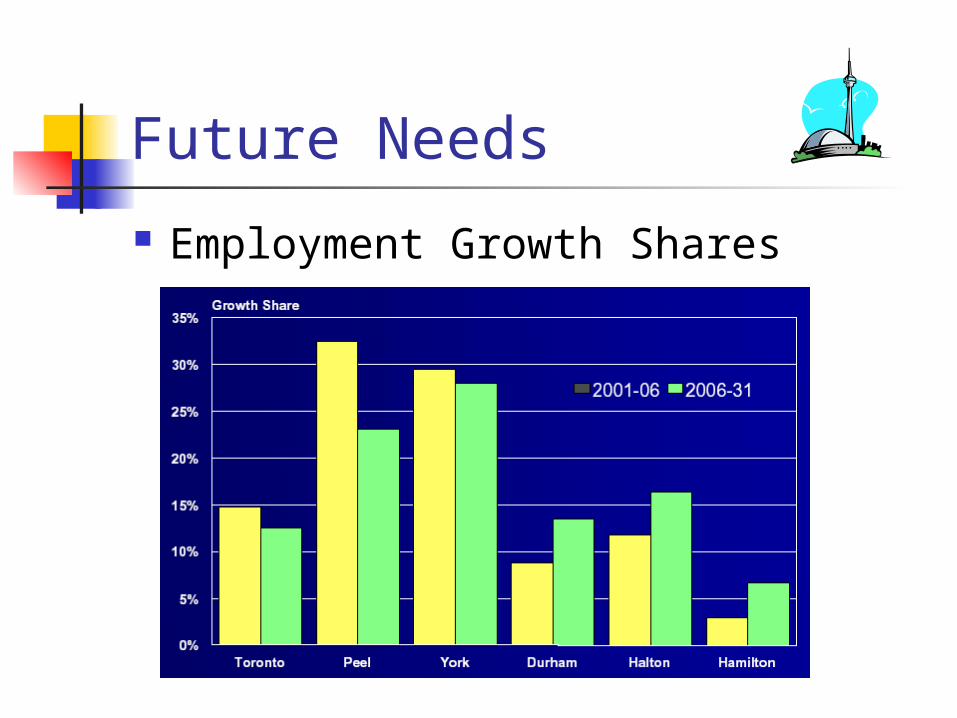
Employment Growth Shares

Future Needs To accommodate the population
growth of 2 400 000 (2001-2031), 1 200 000 new residential units will be required. 840 000 units will be in new urban areas.
(15% high density, 25% medium density, and 60% low density)
Assuming 15 units to the gross hectare, this will require 56 600 hectares of new residential lands

Future Needs
Over the next 30 years, growth forecasts indicate that 600 000 new jobs will be created in areas that we have traditionally called business parks or industrial areas
At 50 jobs per hectare, with a vacancy rate of 20%, 14 500 hectares of new employment lands will be required
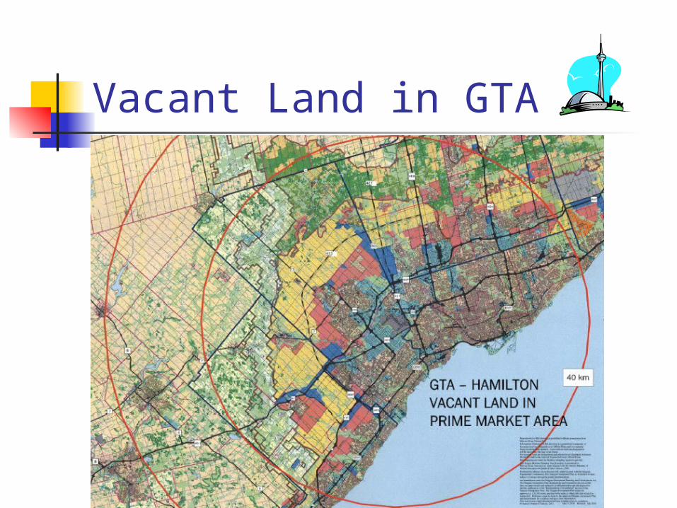
Vacant Land in GTA
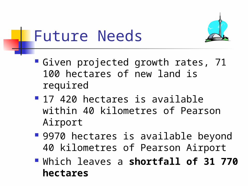
Future Needs
Given projected growth rates, 71 100 hectares of new land is required
17 420 hectares is available within 40 kilometres of Pearson Airport
9970 hectares is available beyond 40 kilometres of Pearson Airport
Which leaves a shortfall of 31 770 hectares

A New Plan for Toronto
Courses of Action Implementation Procedures Costs Benefits
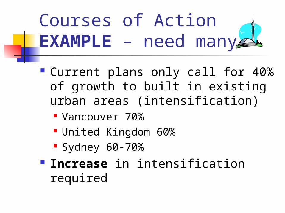
Courses of Action EXAMPLE – need many!
Current plans only call for 40% of growth to built in existing urban areas (intensification) Vancouver 70% United Kingdom 60% Sydney 60-70%
Increase in intensification required

Implementation
How to intensify? Transit improvements Environmental assessment
streamlining Financial tools Revisit Greenbelt Plan areas

Costs
Costs of intensifying $ for transit improvements $ for environmental assessment
streamlining $ for financial tools $ for revisiting Greenbelt Plan areas
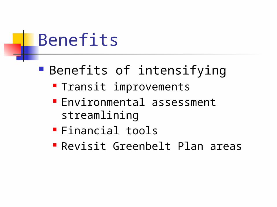
Benefits
Benefits of intensifying Transit improvements Environmental assessment
streamlining Financial tools Revisit Greenbelt Plan areas


