67
APPENDICES

APPENDICES

Elko New Market AUAR Appendix A March 2015
APPENDIX A
SUPPORTING INFORMATION
CONTENTS:
Signed Memorandum of Agreement
Scott County Zoning Map (2013 Update)
Scott County Ag Preserve Programs (2007)
Excerpt from: Draft 2040 Regional Parks Policy Plan


UNION PACIFIC RAILROAD
UNION PACIFIC RAILROAD
UNION
PAC
IFIC
RA
ILR
OA
D
UNION PACIFIC RAILROAD
CANADIAN PAC
IFIC
UN
ION
PA
CIF
IC R
.R.
Riv
er
Porter
Min
neso
ta
Minnesota
River
Min
neso
ta
River
Min
neso
ta
River
Minnesota River
Minnesota River
Rav
en
Str
eam
Rav
en
Str
eam
Raven
Stre
am
Cre
ek
Sand
Creek
Creek
Sand
Porter
Creek
Vermil lion
River
Sand
Creek
Riv
er
Cre
dit
Eagl
e
Creek
Rob
ert
Cre
ek
Big Possum
Creek
Cre
ekS
and
LakeFish
LakePike
HowardLake
Cedar Lake
Strunks Lake
Gifford Lake
DeanLake
Cedar Lake
St. Catherine Lake
McMahon Lake
RiceLake
Lennon Lake
Cynthia Lake
Pleasant Lake
Clarks Lake
GeisLake
Swamp Lake
Thole Lake
Lake
O'Dowd
BlueLake
RiceLake
Lower Prior Lake
Upper Prior Lake
Markley Lake
Crystal Lake
Cleary Lake
Hanrehan Lake
Murphy Lake
Sutton Lake
BuckLake
KaneLake
Horseshoe Lake
Browns Lake
Alswede Lake
Fisher Lake
Spring Lake
RiceLake
Hickey Lake
CampbellLake
LakeSchneider
GïWXGïWXGÏWXGÏWX
GïWXGïWXGqWXGqWX)y)y
GÝWXGÝWX
GpWXGpWX
GoWXGoWX
SÎSÎ )y)yGÏWXGÏWX?±A@?±A@
)y)y?ÌA@?ÌA@ GrWXGrWXSÄSÄ
SÌSÌ
GpWXGpWXGpWXGpWX
?±A@?±A@G|WXG|WXGØWXGØWX GØWXGØWX GpWXGpWX
SÈSÈ GÝWXGÝWXGrWXGrWXG±WXG±WX G±WXG±WX G±WXG±WXG±WXG±WX
SÄSÄ SÎSÎ GqWXGqWX
GuWXGuWX
GnWXGnWX GnWXGnWXGoWXGoWX SÎSÎ GÝWXGÝWXGÜWXGÜWX
GÜWXGÜWXGqWXGqWX)y)y G|WXG|WX
G³WXG³WXG³WXG³WXGuWXGuWX
SÐSÐ
GuWXGuWXGkWXGkWXSÅSÅ
SÖSÖ?±A@?±A@GwWXGwWX
GuWXGuWXSÎSÎ GqWXGqWX G|WXG|WX?ÒA@?ÒA@?±A@?±A@GoWXGoWX
GuWXGuWXSÖSÖ)y)y
GÎWXGÎWXGÎWXGÎWX?ºA@?ºA@ SÖSÖSÆSÆ?ÒA@?ÒA@ GåWXGåWX
GwWXGwWXSÐSÐGiWXGiWX GiWXGiWX GiWXGiWX
SÎSÎ GåWXGåWX GÎWXGÎWXGiWXGiWXSÁSÁ GiWXGiWXGÅWXGÅWXSÖSÖGoWXGoWX
SÐSÐS¼S¼
GjWXGjWXSÁSÁ GgWXGgWXSËSË GgWXGgWX GgWXGgWX GgWXGgWX?¾A@?¾A@ !"$!"$GoWXGoWX ?±A@?±A@ SÖSÖGeWXGeWX GWXGWX
S¿S¿ SsSsSØSØ GwWXGwWXS¿S¿?¾A@?¾A@
GåWXGåWX
)y
)yGdWXGdWX SsSsS¿S¿ S¿S¿S¿S¿GfWXGfWXGeWXGeWXGWXGWX
GbWXGbWX GdWXGdWXG|WXG|WX
S¿S¿S»S»GWXGWXS¿S¿
S½S½S½S½GjWXGjWX
S¼S¼S±S± ?ºA@?ºA@S»S» S½S½ S½S½SS
SÖSÖ GWXGWXS¬S¬ GWXGWX GcWXGcWX SS SSGdWXGdWX
GfWXGfWX
SØSØ GwWXGwWX GåWXGåWXSöSö GaWXGaWX GaWXGaWXGaWXGaWX GaWXGaWX GaWXGaWXSÚSÚS¼S¼
GoWXGoWXSÔSÔ
S¬S¬ )y)y S±S± GoWXGoWX !"$!"$G©WXG©WX
?ºA@?ºA@GbWXGbWX GfWXGfWX SÚSÚ GWXGWX?±A@?±A@SØSØGjWXGjWX G©WXG©WXGdWXGdWX?A@?A@ ?A@?A@?A@?A@ ?±A@?±A@ ?A@?A@ ?A@?A@ GàWXGàWXGàWXGàWXGàWXGàWX
GbWXGbWXGdWXGdWX
GpWXGpWX
GpWXGpWX
?ÒA@?ÒA@
GfWXGfWX
GÅWXGÅWX
G|WXG|WXGwWXGwWX
This map is a legally recorded document. It it a compilation of records, information, and data located in various county, township, city, and state offices, and other sources affecting the area shown, and is to be used for reference purposes only. This is not a survey and is not intended to be used as one. Scott County is not responsible for any inaccuracies herein contained. If discrepancies are found, please contact Scott County Zoning Administration or the Scott County Surveyors Office.
Scott County Zoning
Scott County Zoning DistrictsSCOTT COUNTY COMMUNITY SERVICES DIVISION
Zoning Administration
200 Fourth Avenue West, Shakopee, Minnesota 55379-1220
(952) 496-8475 - Fax (952) 496-8496 - Web: www.scott.mn.us
Ü0 2 4 61
Miles
Zoning Districts
UTR-C Urban Transition Reserve Cluster
A-1 Agricultural Preservation District
A-2 Agricultural Woodlands District
A-3 Agricultural Preservation Density District
UER Urban Expansion Reserve
UER-C Urban Expansion Reserve Cluster
UBR Urban Business Reserve
RR-1 Rural Residential Reserve District
RR-1C Rural Residential Reserve Cluster District
RR-2 Rural Residential Single Family District
RR-3 Residential Suburban Single Family District
C-1 General Commercial District
I-1 Rural Industrial District
Lakes
Overlay DistrictsPUD Planned Unit Development
UTR Urban Transition Reserve
Effective: January 20, 2010Updated: February 5, 2013
City Zoning Authority
Municipalities

33
Figure 9.1: Land Enrolled in Conservation Programs, Scott County Prepared by: Scott County GIS


Elko New Market AUAR Appendix B March 2015
APPENDIX B
COORDINATION AND COMMENTS
CONTENTS:
Study Advisory Committee Input
Summary of Early Input Received on Elko New Market Alternative Urban Areawide Review
Summary of Comments Received on Elko New Market Scoping Alternative Urban Areawide Review
Copies of Comments Received (Early Input plus Scoping AUAR)
Summary of Public Involvement Process – Elko New Market

Elko New Market AUAR B - 1 March 2015
Study Advisory Committee Input
The City of Elko New Market established a Study Advisory Committee (SAC) to review and provide agency input on the AUAR. The SAC was comprised of representatives from the City of Elko New Market (administration, engineering, planning and economic development), New Market Township, Scott County (planning and highway), MnDOT and Ryan Companies. A total of six SAC meetings were planned over the course of the AUAR process. The following summarizes each meeting.
SAC Meeting #1: A kick-off meeting for the SAC was held on November 19, 2014. The meeting included review of the AUAR process and schedule and initiated discussions on the background and study area boundaries, land use scenarios and preliminary traffic analysis results.
SAC Meeting #2: The second SAC meeting was held on December 17, 2014. The purpose of this meeting was to confirm the study area boundary, detailed land use scenarios and stages for proposed actions. An update on the traffic impact study was also presented along with information on early coordination with agencies and stakeholders.
SAC Meeting #3: The third SAC meeting was held on February 4, 2015. A summary of public outreach efforts (public meeting and agency comment on the Scoping AUAR) was presented. A presentation was also given to summarize the results of the traffic generation, impacts and potential mitigation options.
SAC Meeting #4: The fourth SAC meeting was held on March 25, 2015. The purpose of this meeting was to review and collect SAC member comments on the draft AUAR and Mitigation Plan prior to its public release in April.
Final SAC Meetings: The final two SAC meetings are anticipated to be held in May and June of 2015. The purpose of these meetings are to consider public and agency comment on the Draft and Final AUAR and Mitigation Plan documents.

Elko New Market AUAR B - 2 March 2015
Summary of Early Input Received on Elko New Market Alternative Urban Areawide Review (AUAR)
On December 31, 2014, a letter was sent to the Minnesota Environmental Quality Board’s distribution list, as well as to Study Advisory Committee members and other selected agencies. The following summarizes the feedback received and where that information is located within the AUAR or Mitigation Plan.
Appendix B Attachment
No. Agency Summary of Input Location in AUAR or
Mitigation Plan
NA
Minnesota Department of Agriculture
Identify properties in the Metropolitan Agriculture Preserves Program or Green Acres; identify feedlots; suggest City consider providing information to business owners about locating near farming operations
Items 9 and 25
NA Xcel Energy Xcel Energy has a north-south 115 kV
transmission line on an easement through the AUAR area
Items 9 and 28
1 Enterprise Products There is a pipeline through the AUAR
area. Encroachment guidelines provided Items 9 and 28
NA
Dakota County Transportation
Dakota County is in the process of reconstructing CSAH 9 between Scott CSAH 46 in New Market Township and CSAH 70 in Lakeville. Request AUAR traffic analysis examine future traffic volumes and turning movements anticipated on CSAH 9 and on Scott CSAH 46 leading to Dakota CSAH 5S (northbound road paralleling I-35 with access to the I-35/CSAH 70 interchange). The County identifies CSAH 5S as a long-term 3-lane, but the road transitions to a 2-lane south of Kenrick Court in Lakeville.
Item 21
NA State Historical Preservation Office
Contact Tom Cinadr to do a search of the cultural resources databases
Item 25
2
Minnesota Department of Natural Resources Natural Heritage Information System (NHIS)
Blanding’s turtle Item 11 Central Region Regionally Significant Ecological Area (RSEA) ranked Moderate
Item 11
Choose erosion control products that are safe for wildlife
Items 11 and 16
3
US Army Corps of Engineers
The Ryan parcels have had a wetland delineation. No discharge of dredged or fill materials is allowed into a wetland. No work can be done in the other non-Ryan AUAR areas until a wetland delineation and agency coordination has occurred.
Item 12

Elko New Market AUAR B - 3 March 2015
Summary of Comments Received on Elko New Market Scoping Alternative Urban Areawide Review (AUAR)
On January 26, 2015, the Scoping AUAR document with a cover letter was sent to the Minnesota Environmental Quality Board’s distribution list, as well as to Study Advisory Committee members and other selected agencies. The following summarizes the feedback received and where that information is located within the AUAR or Mitigation Plan.
Appendix B Attachment
No. Agency Comments Location in AUAR
and Mitigation Plan
3
Vermillion River Watershed Joint Powers Organization (Scott County)
Stormwater requirements are based on land use authority, infiltration of stormwater, drainage concerns near County Road 2, use Atlas 14 rainfall data
Item 17
Protect wetlands, potential funding source for wetland restoration
Item 12
Consider County Road 2 improvements Item 21 Protect 2040 Regional Parks plan trail search area
Item 25
5
Northwest Associates Consultants, Inc (NAC) (Consulting City Planner)
Plan trail search area
Item 25
NA Bolton & Menk, Inc. (Consulting City Engineer)
Stormwater requirements will go beyond MPCA, the City ordinance will govern, City rules were developed to comply with VRWJPO requirements and approved by VRWJPO
Item 17
6 MnDOT
Traffic study should include both I-35/CSAH 2 ramps, should include current operations, day of opening, and 20-year forecast for build and no-build scenarios, MnDOT Access Permit may be required, include MnDOT throughout development process as they control ROW, instructions for submittal of plans
Item 21


www.mndnr.gov
AN EQUAL OPPORTUNITY EMPLOYER
January 15, 2015 Correspondence # ERDB 20150159 Ms. Chantill Kahler Royer Bolton & Menk, Inc. 1960 Premier Drive Mankato, MN 56001 RE: Natural Heritage Review of the proposed Elko New Market AUAR, T113N R21W Sections 24 & 25; Scott County Dear Ms. Kahler Royer,
As requested, the Minnesota Natural Heritage Information System has been queried to determine if any rare species or other significant natural features are known to occur within an approximate one-mile radius of the proposed project. Based on this query, rare features have been documented within the search area (for details, see the enclosed database reports; please visit the Rare Species Guide at http://www.dnr.state.mn.us/rsg/index.html for more information on the biology, habitat use, and conservation measures of these rare species). Please note that the following rare features may be adversely affected by the proposed project:
• Blanding’s turtles (Emydoidea blandingii), a state-listed threatened species, have been reported from the vicinity of the proposed project. Although we have no records from directly within the project site, turtles may use the site if it contains suitable habitat. Blanding’s turtles use upland areas up to and over a mile distant from wetlands, as well as wetlands. Uplands are used for nesting, basking, periods of dormancy, and traveling between wetlands. Because of the tendency to travel long distances over land, Blanding’s turtles regularly travel across roads and are therefore susceptible to collisions with vehicles. Any added mortality can be detrimental to populations of Blanding’s turtles, as these turtles have a low reproduction rate that depends upon a high survival rate to maintain population levels. Other factors believed to contribute to the decline of this species include wetland drainage and degradation, and the development of upland habitat.
For your information, I have attached a Blanding’s turtle fact sheet that describes the habitat use and life history of this species. The fact sheet also provides two lists of recommendations for avoiding and minimizing impacts to this rare turtle. Please refer to the first list of recommendations for your project. In addition, if erosion control mesh will be used, the DNR recommends that the mesh be limited to wildlife-friendly materials (see enclosed fact sheet). If greater protection for turtles is desired, the second list of additional
Minnesota Department of Natural Resources Division of Ecological and Water Resources, Box 25
500 Lafayette Road
St. Paul, Minnesota 55155-4025
Phone: (651) 259-5109 E-mail: [email protected]

Page 2 of 3
recommendations can also be implemented. The attached flyer should be given to all contractors working in the area. If Blanding’s turtles are encountered on site, please remember that state law and rules prohibit the destruction of threatened or endangered species, except under certain prescribed conditions. If turtles are in imminent danger they should be moved by hand out of harm’s way, otherwise they should be left undisturbed.
• A portion project is within a Central Region Regionally Significant Ecological Area (RSEA) that
is ranked Moderate. The DNR Central Region (in partnership with the Metropolitan Council for the 7-county metro area), identified these ecologically significant terrestrial and wetland areas by conducting a landscape-scale assessment based on the size and shape of the ecological area, land cover within the ecological area, adjacent land cover/use, and connectivity to other ecological areas. The purpose of the data is to inform regional scale land use decisions, especially as it relates to balancing development and natural resource protection. A GIS shapefile of this data layer can be downloaded from the DNR Data Deli at http://deli.dnr.state.mn.us. Additional information, including pdf versions of the RSEA maps, is available at http://www.dnr.state.mn.us/rsea/index.html. If you would like help interpreting the RSEA data or would like assistance with designing the project’s greenspace, please contact Hannah Texler, Regional Plant Ecologist for DNR’s Central Region, at 651-259-5811 or [email protected].
• Please include a copy of this letter in any DNR license or permit application.
The Natural Heritage Information System (NHIS), a collection of databases that contains information about Minnesota’s rare natural features, is maintained by the Division of Ecological and Water Resources, Department of Natural Resources. The NHIS is continually updated as new information becomes available, and is the most complete source of data on Minnesota's rare or otherwise significant species, native plant communities, and other natural features. However, the NHIS is not an exhaustive inventory and thus does not represent all of the occurrences of rare features within the state. Therefore, ecologically significant features for which we have no records may exist within the project area. If additional information becomes available regarding rare features in the vicinity of the project, further review may be necessary.
For environmental review purposes, the results of this Natural Heritage Review are valid for one year; the results are only valid for the project location (noted above) and the project description provided on the NHIS Data Request Form. Please contact me if project details change or for an updated review if construction has not occurred within one year.
The Natural Heritage Review does not constitute review or approval by the Department of Natural Resources as a whole. Instead, it identifies issues regarding known occurrences of rare features and potential effects to these rare features. To determine whether there are other natural resource concerns associated with the proposed project, please contact your DNR Regional Environmental Assessment Ecologist (contact information available at http://www.dnr.state.mn.us/eco/ereview/erp_regioncontacts.html). Please be aware that additional site assessments or review may be required.
Thank you for consulting us on this matter, and for your interest in preserving Minnesota's rare natural resources. An invoice will be mailed to you under separate cover.

Page 3 of 3
Sincerely,
Lisa Joyal
Endangered Species Review Coordinator enc. Blanding’s Turtle Fact Sheets Wildlife Friendly Erosion Control cc: Brooke Haworth Jennie Skancke

Environmental Review Fact Sheet Series
Endangered, Threatened, and Special Concern Species of Minnesota
Blanding’s Turtle (Emydoidea blandingii)
Minnesota Status: Threatened State Rank1: S2 Federal Status: none Global Rank1: G4
HABITAT USE Blanding’s turtles need both wetland and upland habitats to complete their life cycle. The types of wetlands used include ponds, marshes, shrub swamps, bogs, and ditches and streams with slow-moving water. In Minnesota, Blanding’s turtles are primarily marsh and pond inhabitants. Calm, shallow water bodies (Type 1-3 wetlands) with mud bottoms and abundant aquatic vegetation (e.g., cattails, water lilies) are preferred, and extensive marshes bordering rivers provide excellent habitat. Small temporary wetlands (those that dry up in the late summer or fall) are frequently used in spring and summer -- these fishless pools are amphibian and invertebrate breeding habitat, which provides an important food source for Blanding’s turtles. Also, the warmer water of these shallower areas probably aids in the development of eggs within the female turtle. Nesting occurs in open (grassy or brushy) sandy uplands, often some distance from water bodies. Frequently, nesting occurs in traditional nesting grounds on undeveloped land. Blanding’s turtles have also been known to nest successfully on residential property (especially in low density housing situations), and to utilize disturbed areas such as farm fields, gardens, under power lines, and road shoulders (especially of dirt roads). Although Blanding’s turtles may travel through woodlots during their seasonal movements, shady areas (including forests and lawns with shade trees) are not used for nesting. Wetlands with deeper water are needed in times of drought, and during the winter. Blanding’s turtles overwinter in the muddy bottoms of deeper marshes and ponds, or other water bodies where they are protected from freezing. LIFE HISTORY Individuals emerge from overwintering and begin basking in late March or early April on warm, sunny days. The increase in body temperature which occurs during basking is necessary for egg development within the female turtle. Nesting in Minnesota typically occurs during June, and females are most active in late afternoon and at dusk. Nesting can occur as much as a mile from wetlands. The nest is dug by the female in an open sandy area and 6-15 eggs are laid. The female turtle returns to the marsh within 24 hours of laying eggs. After a development period of approximately two months, hatchlings leave the nest from mid-August through early-October. Nesting females and hatchlings are often at risk of being killed while crossing roads between wetlands and nesting areas. In addition to movements associated with nesting, all ages and both sexes move between wetlands from April through November. These movements peak in June and July and again in September and October as turtles move to and from overwintering sites. In late autumn (typically November), Blanding’s turtles bury themselves in the substrate (the mud at the bottom) of deeper wetlands to overwinter. IMPACTS / THREATS / CAUSES OF DECLINE
• loss of wetland habitat through drainage or flooding (converting wetlands into ponds or lakes) • loss of upland habitat through development or conversion to agriculture • human disturbance, including collection for the pet trade* and road kills during seasonal movements • increase in predator populations (skunks, raccoons, etc.) which prey on nests and young
*It is illegal to possess this threatened species.

Minnesota DNR Division of Ecological Resources Environmental Review Fact Sheet Series. Blanding’s Turtle.
2
RECOMMENDATIONS FOR AVOIDING AND MINIMIZING IMPACTS These recommendations apply to typical construction projects and general land use within Blanding’s turtle habitat, and are provided to help local governments, developers, contractors, and homeowners minimize or avoid detrimental impacts to Blanding’s turtle populations. List 1 describes minimum measures which we recommend to prevent harm to Blanding’s turtles during construction or other work within Blanding’s turtle habitat. List 2 contains recommendations which offer even greater protection for Blanding’s turtles populations; this list should be used in addition to the first list in areas which are known to be of state-wide importance to Blanding’s turtles (contact the DNR’s Natural Heritage and Nongame Research Program if you wish to determine if your project or home is in one of these areas), or in any other area where greater protection for Blanding’s turtles is desired. List 1. Recommendations for all areas inhabited by Blanding’s turtles.
List 2. Additional recommendations for areas known to be of state-wide importance to Blanding’s turtles.
GENERAL
A flyer with an illustration of a Blanding’s turtle should be given to all contractors working in the area. Homeowners should also be informed of the presence of Blanding’s turtles in the area.
Turtle crossing signs can be installed adjacent to road-crossing areas used by Blanding’s turtles to increase public awareness and reduce road kills.
Turtles which are in imminent danger should be moved, by hand, out of harms way. Turtles which are not in imminent danger should be left undisturbed.
Workers in the area should be aware that Blanding’s turtles nest in June, generally after 4pm, and should be advised to minimize disturbance if turtles are seen.
If a Blanding’s turtle nests in your yard, do not disturb the nest.
If you would like to provide more protection for a Blanding’s turtle nest on your property, see “Protecting Blanding’s Turtle Nests” on page 3 of this fact sheet.
Silt fencing should be set up to keep turtles out of construction areas. It is critical that silt fencing be removed after the area has been revegetated.
Construction in potential nesting areas should be limited to the period between September 15 and June 1 (this is the time when activity of adults and hatchlings in upland areas is at a minimum).
WETLANDS
Small, vegetated temporary wetlands (Types 2 & 3) should not be dredged, deepened, filled, or converted to storm water retention basins (these wetlands provide important habitat during spring and summer).
Shallow portions of wetlands should not be disturbed during prime basking time (mid morning to mid- afternoon in May and June). A wide buffer should be left along the shore to minimize human activity near wetlands (basking Blanding’s turtles are more easily disturbed than other turtle species).
Wetlands should be protected from pollution; use of fertilizers and pesticides should be avoided, and run-off from lawns and streets should be controlled. Erosion should be prevented to keep sediment from reaching wetlands and lakes.
Wetlands should be protected from road, lawn, and other chemical run-off by a vegetated buffer strip at least 50' wide. This area should be left unmowed and in a natural condition.
ROADS
Roads should be kept to minimum standards on widths and lanes (this reduces road kills by slowing traffic and reducing the distance turtles need to cross).
Tunnels should be considered in areas with concentrations of turtle crossings (more than 10 turtles per year per 100 meters of road), and in areas of lower density if the level of road use would make a safe crossing impossible for turtles. Contact your DNR Regional Nongame Specialist for further information on wildlife tunnels.
Roads should be ditched, not curbed or below grade. If curbs must be used, 4 inch high curbs at a 3:1 slope are preferred (Blanding’s turtles have great difficulty climbing traditional curbs; curbs and below grade roads trap turtles on the road and can cause road kills).
Roads should be ditched, not curbed or below grade.

Minnesota DNR Division of Ecological Resources Environmental Review Fact Sheet Series. Blanding’s Turtle.
3
ROADS cont. Culverts between wetland areas, or between wetland areas and nesting areas, should be 36 inches or greater in diameter, and elliptical or flat-bottomed.
Road placement should avoid separating wetlands from adjacent upland nesting sites, or these roads should be fenced to prevent turtles from attempting to cross them (contact your DNR Nongame Specialist for details).
Wetland crossings should be bridged, or include raised roadways with culverts which are 36 in or greater in diameter and flat-bottomed or elliptical (raised roadways discourage turtles from leaving the wetland to bask on roads).
Road placement should avoid bisecting wetlands, or these roads should be fenced to prevent turtles from attempting to cross them (contact your DNR Nongame Specialist for details). This is especially important for roads with more than 2 lanes.
Culverts under roads crossing streams should be oversized (at least twice as wide as the normal width of open water) and flat-bottomed or elliptical.
Roads crossing streams should be bridged.
UTILITIES
Utility access and maintenance roads should be kept to a minimum (this reduces road-kill potential).
Because trenches can trap turtles, trenches should be checked for turtles prior to being backfilled and the sites should be returned to original grade.
LANDSCAPING AND VEGETATION MANAGEMENT
Terrain should be left with as much natural contour as possible.
As much natural landscape as possible should be preserved (installation of sod or wood chips, paving, and planting of trees within nesting habitat can make that habitat unusable to nesting Blanding’s turtles).
Graded areas should be revegetated with native grasses and forbs (some non-natives form dense patches through which it is difficult for turtles to travel).
Open space should include some areas at higher elevations for nesting. These areas should be retained in native vegetation, and should be connected to wetlands by a wide corridor of native vegetation.
Vegetation management in infrequently mowed areas -- such as in ditches, along utility access roads, and under power lines -- should be done mechanically (chemicals should not be used). Work should occur fall through spring (after October 1st and before June 1st ).
Ditches and utility access roads should not be mowed or managed through use of chemicals. If vegetation management is required, it should be done mechanically, as infrequently as possible, and fall through spring (mowing can kill turtles present during mowing, and makes it easier for predators to locate turtles crossing roads).
Protecting Blanding’s Turtle Nests: Most predation on turtle nests occurs within 48 hours after the eggs are laid. After this time, the scent is gone from the nest and it is more difficult for predators to locate the nest. Nests more than a week old probably do not need additional protection, unless they are in a particularly vulnerable spot, such as a yard where pets may disturb the nest. Turtle nests can be protected from predators and other disturbance by covering them with a piece of wire fencing (such as chicken wire), secured to the ground with stakes or rocks. The piece of fencing should measure at least 2 ft. x 2 ft., and should be of medium sized mesh (openings should be about
2 in. x 2 in.). It is very important that the fencing be removed before August 1st so the young turtles can escape from the nest when they hatch! REFERENCES 1Association for Biodiversity Information. “Heritage Status: Global, National, and Subnational Conservation
Status Ranks.” NatureServe. Version 1.3 (9 April 2001). http://www.natureserve.org/ranking.htm (15 April 2001).
Coffin, B., and L. Pfannmuller. 1988. Minnesota’s Endangered Flora and Fauna. University of Minnesota Press, Minneapolis, 473 pp.

Minnesota DNR Division of Ecological Resources Environmental Review Fact Sheet Series. Blanding’s Turtle.
4
REFERENCES (cont.) Moriarty, J. J., and M. Linck. 1994. Suggested guidelines for projects occurring in Blanding’s turtle habitat.
Unpublished report to the Minnesota DNR. 8 pp. Oldfield, B., and J. J. Moriarty. 1994. Amphibians and Reptiles Native to Minnesota. University of Minnesota
Press, Minneapolis, 237 pp. Sajwaj, T. D., and J. W. Lang. 2000. Thermal ecology of Blanding’s turtle in central Minnesota. Chelonian
Conservation and Biology 3(4):626-636. Compiled by the Minnesota Department of Natural Resources Division of Ecological Resources, Updated March 2008 Endangered Species Environmental Review Coordinator, 500 Lafayette Rd., Box 25, St. Paul, MN 55155 / 651-259-5109

WFEC Fact-sheet – MN DNR 2013 (acc.)
Wildlife Friendly Erosion Control
Wildlife entanglement in, and death from, plastic netting and other man-made plastic materials has been documented in birds (Johnson, 1990; Fuller-Perrine and Tobin, 1993), fish (Johnson, 1990), mammals (Derraik, 2002), and reptiles (Barton and Kinkead, 2005; Kapfer and Paloski, 2011). Yet the use of these materials continues in many cases, without consideration for wildlife impacts. Plastic netting is frequently used for erosion control during construction and landscape projects and can negatively impact terrestrial and aquatic wildlife populations as well as snag in maintenance machinery resulting in costly repairs and delays. However, wildlife friendly erosion control materials do exist, and are sold by several large erosion control material companies. Below are a few key considerations before starting a project.
Know Your Options Remember to consult with local natural resource
authorities (DNR, USFWS, etc.) before starting a project. They can help you identify sensitive areas and rare species.
When erosion control is necessary, select products with biodegradable netting (natural fiber, biodegradable polyesters, etc.).
DO NOT use products that require UV-light to biodegrade (also called, “photodegradable”). These do not biodegrade properly when shaded by vegetation.
Use netting with rectangular shaped mesh (not square mesh).
Use netting with flexible (non-welded) mesh.
Know the Landscape It is especially important to use wildlife friendly
erosion control around: o Areas with threatened or endangered species. o Wetlands, rivers, lakes, and other watercourses. o Habitat transition zones (prairie – woodland
edges, rocky outcrop – woodland edges, steep rocky slopes, etc.).
o Areas with threatened or endangered species. Use erosion mesh wisely, not all areas with
disturbed ground necessitate its use. Do not use plastic mesh unless it is specifically required. Other erosion control options exist (open weave textile (OWT), rolled erosion control products (RECPs) with woven natural fiber netting).

WFEC Fact-sheet – MN DNR 2013 (acc.)
Protect Wildlife Avoid photodegradable erosion control
materials where possible. Use only biodegradable materials
(typically made from natural fibers), preferably those that will biodegrade under a variety of conditions.
Wildlife friendly erosion control material costs are often similar to conventional plastic netting.
Literature Referenced
Barton, C. and K. Kinkead. 2005. Do erosion control and snakes mesh? Soil and Water Conservation Society 60:33A-35A.
Derraik, J.G.B. 2002. The pollution of the marine environment by plastic debris: a aeview. Marine Pollution Bulletin 44:842-852.
Fuller-Perrine, L.D., and M.E. Tobin. 1993. A method for applying and removing bird-exclusion netting in commercial vineyards. Wildlife Society Bulletin 21:47-51.
Johnson, S.W. 1990. Distribution, abundance, and source of entanglement debris and other plastics on Alaskan beaches, 1982-1988. Proceedings of the Second International Conference on Marine Debris 331-348.
Kapfer, J. M., and R. A. Paloski. 2011. On the threat to snakes of mesh deployed for erosion control and wildlife exclusion. Herpetological Conservation and Biology 6:1-9.


1
Chantill Kahler-Royer
From: Bob Kirmis <[email protected]>Sent: Monday, February 16, 2015 4:19 PMTo: Chantill Kahler-RoyerSubject: RE: Trail Search Area for Elko New MarketAttachments: Park and Trail Plan - Regional Facilities.pdf; Park & Trail Plan - 2009.pdf
Thank you Chantill. I think I may have seen the map when the Met Council sent out its various system plans. Attached are a couple related maps from the City’s Park and Trail Plan which may (or may not?) be of interest to you. Bob Bob Kirmis Northwest Associated Consultants, Inc. 4800 Olson Memorial Highway, Suite 202 Golden Valley, MN 55422 Main: 763.231.2555 Facsimile: 763.231.2561 [email protected]
From: Chantill Kahler-Royer [mailto:[email protected]]
Sent: Monday, February 16, 2015 3:50 PM
To: Bob Kirmis
Subject: Trail Search Area for Elko New Market
Chantill A. Kahler Royer, PE, LEED AP ND
Wetland Delineator in Training No. 5197
Project Engineer
Bolton & Menk, Inc. Consulting Engineers & Surveyors
1960 Premier Drive
Mankato, MN 56001
P: (507) 625.4171 ext. 2636
M: (507) 327.8430
F: (507) 625.4177
email: [email protected]
www.bolton-menk.com
______________________________________________________________________ This email has been scanned by the Symantec Email Security.cloud service. For more information please visit http://www.symanteccloud.com ______________________________________________________________________


0 0.8 1.6 2.4 3.20.4Miles
City of Elko New Market
2030 Park & Trail Plan
Map 8
Proposed Park & Trail Plan
*Scott County will seek regional status from the Metropolitan Council.
®
March 4, 2009
260th Street East
Nat
chez
Ave
nue
Texa
s A
venu
e
260th Street East
Dak
ota
Ave
nue
Nat
chez
Ave
nue
Xer
xes
Ave
nue
Vermillio n River
275th Street
280th St. E.
")56
NEIGHBORHOODPARK SEARCH AREA
20 acres
§¦35
250th Street
CONSERVATIONAREA/GREENWAY
Vermillion River 100 foot buffer
280th St. E.!(86
!(27
!(91
!(2
NEIGHBORHOODPARK SEARCH AREA
20 acres
NEIGHBORHOODPARK SEARCH AREA
20 acres
POTENTIALCONSERVATION
AREACOMMUNITY
PARK SEARCHAREA
MINI PARKSEARCH AREA
8 ACRES
COMMUNITY PLAYFIELD/ATHLETIC COMPLEX
SEARCH AREA32 ACRES
COMMUNITYPARK SEARCH
AREA
POTENTIALCONSERVATION
AREA
COMMUNITY PLAYFIELD/ATHLETIC COMPLEXSEARCHAREA*
2030 Elko New Market City Boundary
Streams
Lakes
Wetlands
Existing Elko New Market Park
Existing City Trail
Existing City Sidewalk
MinnCan Pipeline Route (Potential Trail)
CapX 2020 Route (Potential Trail)
Proposed City Trails / Sidewalks
Proposed City Trailway Corridor
Proposed County Trailway Corridor
Proposed Trailway Corridor*
*Explore City extension of Eagle View Elementary existing playfields and athletic complexes.
Source: Scott County GIS Department, Minnesota Department of Natural Resources& Northwest Associated Consultants, Inc.
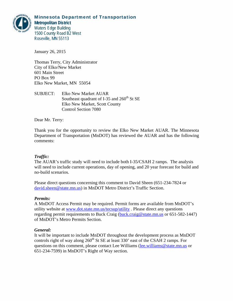
Minnesota Department of Transportation Metropolitan District Waters Edge Building 1500 County Road B2 West Roseville, MN 55113 January 26, 2015 Thomas Terry, City Administrator City of Elko/New Market 601 Main Street PO Box 99 Elko New Market, MN 55054 SUBJECT: Elko New Market AUAR
Southeast quadrant of I-35 and 260th St SE Elko New Market, Scott County Control Section 7080
Dear Mr. Terry: Thank you for the opportunity to review the Elko New Market AUAR. The Minnesota Department of Transportation (MnDOT) has reviewed the AUAR and has the following comments: Traffic: The AUAR’s traffic study will need to include both I-35/CSAH 2 ramps. The analysis will need to include current operations, day of opening, and 20 year forecast for build and no-build scenarios. Please direct questions concerning this comment to David Sheen (651-234-7824 or [email protected]) in MnDOT Metro District’s Traffic Section. Permits: A MnDOT Access Permit may be required. Permit forms are available from MnDOT’s utility website at www.dot.state.mn.us/tecsup/utility . Please direct any questions regarding permit requirements to Buck Craig ([email protected] or 651-582-1447) of MnDOT’s Metro Permits Section. General: It will be important to include MnDOT throughout the development process as MnDOT controls right of way along 260th St SE at least 330’ east of the CSAH 2 ramps. For questions on this comment, please contact Lee Williams ([email protected] or 651-234-7599) in MnDOT’s Right of Way section.

Review Submittal Options: MnDOT’s goal is to complete the review of plans within 30 days. Submittals sent in electronically can usually be turned around faster. There are four submittal options. Please submit either:
1. One (1) electronic pdf. version of the plans. MnDOT can accept the plans via e-mail at [email protected] provided that each separate e-mail is under 20 megabytes.
2. Three (3) sets of full size plans. Although submitting seven sets of full size plans will expedite the review process. Plans can be sent to:
MnDOT – Metro District Planning Section Development Reviews Coordinator 1500 West County Road B-2 Roseville, MN 55113
3. One (1) compact disc. 4. Plans can also be submitted to MnDOT’s External FTP Site. Please send files
to: ftp://ftp2.dot.state.mn.us/pub/incoming/MetroWatersEdge/Planning Internet Explorer doesn’t work using ftp so please use an FTP Client or your Windows Explorer (My Computer). Also, please send a note to [email protected] indicating that the plans have been submitted on the FTP site.
If you have any questions concerning this review, please feel free to contact me at (651) 234-7793. Sincerely,
Michael J. Corbett, PE Senior Planner Copy sent via E-Mail: Chantill Kahler Royer, Bolton & Menk Diane Langenbach, Area Engineer Bruce Irish, Water Resources Nancy Jacobson, Design Buck Craig, Permits Lee Williams, Right-of-Way David Sheen, Traffic Engineering Clare Lackey, Traffic Engineering Russell Owen, Metropolitan Council
Elko New Market AUAR B - 4 March 2015
Summary of Public Involvement Process – Elko New Market AUAR
The Elko New Market AUAR process began in November 2014. As part of this process, several public and agency input outreach efforts were conducted. A summary of these efforts and outcomes are outlined below.
Public Input
Public Meeting #1: The first public meeting was held on January 27, 2015. The purpose of this meeting was to provide information on the purpose of an Alternative Urban Areawide Review (AUAR), discuss the AUAR process, and review the development scenarios that would be reviewed in the AUAR. This meeting was open to the public. Landowners located within and adjacent to the AUAR study area were invited and the meeting was noticed in the New Prague Times January 15, 2015 issue and on the City of Elko New Market’s website.
Public Meeting #2: The second public meeting is anticipated in May 2015 during the 30-day public comment period to review the contents and analysis in the Draft AUAR. Invitations to this meeting will be sent in the same way as the first public meeting.
Public Comments Received
Two public comments were received during the Scoping AUAR process. The following summarizes the comments received and the City’s response.
Public Comment #1: Why is the City of Elko New Market proposing to annex property that is not already contiguous with the city limits? Doesn’t this proposal “leapfrog” other feasible properties that are next to or closer to the city limits (west of I-35) and shouldn’t the City first annex those parcels?
Response to #1: The City proposes to annex the Ryan Development parcels, plus one other property located between the Ryan parcels and County Road 2. This annexation would address the opportunity to support a specific project, the Ryan Development, based on the Ryan Company’s option with current owner(s) to purchase land on the identified parcels and move forward. The City’s proposal to annex parcels east of I-35 is consistent with long-established community plans and is specifically driven by the proposed development. Currently, there are no similar reasons for annexation to proceed into other parcels, including parcels contiguous with the City’s boundary. Previous land use guidance has also long anticipated annexation of parcels both east and west of I-35 for industrial and commercial development. Therefore, the proposed annexation is consistent with prior planning and would only be completed as development moves forward and with the cooperation of New Market Township.
Public Comment #2: What is the anticipated timing of future street connections south of the Ryan Companies Development to CSAH 46? What is the likely alignment of this connection?

Elko New Market AUAR B - 5 March 2015
Response to #2: The Ryan Companies Development will be initially served by one primary entrance off CSAH 2. An additional connection to the south through the Ryan Companies Development and then east to CSAH 46 is also included in the traffic modeling efforts for the AUAR. There are no immediate plans to make this connection (south of Ryan and east to CSAH 46) or other future street connections indicated on AUAR Figures 8 and 18. The need for these future connections is dependent upon development of areas outside the Ryan Companies parcels with willing land owners. Similarly, the alignments of these future street connections are also unknown at this time and will depend on how the area develops in the future.

Elko New Market
Alternative Urban Areawide Review
(AUAR)
FINAL MITIGATION PLAN (AUAR Appendix C)
July 2015

Elko New Market AUAR July 2015
C-1
Table of Contents
Section Page C-
Purpose of the AUAR Process .............................................................................................2
Executive Summary
a. Introduction .........................................................................................................................2
b. Summary of Issues and Mitigation .....................................................................................3
Mitigation Plan
9. Land Use ...........................................................................................................................3
11. Fish, Wildlife and Ecological Resources ..........................................................................3
12. Physical Impacts on Water Resources ..............................................................................5
13. Water Use..........................................................................................................................6
16. Erosion and Sedimentation Control ..................................................................................7
17. Water Quality – Stormwater Runoff .................................................................................7
18. Water Quality – Wastewater .............................................................................................9
19. Geologic Hazards and Soil Conditions .............................................................................9
20. Solid Wastes, Hazardous Wastes, Storage Tanks ...........................................................10
21. Traffic .............................................................................................................................11
24. Odors, Noise and Dust ....................................................................................................12
25. Nearby [Sensitive] Resources .........................................................................................12
26. Visual Impacts ...............................................................................................................14
27. Compatibility with Plans and Land Use Regulations .....................................................15
28. Impact on Infrastructure and Public Service ...................................................................15
Elko New Market AUAR July 2015
C-2
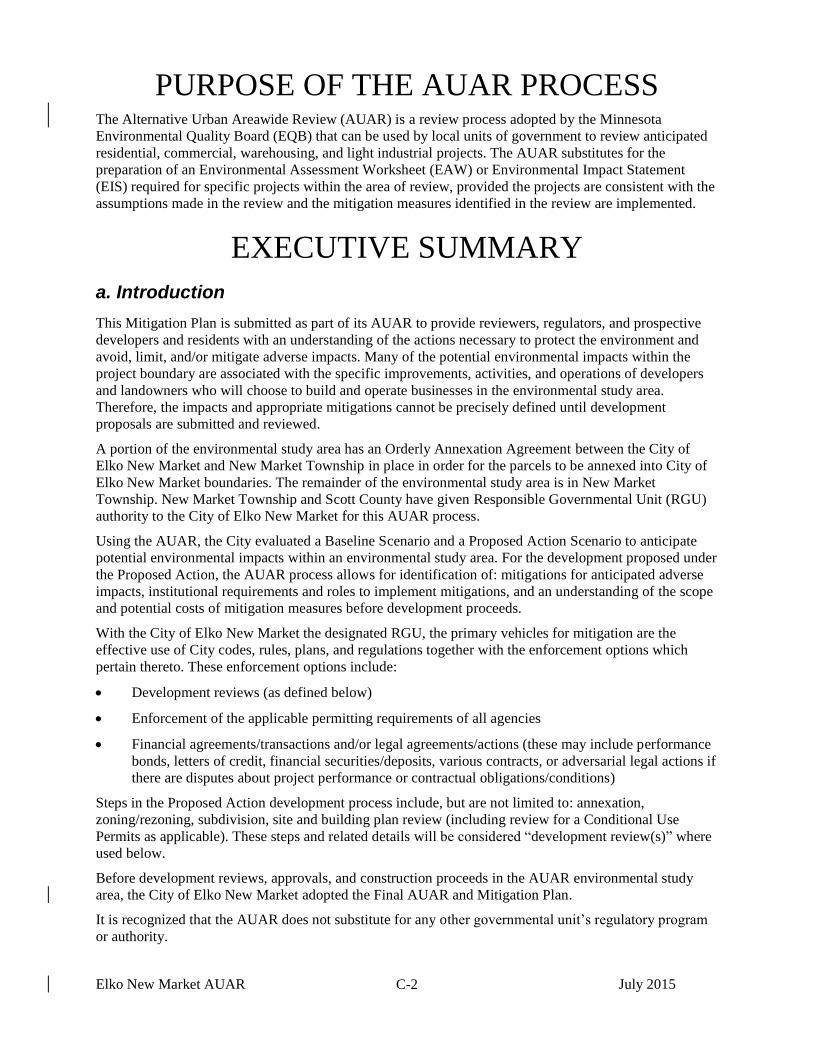
PURPOSE OF THE AUAR PROCESS The Alternative Urban Areawide Review (AUAR) is a review process adopted by the Minnesota
Environmental Quality Board (EQB) that can be used by local units of government to review anticipated
residential, commercial, warehousing, and light industrial projects. The AUAR substitutes for the
preparation of an Environmental Assessment Worksheet (EAW) or Environmental Impact Statement
(EIS) required for specific projects within the area of review, provided the projects are consistent with the
assumptions made in the review and the mitigation measures identified in the review are implemented.
EXECUTIVE SUMMARY
a. Introduction
This Mitigation Plan is submitted as part of its AUAR to provide reviewers, regulators, and prospective
developers and residents with an understanding of the actions necessary to protect the environment and
avoid, limit, and/or mitigate adverse impacts. Many of the potential environmental impacts within the
project boundary are associated with the specific improvements, activities, and operations of developers
and landowners who will choose to build and operate businesses in the environmental study area.
Therefore, the impacts and appropriate mitigations cannot be precisely defined until development
proposals are submitted and reviewed.
A portion of the environmental study area has an Orderly Annexation Agreement between the City of
Elko New Market and New Market Township in place in order for the parcels to be annexed into City of
Elko New Market boundaries. The remainder of the environmental study area is in New Market
Township. New Market Township and Scott County have given Responsible Governmental Unit (RGU)
authority to the City of Elko New Market for this AUAR process.
Using the AUAR, the City evaluated a Baseline Scenario and a Proposed Action Scenario to anticipate
potential environmental impacts within an environmental study area. For the development proposed under
the Proposed Action, the AUAR process allows for identification of: mitigations for anticipated adverse
impacts, institutional requirements and roles to implement mitigations, and an understanding of the scope
and potential costs of mitigation measures before development proceeds.
With the City of Elko New Market the designated RGU, the primary vehicles for mitigation are the
effective use of City codes, rules, plans, and regulations together with the enforcement options which
pertain thereto. These enforcement options include:
Development reviews (as defined below)
Enforcement of the applicable permitting requirements of all agencies
Financial agreements/transactions and/or legal agreements/actions (these may include performance
bonds, letters of credit, financial securities/deposits, various contracts, or adversarial legal actions if
there are disputes about project performance or contractual obligations/conditions)
Steps in the Proposed Action development process include, but are not limited to: annexation,
zoning/rezoning, subdivision, site and building plan review (including review for a Conditional Use
Permits as applicable). These steps and related details will be considered “development review(s)” where
used below.
Before development reviews, approvals, and construction proceeds in the AUAR environmental study
area, the City of Elko New Market adopted the Final AUAR and Mitigation Plan.
It is recognized that the AUAR does not substitute for any other governmental unit’s regulatory program
or authority.
Elko New Market AUAR July 2015
C-3
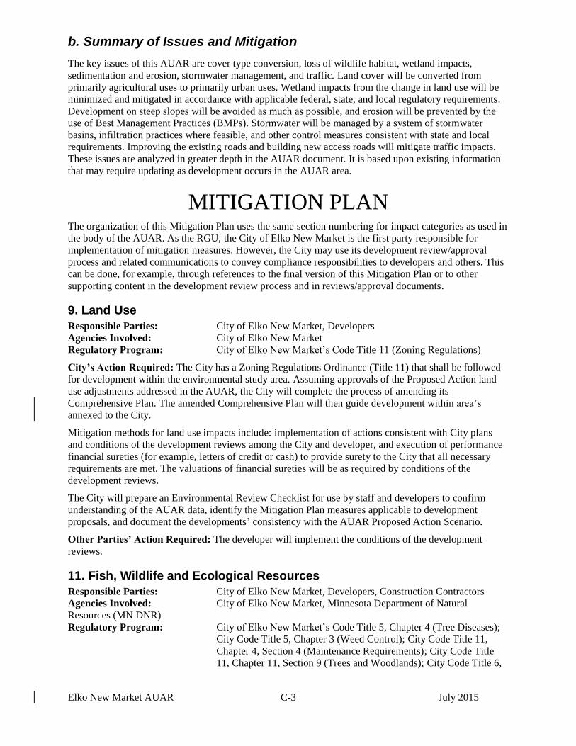
b. Summary of Issues and Mitigation
The key issues of this AUAR are cover type conversion, loss of wildlife habitat, wetland impacts,
sedimentation and erosion, stormwater management, and traffic. Land cover will be converted from
primarily agricultural uses to primarily urban uses. Wetland impacts from the change in land use will be
minimized and mitigated in accordance with applicable federal, state, and local regulatory requirements.
Development on steep slopes will be avoided as much as possible, and erosion will be prevented by the
use of Best Management Practices (BMPs). Stormwater will be managed by a system of stormwater
basins, infiltration practices where feasible, and other control measures consistent with state and local
requirements. Improving the existing roads and building new access roads will mitigate traffic impacts.
These issues are analyzed in greater depth in the AUAR document. It is based upon existing information
that may require updating as development occurs in the AUAR area.
MITIGATION PLAN The organization of this Mitigation Plan uses the same section numbering for impact categories as used in
the body of the AUAR. As the RGU, the City of Elko New Market is the first party responsible for
implementation of mitigation measures. However, the City may use its development review/approval
process and related communications to convey compliance responsibilities to developers and others. This
can be done, for example, through references to the final version of this Mitigation Plan or to other
supporting content in the development review process and in reviews/approval documents.
9. Land Use
Responsible Parties: City of Elko New Market, Developers
Agencies Involved: City of Elko New Market
Regulatory Program: City of Elko New Market’s Code Title 11 (Zoning Regulations)
City’s Action Required: The City has a Zoning Regulations Ordinance (Title 11) that shall be followed
for development within the environmental study area. Assuming approvals of the Proposed Action land
use adjustments addressed in the AUAR, the City will complete the process of amending its
Comprehensive Plan. The amended Comprehensive Plan will then guide development within area’s
annexed to the City.
Mitigation methods for land use impacts include: implementation of actions consistent with City plans
and conditions of the development reviews among the City and developer, and execution of performance
financial sureties (for example, letters of credit or cash) to provide surety to the City that all necessary
requirements are met. The valuations of financial sureties will be as required by conditions of the
development reviews.
The City will prepare an Environmental Review Checklist for use by staff and developers to confirm
understanding of the AUAR data, identify the Mitigation Plan measures applicable to development
proposals, and document the developments’ consistency with the AUAR Proposed Action Scenario.
Other Parties’ Action Required: The developer will implement the conditions of the development
reviews.
11. Fish, Wildlife and Ecological Resources
Responsible Parties: City of Elko New Market, Developers, Construction Contractors
Agencies Involved: City of Elko New Market, Minnesota Department of Natural
Resources (MN DNR)
Regulatory Program: City of Elko New Market’s Code Title 5, Chapter 4 (Tree Diseases);
City Code Title 5, Chapter 3 (Weed Control); City Code Title 11,
Chapter 4, Section 4 (Maintenance Requirements); City Code Title
11, Chapter 11, Section 9 (Trees and Woodlands); City Code Title 6,

Elko New Market AUAR July 2015
C-4
Chapter 5A, Section 12 (Firearms and Weapons); Minnesota Rule
1505 (Pest and Disease Control); Migratory Bird Treaty Act
City’s Action Required: Enforcement of the rules, regulations, City plans, and development reviews.
The AUAR process identified two state-listed threatened species, the Blanding’s turtle and the northern
long-eared bat (the bat is also a federal threatened species).
The Blanding’s turtle may be adversely impacted if present (it has been reported with one mile). As a
mitigation/protection, the City will ensure that DNR Blanding’s turtle fact sheets, flyers, and information
on wildlife-friendly erosion control BMPs are referenced into development reviews and approvals or
distributed to contractors prior to construction.1 In the design of parking and roadways for development of
the AUAR area, the City will encourage the developer to consider sloped or S-curve curbs that are more
easily surmounted by small wildlife than upright curbs. In addition, storm sewer designs that lay flat are
preferable to vertical openings that allow animals to fall inside the system. The City will also encourage
the developers to site traffic areas away from wetlands and stormwater ponds. These features attract a
diversity of nongame wildlife, with the potential for increased traffic collisions and wildlife mortality. If
stormwater ponds must be located close to roadways, fencing will be recommended between the ponds
and the roadway. The objective of this action is to prevent destruction of threatened or endangered
species, specifically Blanding’s turtles.
City plans and the conditions of the development reviews will consider the applicability of design
measures consistent with the above-noted MN DNR guidance. The conditions of the development reviews
will include the provision that the developer agree in writing to protections with owners stating, “In order
to protect indigenous wildlife, no threatened or endangered species shall be destroyed, except under MN
DNR prescribed conditions.” Information on Blanding’s turtles will be included in development review
documentation.
The northern long-eared bat, a federal threatened species, roosts underneath bark, in cavities, or in
crevices of both live and dead trees during the active season (approximately April-October). At the City’s
discretion (based on site characteristics), surveys may be required of the developer and the City may
encourage the developer to generally avoid activities during the active season, April-October. If clearing
and grubbing of trees is necessary, such that future development may adversely affect (“take”) the
northern long-eared bat, the City and developer should determine whether the “take” is exempt under the
interim 4(d) rule or whether the development will need a Federal permit. To make this determination, the
developer will refer to the USFWS Key to the Interim 4(d) Rule available at:
http://www.fws.gov/midwest/endangered/mammals/nleb/Interim4dRuleKeyNLEB.html.
Title 6, Chapter 5A, Section 12 (Firearms and Weapons) of the City Code allows for special hunts (as
established by City Council on the advice of a conservation officer) to control deer population.
Preservation of trees, as covered by City Code Title 11, Chapter 11 Section 9 (Trees and Woodlands) and
City Code Title 5, Chapter 4 (Tree Diseases), combined with wetland preservation and mitigation (see
Section 12), will mitigate adverse effects on wildlife to some degree. Mitigation for impacts to wetland
habitat is covered under Section 12.
Other Parties’ Action Required: Agencies will enforce applicable rules and regulations (ref. Minnesota
Rule 1505 (Pest and Disease Control); Migratory Bird Treaty Act.
The developer(s) will implement the conditions of the development reviews. The conditions will advise
construction crews and landowners in the environmental study area to obey the law regarding threatened
and endangered species and not destroy threatened or endangered species, except under prescribed
conditions. Specifically, if they encounter any Blanding’s turtles, the turtles shall not be disturbed; and
the hibernacula of the northern long-eared bat shall not be altered without a permit.
1 See: http://www.dnr.state.mn.us/rsg/profile.html?action=elementDetail&selectedElement=ARAAD04010;
http://files.dnr.state.mn.us/natural_resources/animals/reptiles_amphibians/turtles/blandings_turtle/flyer.pdf; http://files.dnr.state.mn.us/natural_resources/animals/reptiles_amphibians/turtles/blandings_turtle/factsheet.pdf; http://files.dnr.state.mn.us/eco/nongame/wildlife-friendly-erosion-control.pdf

Elko New Market AUAR July 2015
C-5
12. Physical Impacts on Water Resources
Responsible Parties: City of Elko New Market, Developers
Agencies Involved: Vermillion River Watershed Joint Powers Organization (VRWJPO),
Scott Soil and Water Conservation District (SWCD), U.S. Army
Corps of Engineers, MNDNR, Minnesota Board of Water and Soil
Resources (BWSR), Minnesota Pollution Control Agency (MPCA)
Regulatory Program: Minnesota Wetland Conservation Act; Section 404 of the Federal
Clean Water Act; City of Elko New Market’s Title 11, Chapter 3,
Section 5 (Grading Permits and Wetland Permits); City Code Title 11,
Chapter 11, Section 2 (Stormwater Management); City Code Title 11,
Chapter 11, Section 4 (Wetlands)
City’s Action Required: Enforcement of the rules, regulations, City plans and conditions of development
reviews (ref. City of Elko New Market’s Title 11, Chapter 3, Section 5 Grading Permits and Wetland
Permits; Title 11, Chapter 11, Section 2 (Stormwater Management); and the Minnesota Wetland
Conservation Act).
The City, which is the local governmental unit (LGU) administering the Minnesota Wetland Conservation
Act (WCA), will ensure that all impacts to WCA wetlands follow the sequencing process of avoidance,
minimization, and mitigation as outlined in the WCA. Prior to development, wetland boundaries must be
delineated during the growing season and approved by the City. When wetlands are delineated, the
delineator will be instructed to look for calcareous fens, as well. As stated in Part 8420.0225 Subp. D of
the WCA, wetland delineation boundary confirmation by the LGU is valid for three years unless the
Technical Evaluation Panel determines that natural or artificial changes to the hydrology, vegetation, or
soils of the area have been sufficient to alter the wetland boundary or type. Therefore, wetlands that were
delineated more than three years prior to the start of project construction may require an update.
The City will enforce wetland buffers according to the wetland functional assessment as outlined in City
Code Title 11, Chapter 11, Section 4 (Wetlands), with a minimum of 16.5 feet from any limit of a defined
wetland. The City will ensure that wetland impacts are mitigated in compliance with the Minnesota WCA
and the Federal Clean Water Act. Under the WCA, a minimum of 2 to 1 wetland replacement is required
to compensate for wetland alteration including filling and drainage. At least the first 1 to 1 wetland
replacement must be in the form of New Wetland Credit to satisfy WCA requirements.
Consistent with the above-referenced City code, buffers shall be marked with signs to clearly designate
the boundaries within a site. A sign shall be required at each parcel line where it intersects the outlot and
at each change in easement or outlot alignment. Signs shall have a maximum spacing of two hundred feet
(200 feet) along the boundary. Additional signs shall be placed as necessary to visibly define the edge of
the buffer. A sign shall consist of a post and a buffer sign. The signs shall be obtained from the City at the
developer’s cost.
Other Parties’ Action Required: Agencies will enforce applicable rules and regulations (ref. Section
404 of the Federal Clean Water Act).
The developer(s) will implement the conditions of development reviews and other regulatory
requirements as applicable to wetland mitigation.
Developers impacting jurisdictional wetlands must follow the sequencing process of avoidance,
minimization, and mitigation as outlined in the Minnesota Wetland Conservation Act (WCA). Wetland
permit applications will also be submitted as required by the WCA and Section 404 of the Federal Clean
Water Act prior to construction.
Prior to development, wetland boundaries will be delineated during the growing season at the developer’s
expense and submitted for approval by the City of Elko New Market, which is the LGU administering the
Minnesota Wetland Conservation Act (WCA). The responsibilities of the wetland delineator are
documented above under “City’s Action Required” and these responsibilities may be delegated or
transferred to the developer(s) and contractors. The wetland delineation will typically be paid for by the
developer, as laid out in the conditions of development reviews. Wetlands permit applications will need to

Elko New Market AUAR July 2015
C-6
be prepared and submitted to the City of Elko New Market and the U.S. Army Corps of Engineers to
obtain authorization for wetland alterations under the WCA and Section 404 of the Federal Clean Water
Act prior to project construction.
As applicable, wetland applications will undergo review and comment by the Minnesota DNR, the
Minnesota Board of Water and Soil Resources, the Scott Soil and Water Conservation District, and the
Minnesota Pollution Control Agency. Wetland impacts will be replaced in compliance with the
Minnesota WCA and the Federal Clean Water Act. Under the WCA, a minimum of 2 to 1 wetland
replacement is required to compensate for wetland alteration including filling and drainage. At least the
first 1 to 1 wetland replacement must be in the form of New Wetland Credit to satisfy WCA
requirements. Wetland replacement will either be designed to expand upon existing on-site wetlands,
created in conjunction with stormwater ponding, or credits will be purchased from a local wetland bank.
On-site wetland replacement will be explored as the first alternative for compensatory mitigation.
The developer(s) will include a description of buffers, including drawings showing their location, in the
subdivision documentation, restricting disturbances on lots where buffers are not dedicated to the City.
Developer(s) will install wetland buffer signs obtained from the City at a 200-ft interval along the wetland
buffer boundary, at the developer’s expense.
13. Water Use
Responsible Parties: City of Elko New Market, Developers, Construction Contractors
Agencies Involved: City of Elko New Market, MN DNR, Minnesota Department of
Health (MDH)
Regulatory Program: Minnesota Statutes 103G.271 (Appropriation and Use of Waters),
Minnesota Rules Chapter 6115 (Public Water Resources), Minnesota
Rules Chapter 4725 (Wells and Borings), Elko New Market City
Code Title 9 (Public Utilities), Chapter 1 (Water Use and Service)
City’s Action Required: Enforcement of the rules, regulations, City plans and conditions of the
development reviews (ref. City Code Title 9 Public Utilities, Chapter 1 (Water Use and Service)).
Public water service is not presently available to the entire AUAR area. The trunk water distribution
system will be installed as development occurs, and will be funded at least in part by development
charges. The trunk water supply will be extended to the environmental study area in conjunction with the
extension of the sewer interceptor.
Properties to be annexed and developed under City jurisdiction that will have access to City water will
typically be required to connect as part of development project implementation actions, per City Code
Title 9, Chapter 1, Section 2. As properties that currently have private wells are connected to the City’s
water system, the private wells will be sealed and properly abandoned in accordance with MDH
regulations. Other unregistered wells encountered during construction will be sealed and properly
abandoned by a licensed well contractor in accordance with Minnesota Rules Chapter 4725 and any other
Minnesota Department of Health regulations prior to site development.
One or more temporary Minnesota DNR Water Appropriation Permits may be necessary to conduct
construction dewatering. Dewatering may be necessary during construction to install sanitary sewer,
municipal water, and storm sewer in some areas. The City will require contractors to comply with
applicable DNR and MPCA requirements to limit the potential for impacts during temporary dewatering
procedures.2
Other Parties’ Action Required: Agencies will enforce the rules and regulations (ref. Minnesota
Statutes 103G.271 (Appropriation and Use of Waters), Minnesota Rules Chapter 6115 (Public Water
Resources), Minnesota Rules Chapter 4725 (Wells and Borings)). The Minnesota Department of Natural
2 A temporary MN DNR Water Appropriation Permit will be required if construction dewatering and pumping from
development exceeds 10,000 gallons per day or 1,000,000 gallons per year. The DNR General Permit 97-0005 for Temporary Water Appropriations will apply if construction dewatering does not exceed 50 million gallons in total and duration of one year from the start of pumping.

Elko New Market AUAR July 2015
C-7
Resources (MNDNR) and the Minnesota Department of Health (MDH) will enforce rules and regulations,
including granting permits to allow for the new facilities.
The developer(s) will construct utilities concurrent with the streets, and will pay the applicable fees as
determined by the City.
16. Erosion and Sedimentation Control
Responsible Parties: City of Elko New Market, Project Developers, Contractors
Agencies Involved: City of Elko New Market, Scott SWCD, MPCA
Regulatory Program: NPDES General Permit for Construction Activity; MPCA Phase II
Stormwater Permit; City of Elko New Market’s City Code Title 11,
Chapter 11 (Environmental Protection); City’s Comprehensive Plan
City’s Actions Required: The City will enforce the rules, regulations, City plans and conditions of the
development reviews. The City will review erosion and sediment control plans submitted by the
developer(s) prior to final plat approval or project construction. Erosion and sedimentation control will be
set out in the conditions of development reviews.
Mitigation of erosion and sedimentation include administration and/or enforcement of applicable
regulations with reference to individual projects. To implement the appropriate level of mitigation, the
City will require the developer(s) to submit erosion and sediment control plans prior to construction for
review and approval. The plans must be in compliance with:
the City Comprehensive Plan policies;
the City’s Code Title 11, Chapter 11 (Environmental Protection);3 and
the National Pollutant Discharge Elimination System (NPDES) Phase II permit, which requires
implementation of best management practices (BMPs) and the preparation of a Stormwater Pollution
Prevention Plan (SWPPP) for activities disturbing a site over one acre. The SWPPP and the BMP
implementation strategy must be prepared before submitting a Permit application.
As noted in Section 11 above (with Web links provided there), the City will ensure reference to MN DNR
information on wildlife-friendly erosion control BMPs in development reviews and approvals (with
related information to protect the Blanding’s turtle). The BMPs and related information will be required
by reference or distributed to contractors prior to construction.
Other Parties’ Action Required: The agencies will enforce the rules, regulations and conditions of the
development reviews (NPDES General Permit for Construction Activity).
The developer(s) will implement the conditions of development reviews. The developer(s) will obtain an
NPDES Construction Erosion Control Permit from the MPCA, and prepare and implement a stormwater
pollution prevention plan (SWPPP) as part of that permit. The developer(s) will submit erosion and
sediment control plans prior to final plat approval or project construction and will undergo review and
approval by the City of Elko New Market. Erosion and sedimentation control will be set out in the
conditions of development reviews.
17. Water Quality – Stormwater Runoff
Responsible Parties: City of Elko New Market, Developers, Construction Contractors
Agencies Involved: City of Elko New Market, Vermillion River Watershed Joint Powers
Organization (VRWJPO), Scott County, Scott SWCD, U.S. Army
Corps of Engineers, MPCA
3 The project area is within the Vermillion River Watershed, which is administered by the Vermillion River Watershed
Joint Powers Organization (VRWJPO). The City has incorporated VRWJPO requirements into the referenced City Code, this includes the requirement that post-development drainage flow volumes, and rates cannot exceed pre-development conditions for defined storm events.

Elko New Market AUAR July 2015
C-8
Regulatory Program: City of Elko New Market’s City Code Title 9, Chapter 3 (Stormwater
Drainage Utility); City Code Title 11, Chapter 11, Section 2
(Stormwater Management); City of Elko New Market Comprehensive
Plan; NPDES General Permit for Construction Activity
The AUAR area is located within the Vermillion River watershed. Presently, there is no pretreatment of
runoff into existing wetlands or drainageways due to the agricultural nature most of the AUAR area.
Development within the AUAR area will increase the rate and volume of runoff as well as some pollutant
loadings internal to the site. Without mitigation, this could impact downstream drainage elements and
resources. Wetland mitigations are addressed in Section 12 and general mitigations for natural habitats
and stormwater effects on erosion/sedimentation are addressed in Sections 11 and 16. The content here, in
Section 17, provides additional clarifications with emphasis on managing flows of stormwater runoff.
Stormwater retention and water quality treatment is required for development within the City as regulated
by the City’s Stormwater Management Ordinance, and Comprehensive Plan. Mitigation of impacts
includes:
A. City Code Title 11, Chapter 11, Section 2 (Stormwater Management): Performance standards
requiring stormwater to be managed in accordance with the MPCA’s NPDES/SDS permit
guidelines and the VRWJPO’s requirements. Relevant VRWJPO drainage control requirements
have been adopted into City Code as approved by the VRWJPO.
B. MPCA Requirements: The rules require that water quality standards be met including NPDES
Phase II permit specifications, which include Stormwater Pollution Prevention Program (SWPPP)
requirements. The ultimate TMDL requirements will be met by reserving space and funds to
construct or retrofit the watershed with the necessary additional facilities to achieve those goals,
once they have been finalized.4 At the City’s discretion, this could be accomplished in part
through special conditions of development reviews.
C. Coordination of Development Site and Highway Stormwater: Scott County is considering
regional stormwater ponding in conjunction with plans to improve County Highway 2.
When grading plans are completed for each development area, plans and calculations will be submitted
for review and individual permit approval.
City’s Action Required: Enforcement of the rules, regulations, City plans and conditions of the
development reviews (ref. Elko New Market City Code Title 9, Chapter 3 (Stormwater Drainage Utility)
and Title 11, Chapter 11, Section 2 (Stormwater Management)). Increased stormwater runoff will result
from development within the environmental study area.
With cross-reference to Sections 11, 12, and 16 of this Mitigation Plan, the City will require developers to
meet water quality and quantity requirements in City Code Title 11, Chapter 11 when designing future
developments. Stormwater control measures will be designed and sized to accommodate runoff from
increased impervious surfaces and to attain water quality standards established in the City Code Title 11,
Chapter 11 that meets Vermillion River Watershed Joint Powers Organization (VRWJPO), State and
Federal requirements. Development within the environmental study area will need to comply with the
requirements of the aforementioned City Code. The City will review development plans for compliance
with City requirements. The stormwater modeling will use Atlas 14 rainfall data in its analysis, as
required by the VRWJPO.
The City will coordinate with Scott County and developers regarding the potential to incorporate regional
ponding in drainage design for the site, consistent with planning and coordination initially undertaken for
the AUAR and with reference to potential highway improvement projects.
4 Although the Vermillion River (TMDL Assessment Unit 07040001-516) is not within the AUAR environmental study
area, the environmental study area ultimately drains to the River, which is within 0.75 mile to the northeast. The 7.34 mile long Vermillion River segment (headwaters to T113 R20W S8, east line), is part of the Mississippi River – Lake Pepin watershed. Once the TMDL and load allocations have been determined, the City of Elko New Market will implement appropriate codes and other controls as applicable to contribute to meeting the TMDL objectives.

Elko New Market AUAR July 2015
C-9
Other Parties’ Action Required: If the City chooses, the developer(s) will design and install stormwater
control measures to meet all applicable City and other agencies’ requirements. If the City chooses to
construct such measures, the developer(s) will pay the applicable stormwater fees as determined by the
City. The developer(s) will implement the conditions of development reviews.
MN DNR, MPCA, Scott SWCD, and U.S. Army Corps of Engineers will enforce their rules and
requirements regarding stormwater.
18. Water Quality – Wastewater
Responsible Parties: City of Elko New Market, Developers, Construction Contractors
Agencies Involved: City of Elko New Market, Metropolitan Council Environmental
Services (MCES) MPCA
Regulatory Program: Elko New Market City Code Title 9 Public Utilities, Chapter 2
(Sewer Use and Service); MPCA NPDES/SDS General Permit
Currently the residences in the environmental study area have independent septic treatment systems
(ISTS). Existing landowners will typically be required to connect to the City wastewater system once the
area is annexed and sanitary service is available per City Code Title 9, Chapter 2, Section 3 (Use of
Public Sewers Required). Their ISTS will be properly abandoned at that time. This will improve the
quality of groundwater in areas that currently have ISTS.
City’s Action Required: Enforcement of the rules, regulations, City plans and conditions of the
development reviews (ref. Elko New Market City Code Title 9 Public Utilities, Chapter 2 (Sewer Use and
Service)).
The City must annex the project area before any extension of wastewater services can occur. The trunk
sanitary sewer system will be installed as development occurs, and will be funded by development
charges. The City will extend the trunk sewer line and construct lift stations as needed and will apply for
MPCA permits to allow for the new facilities.
In accordance with Minnesota Statute Section 473.513, at the time the City makes application to the
MPCA for a permit to construct each segment of sanitary sewer for the proposed project, a copy of the
plans, design data, and a location map of the project will also need to be submitted to the Metropolitan
Council. The Council’s Environmental Service Municipal Services staff will need to review, comment,
and recommend issuance of the construction permit by the MPCA before connection can be made to the
City’s wastewater disposal system. Before direct connection to the Metropolitan Council Interceptor, a
Sewer Connection Permit will be required. Scott Dentz, Interceptor Engineering Manager (651-602-4503)
at the Metropolitan Council Environmental Services will be contacted to obtain a Sewer Connection
Permit.
The existing residences will be required to connect to the City wastewater system when annexed and
included in new development, per City Code Title 9, Chapter 2, Section 3 (Use of Public Sewers
Required). When the existing residences in annexed areas are connected, a connection fee will be
assessed at the time of connection.
Other Parties’ Action Required: The MPCA will enforce the rules and regulations (ref. MPCA
NPDES/SDS General Permit), including granting permits to allow for the new facilities. This process
includes a review of technical data by MCES to ensure available system capacity and processing
capability.
The developer(s) will construct utilities concurrent with the streets, and the developer(s) will pay the
applicable fees as determined by the City.
19. Geologic Hazards and Soil Conditions
Responsible Parties: City of Elko New Market, Developers, Construction Contractors
Agencies Involved: City of Elko New Market, Scott County, MPCA
Regulatory Program: Minnesota Rules Chapters 7045 (Hazardous Waste)

Elko New Market AUAR July 2015
C-10
Because development within the AUAR area will be typical of commercial and light industrial land uses,
no unusual wastes or chemicals are anticipated to be spread or spilled onto the soils that would cause
significant groundwater contamination.
Mitigation of potential groundwater pollution includes:
A. Abandoned wells that are discovered as part of the site development will be capped according to
MDH regulations.
B. As development occurs, individual on-site sanitary treatment systems (ISTS) will be replaced
with municipal services to reduce the potential for pollution from septic system sources.
C. Any storage tank installations for fuel or other product as authorized through the City
development review process will need to meet all applicable MPCA and other agency
requirements for secondary containment, leak detection, spill response plans, and other relevant
control measures.
City’s Action Required: The existing groundwater flow regime will be maintained to the extent feasible.
Enforce the City plans and the conditions of the development reviews, which will state: the installation of
buried sewer and water utilities will include the placement of clay barriers during trench backfilling at
every manhole structure and at 250-ft intervals along the pipe between manholes.
Other Parties’ Action Required: The developer(s) will implement the conditions of the development
reviews. The installation of buried sewer and water utilities will include the placement of clay barriers
during trench backfilling at every manhole structure and at 250-ft intervals along the pipe between
manholes. This will prevent any preferential flow paths along any length of the utilities and ensure that
groundwater flows toward the Vermillion River are not altered. Utilities will be directionally bored for all
creek crossings not associated with road crossings.
As referenced in Section 13, one or more temporary Minnesota DNR Water Appropriation Permits may
be necessary to conduct construction dewatering (see Section 13). Groundwater appropriated for
construction dewatering purposes will be discharged into temporary or permanent ponds located within
the environmental study area. If dewatering is undertaken for construction purposes measures will be
taken to ensure that discharge points are adequately protected from erosion and scour. The discharge will
be dispersed with sand bags, plastic sheeting, natural rock riprap, or other approved energy dissipation
measures. Adequate sedimentation control measures, such as settling basins, will be used for discharge
water that contains suspended solids. Where possible, water will be ponded in a manner that allows for
maximum infiltration.
20. Solid Wastes, Hazardous Wastes, Storage Tanks
Responsible Parties: City of Elko New Market, Developers, Construction Contractors
Agencies Involved: City of Elko New Market, Scott County, MPCA
Regulatory Program: City of Elko New Market’s City Code Title 5, Chapter 1 (Garbage
and Refuse); Minnesota Rules Chapters 7045 (Hazardous Waste)
City’s Action Required: Enforcement of the rules, regulations, City plans and conditions of the
development reviews (ref. City Code Title 5, Chapter 1 (Garbage and Refuse)). Provide information on
approved waste disposal facilities.
Other Parties’ Action Required: Agencies will enforce the rules, regulations and conditions of
development reviews (Minnesota Rules Chapters 7035 (Solid Waste) and 7045 (Hazardous Waste)).
The developer(s) will be responsible for the actions of any contractors. The contractor must dispose of
solid construction waste such as collected sediment, asphalt and concrete millings, floating debris, paper,
plastic, fabric, construction and demolition debris and other wastes properly and must comply with
MPCA disposal requirements. Hazardous materials that are used during construction on the development
site may include oil, gasoline, and paint, and all hazardous materials must be properly stored, including
secondary containment, to prevent spills, leaks or discharges. The contractor will dispose of wastes
generated at the site in an approved method or facility. The contractor will be encouraged to recycle

Elko New Market AUAR July 2015
C-11
construction waste that can be recycled. All brush and tree waste generated by construction will be
chipped or otherwise recycled by the contractor and will not be burned on-site.
After construction, typical commercial and light industrial solid waste and hazardous wastes will be
generated and all property/business owners will be responsible for contracting with a garbage and
recycling hauler of their choice to provide solid waste collection services.
The County will provide information on approved waste disposal facilities—for example, the Household
Hazardous Waste Facility located at 588 County Trail East (MN Highway 282, Jordan, MN (Scott
County, 2014).
21. Traffic
Responsible Parties: City of Elko New Market, Developers
Agencies Involved: City of Elko New Market, Scott County, Minnesota Department of
Transportation
Regulatory Program: Minnesota Statutes Chapters 160 to 163
Section 21 of the AUAR, as well as a separate Traffic Impact Study (TIS), compare the effects of traffic
on the area roadway system between the Baseline Scenario and the Proposed Action Scenario. The traffic
analysis shows the potential for adverse impacts to traffic over time under both scenarios, but the
Proposed Action causes unreasonable traffic congestion to appear much sooner because of development-
driven traffic. The mitigations for traffic congestion consist of highway improvement projects.
City’s Action Required: Enforcement of the conditions of development reviews and coordination among
the developer(s), Scott County and the Minnesota Department of Transportation (MnDOT). Based on the
traffic analysis completed for the AUAR, the City will coordinate and require developer cost participation
in transportation infrastructure improvements determined necessary to support development up to the
2016 development stage considered in the AUAR (1.5M ft.2 light industrial or equivalent). The initial
mitigation measures will be determined based on specific information about the planned development
scale(s) and the potential traffic impacts; however, traffic signals and turn lanes at both I-35 ramp
intersections with County Highway 2 are expected to be included as interim (short-term) mitigation
measures. The TIS and anticipated continuing studies will be used to determine the specific traffic
mitigation requirements and costs, including developer cost participation.
Longer-term, the City will continue to coordinate planning for new development projects and
transportation infrastructure. In cooperation with Scott County and MnDOT, the City will employ local
development controls to limit the scale of new development to reasonable levels until highway capacity
projects are sufficiently advanced through planning, design, funding, and implementation. Specifically,
the City will not approve development beyond the 2016 development stage considered in the AUAR
(1.5M ft.2 light industrial or traffic equivalent)5 without appropriate transportation project development
progress and agreements among Scott County, MnDOT, and the City. Such progress and agreements
should reference plans, designs, and approvals, to implement expansion of capacity on County Highway 2
and at the I-35 interchange to mitigate long-term traffic impacts.
Other Parties’ Action Required: In cooperation with the City, Scott County and MnDOT will continue
to plan for potential transportation improvements, to serve both short- and long-term development and
growth scenarios consistent with the AUAR’s Proposed Action. The developer(s) will negotiate with the
City, Scott County, and MnDOT for reasonable participation in costs toward implementation of
transportation improvements.
5 Total average daily traffic trips: 5,835; peak hour trips: 885.
Elko New Market AUAR July 2015
C-12
24. Odors, Noise and Dust
Responsible Parties: City of Elko New Market, Developers
Agencies Involved: City of Elko New Market, MPCA
Regulatory Program: Elko New Market City Code Title 5, Chapter 5 (Noise Control);
Minnesota Rules Chapters 7030 (Noise Pollution Control) and 7009
(Ambient Air Quality Standards)
City’s Action Required: Enforcement of the rules, regulations, City plans and conditions of the
development reviews. The City Code Title 5, Chapter 5 lists noise requirements for certain operations,
including construction. Short-term increases in local noise levels are expected during project construction.
At the City’s discretion, the conditions of the development reviews will state that construction would only
be conducted between the hours of 7 a.m. and 10 p.m. on weekdays and between 9 a.m. and 9 p.m. on a
weekend or holiday, with exceptions granted to accommodate construction in special situations. The
limited hours of construction and the distance from most of the environmental study area to sensitive
noise receptors is expected to mitigate adverse effects of construction noise. The City will require
watering of open graded areas as part of its conditions of the development reviews and enforce the
requirement whenever dust becomes a problem.
Although vegetation is not as effective as topography or structural noise barriers in reducing noise levels,
vegetation can create a visual barrier and a psychological buffer between noise receptors and noise
sources. Any development would be required to screen any outdoor storage areas, either with vegetation,
berms or fences as described in City Code Title 11, Chapter 5. Any development would also be required
to follow City Code Title 11, Chapter 10 regarding landscaping (see Section 26, below).
The City is informing the existing homeowners regarding the change in adjacent land use via the AUAR
and Comprehensive Plan amendment processes. The City will also enforce its City Code Title 11
regarding screening, signage and landscaping when development plans are submitted to the City.
Nonfarm landowners and adjacent homeowners’ expectations can thus be managed.
Other Parties’ Action Required: Enforcement of the rules and regulations (ref. Minnesota Rules
Chapters 7030 (Noise Pollution Control) and 7009 (Ambient Air Quality Standards)). The developer(s)
will implement any applicable conditions of the development reviews.
No mass grading will occur for development within the environmental study area and the lots will be
graded on an individual basis, as laid out in the conditions of the development reviews. The developer(s)
will implement any applicable conditions of the development reviews.
No mitigation measures have been considered for odors. The developer(s) will give consideration to
suppression of fugitive dust by applying water to grading areas and haul roads during dry, dusty
construction conditions to minimize dust emissions. Additional dust control measures will include
minimizing the area of open grading and phasing development of the environmental study area.
25. Nearby [Sensitive] Resources
Responsible Parties: City of Elko New Market, Project Developer
Agencies Involved: City of Elko New Market, Scott County, Minnesota Historical Society
Regulatory Program: Minnesota Field Archaeology Act, Minnesota Private Cemeteries Act,
Minnesota Historic Sites Act, Elko New Market City Code Title 11,
Chapter 10 (Landscaping Requirements); City Code Title 11, Chapter
4, Section 7 (Exterior Lighting); City Code Title 11, Chapter 5
(General Zoning Regulations); City Code Title 11, Chapter 5, Section
1 (Materials for Building Exteriors); City Code Title 11, Chapter 12
(Signs); City Code Title 11, Chapter 5, Section 2 (Height
Requirements and Exceptions); City Code Title 11, Chapter 27A,
Section 8 (Building Height); City Code Title 11, Chapter 27A,

Elko New Market AUAR July 2015
C-13
Section 9 (Building Materials); City’s Code Title 12, Chapter 9,
Section 8 (Land Dedication for Public Sites and Open Spaces or Fee
in Lieu); City’s Comprehensive Plan
A. Archaeological, Historical or Architectural Resources
City’s Action Required: Enforcement of the rules, regulations, City plans and conditions of the
development reviews. The City will require the developer(s) to pay to have a Phase I Cultural Resources
Survey done for any area to be developed, prior to concept approval.
Other Parties’ Action Required: The developer(s) will implement the conditions of development
reviews. A Phase I Cultural Resources Survey will be done for any area to be developed, at the
developer’s expense. The preliminary assessments will include background research at the SHPO, review
of historical maps and aerial photos, and a visual reconnaissance of the project area. The Phase I
investigations will include using systematic pedestrian survey and shovel testing.
If burials are identified or suspected within the study area, then coordination in accordance with the
Minnesota Private Cemeteries Act will be required. Any future funds or permits from state or federal
entities may necessitate compliance with the Minnesota Field Archaeology Act, Minnesota Historic Sites
Act or the National Historic Preservation Act; such involvement is unforeseen at this time.
The State Historic Preservation Office (SHPO) will enforce the rules and regulations. If any cultural
resources are discovered during construction, the developer(s) will halt construction affecting the
discovered resources and consult the SHPO for next steps. If there is any public involvement in future
development projects, there will also be compliance with the Minnesota Field Archaeology Act, the
Minnesota Private Cemeteries Act, the Minnesota Historic Sites Act, and Section 106 of the National
Historic Preservation Act, as applicable.
B. Prime or Unique Farmlands
Because the project area is guided for commercial/light industrial development, no alternative to
conversion of prime farmland or farmland of statewide importance is readily identifiable. Mitigation for
this impact is not required.
C. Designated Parks, Recreation and Trails
City’s Action Required: Enforcement of the rules, regulations, City plans and conditions of development
reviews. As land is developed, the City will require the developer(s) to either dedicate parkland or pay the
City to set aside parkland elsewhere, as required in the City’s Code Title 12, Chapter 9, Section 8 (Land
Dedication for Public Sites and Open Spaces or Fee in Lieu).
Mitigation includes review of trail and park needs and requirements, including the determination of trails
along all the major transportation corridors in the environmental study area at the time development
approvals are reviewed by the City. At a minimum, mitigation will be regulated by compliance of
development plans with the City’s Code. A regional trail search corridor falls within the environmental
study area and is referenced in the Metropolitan Council’s 2030 Regional Parks Policy Plan (and the
preliminary 2040 update) and in the Scott County 2030 Comprehensive Plan. Scott County recognizes a
future trail as an important component of the trail system in Scott County and would like to see a corridor
preserved to serve citizens in Elko New Market and the surrounding area. A ten-foot wide trail along
CSAH 2 could serve this purpose.
The City will coordinate with Scott County and Metropolitan Council in providing for regional trails.
Other Parties’ Action Required: The developer(s) will implement the conditions of the development
reviews. As land is developed, the developer(s) will be required to either dedicate land for parks or trails
or pay the City to set aside parkland elsewhere, as required in the City’s Code Title 12, Chapter 9,
Section 8 (Land Dedication for Public Sites and Open Spaces or Fee in Lieu).
Scott County will coordinate with the City in providing for regional trails.

Elko New Market AUAR July 2015
C-14
D. Scenic Views and Vistas
Views will become more suburban and less agrarian in nature, but there is no impact on important scenic
views and vistas. Nevertheless, design of commercial and light industrial developments shall take tree
preservation, views, and streetscape into account. This is discussed below in Section 26, Visual Impacts.
26. Visual Impacts
Responsible Parties: City of Elko New Market, Project Developers
Agencies Involved: City of Elko New Market, Scott County, Minnesota Historical Society
Regulatory Program: Minnesota Field Archaeology Act, Minnesota Private Cemeteries Act,
Minnesota Historic Sites Act, Section 106 of the National Historic
Preservation Act, Elko New Market City Code Title 11, Chapter 10
(Landscaping Requirements); City Code Title 11, Chapter 4, Section
7 (Exterior Lighting); City Code Title 11, Chapter 5 (General Zoning
Regulations); City Code Title 11, Chapter 12 (Signs); City Code Title
11, Chapter 5, Section 1 (Materials for Building Exteriors); City Code
Title 11, Chapter 5, Section 2 (Height Requirements and Exceptions);
City Code Title 11, Chapter 27A, Section 8 (Building Height); City
Code Title 11, Chapter 27A, Section 9 (Building Materials)
City’s Actions Required: Due to development in the environmental study area, views will become more
urban/suburban and less agrarian in nature. The goal is to minimize the impact to current views.
The City will enforce the rules, regulations, City plans and conditions of development reviews. Exterior
lighting must comply with City Code Title 11, Chapter 4, Section 7. Any development will be required to
screen any outdoor storage areas, either with vegetation, berms or fences as described in City Code Title
11, Chapter 5. Any signage will follow City Code Title 11, Chapter 12. Development will also be
required to follow City Code Title 11, Chapter 10 regarding landscaping. Building height shall not exceed
35 feet, except as provided in City Code Title 11, Chapter 5, Section 2 (City Code Title 11, Chapter 27A,
Section 8).
City Code Title 11, Chapter 27A, Section 9 states requirements in addition to the applicable requirements
of City Code Title 11, Chapter 5, Section 1, that will be followed by development within the
environmental study area, as applicable. Consistent with applicable City Code designs must maintain
open spaces that provide view corridors and land-use buffers, protect landmarks, and maintain the City’s
natural setting. The City will enforce the buffer requirement for the wetlands as discussed in Section 12.
The City will minimize the use of streetlights in the developed areas. If street lighting is required by the
City at intersections, the City will be consistent with other nearby developments. Luminaires and hooded
fixture styles will be selected to direct more light to the ground surface and prevent unwanted light and
glare from escaping outward and upward from the fixture.
Other Parties’ Action Required: The developer(s) will implement the conditions of the development
reviews. The visual impacts will be evaluated and adverse impacts will be minimized through the review
and implementation process. Design of buildings and landscaping must take vegetation preservation,
views, and streetscape into account and retain the visual character of the natural landscape to the greatest
extent feasible by regulating grading location, design, and treatment. The developer(s) will commit with
landowners and business owners as applicable that buildings are to be sided in earth tone colors to
minimize visual impacts. Luminaires and hooded fixture styles will be selected to direct more light to the
ground surface and prevent unwanted light and glare from escaping outward and upward from fixtures.

Elko New Market AUAR July 2015
C-15
27. Compatibility with Plans and Land Use Regulations
Responsible Parties: City of Elko New Market, Project Developers
Agencies Involved: City of Elko New Market, Scott County
Regulatory Program: City of Elko New Market’s Code Title 9 (Public Utilities); City Code
Title 11 (Zoning Regulations); City’s Comprehensive Plan; Scott
County Zoning Code
City’s Action Required: The City currently has a Zoning Regulations Ordinance (Title 11) that shall be
followed for development within the environmental study area.
As parcels within the environmental study area are annexed, they will fall under City planning and zoning
jurisdiction. The City is in the process of amending its Comprehensive Plan to address the Proposed
Action evaluated in the AUAR. The amended Comprehensive Plan will guide development within the
environmental study area.
Other Parties’ Action Required: The developer(s) will implement the conditions of development
reviews, which will include the City’s zoning ordinance.
Scott County will enforce its Zoning Code for areas surrounding parcels to be annexed to the City. The
County’s Zoning Map identifies and maps three land use classifications in the vicinity of the
environmental study area: UBR Urban Business Reserve, I-1 Rural Industrial District, and UER Urban
Expansion Reserve. The Scott County zoning includes Urban Expansion areas that recognize the need for
orderly development patterns and restrict uses such as feedlots, which may not be located within 1 mile of
a city boundary or existing public sewer or water.
28. Impact on Infrastructure and Public Service
Responsible Parties: City of Elko New Market, Developers
Agencies Involved: City of Elko New Market, Scott County, MPCA, MNDNR, MDH,
Scott SWCD, U.S. Army Corps of Engineers, utility companies.
Regulatory Program: City of Elko New Market’s City Code Title 9, Chapter 1 (Water Use
and Service); City Code Title 9, Chapter 2 (Sewer Use and Service);
City Code Chapter 11 (Environmental Protection); City of Elko New
Market Comprehensive Plan; MPCA NPDES/SDS General Permit;
Minnesota Statutes 103G.271 (Appropriation and Use of Waters),
Minnesota Rules Chapter 6115 (Public Water Resources), Minnesota
Rules Chapter 4725 (Wells and Borings)
Development of the AUAR study area will require the provision of urban levels of municipal services and
facilities. All of the facilities for sanitary sewer, public water, and stormwater are to be staged in
accordance with the development phases of properties within the AUAR study area. Utilities will be built
concurrent with the streets. Certain infrastructure improvements are also required to accommodate other
development occurring in the City of Elko New Market and to improve existing municipal facilities as
discussed in other AUAR sections:
Roadways - The construction of roadway improvements is planned to coordinate with development
phasing as discussed in Section 21.
Sanitary Sewer - Wastewater is discussed in Section 18.
Municipal Water - Water is discussed in Section 13.
Stormwater Management - Stormwater is discussed in Section 17.
This leaves small utilities (gas, electric, telephone, and cable television) as remaining infrastructure
details for this Mitigation Plan.
City’s Action Required: Coordinate and cooperate with the developer(s) and utility companies to

Elko New Market AUAR July 2015
C-16
provide utility service to future developments.
Other Parties’ Action Required: Developer(s) will coordinate construction to provide small utilities in
underground easements located adjacent to the right-of-way or along property lines according to the
utility company.
Dakota County Electric provides electric distribution in this area. Xcel Energy has a north-south 115 kV
transmission line on an easement through the proposed development area. Xcel Energy would not allow
activity in the easement which was incompatible with the line. The line could be moved, but it would be
expensive, and if it were moved, it would be at the developer’s expense. Future developers will
coordinate with Xcel Energy so that development activities are compatible with the transmission line.
Enterprise Products provided copies of the alignment sheet and GIS map showing their West Leg Loop
8", Conway to Pine Bend pipeline (operated by Enterprise Products Operating LLC in Scott County,
Minnesota) within the proposed environmental study area. Upon finalization of the proposed plans, a
copy of the plans, scope of work, description and plan and profile views shall be submitted to Enterprise
Products.
Utility companies will work with the developer(s) and City to provide service to future developments.

Elko New Market AUAR Appendix D March 2015
APPENDIX D – REFERENCES

Elko New Market AUAR Appendix D March 2015
Bolton & Menk. 2009a. City of Elko New Market 2030 Water Plan – June 19, 2009. 2008 Elko New Market Comprehensive Plan.
Bolton & Menk. 2009b. City of Elko New Market 2030 Sanitary Sewer Plan – June 19, 2009.
Appendix D, 2008 Elko New Market Comprehensive Plan. City of Elko New Market, 2011, Economic Development Strategy and Action Plan, Prepared by
Ehlers & Associates.
City of Elko New Market. 2014a. History of Elko New Market, Area Public & Private Schools, New Market Area Police Department, New Market Area Fire Department. http://www.ci.enm.mn.us/
City of Elko New Market. 2014b. Ordinances.
http://www.sterlingcodifiers.com/codebook/index.php?book_id=898 EQB. 2008. Recommended Content and Format, Alternative Urban Areawide Review
Documents, updated September 2008, Minnesota Environmental Quality Board. https://www.eqb.state.mn.us/sites/default/files/documents/AUAR%20guidance%20%28form%29%20-9-09.pdf
EQB. 2013. EAW Guidelines Preparing Environmental Assessment Worksheets. p. 13. October
21, 2013. https://www.eqb.state.mn.us/documents/EAW%20guidelines%202013%20revision.pdf Federal Highway Administration. 1995. Highway Traffic Noise Analysis and Abatement Policy
and Guidance, June 1995, Federal Highway Administration. http://www.fhwa.dot.gov/environment/noise/regulations_and_guidance/polguide/polguid.pdf
Federal Highway Administration. 2014. Highway Traffic Noise.
www.fhwa.dot.gov/environment/noise/index.cfm Memorandum of Agreement Regarding I-35/CSAH2 Southeast Quadrant Environmental Study,
between City of Elko New Market and County of Scott, November 20, 2014. Minnesota Department of Agriculture. 2014. “What’s in My Neighborhood” database . Accessed
on November 21, 2014. http://www.mda.state.mn.us/chemicals/spills/incidentresponse/neighborhood.aspx
Minnesota Department of Health. 2014. County Well Index. Accessed October 24, 2014
http://www.health.state.mn.us/divs/eh/cwi/ Minnesota Department of Natural Resources (MN DNR), 2015. Natural Heritage Database search
results, ERDB 20150159, Minnesota Department of Natural Resources. St. Paul, MN. Minnesota Pollution Control Agency. 2004. Minnesota's Construction Stormwater Program
Calcareous Fens List, wq-strm #1-06. January, 2004. www.pca.state.mn.us/publications/wq-strm1-06.xls
Minnesota Pollution Control Agency. 2014a. 2014 Draft TMDL List of Impaired Waters.
http://www.pca.state.mn.us/index.php/water/water-types-and-programs/minnesotas-impaired-waters-and-tmdls/impaired-waters-list.html. Accessed November 21, 2014.

Elko New Market AUAR Appendix D March 2015
Minnesota Pollution Control Agency. 2014b. Minnesota Aboveground / Underground Storage
Tank Site Search. http://cf.pca.state.mn.us/programs/tank_leak/index.cfm Accessed November 21, 2014.
Minnesota Pollution Control Agency. 2014c. “What’s in My Neighborhood” database. Accessed
on November 21, 2014. http://www.pca.state.mn.us/index.php/data/wimn-whats-in-my-neighborhood/whats-in-my-neighborhood.html
Minnesota Pollution Control Agency. 2014d. “Special and Impaired Waters Search” database.
Accessed on November 21, 2014. http://www.pca.state.mn.us/water/stormwater/stormwater-c.html
Northwest Associated Consultants (NAC). 2008. 2030 Elko New Market Comprehensive Plan. Scott County. 2012. Scott County 2030 Comprehensive Plan Update.
http://www.co.scott.mn.us/PropertyGISLand/2030CompPlan/2030PlanDoc/Pages/2030PlanDocument.aspx
Scott County. 2003. Scott WMO Comprehensive Water Resource Plan. July 2003.
http://www.co.scott.mn.us/CountyGov/ReportsStudies/Countyplans/wmocwrp/Pages/home.aspx Scott County. 2013. Scott County Zoning Districts. Updated February 5, 2013.
http://www.co.scott.mn.us/CountyGov/Ordinances/Documents/Zoning_Map_020513.pdf Scott County. 2014. Scott County Zoning Ordinance No. 3. Effective May 23, 2001.
http://www.co.scott.mn.us/CountyGov/Ordinances/Documents/Adopted%20Zoning%20Ordinance%20No.%203%20%20April%201%202014.pdf
Setterholm, D.R. 2006. Geologic Atlas of Scott County, Minnesota, County Atlas Series – Atlas C-
17. Published by the Minnesota Geological Survey and the University of Minnesota. http://conservancy.umn.edu/handle/11299/58717
Vermillion River Watershed Joint Powers Organization. 2014.
http://www.vermillionriverwatershed.org/ University of Minnesota. 2009. The Future of Our Farmland: An Agricultural Inventory for Scott
County, MN Community Growth Options (U-CGO), University of Minnesota, 2009 http://www.co.scott.mn.us/PropertyGISLand/2030CompPlan/NaturalAreaFarmland/Documents/The%20Future%20of%20Our%20Farmland.pdf
U. S. Environmental Protection Agency. 2014. Enviromapper database. Accessed on November
21, 2014. http://www.epa.gov/emefdata/em4ef.home U. S. Environmental Protection Agency. 2015. Urban Nonpoint Source Fact Sheet. Accessed
March 11, 2015. http://water.epa.gov/polwaste/nps/urban_facts.cfm USDA NRCS. 2014. Highly Erodible Soils of Scott County, Minnesota.
http://efotg.sc.egov.usda.gov/references/public/MN/HEL_MN139.pdf


