Challenges in using Space based Information - Climate Change and Disaster Risk Reduction Perspective Shirish Ravan, Head, UN-SPIDER Beijing Office (Third High Level Forum on UNGGIM - Sustainable Development with Geospatial Information, 22-24 October, Beijing, China)
Transcript
Challenges in using Space based Information - Climate Change and Disaster Risk Reduction Perspective
Shirish Ravan, Head, UN-SPIDER Beijing Office
(Third High Level Forum on UNGGIM - Sustainable Development with Geospatial Information, 22-24 October, Beijing, China)
Baseline maps Utility and infrastructureThematic maps on
terrain and landuse
Pre and Post disaster event maps
Socio-economic data
Disaster event data
Field dataAmenities
Multi-hazard risk and vulnerability assessment
Earth Observation and GIS data Other data
Data models, analysis and visualization
Multi‐hazard risk assessment – urgent need
Climate Extremes
Frequent Hazards
Disaster Risks
Enhanced Vulnerability
Irreversible impacts
Climate Variability
Climate Change
• Global level predictions exist
• Better understanding of challenges at national/sub‐national level
• generate information needed for decision making
Climate change extremes and disasters
Free/low cost thematic data sets• DCW• Openstreetmap• ESRI• Global Landuse
Free/low cost Image data sets• Google earth• Global DEM (ASTER and SRTM)• Advanced Very High Resolution Radiometer (AVHRR)• MODIS• Advanced Spaceborne Thermal Emission and Reflection
• Worldview‐3 from DigitalGlobe (Very High resolution images)
• Sentinel satellites (radar and multi‐spectral imaging instruments for land, ocean and atmospheric monitoring)
• TanDEM‐X (TerraSAR‐X add‐on for Digital Elevation Measurement)
• ICEsat‐1 & 2 (pioneered the use of laser altimeters in space – to measure ice sheet elevation change)
• Landscan (Global population data)• GPM (new standard for precipitation
measurements from space, based on success of TRMM)
Advanced Earth observation
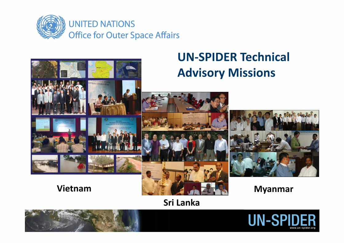
UN‐SPIDER Technical Advisory Missions
VietnamSri Lanka
Myanmar
Sudan Solomon Island
UN‐SPIDER Annual Conference in Beijing
UN‐SPIDER connects disaster managers and geospatial experts
CHALLENGES• Accessibility, restrictions…• Appropriate scale• Completeness of GIS layers• Issues: Data formats, interoperability etc.
Baseline & thematic GIS databaseInadequate availability and access limits applications of earth observation and geospatial information in disaster management
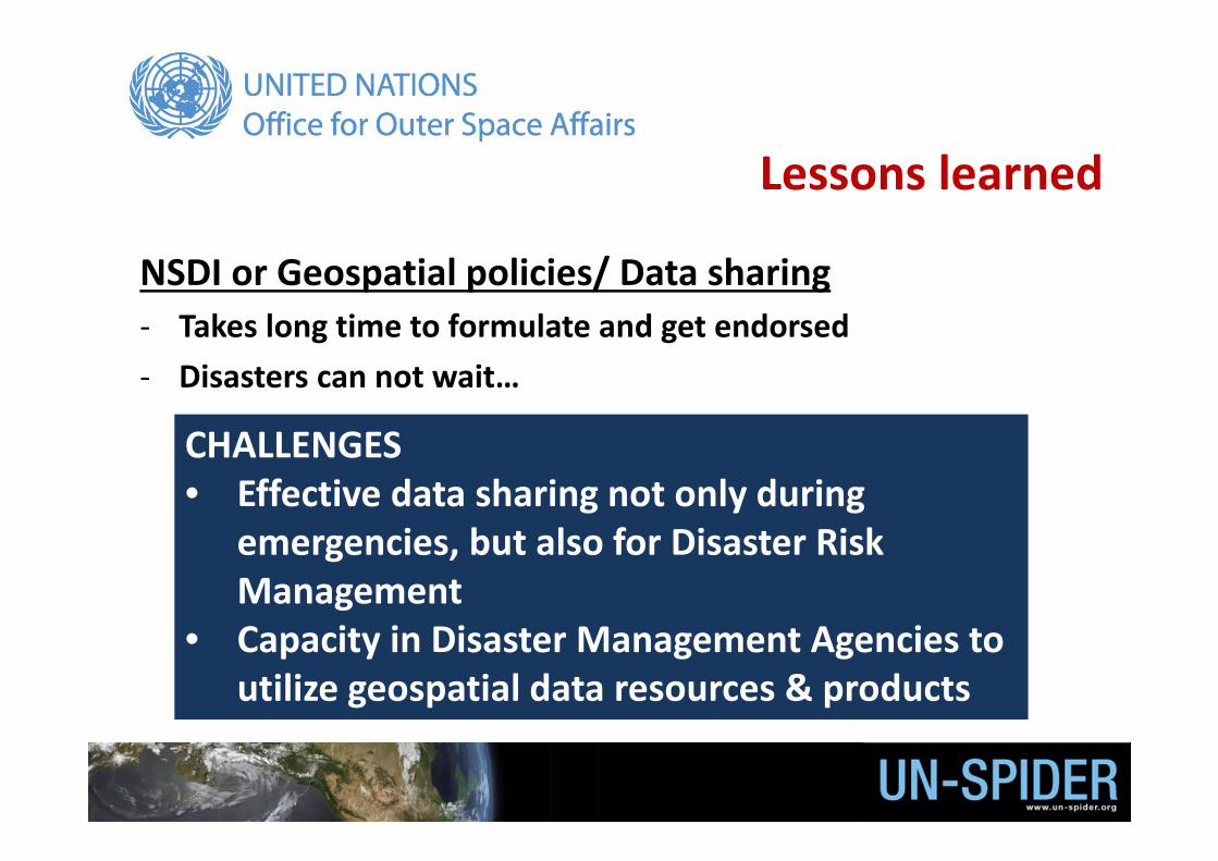
Lessons learned
CHALLENGES• Effective data sharing not only during
emergencies, but also for Disaster Risk Management
• Capacity in Disaster Management Agencies to utilize geospatial data resources & products
NSDI or Geospatial policies/ Data sharing‐ Takes long time to formulate and get endorsed ‐ Disasters can not wait…
Lessons learned
CHALLENGES• Potential of space based information is not fully
utilized• Access to remote sensing data (policies, budget…)• Expertise in using remote sensing data
Space based information for DRR and Climate Change‐ Every element of risk is ‘spatial’ in nature‐ Precise understanding of climate change impact and disaster
risk assessment calls for use of Space‐based and geospatial information
Lessons learned
UN‐SPIDER at WCDRR Proposed Working Session Earth observations to support national and local disaster‐risk reduction initiativesCo‐organisers: United Nations Office for Outer Space Affairs (UNOOSA);United Nations Platform for Space‐based information for Disaster Management and Emergency Response (UN‐SPIDER);UNESCAPGroup on Earth Observations (GEO); Committee on Earth Observation Satellites (CEOS);Food and Agriculture Organization (FAO)UNITAR’s Operational Satellite Applications Programme (UNOSAT);Ministry of Education, Culture, Sports, Science, and Technology of Japan (MEXT);Ministry of Disaster Management and Relief of Bangladesh (MoDMR);German Aerospace Center (DLR);Japan Aerospace Exploration Agency (JAXA);National Disaster Reduction Centre of China (NDRCC);Inter‐institutional Team for Geo‐Spatial Information of the Dominican Republic (EIGEO);Centre of Excellence on Space Technology for Disaster Mitigation of the Chinese Academy of Sciences and the World Academy of Sciences (CAS‐TWAS‐SDIM);The Asian Disaster Reduction Center (ADRC);The International Research Institute of Disaster Science, Tohoku University of Japan (IRIDEeS).
Towards post HFA World Conference on DRRSendai, JAPAN, 14‐18 March 2015