Year_2012 Inventory Unit Number/Name__OR-015-096A/Coglan Buttes East FORM 1 DOCUMENTATION OF BLM WILDERNESS INVENTORY FINDINGS ON RECORD 1. Is there existing BLM wilderness inventory information on all or part of this area? No (go to Form 2) Yes ___X____ (if more than one unit is within the area, list the names/numbers of those units.) a) Inventory Source: Wilderness Inventory: Oregon and Washington Final Intensive Inventory Decisions, November 1980 b) Inventory Unit Name(s)/Number(s):___Coglan Buttes/1-96______ c) Map Name(s)/Number(s): U.S. Department of the Interior: Bureau of Land Management Oregon: Intensive Wilderness Inventory Final Decisions November, 1980 d) BLM District(s)/Field Office(s):_Lakeview District/Lakeview Resource Area 2. BLM Inventory Findings on Record Existing inventory information regarding wilderness characteristics (if more than one BLM inventory unit is associated with the area, list each unit/acreage and answer each question individually for each inventory unit): Land Status Size (historic acres) Natural Condition? Y/N Outstanding Solitude? Y/N Outstanding Primitive & Unconfined Recreation? Y/N Supplemental Values? Y/N BLM 32,000 N N N Y Summarize any known primary reasons for prior inventory findings listed in this table): In 1980, the unit included the steep cliffs of Coglan Buttes on the west border and broad, low-angle slopes descending toward Abert Lake to the east. The majority of the unit was broad, sagebrush-covered flats with very little topographic relief. The unit contained 23 miles of ways, some of which had historical blading. Shores Waterhole was a substantial impact on about 2,500 acres of the unit due its large size. There were a total of five reservoirs, several watering stations, a guzzler, and a radio repeater site located in the unit. These disturbances were dispersed throughout the unit and collectively had a substantial impact on the unit's natural character. Due to the lack of vegetative and topographic screening, the unit was found to have minimal potential for solitude. With the exception of the Coglan Buttes formation, there 1
Transcript
Year_2012 Inventory Unit Number/Name__OR-015-096A/Coglan Buttes East
FORM 1
DOCUMENTATION OF BLM WILDERNESS INVENTORY FINDINGS ON RECORD
1. Is there existing BLM wilderness inventory information on all or part of this area?
No (go to Form 2) Yes ___X____ (if more than one unit is within the area, list the names/numbers of those units.)
a) Inventory Source: Wilderness Inventory: Oregon and Washington Final Intensive Inventory Decisions, November 1980
b) Inventory Unit Name(s)/Number(s):___Coglan Buttes/1-96______
c) Map Name(s)/Number(s): U.S. Department of the Interior: Bureau of Land Management Oregon: Intensive Wilderness Inventory Final Decisions November, 1980
d) BLM District(s)/Field Office(s):_Lakeview District/Lakeview Resource Area
2. BLM Inventory Findings on Record
Existing inventory information regarding wilderness characteristics (if more than one BLM inventory unit is associated with the area, list each unit/acreage and answer each question individually for each inventory unit):
Land
Status
Size
(historic
acres)
Natural
Condition?
Y/N
Outstanding
Solitude?
Y/N
Outstanding
Primitive &
Unconfined
Recreation?
Y/N
Supplemental
Values?
Y/N
BLM 32,000 N N N Y
Summarize any known primary reasons for prior inventory findings listed in this table): In 1980, the unit included the steep cliffs of Coglan Buttes on the west border and broad, low-angle slopes descending toward Abert Lake to the east. The majority of the unit was broad, sagebrush-covered flats with very little topographic relief. The unit contained 23 miles of ways, some of which had historical blading. Shores Waterhole was a substantial impact on about 2,500 acres of the unit due its large size. There were a total of five reservoirs, several watering stations, a guzzler, and a radio repeater site located in the unit. These disturbances were dispersed throughout the unit and collectively had a substantial impact on the unit's natural character.
Due to the lack of vegetative and topographic screening, the unit was found to have minimal potential for solitude. With the exception of the Coglan Buttes formation, there
1
was little opportunity for unconfined, primitive recreation. Wildlife viewing and hunting opportunities were noted, but they were not found to be outstanding. Possible supplemental values were noted as archaeological and geological values, though none were specifically identified at the time.
FORM 2
DOCUMENTATION OF CURRENT WILDERNESS INVENTORY CONDITIONS
a. Unit Number/Name:___OR-015-096A/Coglan Buttes East____
(1) Is the unit of sufficient size? Yes _X_ No
In 2005, the BLM received a citizen proposal from the Oregon Natural Desert Association (ONDA) for the 55,268-acre Coglan Buttes proposed Wilderness Study Area (WSA). ONDA included in their information a narrative report, maps, photos, photo and route logs, and GIS data. All of these materials were considered during the BLM’s wilderness inventory process for this area. The photos submitted by ONDA were taken in July of 2004 and June of 2005. They identified the area as having no interior routes which met the BLM’s wilderness inventory definition of a road (see Map, p. 39 of ONDA 2005).
Between 2008 and 2012, members of the BLM staff conducted field inventory in the area as part of a process to update its road and wilderness inventories and to gather additional information to supplement ONDA’s wilderness information. This included driving and collecting photo documentation of routes and human disturbances in the area. Using both ONDA and BLM photos, field logs, and staff field knowledge, a BLM inter-disciplinary (ID) team completed an analysis of the main routes within the area and made boundary road determinations.
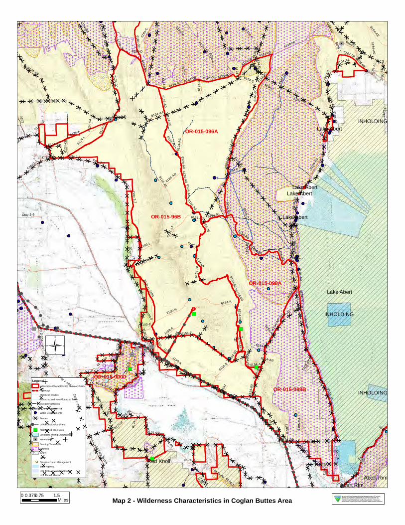
The BLM ID team determined that several of the routes ONDA identified as “ways” are in fact boundary roads defining inventory units. For this reason, the BLM found the Coglan Buttes proposed WSA is not one large roadless unit, but is comprised of several smaller inventory units (4 which met the size criteria and numerous others that did not; see Map 2) which must be evaluated individually. The results of the route analysis are documented in the route analysis forms contained in the wilderness evaluation file.
This evaluation focuses on the Coglan Buttes East unit (OR-015-96A). The unit is bounded on the north by BLM Road 6124-00 (Sand Hollow), on the east and south by the BLM Road 6151-A0 (Big Basin), and on the west by BLM Road 6124-A0 (Coglan Butte) (Map 2). Refer to the route analysis forms, photos, photo logs, and BLM ID team minutes in the wilderness inventory file for additional supporting information regarding these boundary determinations.
Following boundary determination, the BLM ID team evaluated the wilderness characteristics within the unit. These results are contained in the following sections.
2
Additional background on the process that the BLM ID team followed during this evaluation is contained in the ID team meeting notes and the document, Wilderness Inventory Process for the Lakeview Resource Area, BLM. Both documents are contained in the wilderness inventory file.
DESCRIPTION OF CURRENT CONDITIONS: The unit is located approximately 12 north of Valley Falls and about 4 miles west of Lake Abert (Map 1). The triangular-shaped inventory unit is approximately 8 miles long, ranges from 1 to 5 miles wide, and contains approximately 11,029 acres of BLM-administered lands (Map 2). This unit is much smaller than the original unit evaluated in 1980. The topography has not changed since the original inventory and consists of low-angle slopes descending towards Lake Abert with little topographic relief. The vegetation has not changed substantially and consists of sagebrush dominated plant communities.
(2) Is the unit in a natural condition? Yes _ X No _____ N/A_______
In 2005, ONDA (pages 36-37) found their much larger Coglan Buttes proposed WSA to be primarily affected by the forces of nature. However, for the reasons described above, the BLM found that this proposal did not represent one large roadless unit, but is in fact comprised of several smaller inventory units which must be evaluated individually.
The unit boundaries have changed since the 1980 inventory. The Coglan Buttes East (OR-015-096A) unit comprises the northeastern third of the historic Coglan Buttes (1-96) unit. In 1980, the larger Coglan Buttes unit (1-96) did not meet the naturalness criteria (See Form 1). The smaller unit currently contains 0.6 miles of pipeline and 1 associated water trough, and 3 waterholes. There are about 5.3 miles of open, primitive motorized routes and another 4.7 miles of reclaiming routes within the unit. Additionally, 12.8 miles of pasture division fence and 355 acres of crested wheatgrass seeding are present within the unit. These disturbances are distributed around the periphery of the unit, but continue to be substantially noticeable in close proximity (up to a quarter mile), and cannot be logically excluded from the unit boundary (Map 2).
Based upon all of the available information including photos, staff knowledge, and field review, the BLM ID team concluded that the natural character of this unit has not improved dramatically since 1980 and is currently in a marginally natural condition.
(3) Does the unit (or the remainder of the unit if a portion has been excluded due to
unnaturalness and the remainder is of sufficient size) have outstanding opportunities
for solitude? Yes No X N/A________
In 2005, ONDA (page 37) found their much larger Coglan Buttes proposed WSA provided an outstanding opportunity for solitude due to the topography present in the Coglan Buttes formation and large unit size. However, for the reasons described above, the BLM found that this proposal did not represent one large roadless unit, but is in fact comprised of several smaller inventory units which must be evaluated individually.
3
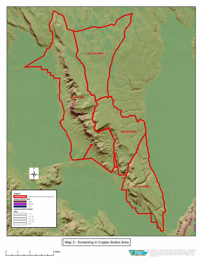
In 1980, the inventory noted that the lack of lack of topographic relief on the northeast side of the larger Coglan Buttes (1-96) unit provided a very poor opportunity for an individual to avoid the sights, sounds, and presence of others. The present unit is smaller and excludes the Coglan Buttes formation to the southwest and, as a result, is relatively flat and open. This current unit is smaller and lacks both topographic or tall vegetative screening where one can avoid the presence of others (see Map 3). Further, the area is currently open to off-highway vehicle use (see Map R-7 of Lakeview RMP/ROD) and is managed to provide motorized access, along the existing, open boundary roads and primitive motorized routes inside the unit (Map 2). This motorized access increases the likelihood of encountering other people visiting the unit. The noise associated with motorized activity may further diminish the solitude experience for those visitors attempting to get away from others.
Based upon all of the available information including photos, staff knowledge, and field review, the BLM ID team concluded that the current smaller unit lacks an outstanding opportunity for solitude.
(4) Does the unit (or the remainder of the unit if a portion has been excluded due to
unnaturalness and the remainder is of sufficient size) have outstanding opportunities
for primitive and unconfined recreation?
Yes No X N/A________
In 2005, ONDA (page 37) found their much larger Coglan Buttes proposed WSA provided an outstanding opportunity for primitive and unconfined recreation including hiking, backpacking, photography, horseback riding, and wildlife viewing. However, for the reasons described above, the BLM found that this proposal did not represent one large roadless unit, but is in fact comprised of several smaller inventory units which must be evaluated individually.
In 1980, the larger Coglan Buttes unit (1-96) was noted as having some limited wildlife viewing and hunting opportunities associated with the Coglan Buttes formation to the southwest (see Form 1). However, this formation is not part of the current unit. The ID team found that the current unit is smaller and provides some opportunities for fall antelope hunting and wildlife viewing. These primitive recreation opportunities were limited and were similar to opportunities available throughout much of the surrounding area. The unit did not offer any single unique primitive recreation opportunity or a unique diversity of primitive recreation opportunities. In addition, the unit is currently being managed to provide semi-primitive motorized recreational experiences and is open to off-highway vehicle use (see Lakeview RMP/ROD Maps R-3 and R-7). Most existing recreational use is indirectly associated with this motorized access.
Based upon all of the available information including photos, staff knowledge, and field review, the BLM ID team concluded that the unit continues to lack outstanding opportunities for primitive and unconfined recreation.
(5) Does the unit have supplemental values? Yes No N/A___X_____
4
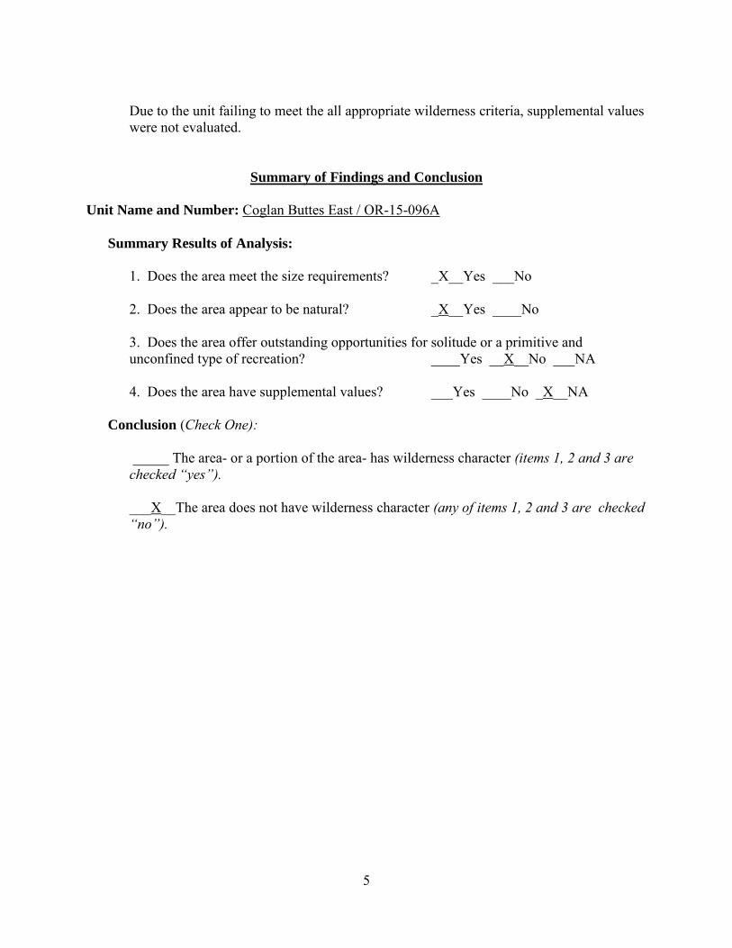
Due to the unit failing to meet the all appropriate wilderness criteria, supplemental values were not evaluated.
Summary of Findings and Conclusion
Unit Name and Number: Coglan Buttes East / OR-15-096A
Summary Results of Analysis:
1. Does the area meet the size requirements? _X__Yes ___No
2. Does the area appear to be natural? _X__Yes ____No
3. Does the area offer outstanding opportunities for solitude or a primitive and unconfined type of recreation? ____Yes __X__No ___NA
4. Does the area have supplemental values? ___Yes ____No _X__NA
Conclusion (Check One):
_____ The area- or a portion of the area- has wilderness character (items 1, 2 and 3 are checked “yes”).
___X__The area does not have wilderness character (any of items 1, 2 and 3 are checked “no”).
5
Prepared by (ID Team Member Names and Titles):
Paul Whitman: Planning Coordinator
Theresa Romasko : Assistant Field Manager
Approved bv:
Thomas .S:. Rasmussen Field Matfager
9/;??i:br 2-Date
This form documents information that constitutes an inventory finding on wildemess characteristics. It does not represent a formal/and use allocation or a final agency decision subject to administrative remedies under either 43 CFR parts 4 or 1610.5-2.
6
Year_2012 Inventory Unit Number/Name_OR-015-096B/Coglan Buttes West
FORM 1
DOCUMENTATION OF BLM WILDERNESS INVENTORY FINDINGS ON RECORD
1. Is there existing BLM wilderness inventory information on all or part of this area?
No (go to Form 2) Yes ___X____ (if more than one unit is within the area, list the names/numbers of those units.)
a) Inventory Source: Wilderness Inventory: Oregon and Washington Final Intensive Inventory Decisions, November 1980
b) Inventory Unit Name(s)/Number(s):____1-96/Coglan Buttes________
c) Map Name(s)/Number(s): U.S. Department of the Interior: Bureau of Land Management Oregon: Intensive Wilderness Inventory Final Decisions November, 1980
d) BLM District(s)/Field Office(s):_Lakeview District/Lakeview Resource Area
2. BLM Inventory Findings on Record
Existing inventory information regarding wilderness characteristics (if more than one BLM inventory unit is associated with the area, list each unit/acreage and answer each question individually for each inventory unit):
Land
Status
Size
(historic
acres)
Natural
Condition?
Y/N
Outstanding
Solitude?
Y/N
Outstanding
Primitive &
Unconfined
Recreation?
Y/N
Supplemental
Values?
Y/N
BLM 32,000 N N N Y
Summarize any known primary reasons for prior inventory findings listed in this table): In 1980, the unit included the steep cliffs of Coglan Buttes on the west border and broad, low-angle slopes descending toward Abert Lake to the east. The majority of the unit was broad, sagebrush-covered flats with very little topographic relief. The unit contained 23 miles of ways, some of which had historical blading. Shores Waterhole was a substantial impact on about 2,500 acres of the unit due its large size. There were a total of five reservoirs, several watering stations, a guzzler, and a radio repeater site located in the unit. These disturbances were dispersed throughout the unit and collectively had a substantial impact on the unit's natural character.
Due to the lack of vegetative and topographic screening, the unit was found to have minimal potential for solitude. It was noted that the cliffs of Coglan Buttes offered some
1
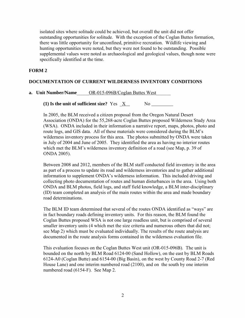
isolated sites where solitude could be achieved, but overall the unit did not offer outstanding opportunities for solitude. With the exception of the Coglan Buttes formation, there was little opportunity for unconfined, primitive recreation. Wildlife viewing and hunting opportunities were noted, but they were not found to be outstanding. Possible supplemental values were noted as archaeological and geological values, though none were specifically identified at the time.
FORM 2
DOCUMENTATION OF CURRENT WILDERNESS INVENTORY CONDITIONS
a. Unit Number/Name_____OR-015-096B/Coglan Buttes West______
(1) Is the unit of sufficient size? Yes _X No
In 2005, the BLM received a citizen proposal from the Oregon Natural Desert Association (ONDA) for the 55,268-acre Coglan Buttes proposed Wilderness Study Area (WSA). ONDA included in their information a narrative report, maps, photos, photo and route logs, and GIS data. All of these materials were considered during the BLM’s wilderness inventory process for this area. The photos submitted by ONDA were taken in July of 2004 and June of 2005. They identified the area as having no interior routes which met the BLM’s wilderness inventory definition of a road (see Map, p. 39 of ONDA 2005).
Between 2008 and 2012, members of the BLM staff conducted field inventory in the area as part of a process to update its road and wilderness inventories and to gather additional information to supplement ONDA’s wilderness information. This included driving and collecting photo documentation of routes and human disturbances in the area. Using both ONDA and BLM photos, field logs, and staff field knowledge, a BLM inter-disciplinary (ID) team completed an analysis of the main routes within the area and made boundary road determinations.
The BLM ID team determined that several of the routes ONDA identified as “ways” are in fact boundary roads defining inventory units. For this reason, the BLM found the Coglan Buttes proposed WSA is not one large roadless unit, but is comprised of several smaller inventory units (4 which met the size criteria and numerous others that did not; see Map 2) which must be evaluated individually. The results of the route analysis are documented in the route analysis forms contained in the wilderness evaluation file.
This evaluation focuses on the Coglan Buttes West unit (OR-015-096B). The unit is bounded on the north by BLM Road 6124-00 (Sand Hollow), on the east by BLM Roads 6124-A0 (Coglan Butte) and 6154-00 (Big Basin), on the west by County Road 2-7 (Red House Lane) and one interim numbered road (2100), and on the south by one interim numbered road (6154-F). See Map 2.
2
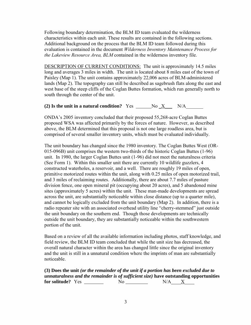
Following boundary determination, the BLM ID team evaluated the wilderness characteristics within each unit. These results are contained in the following sections. Additional background on the process that the BLM ID team followed during this evaluation is contained in the document Wilderness Inventory Maintenance Process for the Lakeview Resource Area, BLM contained in the wilderness inventory file.
DESCRIPTION OF CURRENT CONDITIONS: The unit is approximately 14.5 miles long and averages 3 miles in width. The unit is located about 8 miles east of the town of Paisley (Map 1). The unit contains approximately 22,006 acres of BLM-administered lands (Map 2). The topography can still be described as sagebrush flats along the east and west base of the steep cliffs of the Coglan Buttes formation, which run generally north to south through the center of the unit.
(2) Is the unit in a natural condition? Yes No _X___ N/A_______
ONDA’s 2005 inventory concluded that their proposed 55,268-acre Coglan Buttes proposed WSA was affected primarily by the forces of nature. However, as described above, the BLM determined that this proposal is not one large roadless area, but is comprised of several smaller inventory units, which must be evaluated individually.
The unit boundary has changed since the 1980 inventory. The Coglan Buttes West (OR-015-096B) unit comprises the western two-thirds of the historic Coglan Buttes (1-96) unit. In 1980, the larger Coglan Buttes unit (1-96) did not meet the naturalness criteria (See Form 1). Within this smaller unit there are currently 10 wildlife guzzlers, 4 constructed waterholes, a reservoir, and a well. There are roughly 19 miles of open, primitive motorized routes within the unit, along with 0.25 miles of open motorized trail, and 3 miles of reclaiming routes. Additionally, there are about 7.7 miles of pasture division fence, one open mineral pit (occupying about 20 acres), and 5 abandoned mine sites (approximately 5 acres) within the unit. These man-made developments are spread across the unit, are substantially noticeable within close distance (up to a quarter mile), and cannot be logically excluded from the unit boundary (Map 2). In addition, there is a radio repeater site with an associated overhead utility line “cherry-stemmed” just outside the unit boundary on the southern end. Though those developments are technically outside the unit boundary, they are substantially noticeable within the southwestern portion of the unit.
Based on a review of all the available information including photos, staff knowledge, and field review, the BLM ID team concluded that while the unit size has decreased, the overall natural character within the area has changed little since the original inventory and the unit is still in a unnatural condition where the imprints of man are substantially noticeable.
(3) Does the unit (or the remainder of the unit if a portion has been excluded due to
unnaturalness and the remainder is of sufficient size) have outstanding opportunities
for solitude? Yes No N/A____X____
3
Due to the unit failing to meet the naturalness criteria, opportunities for solitude were not evaluated.
(4) Does the unit (or the remainder of the unit if a portion has been excluded due to
unnaturalness and the remainder is of sufficient size) have outstanding opportunities
for primitive and unconfined recreation?
Yes No N/A___X_____
Due to the unit failing to meet the naturalness criteria, opportunities for primitive and unconfined recreation were not evaluated.
(5) Does the unit have supplemental values? Yes No N/A__X____
Due to the unit failing to meet the naturalness criteria, supplemental values were not evaluated.
Summary of Findings and Conclusion
Unit Name and Number:__OR-015-096B/Coglan Buttes West______
Summary Results of Analysis:
1. Does the area meet the size requirements? _X__Yes ___No
2. Does the area appear to be natural? ___Yes _X___No
3. Does the area offer outstanding opportunities for solitude or a primitive and unconfined type of recreation? ____Yes ____No _X__NA
4. Does the area have supplemental values? ___Yes ____No _X__NA
Conclusion (Check One):
_____ The area- or a portion of the area- has wilderness character (items 1, 2 and 3 are checked “yes”).
___X__The area does not have wilderness character (any of items 1, 2 and 3 are checked “no”).
4
Prepared by (ID Team Member Names and Titles):
Paul Whitman: Planning Coordinator
Theresa Romasko: AssJstant Field Manager
C ris Bishop: Outdoor Recmti<m Specialist
Approved by:
Thomas-If. Rasmussen Field Mattager
~Of2-Date
qj, c-ljc_ ~·
7. , Date
This form documents information that constitutes an inventory finding on wilderness characteristics. It does not represent a formal/and use allocation or a final agency decision subject to administrative remedies under either 43 CFR parts 4 or 1610.5-2.
5
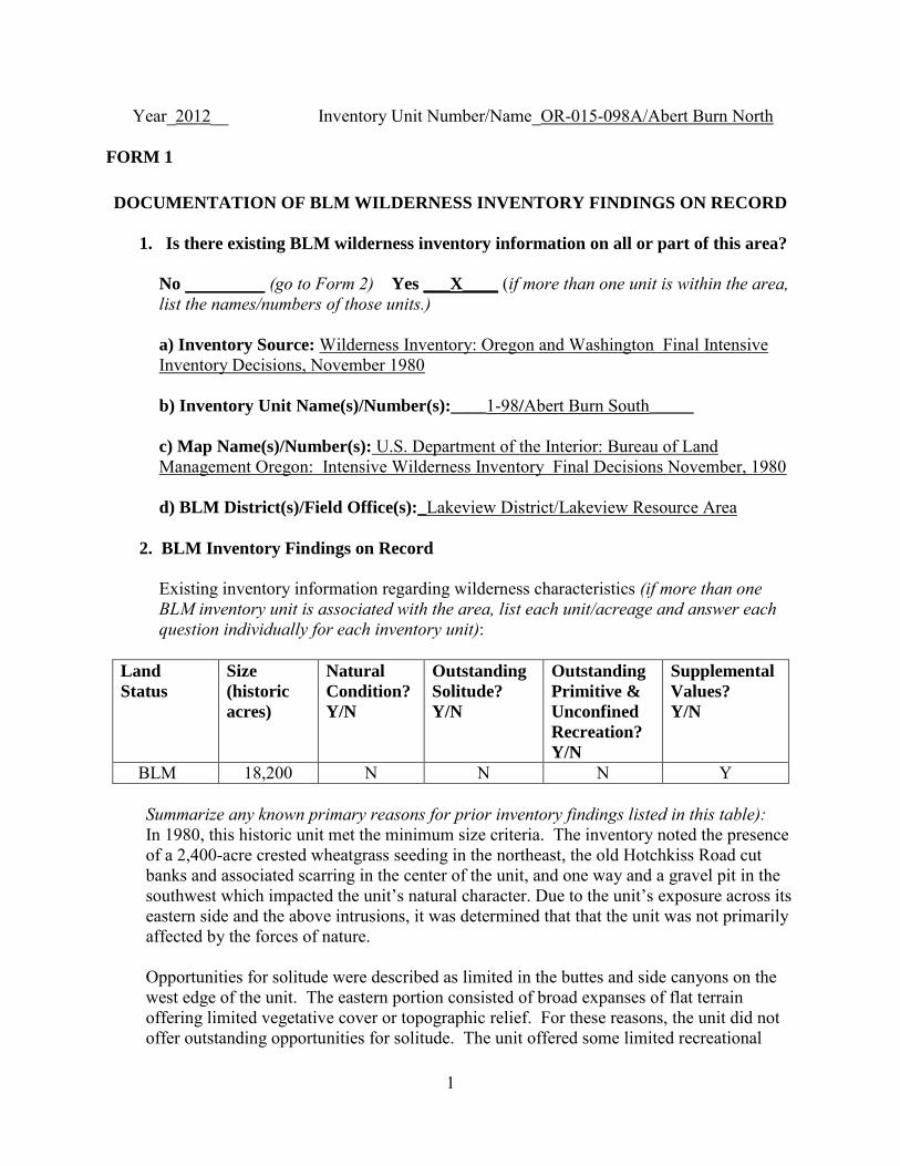
Year_2012__ Inventory Unit Number/Name_OR-015-098A/Abert Burn North
FORM 1
DOCUMENTATION OF BLM WILDERNESS INVENTORY FINDINGS ON RECORD
1. Is there existing BLM wilderness inventory information on all or part of this area?
No (go to Form 2) Yes ___X____ (if more than one unit is within the area, list the names/numbers of those units.)
a) Inventory Source: Wilderness Inventory: Oregon and Washington Final Intensive Inventory Decisions, November 1980
b) Inventory Unit Name(s)/Number(s):____1-98/Abert Burn South_____
c) Map Name(s)/Number(s): U.S. Department of the Interior: Bureau of Land Management Oregon: Intensive Wilderness Inventory Final Decisions November, 1980
d) BLM District(s)/Field Office(s):_Lakeview District/Lakeview Resource Area
2. BLM Inventory Findings on Record
Existing inventory information regarding wilderness characteristics (if more than one BLM inventory unit is associated with the area, list each unit/acreage and answer each question individually for each inventory unit):
Land
Status
Size
(historic
acres)
Natural
Condition?
Y/N
Outstanding
Solitude?
Y/N
Outstanding
Primitive &
Unconfined
Recreation?
Y/N
Supplemental
Values?
Y/N
BLM 18,200 N N N Y
Summarize any known primary reasons for prior inventory findings listed in this table): In 1980, this historic unit met the minimum size criteria. The inventory noted the presence of a 2,400-acre crested wheatgrass seeding in the northeast, the old Hotchkiss Road cut banks and associated scarring in the center of the unit, and one way and a gravel pit in the southwest which impacted the unit’s natural character. Due to the unit’s exposure across its eastern side and the above intrusions, it was determined that that the unit was not primarily affected by the forces of nature.
Opportunities for solitude were described as limited in the buttes and side canyons on the west edge of the unit. The eastern portion consisted of broad expanses of flat terrain offering limited vegetative cover or topographic relief. For these reasons, the unit did not offer outstanding opportunities for solitude. The unit offered some limited recreational
1
opportunities for wildlife observation, especially raptors along the west side of the cliffs, but the unit’s size and narrow shape limited the degree to which one could pursue other forms of primitive recreation. The unit was found not to have outstanding recreation opportunities. Possible supplemental values were noted as archaeological values, though none were specifically identified at the time.
FORM 2
DOCUMENTATION OF CURRENT WILDERNESS INVENTORY CONDITIONS
a. Unit Number/Name_____OR-015-098A/Abert Burn North______
(1) Is the unit of sufficient size? Yes _X No
In 2005, the BLM received a citizen proposal from the Oregon Natural Desert Association (ONDA) for the 55,268-acre Coglan Buttes proposed Wilderness Study Area (WSA). ONDA included in their information a narrative report, maps, photos, photo and route logs, and GIS data. All of these materials were considered during the BLM’s wilderness inventory process for this area. The photos submitted by ONDA were taken in July of 2004 and June of 2005. They identified the area as having no interior routes which met the BLM’s wilderness inventory definition of a road (see Map, p. 39 of ONDA 2005).
Between 2008 and 2012, members of the BLM staff conducted field inventory in the area as part of a process to update its road and wilderness inventories and to gather additional information to supplement ONDA’s wilderness information. This included driving and collecting photo documentation of routes and human disturbances in the area. Using both ONDA and BLM photos, field logs, and staff field knowledge, a BLM inter-disciplinary (ID) team completed an analysis of the main routes within the area and made boundary road determinations.
The BLM ID team determined that several of the routes ONDA identified as “ways” are in fact boundary roads defining inventory units. For this reason, the BLM found the Coglan Buttes proposed WSA is not one large roadless unit, but is comprised of several smaller inventory units (4 which met the size criteria and numerous others that did not; see Map 2) which must be evaluated individually. The results of the route analysis are documented in the route analysis forms contained in the wilderness evaluation file.
This evaluation focuses on the Abert Burn North (OR-015-98A) unit. The unit is bounded by BLM Roads 6154-00 (Big Basin) to the west, 6154-B0 (Abert Burn) to the north, 6104-A0 (Clark Ranch) to the east, and 6154-A0 (Hotchkiss) to the south (Map 2). Refer to the route analysis forms, photos, photo logs, and BLM ID team minutes in the wilderness inventory file for additional supporting information regarding these boundary determinations.
2
Following boundary determination, the BLM ID team evaluated the wilderness characteristics within the unit. These results are contained in the following sections. Additional background on the process that the BLM ID team followed during this evaluation is contained in the document Wilderness Inventory Maintenance Process for the Lakeview Resource Area, BLM contained in the wilderness inventory file.
DESCRIPTION OF CURRENT CONDITIONS: The unit is located about 7.5 miles north of Valley Falls (Map 1). The unit is approximately 6.7 miles long, varies in width from 0.5 to 3 miles, and contains approximately 9,004 acres of BLM-administered lands. The topography has not changed since the original inventory and can still be described as a large fault block with a steep escarpment to the west with a low angle slope falling away toward the shore of Lake Abert on the east.
(2) Is the unit in a natural condition? Yes _X No ____ N/A_______
In 2005, ONDA (pages 36-37) found their much larger Coglan Buttes proposed WSA to be primarily affected by the forces of nature. However, for the reasons described above, the BLM found that this proposal did not represent one large roadless unit, but is in fact comprised of several smaller inventory units which must be evaluated individually.
The unit boundaries have changed since the 1980 inventory. The current Abert Burn North (OR-015-098A) unit comprises roughly the northern half of the historic 1-98 unit. About a third of the unit burned in 1971 and was seeded to crested wheatgrass. This seeding remains evident today, but is being invaded by sagebrush and is returning to a more natural appearing condition. About a third of the unit burned in 1986, but was allowed to revegetate naturally. Current vegetation consists primarily of grasses and sagebrush.
In 1996, the BLM designated Lake Abert and surrounding public lands as an Area of Critical Environmental Concern (ACEC). The ACEC management plan recognized and provided special management for four important resource values or processes in this area including wildlife resources, cultural resources, scenic values, and ecological processes. The western edge of the ACEC overlaps with the eastern edge of this inventory unit (see Map 2). These wildlife values and ecological processes were primarily associated with Lake Abert proper, which lies to the east and just outside of the unit boundary.
Within this smaller unit there are 4 guzzlers, 0.15 miles of pipelines and 1 associated water trough. There are roughly 1.5 miles of open, primitive motorized routes along with another 4 miles of reclaiming routes within the unit. Additionally, 2.9 miles of pasture division fence is present within the unit. There are 2 abandoned mining sites covering several acres. These man-made developments are spread across the unit (Map 2), are substantially noticeable within close distances (up to a quarter mile) and less noticeable from farther distances. However, the unit currently appears to be primarily affected by the forces of nature.
3
Based on a review of all the available information including photos, staff knowledge, and field review, the BLM ID team concluded that the unit was in a natural condition where the imprint of man is substantially unnoticeable.
(3) Does the unit (or the remainder of the unit if a portion has been excluded due to unnaturalness and the remainder is of sufficient size) have outstanding opportunities
for solitude? Yes No X N/A________
In 2005, ONDA (page 37) found their much larger Coglan Buttes proposed WSA provided an outstanding opportunity for solitude due to the topography present in the Coglan Buttes formation and large unit size. However, for the reasons described above, the BLM found that this proposal did not represent one large roadless unit, but is in fact comprised of several smaller inventory units which must be evaluated individually.
The 1980 inventory noted that the larger 1-98 unit had limited opportunities for solitude (see Form 1). The current unit is smaller, has predominantly broad, flat terrain and lacks tall vegetative screening. There is some topographic screening along the western edge of the unit associated with the Coglan Buttes formation, but the eastern face is relatively exposed and provides few places where one can avoid the presence of others (see Map 3). Further, the area is currently open to off-highway vehicle use (see Map R-7 of Lakeview RMP/ROD) and is managed to provide motorized access, particularly along the existing, open boundary roads and primitive motorized routes inside the unit (see Map 2). This motorized access increases the likelihood of encountering other people visiting the unit. The noise associated with motorized activity may further diminish the solitude experience for those visitors attempting to get away from others.
Based on a review of all the available information, the ID team concluded that opportunities for solitude have not changed since 1980 and the current, smaller unit still does not have an outstanding opportunity for solitude.
(4) Does the unit (or the remainder of the unit if a portion has been excluded due to unnaturalness and the remainder is of sufficient size) have outstanding opportunities
for primitive and unconfined recreation?
Yes No X N/A________
In 2005, ONDA (page 37) found their much larger Coglan Buttes proposed WSA provided an outstanding opportunity for primitive and unconfined recreation including hiking, backpacking, photography, horseback riding, and wildlife viewing. However, for the reasons described above, the BLM found that this proposal did not represent one large roadless unit, but is in fact comprised of several smaller inventory units which must be evaluated individually.
The BLM ID Team considered the primitive recreation opportunities identified in 1980 (see Form 1) and those identified by ONDA and determined that the current unit is smaller, and hunting and wildlife observation continue to be the primary primitive recreation opportunities available in the area. These primitive recreation opportunities
4
were similar to opportunities available throughout much of the surrounding area. The unit did not offer any single unique primitive recreation opportunity or a unique diversity of primitive recreation opportunities. In addition, the BLM currently manages the area to provide semi-primitive motorized recreational experiences and is open off-highway vehicle use (see Maps R-3 and R-7 of Lakeview RMP/ROD). Most existing recreational use is indirectly associated with this motorized access.
Based upon all of the available information including photos, staff knowledge, and field review, the BLM ID team concluded that the unit continues to lack outstanding opportunities for primitive and unconfined recreation.
(5) Does the unit have supplemental values? Yes No N/A___X___
Since the unit did not meet all the required criteria, supplemental values were not evaluated.
Summary of Findings and Conclusion
Unit Name and Number:__OR-015-099A/Abert Burn North______
Summary Results of Analysis:
1. Does the area meet the size requirements? __X_Yes ___No
2. Does the area appear to be natural? _X__Yes ____No
3. Does the area offer outstanding opportunities for solitude or a primitive and unconfined type of recreation? ____Yes ____No _X__NA
4. Does the area have supplemental values? ___Yes ____No _X__NA
Conclusion (Check One):
_____ The area- or a portion of the area- has wilderness character (items 1, 2 and 3 are checked “yes”).
___X__The area does not have wilderness character (any of items 1, 2 and 3 are checked “no”).
5
Prepared by (ID Team Member Names and Titles):
Paul Whitman: Planning Coordinator
Theresa Romasko : Assistant Field Manager
Approved by:
~de ' I
Date
a L. _J, _ I~ ~
9/?:<~~~ Date
This form documents information that constitutes an inventory finding on wildemess characteristics. It does not represent a formal/and use allocation or a final agency decision subject to administrative remedies under either 43 CFR parts 4 or 1610.5-2.
6
Year_2012______ Inventory Unit Number/Name_OR-015-098B/Abert Burn South
FORM 1
DOCUMENTATION OF BLM WILDERNESS INVENTORY FINDINGS ON RECORD
1. Is there existing BLM wilderness inventory information on all or part of this area?
No (go to Form 2) Yes ___X____ (if more than one unit is within the area, list the names/numbers of those units.)
a) Inventory Source: Wilderness Inventory: Oregon and Washington Final Intensive Inventory Decisions, November 1980
b) Inventory Unit Name(s)/Number(s):____1-98/Abert Burn South_____
c) Map Name(s)/Number(s): U.S. Department of the Interior: Bureau of Land Management Oregon: Intensive Wilderness Inventory Final Decisions November, 1980
d) BLM District(s)/Field Office(s):_Lakeview District/Lakeview Resource Area
2. BLM Inventory Findings on Record
Existing inventory information regarding wilderness characteristics (if more than one BLM inventory unit is associated with the area, list each unit/acreage and answer each question individually for each inventory unit):
Land
Status
Size
(historic
acres)
Natural
Condition?
Y/N
Outstanding
Solitude?
Y/N
Outstanding
Primitive &
Unconfined
Recreation?
Y/N
Supplemental
Values?
Y/N
BLM 18,200 N N N Y
Summarize any known primary reasons for prior inventory findings listed in this table): In 1980, this historic unit met the minimum size criteria. The inventory noted the presence of a 2,400-acre crested wheatgrass seeding in the northeast, the old Hotchkiss Road cut banks and associated scarring in the center of the unit, and one way and a gravel pit in the southwest which impacted the unit’s natural character. Due to the unit’s exposure across its eastern side and the above intrusions, it was determined that that the unit was not primarily affected by the forces of nature.
Opportunities for solitude were described as limited in the buttes and side canyons on the west edge of the unit. The eastern portion consisted of broad expanses of flat terrain offering limited vegetative cover or topographic relief. For these reasons, the unit did not offer outstanding opportunities for solitude. The unit offered some limited recreational
1
opportunities for wildlife observation, especially raptors along the west side of the cliffs, but the unit’s size and narrow shape limited the degree to which one could pursue other forms of primitive recreation. The unit was found not to have outstanding recreation opportunities. Possible supplemental values were noted as archaeological values, though none were specifically identified at the time.
FORM 2
DOCUMENTATION OF CURRENT WILDERNESS INVENTORY CONDITIONS
a. Unit Number/Name_____OR-015-098B/Abert Burn South______
(1) Is the unit of sufficient size? Yes _X No
In 2005, the BLM received a citizen proposal from the Oregon Natural Desert Association (ONDA) for the 55,268-acre Coglan Buttes proposed Wilderness Study Area (WSA). ONDA included in their information a narrative report, maps, photos, photo and route logs, and GIS data. All of these materials were considered during the BLM’s wilderness inventory process for this area. The photos submitted by ONDA were taken in July of 2004 and June of 2005. They identified the area as having no interior routes which met the BLM’s wilderness inventory definition of a road (see Map, p. 39 of ONDA 2005).
Between 2008 and 2012, members of the BLM staff conducted field inventory in the area as part of a process to update its road and wilderness inventories and to gather additional information to supplement ONDA’s wilderness information. This included driving and collecting photo documentation of routes and human disturbances in the area. Using both ONDA and BLM photos, field logs, and staff field knowledge, a BLM inter-disciplinary (ID) team completed an analysis of the main routes within the area and made boundary road determinations.
The BLM ID team determined that several of the routes ONDA identified as “ways” are in fact boundary roads defining inventory units. For this reason, the BLM found the Coglan Buttes proposed WSA is not one large roadless unit, but is comprised of several smaller inventory units (4 which met the size criteria and numerous others that did not; see Map 2) which must be evaluated individually. The results of the route analysis are documented in the route analysis forms contained in the wilderness evaluation file.
This evaluation focuses on the Abert Burn South unit (OR-015-98B). The unit is bounded by BLM road 6154-00 (Big Basin) to the west, 6104-A0 (Clark Ranch) to the east, and 6154-A0 (Hotchkiss) to the north (Map 2). Refer to the route analysis forms, photos, photo logs, and BLM ID team minutes in the wilderness inventory file for additional supporting information regarding these boundary determinations.
2
Following boundary determination, the BLM ID team evaluated the wilderness characteristics within the unit. These results are contained in the following sections. Additional background on the process that the BLM ID team followed during this evaluation is contained in the document Wilderness Inventory Maintenance Process for the Lakeview Resource Area, BLM contained in the wilderness inventory file.
DESCRIPTION OF CURRENT CONDITIONS: The unit is located about 3 miles north of Valley Falls (Map 1), is approximately 8 miles long, is about 3 miles in width at the center, and tapers at the north and south ends. The unit contains approximately 9,247 acres of BLM-administered lands. The topography has not changed since the original inventory and can still be described as a large fault block with a steep escarpment to the southwest with a low angle slope falling away to the northeast towards the shore of Lake Abert.
(2) Is the unit in a natural condition? Yes __X_ No _____ N/A_______
In 2005, ONDA (pages 36-37) found their much larger Coglan Buttes proposed WSA to be primarily affected by the forces of nature. However, for the reasons described above, the BLM found that this proposal did not represent one large roadless unit, but is in fact comprised of several smaller inventory units which must be evaluated individually.
The unit boundaries have changed since the original inventory. The current Abert Burn South (OR-015-098B) unit comprises roughly the southern half of the historic 1-98 unit. The majority of the unit burned in 1986, but was allowed to revegetate naturally. Current vegetation consists primarily of grasses and sagebrush.
In 1996, the BLM designated Lake Abert and surrounding public lands as an Area of Critical Environmental Concern (ACEC). The ACEC management plan recognized and provided special management for four important resource values or processes in this area including wildlife resources, cultural resources, scenic values, and ecological processes. The western edge of the ACEC overlaps with the eastern edge of this inventory unit (see Map 2). These wildlife values and ecological processes were primarily associated with Lake Abert proper, which lies to the east and just outside of the unit boundary.
Within this smaller unit there is 1 wildlife guzzler and 3 wells with associated troughs. There is one mineral pit totaling less than an acre. There are approximately 7.6 miles of open, primitive motorized routes within the unit. Additionally 15 miles of pasture division fence is present and located mostly near the perimeter of the unit. These man-made developments are spread across the unit, are substantially noticeable within close distances (up to a quarter mile) and less noticeable from farther distances. The majority of these disturbances are located primarily around the unit periphery. Currently the unit appears to be primarily affected by the forces of nature.
Based on a review of all the available information including photos, staff knowledge, and field review, the BLM ID team concluded that the unit is generally in a natural condition where the imprint of man is substantially noticeable.
3
(3) Does the unit (or the remainder of the unit if a portion has been excluded due to unnaturalness and the remainder is of sufficient size) have outstanding opportunities
for solitude? Yes No X N/A_______
In 2005, ONDA (page 37) found their much larger Coglan Buttes proposed WSA provided an outstanding opportunity for solitude due to the topography present in the Coglan Buttes formation and large unit size. However, for the reasons described above, the BLM found that this proposal did not represent one large roadless unit, but is in fact comprised of several smaller inventory units which must be evaluated individually.
The 1980 inventory noted that the larger 1-98 unit had limited opportunities for solitude (see Form 1). The current unit is smaller, has predominantly broad, flat terrain with limited topographic relief on the northeastern half, and lacks tall vegetative screening throughout the unit. The southwestern half of the unit has some topographic relief related to the Coglan Buttes formation, but the southwestern side is completely exposed to Highway 31 (see Map 3). There are small pockets within the unit where one can avoid the presence of others, but these are limited to the northeastern slopes and side canyons of the Coglan Buttes formation. Further, the area is currently open to off-highway vehicle use (see Map R-7 of Lakeview RMP/ROD) and is managed to provide motorized access, particularly along the existing, open boundary roads and primitive motorized routes inside the unit (see Map 2). This motorized access increases the likelihood of encountering other people visiting the unit. The noise associated with motorized activity may further diminish the solitude experience.
Based on a review of all the available information, the ID team concluded that opportunities for solitude have not changed since 1980 and the current, smaller unit still does not have an outstanding opportunity for solitude.
(4) Does the unit (or the remainder of the unit if a portion has been excluded due to unnaturalness and the remainder is of sufficient size) have outstanding opportunities
for primitive and unconfined recreation?
Yes No X N/A________
In 2005, ONDA (page 37) found their much larger Coglan Buttes proposed WSA provided an outstanding opportunity for primitive and unconfined recreation including hiking, backpacking, photography, horseback riding, and wildlife viewing. However, for the reasons described above, the BLM found that this proposal did not represent one large roadless unit, but is in fact comprised of several smaller inventory units which must be evaluated individually.
The BLM ID Team considered the primitive recreation opportunities identified in 1980 (see Form 1) and those identified by ONDA and determined that the current unit is smaller, and hunting and wildlife observation continue to be the primary primitive recreation opportunities available in the area. These primitive recreation opportunities were similar to opportunities available throughout much of the surrounding area. The
4
unit did not offer any single unique primitive recreation opportunity or a unique diversity of primitive recreation opportunities. In addition, the BLM currently manages the area to provide semi-primitive motorized recreational experiences and is open off-highway vehicle use (see Maps R-3 and R-7 of Lakeview RMP/ROD). Most existing recreational use is indirectly associated with this motorized access.
Based upon all of the available information including photos, staff knowledge, and field review, the BLM ID team concluded that the unit continues to lack outstanding opportunities for primitive and unconfined recreation.
(5) Does the unit have supplemental values? Yes No N/A____X__
Since the unit did not meet all the required criteria, supplemental values were not evaluated.
Summary of Findings and Conclusion
Unit Name and Number:__OR-015-096B/Abert Burn South______
Summary Results of Analysis:
1. Does the area meet the size requirements? _X__Yes ___No
2. Does the area appear to be natural? __X_Yes ____No
3. Does the area offer outstanding opportunities for solitude or a primitive and unconfined type of recreation? ____Yes __X__No ___NA
4. Does the area have supplemental values? ___Yes ____No _X__NA
Conclusion (Check One):
_____ The area- or a portion of the area- has wilderness character (items 1, 2 and 3 are checked “yes”).
___X__The area does not have wilderness character (any of items 1, 2 and 3 are checked “no”).
____ ________ Todd Forbes: Assistant Field Manager Date
Paul Whitman: Planning Coordinator Date
Theresa Romasko: Assistant Field Manager Date
Chris Bishop: Outdoor Recreation Specialist Date
Approved by:
Thomas R. Rasmussen Date
Field Manager
This form documents information that constitutes an inventory finding on wilderness characteristics. It does not
represent a formal land use allocation or a final agency decision subject to administrative remedies under either
43 CFR parts 4 or 1610.5-2.
6
Year_2012______ Inventory Unit Number/Name_Coglan Buttes Area
FORM 1
DOCUMENTATION OF BLM WILDERNESS INVENTORY FINDINGS ON RECORD
1. Is there existing BLM wilderness inventory information on all or part of this area?
No (go to Form 2) Yes ___X____ (if more than one unit is within the area, list the names/numbers of those units.)
a) Inventory Source: Wilderness Inventory: Oregon and Washington Final Intensive Inventory Decisions, November 1980
b) Inventory Unit Name(s)/Number(s):__1-96/Coglan Buttes_and 1-98/Abert Burn South
c) Map Name(s)/Number(s): U.S. Department of the Interior: Bureau of Land Management Oregon: Intensive Wilderness Inventory Final Decisions November, 1980
d) BLM District(s)/Field Office(s):_Lakeview District/Lakeview Resource Area
2. BLM Inventory Findings on Record
Existing inventory information regarding wilderness characteristics (if more than one BLM inventory unit is associated with the area, list each unit/acreage and answer each question individually for each inventory unit):
Unit#/
Name
Size
(historic
acres)
Natural
Condition?
Y/N
Outstanding
Solitude?
Y/N
Outstanding
Primitive &
Unconfined
Recreation?
Y/N
Supplemental
Values?
Y/N
1-96 32,000 N N N Y 1-98 18,200 N N N Y
Summarize any known primary reasons for prior inventory findings listed in this table): Some of these small units were evaluated in 1980 as part of the larger 1-96 and 1-98 inventory units. Other small units in the vicinity did not meet the minimum size criteria in 1980 and were dropped from further consideration without much documentation.
1
FORM 2
DOCUMENTATION OF CURRENT WILDERNESS INVENTORY CONDITIONS
a. Unit Number/Name Coglan Buttes Area/Small Unnumbered Units
(1) Is the unit of sufficient size? Yes No X
In 2005, the BLM received a citizen proposal from the Oregon Natural Desert Association (ONDA) for the 55,268-acre Coglan Buttes proposed Wilderness Study Area (WSA). ONDA included in their information a narrative report, maps, photos, photo and route logs, and GIS data. All of these materials were considered during the BLM’s wilderness inventory process for this area. The photos submitted by ONDA were taken in July of 2004 and June of 2005. They identified the area as having no interior routes which met the BLM’s wilderness inventory definition of a road (see Map, p. 39 of ONDA 2005).
Between 2008 and 2012, members of the BLM staff conducted field inventory in the area as part of a process to update its road and wilderness inventories and to gather additional information to supplement ONDA’s wilderness information. This included driving and collecting photo documentation of routes and human disturbances in the area. Using both ONDA and BLM photos, field logs, and staff field knowledge, a BLM inter-disciplinary (ID) team completed an analysis of the main routes within the area and made boundary road determinations.
The BLM ID team determined that several of the routes ONDA identified as “ways” are in fact boundary roads defining inventory units. The results of the route analysis are documented in the route analysis forms contained in the wilderness evaluation file. For this reason, the BLM found the Coglan Buttes proposed WSA is not one large roadless unit, but is comprised of several smaller inventory units, 4 which met the size criteria and 12 others that did not (see Map 2). This evaluation focuses on the 12 small, unnumbered units, all of which are less than 5,000 acres in size and failed to meet the size criteria or any of the exceptions to the size criteria. Based on this determination there was no need for the BLM ID team to evaluate these units further.
Additional background on the process that the BLM ID team followed during this evaluation is contained in the document Wilderness Inventory Maintenance Process for the Lakeview Resource Area, BLM contained in the wilderness inventory file.
DESCRIPTION OF CURRENT CONDITIONS: These units are scattered throughout the Coglan Buttes area and vary from 2.5 to 15 miles north of Valley Falls. Many are located along Highway 31 or along the western edge of the evaluation area (see Maps 1 and 2).
2
(2) Is the unit in a natural condition? Yes No ______ N/A___X____
Naturalness was not evaluated as the units did not meet the minimum size criteria.
(3) Does the unit (or the remainder of the unit if a portion has been excluded due to unnaturalness and the remainder is of sufficient size) have outstanding opportunities
for solitude? Yes No N/A____X____
Solitude opportunities were not evaluated as the units did not meet the minimum size criteria.
(4) Does the unit (or the remainder of the unit if a portion has been excluded due to unnaturalness and the remainder is of sufficient size) have outstanding opportunities
for primitive and unconfined recreation?
Yes No N/A___X____
Recreation opportunities were not evaluated as the units did not meet the minimum size criteria.
(5) Does the unit have supplemental values? Yes No N/A__X____
Supplemental values were not evaluated as the units did not meet the minimum size criteria.
3
Summary of Findings and Conclusion
Unit Name and Number Coglan Buttes Area/Small Unnumbered Units
Summary Results of Analysis:
1. Does the area meet the size requirements? ___Yes __X_No
2. Does the area appear to be natural? ___Yes ____No _X__NA
3. Does the area offer outstanding opportunities for solitude or a primitive and unconfined type of recreation? ____Yes ____No _X__NA
4. Does the area have supplemental values? ___Yes ____No _X__NA
Conclusion (Check One):
_____ The area- or a portion of the area- has wilderness character (items 1, 2 and 3 are checked “yes”).
___X__The area does not have wilderness character (any of items 1, 2 and 3 are checked “no”).
4
Prepared by (ID Team Member Names and Titles):
Paul Whitman: Planning Coordinator
Theresa Romasko: Assistant Field Manager
Approved by:
Thomas X~Rasmussen Field Manager
9/.z_0z:_ ~· Date
9'a(:?~lz Date
CJfs-/zc_ Date
Date
This form documents information that constitutes an inventory .finding on wilderness c/wracteri~·Jics. It does not represent a formal/and use allocation or a .final agency decision subject to administrative remedies under either 43 CFR parts 4 or 1610.5-2.
5
Lake
Cou
nty
Klam
ath C
ounty
Lake County
Lake
Cou
nty
Harn
ey C
ounty
Deschutes County Map 1 - Wilderness Characteristics Evaluation Area
Fort Rock
Christmas Valley
Silver Lake
Summer Lake
Paisley
Valley Falls
Plush
Lakeview Adel
£395¤
LegendResource Area BoundaryWilderness Characteristics Inventory Area Cities Major Utility Corridors Major Roads
02.7 55 .5 11 Miles
.
No warrant is made by the Bureau of Land Management as to the accuracy,reliabilit
yy, or completeness of these data for individual or aggregate use with
other data. Original data were compiled from various sources. This informationmay not meet National Map Accuracy Standards. This product was developedthrough digital means and may be updated without notification.
New Pine Creek
"/
!
!!
!!
!!
!
!!
!!
!!
!!
!!
!!
!!
!!
!!
!
!!
!!
!
!
!
!
!
!
DD
DDDD
DDDD
DD
DD
DD DD DDDD
DDDD
DD
DDDD
DDDD
DDDD
DD
DD
DDDD
DDDD
DDDD
DDDD
DDDD
DD
DD
DDDD
DDDD
DDDD
DDDDDD
DDDD
DDDD
DDDD
DD
DD DD
DD
DD DDDDDD
DDDD
DD
DDDD
DDDDDDDD
DDDD
DDDDDD
DDDDDDDDDD
DD
DD DD DD DDDD
DDDD
DD
DD
DD
DDDD
DDDD
DDDD
DDDDDD
DD DD
DDDD
DD
DDDD
DDDD
DD
DDDD
DDDD
DDDD
DD
DDDD
DD
DDDD
DDDD
DD
DDDD
DD
DD DDDD
DD
DDDD
DDDD
DDDD
DD DD DD DDDD
DDDD
DD DD DD DD DD DD DD DD
DD
DD DD
DDDD
DDDD
DD
DD
DDDDDDDDDD
DD
DD DDDDDDDDDD
DD
DD
DD
DD
DD
DDDD
DD
DDDD
DD
DDDDDD
DD
DD
DD
DD
DDDD
DDDDDD
DDDD
DDDD
DDDD
DDDD
DDDDDD
DDDD
DD
DDDD
DDDD
DDDD
DD
DDDD
DDDDDD
DDDD DD
DDDD
DD
DDDD
! !
!
! ! ! ! ! ! ! !
! !
!
! !
! !
! !
! !
!
!
!
!
!
!
!
!
!
!
!
!
!
!
!
!
!
!
!
! !
! !
! !
! !
! !
!
!
! ! ! ! ! ! ! !
! !
!
!
!
!!
!
!
!
!
!! ! ! !
!
!
!
!!
!
!
!
!
!
!
! !
DD DD DD DD DD
DDDD
DD
DD DD
DDDD
DD DD
DD DD
DD DD
DD DD DD DD DD
DD DD DD DD DD
DD DD
DD DD DD
DD DD DD
DD
DD DD DD DD DD DD
DD DD
DD DD DD
DD DD
DD DD DD DD
DD DD DD
DD
DD DD DD DD
DD DD DD DD DD
DD DD
DD DD DD
DD DD
DD DD DD DD
DD DD DD DD
DD
DD DD DD
DD DD DD DD
DD DD DD
DD DD DD
DD DD DD
DD DD DD DD
DD DD
DD
DD DD DD DD DD DD DD DD DD
DD DD
DD DD
DD DD
DD DD
DD DD
DD DD
DD DD DDDD
DDDD
DD DD
DD DD
DD DD DD
DD DD DD DD DD
DD DD DD
DD DD DD
DD DD DD
DD
DDDD DD
DD
DD DD
DD DD DD DD DD DD
DD
DD
DD DD
DD
DD
DD DD
DD DD DD
DD DD DD
DD DD
DD DD
DD
DD DD DD DD DD DD
DD
DD
DD DD
DD DD
DD DD DD
DD DD DD DD DD
DD DD
DD DD
DD DD
DD
DD
DD DD DD DD
DD DD DD DD DD DD
DD
DD DD DD DD DD DD DD DD DD DD
DD DD DD DD DD DD
DD
DD DD DD
DD DD
DD DD
DDDD
DD DD
DD
DD
DD DD DD
DD DD DD
DD DD DD DD DD DD DD DD DD DD
DD DD
DD DD DDDD DD
DD
DD DDDD
DD DDDD
DD
DD DD DD DD DD DD DD DD DD
DDDD
DD DD
DD DD
DD DD
DD DD
DD DDDD
DD
DDDD
DD DD DD
DD DD
DD DD DD DD DD DD DD DD DD
DD DD DD DD DD DD
DD DD DD DD DD DD DD DD DD DD
DD
DD DD DD DD DD DD
DDDD
DD DD
DD DD DD DD
DD
DD DD DD
DD DD DD
DDDD DD DD DD DD DD DD
DD
DD DD
DD DD DD DD
DD DD DD
DD DD
DD
DD DD DD DD DD DD
DD
DD
DD DD DD
DD
DD DD
DD DD DD
DDDD
DD DD DD
DD DDDD DD DD DD
DD DD DD DD
DD
DD DD
DD
DD DD
DD
DD DD DD
DD
DD DD DD
DD
DD DD DD DD
DD DD
DD DD
DD DD
DD DD DD
DD DD
DD DD DD DD
DD DD DD
DD
DD DDDDDDDD
DD
DD DD DD DDDD
DD
DD
DD DD
DD
DD DD DD
DD
DD
DD DD
DD
DD
DD
DD DDDD DD DD DD
DD DD
DD
DD DD DD
DD
DD
DDDDDD
DD
DD DD DDDD
DD DDDD
DD DDDD
DD
DD DD
DD DD
DDDDDDDD
DDDD
DDDD
DD DD
DD DD DD DD DD
DD DD DD
DD DD
2100
6154
-Q
C
1198
6154-O
6154-F
6124-K 21
02
6124-IA
6134-AB
6124-G
2100-G
6124-L
6104-AE1195-D
2100-H
6184
-C
6154-K
2100-I
1199
1195
-DA
6104-I
1198-A
6154-E
6124
-AF
6124-I
6154-G
6154-S
6124-AD
6124-N
1195
6154-T
1126
6184-AE
2100-F
1195-B
1195-DB
6124
-H
6174-AA
6104-AF
6154-R
6124
-AC
2100-B
6145-N
6104-J
6174
-C
6104-AA
6124-AA
6174
-D
6154-P
2103
6124-J
6124-KC
6154-Alt
6104
-AB
1192
2101
6124
-D
2100-L
6154-AE
6124-BA
6154-AA
2100-E
6174-J
6114
-AA
2107
1193
2100-K
6174-F
2107
-C
6124-E
6124-GA
1191
TEMP
6104-A
G
1195
-DC
6124-AE
1194
6124-F
0180
6154-AB
6174
-H
6124-KG
6174-AC
6154-AC
6124
-KA
6124-AG
6154-I
1199-A
6184-D
0 79
6104-AD
TEMP
C
C
6154-00
6184-00
6144-00
6124-B0
6124-00
6174-A0
Cnty 2-9
6104-0-A
6154
-A0
6124-A0
6104-00
6104
-A0
6154
-B0
6184
-A0
6174-00
Cnty 2-7
Cnty 2-10A
6154-B0
6174-00
6154-00 Cnty 2-7
6154-00
6124-00
6104-A0
Cnty 2-7 Cnty 2-7
6124-00
6154
-00
6104
-A0
6104-A0
6124-A0
6154
-00
Cnty 2-10A
6124-A0
6124-A0
6154-B0
6104-00
6174-00
6154
-A0
6154-00
6104-A0
6174-A0
6174-00
6124-00
6124-00
6124
-00
6154-00
Cnty 2-10A
Cnty 2-10A
Cnty 2-10A
Cnty 2-7
6104-A0
6174-00
6124-00
6104-A0
6154-A
0
6154
-00
6124-00
6154
-00
6154
-00
6184-A0
6154
-00
6154-00
Cnty 2-10A
6104-A0
6104-00
6124-A0
6174
-A0
6104
-A0
6124-00
6174-00
6174-00
6154-B0
6124-00
6154-0
0
6124-B0
6154-00
6124-A0
6174
-A0
6124-A0
6174
-00
6154-00
DD
DD DD"/
6124
-KB
DD
"/
OR-015-096A Lake Abert INHOLDING
Lake AbertLake Abert
OR-015-96B
DDDD
Lake Abert
DD
DD
"/
OR-015-098A Lake Abert
")
")
"/
!
« Legend
Wilderness Characteristics Inventory Units HighwaysMotorized Routes Motorized and Non-Motorized Trails Reclaiming Routes
Water Developments
DD
Water Developments
Fences
LVRA Distribution Lines Abandoned Mine Sites Locatable Mining Disturbances Mineral Pits Seeding Treatments Wildfires ACEC Other Bureau of Land Management State AgencyU.S. Fish and Wildlife Service U.S. Forest Service
DD
OR-015-0000
DD
/ "" / "/
")
")
"/
INHOLDING
")
OR-015-098B
DD
DD DD
")Red Knoll
DD
INHOLDING
1"/
Abert Rim Abert Rim
0 0.3750.75 1.5Miles Map 2 - Wilderness Characteristics in Coglan Buttes Area
OR-015-96B
OR-015-096A
OR-015-098B
OR-015-098A
Legend
Wilderness Characteristics Inventory Units Juniper Density Class
HighMedium Low
Lakeview District SlopeValue
0 - 2 2.1 - 15 15.1 - 35 35.1 - 60 >60
Map 3 - Screening in Coglan Buttes Area No warrant is made by the Bureau of Land Management as to the accuracy,reliabilit
yy, or completeness of these data for individual or aggregate0 1 2 4 Miles use with other data. Original data were compiled from various sources.
This information may not meet National Map Accuracy Standards. Thisproduct was developed through digital means and may be updated withoutnotification.