3/20/2015 1 EFFECTS OF CLIMATE CHANGE AND LAND SUBSIDENCE ON WATER MANAGEMENT ZONING IN TIDAL LOWLANDS Case study Telang I, South Sumatra Rahmadi Land and Water Development GIS/RS specialist . OUTLINE Background Lowlands development in Indonesia and Government policy Climate change and land subsidence, their possible effects to tidal lowlands water management Case study Telang I, South Sumatra Methodology Result and Discussion Conclusions and recommendations
Transcript
3/20/2015
1
EFFECTS OF CLIMATE CHANGE AND LAND SUBSIDENCE
ON WATER MANAGEMENT ZONING IN TIDAL LOWLANDS Case study Telang I, South Sumatra
Rahmadi Land and Water Development
GIS/RS specialist
.
OUTLINE
Background
Lowlands development in Indonesia and Government
policy
Climate change and land subsidence, their possible
effects to tidal lowlands water management
Case study Telang I, South Sumatra
Methodology
Result and Discussion
Conclusions and recommendations
3/20/2015
2
BACKGROUND
Lowlands in Indonesia about 34 million ha
About 20 million ha tidal lowland
The other 13.4 million ha non-tidal lowlands along rivers and
inland swamp areas
Tidal lowlands Almost 4 million ha have been reclaimed,
spontaneous settlers (2.5 million ha) and Government (1.5 million ha)
Lambur, Jambi Sei Kakap, West Kalimantan Telang I, South Sumatra SOURCE: WACLIMAD, 2010
PROBLEM DEFINITION
Sea level rise and land subsidenceflooding
and restrict drainage of low-lying areashydro-
topography, drainage capability (drainability)
and salinity intrusion
land quality/suitability and
water management zoning
Water management zoning based on
land capabilities and cropping type
(by considering effects of climate change and
land subsidence)
3/20/2015
3
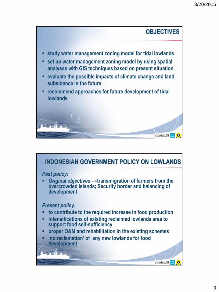
OBJECTIVES
study water management zoning model for tidal lowlands
set up water management zoning model by using spatial
analyses with GIS techniques based on present situation
evaluate the possible impacts of climate change and land
subsidence in the future
recommend approaches for future development of tidal
lowlands
INDONESIAN GOVERNMENT POLICY ON LOWLANDS
Past policy:
Original objectives →transmigration of farmers from the overcrowded islands; Security border and balancing of development
Present policy:
to contribute to the required increase in food production
Intensifications of existing reclaimed lowlands area to support food self-sufficiency
proper O&M and rehabilitation in the existing schemes
‘no reclamation’ of any new lowlands for food development
3/20/2015
4
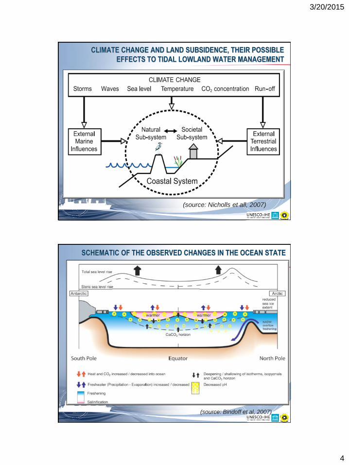
CLIMATE CHANGE AND LAND SUBSIDENCE, THEIR POSSIBLE
EFFECTS TO TIDAL LOWLAND WATER MANAGEMENT
(source: Nicholls et all, 2007)
(source: Bindoff et al, 2007)
SCHEMATIC OF THE OBSERVED CHANGES IN THE OCEAN STATE
3/20/2015
5
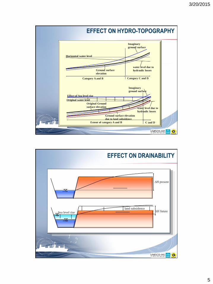
EFFECT ON HYDRO-TOPOGRAPHY
Category A and B Category C and D
Horizontal water level
water level due to
hydraulic losses Ground surface
elevation
Imaginary
ground surface
C and D Extent of category A and B
Original water level
water level due to
hydraulic losses
Original Ground
surface elevation
Imaginary
ground surface
Effect of Sea level rise
Ground surface elevation
due to land subsidence
EFFECT ON DRAINABILITY
∆H present
∆H future Sea level rise
land subsidence
3/20/2015
6
EFFECT ON SALINITY INTRUSION
River zonation and salinity intrusion in normal condition:
River zonation and salinity intrusion with predicted sea level rise: