24
Estimating the Potential Impact of Climate Change driven weather-events on GB Property October 2020

Estimating the Potential Impact of Climate Change driven weather-events
on GB Property
October 2020

Estimating the Potential Impact of Climate Changedriven weather-events on GB Property
B y R i c h a r d C a n t w e l l
The British climate is changing. Warmer oceans are leading to increased rainfall, stormsare becoming stronger and more frequent, heatwaves in summer months hotter andmore prevalent while winter months are becoming significantly wetter [ref 1]. As a resultof global climate change flooding is expected to become more severe across Europe,with Britain and Ireland particularly affected [ref 2]. Drier and hotter summers arealready having a major impact on soil moisture levels, leading to shrinkage andsubsidence [ref 3]. But how can we start to quantify the potential cost of future propertydamage that these changes may bring, based on our current projected scenarios?
This paper aims to calculate an estimate of the potential damage impact on residentialand commercial property from increasing flood and subsidence related events undercurrent climate change scenarios.
2

In carrying out this research Gamma has worked closely with AmbientalRisk and Terrafirma to assess the future impact of climate change onproperties in Great Britain.
We have established that over 1.3 million residential and commercialaddresses in Great Britain will newly be at risk of flooding by 2050, atcurrent levels of payout for flood related insurance claims this representsa potential additional liability of over £122 Billion. Increased risk ofsubsidence will be even more widespread, with an additional1.9 million properties potentially impacted in some scenarios.And while typical subsidence claims are lower than floodrelated claims this still represents a potential liability ofover £52 billion.
3

C l i m a t e C h a n g e S c e n a r i o s
There are 4 main Representative Concentration Pathways (RCPs) used in the literature[ref 4]. These correspond to different concentrations of greenhouse gas in theatmosphere, leading to differing amounts of temperature rise and thus different floodoutcomes. The RCPs are based on different assumptions about population andeconomic growth, sources and consumption of energy, and changes in land use in the21st century. The RCPs are labelled with their radiative forcing by the year 2100, andrange from 2.6W/m2 to 8.5W/m2. RCP 2.6 is the most ambitious target, involvingextreme and immediate cuts to carbon emissions. Even if that target is achievedtemperatures will continue to rise as the elevated levels of carbon dioxide currently inthe atmosphere will take hundreds of years to dissipate [ref 5].
Figures are global and are relative to the 1986-2005 period. Source: IPCC [ref 6].
4
RCP Scenario Description Temperature Rise 2050
Temperature Rise 2100
2.6 Extreme Carbon Cuts
Emissions peak in 2020 and reduce to zero in 2080 1.0c 1.1c
4.5 Moderate Carbon Cuts
Emissions peak in 2050 and decline to 2000 levels 1.4c 1.8c
6.0 Minor Carbon Cuts
Emissions double by 2060 and decline but only to 2030 levels 1.3c 2.2c
8.5 Business as Usual
Emissions continue to increase at the present rate 2.0c 3.7c
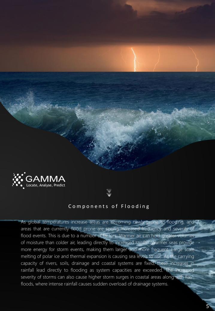
As global temperatures increase areas are becoming newly prone to flooding, andareas that are currently flood prone are seeing increased frequency and severity offlood events. This is due to a number of factors. Warmer air can hold greater volumesof moisture than colder air, leading directly to increased rainfall. Warmer seas providemore energy for storm events, making them larger and more frequent. Large scalemelting of polar ice and thermal expansion is causing sea levels to rise. As the carryingcapacity of rivers, soils, drainage and coastal systems are fixed, these increases inrainfall lead directly to flooding as system capacities are exceeded. The increasedseverity of storms can also cause higher storm surges in coastal areas along with flashfloods, where intense rainfall causes sudden overload of drainage systems.
C o m p o n e n t s o f F l o o d i n g
5

Figure 1: Time series oftime-mean sea levelchange based on theaverage of the UK portslisted in table 3.2.1. Thesolid line andshaded regionsrepresent the centralestimate and ranges foreach RCP scenario asindicated in the legend.The dashed linesindicate the overallrange across RCPscenarios. (right) thespatial pattern of changeat 2100 associated withthe central estimate ofeach RCP scenario. Allprojectionsare presented relative toa baseline period of1981-2000. Source[ref 7].
S e a L e v e l R i s e a n d S t o r m S u r g e
These rising temperatures will directly lead to increased sea levels, due to polar ice cap melting in Greenland and Antarctica, glacier melting and thermal expansion.
6

Recent research [ref 8] on storm surge projections for Europe suggests that climatechange will lead to increased extreme sea levels over and above sea level rise alone.The magnitude of these increases depends on location and RCP, but in the NorthAtlantic a 100 year event is expected to consist of between 64 and 88cm of additionalwater level by 2100.
According to an IPCC 2019 report [ref 9] “Extreme sea level events that are historicallyrare (once per century in the recent past) are projected to occur frequently (at leastonce per year) at many locations by 2050 in all RCP scenarios”.
Figure 2: Components of Extreme Sea Levels. 7

R a i n f a l l
As warmer air has a larger carrying capacity for water, higher temperatures also leadto more rainfall. The effects of climate change are already being seen, with the highestrainfall totals in a five day period in the decade 2008-17 being 4% higher than 1961-1990 [ref 10] in the UK. February 2020 was the wettest February in Britain since recordsbegan, primarily due to the arrival of 3 named storms during the month, Ciara, Dennisand Jorge.
Winter precipitation is expected toincrease significantly {ref 11] acrossthe UK, and while rainfall insummer is expected to decreasesignificantly, storms may becomemore intense. Despite the expectedsummer decrease, UK Summersbetween 2010-19 have been onaverage 11% wetter than 1981-2010 [ref 12].
Figure 3: February 2020 [ref 13].
Figure 4:Increased extreme winter rainfall [ref 14].
8

A m b i e n t a l M o d e l s
Gamma have used the FloodFutures™ model from Ambiental Risk to assess the impactof Climate Change on properties in the UK. FloodFutures™ examines a range ofclimate change scenarios over a set of timescales from 2020 to 2080. The modelincludes data layers on fluvial (river), pluvial (rain), sea level rise, sea level inundation,river bank and river bed erosion potential, impact on transport infrastructure andbridge flooding heights. For this analysis Gamma worked with the high emissionsscenario (90th percentile) data for the year 2050. We included model layers for fluvial,pluvial, sea level rise and tidal inundation.
FloodFutures™ is developed from a broad range of data including UK ClimateProjections, currently UKCP09 with UKCP18 expected to be complete in the near future.Digital terrain (DTM) and digital surface (DSM) data is a key component and is derivedfrom Environment Agency (EA) LiDAR mapping augmented with NEXTMap. Land Useand buildings data is sourced from the Ordnance Survey. The inputs are completedwith hydrological and river flow data from the Centre for Ecology and Hydrology(CEH). The models have a resolution of 5 metres (horizontal) while the vertical accuracyis +/- 0.15m in areas with LiDAR coverage and +/- 0.6m elsewhere. The model isregularly validated against actual flood events in the UK.
9

Figure 5: FloodFutures™ Fluvial & Pluvial Layers, 2050 High Emissions Scenario, Cumbria.
Figure 6: FloodFutures™ Fluvial & Pluvial Layers, 2050 High Emissions Scenario,Richmond-upon-Thames.
10

P r e d i c t i n g f u t u r e f i n a n c i a l i m p a c t o n p r o p e r t i e s f r o m f l o o d i n g
Combining FloodFutures™ model data with OSGB AddressBase, MasterMap and otherdatasets allows for the estimation of the number of properties impacted by flooding acrossthe different flood types, climate change scenarios and timeframes.
Consideration needs to be taken that flooding impacts properties on the ground floor ofbuildings much more severely than properties on higher stories in a multi-unit building. Forthis analysis we have conducted an outline analysis of buildings which contain more thanone address and have worked on the assumption that as the number of addresses in abuilding increases the proportion of those which are on the ground floor decreases. For thisresearch our model allocates 50% of properties to the ground floor level in a building with2-4 addresses, this reduces steadily to 20% in buildings which have 50 or more addresses.
11

DistrictAt Risk
BaseAdditional
by 2050Total Stock
Base %Additional
%Total %
Portsmouth 4,630 16,504 101,324 5% 16% 21%
East Riding of Yorkshire 31,149 28,403 188,396 17% 15% 32%
Arun (West Sussex) 4,689 9,885 81,346 6% 12% 18%
Merton (London) 6,539 10,210 91,555 7% 11% 18%
Chichester (West Sussex) 6,559 7,567 68,891 10% 11% 21%
Kensington and Chelsea 3,579 10,092 101,802 4% 10% 13%
Conwy (Wales) 9,527 6,002 61,273 16% 10% 25%
Great Yarmouth (Norfolk) 13,120 4,813 53,778 24% 9% 33%
West Berkshire 6,704 6,679 76,022 9% 9% 18%
Worthing 3,035 4,906 55,873 5% 9% 14%
The increasing severity and frequency of flood events will have severe implications for flooddefences across the UK. Events that currently have a return rate of once per hundred yearswill become much more common as temperatures continue to rise. Much of the currentflood defence infrastructure is designed to withstand these 1 in 100 year events. For thisanalysis we have worked on the assumption that flood defences other than the ThamesTidal Barrier will have no impact on fluvial, coastal and tidal flood severity and extent.
Looking at the base scenario, set to 2017, we estimate that there are a total of 1,799,271residential and commercial properties in areas currently at risk from flooding in GreatBritain, which is 5.6% of the total number of these properties. In the case of the highemissions scenario from UKCP09, by 2050 we estimate that an additional 4.0% of residentialand commercial properties will be newly at risk, giving a total of 3,066,318, or almost 1 in 10of such properties. This assumes that there are no new interventions in the form of flooddefences or other infrastructural works in at risk areas.
This increase in risk is not evenly distributed across Great Britain. Some districts face muchlarger impacts than others. The 10 with the largest increase in proportion of impactedresidential and commercial properties are listed below. As can be seen the South coast fromPortsmouth to Worthing, including Arun and Chichester sees the largest proportional rise,areas along the East coast also see significant rises and Conwy is the only one of the topten not in England.
12

The most heavily impacted districts are Bolton and South Holland in Lincolnshire,however there is only a marginal difference in these areas between the current baselineand the 2050 scenario as they are already at very high risk currently. Nonetheless, floodevents in these areas and other currently impacted areas can be expected to becomemore extreme and frequent as the climate changes.
Figure 7: Proportion of Residential and Commercial Addresses impacted by flooding,
2017 Baseline.
Figure 8: Proportion of Residential and Commercial Addresses impacted by flooding,
2050 High Emissions scenario.
13
At Risk

I n s u r a n c e I m p a c t
According to the Association of British Insurers (ABI) the average payout for a domesticinsurance flood claim in February 2020, following storms Ciara and Dennis, was£32,000 while commercial flood claims averaged at £57,000 [ref 15]. Applying theseaverage claim amounts to addresses impacted by 2050 gives a potential insuranceliability of £122 Billion, an increase of £50 Billion over the current baseline figure of £72Billion. There are a number of basic assumptions used to arrive at this figure, includingthat all properties within the flood zone are impacted, while in reality some may havereduced or negligible claims, while others may have significantly larger claims.However as remediation costs rise and floods become more severe, payouts can beexpected to rise. Similarly micro site factors can have unexpected effects beyond theresolution of current models, but the figures above provide useful guidance. Ambientalcan provide more detail on risk variance.
P r o p e r t y S a l e s i n i m p a c t e d a r e a s
By combining FloodFutures™ with Price Paid datafrom the Land Registry [ref 16] we can estimate thevolume and value of property transactions in Englandand Wales since 1995 which were in areas which will beimpacted by flooding by 2050 in some scenarios.
Looking at the 10 years from 2010 – 2019 it can be seen that the total value oftransactions in newly impacted areas steadily increased from 2010-17 and has sincedropped slightly, however the average transaction value has increased every year since2011.
New builds as a proportion of all transaction value in impacted areas were as low as10% in the early 2010’s, however this has risen to 20% by the end of the decade,meaning that one fifth of all recorded residential property transaction value in areasthat will newly be impacted by flooding by 2050 was of newly built property.
14

Residential Transactions (£M)
Year Total Of Which New Build Average Value
2010 £ 7,588 £ 764 £ 260,000
2011 £ 7,483 £ 772 £ 259,000
2012 £ 7,794 £ 931 £ 263,000
2013 £ 10,195 £ 1,360 £ 278,000
2014 £ 12,738 £ 1,746 £ 287,000
2015 £ 13,067 £ 1,768 £ 295,000
2016 £ 14,096 £ 2,353 £ 310,000
2017 £ 15,677 £ 3,324 £ 335,000
2018 £ 14,929 £ 3,131 £ 340,000
2019 £ 13,730 £ 2,639 £ 347,000
Given that over 60% of first time buyers in the UK take out mortgages with terms over25 years [ref 17] it is likely that there will be a large volume of mortgages taken out inthe next few years that will not be fully paid off before much of the predicted impact ofclimate change driven flooding will come into play. It remains to be seen how exposedthe GB mortgage market is to these perils.
15

Hotter, drier summers with erratic rainfall and increased solar radiation andwarmer, wetter winters have already altered soil moisture conditions acrossBritain. Long intense dry spells can lower ground levels severely enough to causefissures which undermine the foundations of buildings and other structures.Fluctuations in soil moisture lead directly to shrinking and swelling in soils, particularlyin clay based soils which are common across much of Great Britain. As the soil changesit causes potentially damaging vertical movement. When soils do not dry out evenlythis can lead to even more damaging differential ground movement. [ref 18].
Unlike flooding, impacts from clay related shrinkage and swelling are chronicprocesses, developing over many months or seasons [ref 19]. This has been observedin parts of France where drought induced soil subsidence has caused as muchproperty damage as flooding since 1989 [ref 20]. As the climate continues to changethese severe droughts in summer can be expected to move northwards into Britain. Bycombining climate change models with soil data the Potential Soil Moisture Deficit(PMSD) can be forecast across Britain for a range of climate scenarios.
C l i m a t e C h a n g e a n d S u b s i d e n c e
16

Figure 9: UKCP09-derived projections of accumulated annual Potential Soil Moisture Deficit (PSMD) for GB Baseline (1961–1990) a 10th, b 50th and c 90th percentiles; 2030 (2020–2049) d 10th, e 50th and f 90th percentiles; 2050 (2040–2069) g 10th, h 50th and i 90th percentiles. Source: Prichard, Hallett & Farewell, Climate Change 133, 635-650 (2015).
17

T e r r a f i r m a M o d e l s
Terrafirma’s National Ground Risk Modeltm (NGRM) uses high resolution data from awide range of sources covering land use, soils, local geology, terrain, vegetation,weather historical mining and complex erosional processes. By combining soils datawith climate change models, currently UKCP09 with UKCP18under development, the spatial variation of soil subsidence hazards can be mappedacross Great Britain. To this additional surface and subsurface ground instabilityhazards are added, giving a full understanding of how ground risk may impact thebuilt environment now and into the future.
18

Figure 10: Current and future clay soil subsidence hazard.
Figure 11: Additional ground hazards from the Terrafirma National Ground Risk Model (NGRM).
19

DistrictAt Risk
BaseAdditional
by 2050Total Stock
Base %Additional
%Total %
Swindon 1,339 85,102 107,019 1% 80% 81%
South Tyneside 11,375 58,607 76,395 15% 77% 92%
Stockton-on-Tees 1,621 54,748 94,546 2% 58% 60%
Cheltenham 1,998 32,003 63,061 3% 51% 54%
Crawley 910 24,098 49,849 2% 48% 50%
Mendip 3,254 27,848 58,405 6% 48% 53%
Cotswolds 2,937 22,520 50,075 6% 45% 51%
York 2,629 43,780 102,512 3% 43% 45%
Daventry 977 16,978 40,800 2% 42% 44%
Wellingborough 8,281 15,592 38,791 21% 40% 62%
11
P r e d i c t i n g f u t u r e f i n a n c i a l i m p a c t o n p r o p e r t i e s f r o m s u b s i d e n c e
Currently 70% of subsidence cases are due to soil shrinkage [ref 21]. Given the widespreadbut uneven distribution of clay soils across Great Britain the impact of climate change drivensubsidence and other ground hazards on properties will be highly variable. Terrafirma haveassessed the potential impacts on 44 million buildings, including 29 milliondwellings, sourced from Ordnance Survey data. The districts which will see the largestchange are listed below.
20

It is important to note that in areas where subsidence is currently prevalent, localpractitioners may have expertise in adaptation and mitigation of the risk. However suchexperience is not likely to be widespread in areas that are not currently at risk but willbecome so in future.
As with flooding, the cost of subsidence related insurance claims are highly variable.Remediation costs have been falling in recent years as methods improve, but particularlycomplex claims can exceed £100,000. Based on Terrafirma industry experience and datafrom The Association of British Insurers (ABI) the average claim appears to be in the range£6,000 - £12,000. If we take the lower bound of this, £6,000 and apply it to properties at riskwe can estimate the current total claim potential to be £40.9 Billion. By 2050 this willincrease by £11.8 Billion to £52.7 Billion. There is an assumption that all properties in theimpacted areas are equally at risk, whether they are single or multi-storey and are on theground floor or not. More detailed analysis of the risk variance is available from Terrafirma.
In recent years the number of subsidence claims in the UK has averaged at around 10,000annually, which equates to an average annual loss of approximately £60 Million per annum,according to the Association of British Insurers. However this increases sharply in drier yearssuch as 2018, when the number of claims in a single quarter approached annual levels andthe value of claims almost doubled [ref 22]. Given that drier years will be much morecommon in future and that almost 30% more properties are expected to be at risk ofsubsidence by 2050 the average annual loss could exceed £155 Million in 30 years time, withparticularly dry years significantly exceeding that figure.
Figure 12: Subsidence Risk, baseline. Figure 13: Subsidence Risk, 2050.
21
At Risk

Residential Transactions (£M)
Year Total Of Which New Build Average Value
2010 £ 11,439 £ 902 £ 239,000
2011 £ 11,025 £ 977 £ 233,000
2012 £ 11,618 £ 1,273 £ 238,000
2013 £ 14,326 £ 1,638 £ 242,000
2014 £ 18,350 £ 2,044 £ 260,000
2015 £ 19,775 £ 2,472 £ 276,000
2016 £ 21,734 £ 3,080 £ 296,000
2017 £ 24,688 £ 3,432 £ 334,000
2018 £ 23,762 £ 3,873 £ 329,000
2019 £ 21,742 £ 3,511 £ 324,000
Combining Terrafirma’s National Ground Risk Model with Price Paid data from the LandRegistry for England and Wales we can see the volume and value of residentialproperty transactions in areas that will be newly at risk of subsidence by 2050.
In 2019 alone almost £22 Billion of transactions occurred in these areas, almost doublethe aggregate value of transactions in the same areas 10 years earlier. The averagetransaction value in the impacted areas over that time period rose by only 35%, so thenumber of transactions in impacted areas is rising.
Newly built properties represented 8% of all transactions by value in impacted areas in2010. This has risen steadily to 16% by 2019. Thus newly built residential property nowrepresents one sixth of all residential property transactions in England and Wales thatoccurred in areas that have been projected to be at risk of climate change drivensubsidence by 2050.
22

K e y F i n d i n g s
In writing this report Gamma have worked closely with Ambiental and theirFloodFutures™ Model along with Terrafirma and their National Ground Risk Model™.We utilised the UKCP09 High Emissions scenario for this analysis. UKCP18 models willbe available from both Ambiental and Terrafirma in the near future.
From analysing the geocoded property data and the risk models in our Perilfinder™location intelligence platform, we can conclude that:
Britain’s changing climate is already having a major impact on properties across thecountry. As more energy is added to the atmosphere these impacts will becomemore severe.There is wide spatial variation in the above ground (flooding) and below ground(subsidence) impacts.Using lower bound claim estimates, the current exposure from flooding (£79 Billion)and subsidence (£41 Billion) is £120 BillionUsing lower bound claim estimates the total additional exposure by 2050 fromflooding (£52 Billion) and subsidence (£12 Billion) is £64 Billion. Giving a totalexposure by 2050 of £184 Billion.Given the long term nature of mortgage borrowing and the more widespread andsevere impacts of climate change, mortgage lenders need to evaluate theirexposure.Average annual subsidence claims are expected to rise from £60 Million to over£150 Million by 2050.
23

References
https://www.metoffice.gov.uk/binaries/content/assets/metofficegovuk/pdf/research/ukcp/ukcp18-infographic-headline-findings-land.pdfhttps://www.pnas.org/content/108/7/2678.fullhttps://www.ecca2019.eu/an-assessment-of-great-britainos-future-susceptibility-to-subsidence-as-a-consequence-of-climate-change/https://www.theguardian.com/environment/climate-consensus-97-per-cent/2013/aug/30/climate-change-rcp-handy-summaryhttps://www.theguardian.com/environment/2012/jan/16/greenhouse-gases-remain-airhttps://www.ipcc.ch/site/assets/uploads/2018/02/SYR_AR5_FINAL_full.pdfhttps://www.metoffice.gov.uk/pub/data/weather/uk/ukcp18/science-reports/UKCP18-Marine-report.pdfhttps://agupubs.onlinelibrary.wiley.com/doi/full/10.1002/2016EF000505https://www.ipcc.ch/srocc/https://www.metoffice.gov.uk/research/climate/understanding-climate/uk-extreme-events-_heavy-rainfall-and-floodshttps://www.metoffice.gov.uk/binaries/content/assets/metofficegovuk/pdf/research/ukcp/ukcp18-overview-slidepack.ff.pdfhttps://rmets.onlinelibrary.wiley.com/doi/epdf/10.1002/joc.6726https://www.metoffice.gov.uk/about-us/press-office/news/weather-and-climate/2020/2020-winter-february-statshttps://www.metoffice.gov.uk/research/climate/understanding-climate/uk-extreme-events-_heavy-rainfall-and-floodshttps://www.abi.org.uk/news/news-articles/2020/03/insurance-pay-outs-to-help-customers-recover-from-storms-ciara-and-dennis-set-to-top-360-million/https://www.gov.uk/government/statistical-data-sets/price-paid-data-downloadshttps://www.finder.com/uk/mortgage-statisticshttps://www.landis.org.uk/npd_insurance/https://link.springer.com/article/10.1007/s10584-015-1486-zhttps://nhess.copernicus.org/articles/11/3335/2011/nhess-11-3335-2011.pdfhttp://www.subsidence.co.uk/impact-climate-change-subsidence/https://www.abi.org.uk/news/news-articles/2018/subsidence-claims-quadruple-to-highest-level-in-more-than-a-decade/
1:
2:3:
4:
5:6:7:
8:9:10:
11:
12:13:
14:
15:
16:17:18: 19:20:21:22:
24


