Page 1
GIS Applications in a
Civil Engineering
EnvironmentEnvironment
Kirk Moughamer, EcologistKirk Moughamer, Ecologist
David Evans and Associates Inc.David Evans and Associates Inc.
Bellevue, WABellevue, WA
Page 2
PhilosophyWe find outstanding professionals, and give
them the freedom and support to do what
they do best.
Core PurposeCore Purpose
To improve the quality of life while
demonstrating stewardship to the built and
natural environments.
Page 3
Airport MAX Light Rail Extension,
Portland, Oregon
Transportation
• Bridge Design, Engineering, and
Construction
• Heavy Rail Engineering
• Highway/Roadway Design and
Engineering
• Traffic Engineering
• Transit Planning and Engineering
• Transportation Design
• Transportation Planning
• Surveying
Monroe Street Bridge Restoration
Spokane, Washington
Page 4
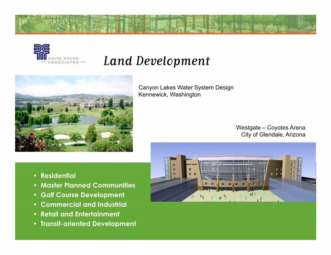
Canyon Lakes Water System Design
Kennewick, Washington
Westgate – Coyotes Arena
Land Development
Westgate – Coyotes Arena
City of Glendale, Arizona
• Residential
• Master Planned Communities
• Golf Course Development
• Commercial and Industrial
• Retail and Entertainment
• Transit-oriented Development
Page 5
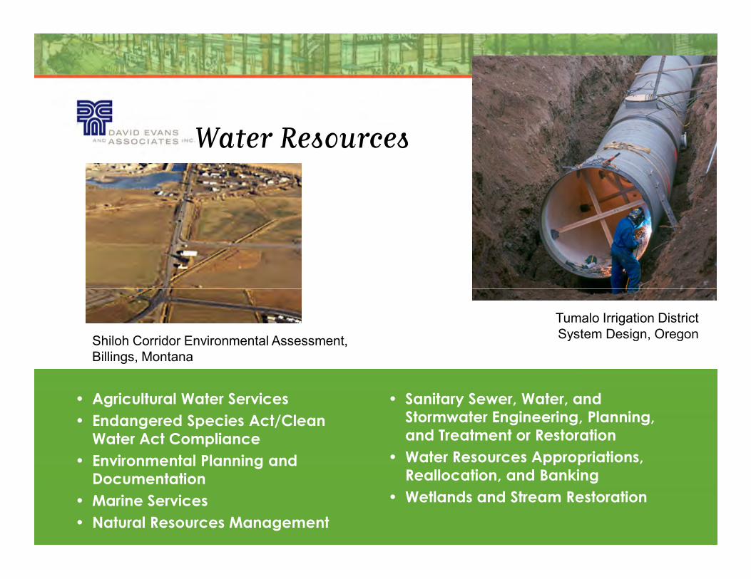
Water Resources
Tumalo Irrigation District
System Design, OregonShiloh Corridor Environmental Assessment,
Billings, Montana
• Agricultural Water Services
• Endangered Species Act/Clean
Water Act Compliance
• Environmental Planning and
Documentation
• Marine Services
• Natural Resources Management
• Sanitary Sewer, Water, and
Stormwater Engineering, Planning,
and Treatment or Restoration
• Water Resources Appropriations,
Reallocation, and Banking
• Wetlands and Stream Restoration
Page 6
Schultz - Wautoma 500kV Transmission
Line, Ellensburg, Washington
Energy
Hells Canyon Complex Aesthetic
Resource Inventory and Evaluation,
Idaho and Oregon
Wild Horse Wind Farm,
Ellensburg, Washington
• Transmission Lines and Pipelines
• Gas- and Coal-fired Power Generation
• Hydropower Projects
• Windpower
Page 7
My Background
BS, Environmental Resource Management
Pennsylvania State University
10 years of experience with the US Forest Service supporting
NEPA documentation for federal actions (forestry practices,
development, new roads, culvert replacements).
6 years with DEA as a project biologist supporting projects
through local, state and federal permitting on infrastructure
projects.
Primary Clients
�Puget Sound Energy
�Washington State Department of Transportation
�Land Development Clients
Page 8
What about GIS?
�First exposure to GIS was through ArcView 3.x in 1997 at PSU.
�At the National Park Service field crews used GPS to record the
location of survey efforts or observations. ArcView 3.x was used to
make maps.
�At the USFS we began to assign attributes to the surveys efforts and �At the USFS we began to assign attributes to the surveys efforts and
observations.
�After years of working on projects designed to identify prime
habitats and document species presence using GIS, I moved to
Seattle and enrolled in the UW GIS Certificate Program in 2004.
�Shortly after I was hired by DEA and since then I have been using
GIS to inform engineers on the potential environmental impacts of
their designs.
Page 9
Main Points
�GIS is a precise analytical tool.
�Outputs are only as accurate as your input.
�Tough economic times require increased efficiencies to �Tough economic times require increased efficiencies to
minimize rework and streamline the permitting and
approval process.
Page 10
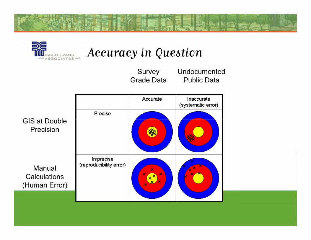
Accuracy in Question
Survey
Grade Data
Undocumented
Public Data
GIS at Double GIS at Double
Precision
Manual
Calculations
(Human Error)
Page 11
Accuracy in Question
�Technology changes fast but institutional
memory…not so fast.
�GIS does not stand for Get It Surveyed.
�Garbage in - Garbage out. Any data can be
inaccurate regardless of format.
�Think of spatial data as something separate from
CAD or GIS…is the spatial data any good? What
about the metadata?
Page 12
Typical Environmental Issues
�Filling of wetlands
�Stream Crossings
�Threatened and Endangered Species�Threatened and Endangered Species
�Archeological and Historic resources
�Significant Tree Removals
Page 13
ENV Impacts and Project Design
�Has the project AVOIDED impacts to the maximum
extent practicable?
�Has the project MINIMIZED unavoidable impacts to the
maximum extent practicable? maximum extent practicable?
�Have the unavoidable impacts been COMPENSATED
for?
Page 14
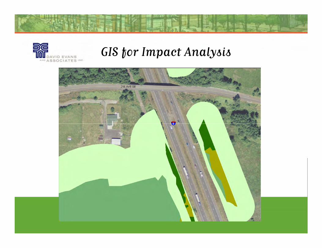
GIS for Impact Analysis
Page 15
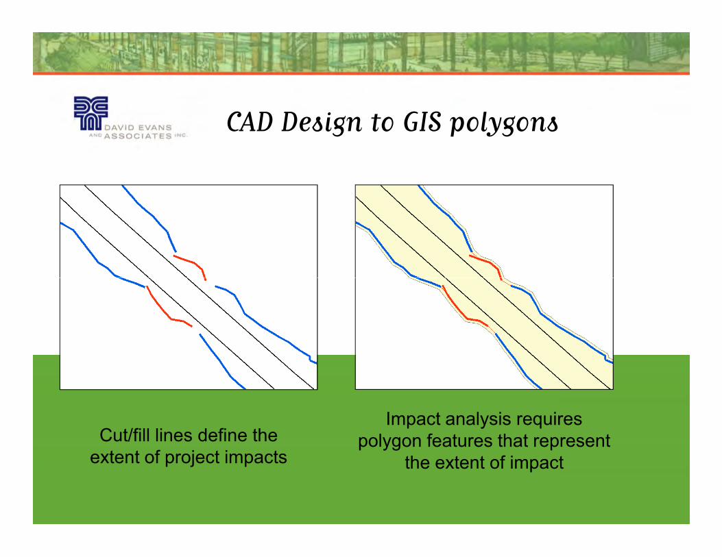
CAD Design to GIS polygons
Cut/fill lines define the
extent of project impacts
Impact analysis requires
polygon features that represent
the extent of impact
Page 16
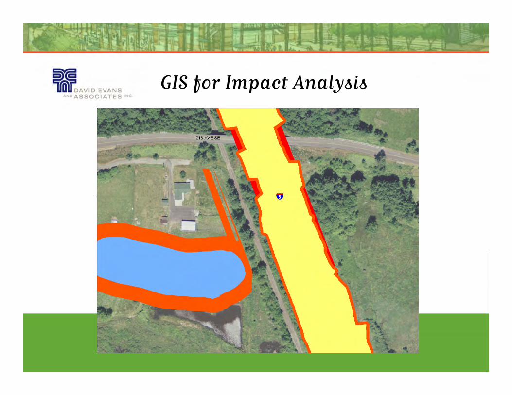
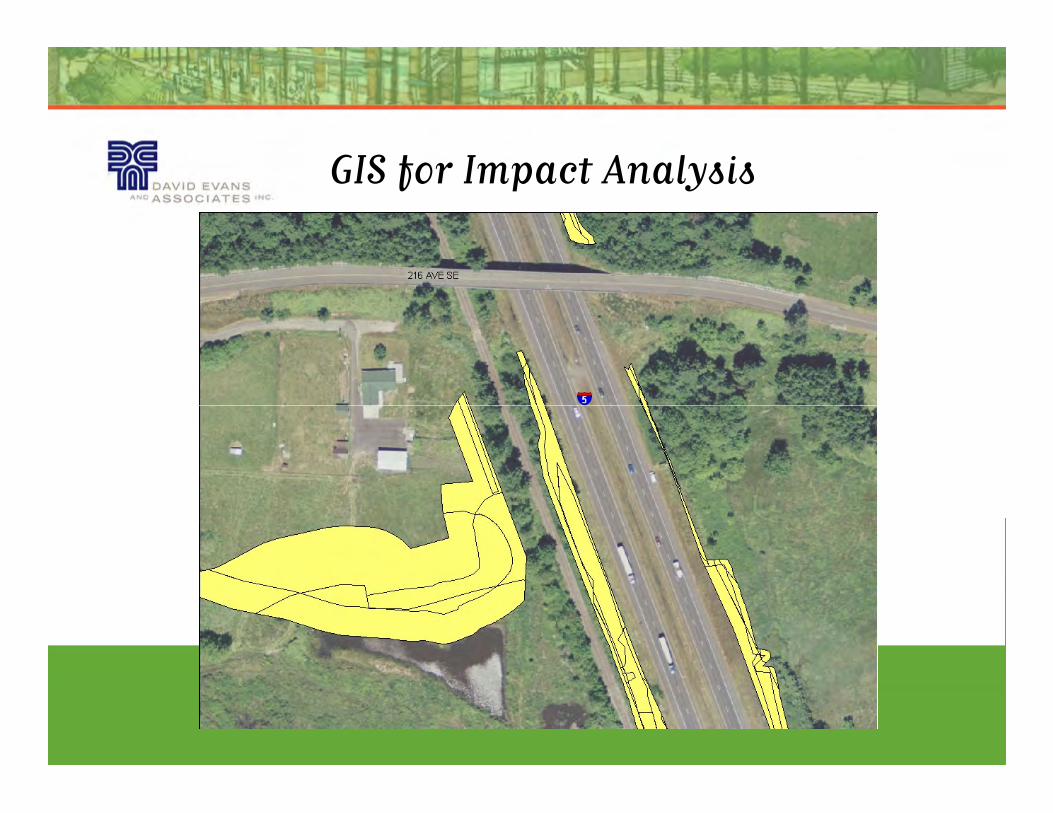
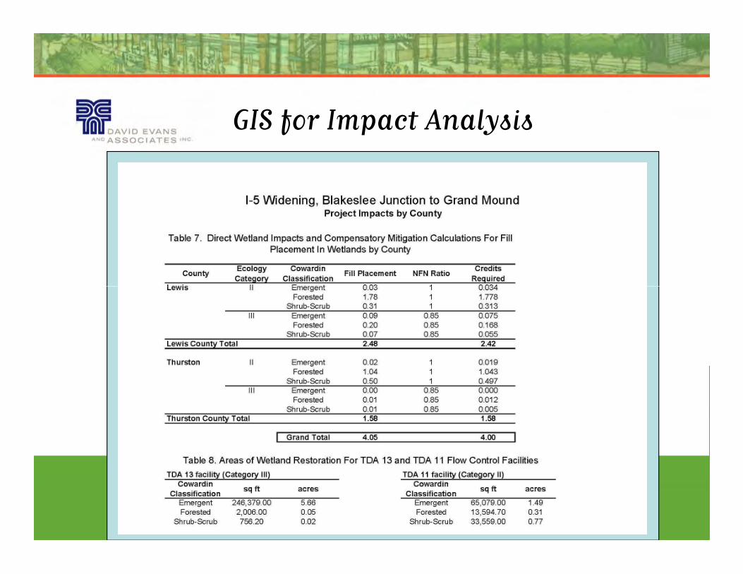
GIS for Impact Analysis
Page 17
GIS for Impact Analysis
Page 18
GIS for Impact Analysis
Page 19
Intersection of Design and Survey
Represents the Environmental Impact
�Cost effective, reasonably dynamic calculation of resource
impacts.
�With survey grade data, analysis can be both accurate and �With survey grade data, analysis can be both accurate and
precise.
�Environmental review and mitigation negotiations proceed
during design, when adjustments can be made at a lower
cost.
Page 20
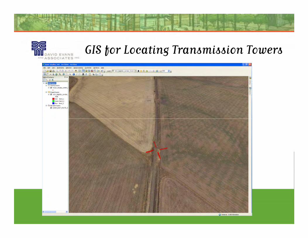
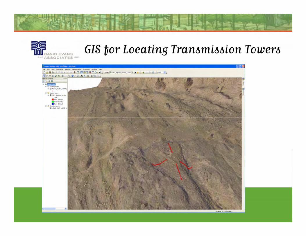
GIS for Locating Transmission Towers
Page 21
GIS for Locating Transmission Towers
•Using GIS we analyzed LiDAR and field survey data for HDR
Engineering and Bonneville Power Administration to check
transmission crossing elevations and proposed tower location
studies.
•100% of the tower study location points matched the LiDAR •100% of the tower study location points matched the LiDAR
based DTM within 1 foot vertically, with 94% matching with 0.5ft,
and 75% matching with 0.25ft.
•We were able to identify areas where the LiDAR DTM would fail
the confidence check as embankments at the edges of roads and
cultivated fields, as well as locations with steep cross slopes and
heavy vegetation.
Page 22
GIS for Locating Transmission Towers
Page 24
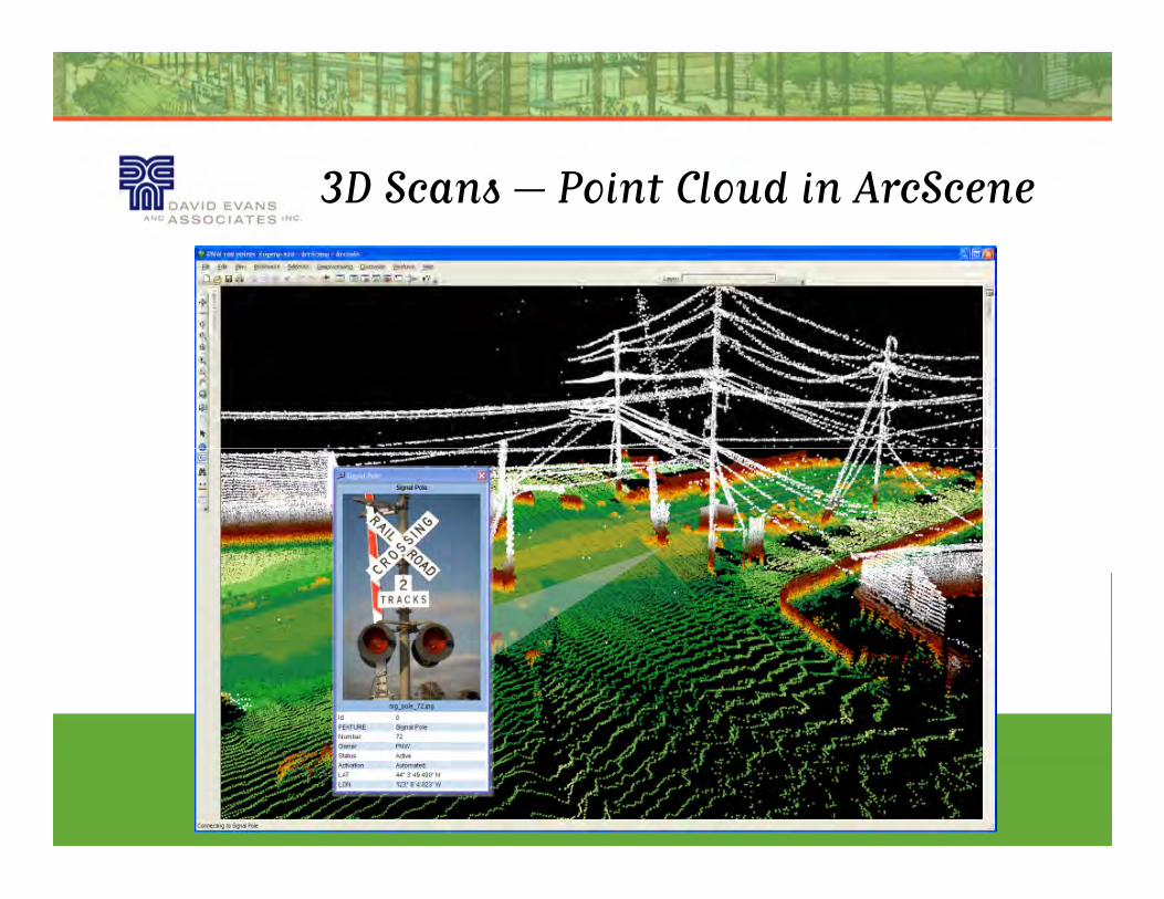
3D Scans – Point Cloud in ArcScene
Page 25
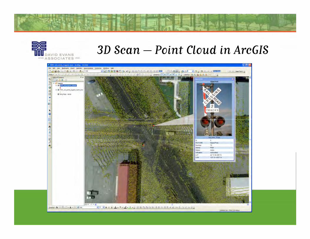
3D Scan – Point Cloud in ArcGIS
Page 26
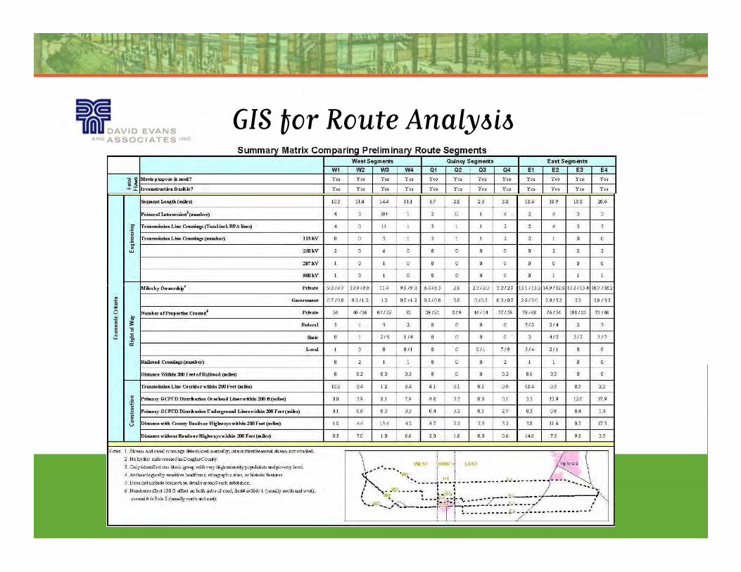
GIS for Route Analysis
Page 27
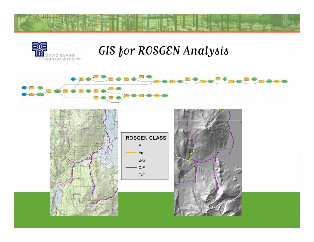
GIS for ROSGEN Analysis
Page 28
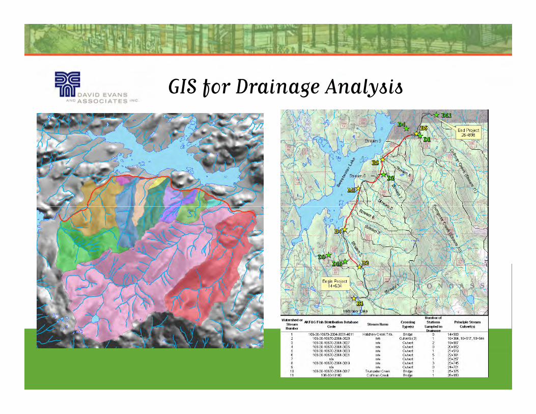
GIS for Drainage Analysis
Page 29
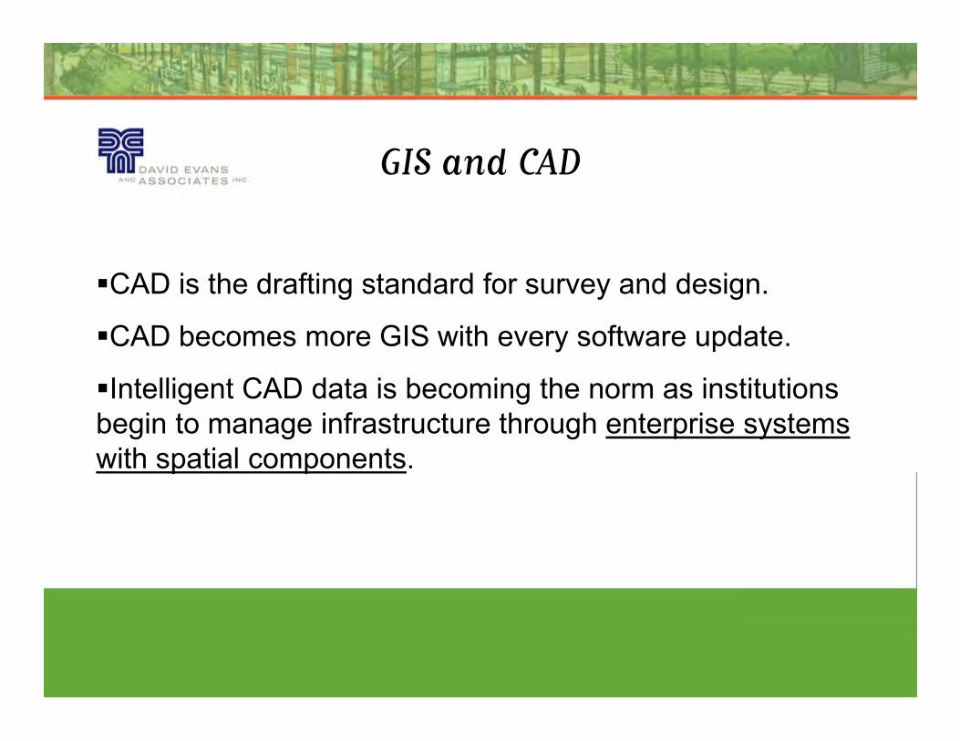
GIS and CAD
�CAD is the drafting standard for survey and design.
�CAD becomes more GIS with every software update.
�Intelligent CAD data is becoming the norm as institutions
begin to manage infrastructure through enterprise systems
with spatial components.
Page 30
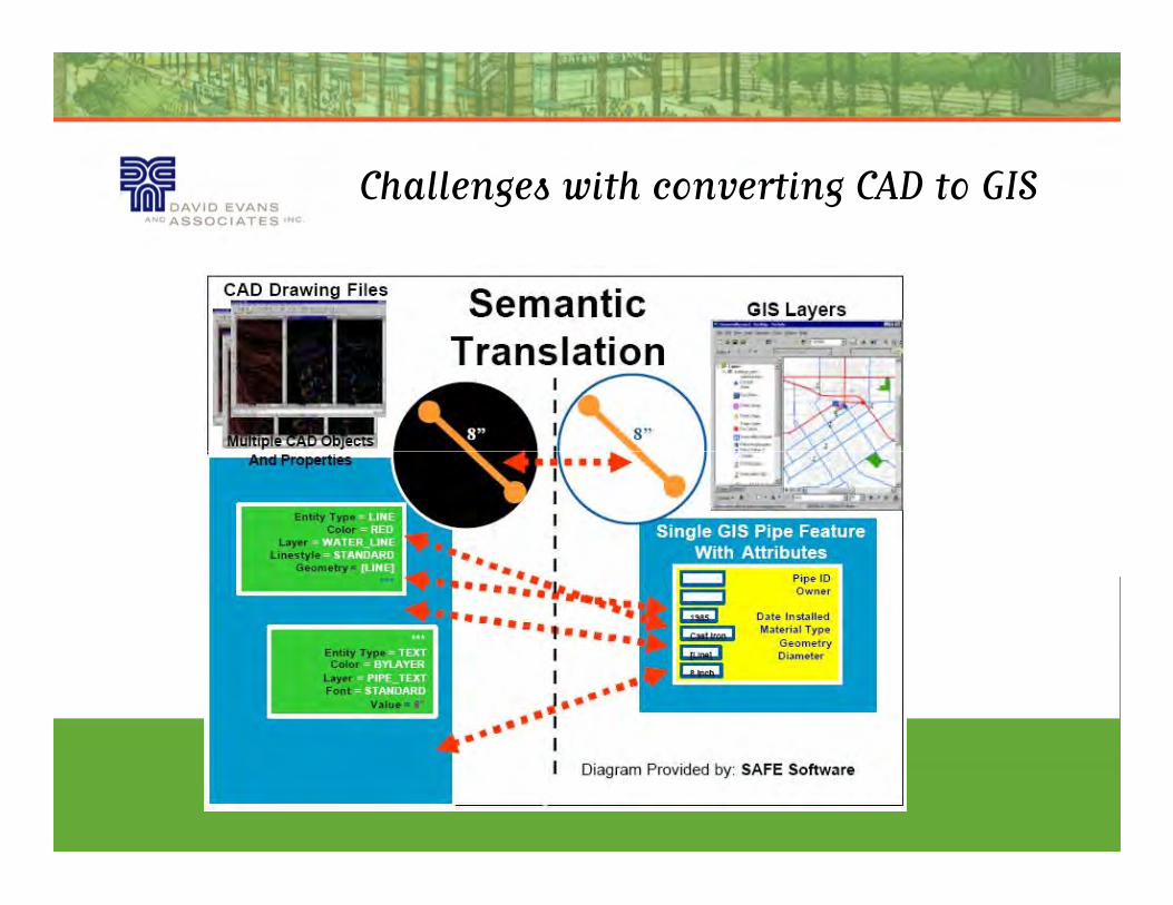
Challenges with converting CAD to GIS
Page 31
Object Tables in AutoCAD Map 3D
�Object tables essentially are the attribute table of the
AutoCAD world.
�Populating object tables during the site survey with new
electronic tools provides attributed data that can be ready electronic tools provides attributed data that can be ready
for GIS analysis.
�Running analysis in separate software programs brings up
enterprise issues.
Page 32
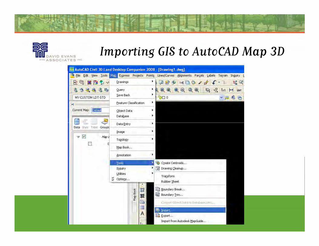
Importing GIS to AutoCAD Map 3D
Page 33
Importing GIS to AutoCAD Map 3D
Click ellipsis (…)
Click Create Object Data
Page 34
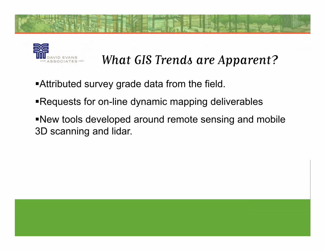
What GIS Trends are Apparent?
�Attributed survey grade data from the field.
�Requests for on-line dynamic mapping deliverables
�New tools developed around remote sensing and mobile
3D scanning and lidar.
Page 35
What’s Going on in the Market?
�Design-build road and bridge projects are the new normal
throughout the country.
�Power and gas transmission infrastructure is aging
requires continual improvements and upgrades.requires continual improvements and upgrades.
�Water resources and stormwater continue to be strong
markets in the PNW due to increasingly restrictive
environmental regulations.