60
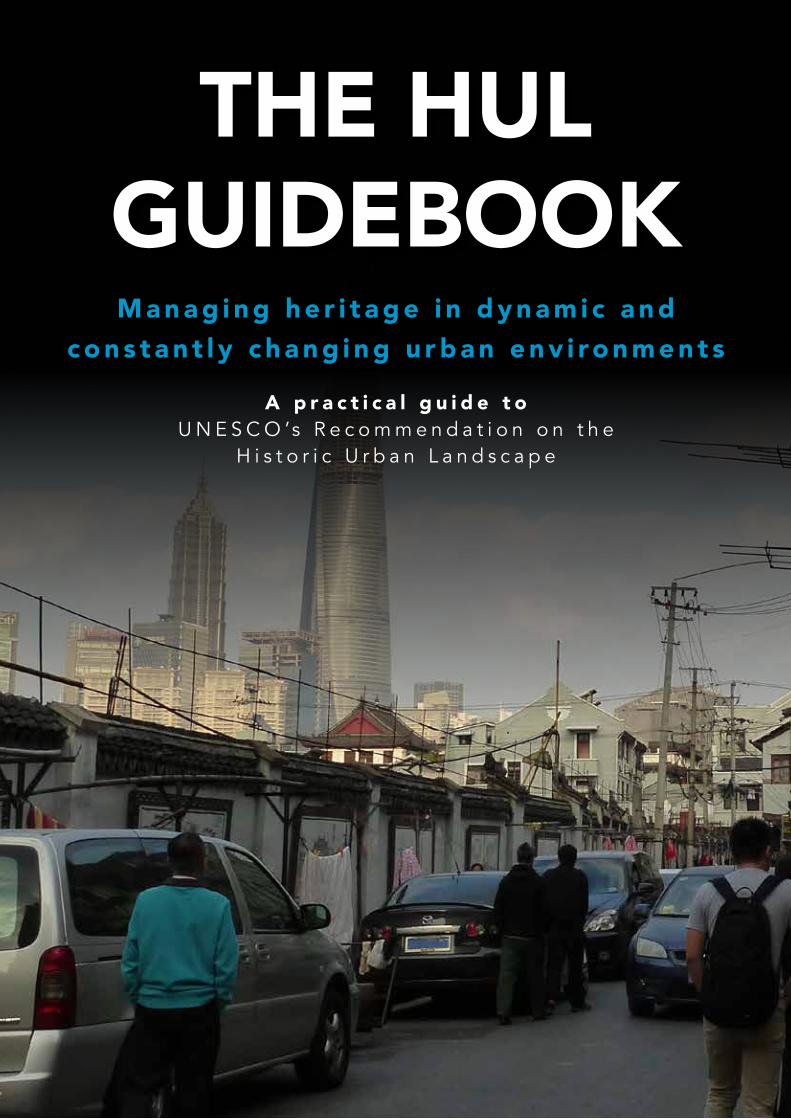
THE HUL GUIDEBOOK Managing heritage in dynamic and constantly changing urban environments A practical guide to UNESCO’s Recommendation on the Historic Urban Landscape
THE HUL GUIDEBOOKM a n a g i n g h e r i t a g e i n d y n a m i c a n d
c o n s t a n t l y c h a n g i n g u r b a n e n v i ro n m e n t s
A p r a c t i c a l g u i d e t oU N E S C O ’s R e c o m m e n d a t i o n o n t h e
H i s t o r i c U r b a n L a n d s c a p e
2 | The HUL Guidebook
The HUL Guidebook | 3
1. About this guidebook 05
2. A new framework for change 06
3. What is the HUL approach? 10
A.TheDefinition 11
4. Implementing the HUL approach 12
B.TheSixCriticalSteps 13
C.TheToolkit 14
5. Case studies and best practice 17
Ballarat,AUSTRALIA 20
Shanghai,CHINA 26
Suzhou,CHINA 30
Cuenca,ECUADOR 34
Rawalpindi,PAKISTAN 38
Zanzibar,TANZANIA 42
Naples,ITALY 46
Amsterdam,NETHERLANDS 50
6. Resources 56
References 58
4 | The HUL Guidebook
1. A
BO
UT
TH
IS G
UID
EB
OO
K
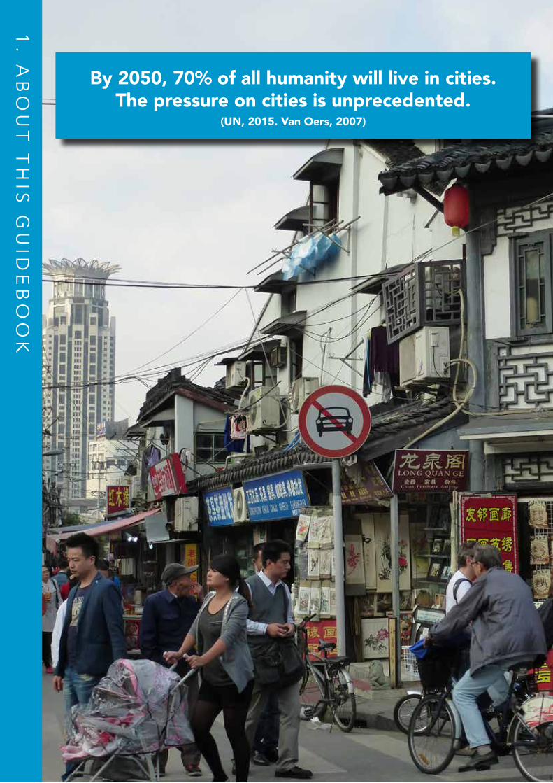
By 2050, 70% of all humanity will live in cities. The pressure on cities is unprecedented.
(UN, 2015. Van Oers, 2007)
The HUL Guidebook | 5
1. ABOUT THIS GUIDEBOOK
Introduction Currently, more than half of the world’s population lives in an urban environment or city. In today’s globalizing and urbanizing world, cities play a major role within the broader international development framework, as a large number of metropolises and intermediate cities are developing at an unprecedented rate. It is projected that exponential population growth and urbanization of the world will mean that 70% of all humanity will live in cities by 2050. (UN, 2015)
Cities are of great importance to the protection of human welfare and health, the development of social creativity and cultural diversity, as well as the conservation and sustainable use of tangible and intangible cultural heritage. In this sense, it is important to acknowledge cities as a vital resource for the future. Nevertheless, cities are dynamic organisms: social structures and needs are always evolving, and the physical fabric adapts constantly. It is in this context that urban conservation can be positioned to protect heritage - often with little or no integration in broader urban development considerations (Bandarin, Van Oers, 2015). Therefore, in a context where ‘development’ and ‘urban heritage conservation’ are seen as conflicting rather than cooperative processes, there was a need for an updated, integrated approach to urban management. This is how the Historic Urban Landscape (HUL) approach was developed and adopted by the UNESCO General Conference through the 2011 Recommendation on the Historic Urban Landscape. Since 2011 the HUL approach is being successfully applied in a number of cities around the world and integrated into new global approaches for sustainable cities. Though this is just the start. The future of HUL includes embedding it in multidisciplinary practice and national/regional frameworks, increasing our knowledge on its application and growing cooperative networks for cities worldwide.
What is the purpose of the ‘HUL’ Guidebook and who is it for?This Guidebook delivers a practical understanding of the Historic Urban Landscape (HUL) approach, along with information regarding its purpose and application. It is structured as a manual, that:
1. Equips readers with an introductory set of practical and theoretical information, including case studies of cities implementing the HUL Approach;
2. Brings together a list of experts and resources to assist with implementing the HUL Approach.
The Guidebook has been designed to assist stakeholders who wish to effectively deal with change in a way that harmonizes urban conservation with urban development and regeneration. In this sense, it is aimed at, but not limited to:
• local authorities • government officials • practitioners operating in the field of urban conservation or urban development • researchers • consultants• University and training partners
6 | The HUL Guidebook
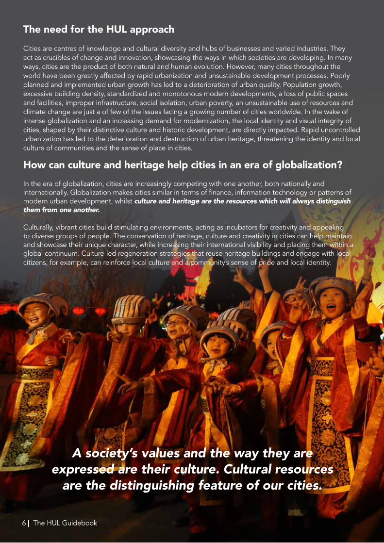
A society’s values and the way they are expressed are their culture. Cultural resources
are the distinguishing feature of our cities.
The need for the HUL approach Cities are centres of knowledge and cultural diversity and hubs of businesses and varied industries. They act as crucibles of change and innovation, showcasing the ways in which societies are developing. In many ways, cities are the product of both natural and human evolution. However, many cities throughout the world have been greatly affected by rapid urbanization and unsustainable development processes. Poorly planned and implemented urban growth has led to a deterioration of urban quality. Population growth, excessive building density, standardized and monotonous modern developments, a loss of public spaces and facilities, improper infrastructure, social isolation, urban poverty, an unsustainable use of resources and climate change are just a of few of the issues facing a growing number of cities worldwide. In the wake of intense globalization and an increasing demand for modernization, the local identity and visual integrity of cities, shaped by their distinctive culture and historic development, are directly impacted. Rapid uncontrolled urbanization has led to the deterioration and destruction of urban heritage, threatening the identity and local culture of communities and the sense of place in cities.
How can culture and heritage help cities in an era of globalization? In the era of globalization, cities are increasingly competing with one another, both nationally and internationally. Globalization makes cities similar in terms of finance, information technology or patterns of modern urban development, whilst culture and heritage are the resources which will always distinguish them from one another.
Culturally, vibrant cities build stimulating environments, acting as incubators for creativity and appealing to diverse groups of people. The conservation of heritage, culture and creativity in cities can help maintain and showcase their unique character, while increasing their international visibility and placing them within a global continuum. Culture-led regeneration strategies that reuse heritage buildings and engage with local citizens, for example, can reinforce local culture and a community’s sense of pride and local identity.
6 | The HUL Guidebook
The HUL Guidebook | 7
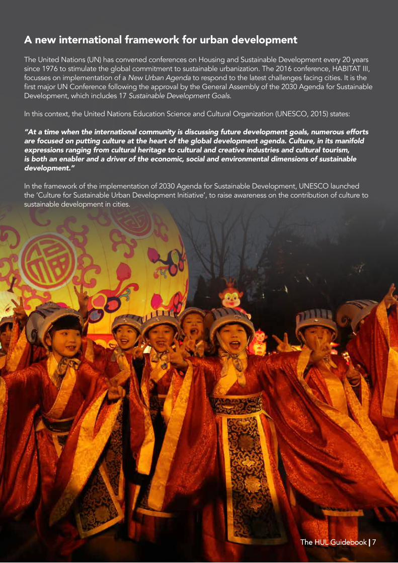
A new international framework for urban developmentThe United Nations (UN) has convened conferences on Housing and Sustainable Development every 20 years since 1976 to stimulate the global commitment to sustainable urbanization. The 2016 conference, HABITAT III, focusses on implementation of a New Urban Agenda to respond to the latest challenges facing cities. It is the first major UN Conference following the approval by the General Assembly of the 2030 Agenda for Sustainable Development, which includes 17 Sustainable Development Goals.
In this context, the United Nations Education Science and Cultural Organization (UNESCO, 2015) states:
“At a time when the international community is discussing future development goals, numerous efforts are focused on putting culture at the heart of the global development agenda. Culture, in its manifold expressions ranging from cultural heritage to cultural and creative industries and cultural tourism, is both an enabler and a driver of the economic, social and environmental dimensions of sustainable development.”
In the framework of the implementation of 2030 Agenda for Sustainable Development, UNESCO launched the ‘Culture for Sustainable Urban Development Initiative’, to raise awareness on the contribution of culture to sustainable development in cities.
The HUL Guidebook | 7 The HUL Guidebook | 7
8 | The HUL Guidebook
2. A
NE
W F
RA
ME
WO
RK
FO
R C
HA
NG
E
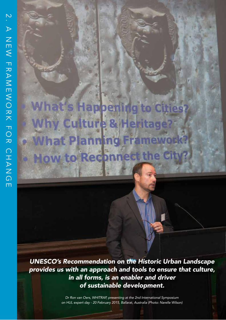
UNESCO’s Recommendation on the Historic Urban Landscape provides us with an approach and tools to ensure that culture,
in all forms, is an enabler and driverof sustainable development.
Dr Ron van Oers, WHITRAP, presenting at the 2nd International Symposiumon HUL expert day - 20 February 2015, Ballarat, Australia (Photo: Narelle Wilson)
The HUL Guidebook | 9
Development of the HUL Concept
UNESCO’s Recommendation on the Historic Urban Landscape provides us with an approach and tools to ensure that culture,
in all forms, is an enabler and driverof sustainable development.
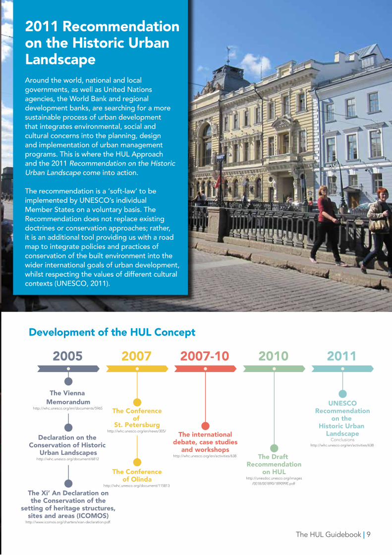
2011 Recommendation on the Historic Urban Landscape Around the world, national and local governments, as well as United Nations agencies, the World Bank and regional development banks, are searching for a more sustainable process of urban development that integrates environmental, social and cultural concerns into the planning, design and implementation of urban management programs. This is where the HUL Approach and the 2011 Recommendation on the Historic Urban Landscape come into action.
The recommendation is a ‘soft-law’ to be implemented by UNESCO’s individual Member States on a voluntary basis. The Recommendation does not replace existing doctrines or conservation approaches; rather, it is an additional tool providing us with a road map to integrate policies and practices of conservation of the built environment into the wider international goals of urban development, whilst respecting the values of different cultural contexts (UNESCO, 2011).
10 | The HUL Guidebook
3. W
HA
T IS
TH
E H
UL
AP
PR
OA
CH
?
The HUL Guidebook | 11
The Historic Urban Landscape (HUL) Approach is holistic and interdisciplinary. It addresses the inclusive management of heritage resources in dynamic and constantly changing environments, aimed at guiding change in historic cities. It is based on the recognition and identification of a layering and interconnection of natural and cultural, tangible and intangible, international and local values present in any city. According to the HUL approach, these
values should be taken as a point of departure in the overall management and
development of the city.
In this way, the HUL is both an approach and a new way of understanding our cities:
As an approach it provides the basis for integration of urban conservation within an overall sustainable development framework through the application of a range of traditional and innovative tools adapted to local contexts
As a definition it expands our understanding of the historic environment, helping us to identify the complex elements that make our cities distinctive and create their sense of place and identity. These layers constitute a richness that needs to be recognised and enhanced in conservation and city development strategies.
3. WHAT IS THE HUL APPROACH?
A. THE HUL DEFINITIONCore to the HUL approach is a new understanding of the historic environment. As defined by the Recommendation, “the historic urban landscape is the urban area understood as the result of a historic layering of cultural and natural values and attributes, extending beyond the notion of ‘historic centre’ or ‘ensemble’ to include the broader urban context and its geographical setting. This wider context includes notably the site’s topography, geomorphology, hydrology and natural features, its built environment, both historic and contemporary, its infrastructures above and below ground, its open spaces and gardens, its land use patterns and spatial organization, perceptions and visual relationships, as well as all other elements of the urban structure. It also includes social and cultural practices and values, economic processes and the intangible dimensions of heritage as related to diversity and identity.” (UNESCO, 2011) Understanding our cities in this way provides us with important knowledge to guide planning decisions and manage change.
4. IM
PL
EM
EN
TIN
G T
HE
HU
L A
PP
RO
AC
H
Community day at the 2nd International Symposiumon HUL - 21 February 2015, Ballarat, Australia. (Photo: Jeremy Dillon)

The HUL Guidebook | 13
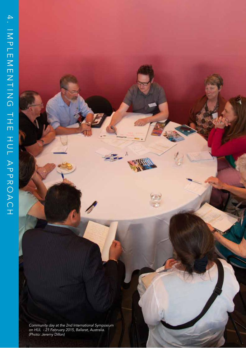
4. IMPLEMENTING THE HUL APPROACHThe HUL Approach in ActionThe HUL approach requires us to take into account the local context of each historic city. Whilst this will result in different approaches to management for different cities, at a minimum six critical steps were recommended to facilitate the implementation of the HUL approach.
B. THE SIX CRITICAL STEPS1. To undertake comprehensive surveys and mapping of the city’s natural, cultural and human resources; 2. To reach consensus using participatory planning and stakeholder consultations on what values to protect for transmission to future generations and to determine the attributes that carry these values; 3. To assess vulnerability of these attributes to socio-economic stresses and impacts of climate change; 4. To integrate urban heritage values and their vulnerability status into a wider framework of city development, which shall provide indications of areas of heritage sensitivity that require careful attention to planning, design and implementation of development projects; 5. To prioritize actions for conservation and development; and 6. To establish the appropriate partnerships and local management frameworks for each of the identified projects for conservation and development, as well as to develop mechanisms for the coordination of the various activities between different actors, both public and private. (UNESCO, 2011)
Reflexiones Temáticas: GEOLOGIA
1.- Geología y Geotecnia
2.- Geomorfología
3.- Hidrología
4.- Topografía
AHORA !! QUE OPINAN USTEDES ?
Miguel Heredia
Miguel Velez
Coronel Talbot
Estevez de Tora
l
Juan Mont
alvo
Tarqu
i
Pio Bravo
Gran Colombia
Calle Larga
Av. 10 de Agosto
Presidente Cordova
Mariscal Sucre
Simon Bolivar
Mariscal Lamar
Gaspar Sangurima
Vega Muñoz
Rafael Maria Arizaga
Av. Heroes de Verdeloma
Av. de las Americas
Av. de las Americas
Convencion del 45
Av. U
nidad
Nac
ional
Av. R
emig
io C
resp
o
Av. Ordoñez Lazo
PARQUE NACIONAL CAJAS
Av. 12 de Abril
Av. Loja
Agustin
Cueva
Av. Federi
co Pro
año
Av. Fr
ay Vice
nte Sola
no
Av. Fr
ay Vice
nte Sola
no
Av.
Rob
erto
Cre
spo
ESTADIO
Federico Malo
Av. Loja
Av. Abelardo J. Andrade
Juan Jaramillo
Honorato Vasquez
Alfonso Jerves
Alfonso Malo Calle Larga
RIO TOMEBAMBA
RIO TOMEBAMBA
RIO YANUNCAY
RIO TARQUI
RIO TOMEBAM
BA
Bajada de Todos Santos
Av. Paucarbamba
Las Herrerias
Av.
Fra
ncis
co M
osco
so
Av. 12 de Abril
Av. 12 de Abril
Av. del Estadio
Av. Florencia Astudillo
Av. Jose Peralta
Av. Luis Moreno Mora
Av. 10 de Agosto
Av. 27 de Febrero
Av. 27 de Febrero
AUTOPISTA CUENCA - AZOGUES AUTOPISTA CUENCA - AZOGUES AUTOPISTA CUENCA - AZOGUES
Av. 24 de Mayo
Av. 24 de Mayo
Av. 24 de Mayo
Av. Don Bosco
MUSEO DEL SOMBRERON
SAN ROQUE
CONVENCION DEL 45
SAN FRANCISCO
PARQUE CALDERON
CRISTO REY
BARRIALBLANCO
SAN BLAS
TOTORACOCHA
ORATORIO DON BOSCO
LUIS CORDERO
MARIA AUXILIADORA
EL VADO
BANCO CENTRAL
Gener
al Tor
res
Padr
e Agu
irre
Benig
no M
alo
Luis
Cord
ero
Pres
iden
te B
orre
ro
Her
man
o M
igue
l
Mar
iano
Cue
va
Varg
as M
achu
ca
Tom
as O
rdoñ
ez
Man
uel V
ega
Av.
Hua
yna
Capa
c
PARQUE DE LA MADRE
CIUDADELA TOMEBAMBA
EL VERGEL
VIRGEN DE BRONCE
HIDROLOGIA:
Cuenca cuenta con cuatro rios, por lo tanto el suministro de agua en la época de los primeros pobladores estaba prácticamente asegurado.
Primeros pobladores preferían asen-tarse en las lomas que rodean la olla de Cuenca probablemente por visibilidad y defensa
TOPOGRAFIA:
La ciudad crece por la llanura aluvial de los cuatro ríos.
Hoy no queda mucho espacio y la ciudad empieza a crecer por las laderas empina-das que la rodean.
¿Qué variable controlará la distrib ción espacial en el futuro? ¿El vehículo?
GEOMORFOLOGIA:
Los ríos Tarqui, Yanuncay, Tomebamba y Machángara y sus llanuras aluviales, pues son los agentes que fundamentalmente han modelado la zona de estudio.
GEOLOGIA Y GEOTECNICA
Lomas, resultado de la combinación estructura geológica y resistencia de ciertos materiales a la erosión.
Escarpe fluvial del río Machángara en el
interior del polígono industrial de Cuenca.
La línea de vegetación coincide
con la traza del escapre.
Escarpes fluviales del río
Tomebamba (flechas negras) y del Yanuncay
(flechas blancas) en el
centro de la ciudad.
Convergen a lo largo de la Av. 10 de Agosto
hasta la Iglesia de la Virgen del Bronce en la Av.
Solano.
Escarpes de falla en la circunvalación Sur (Tomada de http://www.eltiempo.com.ec).
Escarpe de falla interrumpido y desdibujado por la acción erosiva de los ríos Tomebamba y Milchichig
Altiplano resto de una antigua terraza aluvial de hace aproximadamente 1 Ma., afectada por cicatrices de deslizamiento (líneas rojas).
Altura de edificios
Altiplano resto divisoria de aguas entre los ríos Tomebamba y Yanuncay, a lo largo de la avenida 10 de Agosto. Señalar plaza de toros abierto por el hombre para la avenida Loja
"Now! What do you think?" A map about Cuenca's geology from the HUL application Visionary Conference community workshop, 8 May 2015, Cuenca, Ecuador. Source: PUH_C Research Project Team
14 | The HUL Guidebook
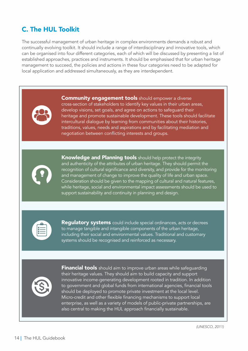
C. The HUL ToolkitThe successful management of urban heritage in complex environments demands a robust and continually evolving toolkit. It should include a range of interdisciplinary and innovative tools, which can be organised into four different categories, each of which will be discussed by presenting a list of established approaches, practices and instruments. It should be emphasised that for urban heritage management to succeed, the policies and actions in these four categories need to be adapted for local application and addressed simultaneously, as they are interdependent.
Community engagement tools should empower a diverse cross-section of stakeholders to identify key values in their urban areas, develop visions, set goals, and agree on actions to safeguard theirheritage and promote sustainable development. These tools should facilitate intercultural dialogue by learning from communities about their histories, traditions, values, needs and aspirations and by facilitating mediation and negotiation between conflicting interests and groups.
Knowledge and Planning tools should help protect the integrity and authenticity of the attributes of urban heritage. They should permit the recognition of cultural significance and diversity, and provide for the monitoring and management of change to improve the quality of life and urban space. Consideration should be given to the mapping of cultural and natural features, while heritage, social and environmental impact assessments should be used to support sustainability and continuity in planning and design.
Regulatory systems could include special ordinances, acts or decrees to manage tangible and intangible components of the urban heritage, including their social and environmental values. Traditional and customary systems should be recognised and reinforced as necessary.
Financial tools should aim to improve urban areas while safeguarding their heritage values. They should aim to build capacity and support innovative income-generating development rooted in tradition. In addition to government and global funds from international agencies, financial tools should be deployed to promote private investment at the local level. Micro-credit and other flexible financing mechanisms to support local enterprise, as well as a variety of models of public-private partnerships, are also central to making the HUL approach financially sustainable.
(UNESCO, 2011)
The HUL Guidebook | 15
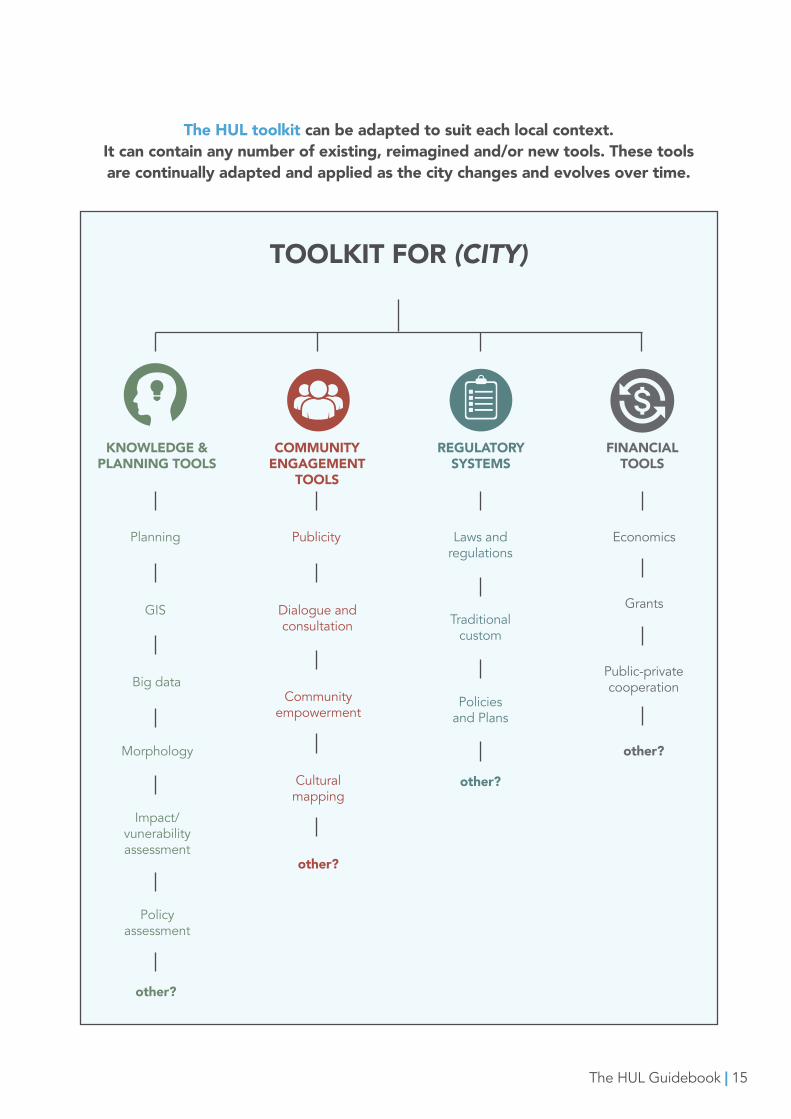
The HUL toolkit can be adapted to suit each local context. It can contain any number of existing, reimagined and/or new tools. These tools are continually adapted and applied as the city changes and evolves over time.
TOOLKIT FOR (CITY)
KNOWLEDGE & PLANNING TOOLS
COMMUNITY ENGAGEMENT
TOOLS
REGULATORY SYSTEMS
FINANCIAL TOOLS
Planning
GIS
Big data
Morphology
Impact/vunerability assessment
Policy assessment
Publicity
Dialogue and consultation
Laws and regulations
Economics
Community empowerment
Cultural mapping
Traditional custom
Policies and Plans
Grants
Public-private cooperation
other?
other?
other?
other?
16 | The HUL Guidebook‘Plaza de las flores’ market place in Cuenca, Ecuador
The HUL Guidebook | 17
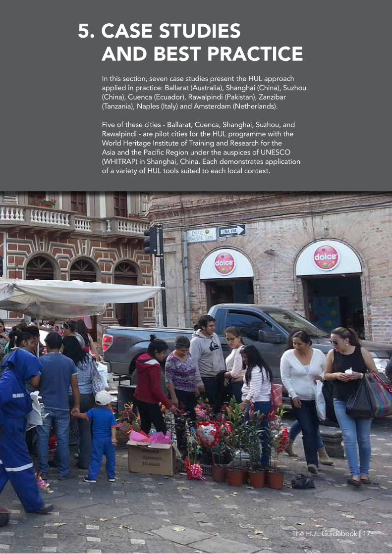
5. CASE STUDIES AND BEST PRACTICE
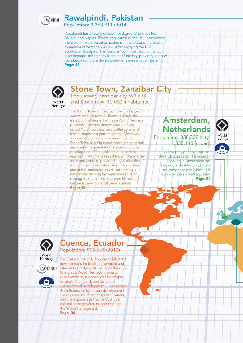
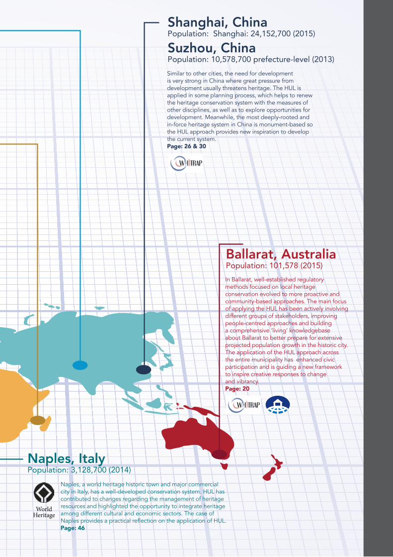
Inthissection,sevencasestudiespresenttheHULapproachappliedinpractice:Ballarat(Australia),Shanghai(China),Suzhou(China),Cuenca(Ecuador),Rawalpindi(Pakistan),Zanzibar(Tanzania),Naples(Italy)andAmsterdam(Netherlands).
Fiveofthesecities-Ballarat,Cuenca,Shanghai,Suzhou,andRawalpindi-arepilotcitiesfortheHULprogrammewiththeWorldHeritageInstituteofTrainingandResearchfortheAsiaandthePacificRegionundertheauspicesofUNESCO(WHITRAP)inShanghai,China.EachdemonstratesapplicationofavarietyofHULtoolssuitedtoeachlocalcontext.
The HUL Guidebook | 17
18
For Cuenca, the HUL approach delivered new methods for local conservation and intervention, taking into account the city’s listing as a World Heritage property. A conventional proposal was developed to create the foundation for future culture-based development. It considered the influence of fast urban development, social economic changes (gentrification), and the impacts this has for Cuenca’s cultural heritage after its inscription on the World Heritage List.Page: 34
The Stone Town of Zanzibar City is a historic coastal trading town in Tanzania. Since the inscription of Stone Town as a World Heritage property, a second area of Zanzibar City called Ng’ambo became a buffer zone and lost its status as a part of the city. Moreover, a creek creates a spatial division between Stone Town and Ng’ambo which led to social and spatial fragmentation, hindering future development. The application of the HUL approach, which analyses the site from a larger scale and context, provided a new direction for heritage conservation, improving spatial and social continuity, as well as creating a new understanding between conservation management and development by making culture a driver for local development.Page: 42
Rawalpindi has a totally different background to cities like Ballarat and Naples. Before application of the HUL programme, there were no conservation systems in the city and the public awareness of heritage was low. After applying the HUL approach, Rawalpindi has found a “common ground” for both local heritage and the environment of the city, providing a good foundation for future development of a conservation system. Page: 38
WorldHeritage
A new policy analysis tool for the HUL approach. The research
applied in Amsterdam has helped to identify how policies are composed and which HUL
concepts are applied and how.Page: 50
WorldHeritage
WorldHeritage
The HUL Guidebook | 19
In Ballarat, well-established regulatory methods focused on local heritage conservation evolved to more proactive and community-based approaches. The main focus of applying the HUL has been actively involving different groups of stakeholders, improving people-centred approaches and building a comprehensive ‘living’ knowledgebase about Ballarat to better prepare for extensive projected population growth in the historic city. The application of the HUL approach across the entire municipality has enhanced civic participation and is guiding a new framework to inspire creative responses to change and vibrancy.Page: 20
Similar to other cities, the need for development is very strong in China where great pressure from development usually threatens heritage. The HUL is applied in some planning process, which helps to renew the heritage conservation system with the measures of other disciplines, as well as to explore opportunities for development. Meanwhile, the most deeply-rooted and in-force heritage system in China is monument-based so the HUL approach provides new inspiration to develop the current system.Page: 26 & 30
Naples, a world heritage historic town and major commercial city in Italy, has a well-developed conservation system. HUL has contributed to changes regarding the management of heritage resources and highlighted the opportunity to integrate heritage among different cultural and economic sectors. The case of Naples provides a practical reflection on the application of HUL.Page: 46
WorldHeritage
2020
CA
SE ST
UD
Y: Ballarat, A
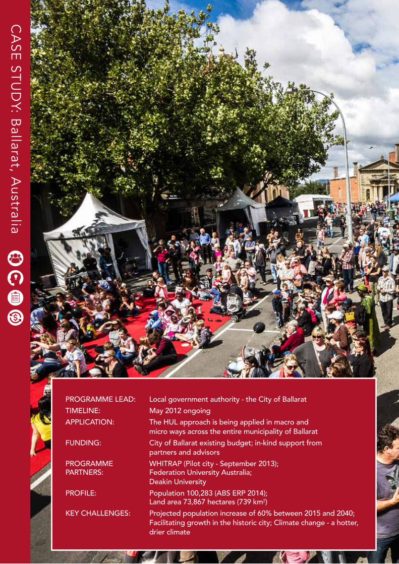
ustraliaPROGRAMME LEAD: Local government authority - the City of Ballarat TIMELINE: May 2012 ongoing APPLICATION: The HUL approach is being applied in macro and micro ways across the entire municipality of Ballarat FUNDING: City of Ballarat existing budget; in-kind support from partners and advisorsPROGRAMME WHITRAP (Pilot city - September 2013);PARTNERS: Federation University Australia; Deakin University PROFILE: Population 100,283 (ABS ERP 2014); Land area 73,867 hectares (739 km²) KEY CHALLENGES: Projected population increase of 60% between 2015 and 2040; Facilitating growth in the historic city; Climate change - a hotter, drier climate
The HUL Guidebook | 21
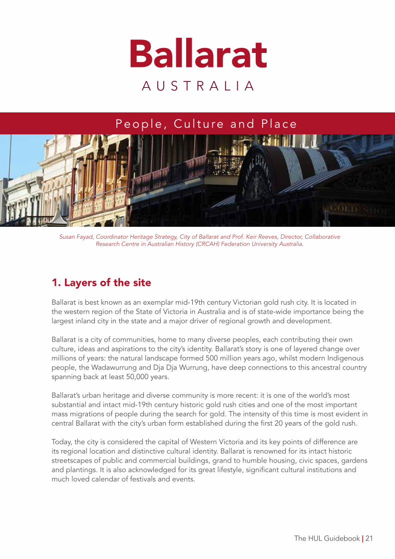
BallaratA U S T R A L I A
Susan Fayad, Coordinator Heritage Strategy, City of Ballarat and Prof. Keir Reeves, Director, Collaborative Research Centre in Australian History (CRCAH) Federation University Australia.
1. Layers of the siteBallarat is best known as an exemplar mid-19th century Victorian gold rush city. It is located in the western region of the State of Victoria in Australia and is of state-wide importance being the largest inland city in the state and a major driver of regional growth and development.
Ballarat is a city of communities, home to many diverse peoples, each contributing their own culture, ideas and aspirations to the city’s identity. Ballarat’s story is one of layered change over millions of years: the natural landscape formed 500 million years ago, whilst modern Indigenous people, the Wadawurrung and Dja Dja Wurrung, have deep connections to this ancestral country spanning back at least 50,000 years.
Ballarat’s urban heritage and diverse community is more recent: it is one of the world’s most substantial and intact mid-19th century historic gold rush cities and one of the most important mass migrations of people during the search for gold. The intensity of this time is most evident in central Ballarat with the city’s urban form established during the first 20 years of the gold rush.
Today, the city is considered the capital of Western Victoria and its key points of difference are its regional location and distinctive cultural identity. Ballarat is renowned for its intact historic streetscapes of public and commercial buildings, grand to humble housing, civic spaces, gardens and plantings. It is also acknowledged for its great lifestyle, significant cultural institutions and much loved calendar of festivals and events.
P e o p l e , C u l t u re a n d P l a c e
22 | The HUL Guidebook
2. BackgroundCollectively Ballarat’s culture and heritage is responsible for significant levels of cultural-tourism visitors and new residents to the region, driving economic, social, health and wellbeing benefits. However Ballarat is facing unprecedented population growth similar to Cuenca and Zanzibar. Forecast growth is considered the single most important factor influencing the city’s economic development in the short, medium and longer terms. At the same time, climate change in Ballarat means a hotter drier climate presenting great challenges for this inland city and surrounding farming communities. The most pressing challenge for Ballarat is helping the city grow and dealing with the impact of a changing climate without compromising its valued character, lifestyle and cultural identity. In 2013, the City of Ballarat became the first local authority to sign onto WHITRAP’s pilot programme to implement UNESCO’s HUL approach and work towards a more sustainable future for the entire municipality.
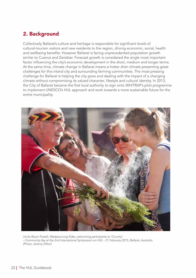
Uncle Bryon Powell, Wadawurrung Elder, welcoming participants to ‘Country’ - Community day at the 2nd International Symposium on HUL - 21 Feburary 2015, Ballarat, Australia. (Photo: Jeremy Dillon)
3. Management of changeA key objective of Ballarat’s implementation of the HUL model has been to build a framework for ensuring sustainable change. The pilot project stage of HUL in Ballarat included integrating the approach in Today, Tomorrow, Together: The Ballarat Strategy - Our Vision for 2040. This Strategy guides the future growth of the city and is concentrated on development, infrastructure and planning to make sure it is coordinated with future population growth. In doing so, the Ballarat Strategy provides an important strategic document for long-term planning throughout the municipality that balances heritage values and community identity with sustainable development. Importantly, and consistent with HUL principles, the Strategy was organised as an all of community initiative through an engagement program titled Ballarat Imagine - the largest ‘community conversation’ ever undertaken by the City of Ballarat.
Complementing the Ballarat Strategy was a range of collaborations and events, including two well attended international symposiums featuring notable practitioners as well as experts from Asia, Australia and the Pacific. Aligned with these events were a number of community forums that ensured community participation as well as community access to the process.The local authority, City of Ballarat, has been the driving force and auspicing body for the HUL pilot. It teamed up with key university stakeholder research partners: the Collaborative Research Centre in Australian History (CRCAH) and Centre for eResearch and Digital Innovation (CeRDI) at Federation University Australia and the Cultural Heritage Centre Asia and the Pacific (CHCAP) at Deakin University, Australia.
This partnership has led to numerous collaborations and development of the HUL principles through WHITRAP, Forum UNESCO, ICOMOS, and League of Historical Cities as well as numerous Australian-based organisations. Underpinning this was a program of intern placements, externally funded PhD scholarships, honorary fellowships, visiting researchers and the development of memoranda of understanding.
The development and maintenance of an online presence of the Ballarat model was a priority throughout the pilot process. This included the development of two award-winning online tools: www.hulballarat.org.au and www.visualisingballarat.org.au that provide collaboration platforms and decision support containing a range of information about the city as well as providing an important easily accessible point of engagement to the Ballarat HUL for the wider community, practitioners and researchers.
The long-term implications of HUL can be found in the implementation of People, Culture and Place: a new heritage plan for Ballarat 2016-2030 which sets out the application of the HUL approach in the city. It ties in with the development of a series of integrated and participatory Local Area Plans and the inclusion of HUL concepts into local planning policy regimes. These have been benchmarked in terms of delivering sustainable change and assessing vulnerability through a holistic evidence based tool: the United Nations Compact Cities Programme: Circles of Sustainability.
CA
SE ST
UD
Y: Ballarat, A
ustralia
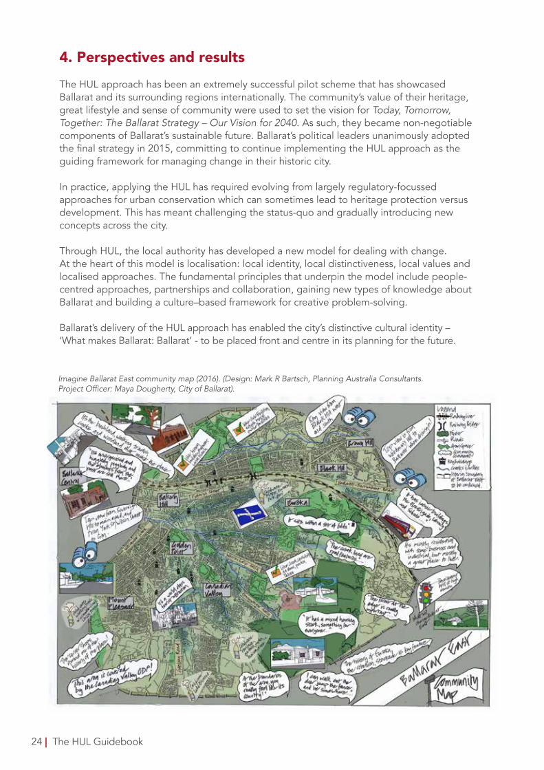
Imagine Ballarat East community map (2016). (Design: Mark R Bartsch, Planning Australia Consultants. Project Officer: Maya Dougherty, City of Ballarat).
4. Perspectives and resultsThe HUL approach has been an extremely successful pilot scheme that has showcased Ballarat and its surrounding regions internationally. The community’s value of their heritage, great lifestyle and sense of community were used to set the vision for Today, Tomorrow, Together: The Ballarat Strategy – Our Vision for 2040. As such, they became non-negotiable components of Ballarat’s sustainable future. Ballarat’s political leaders unanimously adopted the final strategy in 2015, committing to continue implementing the HUL approach as the guiding framework for managing change in their historic city.
In practice, applying the HUL has required evolving from largely regulatory-focussed approaches for urban conservation which can sometimes lead to heritage protection versus development. This has meant challenging the status-quo and gradually introducing new concepts across the city.
Through HUL, the local authority has developed a new model for dealing with change. At the heart of this model is localisation: local identity, local distinctiveness, local values and localised approaches. The fundamental principles that underpin the model include people-centred approaches, partnerships and collaboration, gaining new types of knowledge about Ballarat and building a culture–based framework for creative problem-solving.
Ballarat’s delivery of the HUL approach has enabled the city’s distinctive cultural identity – ‘What makes Ballarat: Ballarat’ - to be placed front and centre in its planning for the future.
24 | The HUL Guidebook
CA
SE ST
UD
Y: Ballarat, A
ustralia
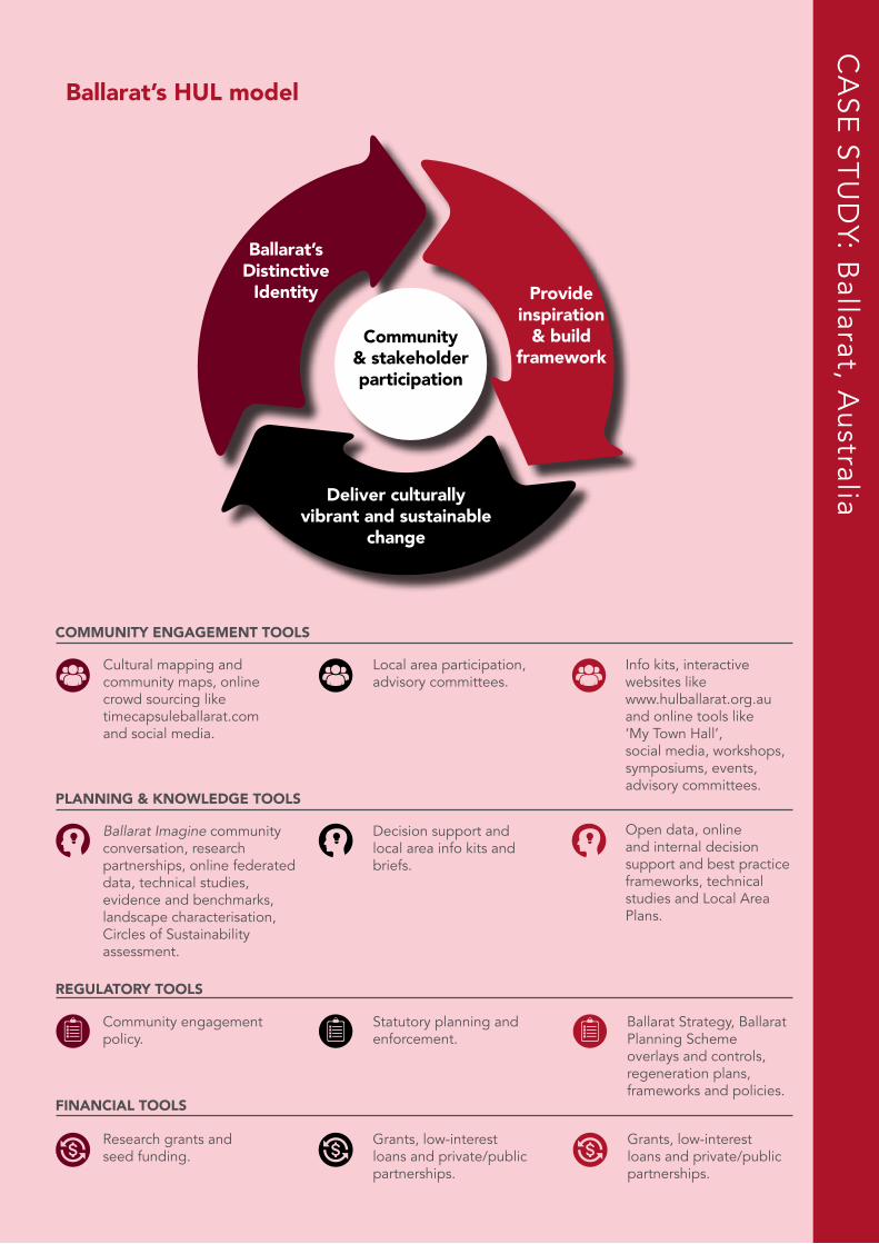
Ballarat’s HUL model
Deliver culturallyvibrant and sustainable
change
Ballarat’sDistinctive
Identity Provideinspiration
& buildframework
Community& stakeholderparticipation
COMMUNITY ENGAGEMENT TOOLS
Cultural mapping and community maps, online crowd sourcing like timecapsuleballarat.com and social media.
Local area participation,advisory committees.
Info kits, interactive websites like www.hulballarat.org.au and online tools like ‘My Town Hall’, social media, workshops, symposiums, events, advisory committees.
PLANNING & KNOWLEDGE TOOLS
Ballarat Imagine community conversation, research partnerships, online federated data, technical studies, evidence and benchmarks, landscape characterisation, Circles of Sustainability assessment.
Decision support andlocal area info kits andbriefs.
Open data, online and internal decision support and best practice frameworks, technical studies and Local Area Plans.
REGULATORY TOOLS
Community engagement policy.
Statutory planning and enforcement.
Ballarat Strategy, Ballarat Planning Scheme overlays and controls, regeneration plans, frameworks and policies.
FINANCIAL TOOLS
Grants, low-interest loans and private/public partnerships.
Research grants and seed funding.
Grants, low-interest loans and private/public partnerships.
2626
CA
SE ST
UD
Y: Shanghai, C
hina
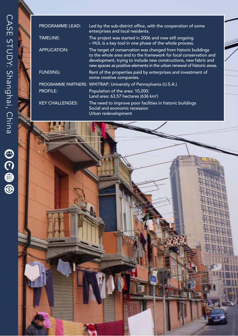
PROGRAMME LEAD: Led by the sub-district office, with the cooperation of some enterprises and local residents.TIMELINE: The project was started in 2006 and now still ongoing – HUL is a key tool in one phase of the whole process. APPLICATION: The target of conservation was changed from historic buildings to the whole area and to the framework for local conservation and development, trying to include new constructions, new fabric and new spaces as positive elements in the urban renewal of historic areas.FUNDING: Rent of the properties paid by enterprises and investment of some creative companies. PROGRAMME PARTNERS: WHITRAP; University of Pennsylvania (U.S.A.)PROFILE: Population of the area: 10,200; Land area: 63.57 hectares (636 km²)KEY CHALLENGES: The need to improve poor facilities in historic buildings Social and economic recession Urban redevelopment
The HUL Guidebook | 27
ShanghaiC H I N A
Prof. Dr. ZHOU Jian, WHITRAP Shanghai, China
1. Layers of the siteHongkou River is located in the central part of Hongkou District in downtown Shanghai. The layers in the historic urban landscape of this area expresses the long history of development and transition from the Qing Dynasty, passing through the Foreign Concessions period, up to contemporary times.
According to archaeological discovery, the first settlement in Shanghai emerged in approximately 4000 BC. With years of development and recession, Shanghai became an important port city in Qing Dynasty (1616-1912). Before the opening of Shanghai (1848), which was the result of the defeat in the First Opium War (1840-1842), there had already been a prosperous market with several small fishing villages in the area, the buildings of which are now still standing alongside Hongkou historic streets.
During the U.S. Concession period (1848-1863), there were many new road construction projects in the area, which developed with the growth of the shipping industry. Later, in the public concession period, the area was well developed in terms of society, economy and culture. For example, with the construction of the road network, the commercial, business and public facilities boomed, and included wharfs, warehouses, and manufacturers. The contemporary urban fabric was mainly formed in that period. The urban development of the area also led to the increase in the number of immigrants, which led to the emergence of diverse cultural activities such as local operas and films.
When the area was occupied by Japanese troops (1932-1945), numerous factories, shops, and residential buildings were destroyed and the whole area entered a period of decline. During the period from 1945 to 1949 and after the end of World War II, urban construction was scarce but the local population was dramatically increasing due to the huge number of refugees moving into the area. Shortly after, certain small and medium scale businesses resumed operations. Many local traditional houses and public buildings built after 1949 have been kept in use until the present day.
H o n g k o u R i v e r A re a , S h a n g h a i - C h i n a
After the 1990s, when the local industries started to transform, many factories in the Hongkou area as well as at Hongkou Wharf were idle. In the urban renewal progress, some shanties and factories were transformed into new residential buildings. Meanwhile, the water system and the urban fabric were preserved so in this area there still maintains historic architecture, public facilities and old urban spaces. The built environment of the site presents the long history of human settlement, city development and cultural exchange.
2. BackgroundIn the past few years, the redevelopment of Hongkou District has put severe pressure on the remaining buildings and environment in three primary regards:
1) The need to improve the poor facilities in historic buildings, such as shared kitchens and bathrooms, the lack of modern appliances, and damages in building structures.
2) Social and economic recession, which causes factories to vacate and businesses to stagnate, and the increase of low-income populations.
3) Urban redevelopment, defined by projects which damaged or even demolished the historic buildings, like road-widening and real estate development.Moreover, the local need of development is now increasing, which contributes to the great change in the physical and social environment of the area, such as road repaving, river maintenance, facilities enhancement in residential buildings, reuse of factories as places for creative industries, etc.
3. Management of changeIn order to have a deep consideration on the balance between development and conservation, the HUL approach - which sees and interprets the site as a continuum in time and space to achieve maintenance of continuity, enhance life quality and living condition, and create a virtuous in urban conservation - is introduced into the management on Hongkou River area. To achieve these three aims, the main tool used in the process is public participation, which is involved in local plan preparation, open discussions, and relevant adjustments in local plans and policies. The local government also organised a consultation on the local development with the participation of research institutes and social associations. Moreover, many local construction projects involved both social and market forces, in which the local industrial heritage and historic buildings were renewed.
Regarding the need to encourage economic development, introducing creative industries was an important part in the local policies for revitalization, which aims to conserve the industrial heritage and improve the quality of surrounding space by reusing the idle factories and warehouses. Meanwhile in the redeveloping progress, new social groups have been attracted for the opportunities which led to the change in the social structure of the area.
28 | The HUL Guidebook
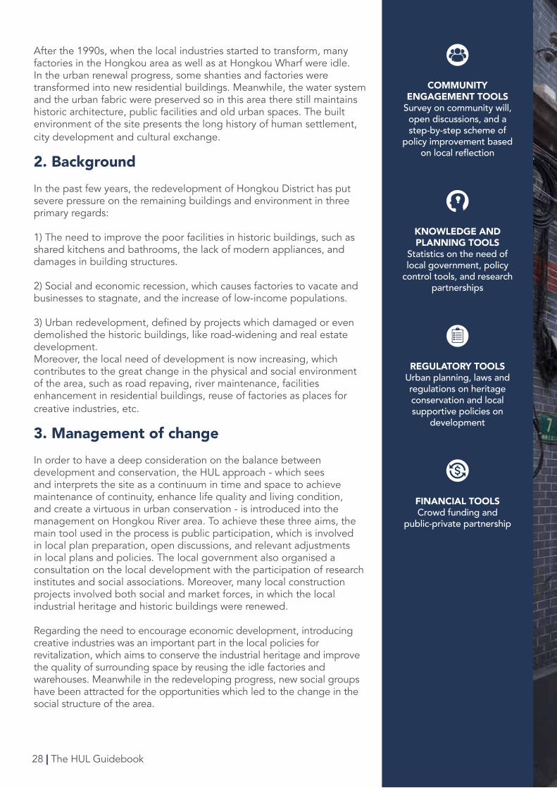
COMMUNITY ENGAGEMENT TOOLS
Survey on community will, open discussions, and a step-by-step scheme of
policy improvement based on local reflection
KNOWLEDGE AND PLANNING TOOLS
Statistics on the need of local government, policy
control tools, and research partnerships
REGULATORY TOOLSUrban planning, laws and regulations on heritage conservation and local supportive policies on
development
FINANCIAL TOOLSCrowd funding and
public-private partnership
The HUL Guidebook | 29
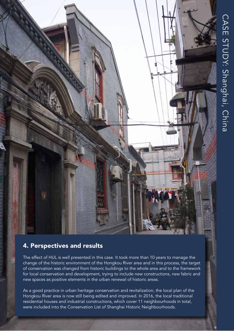
4. Perspectives and resultsThe effect of HUL is well presented in this case. It took more than 10 years to manage the change of the historic environment of the Hongkou River area and in this process, the target of conservation was changed from historic buildings to the whole area and to the framework for local conservation and development, trying to include new constructions, new fabric and new spaces as positive elements in the urban renewal of historic areas.
As a good practice in urban heritage conservation and revitalization, the local plan of the Hongkou River area is now still being edited and improved. In 2016, the local traditional residential houses and industrial constructions, which cover 11 neighbourhoods in total, were included into the Conservation List of Shanghai Historic Neighbourhoods.
CA
SE ST
UD
Y: Shanghai, C
hina
30
CA
SE ST
UD
Y: Wujiang
District, Suzho
u, China
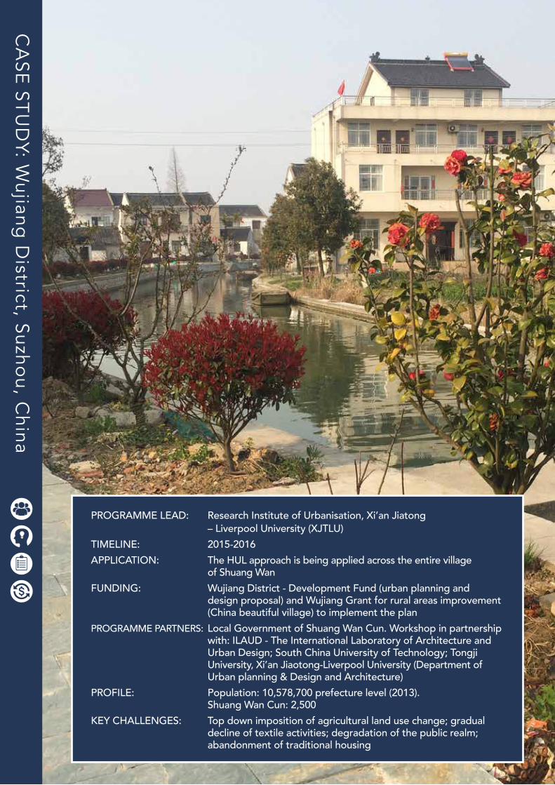
PROGRAMME LEAD: Research Institute of Urbanisation, Xi’an Jiatong – Liverpool University (XJTLU)TIMELINE: 2015-2016APPLICATION: The HUL approach is being applied across the entire village of Shuang WanFUNDING: Wujiang District - Development Fund (urban planning and design proposal) and Wujiang Grant for rural areas improvement (China beautiful village) to implement the planPROGRAMME PARTNERS: Local Government of Shuang Wan Cun. Workshop in partnership with: ILAUD - The International Laboratory of Architecture and Urban Design; South China University of Technology; Tongji University, Xi’an Jiaotong-Liverpool University (Department of Urban planning & Design and Architecture)PROFILE: Population: 10,578,700 prefecture level (2013). Shuang Wan Cun: 2,500KEY CHALLENGES: Top down imposition of agricultural land use change; gradual decline of textile activities; degradation of the public realm; abandonment of traditional housing
The HUL Guidebook | 31
Wujiang District, SuzhouC H I N A
Giulio Verdini, Westminster University & Xi’an Jiaotong – Liverpool University (XJTLU)
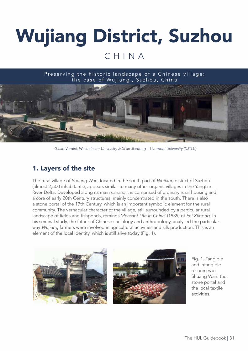
1. Layers of the siteThe rural village of Shuang Wan, located in the south part of Wujiang district of Suzhou (almost 2,500 inhabitants), appears similar to many other organic villages in the Yangtze River Delta. Developed along its main canals, it is comprised of ordinary rural housing and a core of early 20th Century structures, mainly concentrated in the south. There is also a stone portal of the 17th Century, which is an important symbolic element for the rural community. The vernacular character of the village, still surrounded by a particular rural landscape of fields and fishponds, reminds ‘Peasant Life in China’ (1939) of Fei Xiatong. In his seminal study, the father of Chinese sociology and anthropology, analysed the particular way Wujiang farmers were involved in agricultural activities and silk production. This is an element of the local identity, which is still alive today (Fig. 1).
P re s e r v i n g t h e h i s t o r i c l a n d s c a p e o f a C h i n e s e v i l l a g e : t h e c a s e o f Wu j i a n g 1, S u z h o u , C h i n a
Fig. 1. Tangible and intangible resources in Shuang Wan: the stone portal and the local textile activities.
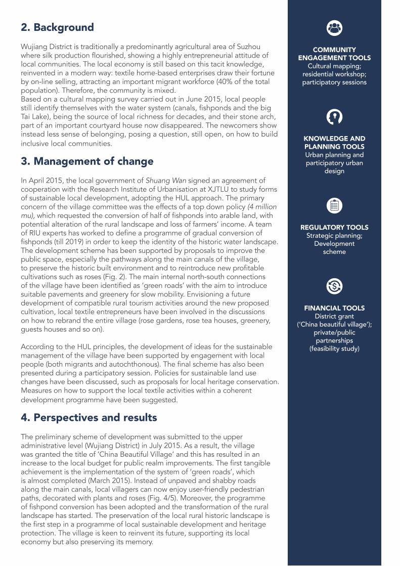
2. BackgroundWujiang District is traditionally a predominantly agricultural area of Suzhou where silk production flourished, showing a highly entrepreneurial attitude of local communities. The local economy is still based on this tacit knowledge, reinvented in a modern way: textile home-based enterprises draw their fortune by on-line selling, attracting an important migrant workforce (40% of the total population). Therefore, the community is mixed.Based on a cultural mapping survey carried out in June 2015, local people still identify themselves with the water system (canals, fishponds and the big Tai Lake), being the source of local richness for decades, and their stone arch, part of an important courtyard house now disappeared. The newcomers show instead less sense of belonging, posing a question, still open, on how to build inclusive local communities.
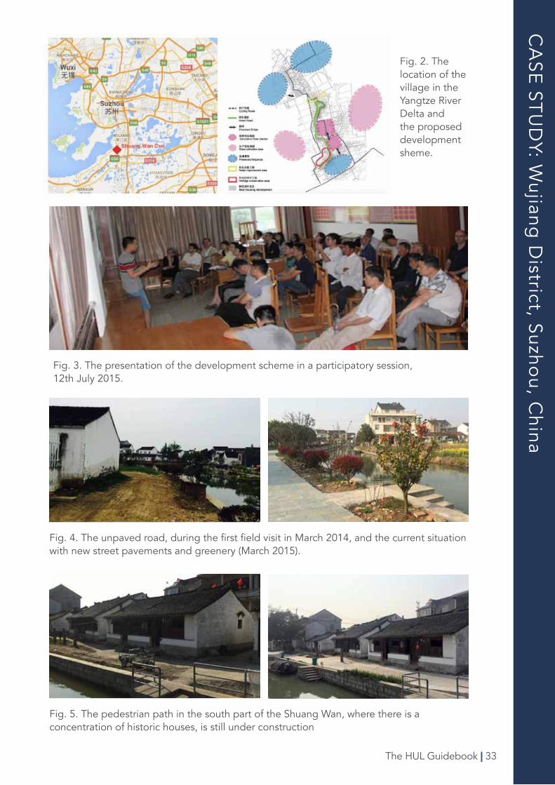
3. Management of changeIn April 2015, the local government of Shuang Wan signed an agreement of cooperation with the Research Institute of Urbanisation at XJTLU to study forms of sustainable local development, adopting the HUL approach. The primary concern of the village committee was the effects of a top down policy (4 million mu), which requested the conversion of half of fishponds into arable land, with potential alteration of the rural landscape and loss of farmers’ income. A team of RIU experts has worked to define a programme of gradual conversion of fishponds (till 2019) in order to keep the identity of the historic water landscape. The development scheme has been supported by proposals to improve the public space, especially the pathways along the main canals of the village, to preserve the historic built environment and to reintroduce new profitable cultivations such as roses (Fig. 2). The main internal north-south connections of the village have been identified as ‘green roads’ with the aim to introduce suitable pavements and greenery for slow mobility. Envisioning a future development of compatible rural tourism activities around the new proposed cultivation, local textile entrepreneurs have been involved in the discussions on how to rebrand the entire village (rose gardens, rose tea houses, greenery, guests houses and so on).
According to the HUL principles, the development of ideas for the sustainable management of the village have been supported by engagement with local people (both migrants and autochthonous). The final scheme has also been presented during a participatory session. Policies for sustainable land use changes have been discussed, such as proposals for local heritage conservation. Measures on how to support the local textile activities within a coherent development programme have been suggested.
4. Perspectives and resultsThe preliminary scheme of development was submitted to the upper administrative level (Wujiang District) in July 2015. As a result, the village was granted the title of ‘China Beautiful Village’ and this has resulted in an increase to the local budget for public realm improvements. The first tangible achievement is the implementation of the system of ‘green roads’, which is almost completed (March 2015). Instead of unpaved and shabby roads along the main canals, local villagers can now enjoy user-friendly pedestrian paths, decorated with plants and roses (Fig. 4/5). Moreover, the programme of fishpond conversion has been adopted and the transformation of the rural landscape has started. The preservation of the local rural historic landscape is the first step in a programme of local sustainable development and heritage protection. The village is keen to reinvent its future, supporting its local economy but also preserving its memory.
COMMUNITY ENGAGEMENT TOOLS
Cultural mapping; residential workshop; participatory sessions
KNOWLEDGE AND PLANNING TOOLSUrban planning and participatory urban
design
REGULATORY TOOLSStrategic planning;
Development scheme
FINANCIAL TOOLSDistrict grant
(‘China beautiful village’); private/public partnerships
(feasibility study)
CA
SE ST
UD
Y: Wujiang
District, Suzho
u, China
Fig. 4. The unpaved road, during the first field visit in March 2014, and the current situation with new street pavements and greenery (March 2015).
Fig. 2. The location of the village in the Yangtze River Delta and the proposed development sheme.
Fig. 3. The presentation of the development scheme in a participatory session, 12th July 2015.
Fig. 5. The pedestrian path in the south part of the Shuang Wan, where there is a concentration of historic houses, is still under construction
The HUL Guidebook | 33
34
CA
SE ST
UD
Y: Cuenca, E
cuado
r
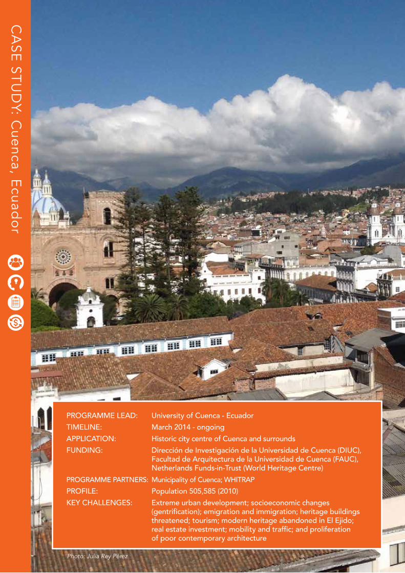
PROGRAMME LEAD: University of Cuenca - EcuadorTIMELINE: March 2014 - ongoingAPPLICATION: Historic city centre of Cuenca and surroundsFUNDING: Dirección de Investigación de la Universidad de Cuenca (DIUC), Facultad de Arquitectura de la Universidad de Cuenca (FAUC), Netherlands Funds-in-Trust (World Heritage Centre)PROGRAMME PARTNERS: Municipality of Cuenca; WHITRAPPROFILE: Population 505,585 (2010)KEY CHALLENGES: Extreme urban development; socioeconomic changes (gentrification); emigration and immigration; heritage buildings threatened; tourism; modern heritage abandoned in El Ejido; real estate investment; mobility and traffic; and proliferation of poor contemporary architecture
Photo: Julia Rey Pérez
The HUL Guidebook | 35
CuencaE C U A D O R
The text shown is part an abstract of the Research Project titled Reassessment of the Cultural and Natural Heritage of the city of Cuenca from the strategies of sustainable development supported in the figure of the
Historic Urban Landscape (PUH_C).
IMPLEMENTATION OF THE HUL APPROACH IN THE CITY OF CUENCA, ECUADOR
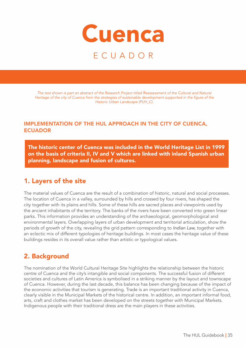
The historic center of Cuenca was included in the World Heritage List in 1999 on the basis of criteria II, IV and V which are linked with inland Spanish urban planning, landscape and fusion of cultures.
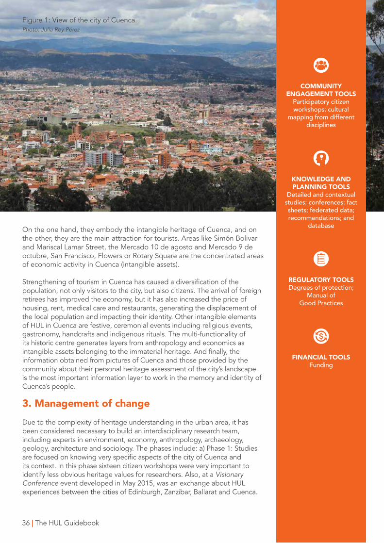
1. Layers of the siteThe material values of Cuenca are the result of a combination of historic, natural and social processes. The location of Cuenca in a valley, surrounded by hills and crossed by four rivers, has shaped the city together with its plains and hills. Some of these hills are sacred places and viewpoints used by the ancient inhabitants of the territory. The banks of the rivers have been converted into green linear parks. This information provides an understanding of the archaeological, geomorphological and environmental layers. Overlapping layers of urban development and territorial articulation, show the periods of growth of the city, revealing the grid pattern corresponding to Indian Law, together with an eclectic mix of different typologies of heritage buildings. In most cases the heritage value of these buildings resides in its overall value rather than artistic or typological values.
2. Background The nomination of the World Cultural Heritage Site highlights the relationship between the historic centre of Cuenca and the city’s intangible and social components. The successful fusion of different societies and cultures of Latin America is symbolised in a striking manner by the layout and townscape of Cuenca. However, during the last decade, this balance has been changing because of the impact of the economic activities that tourism is generating. Trade is an important traditional activity in Cuenca, clearly visible in the Municipal Markets of the historical centre. In addition, an important informal food, arts, craft and clothes market has been developed on the streets together with Municipal Markets. Indigenous people with their traditional dress are the main players in these activities.
On the one hand, they embody the intangible heritage of Cuenca, and on the other, they are the main attraction for tourists. Areas like Simón Bolivar and Mariscal Lamar Street, the Mercado 10 de agosto and Mercado 9 de octubre, San Francisco, Flowers or Rotary Square are the concentrated areas of economic activity in Cuenca (intangible assets).
Strengthening of tourism in Cuenca has caused a diversification of the population, not only visitors to the city, but also citizens. The arrival of foreign retirees has improved the economy, but it has also increased the price of housing, rent, medical care and restaurants, generating the displacement of the local population and impacting their identity. Other intangible elements of HUL in Cuenca are festive, ceremonial events including religious events, gastronomy, handcrafts and indigenous rituals. The multi-functionality of its historic centre generates layers from anthropology and economics as intangible assets belonging to the immaterial heritage. And finally, the information obtained from pictures of Cuenca and those provided by the community about their personal heritage assessment of the city’s landscape. is the most important information layer to work in the memory and identity of Cuenca’s people.
3. Management of changeDue to the complexity of heritage understanding in the urban area, it has been considered necessary to build an interdisciplinary research team, including experts in environment, economy, anthropology, archaeology, geology, architecture and sociology. The phases include: a) Phase 1: Studies are focused on knowing very specific aspects of the city of Cuenca and its context. In this phase sixteen citizen workshops were very important to identify less obvious heritage values for researchers. Also, at a Visionary Conference event developed in May 2015, was an exchange about HUL experiences between the cities of Edinburgh, Zanzíbar, Ballarat and Cuenca.
36 | The HUL Guidebook
COMMUNITY ENGAGEMENT TOOLS
Participatory citizen workshops; cultural
mapping from different disciplines
KNOWLEDGE AND PLANNING TOOLS
Detailed and contextual studies; conferences; fact sheets; federated data; recommendations; and
database
REGULATORY TOOLSDegrees of protection;
Manual of Good Practices
FINANCIAL TOOLSFunding
Figure 1: View of the city of Cuenca.Photo: Julia Rey Pérez
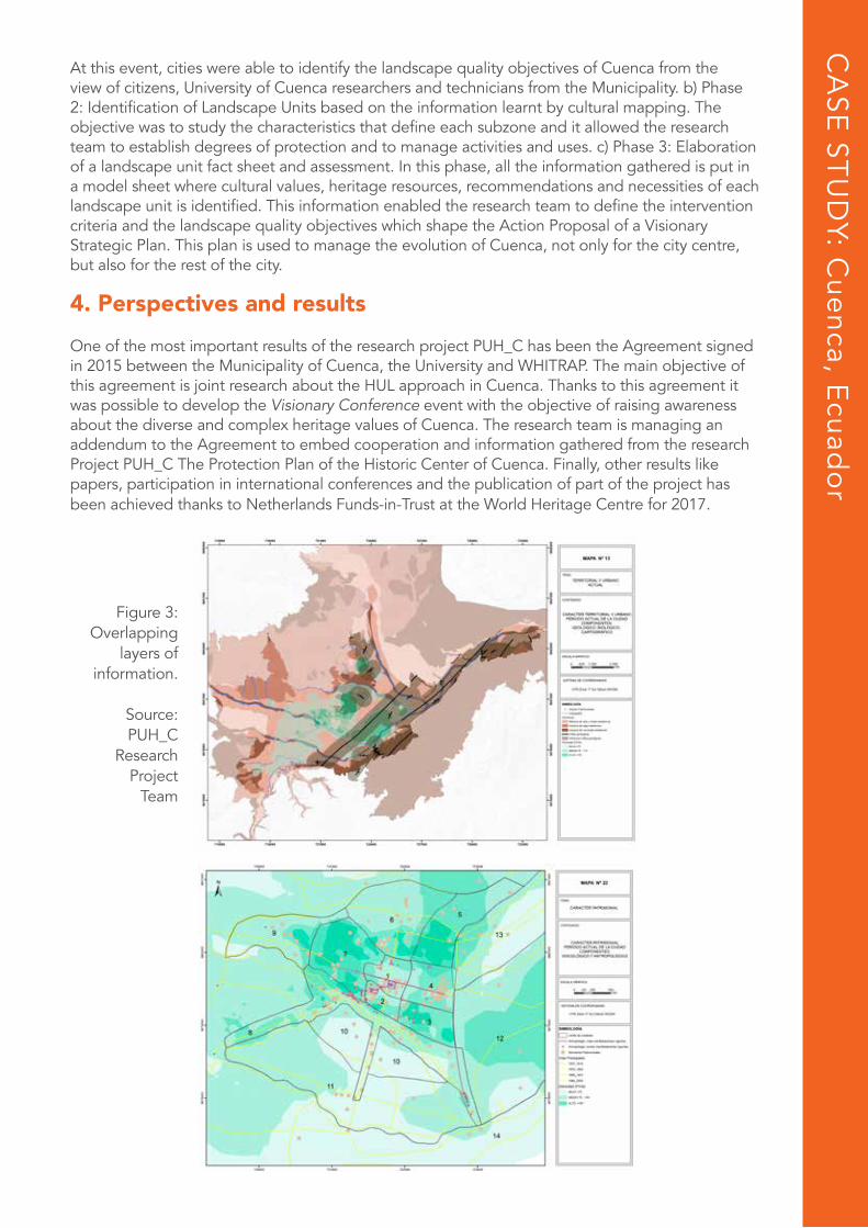
At this event, cities were able to identify the landscape quality objectives of Cuenca from the view of citizens, University of Cuenca researchers and technicians from the Municipality. b) Phase 2: Identification of Landscape Units based on the information learnt by cultural mapping. The objective was to study the characteristics that define each subzone and it allowed the research team to establish degrees of protection and to manage activities and uses. c) Phase 3: Elaboration of a landscape unit fact sheet and assessment. In this phase, all the information gathered is put in a model sheet where cultural values, heritage resources, recommendations and necessities of each landscape unit is identified. This information enabled the research team to define the intervention criteria and the landscape quality objectives which shape the Action Proposal of a Visionary Strategic Plan. This plan is used to manage the evolution of Cuenca, not only for the city centre, but also for the rest of the city.
4. Perspectives and resultsOne of the most important results of the research project PUH_C has been the Agreement signed in 2015 between the Municipality of Cuenca, the University and WHITRAP. The main objective of this agreement is joint research about the HUL approach in Cuenca. Thanks to this agreement it was possible to develop the Visionary Conference event with the objective of raising awareness about the diverse and complex heritage values of Cuenca. The research team is managing an addendum to the Agreement to embed cooperation and information gathered from the research Project PUH_C The Protection Plan of the Historic Center of Cuenca. Finally, other results like papers, participation in international conferences and the publication of part of the project has been achieved thanks to Netherlands Funds-in-Trust at the World Heritage Centre for 2017.
CA
SE ST
UD
Y: Cuenca, E
cuado
r
Figure 3: Overlapping
layers of information.
Source: PUH_C
ResearchProject
Team
3838
CA
SE ST
UD
Y: Raw
alpind
i, Pakistan
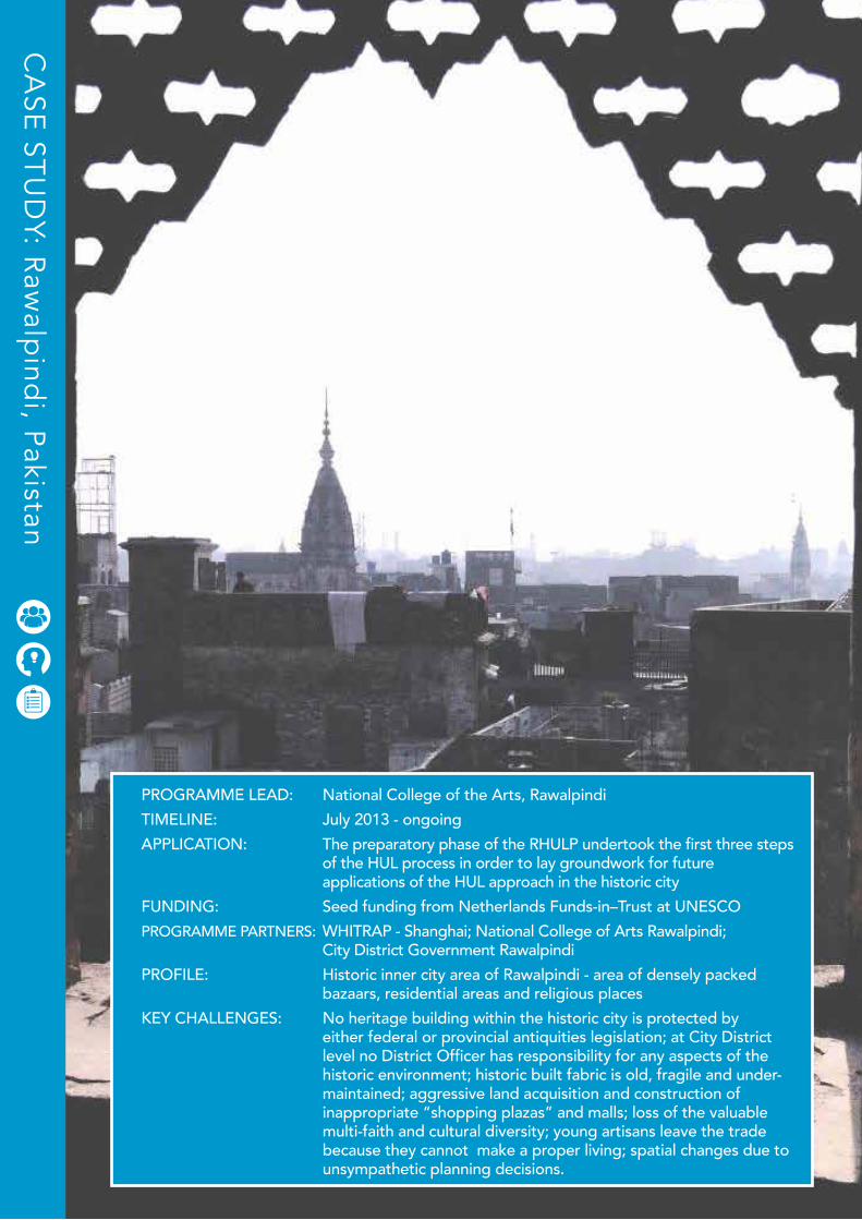
PROGRAMME LEAD: National College of the Arts, RawalpindiTIMELINE: July 2013 - ongoingAPPLICATION: The preparatory phase of the RHULP undertook the first three steps of the HUL process in order to lay groundwork for future applications of the HUL approach in the historic cityFUNDING: Seed funding from Netherlands Funds-in–Trust at UNESCOPROGRAMME PARTNERS: WHITRAP - Shanghai; National College of Arts Rawalpindi; City District Government RawalpindiPROFILE: Historic inner city area of Rawalpindi - area of densely packed bazaars, residential areas and religious placesKEY CHALLENGES: No heritage building within the historic city is protected by either federal or provincial antiquities legislation; at City District level no District Officer has responsibility for any aspects of the historic environment; historic built fabric is old, fragile and under- maintained; aggressive land acquisition and construction of inappropriate “shopping plazas” and malls; loss of the valuable multi-faith and cultural diversity; young artisans leave the trade because they cannot make a proper living; spatial changes due to unsympathetic planning decisions.
The HUL Guidebook | 39
RawalpindiP A K I S T A N
Ayesha-Pamela Rogers (Coordinator of HUL Project in Rawalpindi), Visiting Professor at the National College of Arts, Lahore and Rawalpindi, Pakistan
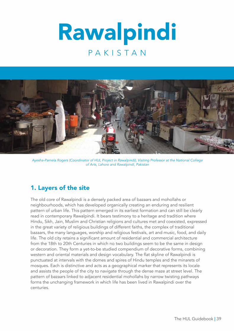
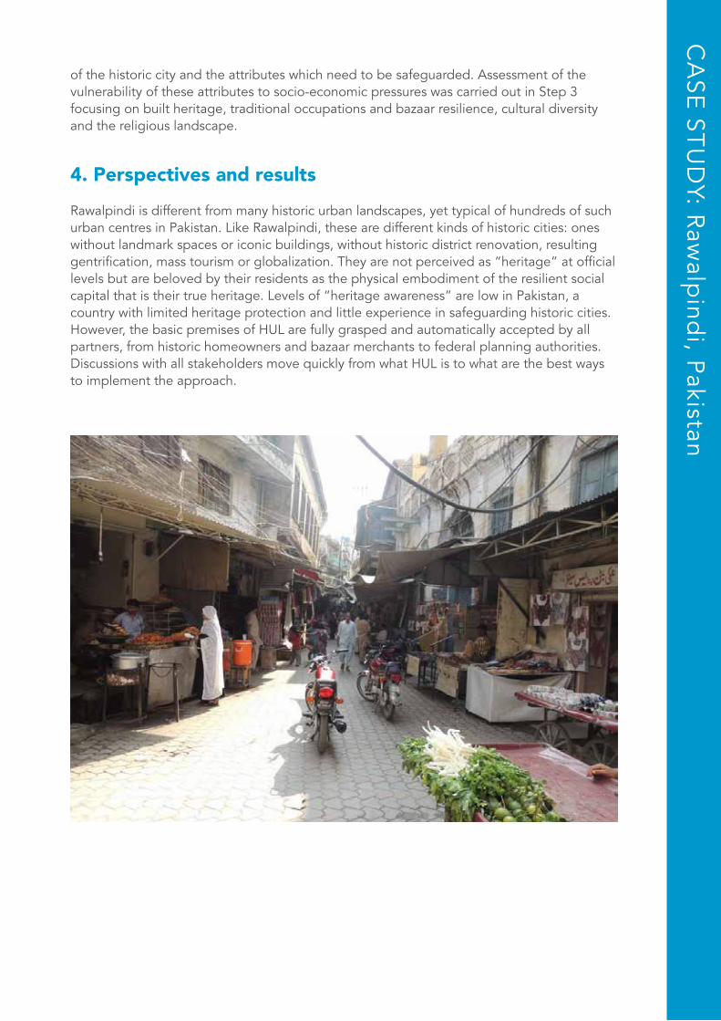
1. Layers of the siteThe old core of Rawalpindi is a densely packed area of bazaars and mohollahs or neighbourhoods, which has developed organically creating an enduring and resilient pattern of urban life. This pattern emerged in its earliest formation and can still be clearly read in contemporary Rawalpindi. It bears testimony to a heritage and tradition where Hindu, Sikh, Jain, Muslim and Christian religions and cultures met and coexisted, expressed in the great variety of religious buildings of different faiths, the complex of traditional bazaars, the many languages, worship and religious festivals, art and music, food, and daily life. The old city retains a significant amount of residential and commercial architecture from the 18th to 20th Centuries in which no two buildings seem to be the same in design or decoration. They form a yet-to-be studied compendium of decorative forms, combining western and oriental materials and design vocabulary. The flat skyline of Rawalpindi is punctuated at intervals with the domes and spires of Hindu temples and the minarets of mosques. Each is distinctive and acts as a geographical marker that represents its locale and assists the people of the city to navigate through the dense maze at street level. The pattern of bazaars linked to adjacent residential mohollahs by narrow twisting pathways forms the unchanging framework in which life has been lived in Rawalpindi over the centuries.
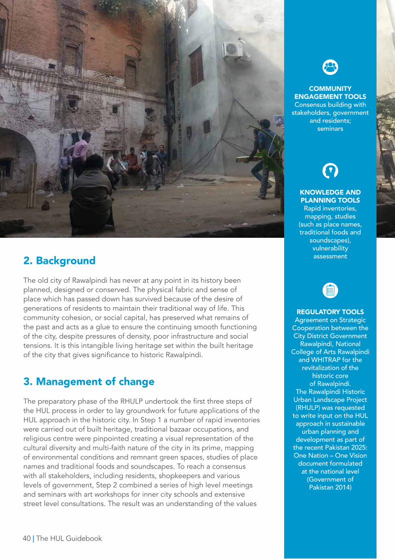
2. Background The old city of Rawalpindi has never at any point in its history been planned, designed or conserved. The physical fabric and sense of place which has passed down has survived because of the desire of generations of residents to maintain their traditional way of life. This community cohesion, or social capital, has preserved what remains of the past and acts as a glue to ensure the continuing smooth functioning of the city, despite pressures of density, poor infrastructure and social tensions. It is this intangible living heritage set within the built heritage of the city that gives significance to historic Rawalpindi.
3. Management of changeThe preparatory phase of the RHULP undertook the first three steps of the HUL process in order to lay groundwork for future applications of the HUL approach in the historic city. In Step 1 a number of rapid inventories were carried out of built heritage, traditional bazaar occupations, and religious centre were pinpointed creating a visual representation of the cultural diversity and multi-faith nature of the city in its prime, mapping of environmental conditions and remnant green spaces, studies of place names and traditional foods and soundscapes. To reach a consensus with all stakeholders, including residents, shopkeepers and various levels of government, Step 2 combined a series of high level meetings and seminars with art workshops for inner city schools and extensive street level consultations. The result was an understanding of the values
40 | The HUL Guidebook
COMMUNITY ENGAGEMENT TOOLS Consensus building with
stakeholders, government and residents;
seminars
KNOWLEDGE AND PLANNING TOOLSRapid inventories, mapping, studies
(such as place names, traditional foods and
soundscapes), vulnerability assessment
REGULATORY TOOLSAgreement on Strategic
Cooperation between the City District Government
Rawalpindi, National College of Arts Rawalpindi
and WHITRAP for the revitalization of the
historic core of Rawalpindi.
The Rawalpindi Historic Urban Landscape Project (RHULP) was requested
to write input on the HUL approach in sustainable
urban planning and development as part of
the recent Pakistan 2025: One Nation – One Vision
document formulated at the national level
(Government ofPakistan 2014)
of the historic city and the attributes which need to be safeguarded. Assessment of the vulnerability of these attributes to socio-economic pressures was carried out in Step 3 focusing on built heritage, traditional occupations and bazaar resilience, cultural diversity and the religious landscape.
4. Perspectives and resultsRawalpindi is different from many historic urban landscapes, yet typical of hundreds of such urban centres in Pakistan. Like Rawalpindi, these are different kinds of historic cities: ones without landmark spaces or iconic buildings, without historic district renovation, resulting gentrification, mass tourism or globalization. They are not perceived as “heritage” at official levels but are beloved by their residents as the physical embodiment of the resilient social capital that is their true heritage. Levels of “heritage awareness” are low in Pakistan, a country with limited heritage protection and little experience in safeguarding historic cities. However, the basic premises of HUL are fully grasped and automatically accepted by all partners, from historic homeowners and bazaar merchants to federal planning authorities. Discussions with all stakeholders move quickly from what HUL is to what are the best ways to implement the approach.
CA
SE ST
UD
Y: Raw
alpind
i, Pakistan
42
CA
SE ST
UD
Y: Zanzibar, Tanzania
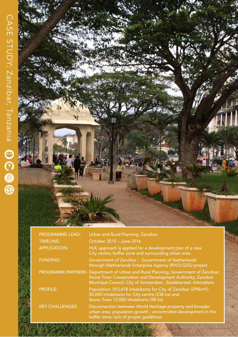
PROGRAMME LEAD: Urban and Rural Planning, ZanzibarTIMELINE: October 2015 – June 2016APPLICATION: HUL approach is applied for a development plan of a new City centre; buffer zone and surrounding urban areaFUNDING: Government of Zanzibar ; Government of Netherlands through (Netherlands Enterprise Agency (RVO)-G2G) projectPROGRAMME PARTNERS: Department of Urban and Rural Planning, Government of Zanzibar; Stone Town Conservation and Development Authority; Zanzibar Municipal Council; City of Amsterdam ; Stadsherstel; AAmattersPROFILE: Population: 593,678 inhabitants for City of Zanzibar (295km²); 50,000 inhabitants for City centre (238 ha) and Stone Town 12,000 inhabitants (98 ha)KEY CHALLENGES: Disconnection between World Heritage property and broader urban area; population growth ; uncontrolled development in the buffer zone; lack of proper guidelines
The HUL Guidebook | 43
ZanzibarT A N Z A N I A
N g ’ a m b o Tu i k a y o : T h e b u f f e r w e w a n t . I m p l e m e n t a t i o n o f H U L a p p ro a c h i n Z a n z i b a r t o w n , Ta n z a n i a .
Dr. Muhammad Juma, Director of Urban and Rural Planning, Zanzibar
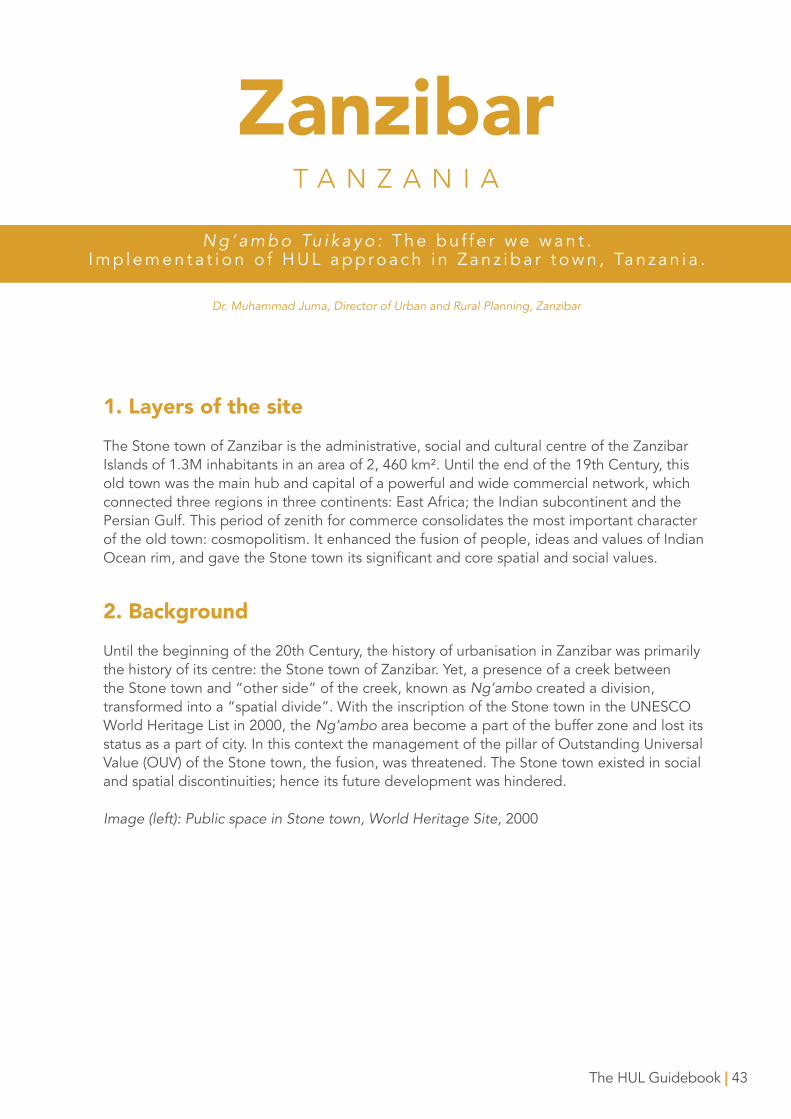
1. Layers of the siteThe Stone town of Zanzibar is the administrative, social and cultural centre of the Zanzibar Islands of 1.3M inhabitants in an area of 2, 460 km². Until the end of the 19th Century, this old town was the main hub and capital of a powerful and wide commercial network, which connected three regions in three continents: East Africa; the Indian subcontinent and the Persian Gulf. This period of zenith for commerce consolidates the most important character of the old town: cosmopolitism. It enhanced the fusion of people, ideas and values of Indian Ocean rim, and gave the Stone town its significant and core spatial and social values.
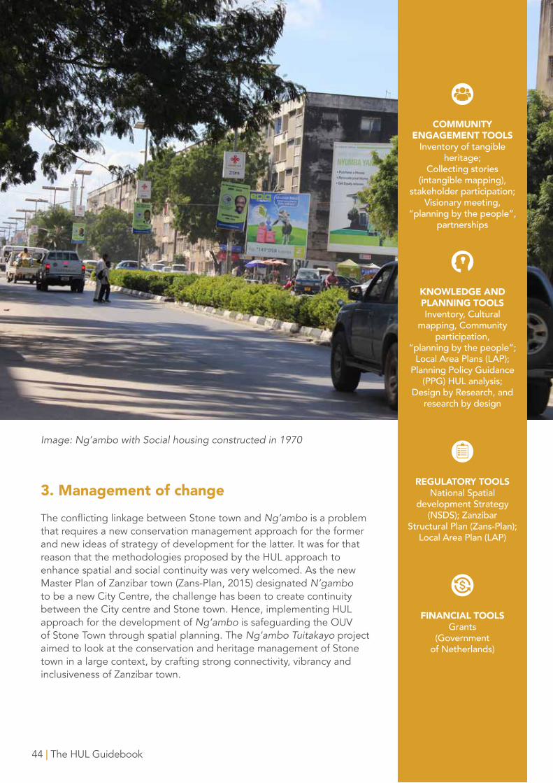
2. BackgroundUntil the beginning of the 20th Century, the history of urbanisation in Zanzibar was primarily the history of its centre: the Stone town of Zanzibar. Yet, a presence of a creek between the Stone town and “other side” of the creek, known as Ng’ambo created a division, transformed into a “spatial divide”. With the inscription of the Stone town in the UNESCO World Heritage List in 2000, the Ng’ambo area become a part of the buffer zone and lost its status as a part of city. In this context the management of the pillar of Outstanding Universal Value (OUV) of the Stone town, the fusion, was threatened. The Stone town existed in social and spatial discontinuities; hence its future development was hindered.
Image (left): Public space in Stone town, World Heritage Site, 2000
3. Management of changeThe conflicting linkage between Stone town and Ng’ambo is a problem that requires a new conservation management approach for the former and new ideas of strategy of development for the latter. It was for that reason that the methodologies proposed by the HUL approach to enhance spatial and social continuity was very welcomed. As the new Master Plan of Zanzibar town (Zans-Plan, 2015) designated N’gambo to be a new City Centre, the challenge has been to create continuity between the City centre and Stone town. Hence, implementing HUL approach for the development of Ng’ambo is safeguarding the OUV of Stone Town through spatial planning. The Ng’ambo Tuitakayo project aimed to look at the conservation and heritage management of Stone town in a large context, by crafting strong connectivity, vibrancy and inclusiveness of Zanzibar town.
Image: Ng’ambo with Social housing constructed in 1970
44 | The HUL Guidebook
COMMUNITY ENGAGEMENT TOOLS
Inventory of tangible heritage;
Collecting stories (intangible mapping),
stakeholder participation; Visionary meeting,
“planning by the people”, partnerships
KNOWLEDGE AND PLANNING TOOLSInventory, Cultural
mapping, Community participation,
“planning by the people”; Local Area Plans (LAP);
Planning Policy Guidance (PPG) HUL analysis;
Design by Research, and research by design
REGULATORY TOOLSNational Spatial
development Strategy (NSDS); Zanzibar
Structural Plan (Zans-Plan); Local Area Plan (LAP)
FINANCIAL TOOLSGrants
(Government of Netherlands)
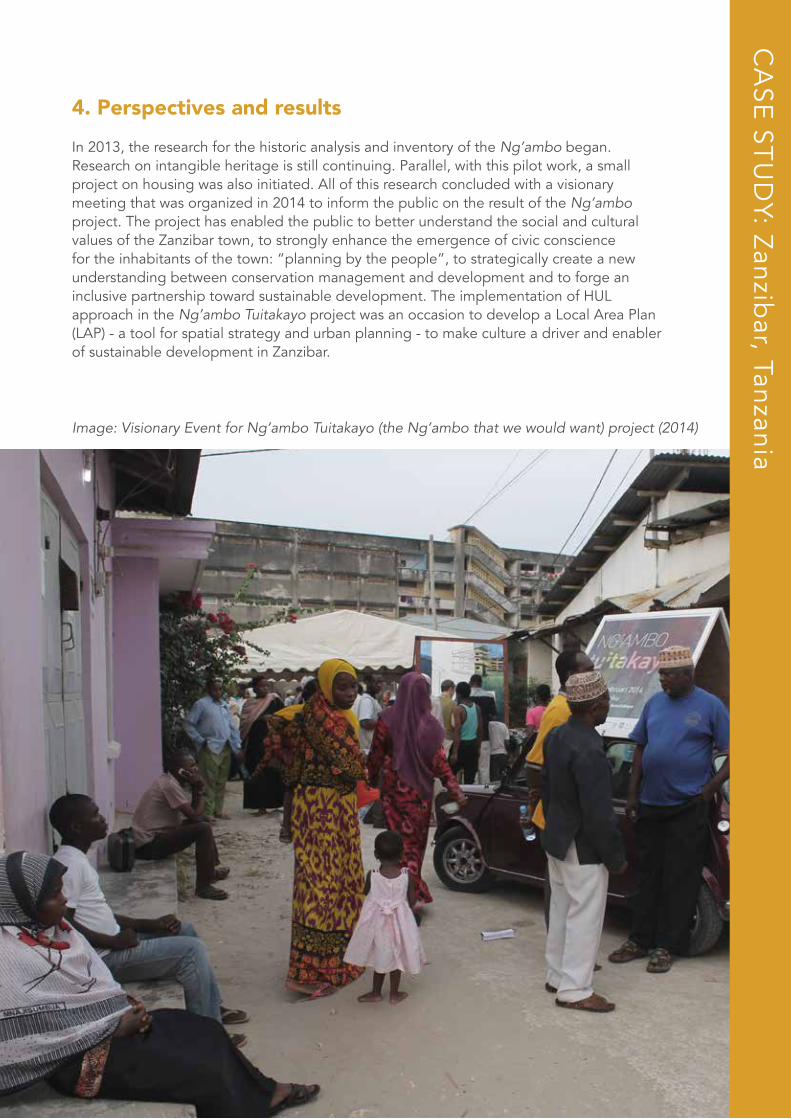
4. Perspectives and resultsIn 2013, the research for the historic analysis and inventory of the Ng’ambo began. Research on intangible heritage is still continuing. Parallel, with this pilot work, a small project on housing was also initiated. All of this research concluded with a visionary meeting that was organized in 2014 to inform the public on the result of the Ng’ambo project. The project has enabled the public to better understand the social and cultural values of the Zanzibar town, to strongly enhance the emergence of civic conscience for the inhabitants of the town: “planning by the people”, to strategically create a new understanding between conservation management and development and to forge an inclusive partnership toward sustainable development. The implementation of HUL approach in the Ng’ambo Tuitakayo project was an occasion to develop a Local Area Plan (LAP) - a tool for spatial strategy and urban planning - to make culture a driver and enabler of sustainable development in Zanzibar.
CA
SE ST
UD
Y: Zanzibar, Tanzania
Image: Visionary Event for Ng’ambo Tuitakayo (the Ng’ambo that we would want) project (2014)
4646
CA
SE ST
UD
Y: Nap
les, Italy
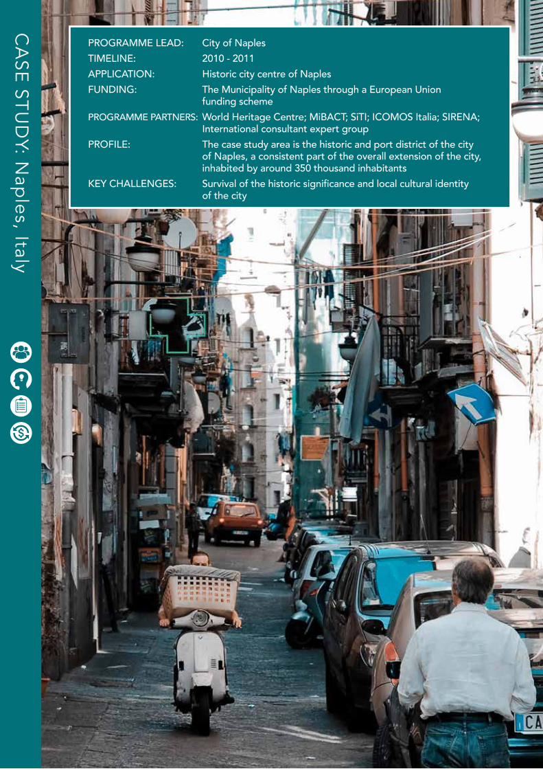
PROGRAMME LEAD: City of NaplesTIMELINE: 2010 - 2011APPLICATION: Historic city centre of NaplesFUNDING: The Municipality of Naples through a European Union funding schemePROGRAMME PARTNERS: World Heritage Centre; MiBACT; SiTI; ICOMOS Italia; SIRENA; International consultant expert groupPROFILE: The case study area is the historic and port district of the city of Naples, a consistent part of the overall extension of the city, inhabited by around 350 thousand inhabitantsKEY CHALLENGES: Survival of the historic significance and local cultural identity of the city
The HUL Guidebook | 47
NaplesI T A L Y
Alessio Re, Secretary General of CSS-Ebla (founder of the International UNESCO Category 2 Centre on the Economics of Culture and World Heritage studies-ITRECH); adjunct professor at University of Torino in Man-
agement of cultural projects and Cultural Industries and Global markets.
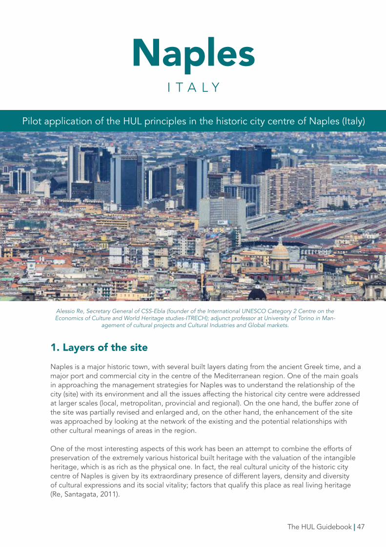
1. Layers of the siteNaples is a major historic town, with several built layers dating from the ancient Greek time, and a major port and commercial city in the centre of the Mediterranean region. One of the main goals in approaching the management strategies for Naples was to understand the relationship of the city (site) with its environment and all the issues affecting the historical city centre were addressed at larger scales (local, metropolitan, provincial and regional). On the one hand, the buffer zone of the site was partially revised and enlarged and, on the other hand, the enhancement of the site was approached by looking at the network of the existing and the potential relationships with other cultural meanings of areas in the region.
One of the most interesting aspects of this work has been an attempt to combine the efforts of preservation of the extremely various historical built heritage with the valuation of the intangible heritage, which is as rich as the physical one. In fact, the real cultural unicity of the historic city centre of Naples is given by its extraordinary presence of different layers, density and diversity of cultural expressions and its social vitality; factors that qualify this place as real living heritage (Re, Santagata, 2011).
Pilot application of the HUL principles in the historic city centre of Naples (Italy)
2. Background The consideration of culture as a resource to set up proper projects for sustaining local development – in line with the principles proposed by the HUL Recommendation - seemsto be widely shared and a central issue in the present debate for the destiny of historic cities in Italy.
One of the first occasions to apply the HUL approach, was the preparation of the management plan for the historic city centre of Naples, recognized as world heritage property since 19952.
The preparation that document, which was completed in 2011, was conducted parallel with the preparation of the HUL Recommendation, and therefore offered a real opportunity for a practical reflection and application for some of the principles proposed by the approach, starting from the definition of the same framework for structuring the plan. In fact, such an instrument provided the possibility not to keep the protection of the site separate from the ones aimed at its valorization, especially investing in the cultural production and intangible values and networks of the city.
3. Management of changeSewing, gastronomy (the art of making the “pizza” is now proposed for the UNESCO Intangible Heritage List), handicrafts , the nativity scene art (Cuccia, Marrelli, Santagata, 2007; De Caro, Marrelli, Santagata, 2008), as well as all the various sectors of local creative industries, including music production , which undoubtedly represent the most vital and authentic expression of the extraordinary and complex system of cultural values in the historic centre of the city, were interpreted as opportunities for generating cultural and economic value throughout the historic city.
As such, survival has been recognized as the first way to guarantee the safeguarding of the authentic historic significance of the whole city, as well as of the identity of local communities. Thus, in structuring the opportunities in action plans, the preservation of tangible and intangible assets has been approached as a combined process between conservation and development, to be achieved through the continuous production of new culture and innovation. Actions to sustain young entrepreneurship, capacity building in the creative sectors, incentivising the reuse of historic areas in the city centre for hosting new start up initiatives were concrete measures put in place to reinforce the link between the historic spaces of the city, its inhabitants and workers. All these measures were combined with policies enforcing the linkages with the territorial system and the touristic sector, which has strong potential to be developed and qualified.
48 | The HUL Guidebook
COMMUNITY ENGAGEMENT TOOLS
Workshops targeted at different levels of
stakeholders
KNOWLEDGE AND PLANNING TOOLS
Participatory planning
REGULATORY TOOLSCommunity
engagement; networking
FINANCIAL TOOLSFiscal incentives;
grants; collective branding
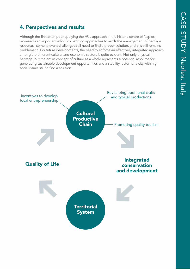
4. Perspectives and resultsAlthough the first attempt of applying the HUL approach in the historic centre of Naples represents an important effort in changing approaches towards the management of heritage resources, some relevant challenges still need to find a proper solution, and this still remains problematic. For future developments, the need to enforce an effectively integrated approach among the different cultural and economic sectors is quite evident. Not only physical heritage, but the entire concept of culture as a whole represents a potential resource for generating sustainable development opportunities and a stability factor for a city with high social issues still to find a solution.
CA
SE ST
UD
Y: Nap
les, Italy
TerritorialSystem
CulturalProductive
Chain
Quality of LifeIntegrated
conservationand development
Revitalizing traditional craftsand typical productions
Promoting quality tourism
Incentives to developlocal entrepreneurship
50 | The HUL Guidebook
CA
SE ST
UD
Y: Heritag
e po
licy analysis too
l for the H
UL ap
pro
ach
50
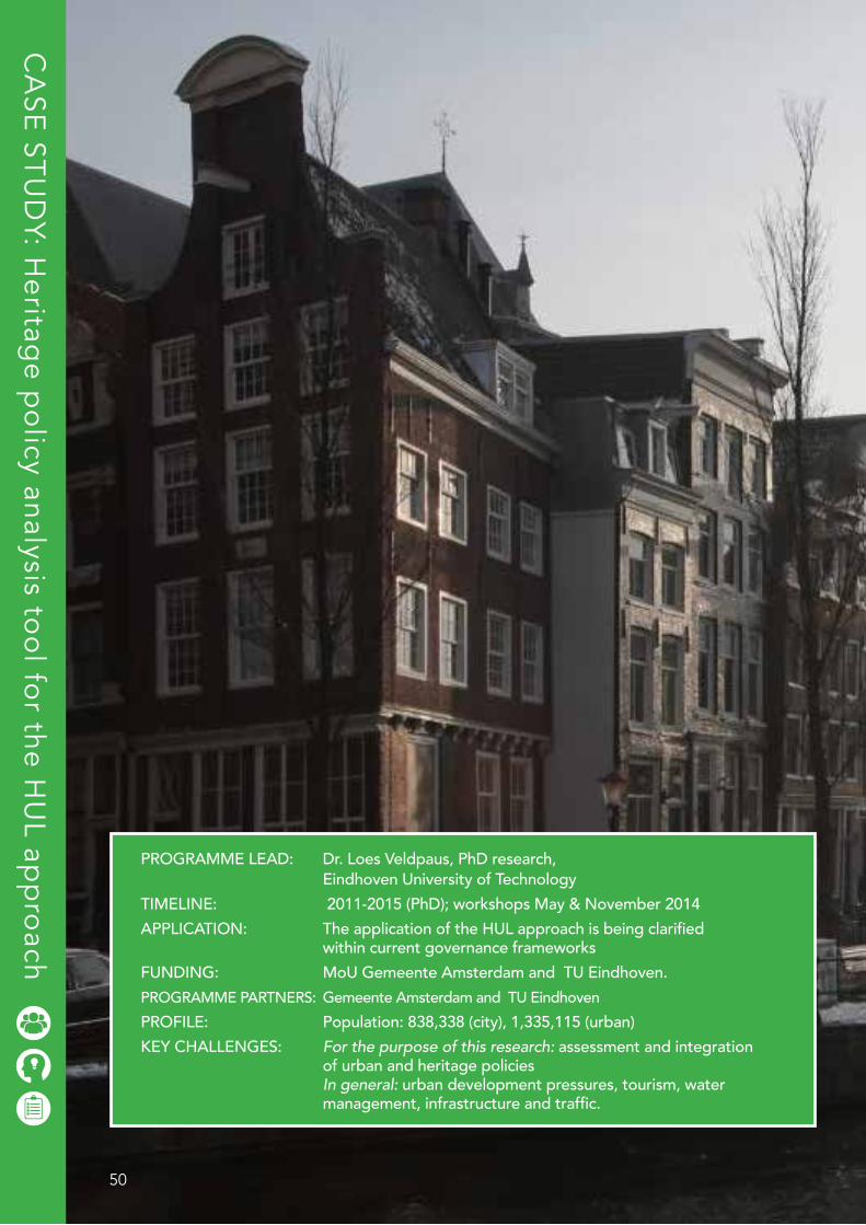
PROGRAMME LEAD: Dr. Loes Veldpaus, PhD research, Eindhoven University of TechnologyTIMELINE: 2011-2015 (PhD); workshops May & November 2014APPLICATION: The application of the HUL approach is being clarified within current governance frameworksFUNDING: MoU Gemeente Amsterdam and TU Eindhoven. PROGRAMME PARTNERS: Gemeente Amsterdam and TU EindhovenPROFILE: Population: 838,338 (city), 1,335,115 (urban)KEY CHALLENGES: For the purpose of this research: assessment and integration of urban and heritage policies In general: urban development pressures, tourism, water management, infrastructure and traffic.
The HUL Guidebook | 51
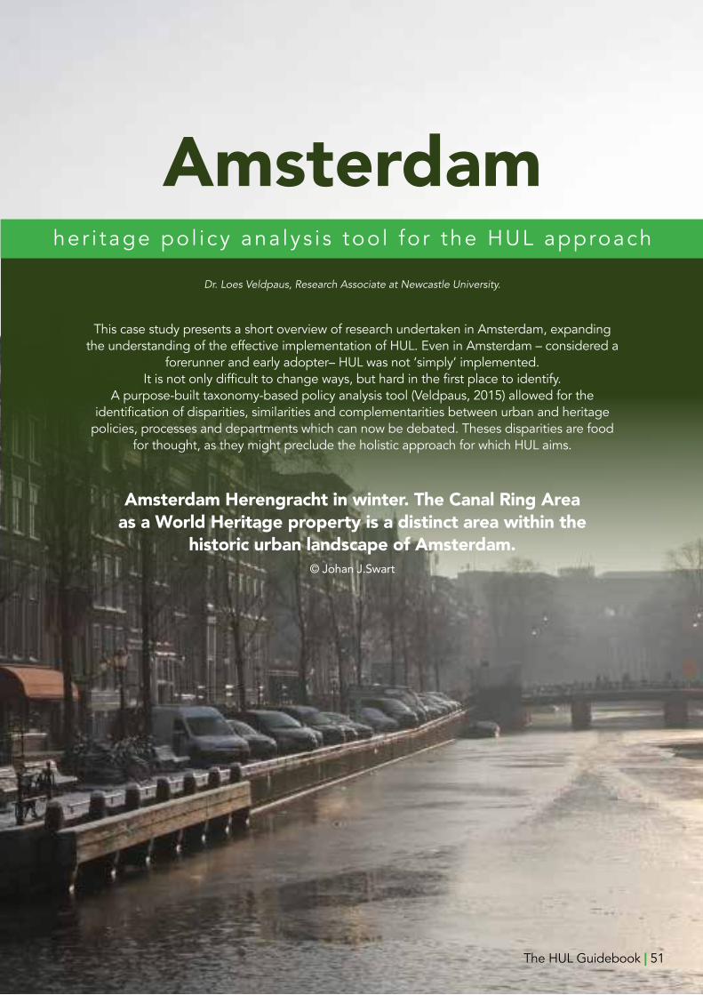
Dr. Loes Veldpaus, Research Associate at Newcastle University.
This case study presents a short overview of research undertaken in Amsterdam, expanding the understanding of the effective implementation of HUL. Even in Amsterdam – considered a
forerunner and early adopter– HUL was not ‘simply’ implemented. It is not only difficult to change ways, but hard in the first place to identify.
A purpose-built taxonomy-based policy analysis tool (Veldpaus, 2015) allowed for the identification of disparities, similarities and complementarities between urban and heritage
policies, processes and departments which can now be debated. Theses disparities are food for thought, as they might preclude the holistic approach for which HUL aims.
Amsterdamher i tage po l i cy ana lys i s too l fo r the HUL approach
Amsterdam Herengracht in winter. The Canal Ring Areaas a World Heritage property is a distinct area within the
historic urban landscape of Amsterdam.©JohanJ.Swart
The HUL Guidebook | 51
52 | The HUL Guidebook
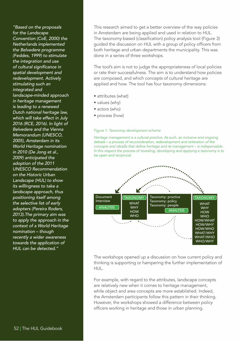
This research aimed to get a better overview of the way policies in Amsterdam are being applied and used in relation to HUL. The taxonomy-based (classification) policy analysis tool (Figure 3) guided the discussion on HUL with a group of policy officers from both heritage and urban departments the municipality. This was done in a series of three workshops.
The tool’s aim is not to judge the appropriateness of local policies or rate their successfulness. The aim is to understand how policies are composed, and which concepts of cultural heritage are applied and how. The tool has four taxonomy dimensions:
• attributes (what)• values (why)• actors (who)• process (how)
“Based on the proposals for the Landscape Convention (CoE, 2000) the Netherlands implemented the Belvedere programme (Feddes, 1999) to stimulate the integration and use of cultural significance in spatial development and redevelopment. Actively stimulating such an integrated and landscape-minded approach in heritage management is leading to a renewed Dutch national heritage law, which will take effect in July 2016 (RCE, 2016). In light of Belvedere and the Vienna Memorandum (UNESCO, 2005), Amsterdam in its World Heritage nomination in 2010 (De Jong et al., 2009) anticipated the adoption of the 2011 UNESCO Recommendation on the Historic Urban Landscape (HUL) to show its willingness to take a landscape approach, thus positioning itself among the selective list of early adopters (Pereira Roders, 2013).The primary aim was to apply the approach in the context of a World Heritage nomination – though recently a wider awareness towards the application of HUL can be detected.”
Figure 1: Taxonomy development scheme
Heritage management is a cultural practice. As such, an inclusive and ongoing debate – a process of reconsideration, redevelopment and reiteration of the concepts and idea(l)s that define heritage and its management – is indispensable. In this respect the process of revealing, developing and applying a taxonomy is to be open and reciprocal.
The workshops opened up a discussion on how current policy and thinking is supporting or hampering the further implementation of HUL.
For example, with regard to the attributes, landscape concepts are relatively new when it comes to heritage management, while object and area concepts are more established. Indeed, the Amsterdam participants follow this pattern in their thinking. However, the workshops showed a difference between policy officers working in heritage and those in urban planning.
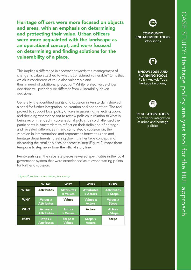
Heritage officers were more focused on objects and areas, with an emphasis on determining and protecting their value. Urban officers were more acquainted with the landscape as an operational concept, and were focused on determining and finding solutions for the vulnerability of a place.
This implies a difference in approach towards the management of change. Is value attached to what is considered vulnerable? Or is that which is considered of value also vulnerable andthus in need of additional protection? While related, value-driven decisions will probably be different from vulnerability-driven decisions.
Generally, the identified points of discussion in Amsterdam showed a need for further integration, co-creation and cooperation. The tool proved to support local policy officers in assessing, reflecting upon, and deciding whether or not to review policies in relation to what is being recommended in supranational policy. It also challenged the participants in Amsterdam to reflect on their definition of heritage and revealed differences in, and stimulated discussion on, the variation in interpretations and approaches between urban and heritage departments. Breaking down the heritage concept and discussing the smaller pieces per process step (Figure 2) made them temporarily step away from the official story line.
Reintegrating all the separate pieces revealed specificities in the local governance system that were experienced as relevant starting points for further discussion.
CA
SE ST
UD
Y: Heritag
e po
licy analysis too
l for the H
UL ap
pro
ach
Figure 2: matrix, cross-relating taxonomy
WHAT WHY WHO HOW
WHAT Attributes Attributes x Values
Attributes x Actors
Attributes x Steps
WHY Values xAttributes
Values Values xActors
Values xSteps
WHO Actors xAttributes
Actors x Values
Actors Actors x Steps
HOW Steps xAttributes
Steps xValues
Steps xActors
Steps
COMMUNITY ENGAGEMENT TOOLS
Workshops
KNOWLEDGE AND PLANNING TOOLSPolicy Analysis Tool; heritage taxonomy
REGULATORY TOOLSIncentive for integration of urban and heritage
policies
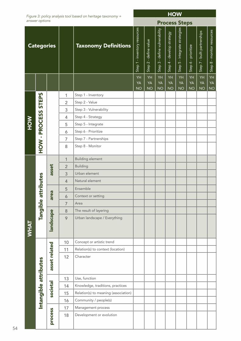
54
HOWProcess Steps
Categories Taxonomy Definitions
Step1-inventoryresources
Step2-definevalue
Step3-definevulnerability
Step4-developstrategy
Step5-integratestrategies
Step6-prioritize
Step7-builtpartnerships
Step8-monitorresources
YHYANO
YHYANO
YHYANO
YHYANO
YHYANO
YHYANO
YHYANO
YHYANO
HO
W
HO
W -
PRO
CESS
STE
PS 1 Step1-Inventory NO
2 Step2-Value
3 Step3-Vulnerability
4 Step4-Strategy
5 Step5-Integrate
6 Step6-Prioritize
7 Step7-Partnerships
8 Step8-Monitor
WH
AT
Tang
ible
att
ribut
es asse
t
1 Buildingelement
2 Building
3 Urbanelement
4 Naturalelement
area
5 Ensemble
6 Contextorsetting
7 Area
land
scap
e 8 Theresultoflayering
9 Urbanlandscape/Everything
Inta
ngib
le a
ttrib
utes
asse
t rel
ated
10 Conceptorartistictrend
11 Relation(s)tocontext(location)
12 Character
soci
etal
13 Use,function
14 Knowledge,traditions,practices
15 Relation(s)tomeaning(association)
16 Community/people(s)
proc
ess 17 Managementprocess
18 Developmentorevolution
Figure 3: policy analysis tool based on heritage taxonomy + answer options
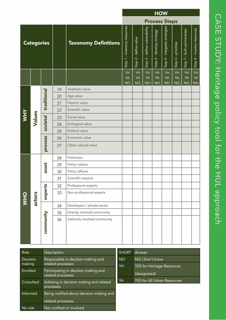
HOWProcess Steps
Categories Taxonomy Definitions
Step1-inventoryresources
Step2-definevalue
Step3-definevulnerability
Step4-developstrategy
Step5-integratestrategies
Step6-prioritize
Step7-builtpartnerships
Step8-monitorresources
YHYANO
YHYANO
YHYANO
YHYANO
YHYANO
YHYANO
YHYANO
YHYANO
WH
Y
Valu
es
trad
ition
al 19 Aestheticvalue
20 Agevalue
21 Historicvalue
22 Scientificvalue
soci
etal 23 Socialvalue
24 Ecologicalvalue
25 Politicalvalue
proc
ess 26 Economicvalue
27 Otherculturalvalue
WH
O
acto
rs
asse
t
28 Politicians
29 Policymakers
30 Policyofficers
31 Scientificexperts
expe
rts 32 Professionalexperts
33 Non-professionalexperts
com
mun
ity
34 Developers/privatesector
35 Directlyinvolvedcommunity
36 Indirectlyinvolvedcommunity
Role Description
Decisionmaking
Responsibleindecisionmakingandrelatedprocesses
Enrolled Participatingindecisionmakingandrelatedprocesses
Consulted Advisingindecisionmakingandrelatedprocesses
Informed Beingnotifiedaboutdecisionmakingand
relatedprocesses
Norole Notnotifiedorinvolved
SHORT Answer
NO NO|Don’tknow
YH YESforHeritageResources
(designated)
YA YESforAllUrbanResources
CA
SE ST
UD
Y: Heritag
e po
licy too
l for the H
UL ap
pro
ach
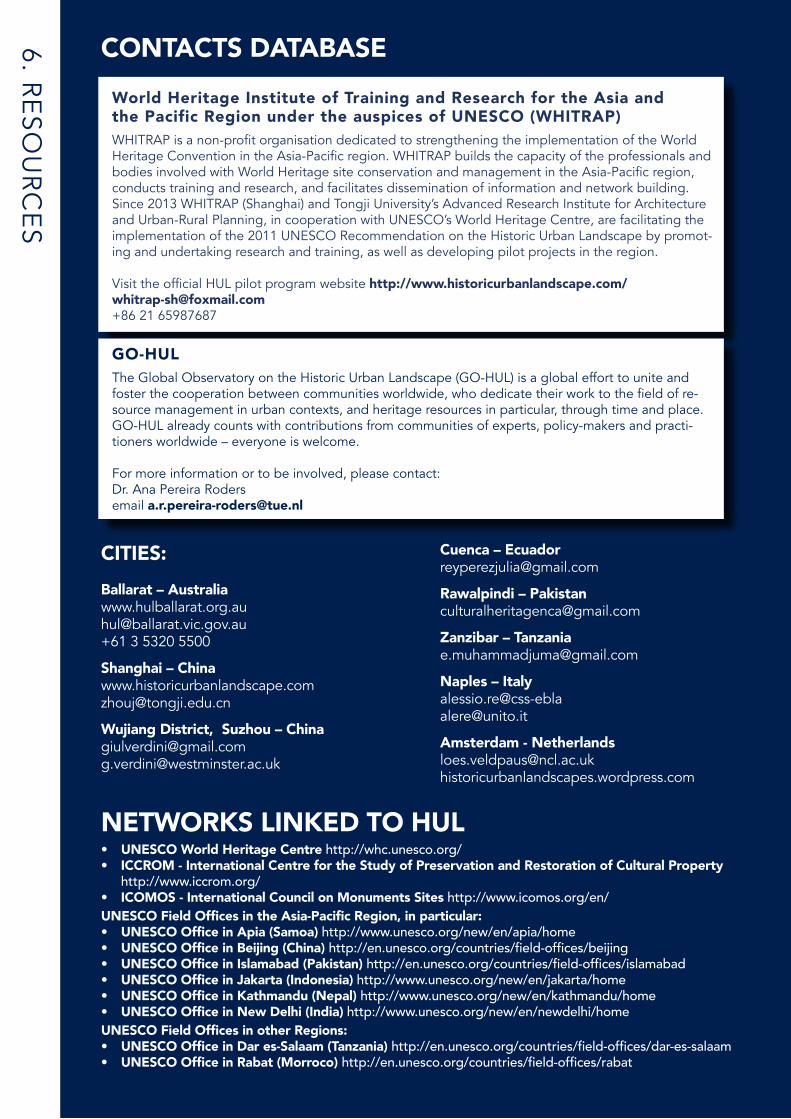
CITIES:Ballarat – [email protected]+61 3 5320 5500
Shanghai – [email protected]
Wujiang District, Suzhou – [email protected] [email protected]
6. RE
SOU
RC
ES
World Heritage Institute of Training and Research for the Asia and the Pacific Region under the auspices of UNESCO (WHITRAP)WHITRAP is a non-profit organisation dedicated to strengthening the implementation of the World Heritage Convention in the Asia-Pacific region. WHITRAP builds the capacity of the professionals and bodies involved with World Heritage site conservation and management in the Asia-Pacific region, conducts training and research, and facilitates dissemination of information and network building.Since 2013 WHITRAP (Shanghai) and Tongji University’s Advanced Research Institute for Architecture and Urban-Rural Planning, in cooperation with UNESCO’s World Heritage Centre, are facilitating the implementation of the 2011 UNESCO Recommendation on the Historic Urban Landscape by promot-ing and undertaking research and training, as well as developing pilot projects in the region.
Visit the official HUL pilot program website http://www.historicurbanlandscape.com/ [email protected]+86 21 65987687
Cuenca – [email protected]
Rawalpindi – [email protected]
Zanzibar – [email protected]
Naples – Italyalessio.re@[email protected]
Amsterdam - [email protected] historicurbanlandscapes.wordpress.com
CONTACTS DATABASE
GO-HULThe Global Observatory on the Historic Urban Landscape (GO-HUL) is a global effort to unite and foster the cooperation between communities worldwide, who dedicate their work to the field of re-source management in urban contexts, and heritage resources in particular, through time and place. GO-HUL already counts with contributions from communities of experts, policy-makers and practi-tioners worldwide – everyone is welcome.
For more information or to be involved, please contact: Dr. Ana Pereira Rodersemail [email protected]
NETWORKS LINKED TO HUL• UNESCO World Heritage Centre http://whc.unesco.org/• ICCROM - International Centre for the Study of Preservation and Restoration of Cultural Property http://www.iccrom.org/• ICOMOS - International Council on Monuments Sites http://www.icomos.org/en/UNESCO Field Offices in the Asia-Pacific Region, in particular:• UNESCO Office in Apia (Samoa) http://www.unesco.org/new/en/apia/home • UNESCO Office in Beijing (China) http://en.unesco.org/countries/field-offices/beijing • UNESCO Office in Islamabad (Pakistan) http://en.unesco.org/countries/field-offices/islamabad • UNESCO Office in Jakarta (Indonesia) http://www.unesco.org/new/en/jakarta/home • UNESCO Office in Kathmandu (Nepal) http://www.unesco.org/new/en/kathmandu/home • UNESCO Office in New Delhi (India) http://www.unesco.org/new/en/newdelhi/home UNESCO Field Offices in other Regions: • UNESCO Office in Dar es-Salaam (Tanzania) http://en.unesco.org/countries/field-offices/dar-es-salaam • UNESCO Office in Rabat (Morroco) http://en.unesco.org/countries/field-offices/rabat
57
OTHER INSTITUTIONS: • American Planning Association (APA) https://www.planning.org/ • City District Government of Rawalpindi and National College of Arts (NCA) in Rawalpindi (Pakistan) http://rawalpindi.gov.pk/ and http://www.nca.edu.pk/ • City of Ballarat (Australia) www.cityofballarat.vic.gov.au • City of Edmonton, Old Strathcona Foundation, ICOMOS Canada http://www.edmonton.ca/ http://canada.icomos.org/ http://www.oldstrathconafoundation.ca/• Municipality of Cuenca (Ecuador) http://www.cuenca.gov.ec/ • National Research Council of Italy – Institute for the Conservation and Valorization of Cultural Heritage (CNR-ICVBC) http://www.parthenos-project.eu/consortium/cnr-consiglio-nazionale-delle-ricerche/ • PricewaterhouseCoopers http://www.pwc.com/ • Tongji University (China) http://www.tongji.edu.cn • Tongli Old Town Conservation and Management Committee (China)• University of Cuenca (Ecuador) http://www.ucuenca.edu.ec/ • Willowbank’s Center for Cultural Landscape (Canada) http://willowbank.ca/wpdir/centre • Xi’an Jiaotong-Liverpool University - Research Institute of Urbanization (China) http://www.xjtlu.edu.cn/en/research/institutes-centres-and-labs/research-institute-of-urbanisation
OTHER ORGANISATIONS:Edinburgh World Heritage (Scotland)Edinburgh World Heritage is a charity with the role of conserving, enhancing and promoting the city’s World Heritage Site. It is an exemplar of best practice in heritage conservation using innovative new planning, engagement, financial and strategic approaches that align with HUL. It is funded through donations, and contributions from local businesses, Historic Environment Scotland and the City of Edinburgh Council. http://www.ewht.org.uk/
Federation University Australia: Collaborative Research Centre in Australian History (CRCAH) http://federation.edu.au/research/research-areas/research-centres-and-networks/crcah
Federation University Australia: Centre for eResearch and Digital Innovation (CeRDI) http://www.cerdi.edu.au/
Deakin University: Cultural Heritage Asia Pacific http://www.deakin.edu.au/alfred-deakin-institute/research/research-networks/cultural-heritage-asia-pacific
The World Bank http://www.worldbank.org/
Centro Studi Silvia Santagata-EBLA, Turin, Italy http://www.css-ebla.it/en
League of Historical CitiesEstablished in Kyoto, Japan in 1987, the League aims to strengthen affiliations between historic cities to exchange knowledge and experience. It is one of only a few substantial international platforms for historic city cooperation. http://www2.city.kyoto.lg.jp/somu/kokusai/lhcs/
RECOMMENDED READING• Recommendation on the Historic Urban Landscape, UNESCO, 10 November 2011 http://whc.unesco.org/en/activities/638• New life for historic cities: The historic urban landscape approach explained, UNESCO, 2013 http://whc.unesco.org/en/activities/727• Guide for city professionals “Historic Districts for all; a social and human approach for sustainable revitalisation”, UN-HABITAT and UNESCO, 2008. http://www.unhabitat.org/downloads/docs/10362_1_594123.pdf• Managing Historic Cities, World Heritage Papers No. 27, UNESCO, Paris, 2010 http://whc.unesco.org/en/series/27• Partnerships for World Heritage Cities – Culture as a Vector for Sustainable Urban Development. Proceedings from the Urbino workshop, November 2002. World Heritage Papers No. 9, UNESCO, Paris, 2004. http://whic.unesco.org/en/series/9/• Shanghai Agenda for The Implementation of UNESCO Recommendation on Historic Urban Landscape (HUL) in China, 15 May 2015. http://historicurbanlandscape.com/themes/196/userfiles/download/2016/3/25/jwjg2hpjzrdcr9s.pdf
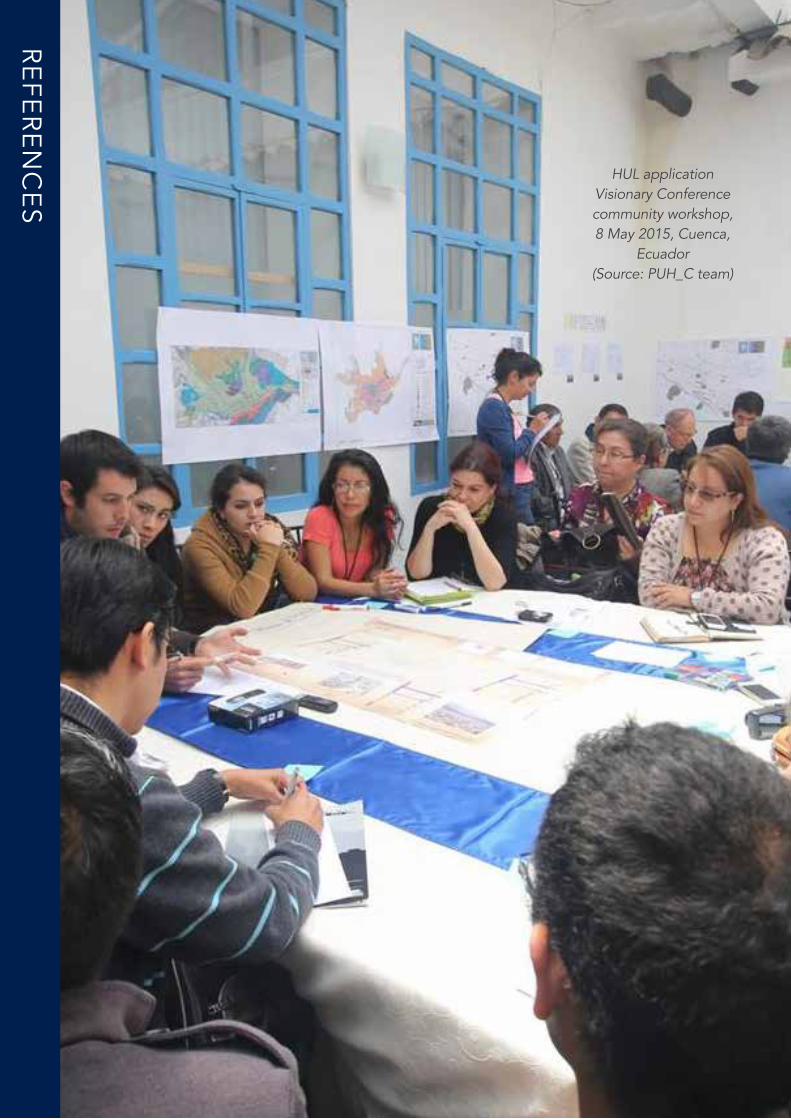
58
RE
FER
EN
CE
S
HUL application Visionary Conference community workshop, 8 May 2015, Cuenca,
Ecuador(Source: PUH_C team)
The HUL Guidebook | 59
REFERENCESPage 7: UNESCO (2015) http://en.unesco.org/themes/culture-sustainable-development Page 9 and 13:UNESCO Recommendation on the Historic Urban Landscape http://whc.unesco.org/en/activities/638Page 11 and 14: UNESCO Recommendation on the Historic Urban Landscape http://portal.unesco.org/en/ev.php-URL_ID=48857&URL_DO=DO_TOPIC&URL_SECTION=201.htmlCASE STUDY: Amsterdam heritage policy tool for the HUL approachCoE, 2000. European Landscape Convention - ETS No. 176. [WWW Document]. Council of Europe. URL http://www.coe.int/en/web/landscape (accessed 16.03.16).De Jong, R., National Service for Archaeology, Cultural Landscape and Monuments, Amsterdam Central Borough, Spatial Policy Department, Building and Housing Sector, 2009. The seventeenth-century canal ring area of Amsterdam within the Singelgracht, Nomination file. Kingdom of the Netherlands.Feddes, F., 1999. Nota Belvedere: beleidsnota over de relatie cultuurhistorie en ruimtelijke inrichting / Belvedere Memorandum A policy document examining the relationship between cultural history and spatial planning. VNG uitgeverij, Den Haag.Pereira Roders, A., 2013. Lessons from Island of Mozambique on limits of acceptable change, in: Oers, R. van (Ed.), Report on the Historic Urban Landscape Workshops and Field Activities on the Swahili Coast in East Africa 2011-2012. UNESCO World Heritage Centre, Paris, France, pp. 40–49.RCE, 2016. De Erfgoedwet 2016 [WWW Document]. Rijksdienst voor het Cultureel Erfgoed. URL http://cultureelerfgoed.nl/publicaties/de-erfgoedwet-2016 (accessed 16.03.16).UNESCO, 2005. Vienna Memorandum on “World Heritage and Contemporary Architecture – Managing the Historic Urban Landscape.”Veldpaus, L., 2015. Historic urban landscapes : framing the integration of urban and heritage planning in multilevel governance, Bouwstenen 207. Eindhoven University of Technology: Eindhoven URL http://www.ncl.ac.uk/guru/publications/publication/218814
CASE STUDY: Ballarat, Australia.Fayad, S (2015) The Historic Urban Landscape Approach: Finding a Better Way to Manage Change in the Dynamic Historic City of Ballarat: WHITRAP, China. (Unpublished)City of Ballarat (2015a) Economic Program 2015-2019City of Ballarat (2015b) Today, Tomorrow, Together: The Ballarat Strategy: Our Vision to 2040
CASE STUDY: Wujiang District, Suzhou – China1 This is the outcome of the consultation for the local government of Shuang Wan Cun in Wujiang District. Team involved: Dr. Giulio Verdini (Coordinator), Dr. Heini Shi, Ms. Xiangyi Wang. During the participatory workshop a team of experts have been involved: Prof. Paolo Ceccarelli, Prof. Pierre-Alain Croset, Mr. Harry den Hartog, Mr. Feiran Huang, Dr. Francesca Frassoldati, Dr. Chris Nolf, Prof. Etra Connie Occhialini, Dr. Claudia Westermann.
CASE STUDY: Cuenca, EcuadorThe PUH_C team is formed by Sebastián Astudillo Cordero and Julia Rey Pérez (directors), María Eugenia Siguencia Ávila, Soledad Moscoso Cordero, Silvia Auquilla Zambrano, Paul Moscoso Riofrio and Edison Sinchi Tenesaca. The Project was allotted in November 2014 by the Research Division of the Universidad de Cuenca (DIUC). Also, the Faculty of Architecture, the Research Center of the Faculty of Architecture (CINA), and the Project vlirCPM have supported the development of the project. Source: PUH_C Research team.
CASE STUDY: Naples, Italy2 The plan was prepared by the Municipality of Naples with the technical assistance of SiTI and of a group of international experts. Cuccia, T., Marrelli, M. & Santagata, W. (2007) Collective Trademarks and Cultural Districts: the Case of San Gregorio Armeno - Naples, Torino: Ebla Centre Working Paper Series N. 1, Department of Economics “S. Cognetti de Martiis”; http://www.css-ebla.it/wp-content/uploads/1_WP_Ebla-5.pdfDe Caro, S., Marrelli, M., Santagata W. (2008) Patrimoni intangibili dell’Umanità, Guida, Napoli;Re, A., Santagata W. (2011), Produzione di cultura come fattore di sviluppo: il caso del piano di gestione del centro storico di Napoli, in “Territori della cultura”, n.2-2010.The management plan of the Historic Centre of Naples is available at this link:http://www.comune.napoli.it/flex/cm/pages/ServeBLOB.php/L/IT/IDPagina/14142
HUL application Visionary Conference community workshop, 8 May 2015, Cuenca,
Ecuador(Source: PUH_C team)
This guidebook was launched at the 15th World Conference of theLeague of Historical Cities in Bad Ischl, Austria in 2016:


