+ All Categories
Home > Documents > Lands Open to Public Hunting LUCE COUNTY - midnr. · PDF fileBranch Sage River Muskrat Lakes...

Lands Open to Public Hunting LUCE COUNTY - midnr. · PDF fileBranch Sage River Muskrat Lakes...

Date post: 25-Mar-2018
Category:
Upload: lehanh
View: 214 times
Download: 1 times
Share this document with a friend
1
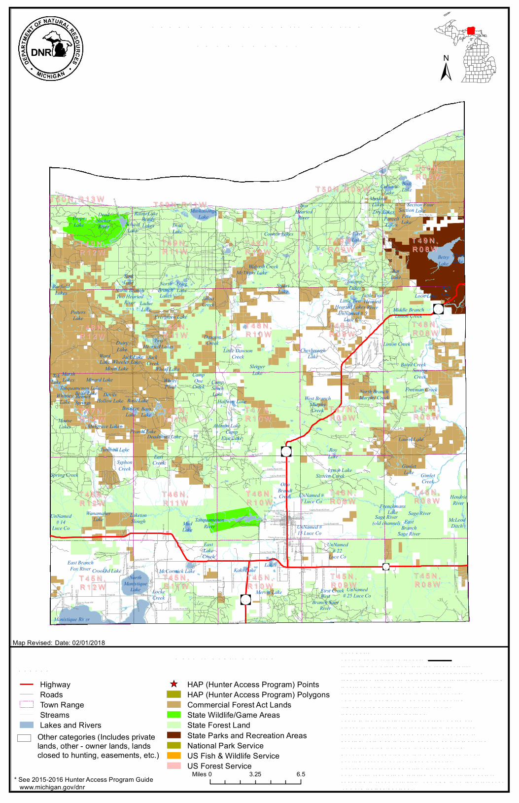
Ladue Lake First Creek Buckeye Lake Rainy Lake West Branch Sage River Muskrat Lakes Middle Branch Linton Creek Bass Lake Wanamaker Lake Devils Hollow Lake Linton Creek Little Dawson Creek Clark Lake North Branch Murphy Creek North Branch Two Hearted River Belle Lake Halfway Lake Gimlet Creek Whitney Lake North Branch Lakes Bennet Springs McCormick Lake Ross Lake Johns Creek Wolf Lake Crooked Lake Rat Lake Ahlman Lake Sleeper Lake UnNamed # 7 Luce Co Whorl Lake Swamp Lakes Deadmans Lake Tank Lake Dawson Creek Dry Lakes North Manistique Lake Betsy Lake West Branch Murphy Creek Whorl Pond Barfield Lakes Camp Seven Lake McTivers Lake Wabash Creek Wheeler Lake Freeman Creek Mud Lake Peanut Lake Loon Lake Moose Lakes Tek Lake Jack Creek Connor Lakes East Lake Creek Ward Lake Muskallonge Lake Mervin Lake Ready Lakes Moon Lake Potters Lake Long Lake Jack Lake Otto Brandt Creek Bodi Lake Laurel Lake Culhane Lake Dairy Lake UnNamed # 25 Luce Co Syphon Creek Twin Lakes Parcell Lakes Trout Lake Camp Five Lake Section Four Lake East Creek Turnbull Lake Camp One Creek Locke Creek Schaaf Lake UnNamed # 15 Luce Co Pike Lake Roy Lake East Branch Fox River Tahquamenon Lakes Frenchmans Lake Kaks Lake Props Lake Gimlet Lake Chesbrough Lake Two Hearted Lakes Marsh Lakes Evergreen Lake Little Two Hearted Lakes Stuart Lake Sixteen Creek UnNamed # 22 Luce Co Minard Lake Musgrave Lakes Lynch Lake Section Five Lake Laketon Slough Sage River (old channel) Dead Sucker River Two Hearted River East Branch Sage River Manistique River UnNamed # 14 Luce Co Little Two Hearted River McLeod Ditch Baird Creek Tahquamenon River Spring Creek Hendrie River Savage Creek UnNamed # 5 Luce Co Sage River T50N,R09W T50N,R13W Mcleod Road Camp 7 Rd County Road 379 County Road 434 Sage Truck Trail Charcoal Grade Rd County Road 463 County Road 418 County Road 431 Peanut Lake Rd Somers Trl County Road 465 County Road 439 M117 Cut Across Road W Blind Sucker Rd County Road 367 County Road 363 County Road 502 W Victory Way County Road 480 High Banks Trail S Maplewood Rd County Road 373 County Road 437 Silver Creek Trout Pond BAS County Road 429 Danaher Plains Rd Swamp Lakes Rd Betsy River Rd Camp Six Rd County Road 500 Look out Dr Fawn Trail County Road 476 S Greenwood Dr County Road 387 County Road 405 North County Road 501 Spring Creek Rd Robinson St East Limits St County Road 448 McCleod Rd Rabbit Patch Rd W McMillan Ave County Road 462 West Phelps St Long Lake Trail Handy St County Road 403 South Grac e St W Avenue B W John St County Road 370 County Road 407 Railroad St Hunters Truck Trail Third Creek Pond Road Broken Hammer Trail County Road 135 Fordney Tower Rd County Road 377 1st St County Road 426 County Road 475 Lonelane Rd County Road 451 County Road 392 Forest Legacy Trail County Road 466 Singleton Rd Burgess Camp Rd Pretty lake County Road 428 West Silver Creek Rd E Blind Sucker Rd County Road 432 Autumn Ln E McMillan Ave County Road 446 Pine Camp Road Jago Trl Pollack Dr County Road 413 North County Road 467 County Road 462 East CCI Road Pratt Lake Road County Road 453 County Road 442 County Road 393 East Branch Club Trl. County Road 506 County Road 472 KNneland Bigelow Rd Sleeper Lake Rd Rosemary Ln County Road 477 County Road 435 Pullup Lake Rd County Road 378 Brayton Trl County Road 468 Tokar Lake Rd County Road 474 County Road 422 Chris Brown Lake Rd County Road 381 Little Lake Trl County Road 510 Bass Lake Campground County Road 479 Boggy's Camp Trail Murphy Creek Trl Headquarters Lake road County Road 507 Culhane Grade Camp One Rd Bone Lake Trail County Road 390 Natalie Campground Rd County Road 410 West County Road 403 North County Road 445 Atwood Creek Rd Seven Mile Fire Lane State St North Fordney Tower Rd E Truman St North Spring Hill Road County Road 478 Ulbeck Trl County Road 469 N Cooper St Wolverine Lake Rd Marchese Dr Gasoline Alley Section 34 Rd Schook Dr County Road 417 County Road 433 County Road 414 CCI Tank Lake E Lake Rd Antler Trl Camp 7 Cut Across County Road 413 South County Road 383 East Lane Rd Halifax Rd Prett Lake Road Lake Rd County Road 473 Oakwood Rd County Road 409 Clark Trl County Road 411 service rd (for internal use only) Coast Guard Road Brockies Trout Pond Rd River Rd County Road 416 Superior Dunes Rd County Road 412 County Road 419 County Road 410 East Potato Farm County Road 458 County Road 460 East County Road 481 Hemlock Ridge Trail County Road 505 Charcoal Grade County Road 423 County Road 421 North County Road 402 County Road 460 West Bowman Trail Chesbrough Lake Rd Barret's Grade Ross Lake Rd W Fossitt Logging Rd Pinewood Rd Hardwood Island County Road 450 S. Spring Hill Rd County Road 447 County Road 454 Fisher Trl County Road 503 County Road 441 Smith Rd Kneeland Bigelow Rd Ulbeck Trail Barker Trl County Road 408 Beechwood Rd County Road 425 County Road 440 County Road 428 East Serv ic e Dr Rd Two Track Woods County Road 98 Rd East T Lake Road County Road 401 County Road 98 County Road 457 County Road 459 Murray Lake Rd W Superior Dunes Rd Mead Fire Lane County Road 455 County Road 415 North Gimlet Trl Sawdust Pile Rd County Road 427 County Road 438 Shamrock Road Old Grade Rd County Road 399 South Laurel Lake Trl Schuttes Trl Little Two Hearted Trl County Road 405 South Carlson Camp Rd County Road 420 County Road 371 T45N, R10W T50N,R11W T46N, R09W T49N, R09W T46N, R12W T47N, R11W T47N, R08W T48N, R08W T47N, R12W T47N, R09W T46N, R10W T48N, R11W T49N, R11W T45N, R08W T48N, R12W T47N, R10W T49N, R08W T45N, R12W T48N, R09W T45N, R11W T49N, R10W T46N, R11W T48N, R10W T50N, R08W T45N, R09W T49N, R12W T46N, R08W Highway Roads Town Range Streams Lakes and Rivers HAP (Hunter Access Program) Points HAP (Hunter Access Program) Polygons Commercial Forest Act Lands State Wildlife/Game Areas State Forest Land State Parks and Recreation Areas National Park Service US Fish & Wildlife Service US Forest Service Map Revised: 0 6.5 3.25 Miles * See 2015-2016 Hunter Access Program Guide www.michigan.gov/dnr Other categories (Includes private lands, other - owner lands, lands closed to hunting, easements, etc.) Date: 02/01/2018
Transcript

LadueLake

First Creek

BuckeyeLake

Rainy Lake

WestBranch Sage

River

MuskratLakes

Middle BranchLinton Creek

BassLake

WanamakerLake

DevilsHollow Lake

Linton CreekLittle Dawson

Creek

ClarkLake

North BranchMurphy Creek

North BranchTwo Hearted

River

Belle LakeHalfway Lake

GimletCreek

WhitneyLake

NorthBranchLakes

BennetSprings

McCormick Lake

Ross Lake

JohnsCreek

WolfLake

Crooked Lake

RatLake

Ahlman Lake

SleeperLake

UnNamed #7 Luce Co

Whorl Lake

SwampLakes

Deadmans Lake

TankLake

DawsonCreek

Dry Lakes

NorthManistique

Lake

BetsyLake

West BranchMurphyCreek

WhorlPond

BarfieldLakes

CampSevenLake

McTivers LakeWabash Creek

Wheeler Lake

Freeman Creek

MudLake

Peanut Lake

Loon Lake

MooseLakes

TekLake

JackCreek

Connor Lakes

EastLakeCreek

WardLake

MuskallongeLake

Mervin Lake

ReadyLakes

Moon Lake

PottersLake

LongLake

Jack Lake

OttoBrandtCreek

BodiLake

Laurel Lake

CulhaneLake

DairyLake

UnNamed# 25 Luce Co

SyphonCreek

TwinLakes

ParcellLakesTrout

Lake

CampFive Lake

Section FourLake

EastCreek

Turnbull Lake

CampOne

Creek

LockeCreek

SchaafLake

UnNamed #15 Luce Co

PikeLake

RoyLake

East BranchFox River

Tahquamenon Lakes

FrenchmansLake

Kaks Lake

PropsLake

GimletLake

ChesbroughLake

TwoHearted Lakes

MarshLakes

Evergreen Lake

Little TwoHearted Lakes

StuartLake

Sixteen Creek

UnNamed# 22

Luce Co

Minard Lake

Musgrave Lakes

Lynch Lake

SectionFiveLake

LaketonSlough Sage River

(old channel)

DeadSuckerRiver

TwoHearted

River

EastBranch

Sage River

Manistique River

UnNamed# 14

Luce Co

Little TwoHearted

River

McLeodDitch

Baird Creek

TahquamenonRiver

Spring Creek

HendrieRiver

SavageCreek

UnNamed # 5Luce Co

Sage River

28

117

123

123

T 5 0 N , R 0 9 WT 5 0 N , R 1 3 W

Mcleod Road

Camp 7 Rd

Coun

ty Ro

ad 37

9

County Road 434

Sage Truck Trail

Charcoa

l Grad

e Rd

Coun

ty Ro

ad 46

3

County Road 418

Coun

ty Ro

ad 43

1

Peanut Lake Rd

Somers Trl

Coun

ty Ro

ad 46

5

Coun

ty Ro

ad 43

9

M117 Cut Across Road

W Blind Sucker Rd

County Road 367

Coun

ty Ro

ad 36

3

County Road 502

W Victory Way

County Road 480

High Banks Trail

S Maplewood RdCounty Road 373

County Road 437

Silve

r Cree

k Trou

t Pon

d BAS

Coun

ty Ro

ad 42

9

Danaher Plains Rd

Swamp Lakes Rd

Betsy River Rd

Camp Six Rd

County Road 500

Lookou

t Dr

Fawn Trail

County Road 476

S Greenwood Dr

Coun

ty Ro

ad 38

7

Coun

ty Ro

ad 40

5 Nort

h

County Road 501

Spring Creek Rd

Robin

son S

t

East

Limits

St

County Road 448

McCleod Rd

Rabbit Patch Rd

W McMillan Ave

County Road 462 West

Phelp

s St

Long

Lake

Trail

Hand

y St

Coun

ty Ro

ad 40

3 Sou

th

Grac

e St

W Avenue B

W John St

County Road 370

County Road 407

Railroad St

Hunters Truck Trail

Third Creek Pond Road

Broken Hammer Trail

County Road 135

Fordney Tower Rd

County Road 377

1st St

County Road 426County Road 475

Lonelane Rd

Coun

ty Ro

ad 45

1

County Road 392

Forest Legacy Trail

County Road 466

Singleton Rd

Burgess Camp Rd

Pretty lake

County Road 428 West

Silver Creek Rd

E Blind Sucker Rd

County Road 432

Autum

n Ln

E McMillan Ave

County Road 446

Pine C

amp R

oad

Jago Trl

Pollac

k Dr

Coun

ty Ro

ad 41

3 Nort

h

County Road 467

County Road 462 East

CCI Road

Pratt L

ake R

oad

County Road 453

County Road 442

Coun

ty Ro

ad 39

3

East Branch Club Trl.

County Road 506

Coun

ty Ro

ad 47

2

KNneland Bigelow Rd

Sleeper Lake Rd

Rosemary Ln

County R

oad 47

7

Coun

ty Ro

ad 43

5

Pullup Lake Rd

County Road 378

Bray ton Trl

County Road 468

Tokar

Lake R

d

County Road 474

County Road 422

Chris

Brow

n Lake

Rd

Coun

ty Ro

ad 38

1

Litt le Lake Trl

County Road 510

Bass Lake Campground

County Road 479

Bogg

y's C

amp T

rail

Murphy Creek Trl

Headquarters Lake road

County Road 507

Culha

ne G

rade

Camp One Rd

Bone Lake Trail

County Road 390

Natalie Campground Rd

County Road 410 West

Coun

ty Ro

ad 40

3 Nort

h

Coun

ty Ro

ad 44

5

Atwood Creek Rd

Seven Mile Fire Lane

State

St

North

Fordn

ey To

wer R

d

E Truman St

North

Sprin

g Hill R

oad

County Road 478

Ulbeck Trl

Coun

ty Ro

ad 46

9

N Cooper St

Wolve

rine L

ake R

d

Marchese Dr

Gasoline Alley

Section 34 Rd

Scho

ok D

r

Coun

ty Ro

ad 41

7

County Road 433

County Road 414

CCI

Tank Lake

E Lake Rd

Antle

r Trl

Camp

7 Cu

t Acro

ss

Coun

ty Ro

ad 41

3 Sou

th

Coun

ty Ro

ad 38

3

East Lane Rd

Halifax Rd

Pret t Lake Road

Lake Rd

Coun

ty Ro

ad 47

3

Oakw

ood R

d

Coun

ty Ro

ad 40

9

Clark

Trl

Coun

ty Ro

ad 41

1

service rd (for internal use only)

Coast Guard Road

Brockies Trout Pond Rd

River Rd

County Road 416

Superior Dunes Rd

County Road 412

Coun

ty Ro

ad 41

9

County Road 410 East

Potat

o Farm

County Road 458

Coun

ty Ro

ad 46

0 Eas

t

County Road 481

Hemlock Ridge Trail

Coun

ty Ro

ad 50

5

Charcoal Grade

County R

oad 42

3

Coun

ty Ro

ad 42

1 Nort

h

County Road 402

County Road 460 West

Bowman Trail

Chesbrough Lake Rd

Barret'

s Grad

e

Ross Lake Rd

W Fossitt Logging Rd

Pinew

ood R

d

Hardwood Island

County Road 450S. Spring Hill Rd

County Road 447

County Road 454

Fisher Trl

County Road 503

Coun

ty Ro

ad 44

1

Smith

Rd

Kneeland Bigelow Rd

Ulbeck Trail

Barke

r Trl

County Road 408

Beechwood Rd

Coun

ty Ro

ad 42

5

County Road 440

County Road 428 East

Servi

ce D

r Rd

Two Track Woods

County Road 98 RdEast T Lake Road

Coun

ty Ro

ad 40

1

County Road 98

Coun

ty Ro

ad 45

7

Coun

ty Ro

ad 45

9

Murray Lake Rd

W Superior Dunes Rd

Mead

Fire

Lane

County Road 455

Coun

ty Ro

ad 41

5 Nort

h

Giml

et Trl

Sawdust Pile Rd

Coun

ty Ro

ad 42

7

County Road 438

Shamrock Road

Old Grade Rd

Coun

ty Ro

ad 39

9 Sou

th

Laurel Lake Trl

Schu

ttes T

rl

Litt le Two Hearted Trl

Coun

ty Ro

ad 40

5 Sou

th

Carlson Camp Rd

County Road 420

County Road 371

T 4 5 N ,R 1 0 W

T 5 0 N , R 1 1 W

T 4 6 N ,R 0 9 W

T 4 9 N ,R 0 9 W

T 4 6 N ,R 1 2 W

T 4 7 N ,R 1 1 W

T 4 7 N ,R 0 8 W

T 4 8 N ,R 0 8 W

T 4 7 N ,R 1 2 W

T 4 7 N ,R 0 9 W

T 4 6 N ,R 1 0 W

T 4 8 N ,R 1 1 W

T 4 9 N ,R 1 1 W

T 4 5 N ,R 0 8 W

T 4 8 N ,R 1 2 W

T 4 7 N ,R 1 0 W

T 4 9 N ,R 0 8 W

T 4 5 N ,R 1 2 W

T 4 8 N ,R 0 9 W

T 4 5 N ,R 1 1 W

T 4 9 N ,R 1 0 W

T 4 6 N ,R 1 1 W

T 4 8 N ,R 1 0 W

T 5 0 N ,R 0 8 W

T 4 5 N ,R 0 9 W

T 4 9 N ,R 1 2 W

T 4 6 N ,R 0 8 W

Lands Open to Public Hunting

LegendHighwayRoadsTown RangeStreamsLakes and Rivers

HAP (Hunter Access Program) PointsHAP (Hunter Access Program) PolygonsCommercial Forest Act LandsState Wildlife/Game AreasState Forest LandState Parks and Recreation AreasNational Park ServiceUS Fish & Wildlife ServiceUS Forest Service

Map Revised:User Note:Th ere may be refuges th at are CLOSEDto h unting on State land. It is th e responsibilityof th e users of th is map to be aware of all rules andregulations relev ant to th eir h unting activ ities and h untinglocations. Th is map sh ows approx imate boundaries of lands open to public h unting.Th is map is designed to be used for h untingtrip planning purposes only, and not for legal boundary determinations.Th ere is th e potential for small areas, wh ich areclosed to h unting, to be found with in th e sh adedboundaries of areas wh ich are sh own as open toh unting. Th is map is not to be used as a sole sourcefor determining if an area is open to h unting.Not all lands depicted on th is map are open for all h unting seasons or for all game species. Contact y our local DNR office if y ou h av e questionsor to v erify regulations relating to y our activ ities before engaging in th ose activ ities. Th e DNR is on th e internet at “www.mich igan.gov /dnr “.

0 6.53.25Miles* See 2015-2016 Hunter Access Program Guide www.michigan.gov/dnr

Open to Public Hunting

Other categories (Includes privatelands, other - owner lands, landsclosed to hunting, easements, etc.)

LUCE COUNTY

Date: 02/01/2018

Recommended