MEMORANDUM TO: ARCHITECTURAL REVIEW COMMITTEE FROM: nft KELLY HEFFERNON, ASSOCIATE PLANNER SUBJECT: CONSIDERATION OF VESTING TENTATIVE TRACT MAP 16-001 (TRACT 3079) AND DEVELOPMENT CODE AMENDMENT 17-001; REVIEW OF DESIGN GUIDELINES FOR A 7-LOT RESIDENTIAL SUBDIVISON; APPLICANT- KIRBY GORDON; REPRESENTATIVE - JEFF EMRICK; LOCATION- RODEO DRIVE AND GRACE LANE DATE: MARCH 6, 2017 RECOMMENDATION: It is recommended that the Architectural Review Committee (ARC) consider the proposed project design guidelines and make a recommendation to the Planning Commission. IMPACT ON FINANCIAL AND PERSONNEL RESOURCES: None. BACKGROUND: The 7.52-acre project site is located within the Royal Oaks Planned Development (PD 1.3) as shown in the map below. The property is currently vacant, and bounded by Rodeo Drive to the south and Grace Lane to the east.
Transcript
MEMORANDUM
TO: ARCHITECTURAL REVIEW COMMITTEE
FROM: nft KELLY HEFFERNON, ASSOCIATE PLANNER
SUBJECT: CONSIDERATION OF VESTING TENTATIVE TRACT MAP 16-001 (TRACT 3079) AND DEVELOPMENT CODE AMENDMENT 17-001; REVIEW OF DESIGN GUIDELINES FOR A 7-LOT RESIDENTIAL SUBDIVISON; APPLICANT- KIRBY GORDON; REPRESENTATIVE -JEFF EMRICK; LOCATION- RODEO DRIVE AND GRACE LANE
DATE: MARCH 6, 2017
RECOMMENDATION: It is recommended that the Architectural Review Committee (ARC) consider the proposed project design guidelines and make a recommendation to the Planning Commission.
IMPACT ON FINANCIAL AND PERSONNEL RESOURCES: None.
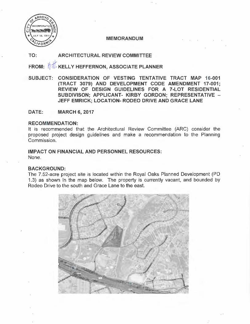
BACKGROUND: The 7.52-acre project site is located within the Royal Oaks Planned Development (PD 1.3) as shown in the map below. The property is currently vacant, and bounded by Rodeo Drive to the south and Grace Lane to the east.
ARCHITECTURAL REVIEW COMMITTEE CONSIDERATION OF VTTM 16-001 & DCA 17-001 MARCH 6, 2017 PAGE2
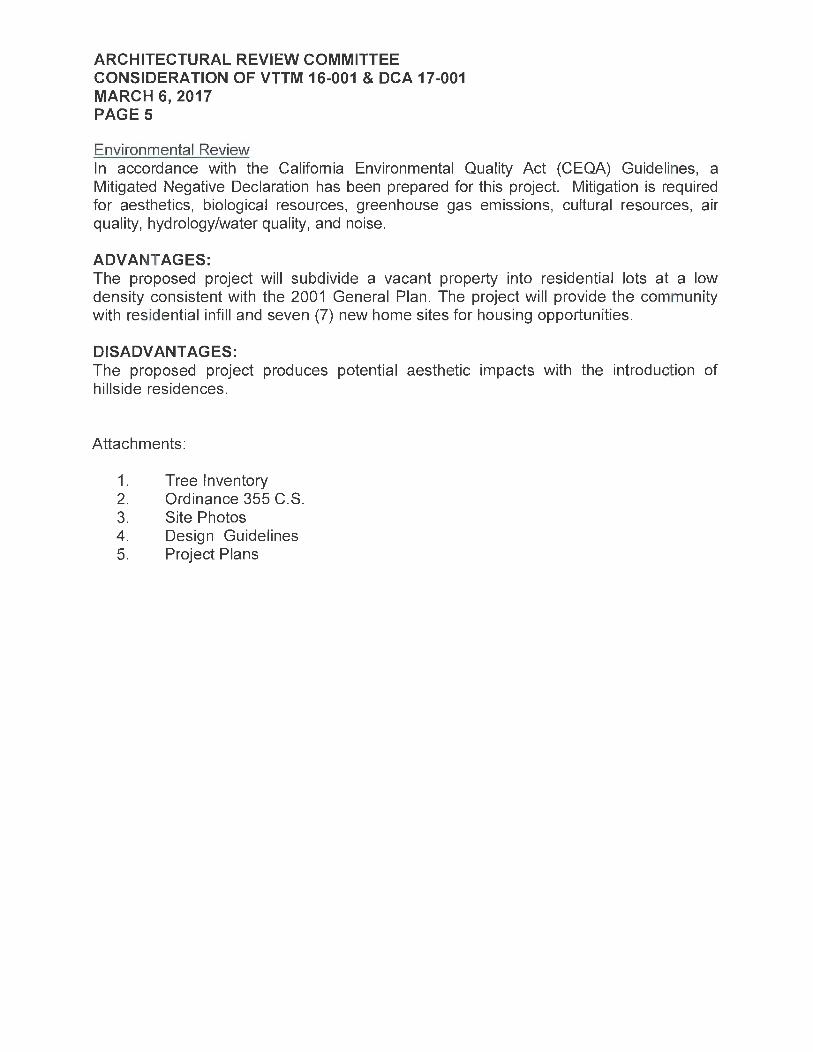
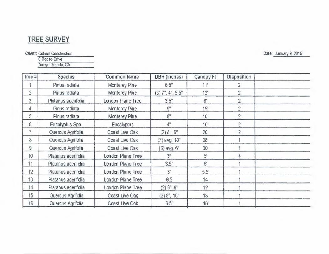
Surrounding land uses include St. Patrick's school and low-medium density residential development within the Rancho Grande Planned Development (PO 1.2) to the west, low-medium density residential development in the Grace Lane subdivision to the north, open space and low-medium density residential development to the east, and vacant multi-family residential property owned by the County of San Luis Obispo to the south. Site topography ranges from a previously graded flat terrace area to steeply sloped banks. The site has not been maintained for an extended period of time, and existing vegetation consists primarily of weeds, grasses and shrubs. A tree inventory was conducted as part of a previous Pre-Application for this property by Pleinaire Design Group, which identified a total of sixteen (16) trees in varying degrees of health. Trees identified include Monterey Pine, London Plane, Eucalyptus, and Coast Live Oak (see Attachment 1 for tree inventory).
As mentioned above, the project site is located within the Royal Oaks Planned Development (PO 1.3), which was established in 1987 by Ordinance 355 C.S. (Attachment 2) and was later amended by the following Ordinances:
Ordinance No. 356
358 384 406
418 430
449
553
Title Amending 355 C.S. Re: Lot A and Via La Barranca Drainage System in Royal Oaks Estates Amending Lot A, and Lots 34-40 Lot Lines in Royal Oaks Estates Sidewalk Construction in Royal Oaks Subdivision Amending Ordinance No. 355 C.S. Royal Oaks Estates to Modify Exhibit "A" Amending Ord. No. 355 C.S. Royal Oaks Estates Amending Ordinance 355 C.S. by Allowing a Church on Lot B, Royal Oaks Amending Ordinance No. 355 C.S. "Royal Oaks Estates" by Allowing a Church on Lot 184 and Approving and Adopting Specific Development Plan 91-05 Amending Ordinance No. 355 C.S. "Royal Oaks Estates" To Increase The Maximum Allowed Density Within The Planned Development, And Amending The Zoning Map To Designate The Subject Property As Residential Rural (RR) With A Planned Development Overlay; Development Code Amendment 02-001, Applied For By Don McHaney, For Property Located On Grace Lane (Lot 182 And Portion Of Lot B Of Tract 1390)
The subject property is identified as Lot 184. Lots "B", 182 and 184 were zoned specifically for "single family estate homes" allowing only one dwelling unit per lot. The 2001 General Plan changed the land use of these lots from PO 1.3 residential estate lots to Residential Single Family Low Density with a Planned Development overlay (RSF-LDPD), allowing up to one dwelling unit per acre.
ARCHITECTURAL REVIEW COMMITTEE CONSIDERATION OF VTTM 16-001 & DCA 17-001 MARCH 6, 2017 PAGE3
Staff Advisory Committee (SAC) review: The SAC reviewed this project on July 27, 2016. Discussion focused on building envelopes, emergency access and adequate turnaround, slope analysis, perimeter fencing, design guidelines, maintenance of the drainage basins, water availability, and sight distance at the access driveway.
ANALYSIS OF ISSUES: Project Description The proposed project involves amending the Arroyo Grande Municipal Code to allow additional residential units within Planned Development 1.3 and subdividing a 7.52-acre property into seven (7) residential lots with an offer of dedication for roadway purposes. Access to the site is via a cul-de-sac (Rodeo Court) from Rodeo Drive. Residential lot sizes range from 0.58 to 1.32 acres and the roadway dedication is 0.28 acre. Public improvements for the tract, including installation of utilities, drainage basins and the access road will require the removal of several trees. The property is located on a knoll and is visible from US Highway 101 and residential development to the east. The area of the project proposed for development has been previously graded and has lost its natural appearance to some degree. All common facilities (Rodeo Court, drainage basins) will be maintained through an approved cooperative maintenance agreement.
Drainage Low Impact Development (LID) standards for a project of this size require LID measures to be implemented with the project. The project proposes two (2) drainage basins along the Rodeo Drive frontage and individual lots will be required to meet LID requirements through the building permit process. Project conditions of approval will include full compliance with LID and stormwater requirements.
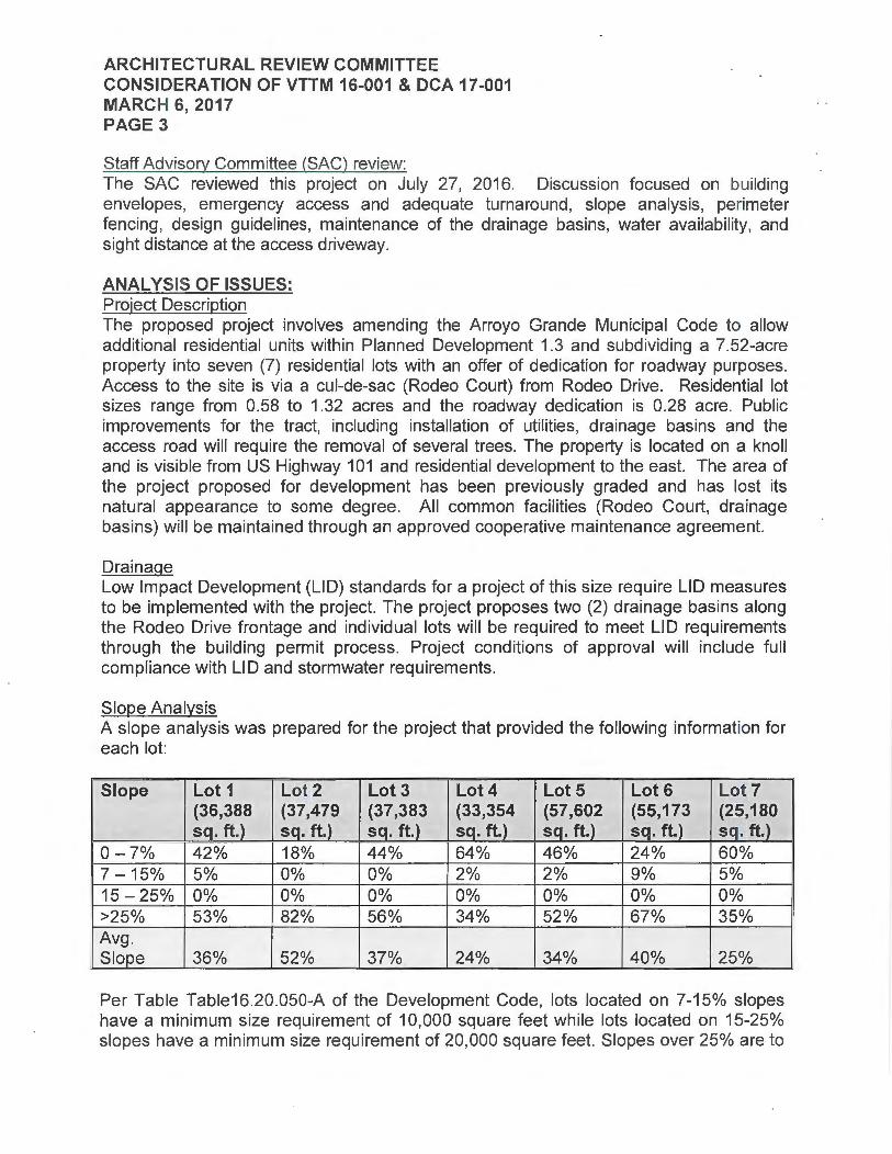
Slope Analysis A slope analysis was prepared for the project that provided the following information for each lot:
Per Table Table16.20.050-A of the Development Code, lots located on 7-15% slopes have a minimum size requirement of 10,000 square feet while lots located on 15-25% slopes have a minimum size requirement of 20,000 square feet. Slopes over 25% are to
ARCHITECTURAL REVIEW COMMITTEE CONSIDERATION OF VTTM 16-001 & DCA 17-001 MARCH 6, 2017 PAGE4
be preserved for open space. All of the lots have some percentage of slopes greater than 25% and all are over the 20,000 square foot requirement. As shown on the project plans, the majority of development will occur within the designated building envelopes on slopes between 0% and 7% where the site was previously graded, with the exception of Lots 1 and 2 which have a higher percentage of steeper slopes. It is anticipated that development of these two lots will cut into the existing slope with the back wall of the home serving as a retaining wall.
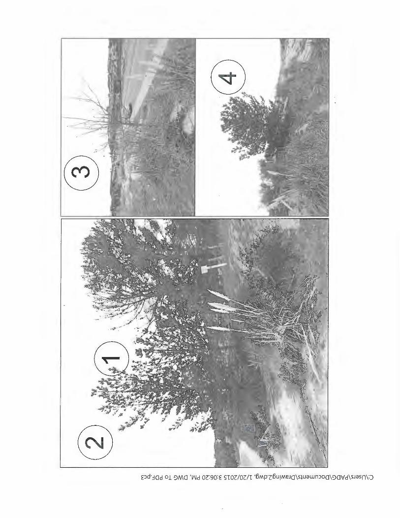
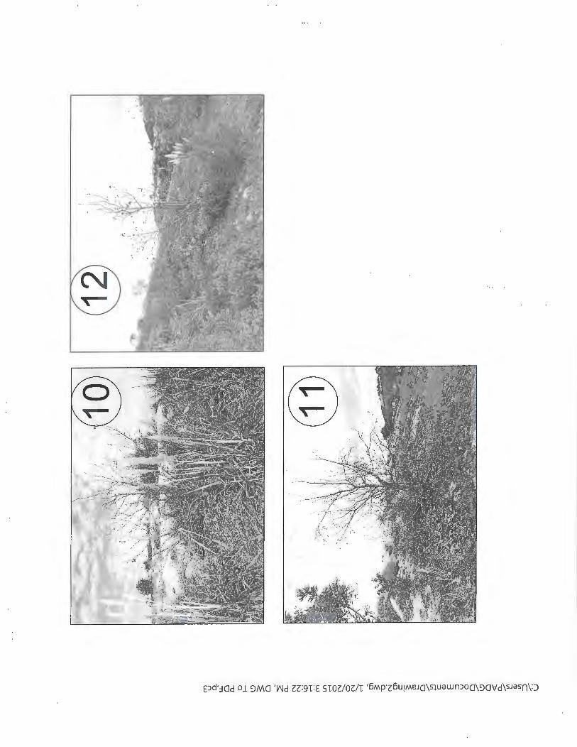
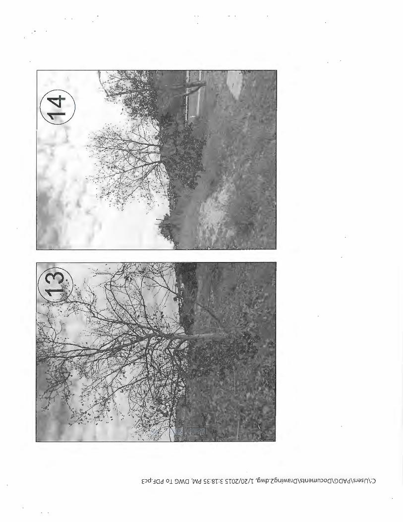
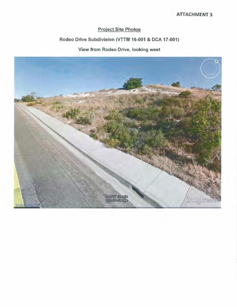
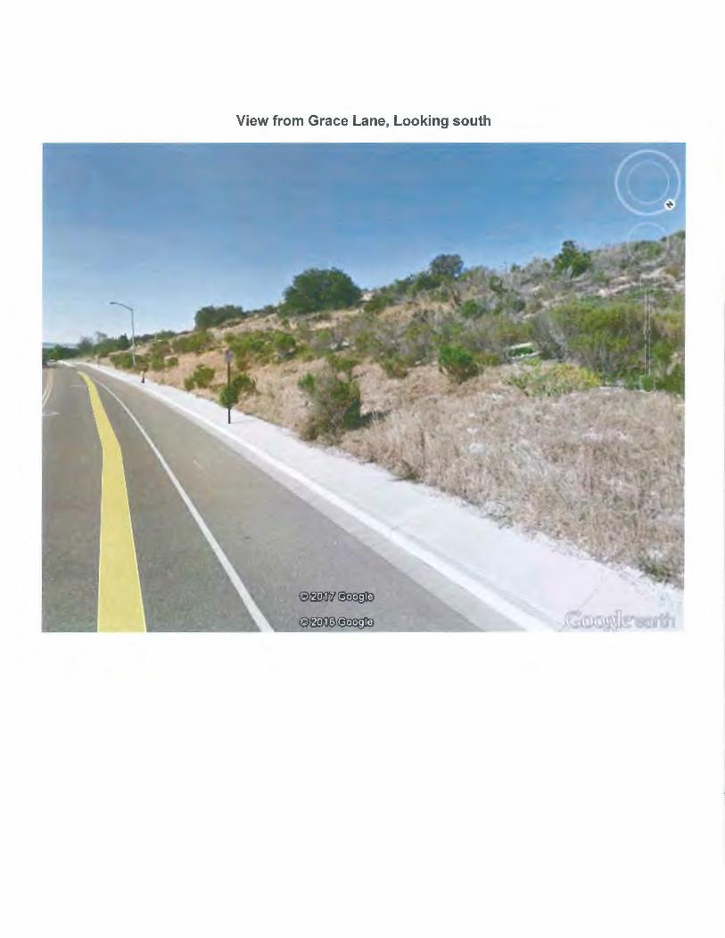
Project Landscaping A landscape and irrigation plan consistent with the State Model Water Efficiency Landscape Ordinance (MWELO) will be required as a condition of approval for each lot prior to issuance of building permit. The ARC might consider if project frontage landscaping along Rodeo Drive and Grace Lane should be required as part of the subdivision entitlement, or be left in its current natural state (see Attachment 3 for site photos).
Design Guidelines The development plan creates seven (7) custom residential lots arranged around a culde-sac that utilizes the previously graded upper plateau area. Although a Planned Unit Development application is not required to accompany the proposed subdivision, design guidelines have been prepared to ensure that future development of the lots complement the surrounding development to the west within the Rancho Grande Planned Development, and to the north within the Grace Lane subdivision. The proposed design guidelines are included as Attachment 4.
The design guidelines include information and guidance on design goals (setting, concept, intent, application and common facilities), site design (drainage, grading, building envelopes and building height), building design (style and character, driveway and garages, architectural features, articulation, entries, garage doors, exterior materials, exterior colors, roof materials, roof drainage, trash containers, mechanical equipment, satellite dishes and antennas, fire sprinklers, lighting, secondary units, water conservation and energy efficiency), and site improvements (hardscape, landscaping and fencing).
The design guidelines do not designate any particular architectural style, although any style proposed should be consistent in detail. Specifically, the design guidelines state that architectural styles shall be low profile and may include Farmhouse, Craftsman, Cottage, Bungalow, Prairie and Spanish Eclectic. Unacceptable styles include Victorian, Tudor, Colonial, and Mid Century Modern designs, mainly due to the high roof pitches or flat two-story wall planes.
The project will be conditioned to require ARC review of building plans for individual lots to ensure adherence with the design guidelines. Staff requests that the ARC review the design guidelines to determine adequacy.
ARCHITECTURAL REVIEW COMMITTEE CONSIDERATION OF VTTM 16-001 & DCA 17-001 MARCH 6, 2017 PAGES
Environmental Review In accordance with the California Environmental Quality Act (CEQA) Guidelines, a Mitigated Negative Declaration has been prepared for this project. Mitigation is required for aesthetics, biological resources, greenhouse gas emissions, cultural resources, air quality, hydrology/water quality, and noise.
ADVANTAGES: The proposed project will subdivide a vacant property into residential lots at a low density consistent with the 2001 General Plan. The project will provide the community with residential infill and seven (7) new home sites for housing opportunities.
DISADVANTAGES: The proposed project produces potential aesthetic impacts with the introduction of hillside residences.
Attachments:
1. Tree Inventory 2. Ordinance 355 C.S. 3. Site Photos 4. Design Guidelines 5. Project Plans
January 20, 2015
Mr. Wayne Colmer 23679 Calabasas Rd. Calabasas, CA 91302
ATTACHMENT 1
2615 SKY\XIAY DRJVE, SUITE B S.Al'JTA MARIA, CA 93455-1414 T 805.349.9695 F: 305.9284639 www.ple inairedg.com
RE: Colmer Construction; Rodeo Drive Single Family Development Tree Inventory
Dear Mr. Colmer:
Please find attached our tree inventory prepared for Colmer Construction. On January 9, 2015, I visited the site to review the existing conditions and inventor_y_all trees.
I also spoke with City staff regarding tee preservation requirements and was told that currently the only trees requiring protection are Oak trees with a DBH measurement of 12" or greater.
On this site there is only one tree that meets that requirement. It is tree number 7. It is on the existing slopes and should not be impacted by construction operations.
The site has not been maintained for an extended period of time. There are some existing street trees that are severely stressed and or dead. There are also large clusters of acacia and some pampas grass. There are some Pinus radiata, Monterey Pines on site as well. These trees are not doing well in this area and can become infested by Pine Bark Beetle and I recommend removal.
Attached you will find a photo inventory of all the trees in numerical order. Please call if you have any questions.
Respectfully,
~6-COJQ Kevin J. Small PleinAire Design Group
CA Registered Landscape Architect 2929 !SA Certified Arborist WE-7333A
Client Colmes Construction 0 Rodeo Drive ~royo Grande_ CA
Tree# Species
1 Pinus radia ta
2 Pinus radia ta
3 Platanus acerifolia
4 Pmus radia ta
5 Pinus radiata
6 Eucalyptus Spp.
7 Quercus Agnfolia
8 Quercus Agrifolia
9 Quercus Agrifol ia
10 Platanus acerifolia
11 Platanus acerifolia
12 Platanus acerifolia
13 Platanus acerifolia
14 Platanus acerifolia
15 Quercus Agrifolia
16 Quercus Agrifolia
Common Name
Monterey Pine
Monterey Pine
London Plane Tree
Monterey Pine
Monterey Pine
Eucalyptus
Coast Live Oak
Coast Live Oak
Coast Live Oak
London Plane Tree
Loodon Plane Tree
Loodoo Plane Tree
Loodoo Plane Tree
Loodoo Plane Tree
Coast Live Oak
Coast Live Oak
Date: January 9, 2016
DBH (Inches) Canopy Ft Disposition
6.5" 11' 2 (3 ) 7'', 4" 5.5" 12' 2
3.5" 8' 2 9" 15' 2
8" 10' 2 4" 10' 2
(2) 8". 611 20' 2 (7 ) avg. 1011 38' 1
(6) avg. 6'' 30' 1
3'' 5' 4 I
3.5" 6' 1 ' I
3'' 5.5' 1
6.5 14' 1
(2) 6", 6" 12' 1
(2) 8", 10" 18' 1
6.5" 16' 1
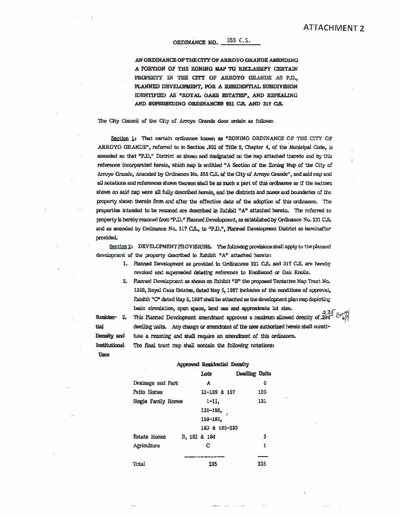
OB.DINANCB NO. _3_55_C_.s_._
AH OllDINANCBO.P THBCI'rr OF ARBOYO GRANDEAIIENDJNQ
A PORTION OF TBE ZONING IIAP '10 REa.ASSIFY amTAIN
PBOPEB.Tr IN 'IBE arr OF ABllOYO GRAHDE AS P.D.,
PLANNED DBVElOPIIBNT, PO& A BJIIIDBHTIAL SUBDIVISION . .
IDENTI.PIED AS •ROYAL OAKS l!S'l'A"''BS", AND ~G
AND SOPBBSBDJHQ OB.DJNAHCBS 121 C.S. AND Slf C.S.
The City Council ot the City ot Arroyo Grailde does ordain as tolkwa:
ATTACHMENT 2
~ 1: That certain ordinance known as "ZONING ORDINANCE OF THE CITY OF
ARROYO GRANDE", referred to in Section .302 o! Title 9, Olapter 4, or the MwlJcipal Code, is
amended so that "P.D.11 District as showri and designated on the map attached thereto and by this
reference lncorponted herein, which map is entitled ~A Section or the ~ Map or the City or Arroyo ere.nae, Ammded by Ordinance No. 355 c.s. or the Clty or Arroyo GraOde", and said map and
all notatiom and references shown thereon shall be as nuch a pert or this ordinance as if the matters
shown on said map were all fully described herein, and the districts and zones and boundaries of the
property shown therein fran and after the effective date ot the adoption ot this ordinonce. The
p-operties intended to be rezoned are descrJbed in Exhibit "A" attached hereto. The referred to
property Is hereby rezoned fran np .D." Aanned Development, as eStablished by Ordinance No. 221 C.S.
and as amended by Ordinance No. 317 C.S., to "P.D.11, Planned Development District as hereinafter
provided.
-~1: DEVELOPMENT PROVISIONS. The!~ provisiDm shall apply to the planned
development of the property described In Exhibit "A" attached hereto: 1. Planned Development as provided in Ordinances 221 C.S. and 317 C.S. are hereby
revoked and superseded dele~ reference to Knollwood or Oak Knolls.
2. Planned Development as shown on Exhibit "B" the propased Tentative Map Tract No.
1390, Royal Oaks &tates, dated May 5, 1987 inclusive or the conditions of approval,
Exhibit "C" dated May 5, 1987 shall be attached as the develaprrent plan map depicting
basic circulation, open apace, land use and &p(ll'C~Xlnte lot size. 3
.;- · This Planned Developnent 811MmQnent approves a maxinun allowed density of~ {!.ll't?J ~units. Any~ or amencinent ot the uses authorized herein shall consti-
tute a rezoning. and shall ~ an amencment ot this ordinance.
'llle final tract map shall contain the f~ notatkn:
Ap(mveci Besjdential Jleality
JA)ts Dwe11ilc Units
Drainage and Park
Patio Homes
A
11-109 & 157
S. Family Homes 1-11, llD-156,
&tate llcmls
Agriculture
Total
158·181, I ;
183 & 185-233
B, 182 11 184
c
235
0
100
131
3
1
235
64
Re9ubdi-
Yislon
Lot Uses
4.
5.
•Note: Lots C, 182 and 184 may be eonverted to lmtltutlonal ws upon approval oC
aty Council after re~ ~bllo hearir1t. Lot B may be converted to a ~bUc
elementary school upon approval of Qty Oxmcil after rezo~ public he~.· O>nditions, covenants and restrictions for the tract shall prohibit resubdivision of any
lots.
Lo.nd me shali be consistent with the approved devel~ plan and the s~ or the R-1, s~e family residential district tor all lots except 11-109, 157, 182 and 184
ond Lots A, B and C. Lots 11-109 and 157 shall be allowed site and lot width,
eoverage and yard variations pt.nUant to Section 9-4.611 of the R-1 District. Lot A I
shall be a drninage and park-recreation site. Lots 182 and 184, Lot B and Lot Care
intended as individual ~e ramny estate lots, each restricted to one ~e family
~ Wlit and residential related, accessory or agricultural U9eS aDowed in the R-A
B. Light r~, except camerclal dairies, ccmnercial rabbit, fox, goat, or hog
Cmm;, or ccmnerclal chicken or poultry ranches;
c. Livestock limited to two (2) anlJmls only 'When camined with a B.3 Dlstrici. A
like nuniler or anlrmls nBy be permitted tor additional acreage. Pere or fenc~
tmed Cor the hcn.B~ of such aniJnalg shall be located not less than 150 teet fran
the boundary of the Residential Agricultural (R-A) DJstrlct;
n. Qop and tree r~ E. One noncannerclal guest hou!lei except 'M1ere there Is an ~ second
residentiol dwelll~ Wlit;
F. MobUe homes subject to the provislom or MWliclpal O>de Section 9-4.2405.1. A
public elementary school on Lot B may be permitted . pursuant to rezoning
procedures. The YMCA and/or alternative in!rtitutional U9eS on Lots 182, 184
and B may be considered pursuant to PD amenanent, zone charve procedures, but
in no event shaD additional residential resubdlvlsion be cor•lclered• 6, Architectural Review or all pooposed homes on Lots 11-109 and 157 shall be
considered after the Cty Councll approves this PD amenctnent and the tentative 1111p
lor Royal Oaks. Generally, .the preUmlnary Jot plan!J and e1eYetJcn
inYol~ "Z" and "J" lots with zero ~~etbeleks on stde yards tor Lots 11-
109 and 157 are conceptually acceptable, Oty Council architectural
review on all lots shall include representative renderiJ1ls and pivpteed Conditions,
OWenants and Restrictions (C.C.c\Jl.ll), 'Which establish a deveJopere actnr.teNd
subdlwion Architectural 0xrtro1 Omnlttee and describes the propca!d architectural
style (s) or theme tor ~ to be pennitted in the subdiwlon. Generalized
architectural theme review tor Institutional Illes shall be Included with the Oty's
architectural review and shall include proposed C.C.4:R.s, but not renderi11!1 or
drawings. The developer and/or his architectural review comnlttee shall review each
individual bull~ plan, and the Oty will approve the developer's general C.C.4: R.
plan only.•
7. The developer shall nBke avaDable Lot B, a school site oC approxinately fourteen
ocres adjo~ James Way, to Lucia Mar Unified School District tor the District's
Sehoo1 future c:omtruction or an elementary school under tel'll'l!l jointly agreed upon
Site by the developer and District In their contractural agreement, dated March 10,1987. Any amerdnent of the March 10, 1981 agreement shall require Oty Ccuncll
2
i .
concurrence.. All gra~, develqxrent and access plans ot the District WlCI/or
developer for &Ee of the proposed school alte shall be approved by the Oty Councll.
8. The planned develq:ment . shall be constructed in tlt\0 phases.
Pbll8e L 1be initial and first phase of planned development shall be called Phase I.
Pbilse I development shall pemit the concurrent developnent ot au public and private
ilq;Jrovements identified on-site and within the area defined ·as Phose I upon tile
approved tentative tract map, plus au ott-site fntlrovements, excepting 11E" Street.
Phase I jzqlroveaents shall include the construction ot all patio and other homes
cootained within the Phase I tentative tract map area, but shall exclude construction
ot buildlni upon Lots B. C, 182 and 184. ~. dralnage and non-building
lirpovements may take place upon Lots B, C. 182 and 184 according to approved City
plans during Phase I. ~construction upon Lots B, C, 182 and 184 shllll require
CoW\Cil detailed site plan review and approval prior to coammcement.
No building pennits shall be issued for Phase I developnent until after City acceptance
ot au water &)'Stem lnprovemems and ~.mtil the developer provicllli the aty Council with
a construction schedule which Council, in its Sole juc:lgemlmt, detennines shall provide
tor the total canpletlon and Clty acceptance o! any on- and ott-site public
in{lrovements prior to, or cancurrent with, the COil'pletion ot au residential housing
proposed upon said schedule. In no event shall the Clty issue occupancy pennits for
residential bu.ilding9 prior to City acceptance o! all public on- and off-site
in"(li'OV~Rmts required in Phase L
Prior to comnencing Phase I developnent, the developer shall provide the Public Works
Director with a five-year ccntruction bond ~U&NRtee sufficient to cover oft-site
"E" Street public lrqlrovements to be constructed in Phase IL
Developer is pemlitted. to grade in the Phase II area ~ Phase I according to a
grad~ plan approved by the Public Works Director and only tor purposes of
transporting excess tw fl'CIIIl the Phase II area to the Phase I area.
ftlase IL The second and tinal.phase ot the planned dovelqxnent shall be canpleted
atter Phase I. Phase II deVelcpnent shall permit the concurrent development of all
public and private iaprovements identified on-site and within the area defined as
Phase II upon the approwcl tentative map, plus ott-site 11E" Street. Phase II
lnt'lrovements shall Include the comtructlon ot all bale contained within the Phase II
tentative tract map area. · No building pennlts shall be issued for Phase II devell:l(ftnt until the developer
providel the City CouncJl with a ocnatruc:tion llcbeclule Mlich Council, in its sole
jlqement, detennines shall provide for the total ~tion and Qty acceptance ot all
on- and ott-site public Improvements prior to, or concurrent with, the canpletlon or
any resldentlal housing proposed upon safd schadule. In no event shall the City Issue occupancy pemits tor resldentlalllulldqs prior to a~ acceptance ot all public on
and ott-site ilqlrovements lequired 1n Phase IL .
lqlrowe-- 9. lapowllmt PJam
ment PJam A. Stancl&rd speclficatlom tor fub41c Worl<s Construction, latest edition, and all
applicable aty Standal'd Aates shall be the project specitiCations except as noted otherwise On the approved ilr{lrovement plans. 1be ilrprovement plans
tor the project shall be prepared by a Calitomia Registered Civil Engineer
and shall be approved by the .Public Works Department prior to recordation ot the final map.
3
65
,,.,
B. Pl.om shall Include, but not be llmlted to, gro~, drainage, sewer, woter and
utility lntlrovements. In addition, a IJIISter utruty plan shill be submitted
showing the layout and location or an the on-site and off-site utility facility
lrr{lrovement or the projeet, Including water, sewer, drainage, gas, eleetrlc
and cannunlca.t.lon utilities. The naster water, sewer and drainage plan
shll1l be submitted and approved prior to presentation of other fntx'ovement plans. The plans sul:lnltted llhall also Include aonstrucrtlan east estimates,
plan eheck f~ soik reports and all pertinent ~ design
calculations. The llnal trap lillY not be IDed with the Qty Qlunci1 unless all
said Jntx'ovement plans have been approved by the PubUc Works
Department. All required rights of 'MIY or easements shall be dedieated to the aty prior to, or COilCim!nt with, sul:mittals of the final map to the Cty
eouncn for approval.
10. 'Water, Sewer, street 'Dee and OU. P\tilc UtDltles
Water, ~. A. All lots shall be provided with aervfC!e fran Cty water supply. This system Street "''ree and shall tie Into the backbone ~)'Stem constructed by Rancho Grande and the
Otber Atltie Royal Oak Estates deYeJopera will be required to pay any a •e•bl with the
UtDities recordation or final ~~~~p(s).
B. The subdivider shall Install water maim, fire hydrants and 8el'Yiee laterals In
eonfonmnee with the Water Department Standard Deslcn and Specifications
and approved plans. Fire now as speclCied by the Fire Odet and approval or the PUblic Works Department 8hall be awllable prior to obtaining any
bull~ pemdt&
C. An lots shall be served with Cty sewer. D. In addition to speelflc easenenbl shown on . the tentative map, a six foot
· eosement alo~ Mel adjo~ lOea1 streets and a ten Coot easement along and
odjolnlng eolleetor streeblllhall be reserved as a street tree and public utility
easement.
Lot 11. Lot~
~ A. Developer shall provide the tlnal grades and finish of . residential lots.
C.C.4:R. 's shall advlae future property OMM!i'S that no further gra~ shell
be permitted, other than minor detan. gl'8dq work which requires Cty
pennlt.•
B. lots 220 through 226 shall be developed In natural terrain. •
C. Grading or Lots 227-232 and lot 183 shall be redesigned to reCiect natural
terrain and drainage patterns and confonn to cross slope design criteria. •
D. Slope banks at the rear or Lobl187-191 and the IIDUthsldeotLot 2061hall be
designed with variable slopes or 3 to 1 or greater and landscaped In
accordance with approved plan designed by a lanc:l!cape architect and
imtalled by the subdivider and maintained as part or the side or rear yards or
the Involved lots, to butter residential developnent fran adjoining future
development on OJunty property~•
E. Lot width to depth ratio exceptiors are approved for tho!le portions or lots
127 through 130, which extend Into the tree preserYiltion m;sessnent area. The rear portion of l.obl127 Urough 130 shall be designated and recordeci a5 a
scenic easement.•
F. Gro~ of Lots 127 through 134 shaD be mxllfied to pad the front 125 foot
4
. ;
'
with the rear slope banks reduced to 3 to · 1 or greater.•
G. In develo{:ment ot patio hanes, the tentative map layout for retaining willis is
conceptual: When final map, ~or architectural review ot construction
plam for structures are resolved, additional walls ~my be permitted as required.
No wood re~ walls which intercept slopes at property lines shnll be
permitted.
12. Abendpned Well-Head
Abandoned A. The developers and the Independent soDs e~ shall Inspect the site,
WeD.-Heed !Tali tor grading and, It an abandoned wellhead Is found on-site, shall provide
plana and, upon approval by the Qty, poperly seal and cap said wen.• 13. Geoere1 Drainace. Gradilc IUid P.laiian OIDtiGl
Geoenl A. ~ete grading and clrainllge plans shall be submitted to and approved bY the
Public Works Department prior to any final map. Prior to any site grading or
construction, an eoosion. control plan and program shall be sumlitted to and
approved by the .Public Works Department, said plan and program to address
specific teJl{Xlr81'Y and pemmaent erosion control JneDSw-es ossociD.ted with the projec:t.. .
B, The subdivider shall pay tor a qualltiec:l Independent eq;:ineeriq: colSiltant
selected by the City to review ~ and c:lrainage iqlrovenw:nt pluns,
inspect the site prior to and durq alliiBjor site preparation gradillg. The
subdivider's soil ~ shall submit tests and reports to certify all lots as
ready for construction prior to issuance ot building pennits thereon.
(Further site or lot grading shall be noted on the final map os prohibited
except for bu1ldiq: and driveway purposes speci!ic:ally approved by the City
pursuant to subsequent permit appllc:atiClllS.)•
C. Detailed site gradiqt, drainap Jntxovement and erosion control plans for the
entire subdivision and ott-site 11J4xovenw:nts, ~ interim grading of any
lots, It proposed, shall be subaittec:l to and approved by the Qty Public Works
Director, QualWed Independent cansultants lball be paid tor by the
subdivider but selected by the Qty, Such shall review II8Jd plans and inspect
the gra~. 'lllese plans shall be approved prior to any grac:li..r pennits for
any phased developnant. Site grading ahall be restric:tec:l to the Spring or
S&.mner season, April 1st ~ October 31st, Wlle&s otherwise approved by
Council; and req.dre replan~ tot ercslon oontiOl in aeccramce with plans
prepaNI by alandiicape architect, v41lch will be ~ted dur~ October
November and zWntained during at least one wet season, Novefli)er through
March, tollowq sradlili to assure mlnlnun slltatlon. •
14. Lot A and Via La ~ Ilralaep S)iBtem
Lot A aod A. The developer shall be f8CJili'ed to design and oonstruct a stonn drainage
Via La Bamulca retention facility and other c:tain8p and park facility on Lot A and upon the
Drainllp ~ Qty-owned adjacent ott-site pooperty as ~ by the Oty Council.
lrr{lrovement plans and contr&Qt,ll nust be appooved by the Public Works 1 . Director prior to constniCtlon or gr~ for these tacD.ities. •
B, The slope bank behind Lots 34-40 shall be part of Lot "A", the proposed
drainage detention basin; the slope bank shall be unved westerly to enable a
drainage swa1e on site ~ the east tract bowldary into the basin. Slope
bank, swale and basin lonclscaping shall be designed by a landscape architect
5
oncl installed by the subdivider.* . .
c. The aty-owned Via La Barranca drainage property was aeeepted by the aty Cor both pork and drainage pll'pOSeS.· Developer's COI\9Uitants shall sutxnit
specific draJnnge landseu~ pl8l'll Cor Lot A, the ndjo~ a~ Via
La Berronca property and dowrstream dralnoge lines or other mltlgntlng
meosures toward9 oft1ite chlnage deCiclencfes, where necessary, to the
Public Works Dlreetor ond Parks and Recreation Director. The two directors
shall review and arinlyze sueh pl8l'll to detennlne the adequacy or such plans
tos
1) mitigate or reduce current and projeeted noodl~ or the streets and areas
below the current Oty drainage racillty and works, . and;
2) mitigate or prewnt any further nood~ or the streets and &reDS below
the ct.nTent Oty drainage Caclllty and v.orlcs to be caused by the planned
clevelopnent; and;
3) provide recreational opportunities upon the site to the lrnnedlate
neighborhood; and;
4) . how those proposed recreational opportunities upon the site ClOI'I1lfll'e with
opportunities to be provided by the currently approved park de\oelopnent
plans or the Parks and Recreation Omnlsslon, and;
5) provide security and safety measures and durable and substantial
irrprovements which can be efficiently and adequately lllllntained by the
Oty.
The directors shall sutmt a 'Wl'itten report or their findings and the
proposed specific plan to the Oty Qmncll which shall detennlne prior to
the lssuanee or any grading pennifst the future ownership and
responslbllitles for Lot A, the tile or the Cty-owned VIa La Barranca drnlnage and specific park and drolnage plan. •
15. lot 182 Drainage s,sten
A. The developer shall be required to design and conrtruct: a stonn drainage
Lot 182 retention racllity and other drainage on Lot 182 as required by the Cty
Dl'llinage Systan c:ouncn. ll11ll'Omnenl plans and contracts I1'IJSt be approwd by the Public Works Dlreetor prior to comtructlon or grading tor· these Cacllitles. • ·
Doth
Dralnuge
SystmB
B. Developer's Consultants shall sul:mlt specific drnlnage and landseape plans Cor
drainage on Lot 182 to the Public Works Director. The dlreetor shall review
and analyze such plans to detennlne the adequacy or such plans to:
a) mitigate or reduce current and projected nooding
b) provide security and safety measures and durnble and sub;tantive
irJllrovements which can be etnclently and adequately rmlntalned.
The direetor shall sul:mlt a written report or his findq and the proposed
specific plan to the Cty CouneD which shall detennlne, prior to the Issuance or
any groding pennits, the ruture ownerslilp and responsibilities ror the drainage
racilltles and the acceptability or the proposed specific drainage plan. • 16. Both Drainage SJStara. J
Regarding storm drainage retention capoclty within Lot "A" and the adjoining City
drainage retention basin, and on Lot 182, evidence or orr-site eoseinents and design solutions acceptable to the Cty shall be sutmtted to and approved prior to gradi~ or concurrent v.Uh final JTep lmprovemenm plans.*
6
The subdivider shall bond for, provide and restore all on-site and off-site drainage
detention basins capacity, . remove alltatlon \'dlleh occurs and provide general
maintenance of all drainage facllitles ~ the three-year period following
acceptance of subdivisJOn. kqlrowmmts by the Cty or f~ site preparation
gr~. Thereafter, the City shall8SSUIJIO total maintenance responsibilities for same
without benefit of ma.intenance aassnent district. •
1'7. No l'8rldlc A. "No Parking" signs shall be iiwtalled on Halc)'on Road in front of Lots 110-
113, 123 and 1 '18-181, and, it necessary, a street tree and landscaping control
easement shall extend into the 201 frant yard ot these lots to assure adequate
sight distance at the lntersectlon with "F" Way. 11 No Parking" signs shall be
installed on Halcyon Road in trent of Lot B. •
Park and Signal Pees
A.· The developer shall contribute fwxls pursuant to the City's park in-lieu fee
and the signal fee ordinances to provide for off-site park and recreation and
traffic iaprovements. • Stleet 19. Street Names
Names A. Street names acceptable to the Fire, Police, Public Works and Planning
Departmerits shall be submitted prior to or. ooncLUTent with finul ll'lllP and
ilf4lc'ovement plans. (IJst of possible names avallable fran Planning
Departmerit). Halcyon Road shall be renamed also..
ott-site 20. Oft-site lqmvemeolll
lqmvemeots , A. Any right of way or property flC91isitions necessary to accorJl>lish off -site
.lqlrovements l'eQ.Iired as part of this planned develo(:xnent shall be
~ by or exclusively at the upeme of the developer.•
Street 21. Slreet Trees, I~ and Olnbo1s
'flees, A. A detailed on- and off-site landscapq plan, ~ materials
and lrrlgation plans for street trees and other specltic areas ot public concern (~segments of James Way and Halc)on Road); shall be sublritted
to and approved by the Paries and Recreatlcn Director, prior to any finalll'lllp
approval. · A nwster fencing plan, ~ unilorm design along public
streets, shall be part ot the detalled ~ plan.•
B. Developer shall plant all land!lcapq materiels according to the approved
~plan, and shall nlntainand replace, when necesary, all plantings
for two years alter' aty acceptance of phased public inp'ovements..
C. A water conservation program, partlcularly including drought resistant
landscap~, aha1l be provided by the developer conc&l'l'ent with other utility
plaM, such as nster water and sewer plans and specific drainage and park and
street tree plan9. •
D. Street trees ewjjor unilcnn slope bank plan~ on, or near, street frontages
shall be the maintenance responsiblllty of .the lot ciNier, lllless specitically
acceP,ted by the City. In addi~ to specific easements on-site shown on the
tentative map, a six-toot easement, ~ and ad~ local streets, and a
ten-toot easement, ~and adjo!nq co11ectcr streets, shall be reserved as a street tree and public utility easemenV
'I
69
' ·J
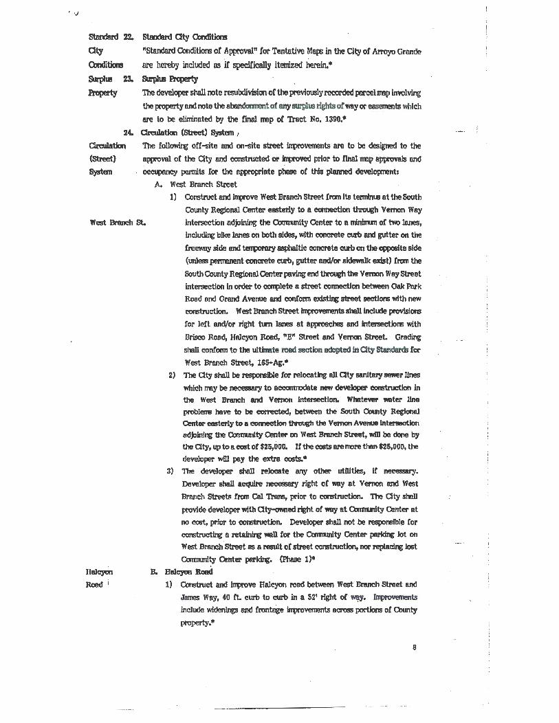
st.mdlrd 22. Standard Cty Olndltiom
Cty "Standard Conditiom of Approval" for Tentative Ma~ in the City or ArroyO Grande
Olnditiom ore hereby included os if' speclCically itemized herein. • Smp)lll 23. &lrpllll Pi'q)erty
Pr'operty The developer shall note resubdlvlsion of the previously recorded parcel Dllp involving
the property and note the abondonnent ol any IIUl'plm rights otway or emenmts which
are to be eliminated by the final Dllp of Tract No. 1390,•
24.
Creulation (Street}
Systan
Om.IJation (Street) Syslml 1
The rollowir€ ott-site and on-site street fntn'ovements are to be designed to the
approval or the Cty and constructed or improved prior to finalrmp approva1s and
occuponcy pennits for the opproprlate phase or this planned development:
A. West Branch Street
1) Construct and lntx'ove West Branch Street from Its tenrdnm at the South
County Regional Center easterly to a connection through Vemon Way
West Branch St. intersection adjoining the Caimmity Center to a mlnfnun or two lo.nes, lnclu~ bike lanes on both sides, with ClOnCll'ete curb and gutter on the
freeway side end ter1llorm'Y asphaltic concrete curb on the opposite side
(unless penmnent concrete curb, gutter and/or sldeMlk exist) Cram the
South County Regional Center paving end through the Vemon Wny street
intersection in order to celq)lete a street connection between Onk Pnrk
Road and Grand Avenue and contonn msting street sections with new
construction. West Bmnch Street lrnprovunents shalllnelucle provisions
Cor left and/or right tum Janes at approaches and lnterseetlom with
Brisco Rood, Halcyon Road, "E" Street and Vemon Street. Grading
shall confonn to the ultlnllte road section adopted in 0ty standards !or
West Branch Street, 165-Ag.•
Haleyon
Road i
2) The City shall be resporBlble tor relocating all Cty sanitary sewer Jines
which rmy be necessary to ae:camJOdate new developer ~ in the West Branch and Vemon intersection. Whatewr water line
problerm have to be corrected, bet\Yeen the South County Regional Center easterly to a connection through the Vemon Avenue lntlll'llllatlon odjolnl~ the O:mludty Center on West Braneh Street, wD1 be done by
the City, up to a cost or $25,000, If the coats are more than $25,000, the
developer will pay the extra costs..
3) The developer shall reloeate any other utDJtles, It necessary.
Developer shall a~ neceSsary right or way at Vemon and West
Brnnch Streebl tram Cal Trans, prior to construction. The City sholl
provide developer with Oty-ormecl right or way at Omrudty O!nter at
no cost, prior to eonstruetJon. Developer shall not be responsible for
construe~ a ~ ...U tor the Camudty Center parking lot on West BI'IUICh Street as a result or street constMiction, nor repla~ last
O:mmmlty Center par~. (Phase 1)* B. Halcyon Jload
1) Construct and lrrprove Halcyon road between West Branch Street and
James Way, 40 ft. curb to curb in a 52' right of~· Jrrtx'overnents include wlclenlngs and frontage frrtlrovements across portions or County
property.•
8
.ilmesWay
2) Concrete curb and gutter shall be installed on the \WlSterly frontage ot Halcyon Road between West Branch Street and the southern tract ·
bowldary where pavement ~· is required. A tentxney asphaltic
concrete curb will be lrtital1ed on the easterly iron• of Hal~on Road
between West Branch Street and the 50Utllem tract boundary. •
3) Access rights to Halcyon Boad fran Lots 94-109 shall be offered io the
city to ~vent driveways directly onto this residential callecto.r street,
and the tencq IUWJ/or ~of the slope banks abutting Halcyon
Road shall be desJ&ned by a lan49cape u.rchitect, installed by the
subdivider CODCUrreDt with street lrontap and shall be maintained as P6rt ot the aide or rear yercls ot involved lots. •
4) '1be right of v.ay tor the northern elttenslon of Halcyon road, on which
Lots 1-10 front, shall extend to the north tract bowldary and an access
denial strip shall be ottered to the City to control said connection until
and unless approved by the Cty Council. Landscap~ shall be designed
by the subdivider and Installed conc&.m~nt with construction ot tllllcyan Road fnlltovements alter design &pplOVecl by the ParkS and Recreation
Director and nlntainecl by the aty. (Fhase I)*
C. oilmeiJWay
1) Jomes Way shoD have an ultin&te width ot 44 teet of drivi!v surface
between concrete curb and gutters (incl~ gutter p&M) with six-foot
sidewalks (including curb width) on both sides. '!be ilftxovurent shall be
centered within a 64 toot wide right ot way. Street inprovements shall
include all necessary utilities, inc1l.ldq cable TV, telephone and sewer, Jn conto~. with the approved master utility plan tor the subdivision. •
2) ln{lrovement requirements between the developrent east and west
property bowldaries shall conform to the ultimate inp'ovement section. •
3) ln{ltovement requirements westerly ot the tract to Rancho Parkway shall
be limited to installation of a. VoBter main,~ trench patchini: with a
one-Jnch pavement overlay to be eppUed on the full in{lroved width of the
street existing at the time the water main Is ntalled.*
4) Jntx'ovements requJrecl on the length ot Jomea Way easterly of the tract
shall be JJmited to contonnance to the exls~ clri~ lanes nnd any
drainage inpovements deemed appropriate to prevent erosion or the
appropriate rights ot way pt"'PC6ed for use at the time construction
conmences.• 5) ln{lrovements ot .TIImel Way northerly ot the subdivision (fronting on the
James parcel wh1ch lies outside the corporate limlta ot the Oty) have been
volunteered by the developer tor constnactlon that contoma to the
ultimate section of road between the east and west tract bowldaries.
This inprovement Is theletore comlcSered a conclitJon to the approval ot
the~.·
6) Access right to James Way fran Lot 1 and Lots 6-34 ahall be offered to
the City to prevent driveways directly onto this collector route. The
f~ and lanaicapq ot these~ lots abutting James Way shall be
designed by a landscape architect and 1nsta11e<1 by the :Aibdivider
concurrent with street frontage irqlrovements and shall be nw.intnined as
9
?1
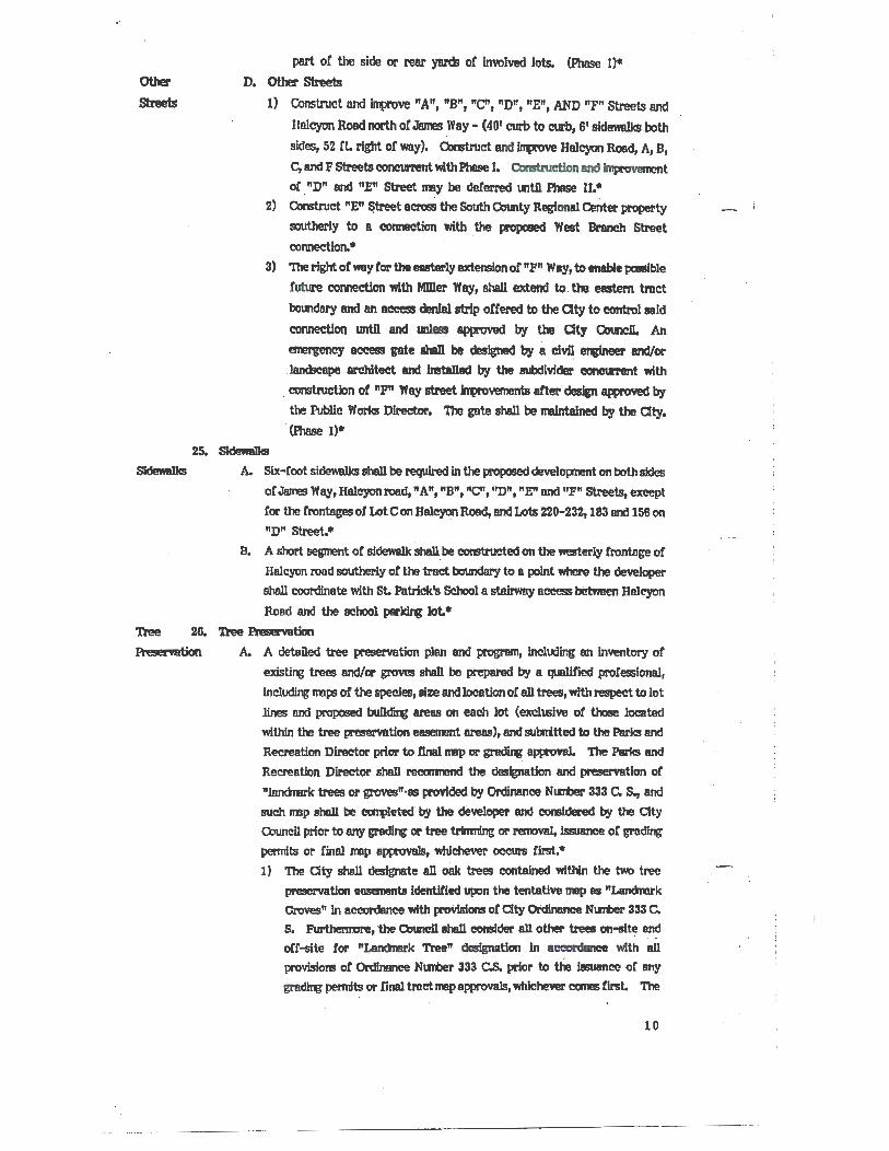
Other
streets
part or the side or rear yards or involved lots. (Phose I)•
D. Other Streets
1) Construct and intx'ove "A", "B", "C'', "D", "E", AND "F" Streets and
Halcyon Road north or James Way- (401 curb to curb, 6' sidewaDcs both
sides, 52 rt. right or way). Constnlct and lrrpove Halcyon Rood, A, B,
C, and F Streetll tlOI1CUI'l'el1t with Phase I. Ontnlctlon and h!provement
oC . "D" and "E" Street lillY be deterred untn Phase II.*
2) Construct "E" fitreet across the South County Regional Center property
southerly to a connection with . the propaaed West Branch Street
connection.•
3) 'I11e right or way Cor the easter~ extension o! "P" Way, to enable pclll!lble
ruture connection with MDler Way, shall extend to . the eastem tract
boundnry and an access denial strip offered to the aty to control said
connection untn and lmless approved by the Oty OJuncU. An
emergency aC!C!ei!IS gate aba11 be designed by a civil ~ and/or
Jandseape architect and Jnstalled by the subdivider coneurrent with
. construction of "P" Way street lrrpovements arter design approved by
25. Sidewa1Jcs
the Public Works Director. The gate shall be ll'lllntalned by the City. (Phase I)•
SidewllDcs A. Six-Coot sidewa1Jcs shall be required In the proposed developnent on both sides
of James Way,Haleyonroad, "A", "B", "C'', "D", "E" ond "P" Streets, except
Cor the Crontsgeso! Lot Con Halcyon Road, and Lots 220-232, 183 and 156 on
"D" Street.•
B. A short segment or sidewalk shall. be conrtrueted on the westerly frontage or
Halcyon road southerly or the tract boundary to a point where the developer
sholl coordinate with St. Patrick's School a stairway access between Halcyon
Road and the school parki~ Jot. •
Tree 2G. Tree Pft!servation
Pk m wrtion A. A detaned tree preservation plan and program, including an Inventory of
existi~ trees and/or groves shall be prepared by a qualified proCessional,
including nnps or the species, size and location or all trees, with respect to Jot
lines ond proposed bull~ areas on each lot (exclusive or those located
within the tree preservation eB!11!11'11!nt areas), ond sutmtted to the Parks and
Recreation Director prior to llnalrmp or ~ approval. The Parks and
Recreation Director shall recamend the designation and preservation of
"landnlrk trees or groves"·as provided by Ordinance NIJTOer 333 C. S., and
such nnp shall be COIJl)leted by the developer and ClOnSldered by the City
Cotmeil prior to any gra~ or tree tr!nming or removal, Issuance or grading
pemdts or !inall!llp approvals, whichever occurs first.•
1) The City shall designate an o8k trees eontained within the two tree
preservation easements Identified upon the tentative np as "Landmrk Groves" in accordance with proYtsions of Clty Ordinance Nlll'ber 333 C.
s. Furtherrmre, the Onlncll shall consfder an other' trees on-site ~
oCf-slte tor "Landnark Tree" designation In accordance with all
provisions o! Ordinance Nt.mber 333 C.S. prior to the IEuanee or any
gra~ permits or llnal trnct rmp approvals, whichever comes first. The
10
developer shall caJtlly wlth all (X'Ovisions ot Ordinance N~~Wer 333 C.S.,
except that developer may replace authorized tree removals in 241
containers rather than 481 containers, which Is provided for in Ordinance
NIIWer 333 CS. and replacement trees need not be oak trees it so
detemined b)o thl Parle. and Raareation DINctor, 1bt Dlreotor moy authorize a replacement tree ratio fran two-to-<lne to five-to-one as a
variance fran Ordinance Nllllber 333 C.S. • 2) Scenic and tree preservation easerrents for the two oak groves shall be
recarcled by the developer after appi:ooval b)o the City Attorney and Parks
end Recreatlcn Director, Such easements shall ~Y with State law, inclucle provlsians ot future tree maintenance and protection os
contained iD Ordinance Nunber 333 C.S. and bind the owners, heirs and
assigns ot all lot owners overlapping the easements to such tree
ownership, n.intenance and protection forever. •
Similar re~ are recpred for any other tree detennined by Council to be
a "I..ananark Tree."• B. The tree preiei'VIltion euernanta lhown on the proopc.ed tentative tract mop
shall be otfered to the owners, heirs and assigns ot all tract owners, and it shall
be stipulated by recorded C.C. and R Is that tree removal, gradi~, fencing or
buildiqr shall be prohibited iD these easernents unless specifically approved by
the City CouncD. Additional recorded scenic easements with similar
restrlctlc;lns shall be applied to the steep slopes on Lots 127-130,•
C. Developer shall grant to the Cty a recordable pennanent open space easement
and tree preservation easement ~ and restrictiqt the use or the
rear port.ions ot Lots 138 throuBh 1401 220 throuih 228 and 232 and portions ol
Lot c and Lot 112, all as more apeclfiCauy depleted on the approved tentative
map ol Tract No.; 1390. 'lbe first grant deed to each ol said parcels shall
specifically refer to both ot said easements and their recordation, and shllll further note that the easeaents are enforceable not only by the owners of the
affected lot but also by the City and by all other QV.ftei'S of property in Tract
No. 1390. No such easerrent shall be arrended, released, abllndoned or
teminated by the aty except by specific amencmmt ot the Royal ·Oaks'
planned developnent zoning ordinance ot 61JCCI'S!!Ol' ordinances thereto. •
27. BemMJoo Appro~ Tl!ldatiw Ttect llap
. Asterisk A. All paragraphs contained within this ordinance, followed by an asterisk (•),
shall be Incorporated verbatim as conclltlons to be attached to the tentative
tract map.
Sed:lon 31 This ordinance shall.be In tun force and ettect thirty (30) days after its passage;
and within titteen (15) days after its passage, it shall be published once,
together with the 11811a1 ot the Council Mea'bers YO~ thereon, In a ne\\Spaper ot general c1rculat1on within the City.
11
'73
On mtion o£ Qnmcll Mermer Moots
the following ra11 eall vote, to wit: seconded by Councn Mermer Porter and on
AYES: Council Members Moots , Porter and Mayor Mankins NO~: Co unci 1 Member Mi 11 is
ABS~:Council Member Johnson
r
the foregoq ~ was passed and . adopted on this . 19th day ot _M_a.._Y __ ,. 1987'.
Attest= 7~ a .. ~ CITY CL K
I, NANCY A. DAVIS, City Clerk of the City of Arroyo Grande, County of San Luis Obispo, State of California, do hereby certify that the foregoing Ordinance No. 355 G.S. is a true, full and correct copy of said Ordinance passed and adopted at a regular meeting of said Council on the 19th day of May , 1987.
WITNESS my hand and the Seal of the City of Arroyo Gr.ande affixed this 28th day of May, 1987.
12
; . - ------···---
., I
0
;c .,
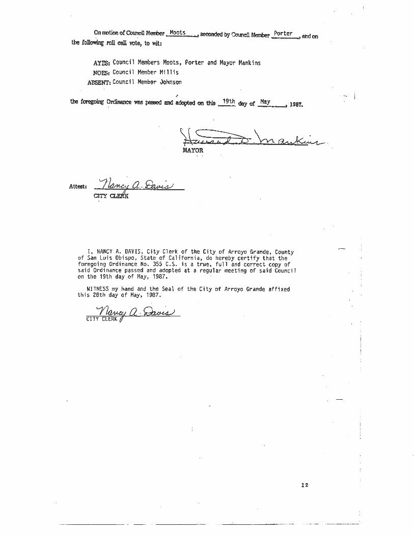
EKN/6/T A .s£C17tJ,V ty Dt'E .r.ow..u;- MQ tY l7tY l'/Tr IV" AMPI1J t:Uc/N
ZONING 1. Lot A zoned PO Drainage and Park 2. Lot C zoned PD Agriculture 3. tots 1-10, 110-156, 158-181, 183 and 185-233 zoned PD Single ~. Lots 11-109 and 157 zoned PO Patio Homes 5. Lots 182, 18~ and B zoned PD Single family rstate Homes Hay 5, 1'87
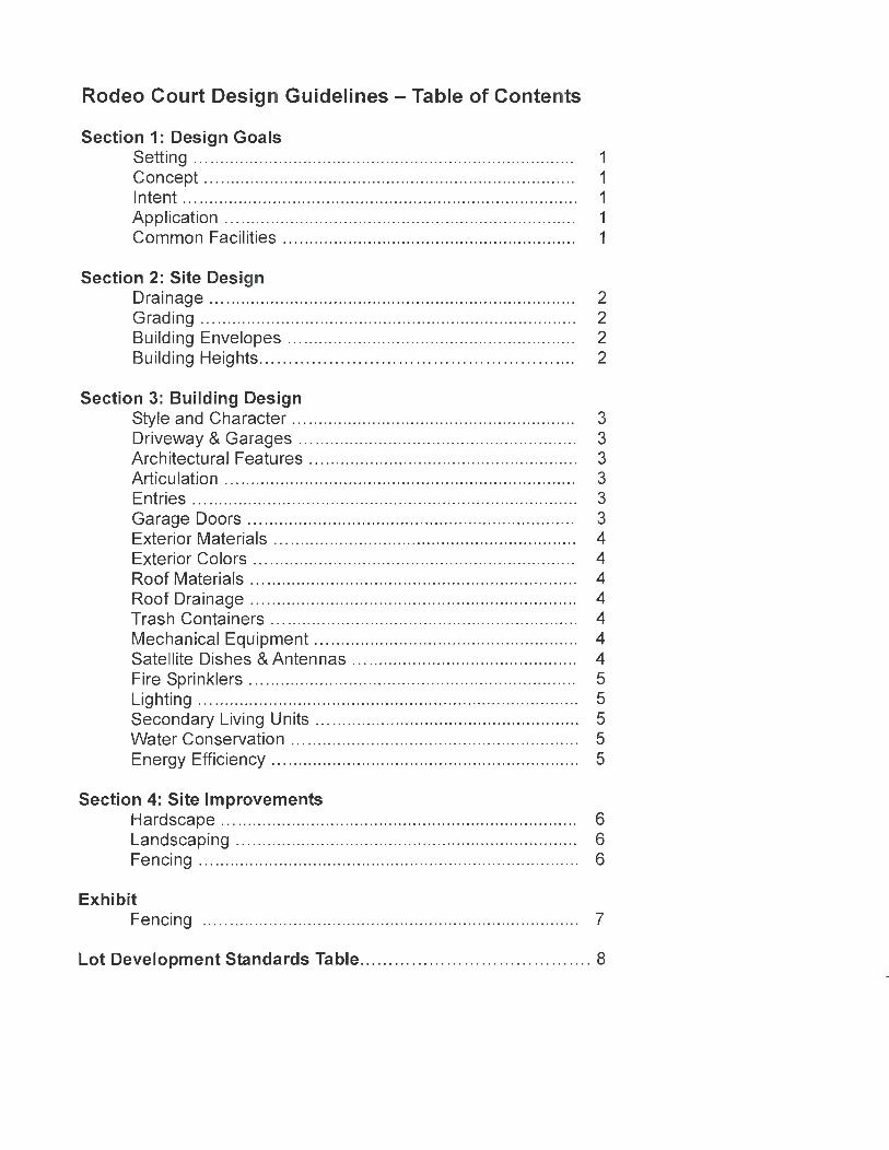
Lot Development Standards Table ... .................. ... ........ .. ...... 8
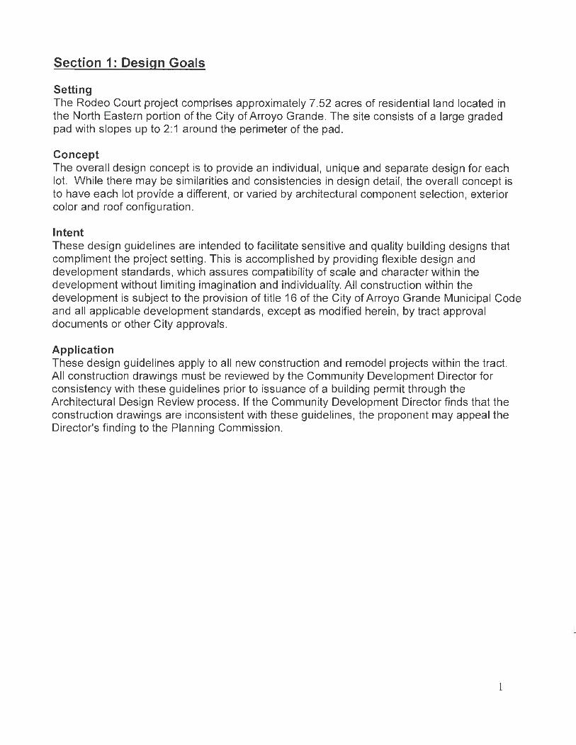
Section 1: Design Goals
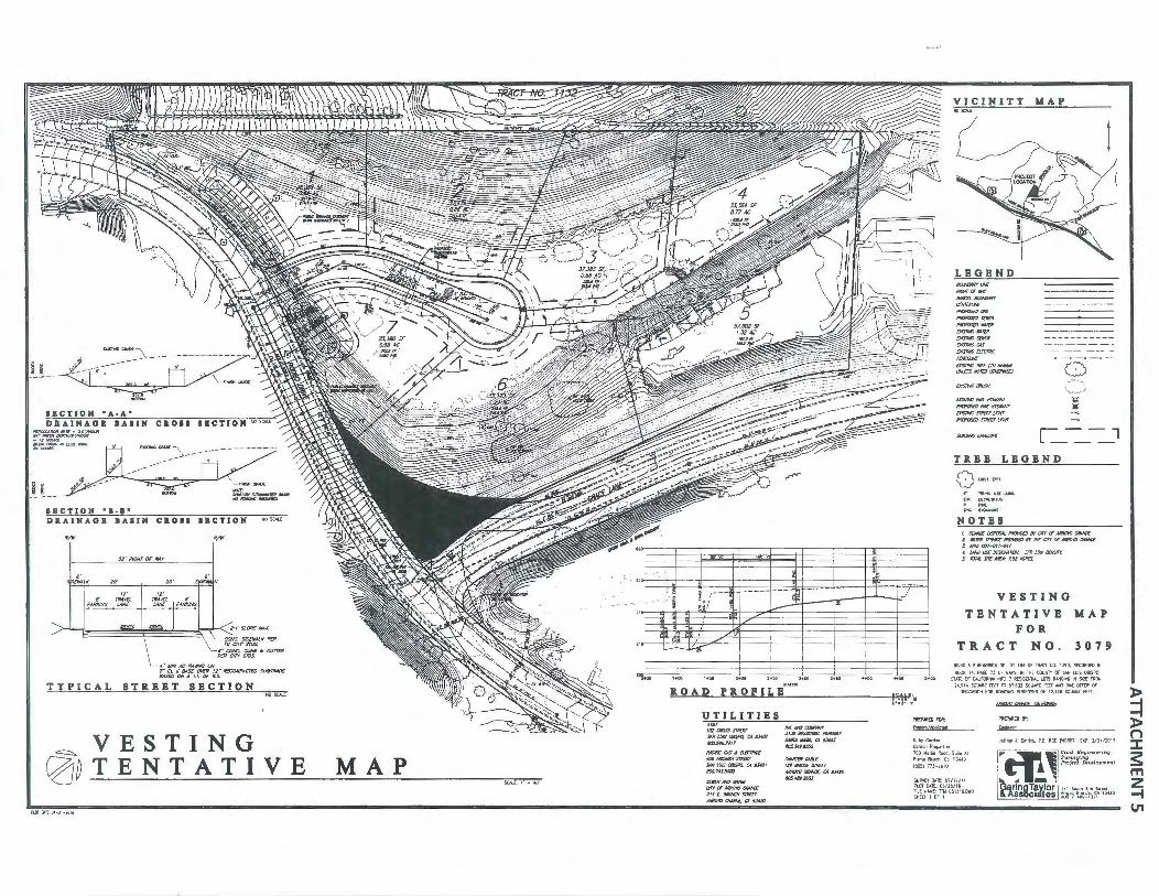
Setting The Rodeo Court project comprises approximately 7.52 acres of residential land located in the North Eastern portion of the City of Arroyo Grande. The site consists of a large graded pad with slopes up to 2:1 around the perimeter of the pad .
Concept The overall design concept is to provide an individual, unique and separate design for each lot. While there may be similarities and consistencies in design detail, the overall concept is to have each lot provide a different, or varied by architectural component selection, exterior color and roof configuration.
Intent These design guidelines are intended to facilitate sensitive and quality building designs that compliment the project setting. This is accomplished by providing flexible design and development standards, which assures compatibility of scale and character within the development without limiting imagination and individuality. All construction within the development is subject to the provision of title 16 of the City of Arroyo Grande Municipal Code and all applicable development standards, except as modified herein, by tract approval documents or other City approvals.
Application These design guidelines apply to all new construction and remodel projects within the tract. All construction drawings must be reviewed by the Community Development Director for consistency with these guidelines prior to issuance of a building permit through the Architectural Design Review process. If the Community Development Director finds that the construction drawings are inconsistent with these guidelines, the proponent may appeal the Director's finding to the Planning Commission.
1
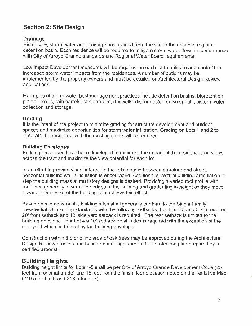
Section 2: Site Design
Drainage Historically, storm water and drainage has drained from the site to the adjacent regional detention basin . Each residence will be required to mitigate storm water flows in conformance with City of Arroyo Grande standards and Regional Water Board requirements
Low Impact Development measures will be required on each lot to mitigate and control the increased storm water impacts from the residences. A number of options may be implemented by the property owners and must be detailed on Architectural Design Review applications.
Examples of storm water best management practices include detention basins, bioretention planter boxes, rain barrels, rain gardens, dry wells, disconnected down spouts, cistern water collection and storage.
Grading It is the intent of the project to minimize grading for structure development and outdoor spaces and maximize opportunities for storm water infiltration. Grading on Lots 1 and 2 to integrate the residence with the existing slope will be required.
Building Envelopes Building envelopes have been developed to minimize the impact of the residences on views across the tract and maximize the view potential for each lot.
In an effort to provide visual interest to the relationship between structure and street, horizontal building wall articulation is encouraged. Additionally, vertical building articulation to step the building mass at multistory designs is desired. Providing a varied roof profile with roof lines generally lower at the edges of the building and graduating in height as they move towards the interior of the building can achieve this effect.
Based on site constraints, building sites shall generally conform to the Single Family Residential (SF) zoning standards with the following setbacks. For lots 1-3 and 5-7 a required 20' front setback and 1 0' side yard setback is required. The rear setback is limited to the building envelope. For Lot 4 a 1 0' setback on all sides is required with the exception of the rear yard which is defined by the building envelope.
Construction within the drip line area of oak trees may be approved during the Architectural Design Review process and based on a design specific tree protection plan prepared by a certified arborist.
Building Heights Building height limits for Lots 1-5 shall be per City of Arroyo Grande Development Code (25 feet from original grade) and 15 feet from the finish floor elevation noted on the Tentative Map (219.5 for Lot 6 and 218.5 for lot 7).
2
Section 3: Building Design
Style and Character While no particular design style is required, it is encouraged that all designs be consistent with an overall character, or vocabulary of acceptable details. Architectural styles shall be low profile at all lots. Detailing and materials appropriate to the chosen styles are envisioned and include, but are not limited to Farmhouse, Craftsman, Cottage, Bungalow, Prairie and Spanish Eclectic. Inappropriate styles include Victorian, Tudor and Colonial due to high roof pitches and/or flat 2 story wall planes to replicate the style. Mid Century Modern styles with flat or mansard roofs are not appropriate.
Driveways and Garages The concept of "street elevation" is encouraged. As such, it is recommended that a variety of garage locations be considered. These include front loaded, side loaded in the front yard area and rear yard locations (front, side and rear loading). Garages may be attached or detached, depending on overall building design and/or site constraints. These variations will provide a more individual look and varied Bite plan for the project.
Outdoor storage of recreational vehicles, boats, trailers , etc. , is not permitted unless such vehicles are stored in covered or enclosed structures or located in yard areas screened from public view.
Architectural Features The use of architectural features such as porches, arbors, trellises and garden walls are encouraged to assist in building articulation . Articulation and varying finish materials, either horizontally or vertically, should minimize large single plan wall expanses, (i.e. masonry veneer or wainscot, varied siding materials, etc.).
Articulation The use of varying ridge heights, wall planes and roof articulations provides variety to the overall building mass. Roof elements such as dormers may also be used to break up large roof masses. Primary roof planes should be low pitched (3:12 to 6:12). Eave lines shall be dominantly horizontal.
Entries Entries shall be architecturally defined, appropriately detailed and obvious with a defined walkway from the public right of way, or off the approach driveway area. Entries should be covered and complimented with obvious enhancements such as porches, courtyards, flatwork finished, windows, etc.
Garage Doors Garage door styles shall be detailed appropriately to enhance the chosen architectural style. Recessed double car or staggered single car garage doors are encouraged .
Exterior Materials Exterior materials such as horizontal siding, board and batt siding, shingles or plaster are
3
appropriate. Plaster may be used as appropriate to a specific style (i.e . Spanish eclectic, Bungalow, etc.); however, detailing and articulation are required . Masonry (either brick, split faced concrete block, or any articulated masonry material) can be utilized as a veneer, or compliment, to exterior stucco or siding finishes .
Exterior Colors Exterior colors should create visual compatibility between the structures and the natural surroundings. Exterior colors should be of individually coordinated palettes. Simple color schemes consisting of a maximum of 3 colors are recommended. Masonry materials have distinct coloring and shall be considered as an element of the color palette. The use of natural materials is encouraged .
Roof Materials Roof coverings appropriate for use include clay tile, concrete tile or dimensional shingle roofing. Metal or flat shingle roofing is not appropriate. All flashing, sheet metal, vents and pipe stacks shall be painted to match the adjacent roof or wall material. Exposed copper is also allowed. Skylights and sun tunnels shall be low profile, flat panel glazed. Solar collector panels, if used, shall be low profile and installed planar with roof surfaces. Panels shall be incorporated into roof design and installed flush with roof materials where possible.
Roof Drainage Gutters and downspouts shall be installed on all roof areas to control water generated during a storm event. Gutters and downspouts shall be color coordinated with the structure. Individual disbursement methods are to be determined based upon each individual property constraints; however, each prop3rty shall disburse the water from impervious surfaces to City approved swales, catchment, or containment devices. It is recommended that storm water from down spouts be directed to a rain garden, rain barrel or cistern for reuse.
Trash Containers Trash, Recycle and Greenwaste containers shall be screened from public view with materials that are architecturally compatible with the main structure, except on pick-up day.
Mechanical Equipment Equipment such as air conditioners, water treatment tanks, utility meters, etc. shall be screened from neighboring lots or public view with materials that are architecturally compatible with the main structure. Utility meters shall be located off of front facade, but accessible per utility provider requirements.
Satellite Dishes and Antennas No satellite dishes larger than 3 feet in diameter are permitted. Any antennas or permitted satellite dishes shall be located to minimize public view as best possible. Antennas shall be subject to City approval per Title 16 of the Arroyo Grande Municipal Code.
Fire Sprinklers All residences shall have residential fire sprinkler system per California Building Code requirements.
4
Lighting Exterior lighting should minimize direct glare through the use of fixtures that direct light in a downward direction. No lights are permitted on the top of any structure. All lighting fixtures shall be compatible with the architectural character of the structure and meet California Green Code and Uniform Building Code requirements.
Secondary Living Units Secondary living units are allowed within the subdivision subject to State Law and Title 16 of City of Arroyo Grande Municipal Code requirements. Parking shall be provided on-site and exclusive of required parking for the main residence.
Water Conservation The use of water efficient plumbing fixtures, smart irrigation controllers, plumbing for grey water reuse, on demand water heaters, etc. in conformance with the California Green Code and California Building Code is required.
Energy Efficiency The use of passive solar design, solar panels, high efficiency windows, solar water heaters (and water heating systems), compact fluorescent or light emitting diode exterior lighting and high efficiency HVAV systems is encouraged to meet the goals of the California Green Code and California Energy Code.
5
Section 4: Site Improvements
Hardscape Areas Incorporation of various types of pervious and impervious hardscape is encouraged with variation and texture. Examples include colored concrete, tile, stone, pavers and brick. Flatwork color, texture and type should relate to the architectural style and design of the residence. Impervious coverage should be minimized to the extent possible via permeable pavement materials or permeable pavers.
Landscaping Native and drought resistant plant types are to be utilized in all planting areas. All landscaping shall meet the requirements of Arroyo Grande Municipal Code Chapter 16.84. Turf areas shall not exceed 25% of the landscaped area in conformance with the State Model Water Efficient Landscape Ordinance. Landscape materials shall compliment the architecture, fencing, walls and other aspects on the site. Selection of plant materials should take maintenance into consideration. Irrigation design must respect the varying water requirements of the plant materials.
Trees should be located as to provide a vertical complement to the Architectural massing and where shade is important for window placement and outdoor uses. All planting areas shall include permanent automatic irrigation with separately zoned areas. Irrigation shall be achieved primarily through a drip system and requiring spray irrigation shall be minimized to the greatest extent possible.
Fencing Fencing and walls shall be incorporated with each specific architectural design approval package. Fencing in public areas shall have a similar design theme and design shall not be primarily comprised of ornamental iron fencing. Walls, fences or retaining walls shall compliment the architectural style of the home. Privacy and defining areas for outdoor space is a primary function for location and vertical height. Fencing may be various forms of wood fencing (either solid or open), vinyl, ornamental welded metal (not including chain link) or masonry. (See Fencing Exhibit on page 7).
Tract perimeter fencing shall be split rail with no climb mesh wire similar to fencing found in Rancho Grande Estates.
Fencing and/or freestanding walls, either separately or combined shall not exceed six feet in height without prior City permit approval. View protection is an important element for determining fence heights, as is privacy of the occupants. All property owners should work together to minimize obstruction of views and maximize outdoor area privacy during the design review process.
6
b b b I I
~ ~ ~
4-- 1 I I I I I --+--' I I I I I
SOLID FENCING STYLES SUGGESTED MATERJALS MAY BE WOOD OR VINYL
EXHIBIT ALL LOTS - FENCING STYLE EXAMPLES
-.)
b ~
b ~
r
~
OPEN FENCING STYLES SUGGESTED IRON FENCE WIRE FENCE
NO CLIMB WIRE MESH
"T1 m z 0 z G)
m X :I: OJ ""'i
Lot Development Standards Area in square feet Lot1 Lot2 Lot 3 Lot4 Lot 5 Lot 6 Lot7 LotS Total Lot Size (gross) 8,947 8,463 9,068 8,004 8,005 8,260 8,260 34,459 93,466