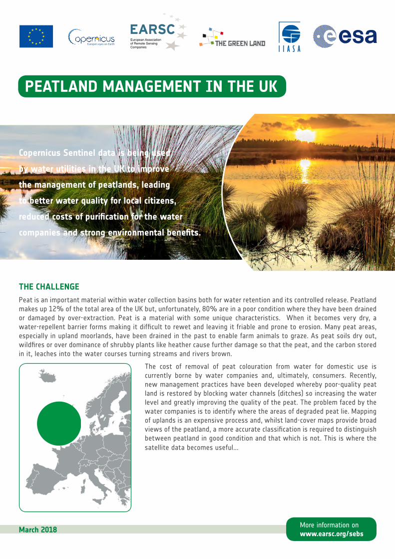
PEATLAND MANAGEMENT IN THE UK THE CHALLENGE Peat is an important material within water collection basins both for water retention and its controlled release. Peatland makes up 12% of the total area of the UK but, unfortunately, 80% are in a poor condition where they have been drained or damaged by over-extraction. Peat is a material with some unique characteristics. When it becomes very dry, a water-repellent barrier forms making it difficult to rewet and leaving it friable and prone to erosion. Many peat areas, especially in upland moorlands, have been drained in the past to enable farm animals to graze. As peat soils dry out, wildfires or over dominance of shrubby plants like heather cause further damage so that the peat, and the carbon stored in it, leaches into the water courses turning streams and rivers brown. The cost of removal of peat colouration from water for domestic use is currently borne by water companies and, ultimately, consumers. Recently, new management practices have been developed whereby poor-quality peat land is restored by blocking water channels (ditches) so increasing the water level and greatly improving the quality of the peat. The problem faced by the water companies is to identify where the areas of degraded peat lie. Mapping of uplands is an expensive process and, whilst land-cover maps provide broad views of the peatland, a more accurate classification is required to distinguish between peatland in good condition and that which is not. This is where the satellite data becomes useful... March 2018 Copernicus Sentinel data is being used by water utilities in the UK to improve the management of peatlands, leading to better water quality for local citizens, reduced costs of purification for the water companies and strong environmental benefits. More information on www.earsc.org/sebs
Transcript
PEATLAND MANAGEMENT IN THE UK
THE CHALLENGEPeat is an important material within water collection basins both for water retention and its controlled release. Peatland makes up 12% of the total area of the UK but, unfortunately, 80% are in a poor condition where they have been drained or damaged by over-extraction. Peat is a material with some unique characteristics. When it becomes very dry, a water-repellent barrier forms making it difficult to rewet and leaving it friable and prone to erosion. Many peat areas, especially in upland moorlands, have been drained in the past to enable farm animals to graze. As peat soils dry out, wildfires or over dominance of shrubby plants like heather cause further damage so that the peat, and the carbon stored in it, leaches into the water courses turning streams and rivers brown.
The cost of removal of peat colouration from water for domestic use is currently borne by water companies and, ultimately, consumers. Recently, new management practices have been developed whereby poor-quality peat land is restored by blocking water channels (ditches) so increasing the water level and greatly improving the quality of the peat. The problem faced by the water companies is to identify where the areas of degraded peat lie. Mapping of uplands is an expensive process and, whilst land-cover maps provide broad views of the peatland, a more accurate classification is required to distinguish between peatland in good condition and that which is not. This is where the satellite data becomes useful...
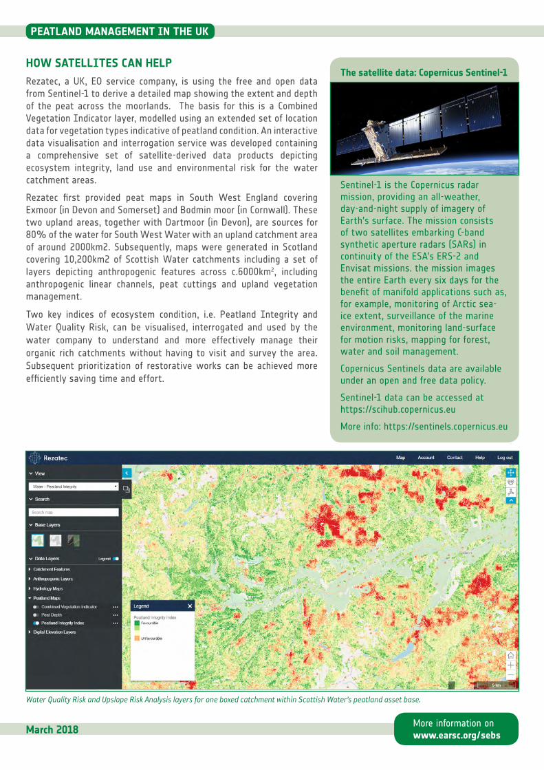
HOW SATELLITES CAN HELPRezatec, a UK, EO service company, is using the free and open data from Sentinel-1 to derive a detailed map showing the extent and depth of the peat across the moorlands. The basis for this is a Combined Vegetation Indicator layer, modelled using an extended set of location data for vegetation types indicative of peatland condition. An interactive data visualisation and interrogation service was developed containing a comprehensive set of satellite-derived data products depicting ecosystem integrity, land use and environmental risk for the water catchment areas.
Rezatec first provided peat maps in South West England covering Exmoor (in Devon and Somerset) and Bodmin moor (in Cornwall). These two upland areas, together with Dartmoor (in Devon), are sources for 80% of the water for South West Water with an upland catchment area of around 2000km2. Subsequently, maps were generated in Scotland covering 10,200km2 of Scottish Water catchments including a set of layers depicting anthropogenic features across c.6000km2, including anthropogenic linear channels, peat cuttings and upland vegetation management.
Two key indices of ecosystem condition, i.e. Peatland Integrity and Water Quality Risk, can be visualised, interrogated and used by the water company to understand and more effectively manage their organic rich catchments without having to visit and survey the area. Subsequent prioritization of restorative works can be achieved more efficiently saving time and effort.
Water Quality Risk and Upslope Risk Analysis layers for one boxed catchment within Scottish Water’s peatland asset base.
March 2018
The satellite data: Copernicus Sentinel-1
Sentinel-1 is the Copernicus radar mission, providing an all-weather, day-and-night supply of imagery of Earth’s surface. The mission consists of two satellites embarking C-band synthetic aperture radars (SARs) in continuity of the ESA’s ERS-2 and Envisat missions. the mission images the entire Earth every six days for the benefit of manifold applications such as, for example, monitoring of Arctic sea-ice extent, surveillance of the marine environment, monitoring land-surface for motion risks, mapping for forest, water and soil management.
Copernicus Sentinels data are available under an open and free data policy.
Sentinel-1 data can be accessed at https://scihub.copernicus.eu
WHO IS CONCERNED?In the UK, 12 water companies supply the large majority of users of which 6 collect their supply from moorland catchment areas including large expanses of peatland (the other 6 collect from underground water sources). Of these, both Scottish Water and South West Water have recently been using Sentinel-derived maps of the moorland within their water catchment areas to identify where the peat quality is severely degraded. This enables them to focus their investment where it can have maximum effect to restore the peat progressively to a much better condition.
The maps are provided by Rezatec a small UK geospatial company (see box). The technique was first tested over Exmoor for South West Water as part of a research project funded by ESA. Its success led to further maps over other moorlands in the SW England catchment area. As a result, Rezatec then supplied Scottish Water with maps on a commercial basis.
The challenge for both companies is to reduce the cost of processing the water which has been polluted by running off the degraded peat land. South West Water supplies 340 million litres of water each year to 800,000 homes and 70,000 businesses in the South West of England. Its region covers over 11,000 km2. Scottish Water has over 230 water treatment works supplied with water from over 400 catchments covering an area of nearly 80,000 km2. Both face an ongoing challenge to improve water quality upstream in order to reduce the rising operational cost of treatment downstream. Approximately 50% of the catchment areas are peatland or consist of soils with a high organic matter content.
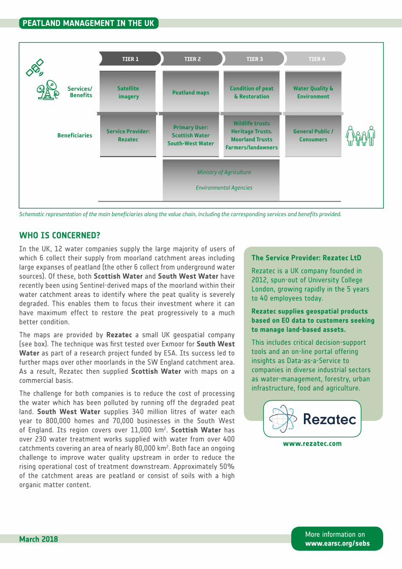
TIER 1 TIER 2 TIER 3 TIER 4
Ministry of Agriculture
Environmental Agencies
Condition of peat& Restoration
Peatland mapsWater Quality &
EnvironmentSatellite imagery
Service Provider:Rezatec
Primary User:Scottish Water
South-West Water
Wildlife trustsHeritage Trusts.Moorland Trusts
Farmers/landowners
General Public /Consumers
Services/Benefits
Beneficiaries
March 2018
Schematic representation of the main beneficiaries along the value chain, including the corresponding services and benefits provided.
The Service Provider: Rezatec LtD
Rezatec is a UK company founded in 2012, spun-out of University College London, growing rapidly in the 5 years to 40 employees today.
Rezatec supplies geospatial products based on EO data to customers seeking to manage land-based assets.
This includes critical decision-support tools and an on-line portal offering insights as Data-as-a-Service to companies in diverse industrial sectors as water-management, forestry, urban infrastructure, food and agriculture.
For the two water companies, the degraded peat leaching into their water source increases the water treatment costs in terms of chemicals and energy. The use of peatland maps helps them improve the quality of the peat so reducing the peat pollution and hence their costs for water treatment and recycling It allows them to provide consumers and citizens with improved water quality. It helps them save time and cost to identify where restoration should be carried out and, as a direct consequence, their investment increases the quality of the peat leading to environmental benefits.
Peat is not the only source of pollutant into the water supply and the water companies are working with farmers and landowners to reduce fertiliser and pesticide use and to keep livestock away from the rivers. Managing the moorlands is a complex process and, besides the key primary users, many other stakeholders are involved. Partnerships are common where those interested are working together to improve the landscape and its environment. The water companies pay for the work, sometimes with the aid of grants, and see the direct financial benefit. By working with others, they leverage the investment to provide environmental gains for the local community.
For example, South West Water is working in partnership with many other local stakeholders in an in initiative called Upstream Thinking with partners being the West Country Rivers Trust, moorland trusts, wildlife trusts, heritage trusts. Their goal is to ensure a better future for farming, value for their customers, improve wildlife habitats and restore wetlands as well as improving future water supplies. Scottish Water also works in partnerships in this case with Scottish Natural Heritage (SNH), RSPB, the James Hutton Institute (JHI), the International Union for the Conservation of Nature (IUCN) UK Peatlands Programme and the Centre for Ecology and Hydrology (CEH), Edinburgh.
These combined efforts all benefit the general public, households and businesses. who are also the consumers and customers of the water companies. For both regions, tourism is an important industry which brings many millions of visitors each year and a strong seasonal demand for water. Efficient management of the water supply is a key requirement for the local economy.
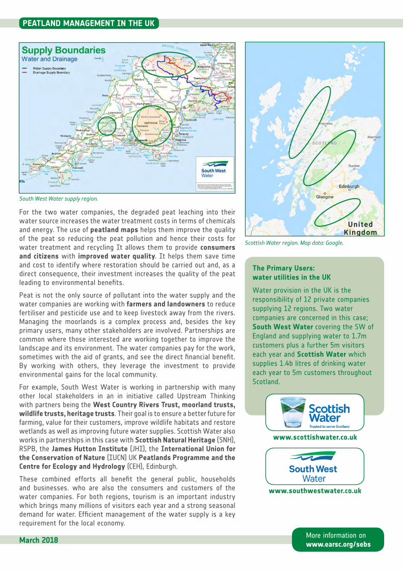
South West Water supply region.
Scottish Water region. Map data: Google.
March 2018
The Primary Users: water utilities in the UK
Water provision in the UK is the responsibility of 12 private companies supplying 12 regions. Two water companies are concerned in this case; South West Water covering the SW of England and supplying water to 1.7m customers plus a further 5m visitors each year and Scottish Water which supplies 1.4b litres of drinking water each year to 5m customers throughout Scotland.
EXTENDED IMPACTGlobally, Peatlands exist in at least 175 countries, covering 3% of the world’s land area, or approximately four million km2. Peatlands store 30% of global carbon, but when drained and damaged they exacerbate climate change by emitting two giga-tonnes of CO2 every year, which accounts for almost 6% of all global greenhouse gas emissions. Many of the peatlands are tropical meaning that their characteristics vary and the ability to use satellite data as a source to update maps is less-well defined.
The commission on Ecosystem Management under the IUCN (International Union for Nature Conservation) has a group working to address the issues raised. The IUCN UK Peatland Programme helps to draw together the actions of the water companies and peatland partnerships into an international setting. It is hoped that this collaborative working can help scale-up delivery of peatland conservation and restoration, and make significant contributions towards biodiversity, Aichi targets, Ramsar Convention, climate change objectives and other international obligations.
Peatlands store 30% of global carbon, but when drained and damaged they exacerbate climate change by emitting two giga tonnes of CO2 every year, which accounts for almost 6% of all global greenhouse emissions.
”
“
WHAT ARE THE BENEFITS?For the water companies the main benefits are economic but with a strong, image-enhancing, environmental benefit to their customers in the region.
Combined, their efforts are considered to cut the cost of the water treatment in half; from £120 to £60 per Megalitre. The total water treatment cost is around £20m per annum of which about 95% is for water recycling costs. Between 16k and 17k Megalitre of catchment water is treated each year giving an annual saving of around £1m (€1,1m).
The contribution to nature conservation, preservation of wildlife plus the introduction of better management practices by farmers are all key outcomes of these projects. Knowing where the degraded peat is located, greatly improves the peatland management strategy and provides many benefits to the community surrounding a water catchment area (see box).
Financial: The water companies save costs through the use of less energy and chemicals in the water treatment works.
Climatic: known peatlands only cover about 3% of the world’s land surface, but store at least twice as much carbon as all of Earth’s standing forests. Carbon storage varies by peatland but generally is 30–70kg of carbon per cubic meter.
Heritage: peat is a good environment for conservation of archaeological sites. Moorlands were extensively inhabited in prehistoric times and more recently used for activities such as quarrying.
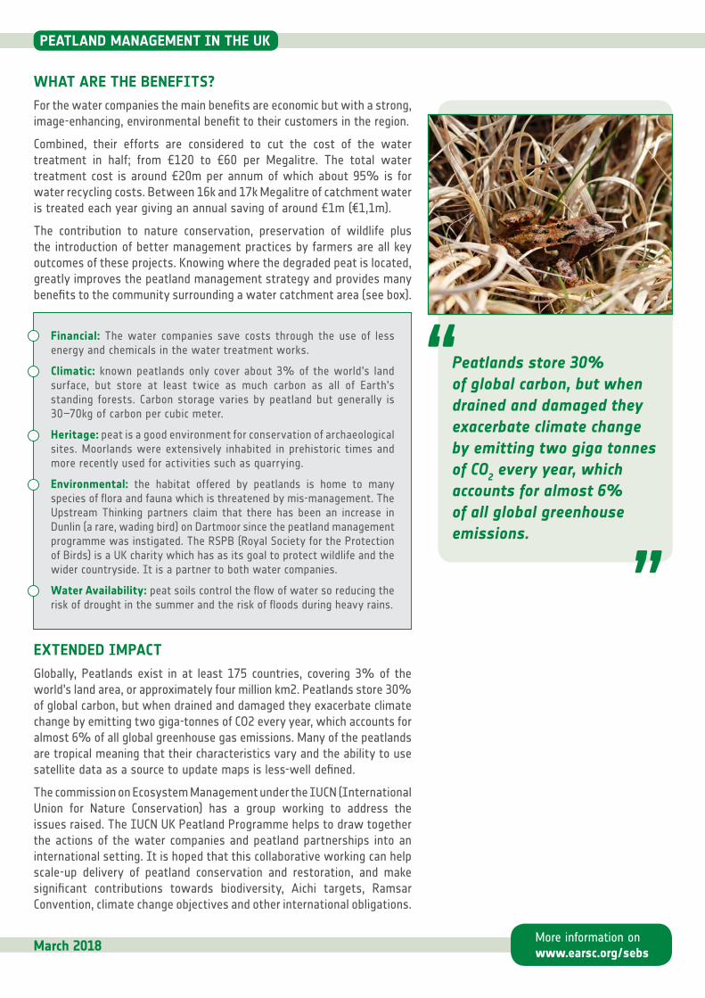
Environmental: the habitat offered by peatlands is home to many species of flora and fauna which is threatened by mis-management. The Upstream Thinking partners claim that there has been an increase in Dunlin (a rare, wading bird) on Dartmoor since the peatland management programme was instigated. The RSPB (Royal Society for the Protection of Birds) is a UK charity which has as its goal to protect wildlife and the wider countryside. It is a partner to both water companies.
Water Availability: peat soils control the flow of water so reducing the risk of drought in the summer and the risk of floods during heavy rains.
ABOUT THE PROJECTThe Sentinel Benefits Study (SeBS) is conducted by EARSC (the European Association of Remote Sensing Companies) in partnership with The Greenland, IIASA (International Institute for Applied Systems Analysis) and Evenflow, on behalf of the European Space Agency (ESA) as part of the Copernicus Programme. The study aims at showcasing the benefits brought by the use of Copernicus Sentinel data along the full value chain. 20+ use cases are addressed in details as part of the study, but many more have been identified. The current report describes one of such cases that have not been (yet) investigated in details.
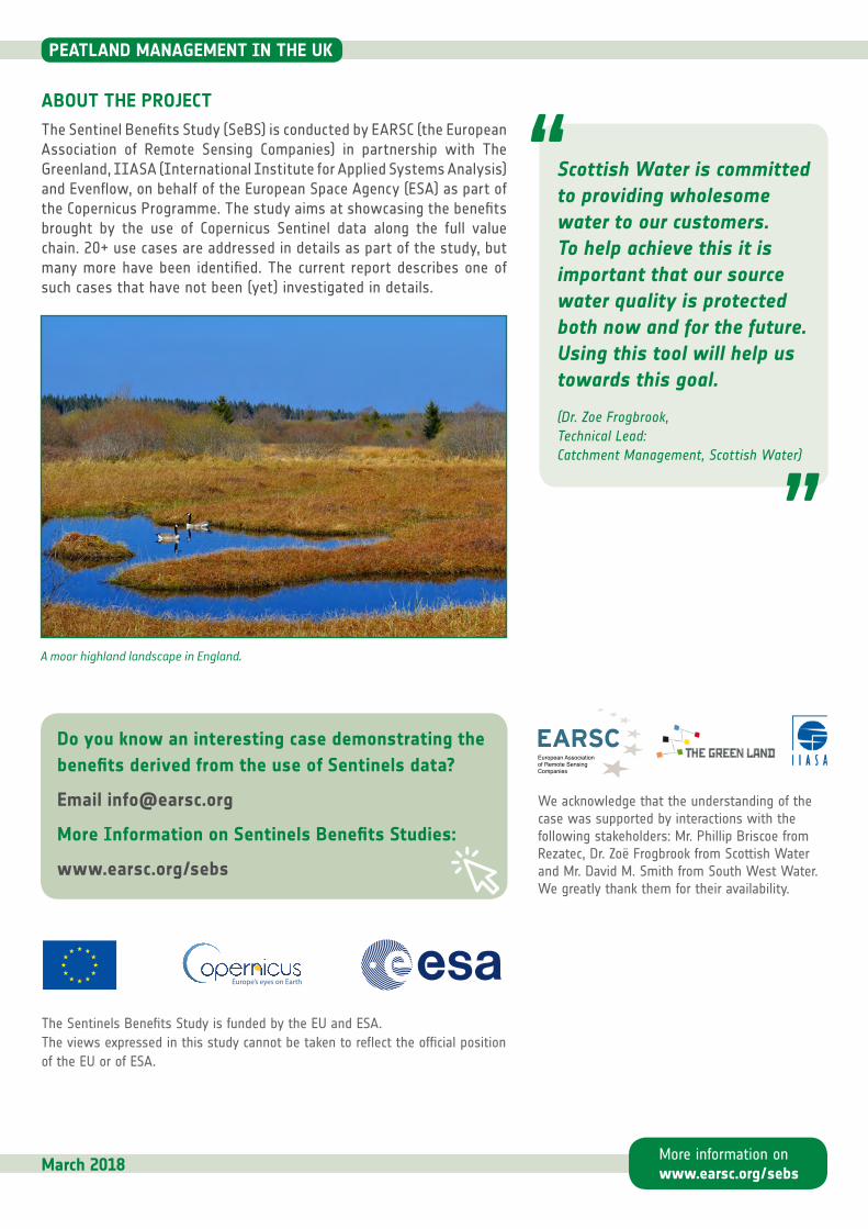
A moor highland landscape in England.
Do you know an interesting case demonstrating the benefits derived from the use of Sentinels data?
We acknowledge that the understanding of the case was supported by interactions with the following stakeholders: Mr. Phillip Briscoe from Rezatec, Dr. Zoë Frogbrook from Scottish Water and Mr. David M. Smith from South West Water. We greatly thank them for their availability.
The Sentinels Benefits Study is funded by the EU and ESA.The views expressed in this study cannot be taken to reflect the official position of the EU or of ESA.
March 2018
”
“Scottish Water is committed to providing wholesome water to our customers. To help achieve this it is important that our source water quality is protected both now and for the future. Using this tool will help us towards this goal.