10
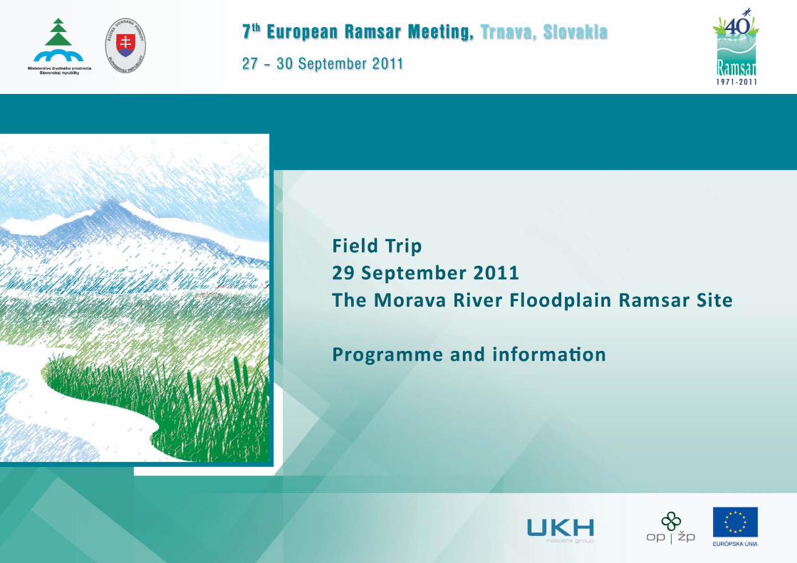
Programme of the fi eld trip
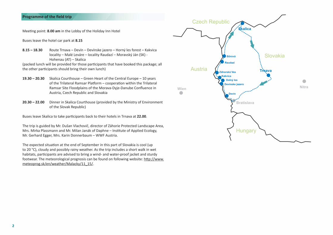
Meeti ng point: 8.00 am in the Lobby of the Holiday Inn Hotel
Buses leave the hotel car park at 8.15
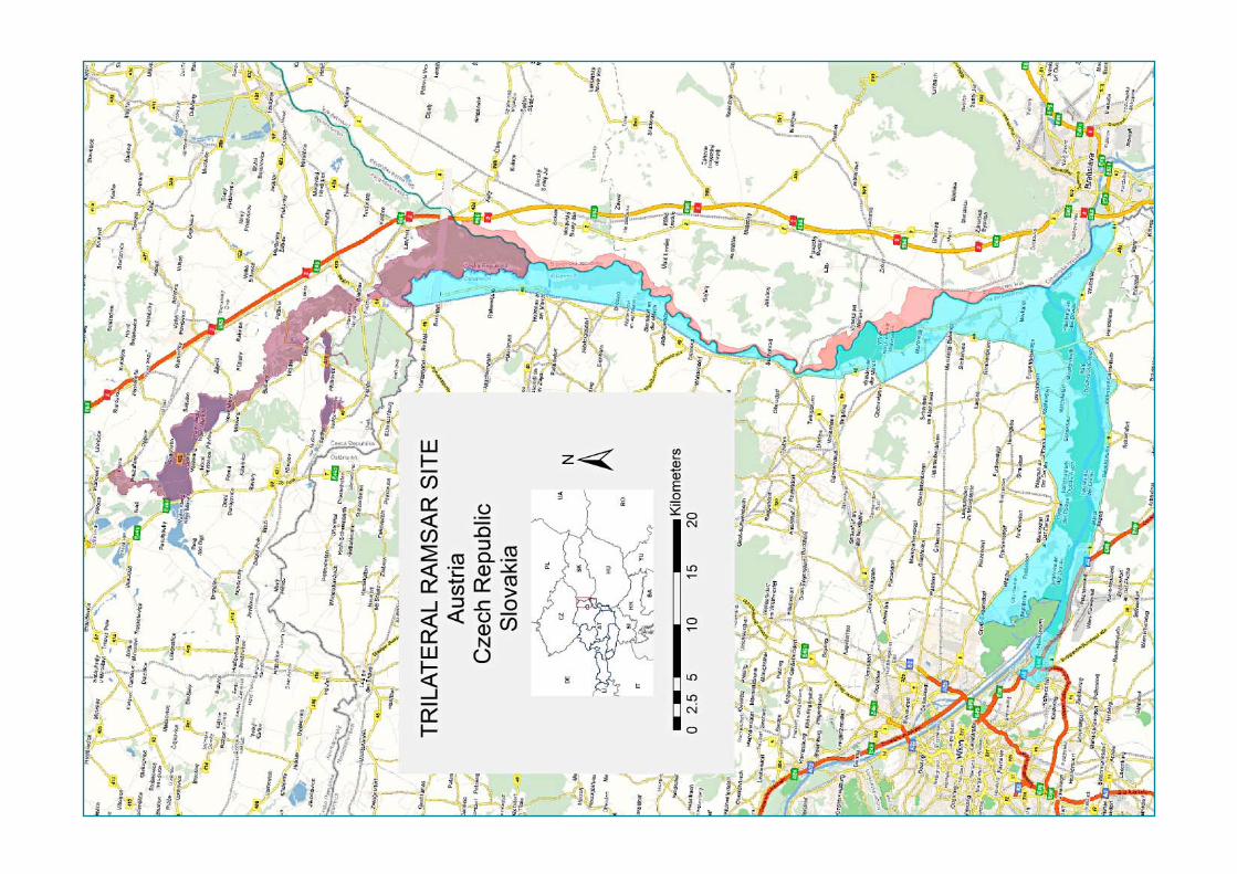
8.15 – 18.30 Route Trnava – Devín – Devínske jazero – Horný les forest – Kakvica locality – Malé Leváre – locality Raudazí – Moravský Ján (SK) - Hohenau (AT) – Skalica(packed lunch will be provided for those parti cipants that have booked this package; all the other parti cipants should bring their own lunch)
19.30 – 20.30 Skalica Courthouse – Green Heart of the Central Europe – 10 years of the Trilateral Ramsar Platf orm – cooperati on within the Trilateral Ramsar Site Floodplains of the Morava-Dyje-Danube Confl uence in Austria, Czech Republic and Slovakia
20.30 – 22.00 Dinner in Skalica Courthouse (provided by the Ministry of Environment of the Slovak Republic)
Buses leave Skalica to take parti cipants back to their hotels in Trnava at 22.00.
The trip is guided by Mr. Dušan Vlachovič, director of Záhorie Protected Landscape Area, Mrs. Mirka Plassmann and Mr. Milan Janák of Daphne – Insti tute of Applied Ecology, Mr. Gerhard Egger, Mrs. Karin Donnerbaum – WWF Austria.
The expected situati on at the end of September in this part of Slovakia is cool (up to 20 °C), cloudy and possibly rainy weather. As the trip includes a short walk in wet habitats, parti cipants are advised to bring a wind- and water-proof jacket and sturdy footwear. The meteorological prognosis can be found on following website: htt p://www.meteoprog.sk/en/weather/Malacky/11_15/.
2
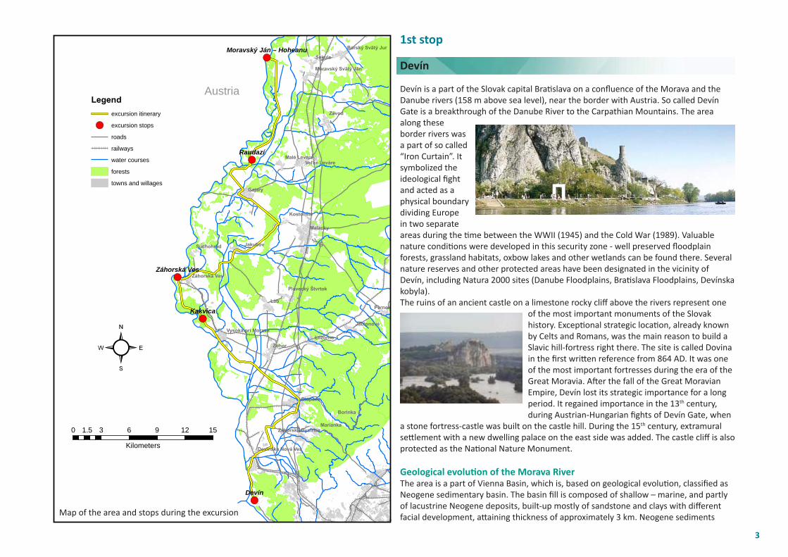
1st stop
Devín
Devín is a part of the Slovak capital Brati slava on a confl uence of the Morava and the Danube rivers (158 m above sea level), near the border with Austria. So called Devín Gate is a breakthrough of the Danube River to the Carpathian Mountains. The area along these border rivers was a part of so called “Iron Curtain”. It symbolized the ideological fi ght and acted as a physical boundary dividing Europe in two separate areas during the ti me between the WWII (1945) and the Cold War (1989). Valuable nature conditi ons were developed in this security zone - well preserved fl oodplain forests, grassland habitats, oxbow lakes and other wetlands can be found there. Several nature reserves and other protected areas have been designated in the vicinity of Devín, including Natura 2000 sites (Danube Floodplains, Brati slava Floodplains, Devínska kobyla). The ruins of an ancient castle on a limestone rocky cliff above the rivers represent one
of the most important monuments of the Slovak history. Excepti onal strategic locati on, already known by Celts and Romans, was the main reason to build a Slavic hill-fortress right there. The site is called Dovina in the fi rst writt en reference from 864 AD. It was one of the most important fortresses during the era of the Great Moravia. Aft er the fall of the Great Moravian Empire, Devín lost its strategic importance for a long period. It regained importance in the 13th century, during Austrian-Hungarian fi ghts of Devín Gate, when
a stone fortress-castle was built on the castle hill. During the 15th century, extramural sett lement with a new dwelling palace on the east side was added. The castle cliff is also protected as the Nati onal Nature Monument.
Geological evoluti on of the Morava RiverThe area is a part of Vienna Basin, which is, based on geological evoluti on, classifi ed as Neogene sedimentary basin. The basin fi ll is composed of shallow – marine, and partly of lacustrine Neogene deposits, built-up mostly of sandstone and clays with diff erent facial development, att aining thickness of approximately 3 km. Neogene sediments
!(
!(
!(
!(
!(
Devín
Raudazí
Kakvica
Záhorská Ves
Moravský Ján – Hoheanu
Láb
Zohor
Závod
Sekule
Pernek
Gajary
Borinka
Stupava
Lozorno
Jakubov
Malacky
Marianka
Suchohrad
Jablonové
Kostolište
Malé Leváre
Záhorská Ves
Veľké Leváre
Borský Svätý Jur
Plavecký Štvrtok
Devínska Nová Ves
Záhorská Bystrica
Vysoká pri Morave
Moravský Svätý Ján
Legendexcursion itinerary
!( excursion stops
roads
railways
water courses
forests
towns and willages
²0 3 6 9 12 151.5
Kilometers
Austria
Map of the area and stops during the excursion
3
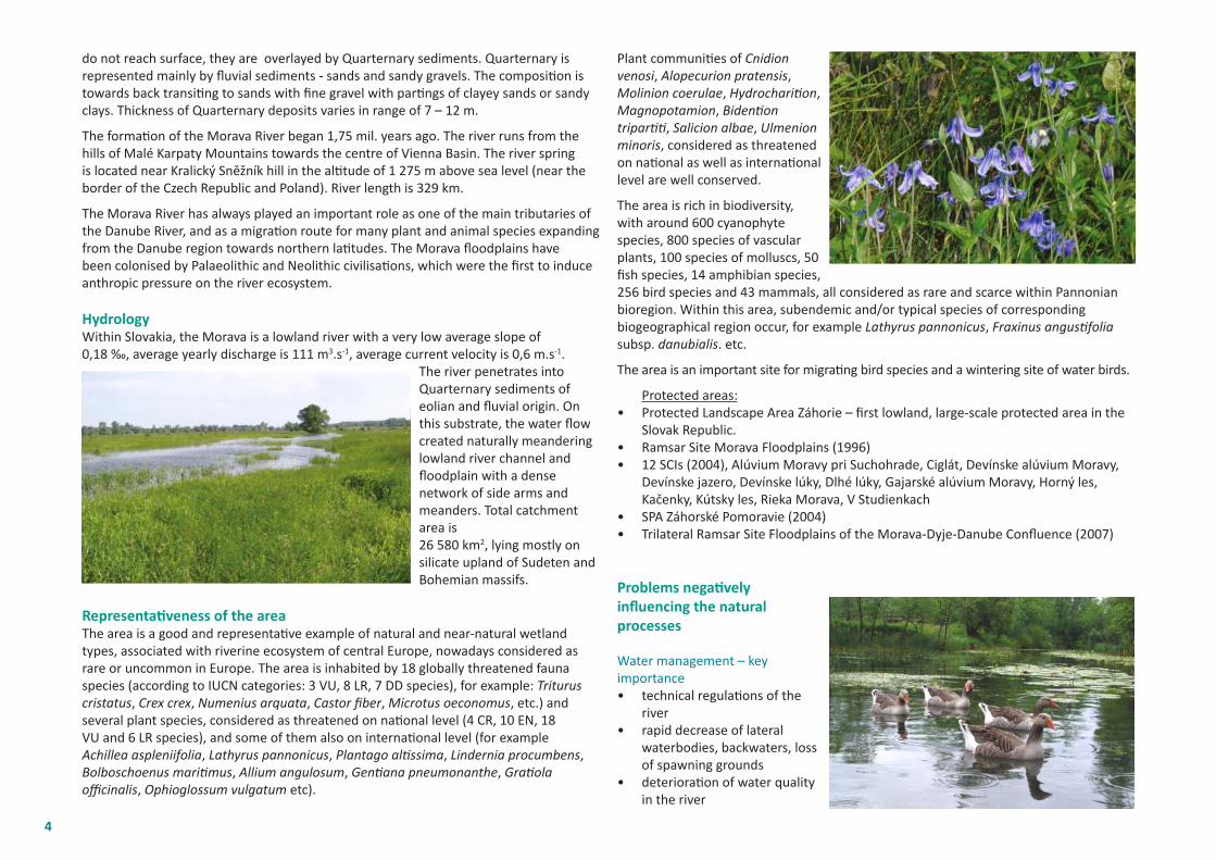
do not reach surface, they are overlayed by Quarternary sediments. Quarternary is represented mainly by fl uvial sediments - sands and sandy gravels. The compositi on is towards back transiti ng to sands with fi ne gravel with parti ngs of clayey sands or sandy clays. Thickness of Quarternary deposits varies in range of 7 – 12 m.
The formati on of the Morava River began 1,75 mil. years ago. The river runs from the hills of Malé Karpaty Mountains towards the centre of Vienna Basin. The river spring is located near Kralický Sněžník hill in the alti tude of 1 275 m above sea level (near the border of the Czech Republic and Poland). River length is 329 km.
The Morava River has always played an important role as one of the main tributaries of the Danube River, and as a migrati on route for many plant and animal species expanding from the Danube region towards northern lati tudes. The Morava fl oodplains have been colonised by Palaeolithic and Neolithic civilisati ons, which were the fi rst to induce anthropic pressure on the river ecosystem.
HydrologyWithin Slovakia, the Morava is a lowland river with a very low average slope of 0,18 ‰, average yearly discharge is 111 m3.s-1, average current velocity is 0,6 m.s-1.
The river penetrates into Quarternary sediments of eolian and fl uvial origin. On this substrate, the water fl ow created naturally meandering lowland river channel and fl oodplain with a dense network of side arms and meanders. Total catchment area is 26 580 km2, lying mostly on silicate upland of Sudeten and Bohemian massifs.
Representati veness of the areaThe area is a good and representati ve example of natural and near-natural wetland types, associated with riverine ecosystem of central Europe, nowadays considered as rare or uncommon in Europe. The area is inhabited by 18 globally threatened fauna species (according to IUCN categories: 3 VU, 8 LR, 7 DD species), for example: Triturus cristatus, Crex crex, Numenius arquata, Castor fi ber, Microtus oeconomus, etc.) and several plant species, considered as threatened on nati onal level (4 CR, 10 EN, 18 VU and 6 LR species), and some of them also on internati onal level (for example Achillea aspleniifolia, Lathyrus pannonicus, Plantago alti ssima, Lindernia procumbens, Bolboschoenus mariti mus, Allium angulosum, Genti ana pneumonanthe, Grati ola offi cinalis, Ophioglossum vulgatum etc).
Plant communiti es of Cnidion venosi, Alopecurion pratensis, Molinion coerulae, Hydrochariti on, Magnopotamion, Bidenti on triparti ti , Salicion albae, Ulmenion minoris, considered as threatened on nati onal as well as internati onal level are well conserved.
The area is rich in biodiversity, with around 600 cyanophyte species, 800 species of vascular plants, 100 species of molluscs, 50 fi sh species, 14 amphibian species, 256 bird species and 43 mammals, all considered as rare and scarce within Pannonian bioregion. Within this area, subendemic and/or typical species of corresponding biogeographical region occur, for example Lathyrus pannonicus, Fraxinus angusti folia subsp. danubialis. etc.
The area is an important site for migrati ng bird species and a wintering site of water birds.
Protected areas:• Protected Landscape Area Záhorie – fi rst lowland, large-scale protected area in the
Slovak Republic.• Ramsar Site Morava Floodplains (1996)• 12 SCIs (2004), Alúvium Moravy pri Suchohrade, Ciglát, Devínske alúvium Moravy,
Devínske jazero, Devínske lúky, Dlhé lúky, Gajarské alúvium Moravy, Horný les, Kačenky, Kútsky les, Rieka Morava, V Studienkach
• SPA Záhorské Pomoravie (2004) • Trilateral Ramsar Site Floodplains of the Morava-Dyje-Danube Confl uence (2007)
Problems negati vely infl uencing the natural processes
Water management – key importance• technical regulati ons of the
river• rapid decrease of lateral
waterbodies, backwaters, loss of spawning grounds
• deteriorati on of water quality in the river
4
Forest management – alluvial forests• forest types change towards dryer forest types • forests with allochtonous tree species• unsuitable management – loss of conti nuity
Agriculture• notable decrease of meadows (permanent grassland) + illegal ploughland within
inundati on
Biodiversity conservati on• disappearance and decrease of several species• beaver acti viti es colliding with human interests (economical and security)
Human acti viti es present from ancient ti mes have infl uenced natural auto-processes. Prevailing part of communiti es developed with human infl uence – as a cultural land they depend on human input, and also on recovery of human caused disturbances.
Ramsar Site area range from mouth of the Morava, 0,0 rkm, up to the confl uence of the Dyje on rkm 72. It covers an area of 5200 ha, including: 55.9 % arable land (38,6 % meadows) 32.5 % forests 7.6 % waterbodies 4.0 % succession on ploughland
2nd stop
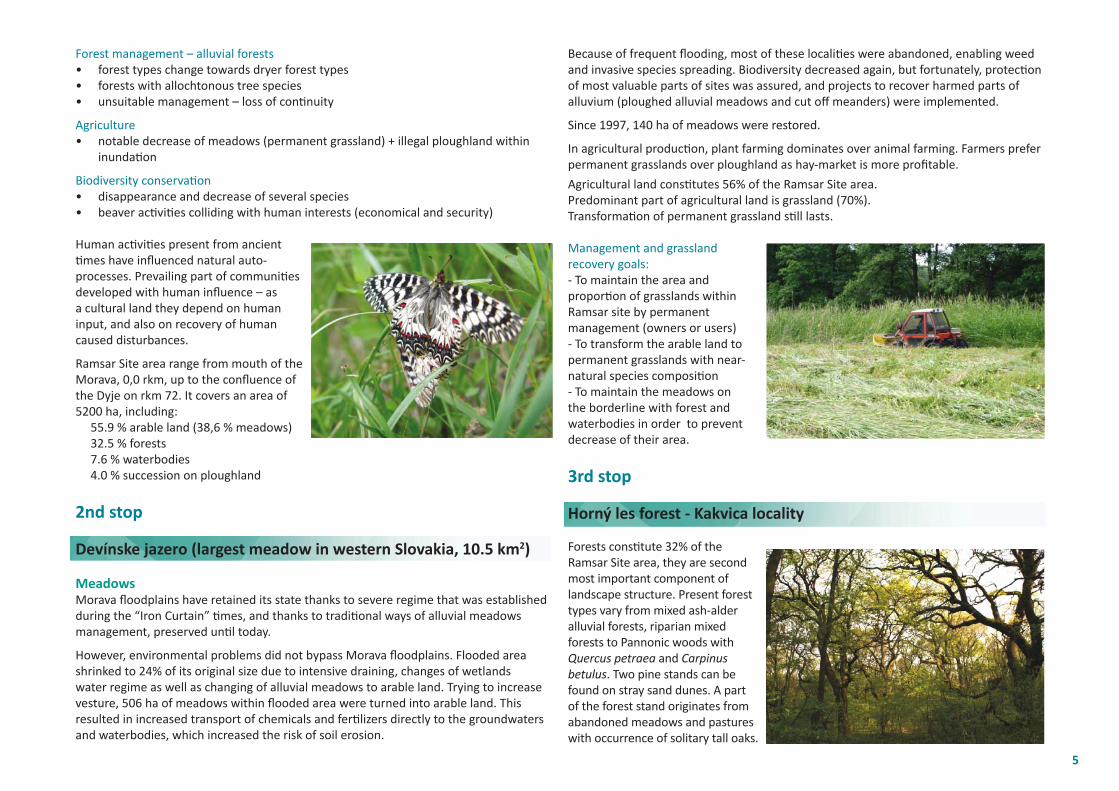
Devínske jazero (largest meadow in western Slovakia, 10.5 km2)
MeadowsMorava fl oodplains have retained its state thanks to severe regime that was established during the “Iron Curtain” ti mes, and thanks to traditi onal ways of alluvial meadows management, preserved unti l today.
However, environmental problems did not bypass Morava fl oodplains. Flooded area shrinked to 24% of its original size due to intensive draining, changes of wetlands water regime as well as changing of alluvial meadows to arable land. Trying to increase vesture, 506 ha of meadows within fl ooded area were turned into arable land. This resulted in increased transport of chemicals and ferti lizers directly to the groundwaters and waterbodies, which increased the risk of soil erosion.
Because of frequent fl ooding, most of these localiti es were abandoned, enabling weed and invasive species spreading. Biodiversity decreased again, but fortunately, protecti on of most valuable parts of sites was assured, and projects to recover harmed parts of alluvium (ploughed alluvial meadows and cut off meanders) were implemented.
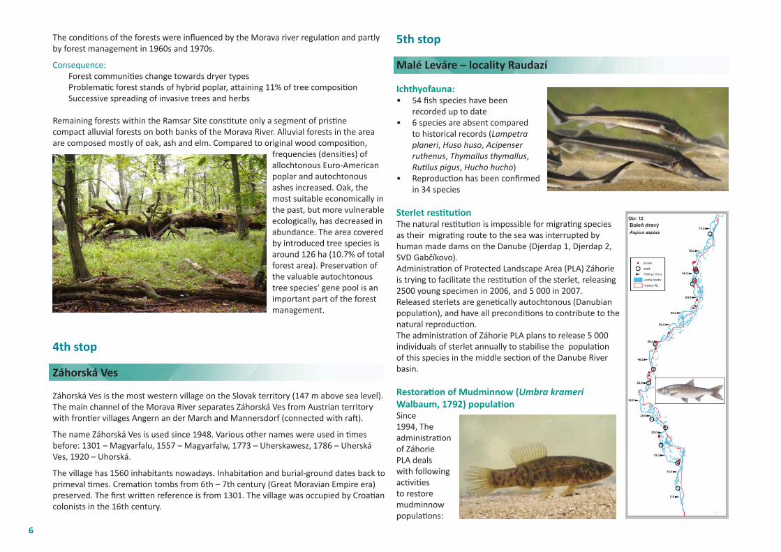
Since 1997, 140 ha of meadows were restored.
In agricultural producti on, plant farming dominates over animal farming. Farmers prefer permanent grasslands over ploughland as hay-market is more profi table.
Agricultural land consti tutes 56% of the Ramsar Site area.Predominant part of agricultural land is grassland (70%).Transformati on of permanent grassland sti ll lasts.
Management and grassland recovery goals:- To maintain the area and proporti on of grasslands within Ramsar site by permanent management (owners or users)- To transform the arable land to permanent grasslands with near-natural species compositi on - To maintain the meadows on the borderline with forest and waterbodies in order to prevent decrease of their area.
3rd stop
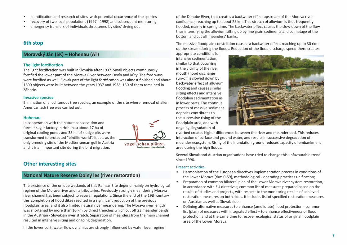
Horný les forest - Kakvica locality
Forests consti tute 32% of the Ramsar Site area, they are second most important component of landscape structure. Present forest types vary from mixed ash-alder alluvial forests, riparian mixed forests to Pannonic woods with Quercus petraea and Carpinus betulus. Two pine stands can be found on stray sand dunes. A part of the forest stand originates from abandoned meadows and pastures with occurrence of solitary tall oaks.
5
The conditi ons of the forests were infl uenced by the Morava river regulati on and partly by forest management in 1960s and 1970s.
Consequence: Forest communiti es change towards dryer types Problemati c forest stands of hybrid poplar, att aining 11% of tree compositi on Successive spreading of invasive trees and herbs Remaining forests within the Ramsar Site consti tute only a segment of pristi ne compact alluvial forests on both banks of the Morava River. Alluvial forests in the area are composed mostly of oak, ash and elm. Compared to original wood compositi on,
frequencies (densiti es) of allochtonous Euro-American poplar and autochtonous ashes increased. Oak, the most suitable economically in the past, but more vulnerable ecologically, has decreased in abundance. The area covered by introduced tree species is around 126 ha (10.7% of total forest area). Preservati on of the valuable autochtonous tree species‘ gene pool is an important part of the forest management.
4th stop
Záhorská Ves
Záhorská Ves is the most western village on the Slovak territory (147 m above sea level). The main channel of the Morava River separates Záhorská Ves from Austrian territory with fronti er villages Angern an der March and Mannersdorf (connected with raft ).
The name Záhorská Ves is used since 1948. Various other names were used in ti mes before: 1301 – Magyarfalu, 1557 – Magyarfalw, 1773 – Uherskawesz, 1786 – Uherská Ves, 1920 – Uhorská.
The village has 1560 inhabitants nowadays. Inhabitati on and burial-ground dates back to primeval ti mes. Cremati on tombs from 6th – 7th century (Great Moravian Empire era) preserved. The fi rst writt en reference is from 1301. The village was occupied by Croati an colonists in the 16th century.
5th stop
Malé Leváre – locality Raudazí
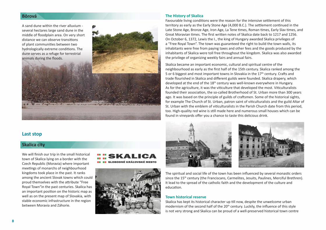
Ichthyofauna:• 54 fi sh species have been
recorded up to date• 6 species are absent compared
to historical records (Lampetra planeri, Huso huso, Acipenser ruthenus, Thymallus thymallus, Ruti lus pigus, Hucho hucho)
• Reproducti on has been confi rmed in 34 species
Sterlet resti tuti onThe natural resti tuti on is impossible for migrati ng species as their migrati ng route to the sea was interrupted by human made dams on the Danube (Djerdap 1, Djerdap 2, SVD Gabčíkovo).Administrati on of Protected Landscape Area (PLA) Záhorie is trying to facilitate the resti tuti on of the sterlet, releasing 2500 young specimen in 2006, and 5 000 in 2007. Released sterlets are geneti cally autochtonous (Danubian populati on), and have all preconditi ons to contribute to the natural reproducti on.The administrati on of Záhorie PLA plans to release 5 000 individuals of sterlet annually to stabilise the populati on of this species in the middle secti on of the Danube River basin.
Restorati on of Mudminnow (Umbra krameri Walbaum, 1792) populati onSince 1994, The administrati on of Záhorie PLA deals with following acti viti es to restore mudminnow populati ons:
6
• identi fi cati on and research of sites with potenti al occurrence of the species• recovery of two local populati ons (1997 - 1998) and subsequent monitoring • emergency transfers of individuals threatened by sites‘ drying out
6th stop
Moravský Ján (SK) – Hohenau (AT)
The light forti fi cati onThe light forti fi cati on was built in Slovakia aft er 1937. Small objects conti nuously forti fi ed the lower part of the Morava River between Devín and Kúty. The ford ways were forti fi ed as well. Slovak part of the light forti fi cati on was almost fi nished and about 1800 objects were built between the years 1937 and 1938. 150 of them remained in Záhorie.
Invasive speciesEliminati on of allochtonous tree species, an example of the site where removal of alien American ash tree was carried out.
Hohenau In cooperati on with the nature conservati on and former sugar factory in Hohenau about 17 ha of original cooling ponds and 38 ha of sludge pits were transformed to protected “birdlife world”. It acts as the only breeding site of the Mediterranean gull in Austria and it is an important site during the bird migrati on.
Other interesti ng sites
Nati onal Nature Reserve Dolný les (river restorati on)
The existence of the unique wetlands of this Ramsar Site depend mainly on hydrological regime of the Morava river and its tributaries. Previously strongly meandering Morava river channel has been subject to several regulati ons. Since the end of the 19th century the completi on of fl ood dikes resulted in a signifi cant reducti on of the previous fl oodplain area, and it also limited natural river meandering. The Morava river length was shortened by more than 10 km by direct trenches which cut off 23 meander bends in the Austrian - Slovakian river stretch. Separati on of meanders from the main channel resulted in intensive silti ng and ongoing degradati on.
In the lower part, water fl ow dynamics are strongly infl uenced by water level regime
of the Danube River, that creates a backwater eff ect upstream of the Morava river confl uence, reaching up to about 25 km. This stretch of alluvium is thus frequently fl ooded, mainly in spring ti me. The backwater eff ect causes the slow-down of the fl ow, thus intensifying the alluvium silti ng up by fi ne grain sediments and colmatage of the bott om and cut off meanders‘ banks.
The massive fl oodplain constricti on causes a backwater eff ect, reaching up to 30 rkm up the stream during the fl oods. Reducti on of the fl ood discharge speed there creates appropriate conditi ons for intensive sedimentati on, similar to that occurring in the vicinity of the river mouth (fl ood discharge run-off is slowed down by backwater eff ect of alluvium fl ooding and causes similar silti ng eff ects and intensive fl oodplain sedimentati on as in lower part). The conti nual process of massive sediment deposits contributes to the successive rising of the fl oodplain area, and with ongoing degradati on of riverbed creates higher diff erences between the river and meander bed. This reduces interacti on of surface and ground water, and results in successive degradati on of meander ecosystem. Rising of the inundati on ground reduces capacity of embankment area during the high fl oods.
Several Slovak and Austrian organisati ons have tried to change this unfavourable trend since 1996.
Present acti viti es:• Harmonisati on of the European directi ves implementati on process in conditi ons of
the Lower Morava (rkm 0-59), methodological - operati ng practi ces unifi cati on;• Preparati on of common bilateral plan of the Lower Morava river system restorati on,
in accordance with EU directi ves; common list of measures prepared based on the results of studies and projects, with respect to the monitoring results of achieved restorati on measures on both sides. It includes list of specifi ed restorati on measures on Austrian as well as Slovak side.
• Defi ning alternati ve measures to enhance (ameliorate) fl ood protecti on - common list (plan) of measures with integrated eff ect – to enhance eff ecti veness of fl ood protecti on and at the same ti me to recover ecological status of original fl oodplain area of the Lower Morava.
7
Bôrová
A sand dune within the river alluvium - several hectares large sand dune in the middle of fl oodplain area. On very short distance we can observe transiti ons of plant communiti es between two hydrologically extreme conditi ons. The dune serves as a refuge for terrestrial animals during the fl oods.
Last stop
Skalica city We will fi nish our trip in the small historical town of Skalica lying on a border with the Czech Republic (Moravia) where important meeti ngs of monarchs of neighbourhood kingdoms took place in the past. It ranks among the ancient Slovak towns which could proud themselves with the att ribute “Free Royal Town“in the past centuries. Skalica has an important positi on on the historic map as well as on the present map of Slovakia, with stable economic infrastructure in the region between Moravia and Záhorie.
The History of SkalicaFavourable living conditi ons were the reason for the intensive sett lement of this territory as early as the Early Stone Age (4,000 B.C.). The sett lement conti nued in the Late Stone Age, Bronze Age, Iron Age, La Tene ti mes, Roman ti mes, Early Slav ti mes, and Great Moravian ti mes. The fi rst writt en notes of Skalica date back to 1217 and 1256.On October 6, 1372, Lewis the I., the king of Hungary awarded Skalica privileges of a “Free Royal Town“. The town was guaranteed the right to build the town walls, its inhabitants were free from paying taxes and other fees and the goods produced by the inhabitants of Skalica were toll free throughout the kingdom. Skalica was also awarded the privilege of organizing weekly fairs and annual fairs.
Skalica became an important economic, cultural and spiritual centre of the neighbourhood as early as the fi rst half of the 15th century. Skalica ranked among the 5 or 6 biggest and most important towns in Slovakia in the 17th century. Craft s and trade fl ourished in Skalica and diff erent guilds were founded. Skalica drapery, which developed at the end of the 18th century was well-known everywhere in Hungary.As for the agriculture, it was the viti culture that developed the most. Viti culturalists founded their associati on, the so-called Brotherhood of St. Urban more than 300 years ago. It was based on the principle of guilds of craft smen. Some of the historical sights, for example The Church of St. Urban, patron saint of viti culturalists and the guild Altar of St. Urban with the emblem of viti culturalists in the Parish Church date from this period, too. High-quality red wine is sti ll made here and numerous small houses which can be found in vineyards off er you a chance to taste this delicious drink.
The spiritual and social life of the town has been infl uenced by several monasti c orders since the 15th century (the Franciscans, Carmelites, Jesuits, Paulines, Merciful Brethren). It lead to the spread of the catholic faith and the development of the culture and educati on.
Town historical reserveSkalica has kept its historical character up ti ll now, despite the unwelcome urban modernism of the second half of the 20th century. Luckily, the infl uence of this style is not very strong and Skalica can be proud of a well-preserved historical town centre
8
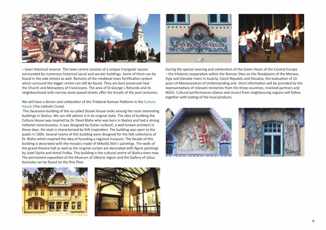
– town historical reserve. The town centre consists of a unique triangular square surrounded by numerous historical sacral and secular buildings. Some of them can be found in the side streets as well. Remains of the medieval town forti fi cati on system which surround the bigger centre can sti ll be found. They are best preserved near the Church and Monastery of Franciscans. The area of St George´s Rotunda and its neighbourhood with narrow stone paved streets off er the breath of the past centuries.
We will have a dinner and celebrati on of the Trilateral Ramsar Platf orm in the Culture House (The Catholic Circle) This Secession building of the so-called Slovak House ranks among the most interesti ng buildings in Skalica. We can sti ll admire it in its original state. The idea of building the Culture House was inspired by Dr. Pavol Blaho who was born in Skalica and had a strong nati onal consciousness. It was designed by Dušan Jurkovič, a well-known architect in those days. His style is characterized by folk inspirati on. The building was open to the public in 1905. Several rooms of this building were designed for the folk collecti ons of Dr. Blaho which inspired the idea of founding a regional museum. The facade of this building is decorated with the mosaics made of Mikoláš Aleš´s painti ngs. The walls of the grand theatre hall as well as the original curtain are decorated with fi gure painti ngs by Jozef Úprka and Antoš Frolka. This building is the cultural centre of Skalica even now. The permanent expositi on of the Museum of Záhorie region and the Gallery of Július Koreszka can be found on the fi rst fl oor.
During the special evening and celebrati on of the Green Heart of the Central Europe – the trilateral cooperati on within the Ramsar Sites on the fl oodplains of the Morava, Dyje and Danube rivers in Austria, Czech Republic and Slovakia, the evaluati on of 10 years of Memorandum of Understanding and short informati on will be provided by the representati ves of relevant ministries from the three countries, involved partners and NGOs. Cultural performances (dance and music) from neighbouring regions will follow together with tasti ng of the local products.
9


![Value Education Preview Page · • The brush interrupted the fi ght between the colours. True [ ] False [ ] • Do you agree with the brush that all colours are important? Yes ...](https://static.documents.pub/doc/80x56/5f8908c5278b8d1d521d544a/value-education-preview-page-a-the-brush-interrupted-the-i-ght-between-the-colours.jpg)