REQUEST FOR PROPOSAL Airborne LiDAR Data Acquisition – Floodplain Mapping Date Issued: August 7, 2018 Closing Date: September 7, 2018 Charlsey White, MCIP, RPP Director of Planning/Deputy CAO [email protected]
Transcript
REQUEST FOR PROPOSAL Airborne LiDAR Data Acquisition – Floodplain Mapping
Date Issued: August 7, 2018 Closing Date: September 7, 2018
Charlsey White, MCIP, RPP Director of Planning/Deputy CAO [email protected]
County of Haliburton
Airborne LiDAR Data Acquisition – Floodplain Mapping
2
TABLE OF CONTENTS Table of Contents Page 2-3 Company Contact Information Form Page 4 Definitions Page 5
PART A - INSTRUCTIONS TO PROPONENTS
1. Review of RFP Document Page 6
2. Enquiries Page 6
3. Solicitation of County Staff and Council Members Page 6
4. Proposal Submission and Closing Date Page 6
5. Addenda Page 7
6. Proposal Withdrawal and Acceptance Period Page 7
7. Schedule of Project Timelines Page 7
PART B – GENERAL CONDITIONS FOR PROPONENTS
1. Influence Page 8
2. No Collusion Page 8
3. Conflict of Interest Page 8
4. Disclosure of Proposal Documentation Page 8
5. Omission Page 8
6. Funding Page 8
7. Cost of Proposal Page 9
8. No Claim Page 9
9. No Binding Contract Page 8
10. Negotiations Page 9
11. Clarification of Proposal Page 9
12. Confidentiality of County Provided Resources Page 9
13. Compliance with Laws and Licensing Page 9
14. Health and Safety Requirements Page 10
15. Insurance Requirements Page 10
16. Workplace Safety and Insurance Board Page 10
17. Indemnification Page 10
County of Haliburton
Airborne LiDAR Data Acquisition – Floodplain Mapping
3
PART C - SCOPE OF PROJECT
1. Project Description Page 11
2. Background Page 11
3. Goals and Objectives Page 12
4. Deliverables Page 12
PART D – EVALUATION CRITERIA
1. Evaluation Criteria Table Page 18
PART E – PROPOSAL SUBMISSION REQUIREMENTS
1. Letter of Interest Page 19
2. Detailed Work Plan Page 19
3. Instrumentation Page 19
4. Data Collection Page 19
5. Environmental Conditions Page 20
6. Data Acquisition Parameters Page 20
7. Data Processing Page 21
8. Upset Fee Estimate Page 21
APPENDIX A County of Haliburton Map – LiDAR Acquisition Area - Study area 1 Page 22
APPENDIX B County of Haliburton Map – LiDAR Acquisition Area – Study area 2 Page 23
APPENDIX C Map of the County of Haliburton Page 24
County of Haliburton
Airborne LiDAR Data Acquisition – Floodplain Mapping
4
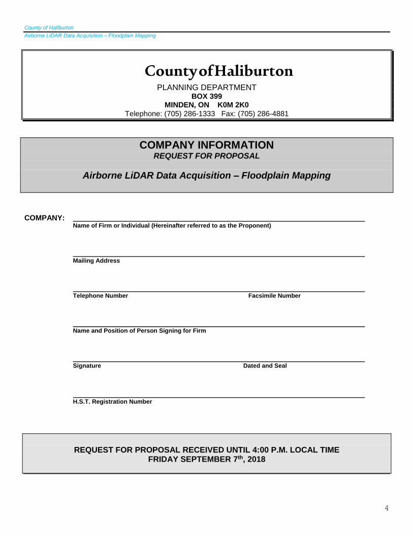
County of Haliburton PLANNING DEPARTMENT
BOX 399 MINDEN, ON K0M 2K0
Telephone: (705) 286-1333 Fax: (705) 286-4881
COMPANY INFORMATION REQUEST FOR PROPOSAL
Airborne LiDAR Data Acquisition – Floodplain Mapping
COMPANY:
Name of Firm or Individual (Hereinafter referred to as the Proponent)
Mailing Address
Telephone Number Facsimile Number
Name and Position of Person Signing for Firm
Signature Dated and Seal
H.S.T. Registration Number
REQUEST FOR PROPOSAL RECEIVED UNTIL 4:00 P.M. LOCAL TIME
FRIDAY SEPTEMBER 7th, 2018
County of Haliburton
Airborne LiDAR Data Acquisition – Floodplain Mapping
5
DEFINITIONS:
1. “Agreement” shall mean any written contract between the County and a Successful Proponent with respect to the services outlined by the Request for Proposal (RFP), and shall be deemed to include the terms and conditions for the provision of the services as set out in this RFP.
2. “County” shall mean The Corporation of the County of Haliburton.
3. “Closing Date” shall mean the date and time as set out in Section 4 Proposal Submission and Closing Date.
4. “Consultant” shall mean the Successful Proponent with whom the County enters into an Agreement.
5. “Council” shall mean the Council of the County of Haliburton.
6. “may” and “should” used in this RFP denote permissive – not mandatory.
7. “MFIPPA” shall mean the Municipal Freedom of Information and Protection of Privacy Act.
8. “Preferred Proponent” shall mean the Proponent whose proposal, as determined through an evaluation analysis as described in the RFP, provides the best overall value in meeting the County’s requirements, and is recommended for award.
9. “Proposal” shall mean an offer submitted by a Proponent in response to this formal RFP which includes all documents necessary to satisfy the submission requirements of said RFP.
10. “Proponent” shall mean a legal entity, being a person, partnership, firm or corporation that submits a proposal in response to a formal Request for Proposal with the intent of undertaking and executing the respective project.
11. “RFP” shall mean this Request for Proposal package in its entirety, inclusive of all schedules and addendums that may be issued by the County.
12. “Services” shall mean all services and deliverables to be provided by a Consultant.
13. “Sub-Contractor” shall mean a legal entity approved by the Owner, undertaking the execution of a part of the project, pursuant to an agreement with the Proponent.
14. “Successful Proponent” shall mean the Proponent whose proposal is recommended to Council for award.
15. “must”, “shall” and “will” used in the RFP denote imperative/mandatory, meaning proposals not satisfying imperative requirements will be deemed to be non-compliant and will not be considered for contract award.
County of Haliburton
Airborne LiDAR Data Acquisition – Floodplain Mapping
6
PART A – INSTRUCTIONS TO PROPONENTS 1. Review of RFP Document
Proponents shall examine the Request for Proposal document in its entirety and report to the Director of Planning and/or designate any errors, omissions or ambiguities. 2. Enquiries
All enquiries and questions shall be in writing, including but not limited to email, and should be directed to the attention of: Charlsey White, MCIP, RPP Director of Planning/Deputy CAO County of Haliburton 11 Newcastle Street Minden, Ont. K0M 2K0 (705) 286-1333 Ext. 222 [email protected] Such enquiries should be provided no later than five (5) days prior to the Closing Date so that responses can be generated for all Proponents as an addendum. 3. Solicitation of County Staff and Council Members
With the exclusion of the Director of Planning and the Planning Technologist, and except as otherwise specified by the County, Proponents shall not contact, or communicate with any individuals working for or associated with the County in relation to this RFP, this includes staff or members of the board with the Kawartha Conservation Authority and/or Ganaraska Region Conservation Authority. Any Proponent which the County determines to be circumventing this process may, in the County’s absolute discretion, be disqualified. 4. Proposal Submission and Closing Date
Proponents shall submit their Proposal in a sealed package to the attention of: Charlsey White, MCIP, RPP Director of Planning/Deputy CAO County of Haliburton 11 Newcastle Street Minden, Ont. K0M 2K0 The package should be clearly identified as “Airborne LiDAR Data Acquisition – Floodplain Mapping”, and include the Proponent’s name and return address. The proposal submission must be received no later than 4:00 P.M. local time on Friday, September 7th, 2018.
The Proponent shall have complete responsibility for delivery and submission of the completed proposal. The County accepts no responsibility for any loss or delay with regard to Proposals that are delivered to any location other than the location as specified.
Airborne LiDAR Data Acquisition – Floodplain Mapping
7
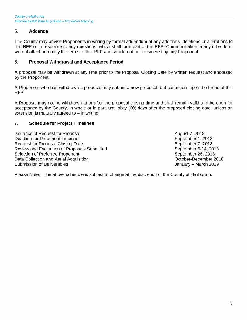
5. Addenda
The County may advise Proponents in writing by formal addendum of any additions, deletions or alterations to this RFP or in response to any questions, which shall form part of the RFP. Communication in any other form will not affect or modify the terms of this RFP and should not be considered by any Proponent. 6. Proposal Withdrawal and Acceptance Period A proposal may be withdrawn at any time prior to the Proposal Closing Date by written request and endorsed by the Proponent. A Proponent who has withdrawn a proposal may submit a new proposal, but contingent upon the terms of this RFP.
A Proposal may not be withdrawn at or after the proposal closing time and shall remain valid and be open for acceptance by the County, in whole or in part, until sixty (60) days after the proposed closing date, unless an extension is mutually agreed to – in writing. 7. Schedule for Project Timelines Issuance of Request for Proposal August 7, 2018 Deadline for Proponent Inquiries September 1, 2018 Request for Proposal Closing Date September 7, 2018 Review and Evaluation of Proposals Submitted September 6-14, 2018 Selection of Preferred Proponent September 26, 2018 Data Collection and Aerial Acquisition October-December 2018 Submission of Deliverables January – March 2019 Please Note: The above schedule is subject to change at the discretion of the County of Haliburton.
County of Haliburton
Airborne LiDAR Data Acquisition – Floodplain Mapping
8
PART B – GENERAL CONDITIONS FOR PROPONENTS 1. Influence
No person, partnership, firm, company, corporation, or organization shall attempt in any way, directly or indirectly either in private or in public, to influence the outcome of the evaluation or acceptance thereof. The proposal of any person, company, corporation, or organization found to influence the outcome of any portion of the County purchasing policy process will be disqualified and may be subject to further exclusion. 2. No Collusion
No Proponent may discuss or communicate about, directly or indirectly, the preparation or content of its proposal with any other Proponent or the Agent or Representative of any other Proponent. If the County discovers that there has been a breach at any time, the County reserves the right to disqualify the proposal and/or terminate any ensuing agreement.
3. Conflict of Interest The Proponent must disclose to the County any potential conflict of interest that might compromise the performances of the services rendered. If such conflict of interest does exist, the County may, at its discretion, refuse to consider the respective proposal. The Proponent must disclose whether any County employee, member of Council, member of a County agency, Conservation Authority employee, or Conservation Authority Board member has a financial interest in the Proponent and the nature of such interest. If such an interest exists or arises, the County may, at its discretion, refuse to consider the proposal or withhold the awarding to the Successful Proponent until the matter is resolved to the County’s sole satisfaction. 4. Disclosure of Proposal Documentation Documentation comprising any proposal submitted in response to the RFP, along with correspondence, documentation and information provided to the County by any Proponent in connection with or arising from the RFP, once received by the County shall become the property of the County. Further, this documentation is subject to the Municipal Freedom of Information and Protection of Privacy Act (“MFIPPA”), and may be released pursuant to this Act. Proponents are advised to disclose in their submission any scientific, technical, commercial, proprietary or confidential information that could cause them injury. Proposals will be made available to members of Council provided that their requests are in compliance with County policy and may be released to the public pursuant to the MFIPPA. 5. Omission The County of Haliburton reserves the right in its sole discretion to accept or reject all or part of any submission which is found to be non-compliant with the requirements of this request.
6. Funding The award of any contract shall be conditional upon available funding as prescribed by the County of Haliburton Planning Department budget, subsequent approval from members of Council and receipt of promised funding from the Federal government of Canada through the National Disaster Mitigation Program.
County of Haliburton
Airborne LiDAR Data Acquisition – Floodplain Mapping
9
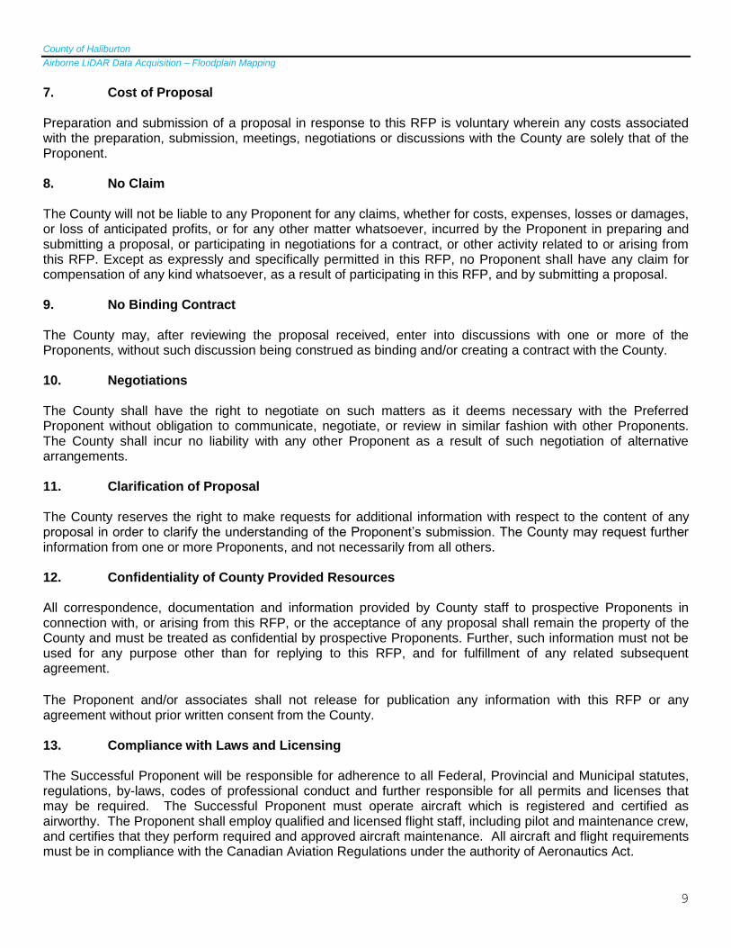
7. Cost of Proposal Preparation and submission of a proposal in response to this RFP is voluntary wherein any costs associated with the preparation, submission, meetings, negotiations or discussions with the County are solely that of the Proponent. 8. No Claim The County will not be liable to any Proponent for any claims, whether for costs, expenses, losses or damages, or loss of anticipated profits, or for any other matter whatsoever, incurred by the Proponent in preparing and submitting a proposal, or participating in negotiations for a contract, or other activity related to or arising from this RFP. Except as expressly and specifically permitted in this RFP, no Proponent shall have any claim for compensation of any kind whatsoever, as a result of participating in this RFP, and by submitting a proposal. 9. No Binding Contract The County may, after reviewing the proposal received, enter into discussions with one or more of the Proponents, without such discussion being construed as binding and/or creating a contract with the County. 10. Negotiations The County shall have the right to negotiate on such matters as it deems necessary with the Preferred Proponent without obligation to communicate, negotiate, or review in similar fashion with other Proponents. The County shall incur no liability with any other Proponent as a result of such negotiation of alternative arrangements. 11. Clarification of Proposal The County reserves the right to make requests for additional information with respect to the content of any proposal in order to clarify the understanding of the Proponent’s submission. The County may request further information from one or more Proponents, and not necessarily from all others. 12. Confidentiality of County Provided Resources All correspondence, documentation and information provided by County staff to prospective Proponents in connection with, or arising from this RFP, or the acceptance of any proposal shall remain the property of the County and must be treated as confidential by prospective Proponents. Further, such information must not be used for any purpose other than for replying to this RFP, and for fulfillment of any related subsequent agreement.
The Proponent and/or associates shall not release for publication any information with this RFP or any agreement without prior written consent from the County. 13. Compliance with Laws and Licensing The Successful Proponent will be responsible for adherence to all Federal, Provincial and Municipal statutes, regulations, by-laws, codes of professional conduct and further responsible for all permits and licenses that may be required. The Successful Proponent must operate aircraft which is registered and certified as airworthy. The Proponent shall employ qualified and licensed flight staff, including pilot and maintenance crew, and certifies that they perform required and approved aircraft maintenance. All aircraft and flight requirements must be in compliance with the Canadian Aviation Regulations under the authority of Aeronautics Act.
County of Haliburton
Airborne LiDAR Data Acquisition – Floodplain Mapping
10
14. Health and Safety Requirements The Successful Proponent shall perform all work in strict compliance with the Occupational Health and Safety Act of Ontario. The Proponent acknowledges possession of the current OHSA and its applicable regulations. The Proponent acknowledges its duty as an Employer and a Supervisor under the Occupational Health and Safety Act and under the applicable regulations and in particular, that the Proponent shall take all reasonable measures under the circumstance for the protection of a Worker. The Proponent shall provide all safety and personal protective equipment as required under the OHSA and Safety Act. The County has the right to stop the work if improper performance or measures are being witnessed. The Proponent releases and discharges the County from any claim or demand for any action taken by the County to exercise its duties of due diligence under the OHSA.
15. Insurance Requirements The Successful Proponent shall confirm and maintain in effect, at their expense (including the payment of all deductibles) and for the duration of the services provided, the following policies of insurance, which shall be in a form acceptable to the County. A certificate of these policies must be provided to the County prior to the commencement of the prospective services. Professional Liability
o for the performance of services by the Proponent providing that the policy is in an amount of not less than two million dollars ( $2,000,000.00), and shall not be construed as a limit of liability in the performance of said services.
Comprehensive General Liability
o providing that the policy is in an amount of not less than five million dollars ( $5,000,000.00) per
occurrence, and
o adds the Corporation of the County of Haliburton as an additional insured, and
o has provisions for cross-liability and severability of interest between the Proponent and the County.
16. Workplace Safety and Insurance Board The Proponent shall be required to provide a Certificate from the Workplace Safety and Insurance Board, prior to the start of the work and at a minimum of every sixty (60) days during the life of the contract – indicating that all of the assessments the Successful Proponent or any affiliate is liable to pay under the Workplace Safety and Insurance Board Act or successor legislation have been paid and they are in good standing with the Board. 17. Indemnification The Successful Proponent shall indemnify and hold harmless the County, and their respective officers, directors, agents and employees, from and against claims, demands, losses, costs, damages, actions, suits or proceedings by third parties that arise out of, or are attributable to the Proponent’s performance of services.
County of Haliburton
Airborne LiDAR Data Acquisition – Floodplain Mapping
11
PART C – SCOPE OF WORK 1. Project Description The National Disaster Mitigation Program (NDMP) is a 5-year, $200 million federal program that is intended to reduce the impacts of natural disasters on Canadians through focused investments on significant, recurring flood risk and costs; while advancing work to facilitate private residential insurance for overland flooding. The County of Haliburton successfully submitted a proposal for a floodplain mapping project to begin in the 2018-19 fiscal year (by March 31, 2019), and be completed by the end of the 2019-20 fiscal year (by March 31, 2020). The federal government funds up to 50 per cent of the costs of eligible flood mitigation projects in four categories (which can be combined):
1. Risk Assessments 2. Flood Mapping 3. Mitigation Planning 4. Investments in Non-structural and Small Scale Structural Mitigation Projects
The County of Haliburton, with the support of its four local municipalities and other agencies/ organizations (Kawartha Conservation Authority, Ganaraska Region Conservation Authority and the Trent Severn Waterway), is to receive NDMP funding to obtain digital terrain model mapping; consultant services to format the data for use in the County’s ARCGIS system and create mitigation planning program to run simulations related to potential precipitation and flooding events; and risk assessment services and tools (including IT hardware and software). The acquisition of LiDAR is the first step in this project. At present estimate, the total area is approximately 2000 square kilometres (may be refined further). Staff are currently working to refine that area, as the two riversheds equal over 2650 square kilometres total. The total area will be based on straight run flights, therefore some land will be captured outside of the target area. The target area includes the shorelines, flood plains and flood fringe. The County of Haliburton is seeking Requests for Proposals (RFP) for Airborne LiDAR Data Acquisition related to this flood mapping project. Two cost estimates are sought to be included within the RFP:
1. The cost for LiDAR acquisition for the portion of the Kawartha Watershed which is located within the
County of Haliburton (the area identified on Schedule A) 2. The cost for LiDAR acquisition for the reservoir lakes and rivers located within the County of Haliburton,
plus a 200 m buffer (the area identified on Schedule B) 2. Background The Gull River has been subject to flooding over many years due to its large watershed with a large drainage area, mass amount of spring runoff caused by heavy precipitation and snow melt. The most recent flood events to cause significant flood damage were in 2013, 2017. The community of Minden was extensively flooded during these events. Many homes, businesses, and municipal properties were damaged in these flood events along with damages to infrastructure such as roads, bridges, and dams. Another area of concern was municipal drinking water and private wells due to septic flooding and release of other contaminants. Due to the increase in frequency of flooding in this area the municipality purchased an automatic sand bagging machine in 2016 which was used heavily in the 2017 flood. Many members of the public depend on the municipality to provide them with sand bags to protect their homes, businesses and property.
County of Haliburton
Airborne LiDAR Data Acquisition – Floodplain Mapping
12
The Burn River has a well-documented history of flooding. The flooding is caused by extensive runoff as a result of snow melt and significant precipitation in the head waters of the watershed. The most recent major flood events occurred in 2013 and 2016. Both of these events caused the river to reach and pass critical levels causing many homes and proprieties to flood. In 2013 alone there were uninsurable losses as a result of damages caused by flood waters to residential homes, local businesses, and industries. Many access points to homes were blocked by flood waters so emergency services had to use boats to evacuate people. Other areas affected by the flooding included source water protection issues due to septic tank flooding, bank erosion (property loss), infrastructure loss (damage to roads, bridges, and dams), and an increase potential of ice jam causing further flooding. Both watersheds have experienced large rain events, earlier in the season, when the lakes are still frozen over. Due to climate change the severity of these events, event frequency and impact are all increasing. It is of significant note that the lakes proposed to be studied within the watersheds as part of this project, contain 93% of the Trent Severn Waterways reservoir capacity. The completion of this project will be useful to the Federal, Provincial and Municipal governments in the operation of systems and fulfillment of their mandates.
3. Goals and Objectives The Burnt and Gull River Watersheds will be surveyed using LiDAR airborne survey technology. Flood plain mapping will be produced for river systems. Once the LiDAR is obtained, the river’s will be field surveyed to obtain channel elevations, structure inventory (bridges and culverts) and ground elevations (for quality control purposes). Hydraulic and hydrologic models will be completed using the collected data and LiDAR information. This model will be used to determine the regulatory flood line of each system. The developed flood line will be used to update the County of Haliburton flood plain area mapping and the County and area municipality planning/building regulations. The primary goal of LiDAR applications in floodplain mapping is to obtain accurate elevation data, which are required for both the hydraulic modelling (deriving water elevations and extents for floods of various magnitudes) and the cartographic components of floodplain mapping projects. The secondary objective is to use the LiDAR to facilitate floodplain characterization, including planimetric or basemap features useful for hydraulic modelling and creating floodplain maps. This will be completed in conjunction with the County of Haliburton 2018 orthphotos for the subject area. NOTE: The Stanhope Airport is located within the County of Haliburton and may be contacted to inquire about its use during the flight portions of this project https://www.algonquinhighlands.ca/trails/airport.php and phone 1-705-489-2379.
4. Deliverables A comprehensive Project Report is to be provided by the Successful Proponent that includes all documentation, images, notes and data related to the LiDAR acquisition project. This report will outline the project method details, Instrumentation details and data collection. Reporting items will include field notes for surveying and flight logs; data quality assurance report; and a data inventory and dictionary describing all the data and documentation collection in relation to the project. The report should include sufficient detail to demonstrate that the specifications have been met for each pulse data collected. To be provided in Microsoft Word and Excel or pdf. Progress reports will be required to be made at weekly intervals from the signing of the contract until completion of the project. Progress reports shall identify if the consultant is “on” or “off” schedule, the status of collection including percent completed and in which locations; changes required to the collection plan (including people or instrumentation); current issues causing delay; and a summary of anticipated impact of the above on data collection, budget and /or schedule. Direct contact is to be made with the Director of Planning/Deputy CAO and is to be provided in Microsoft Word and Excel or pdf.
Airborne LiDAR Data Acquisition – Floodplain Mapping
13
Field Data required to be submitted includes survey control; flight files and trajectory; and in-situ validation. These are to be provided as outlined in the Federal Airborne LiDAR Data Acquisition Guidelines 2017, and is to be submitted in PDF, Shapefile, MS Word or MS Excel as appropriate to the data. LiDAR data deliverables are to include point cloud data, an index file; raw data and metadata. The acceptable format is LAS/LAZ, Shapefile, XML as appropriate for the data.
The Supplemental information on the LiDAR acquisition shall be included in an Excel file to complement the Metadata ISO 19115:2003 standard North American Profile.
classification_code LAS Class used
ldr_sensor LiDAR Sensor Used
ldr_max_number_return Maximum number of returns per pulse
ldr_aggregate_density ANPD
ldr_flight_height Flight Height (m)
ldr_flight_speed Flight speed (knts and km/hr)
ldr_scan_angle Scan Angle (degrees)
ldr_scan_frequency Scan Frequency (Hz)
ldr_pulse_rate Pulse Repetition Frequency (kHz)
ldr_pulse_width LiDAR pulse footprint size (m)
ldr_wave_length Sensor wavelength (nm)
ldr_multi_pulse_in_air Whether the sensor was operated with Multiple Pulses In The Air, 0=No; 1=Yes.
ldr_beam_divergence Beam Divergence (mrad)
ldr_swath_ width Swath with (m)
ldr_swath_overlap Swath overlap (%)
las_version LAS version used (e.g. v1.4)
las_overlap Points classified in areas overlap
las_withheld Detail description on points removed as noise,
low points, or anomalous points.
las_intensity_resolution Intensity bit resolution
The County of Haliburton shall have unrestricted rights to all received data and reports, which shall be placed in the public domain. Product requirements include:
A) Metadata I. Collection Report detailing mission planning and flight logs
II. Survey Report detailing the collection of control and reference points used for calibration and QA/QC
III. Processing Report detailing calibration, classification and product generation procedures IV. QA/QC Reports detailing the analysis, accuracy assessment and validation of:
- The point data (absolute, within swath and between swath) - The bare earth surface (absolute) - Other optional deliverables as appropriate
V. Control and Calibration points. All control and reference points used to calibrate, control, process and validate the LiDAR point data or any derivative products are to be provided
VI. Geo-referenced, digital spatial representation of the precise extents of each delivered dataset. This should reflect the extents of the actual LiDAR source or derived product data, exclusive of Triangular Irregular Network (TIN) artifacts or raster NODATA areas. A union of tile boundaries or minimum bounding rectangle is not acceptable. ESRI polygon shape file is preferred
VII. Overall project metadata shall be produced in XML format
County of Haliburton
Airborne LiDAR Data Acquisition – Floodplain Mapping
14
VIII. The XML files will be compliant with the rules of the North American Profile (NAP) of IS) 19115:2003 standard or GOITS 72 (v2) rules and include the following minimum elements:
- Tiled deliverable product group (classified point data, bare earth DEM’s, etc) Metadata files for individual tiles are not required
Minimum Requirements One of the Following:
Metadata Standard Name
Title
Date
Date type Creation, publication, revision, notAvailable, inForce, adopted, deprecated, superseded
Individual Name and/or Organization Name and/or Position Name
Spatial Extent Polygon and/or North Bound, South Bound, East Bound and West Bound Coordinates (UTM Easting and Northing)
Reference System Information
Applicable code of reference system used
IX. the GOITS 72 (v2) rules can be accessed at http://www.gov.on.ca/mgs/graphoc/226920.pdf X. Metadata will be accompanied by a shape file of the footprint area the XML file refers to
XI. There shall be an XML file for each data type, i.e. LIDAR, Orthophoto, Planimetric data, Topographic data, etc…
XII. All North American Profiles of ISO 19115:2003 standard of GOITS 72(v2) mandartoy fields must be populated
XIII. The dates component shall be represented by a date range including year, month and day for the start and end dates of the source data layer (acquisition of the imagery, LiDAR, etc)
XIV. The accuracy statements are to be fully populated with the results of the accuracy tests as performed by the data provider listing the calculated Non-Vegetated (NVA), Vegetated Vertical Accuracy (VVA), and Fundamental Horizontal Accuracy (FHA) values for the various data sets, as outlined in the Federal Airborne LiDAR Data Acquistion Guidelines (2017) Table 13.
XV. The production procedures sections are to be populated with information on:
Organizations used to acquire, compile and produce each deliverable
Sensor hardware used for each data set
Software used in the data population
Procedures followed to complete the production and QC
Airborne LiDAR Data Acquisition – Floodplain Mapping
15
Any outstanding issues with regard to non-compliance with the guidelines of the final data sets
XVI. There shall be an attribute defined in the XML file for each Feature Type produced in the project
XVII. Contour shall have metadata that identifies all the source data inputs to the creation of the TIN the contour were derived from. The accuracy attribute of the contours shall not be better than two times the least accurate component of the TIN.
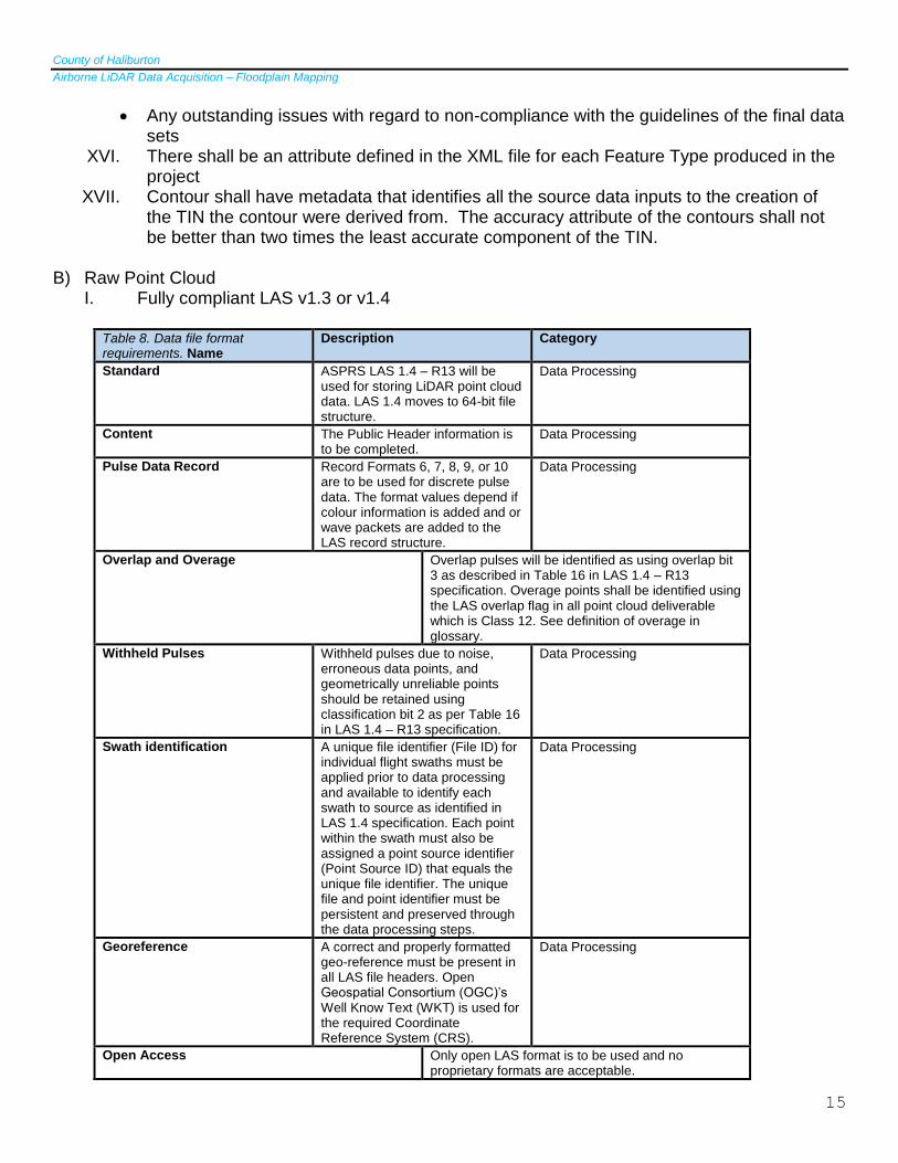
B) Raw Point Cloud
I. Fully compliant LAS v1.3 or v1.4
Table 8. Data file format requirements. Name
Description Category
Standard ASPRS LAS 1.4 – R13 will be used for storing LiDAR point cloud data. LAS 1.4 moves to 64-bit file structure.
Data Processing
Content The Public Header information is to be completed.
Data Processing
Pulse Data Record Record Formats 6, 7, 8, 9, or 10 are to be used for discrete pulse data. The format values depend if colour information is added and or wave packets are added to the LAS record structure.
Data Processing
Overlap and Overage Overlap pulses will be identified as using overlap bit 3 as described in Table 16 in LAS 1.4 – R13 specification. Overage points shall be identified using the LAS overlap flag in all point cloud deliverable which is Class 12. See definition of overage in glossary.
Withheld Pulses Withheld pulses due to noise, erroneous data points, and geometrically unreliable points should be retained using classification bit 2 as per Table 16 in LAS 1.4 – R13 specification.
Data Processing
Swath identification A unique file identifier (File ID) for individual flight swaths must be applied prior to data processing and available to identify each swath to source as identified in LAS 1.4 specification. Each point within the swath must also be assigned a point source identifier (Point Source ID) that equals the unique file identifier. The unique file and point identifier must be persistent and preserved through the data processing steps.
Data Processing
Georeference A correct and properly formatted geo-reference must be present in all LAS file headers. Open Geospatial Consortium (OGC)’s Well Know Text (WKT) is used for the required Coordinate Reference System (CRS).
Data Processing
Open Access Only open LAS format is to be used and no proprietary formats are acceptable.
County of Haliburton
Airborne LiDAR Data Acquisition – Floodplain Mapping
16
Compression Compression of LAS form using an open source product is acceptable for data management. The compression must be lossless and converted seamlessly from and to LAS format, retaining all the information. LAZ format is the recommended compression format. The contracting authority will specify the file format required as the deliverable.
Data Processing
GPS Time Each Global Navigation Satellite System (GNSS) aircraft positional measurement must be time stamped using Adjusted Global Positioning System (GPS) Time, at a precision sufficient to allow a unique timestamp for each LiDAR pulse. Adjusted GPS time is the satellite GPS time minus 1x10⁹. The encoding tag in the LAS header shall be properly set.
Data Processing
Measurement Units Measurements are in metres (m), and must be specified to a minimum of 3 decimal places.
Federal Airborne LiDAR Data Acquisition Guideline (2017) – Table 8.
II. Geo-reference information included in all LAS file headers III. Point Density on average of 3 points per square metre IV. GPS times are to be recorded as Adjusted GPS Time, at a precision sufficient to allow
unique timestamps for each return V. Intensity values (normalized to 16 bit) VI. Full swaths, all collected points to be provided VII. 1 file per swath, q swath per file, file size not to exceed 2 GB
C) Classified Point Cloud
I. Fully compliant LAS v1.3 or v1.4, II. Geo-reference information included in all LAS file headers III. GPS times are to be recorded as Adjusted GPS Time, at a precision sufficient to allow
unique timestamps for each return IV. Intensity values (normalized to 16 bit) V. Tiled delivery, without overlap (tiling scheme TBD) VI. Classification Scheme (minimum) VII. LiDAR data accuracy and density:
Aggregate nominal point density (ANPD) for DSM (first return) and DEM (last return)
VIII. Federal Airborne LiDAR Data Acquisition Guidelines (2017) – Table B2. IX. Medium Flood Risk Category: All other rural areas that include settlements and agricultural
lands; Classification (LAS 1.4 Classification)
1 – Processed but unclassified 2 – Ground 6 - Building 9 – Water 7 – Low points (noise) 17 – Bridge decks 18 – High noise
D) Bare Earth Surface (Raster DEM)
I. Cell size no greater than 0.5 metre and no less than the design Nominal Pulse Spacing (NPS)
II. Product shall be an industry-standard, GIS compatible, 32-bit floating point raster format (ESRI Grid or IMG preferred)
III. Geo-reference information shall be included in raster file IV. Tile product, without overlap V. DEM Tiles will show no edge artifacts or mismatch VI. Void areas (i.e. areas outside the project boundary but within the tiling scheme) shall be
coded using unique “NODATA” value. This value shall be identified in the appropriate location within the file header
VII. Where the perimeter of the project is an irregular shape that is not coincident with the tile layout then the portion of the perimeter tiles that lie outside the limits of the required DEM coverage may be filled with black (0,0,0) pixels. This will serve to signify that no elevation data exists for this area. Hydro-flattening – DEM tiles must be hydro-flattened to ensure water surfaces are flat in the bank-to-bank direction, and non-increasing in the downstream direction.
E) Building Footprints
I. Extracted buildings (polygon Z): Footprints with maximum=m elevation and/or height above ground as an attribute.
County of Haliburton
Airborne LiDAR Data Acquisition – Floodplain Mapping
18
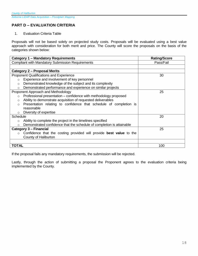
PART D – EVALUATION CRITERIA
1. Evaluation Criteria Table Proposals will not be based solely on projected study costs. Proposals will be evaluated using a best value approach with consideration for both merit and price. The County will score the proposals on the basis of the categories shown below:
Category 1 – Mandatory Requirements Rating/Score
Compliant with Mandatory Submission Requirements Pass/Fail
Category 2 – Proposal Merits
Proponent Qualifications and Experience o Experience and involvement of key personnel o Demonstrated knowledge of the subject and its complexity o Demonstrated performance and experience on similar projects
30
Proponent Approach and Methodology o Professional presentation – confidence with methodology proposed o Ability to demonstrate acquisition of requested deliverables o Presentation relating to confidence that schedule of completion is
reasonable o Diversity of expertise
25
Schedule o Ability to complete the project in the timelines specified o Demonstrated confidence that the schedule of completion is attainable
20
Category 3 – Financial o Confidence that the costing provided will provide best value to the
County of Haliburton
25
TOTAL 100
If the proposal fails any mandatory requirements, the submission will be rejected. Lastly, through the action of submitting a proposal the Proponent agrees to the evaluation criteria being implemented by the County.
County of Haliburton
Airborne LiDAR Data Acquisition – Floodplain Mapping
19
PART E – PROPOSAL SUBMISSION REQUIREMENTS
The Proponent shall provide a proposal that should include, but is not limited to the following items:
1. Letter of Interest
o An outline of the proposed approach for meeting the County’s goals and objectives, and
o A personnel listing of the project staff including the Project Manager, key personnel staff for all phases of the study, detailing experience on similar projects and their specific role for this project, and
o An account of the relevant experience of the Project Manager and key personnel with specific reference to
similar projects undertaken and completed successfully for counties, municipalities, ministries, and
o The base of operations for this project, and
o Confirmation that the consultant firm is available autumn and winter 2018 to complete work
2. Detailed Work Plan
o An outline describing the main tasks to be undertaken and all subtasks required to execute all aspects of work consistent with the goals and objectives as detailed in PART C – Scope of Work, and
o A graphical project schedule providing the time requirements and date of completion of the main tasks,
subtasks and activities – including an allotment of time for review by County and Conservation Authority staff, and
o A time breakdown and summation of estimated person-hours for each identified task and named member
of the Project Team and support staff as required to complete all tasks of the project.
3. Instrumentation
Details of the specific LiDAR sensor will be provided including manufacturer, year, model, ownership, most current calibration with date. A copy of the most current manufacturer’s calibration for the complete system including laser, IMU, and GNSS system used maybe requested and upon request must be provided. Any sensor changes, failure or replacement prior or during the data collecting is required to be reported.
4. Data Collection
LiDAR Specifications shall include all of the following:
- Multiple Discrete Return, capable of at least 2 outbound pulses, the first return will record the vegetation canopy, the last return through the vegetation (bare earth);
- Intensity values for each return;
Name Description Category
Pulse Density (ANPD) ≥ 2.0 pls/m2 for first and only (single) pulse returns across DCAOI
Acquisition
Pulse Spacing (ANPS) ≤ 0.71 m Acquisition
Laser Returns Pulse data collection is based on laser pulse echo returns measured at the receiving sensor. At a minimum, first and last returns are required
County of Haliburton
Airborne LiDAR Data Acquisition – Floodplain Mapping
20
- Federal Airborne LiDAR Data Acquistion Guideline (2017) – Table 6. - Collection designed to achieve the NPA through swath overlap or multiple passes are generally
discouraged. Such collections may be permitted in special cases, with prior approval; - The spatial distribution of geometrically usable points is expected to be uniform and free from
clustering. In order to ensure uniform densities throughout the data set; - A regulate grid, with cell size equal to the design NPS will be laid over the data
i) At least 90% of the cells in the grid shall contain at least 1 LiDAR point ii) Clustering will be tested against the 1st return only data iii) Acceptable data voids identified previously in this specification are excluded NOTE: This requirement may be relaxed in areas of significant relief where it is impractical to maintain a consistent NPS
- Flight line overlap 60% or greater, as required to ensure there is no data gaps between the usable portions of the swaths. Collections in high relief terrain are expected to require greater overlap. Any data with gaps between the geometrically usable portions of the swaths will be rejected;
For creating and hydro-enforcing the DTM required classes are listed in the following table. The requested classification is to have 90-95% of buildings and structures removed from the DTM.
5. Environmental Conditions
In addition to the meteorological and environmental conditions recommended for LiDAR data collection (no snow or ice on the ground, shorelines and water courses free from significant ice buildup, no unusual flooding or inundation), LiDAR collection related to this project is to take place during base flow in the Trent Severn Waterway system (dry conditions) to maximize the area of water courses exposed. Further, for the purposes of this project the forest is to be leaf off and with as little foliage as possible without snow cover. Parks Canada is to be notified when LiDAR acquisition is occurring. Communication from the consultant to both the County of Haliburton and Parks Canada is imperative during data acquisition to ensure flow and levels in the water courses and water bodies remain stable. Communication is important to ensure a maximum are of the water courses are exposed.
Collection conditions must include:
- Atmospheric: Cloud and fog free between the aircraft and the groud - Ground: snow free, very light, - Water Level: low water, no unusual flooding or inundations - Vegetation: leaf off
6. Data Acquisition Parameters
The floodplain subject to this project contains large areas of forest, some open low vegetation, brushland and small urban areas. The waterbodies are part of the Trent Severn Waterway and are regulated through a series of damns; in some areas the water channels include hard fixtures. The proposal should include
Acquisition Parameter Requirement
Swath overlap – overlap between geometrically usable portions of swath (typically 95% of swath width)
25%
Field of view (FOV) ± 20 degrees from nadir
Number of returns > 3
Intensity Yes
County of Haliburton
Airborne LiDAR Data Acquisition – Floodplain Mapping
21
an outline of data density and accuracy based on the vegetation (or lack thereof) identifying that sufficient ground point density in the area while ensuring vertical and horizontal accuracy. The flood risk categories are based on development and ground cover type. Outlined in the chart below are the LiDAR data accuracy and density specifications required for this project based on the flood risk category.
Flood Risk Category
High Medium Low
Vertical Accuracy (open, level, hard surfaces) Non-vegetated Vertical Accuracy (NVA) – Vertical Root Mean Square Error (RMSEz)
Data Density Aggregate nominal point density (ANPD) for DSM (first return) and DEM (last return)
≥ 4-10 pts/m2
2-4 pts/m2
1-2 pts/m2
7. Data Processing
Hydro-flattening will be required through post-processing of the LiDAR derived DEMs and is to be included in the proposal. The following data processing and handling requirements must be provided:
- All processing should be carried out with the understanding that all point products are required to be fully compliant LAS v1.3 or 1.4 format. Data producers are encouraged to review the LAS specifications in detail;
- The horizontal projection and datum for all imagery and data will be 6-degree Universal Transverse Mercator Projection grid coordinates. Zone 17N on NAD83 – CRS (Canadian Spatial Reference System) epoch 2010. In accordance with GO-ITS 45.1 – North American Datum 1983;
- The Canadian Geodetic Vertical Datum 2013 (CGVD2013) should be used for the vertical data with specification of which form, CGVD2013 Version
- The Geoid model to be used will be the Canadian Gravimetric Geoid 2013 (CGG2013) - All data must adhere to UTM Easting and UTM Northing and elevation in un-truncated
metres; - Long swaths (those which result in a LAS file larger than 2GB) should be split into
segments. Each segment will thenceforth be regarded as a unique swath. Other swath segmentation criteria may be acceptable, with prior approval.
8. Upset Fee Estimate
The upset cost estimate shall be itemized according to the tasks of the work plan, and shall include staff hourly rates, and all fees and disbursements required for completing the work plan assignments. Prices shall not include contingencies and HST. (Administration and/or office charges are considered overhead and shall not be invoiced as disbursements.) Costing is to include two fee estimates, the first is a fee estimate for the whole watershed area (study area 1) as identified in Appendix A and the second fee estimate is for the scoped areas (study area 2) highlighted in Appendix B.
County of Haliburton
Airborne LiDAR Data Acquisition – Floodplain Mapping
22
APPENDIX A
County of Haliburton Map – Study Area 1 (Watershed)
County of Haliburton
Airborne LiDAR Data Acquisition – Floodplain Mapping
23
APPENDIX B
County of Haliburton Map – Study Area 2
(Scoped)
County of Haliburton
Airborne LiDAR Data Acquisition – Floodplain Mapping