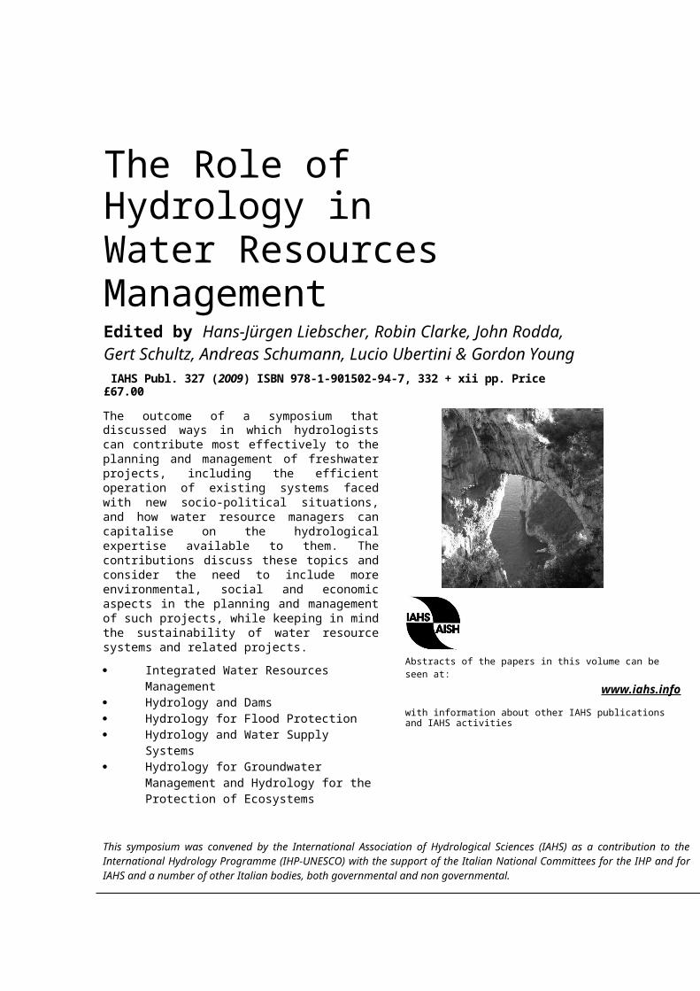
The Role of Hydrology in Water Resources Management Edited by Hans-Jürgen Liebscher, Robin Clarke, John Rodda, Gert Schultz, Andreas Schumann, Lucio Ubertini & Gordon Young IAHS Publ. 327 (2009) ISBN 978-1-901502-94-7, 332 + xii pp. Price £67.00 The outcome of a symposium that discussed ways in which hydrologists can contribute most effectively to the planning and management of freshwater projects, including the efficient operation of existing systems faced with new socio-political situations, and how water resource managers can capitalise on the hydrological expertise available to them. The contributions discuss these topics and consider the need to include more environmental, social and economic aspects in the planning and management of such projects, while keeping in mind the sustainability of water resource systems and related projects. Integrated Water Resources Management Hydrology and Dams Hydrology for Flood Protection Hydrology and Water Supply Systems Hydrology for Groundwater Management and Hydrology for the Protection of Ecosystems Abstracts of the papers in this volume can be seen at: www.iahs.info with information about other IAHS publications and IAHS activities This symposium was convened by the International Association of Hydrological Sciences (IAHS) as a contribution to the International Hydrology Programme (IHP-UNESCO) with the support of the Italian National Committees for the IHP and for IAHS and a number of other Italian bodies, both governmental and non governmental.
Transcript
The Role of Hydrology in Water Resources Management Edited by Hans-Jürgen Liebscher, Robin Clarke, John Rodda, Gert Schultz, Andreas Schumann, Lucio Ubertini & Gordon Young IAHS Publ. 327 (2009) ISBN 978-1-901502-94-7, 332 + xii pp. Price £67.00
The outcome of a symposium that discussed ways in which hydrologists can contribute most effectively to the planning and management of freshwater projects, including the efficient operation of existing systems faced with new socio-political situations, and how water resource managers can capitalise on the hydrological expertise available to them. The contributions discuss these topics and consider the need to include more environmental, social and economic aspects in the planning and management of such projects, while keeping in mind the sustainability of water resource systems and related projects.
Integrated Water Resources Management Hydrology and Dams Hydrology for Flood Protection Hydrology and Water Supply Systems Hydrology for Groundwater Management
and Hydrology for the Protection of Ecosystems Abstracts of the papers in this volume can be seen at:
www.iahs.infowith information about other IAHS publications and IAHS activities
This symposium was convened by the International Association of Hydrological Sciences (IAHS) as a contribution to the International Hydrology Programme (IHP-UNESCO) with the support of the Italian National Committees for the IHP and for IAHS and a number of other Italian bodies, both governmental and non governmental.
Preface Hans-Jürgen H. Liebscher & Lucio Ubertini v
INTRODUCTION – The role of hydrology in water resources management Hans-Jürgen H. Liebscher
1
1 Integrated Water Resources Management
Challenges for water managers: can science help to solve the problems? Gordon J. Young
9
On the complementary roles of the hydrological analyst and the decision-maker in water resources management Robin T. Clarke
18
Requirements for hydrological models to be used as part of decision support systems in integrated water resources management Uwe Haberlandt,Imke Buchwald, Sven Van Der Heijden & Alexander Verworn
29
The Hydrological Atlas of Austria – comprehensive transfer of hydrological knowledge and data to engineers, water resources managers and the public Josef Fürst, Reinhold Godina, Hans Peter Nachtnebel & Franz Nobilis
36
Integrated scenarios of long-term river runoff changes within large river basins in the 21st century A. G. Georgiadi, N. I. Koronkevich, I. P. Milyukova, E. A. Barabanova & A. V. Kislov
45
A distributed package for sustainable water management: a case study in the Arno basin Fabio Castelli, Giovanni Menduni & Bernardo Mazzanti
52
Integrated real-time data access and monitoring systems for hydrological investigations and water resources management Hermann Stadler, Paul Skritek, Christian Kollmitzer, Erich Klock, Wolfgang Zerobin & Andreas Farnleitner
62
Hydrological model and WEB-GIS for water resource management at a basin scale Michele Bellezza, Stefano Casadei & Arnaldo Pierleoni
72
Characterizing the multi-criteria parameters of an integrated water management model for the Annaba region, Algeria B. Aoun-Sebaiti, A. Hani, S. Lallahem, L. Djabri & E. Carlier
80
An interaction approach to water resource management in Mediterranean countries Immacolata Caruso & Tiziana Vitolo
91
The consequences of hydrological events on steep coastal watersheds: the Costa d’Amalfi, eastern Tyrrhenian Sea Crescenzo Violante, Chiara Biscarini, Eliana Esposito, Flavia Molisso, Sabina Porfido & Marco Sacchi
102
The management of Lake Maggiore water levels: a study of low water episodes Elisabetta A. Carrara, Walter Ambrosetti & Luigi Barbanti
115
2 Hydrology and Dams
Hydrological risk and flood management using hydraulic structures A. Schumann
127
Climate change and water resources: an approach to adaptive management Guenther Pacher, Marie Minville, Anne Frigon, René Roy & Michel Slivitzky
136
Integrated water resources management: development of data parsimonious models for reservoir planning Adebayo Adeloye
144
Integrated hydrological data in a hydropower cascade Isabella Pallavicini & Azeb Asnake
151
3 Hydrology for Flood Protection
Long-range hydrological forecasts and predictions: efficiency, failures, and scientific background (Russian experience) Lev Kuchment
165
Flood protection and risk management: the case of Tescio River basin Piergiorgio Manciola, Silvia Di Francesco & Chiara Biscarini
174
Water resources management for the Terek River delta (Western Caspian Region) Olga Gorelits, Igor Zemlianov1 & Vladimir Kryjov
184
4 Hydrology and Water Supply Systems
Sustaining water resources in South East England John C. Rodda 193
Water supply management of the New York Metropolitan area and future challenges from population growth and global climate change Yuri Gorokhovich & Victor Goldsmith
204
System hydrology models for managing the salinity of Lake Kinneret, Israel Alon Rimmer
212
Climate change and water resources: scenarios of low-flow conditions in the Upper Danube River Basin Wolfram Mauser & Thomas Marke
225
Hydrological consequences of a changing climate: the Umgeni Water Utility case study Mark Summerton & Roland Schulze
237
Deriving optimal information from inadequate data collection networks for water alloca-tion in Ghana Christine Young, Sven Jacobi & Kodwo Andah
247
Operational applications of radar rainfall data in urban hydrology Federico Lombardo, Valeria Montesarchio, Francesco Napolitano, Fabio Russo & Elena Volpi
258
5 Hydrology for Groundwater Management and Hydrology for the Protection of Ecosystems
Water resources and management in Libya Ali Geath Mahmoud Eljadid 269
Reframing groundwater vulnerability assessment for a better understanding between de-cision makers and hydrogeologists A. Dassargues, I. C. Popescu, J. Beaujean, J. M. Lemieux & S. Brouyere
278
On the potential of Life Cycle Assessment in water resources management: focus on groundwater Peter Bayer, Stephan Pfister & Stefanie Hellweg
285
Hydrological simulations of water-management scenarios in support of the Comprehens-ive Everglades Restoration Plan Eric D. Swain, Melinda Lohmann & Jeremy Decker
296
Blue Ecology and climate change: interweaving cultural perspectives on water, an indi-genous case study Michael D. Blackstock
306
A new approach for assessing minimum flow in ephemeral streams Angela Candela, Mario Santoro & Gaspare Viviani
314
Plot scale measurements of rainfall erosion losses in central Italy F. Todisco, F. Mannocchi, L. Vergni & A. Vinci
324
Key word index 331
The Role of Hydrology in Water Resources Management (Proceedings of a symposium heldon the island of Capri, Italy, October 2008). IAHS Publ. 327, 2009, 9-17
Challenges for water managers: can science help to solve the problems?
GORDON J. YOUNG34 Vincent Avenue, PO Box 878, Niagara on the Lake, Ontario L0S 1J0, Canada [email protected]
Abstract Water pervades all human activities and thus is of fundamental importance for basic human well-being, for economic and social development, and for physical security. Water is also vital for the maintenance of the natural ecosystems on which we all ultimately depend. Thus water managers must be concerned with a large variety of issues, including water-related health issues (safe drinking water, sanitation and water-related diseases), the availability of water for food production, the water needs for energy and industrial production, and the safeguarding of societies from the ravages of floods, droughts and pollution spills. These human needs must always be balanced with consideration for the natural environment. These issues are not independent of each other – they are interlinked and thus must be treated in an integrated manner. The settings in which water managers find themselves are highly varied from region to region and country to country. Not only are climates and hydrologies extremely diverse, but the ways in which societies organize themselves are equally varied. Governance systems are based on the cultures, the religions and the attitudes of peoples. They link to the political settings, to the effectiveness of institutions, to legislative frameworks and to financial instruments. Water managers must find solutions to the challenges facing them, considering the constraints of the systems within which they work. Thus different solutions must be considered for different circumstances. Sciences (hydrological, political, social, economic) provide knowledge and understanding of the systems involved. All are essential in informing water managers in their decision-making. Hydrological science is of vital importance, but is just one of many relevant sciences.Key words governance; health; economic development; integrated management
The Role of Hydrology in Water Resources Management (Proceedings of a symposium heldon the island of Capri, Italy, October 2008). IAHS Publ. 327, 2009, 18-23
On the complementary roles of the hydrological analyst and the decision-maker in water resources management
ROBIN T. CLARKEInstituto de Pesquisas Hidráulicas, Universidade Federal do Rio Grande do Sul, Porto Alegre 91501-970, RS Brazil [email protected]
Abstract Decisions about water resource management are made in the presence of uncertainty about future events, whether these be reservoir inflows, water demand, or the consequences of climate change. The framework for any decision-making process therefore consists of the following elements: (a) a list of future events that may or may not occur; (b) the probabilities of these events; (c) a list of possible decisions, from which one – the “optimum” – must be selected by the decision-maker; (d) measures of the consequences of each decision according to which uncertain event occurs. These consequences may sometimes be expressed in monetary terms (losses), but more often must be expressed in terms of utility. When the optimal decision is that which maximizes expected utility (minimizes expected loss), the paper discusses the roles of the hydrologist and the decision-maker in assessing the elements (a) to (d) above, showing how these roles complement each other. In particular the role of the hydrologist in determining probabilities (item (b) of the above) is discussed, in the context where probabilities must be evaluated for events which have not occurred in the past. The paper also shows why maximizing expected utility (or minimizing expected loss, when consequences can be expressed in terms of money) is better than minimizing the maximum loss (MINIMAX) criterion for selecting the best decision.Key words risk; probability; decision-making; degrees of belief
The Role of Hydrology in Water Resources Management (Proceedings of a symposium heldon the island of Capri, Italy, October 2008). IAHS Publ. 327, 2009, 24-28
The contribution of the legal aspect of hydrology to the management of international water resources
Abstract Hydrology as a general science, comprises different aspects, one of which is legal. While the technical aspects of hydrology could never be neglected in the management of international freshwater resources, the legal aspect could prove to be of equal importance. Respect for the law that governs the management of international rivers, lakes and aquifers is necessary in order to provide sustainable development and to avoid potential conflicts between riparian states. Therefore, this paper examines the contribution of international law in the management of international water resources; in particular with the legal principles, as they are incorporated in the United Nations (UN) Convention of the Non-Navigational Uses of International Watercourses and their effect in the sound and integrated management of water resources that are shared between two or more states. It argues that the purpose of the drafters of the Convention was to create an international legal framework in order to facilitate the management of water resources. Key words UN Convention; cooperate; equity; ecosystems; sustainable development
The Role of Hydrology in Water Resources Management (Proceedings of a symposium heldon the island of Capri, Italy, October 2008). IAHS Publ. 327, 2009, 29-35
Requirements for hydrological models to be used as part of decision support systems in integrated water resources management
UWE HABERLANDT, IMKE BUCHWALD, SVEN VAN DER HEIJDEN & ALEXANDER VERWORNInstitute of Water Resources Management, Hydrology and Agricultural Hydraulic Engineering, Leibniz University of Hannover, Appelstr. 9a, D-30167 Hannover, [email protected]
Abstract Today there are numerous hydrological models available for calculating water balance components at different spatial and temporal scales. So, a selection of one suitable hydrological model, which serves as a module in a more complex decision support system for integrated water resources management, should not be a problem. However, more closely reviewing the specific requirements of hydrological modelling in IWRM reveals that not many models really fulfil all the needs. This contribution presents a hybrid modelling framework for IWRM, discusses requirements of a hydrological model as part of such a system, and then compares the three different hydrological models: HEC-HMS, WASIM-ETH and SWAT regarding their suitability for such a task. The results show that none of the models fulfils all requirements in an optimal sense, and that there is still a lot of work to do on hydrological modelling for integrated water resources management.Key words hydrological model; water balance; integrated water resources management; metamodel; decision support system
The Role of Hydrology in Water Resources Management (Proceedings of a symposium heldon the island of Capri, Italy, October 2008). IAHS Publ. 327, 2009. 36-44
The Hydrological Atlas of Austria – comprehensive transfer of
hydrological knowledge and data to engineers, water resources managers and the public
JOSEF FÜRST1, REINHOLD GODINA2, HANS PETER NACHTNEBEL1 & FRANZ NOBILIS2
1University of Natural Resources and Applied Life Sciences Vienna, Institute of Water Management, Hydrology and Hydraulic Engineering, Muthgasse 18, A-1190 Vienna, Austria [email protected]
2Department VII/3 - Water Balance at the Federal Ministry of Agriculture, Forestry, Environment and Water Management, Marxergasse 2, A-1030 Vienna, Austria
Abstract The Hydrological Atlas of Austria (HAA) is presented as an effective and efficient tool to provide spatial hydrological information consistently for the whole country to engineers, water resources managers and the public. The information is cartographically communicated on 52 map sheets, with a total of more than 100 thematic maps. The structure of the atlas shows the different components of the hydrological cycle; it has chapters considering water and mass balances, and covers the themes of water management as well as those of water-related environmental issues. Being a dual-mode product, the printed version is accompanied by a digital, GIS-based version on CD-ROM, including convenient viewing software and the data sets in industry-standard GIS formats. Only one year after publication, a wide range of applications is reported, both by administrative institutions and civil engineers.Key words hydrology; water resources; hydrological atlas; information system; GIS; Austria
The Role of Hydrology in Water Resources Management (Proceedings of a symposium heldon the island of Capri, Italy, October 2008). IAHS Publ. 327, 2009, 45-51
Integrated scenarios of long-term river runoff changes within large river basins in the 21st century
A. G. GEORGIADI1, N. I. KORONKEVICH1, I. P. MILYUKOVA1, E. A. BARABANOVA1 & A. V. KISLOV2
1 Institute of Geography, Russian Academy of Sciences, Staromonetny Lane, 29, 119017 Moscow, [email protected]
2 Geographical Faculty, GSP-2 Vorobievy gory, Moscow State University, Russia
Abstract Global and regional climate changes and anthropogenic impacts are the leading factors determining the future state of large river basin water systems which play important roles in the economic development of Russia. That is why it is necessary to create integrated scenarios of river runoff changes within large river basins. Such scenarios should make one of the main bases for ecologically safe management of water systems in the future. Integrated scenarios include the following components: (a) Scenarios of global climate change and methods of their assimilation. (b) Scenarios of hydrological consequences caused by climate changes. (c) Scenarios of hydrological consequences of socio-economic development, including changes in the water management complexes. Results of development of integrated scenarios are submitted by the example of Lena River basin – one of the largest rivers of Northern Eurasia. It is especially important for permafrost regions of Russia which covers two thirds of its territory.Key words scenarios of global climate warming; water management complex; river runoff changes; monthly water budget model; Lena River basin
The Role of Hydrology in Water Resources Management (Proceedings of a symposium heldon the island of Capri, Italy, October 2008). IAHS Publ. 327, 2009, 52-61
A distributed package for sustainable water management: a case study in the Arno basin
FABIO CASTELLI1, GIOVANNI MENDUNI2 & BERNARDO MAZZANTI2
1Department of Civil and Environmental Engineering, University of Firenze, Firenze, [email protected]
2Arno Basin Authority, Firenze, Italy
Abstract MOBIDIC (MOdello di Bilancio Idrologico DIstribuito e Continuo) is a distributed hydrological modelling package for various applications. The main innovations concern: (a) the coupling of the water balance in the soil and vegetation with the surface energy balance, to the benefit of evapotranspiration computation and the use of remotely-sensed maps for calibration and validation; (b) the interaction between groundwater and surface water bodies, (c) the capability of easily managing data on withdrawals of water, reservoir operation and environmental flow. MOBIDIC-WRM can be used as an effective tool for the evaluation of basin scenarios (e.g. effects of changes in land cover/deforestation and irrigation strategies, exploitation policies for groundwater). It provides a reliable hydrological base for the assessment of crisis indicators such as vegetation stress and lack of environmental flow. In this work we present an application in the Arno basin, central Italy. The outcome of applying the package in order to determine the water budget management strategies is discussed.Key words water resources monitoring and control; distributed hydrological models; remote-sensing; soil-atmosphere fluxes; environmental flow
The Role of Hydrology in Water Resources Management (Proceedings of a symposium heldon the island of Capri, Italy, October 2008). IAHS Publ. 327, 2009., 62-71
Integrated real-time data access and monitoring systems for hydrological investigations and water resources management
HERMANN STADLER1, PAUL SKRITEK2, CHRISTIAN KOLLMITZER2, ERICH KLOCK1, WOLFGANG ZEROBIN4 & ANDREAS FARNLEITNER3
1 Joanneum Research, Institute of Water Resources Management, Hydrogeology and Geothermics, Elisabethstrasse 16, A-8010 Graz, [email protected]
2 University of Applied Sciences, FH-Technikum Vienna, Hoechstaedtplatz 5, A-1200 Vienna, Austria3 Vienna University of Technology, Institute of Chemical Engineering, Department of Applied Biochemistry and Gene
Technology, Getreidemarkt 9–166, A-1060 Vienna, Austria4 Vienna Waterworks, Municipal Department 31, Grabnergasse 4–6, A-1060 Vienna, Austria
Abstract Global changes in ecosystems, the growth of population as well as the modifications to legal frameworks, in recent years have caused an increasing requirement for groundwater and spring water quality monitoring with the target of supplying present and future consumers with high-quality uncontaminated drinking water. There is also the demand for sustainable protection of drinking water resources which causes the deployment and use of early warning systems and quality assurance networks in water supplies. Hydrological research has to seize these challenges by groundbreaking, multidisciplinary approaches. Data transmission using Low Earth Orbit Satellites (LEOS) provides world-wide “nomadic” on-line data-communication. This is particularly important for regions which are inaccessible by land-based wireless (GSM/UMTS) or geostationary (GEO) satellite systems. For several years our working-group has successfully applied LEO satellite data transmission to hydro-meteorological research, e.g. for online data transmission, event-triggered water quality monitoring and sampling networks and also for remote quality monitoring of online measurements. This paper shows the possibilities of bringing these different systems together. This is achieved by a bi-directional satellite link, near-real-time data transmission, event monitoring and event sampling as well as remote quality monitoring of on-line field measurements.Key words LEO-satellite communication; on-line data access; automated event sampling; early warning systems;
The Role of Hydrology in Water Resources Management (Proceedings of a symposium heldon the island of Capri, Italy, October 2008). IAHS Publ. 327, 2009, 72-79
Hydrological model and WEB-GIS for water resource management at a basin scale
MICHELE BELLEZZA, STEFANO CASADEI & ARNALDO PIERLEONIDept. of Civil and Environmental Engineering, University of Perugia, Borgo XX Giugno 74, 06121 Perugia, Italy HTU [email protected] UTH
Abstract Water resources management at the basin scale foresees a deep knowledge of the data upon which all the allocation plans of the available water are developed. This consideration means that different kinds of data and information, e.g. hydrological, soil and terrain, water use and distribution, existing hydraulic works and environmental constraints are to be taken into account. Obviously, all this information must be collected, validated, continuously updated, and most of all, shared amongst all the participants in the complex process of water management. Particularly, hydrological and water use data show high uncertainties that are not due to technical issues concerning the process of collection and validation, but mainly to the fact that they are not widely shared and agreed amongst the basin authorities and stakeholders. For this reason a different approach that exploits the potentials of GIS engines and the WWW has been developed in order to provide a common platform that could allow the sharing of all the information collected and validated so far. This tool also offers computational and modelling engines to help in sharing the entire decision process so that more effective water resources management plans could be developed and possible controversies could be prevented.Key words model; data; reservoir; decision support system; water management; environmental use; GIS; WEB
The Role of Hydrology in Water Resources Management (Proceedings of a symposium heldon the island of Capri, Italy, October 2008). IAHS Publ. 327, 2009, 80-90
Characterizing the multi-criteria parameters of an integrated water management model for the Annaba region, Algeria
B. AOUN-SEBAITI1, A. HANI2, S. LALLAHEM3, L. DJABRI2 & E. CARLIER3 1 Université du 20 août 1955, Faculté des Sciences et Technologies, Skikda, Algérie
[email protected] 2 Laboratoire de Géologie, Université Badji Mokhtar de Annaba, BP 12, 23000 Annaba, Algérie3 Laboratoire de Mécanique de Lille, UMR 8107, Ecole Polytechnique Universitaire de Lille, Av. Paul Langevin,
F-59655 Villeneuve d’Ascq, France
Abstract Sustainable water resources management in the Annaba region of Algeria is a complex challenge which requires a new approach if management is to have a sound scientific basis for optimizing and conserving precious and scarce water resources. Increased water demand from population and economic growth, environmental needs, land-use change, urbanization, over-abstraction from aquifers, deterioration of water quality, pollution from local and diffuse sources, water infrastructure hotspots and impacts on public health and ecosystems, are all factors that will continue to create severe water shortage problems. In this research, a new conceptual integrated water-management model has been developed, based on cause–effect relationships. The Driver–Pressure–State–Impact–Response was selected as a well-established framework to allocate the possible variables into five categories: namely socio-economic; pollution pressures; water quality; impacts; and management responses. The effective variables have been characterized and prioritized using multi-criteria analysis with artificial neural networks (ANN), risk assessment techniques and expert opinion and judgment. The selected variables were classified and organized using the multivariate techniques of cluster analysis, factor analysis, principal components and classification analysis. It was concluded that no single measure will be able to solve the water problems in the Annaba region. Rather, a combination of these measures is needed to ensure water availability,
suitability, sustainability and security. Key words ANN; expert opinion and judgment; Annaba region; groundwater; integrated water management model; pollution pressures; public health and ecological impacts; socio-economic driving forces; state of water quality
The Role of Hydrology in Water Resources Management (Proceedings of a symposium heldon the island of Capri, Italy, October 2008). IAHS Publ. 327, 2009, 91-101
An interaction approach to water resource management in Mediterranean countries
IMMACOLATA CARUSO & TIZIANA VITOLOISSM-CNR, Institute of Studies on Mediterranean Societies, Italian National Research Council, via P. Castellino 111, I-80131 Naples, [email protected]
Abstract This study presents the findings of the INGO MED project which analyses the reformation of the public utilities system, with particular reference to water resources management. This is a process linked to broad participation of economic, social, and political agents engaged in processing and implementing decentralised decision-making. The originality of the study consists in using the behaviour of intermediate institutions as a proxy indicator of governance in the water utilities sector. The analysis, which considers three North African countries and Italy, is limited to the last 10 years, and seeks to identify the appropriate institutions with a coherent set of strategies and instruments.Key words Mediterranean countries; stakeholders; governance; economics; water management
The Role of Hydrology in Water Resources Management (Proceedings of a symposium heldon the island of Capri, Italy, October 2008). IAHS Publ. 327, 2009, 102-113
The consequences of hydrological events on steep coastal watersheds: the Costa d’Amalfi, eastern Tyrrhenian Sea
1 Institute for Coastal Marine Environment, National Research Council, Calata Porta di Massa, Napoli, [email protected]
2 WARREDOC, Water Resource Research and Documentation Centre, University for Foreigners, Perugia, Italy
Abstract Mitigating the adverse impacts of extreme hydro-meteorological events such as floods requires a multi-hazard approach that integrates land and water resources development in a river basin. For this aim, geological data combined with historical and direct field investigations play a major role both for basin and flood analysis, especially in poorly monitored systems. In steep, rocky watersheds with ephemeral fluvial discharge, the scarcity of suitable networks of instrument stations and the importance of erosional processes claim the use of different data sources for predictive water models that include hydrological analyses. The advantages of an integrated approach is discussed within the case of the Costa d’Amalfi, a stretch of rocky coast with small and high-elevation drainage basins punctuated by rapid and catastrophic floods. The elevated bed load transport occurring in conjunction with rainstorms strictly associates with sediment supply by slope erosion that clearly excludes any kind of clear-water flows in favour of hyper-concentrated flows.Key words multi-hazard approach; rain storm; stream flow; rocky coast
The Role of Hydrology in Water Resources Management (Proceedings of a symposium heldon the island of Capri, Italy, October 2008). IAHS Publ. 327, 2009, 114-124
The management of Lake Maggiore water levels: a study of low water episodes
ELISABETTA A. CARRARA, WALTER AMBROSETTI & LUIGI BARBANTIInstitute of Ecosystem Studies, National Research Council, Largo Tonolli 50, 28922 Verbania Pallanza, [email protected]
Abstract Lake Maggiore, due to the elevation, morphology and precipitation regime of its drainage basin, is subjected to floods and long-lasting low water episodes. Based on the lake water levels recorded at Pallanza from 1952 to 2005, 30 flood and 41 low water episodes were identified. In the last 15 years, the frequency of floods has decreased, and since the end of 2004, no floods have occurred. In light of this, the cause–effect relationship between each low water episode and the precipitation, the management of the weir, and the mountain reservoir is analysed. The data presented shows that the altered rainfall regime characteristic of the 1980s onwards, although of great relevance, is not the only factor influencing low water episodes. In fact, the management of the outflow at the Miorina weir and of the mountain reservoirs has a great impact on the onset and evolution of low water events. Key words low water; climate change; anthropogenic impact; Southern Alpine lake
The Role of Hydrology in Water Resources Management (Proceedings of a symposium heldon the island of Capri, Italy, October 2008). IAHS Publ. 327, 2009, 127-135
Hydrological risk and flood management using hydraulic structures
A. SCHUMANNRuhr-University Bochum, Institute of Hydrology, D-44780 Bochum, [email protected]
Abstract The risk oriented approach in flood design demands a new quality in the cooperation between water managers and hydrologists. A design flood is not the result of a standardized hydrological procedure but the outcome of a discussion between hydrologists and water managers about practical needs, hydrological complexities and applied tools. Sophisticated hydrological methodologies are available, but not generally accepted. The simplifications of hydrological assessments used in safety-oriented design have to be replaced by more complex analyses. For this purpose some new methods, based on Copulas and stochastic–deterministic modelling are presented here. Key words design floods; copula; fuzzy numbers; Monte Carlo simulation
The Role of Hydrology in Water Resources Management (Proceedings of a symposium heldon the island of Capri, Italy, October 2008). IAHS Publ. 327, 2009, 136-143
Climate change and water resources: an approach to adaptive management
GUENTHER PACHER1, MARIE MINVILLE2, ANNE FRIGON3, RENÉ ROY1 & MICHEL SLIVITZKY4
4 INRS-ETE / Ouranos, 490 de la Couronne, Quebec G1K 9A9, Canada
Abstract In the presence of uncertainty, adaptive management is recognized to be effective, normally relying on field experimentation to accelerate the learning process. For the design, optimisation, and operation of hydropower installations, such an approach is generally feasible only by considering experimentation as “virtual” in a modelling exercise. This paper describes such an approach to adaptive management and illustrates it with an example for a watershed in Quebec.Key words climate change; adaptive management; hydropower
The Role of Hydrology in Water Resources Management (Proceedings of a symposium heldon the island of Capri, Italy, October 2008). IAHS Publ. 327, 2009, 144-150.
Integrated water resources management: development of data parsimonious models for reservoir planning
ADEBAYO ADELOYESchool of the Built Environment, Herriot-Watt University, Edinburgh EH14 4AS, [email protected]
Abstract Data parsimonious models are developed which offer the realistic possibility for reservoir storage-yield-reliability (S-Y-R) planning analysis at ungauged sites. One of the models was based on multiple linear regression analysis and the second set of models were designed using artificial neural networks (ANNs); both models use input variables comprising runoff summary statistics, e.g. the CV of annual runoff, and reservoir systems variables such as the demand and reliability index. The models performed satisfactorily when tested using independent data sets not utilised during their development. Finally, algorithms for obtaining the runoff summary statistics at ungauged sites are presented. Key words artificial neural networks; storage-yield-reliability; sequent peak algorithm; over-year capacity; within-year capacity; multiple regression; ungauged sites
The Role of Hydrology in Water Resources Management (Proceedings of a symposium heldon the island of Capri, Italy, October 2008). IAHS Publ. 327, 2009, 151-162.
Integrated hydrological data in a hydropower cascade
ISABELLA PALLAVICINI1 & AZEB ASNAKE2 1Sapienza University of Rome, Via Eudossiana 18, I-00184 Rome, Italy
[email protected], Ethiopian Electric Power Corporation, PO Box 1233, Addis Ababa, Ethiopia
Abstract The exploitation of hydropower potential has been recognized by the Ethiopian Government as a key issue in the economic development of the country. To meet the strong increase of energy demand in future years the Ethiopian Government has undertaken a series of actions for the construction of plants on the Omo River for hydropower generation. The Gibe Hydropower cascade system along the Gibe/Omo River, among others planned in the same watershed, provides a very significant improvement in this sense. The implementation of such a complex system requires a strong integration between types of technical expertise, among which hydrology is of great importance throughout all the project phases: from the preliminary planning to the technical design, to the final management. In each phase of the project the hydrological contribution is never a standard approach, but is a result of a fine calibration of methodologies according to the requested degree of approximation and the available data.Key words hydropower cascade; Ethiopia
The Role of Hydrology in Water Resources Management (Proceedings of a symposium heldon the island of Capri, Italy, October 2008). IAHS Publ. 327, 2009, 165-173.
Long-range hydrological forecasts and predictions: efficiency, failures, and scientific background (Russian experience)
LEV KUCHMENTWater Problems Institute of Russian Academy of Sciences, 119991 Gubkin 3, Moscow, Russia [email protected]
Abstract The flow of almost all large Russian rivers is regulated by means of reservoir cascades. Long-range forecasts of snowmelt flood characteristics have a special significance for regulation of flood runoff and mitigation of flood damages. The use of these forecasts in Russia commonly results in increases of the hydropower output by 3–5%. At the same time, the application of current methods and techniques has on many occasions led to serious failures and damage (e.g. the enormous errors in forecasting of the Volga River spring flood runoff in 1973, the prediction of variations of the Caspian Sea water level). Analysis of these failures has shown that the damage could, to a significant extent, be avoided if the decision makers had an opportunity to take into account the uncertainty in prediction and could use more cautious strategies in water resources planning and operations. At present, most hydrological forecasts and predictions that are issued in Russia are based on methods and techniques developed in the period 1950–1970. Development of distributed physically-based and dynamic–stochastic models, which properly describe the main spatio-temporal processes of runoff generation, has created, in principle, a new basis for hydrological forecasting and prediction, providing the means to improve the accuracy and reliability of hydrological predictions as well as enabling their presentation in a probabilistic form. This approach is illustrated for forecasting of the spring–summer flood volume and peak discharge of the Vyatka River. Key words hydrological forecast; hydrological prediction; Russian experience; physically-based runoff generation models
The Role of Hydrology in Water Resources Management (Proceedings of a symposium heldon the island of Capri, Italy, October 2008). IAHS Publ. 327, 2009, 174-183.
Flood protection and risk management: the case of Tescio River basin
PIERGIORGIO MANCIOLA1, SILVIA DI FRANCESCO2 & CHIARA BISCARINI3
1CIPLA- Interuniversitary Research Centre for the Environment, University of Perugia, Perugia, [email protected]
2Department of Civil and Environmental Engineering, University of Perugia, Perugia, Italy3Water Resources Research And Documentation Centre, University For Foreigners, Perugia, Italy
Abstract This paper presents a definition of the hydrological engineering requirements for formulating and evaluating economically efficient flood damage reduction plans aimed to meet performance and environmental-protection standards. Most of the research efforts have been devoted to the technical factors of risk assessment, providing quantitative and qualitative estimates of possible alternatives, containing measures of the risk associated with those alternatives. Moreover, the issues of risk management are analysed, in particular with respect to the role of decision making when risk information is available. The present study highlights that plans should also be evaluated in terms of many factors, such as contribution to local economic development, impact on the quality of the total environment, impact on the population’s well-being, prevention of loss of life, and preservation of cultural and historical values. In order to prove the reliability of the proposed methodology and to show how risk-based information can be incorporated into a flood analysis process, an application is also presented. This application concerns a first set of results of the flood risk assessment in the Tescio River basin.Key words flood; risk management; Tescio River basin; environmental protection
The Role of Hydrology in Water Resources Management (Proceedings of a symposium heldon the island of Capri, Italy, October 2008). IAHS Publ. 327, 2009., 184-190
Water resources management for the Terek River delta (Western Caspian Region)
OLGA GORELITS1, IGOR ZEMLIANOV1 & VLADIMIR KRYJOV2
1 State Oceanographic Institute (SOI), 6, Kropotkinsky Per., Moscow 119034, [email protected]
2 Hydrometeorological Research Centre of the RF, 11-13, B.Predtechensky Per., Moscow 123242, Russia
Abstract The changes in hydrological conditions in the Terek delta occur against a background of global climate changes. The climate warming and humidity increase causes the intensification of erosion processes in the Terek watershed, the essential increase of the water runoff and sediment load. Regulation of the delta channel network should be carried out by restoration of existing and construction of new artificial canals and usage of natural delta branches and lakes. The main factors of the Terek delta channel network formation are considered. The recommendations for the optimum reserve tracts of water distribution have been developed. These new canals are able to pass up to 50% of the flood waters and significantly reduce the risk of destruction of the protective levees and dams in the delta. At the same time these tracts have important ecological value for the delta environment.Key words flooding; river delta formation; hydrological regime; runoff distribution; remote sensing
The Role of Hydrology in Water Resources Management (Proceedings of a symposium heldon the island of Capri, Italy, October 2008). IAHS Publ. 327, 2009, 193-203.
Sustaining water resources in South East England
JOHN C. RODDACentre for Ecology and Hydrology, Wallingford, Oxfordshire, UK and Hydro-GIS Ltd, Chalgrove, Oxfordshire, [email protected]
Abstract Water is one of the most crucial issues for virtually every nation. Floods, droughts, pollution, lack of reliable public supplies, no effective sanitation and similar predicaments pose innumerable problems in the developing world, but also in the developed world. While poor communities where the infrastructure is minimal invariably suffer most, there can also be considerable difficulties in richer regions. Population increase, rising demand for water per capita, ageing water mains, sewers and treatment works, lack of investment, unforeseen effects of government policies, environmental constraints and the impact of climate variability and change are factors which can stress water resources and degrade water services. This is the case in the United Kingdom’s South East England Region, where the meagre resources are coming under increasing pressure. This is one of the driest parts of the UK and, except for London, the most densely populated. But the South East England Plan (SEP, 2006) formulated at the behest of central government requires the Region to accommodate at least 1 million more people by 2026, with scant regard for the risk that water resources and the water services that rely on them will be unable to cope. Climate change, together with the restrictions imposed on abstractions by international agreements, heighten this risk. This paper examines these stresses, potential solutions and the dilemma facing government. Should existing policies be maintained with consequences for the environment, particularly during droughts? Should water be transferred from more humid parts of mainland UK, again with consequences for the environment? Should the planned increase in population go ahead? Key words water resources; South East England; water stress; governance; planning; environment
The Role of Hydrology in Water Resources Management (Proceedings of a symposium heldon the island of Capri, Italy, October 2008). IAHS Publ. 327, 2009., 204-211
Water supply management of the New York Metropolitan area
and future challenges from population growth and global climate change
YURI GOROKHOVICH1 & VICTOR GOLDSMITH2
1Department of Environmental, Geographical and Geological Sciences, Lehman College, CUNY, 250 Bedford Park Blvd, West. Bronx, New York 10468, [email protected]
2Associate Provost, Pace University, 1 Pace Plaza, NY, New York 10038, USA
Abstract The New York Metropolitan Area (NYMA), with a population of more than 8 000 000 people consumes more than 4.5 million cubic metres of water daily from a watershed area of more than 4970 km 2. Developed in the late 1800s and expanded in the early 1900s, this system was designed according to climatic and demographic conditions existing at that time. Today, the management of one of the largest surface water supply systems in the US experiences new challenges associated with climate change, maintenance and enhancement of current conservation measures, coastal salt water intrusion, and continuing demands for economical development in upstate watershed communities. However, as described here, the large spatial distribution of the system allows effective management of water supply and treatment; and to a large extent, prevents the effects of droughts and floods. Recent changes in climatic conditions and population growth present challenges that require applications of new hydrological tools to develop better economic and political strategies. The main challenges are: (1) the management of the changing hydrological conditions in the watershed area due to climate change; (2) the ability to improve current water supply management and conservation measures or find water alternatives to accommodate the still growing population; and (3) to preserve the currently pure natural water supply for the future generations. Climate change on the Northeastern Coast of the USA is becoming well pronounced, with increasing average winter temperatures, ocean surface temperatures, and general instability in annual weather patterns. This affects the amount of available precipitation, and as a result, the amount of water storage in reservoirs. However, the uncertainty of future climatic changes makes it difficult to make effective forecasts. In this paper we argue that current considerations of presently uncertain climate change effects on the New York City watershed system might be less challenging to the future management than the current trends in population growth and maintenance and enhancement of existing conservation measures. Key words New York City water supply; climate change; water quality; hydrology; management
The Role of Hydrology in Water Resources Management (Proceedings of a symposium heldon the island of Capri, Italy, October 2008). IAHS Publ. 327, 2009, 212-224.
System hydrology models for managing the salinity of Lake Kinneret, Israel
ALON RIMMERIsrael Oceanographic & Limnological Research Ltd, The Yigal Allon Kinneret Limnological Laboratory, PO Box 447, Migdal 14950, [email protected]
Abstract The salinity of Lake Kinneret (LK), Israel, fluctuating between 190 to 280 ppm Cl -, is significantly higher than the salinity of the Jordan River (~30 ppm Cl -) and other surface streams that flow to the lake. By pumping ~330 million cubic metres annually of the lake water through the National Water Carrier (NWC) to the coastal area of Israel, the lake water is used for drinking, irrigation and re-use in the populated areas above the coastal aquifer. Its extensive usage as agricultural irrigation, both as original LK water and re-used water, poses a threat to the future sustainability of the groundwater and agricultural soils near the coastal areas. The hydrology of LK has been studied for the explicit purpose of establishing operational tools that can be used for managerial decisions regarding maintaining and reducing LK salinity. By application of the system modeling approach to three different hydrological problems associated with Lake Kinneret salinity, the major physical laws that govern its operation have been established. The three studies focused on: (1) detection of three unknown components, namely, evaporation, saline springs discharge and salinity, of the monthly water–solute–heat balances of the lake; (2) identification of the karst hydrological system of the saline springs that recharge the lake; and (3) long-term predictions of LK
salinity, in response to operational changes. Each system will be presented from the description of the problem, through the conceptual model approach, to the results and the attributed conclusions. Finally, the usage of each system separately is discussed, together with the integration of knowledge from the three studies, in order to reach practical managerial decisions.Key words system hydrology; direct and inverse problems; karst hydrology; mass balances; lake salinity
The Role of Hydrology in Water Resources Management (Proceedings of a symposium heldon the island of Capri, Italy, October 2008). IAHS Publ. 327, 2009, 225-236
Climate change and water resources: scenarios of low-flow conditions in the Upper Danube River Basin
WOLFRAM MAUSER & THOMAS MARKEDepartment for Geography, Ludwig-Maximilians University (LMU), Luisenstrasse 37, D-80333 Munich, [email protected]
Abstract Within the project GLOWA-Danube (www.glowa-danube.de) an analysis was made of the impact of a possible climate change on the low-flow conditions in the mountainous Upper Danube basin (A = 77 000 km²). The physical and spatially distributed hydrological model PROMET is used for this purpose, together with a stochastic climate change scenario generator. To ensure its predictive capabilities, PROMET strictly preserves energy and matter and is not calibrated. PROMET reproduces the daily discharge for the time period 1970–2005 with a Nash-Suttcliffe coefficient of 0.84 at the flow gauge at Achleiten. Twelve statistically equivalent realisations of the IPCC-A1B climate scenario were used to investigate changes in low-flow during the period 2011–2060. The analysis of the simulated scenarios shows increasing droughts, a remarkable change in the low-flow regime of the Danube as well as severe changes in low-flow and its frequency of occurrence. Possible water management adaptation strategies are discussed. Key words climate change; mountain hydrology; PROMET; low-flow
The Role of Hydrology in Water Resources Management (Proceedings of a symposium heldon the island of Capri, Italy, October 2008). IAHS Publ. 327, 2009, 237-246
Hydrological consequences of a changing climate: the Umgeni Water Utility case study
MARK SUMMERTON1 & ROLAND SCHULZE2
1 Umgeni Water, PO Box 9, Pietermaritzburg 3200, South [email protected]
2 School of Bioresources Engineering and Environmental Hydrology, University of KwaZulu-Natal, Private Bag X01, Scottsville 3209, South Africa
Abstract For effective water resources management, all “stressors” that may impact on balancing future water supply and demand must be assessed. Hydrologists have recently begun making headway towards assessing a previously ignored “stressor”, viz. the impact of a changing climate. At Umgeni Water, a bulk water utility in South Africa, a process has been initiated to quantify potential impacts, initially on strategic catchments using daily physical-conceptual hydrological modelling. Preliminary results based on the Geophysical Fluid Dynamics Laboratory General Circulation Model indicate that streamflow could increase by up to 2.6- and 5.3-fold by the years 2065 and 2100, respectively, mostly in the currently dry winter months. Furthermore, inter-annual variability could decrease. This could increase risks of flooding and compromise dam safety. Should additional streamflow improve water yields, climate change could potentially benefit cash flows by delaying capital expenditure on projects to improve assurance of supply. Regardless, it is imperative that the hydrological consequences of a changing climate be included in water development, disaster risk and system operating plans. Key words climate change; water resources management and planning; sustainable economic development; ACRU agrohydrological model; adaptation; Mgeni catchment in KwaZulu-Natal
The Role of Hydrology in Water Resources Management (Proceedings of a symposium heldon the island of Capri, Italy, October 2008). IAHS Publ. 327, 2009, 247-327
Deriving optimal information from inadequate data collection networks for water allocation in Ghana
CHRISTINE YOUNG1, SVEN JACOBI2 & KODWO ANDAH3
1 Water Resources Commission, PO Box CT 5630, Accra, [email protected]
2 NIRAS Consulting Engineers and Planners – Orestads Boulevard 35, Copenhagen, Denmark 3 Water Resources Research and Documentation Centre – WARREDOC, Villa la Colombella, I-06080 Colombella,
Perugia, Italy
Abstract While Africa uses only about 4% of its renewable freshwater resources, water is becoming one of the most critical natural resources issues. The continent is one of the two regions in the world facing water shortages. Although it has abundant freshwater resources, there are great disparities in water availability and use within and between African countries because the water resources are very unevenly distributed. Most areas on the continent receive either too much rain or too little. Most failures in water projects in Africa are not only due to improper technological application, but also to lack of the knowledge and skills that must accompany the selection and use of a given technology. Water resources technologies are more process-oriented than product-related since their application is not only to develop and manage water projects but also to improve the general perception of the dynamic interaction between the elements of the water cycle, human society and natural ecosystems. Another problem, not secondary is the problem of data collection, archiving and retrieval which until a few years ago was still done manually. The use of hydrological data in the design and operation of various categories of water resource projects generates both economic and social benefits, but when the information content is low, can lead to negative results and impacts. It has been estimated that at least 25 to 50 years of hydrometric data are desirable to give adequate design parameters for water resources projects for practical purposes but at a higher cost. More hydrological knowledge and information are therefore needed for optimal design conditions. The Water Resources Commission is presently carrying out a comprehensive water allocation scheme which calls for an up-to-date hydrological information system, taking into consideration missing data and insufficiencies in the areal coverage of data collection networks and also sources of indigenous knowledge. Key words hydrological data; method; model; stations; insufficiencies; data collection; Ghana
The Role of Hydrology in Water Resources Management (Proceedings of a symposium heldon the island of Capri, Italy, October 2008). IAHS Publ. 327, 2009, 258-266
Operational applications of radar rainfall data in urban hydrology
FEDERICO LOMBARDO1, VALERIA MONTESARCHIO1, FRANCESCO NAPOLITANO1, FABIO RUSSO1 & ELENA VOLPI2
1Department of Hydraulics, Transportation and Highways, “Sapienza” University of Rome, Via Eudossiana 18 00184 Rome, [email protected]
2Department of Civil Engineering Sciences, Università Roma Tre of Rome, via Vito Volterra 62-00146 Rome, Italy
Abstract With the aim to perform real-time management of urban drainage systems, in this work an automated method is developed in order to track and forecast in the short term (5 min to 1 h lead times) the evolution of rain fields in time and space, as observed by weather radars. The model identifies single rain cells, tracks their motion and evolution, then forecasts their position, intensity and area on the basis of the information obtained during cell tracking. The model capability to provide realistic rainfall fields was assessed by comparing generated fields with radar observations in the study area. Simulated rain fields were used as an input to a rainfall–runoff model calibrated for the service area of the southside wastewater
treatment plant of Rome, Italy. Results show how the proposed model can forecast the storm cell motion satisfactorily, when the past development is known. However, an improvement in cell area and intensity forecasting method is required. Key words weather radar; storm tracking; urban drainage systems
The Role of Hydrology in Water Resources Management (Proceedings of a symposium heldon the island of Capri, Italy, October 2008). IAHS Publ. 327, 2009, 269-277
Water resources and management in Libya
ALI GEATH MAHMOUD ELJADIDAl-Fath University, Faculty of Science, Atmospheric Science Department, PO Box 13488, Tripoli, [email protected]
Abstract Libya is one of the driest and semi-driest regions in the world, with small total annual rainfall and high evaporation rates. No significant surface water resources are available; groundwater is the main source of water. To face these water problems, Libya built-up a large project designed to transfer freshwater from its southern parts to the northern parts. This paper investigates the current water supplies, demands, the necessity for a water management system, and the future prediction of water demands until the year 2020. The results show that the present water production at the present demand rates are only enough until the year 2012, and the country should have a new policy for producing more water, with a water management system sufficient to meet its future demands for water. Desalination water from the Mediterranean Sea seems to be the first priority for Libya in future. Key words Libya; water; management; agricultural demand; domestic demand; industrial demand; future; resources; supply
The Role of Hydrology in Water Resources Management (Proceedings of a symposium heldon the island of Capri, Italy, October 2008). IAHS Publ. 327, 2009, 278-284
Reframing groundwater vulnerability assessment for a better understanding between decision makers and hydrogeologists
A. DASSARGUES1, I. C. POPESCU1,2, J. BEAUJEAN1, J. M. LEMIEUX1,3
2Groundwater Direction, Water Division, DGRNE, Walloon Region, Belgium3Now at: Geological Institute, ETH Zurich, Zurich, Switzerland
Abstract Management of water resource systems includes adequate decisions about groundwater resource protection. Groundwater vulnerability maps can greatly help for these decisions. In the vulnerability assessment, physical attributes are often mixed with conventional priorities implicitly embedded in the applied methods. Results from one or another method can consequently be very dissimilar and decision makers are losing confidence in these tools. A methodology is proposed to reframe the groundwater vulnerability assessment in a Pressure–State–Impact causal chain that is familiar to decision makers. The physically-based analysis is clearly separated from the agreement aspects induced by local societal, environmental or political priorities. An example is given and perspectives of generalisation are evoked.Keywords groundwater vulnerability; sensitivity; contaminant migration; risk assessment; groundwater protection
The Role of Hydrology in Water Resources Management (Proceedings of a symposium heldon the island of Capri, Italy, October 2008). IAHS Publ. 327, 2009, 285-295 .
On the potential of Life Cycle Assessment in water resources management: focus on groundwater
PETER BAYER, STEPHAN PFISTER & STEFANIE HELLWEG Institute of Environmental Engineering, Ecological Systems Design, ETH Zurich, Hoenggerberg, CH-8093 Zurich, [email protected]
Abstract In water resources management the environmental benefits and impacts of projects have to be assessed, a task that can hardly be achieved with the methodologies that are available in current practice. Life Cycle Assessment (LCA) is the standardised method for measuring the environmental impact of any product or service. After quantifying all associated emissions and the consumption of resources, this impact is expressed with respect to a few common impact categories. These are supposed to reflect major societal and environmental priorities. However, despite their central role in environmental processes, hydrological aspects are only rarely considered in LCA at present. One neglected aspect is groundwater; although groundwater is the most extracted raw material in the world, it is virtually ignored in LCA. To overcome this deficiency, an interdisciplinary approach is needed. This contribution reviews the rudimentary state of the art and develops the initial steps for approaching groundwater quality and quantity issues within a LCA framework. A major focus is the issue of whether, and how, a natural water system can be considered a safeguard object within impact assessment, assuming that it represents a separate receptor. Resulting enhanced LCA will complement integrated water resources management (IWRM) with a focus on processes within a life cycle perspective of specific products and services. Key words groundwater; Life Cycle Assessment (LCA); environmental impact
The Role of Hydrology in Water Resources Management (Proceedings of a symposium heldon the island of Capri, Italy, October 2008). IAHS Publ. 327, 2009, 295-305.
Hydrological simulations of water-management scenarios in support of the Comprehensive Everglades Restoration Plan
ERIC D. SWAIN, MELINDA LOHMANN & JEREMY DECKER US Geological Survey, Florida Integrated Science Center, 3110 SW 9th Avenue, Fort Lauderdale, Florida 33315, USA
Abstract Applications of new and improved numerical models of proposed restoration scenarios are presented and discussed in terms of how they support and necessitate communication between hydrologists and water managers. Management of ecosystem hydrology has become a major concern in communities worldwide due to competition for limited water resources. Numerical models have been developed by the US Geological Survey (USGS) in southern Florida, USA, for the Comprehensive Everglades Restoration Plan (CERP). Specifically, the coupled surface-water/groundwater Flow and Transport in a Linked Overland-Aquifer Density-Dependent System (FTLOADDS) code has been developed and applied to three locations to simulate the complex hydrology of southern Florida. The Tides and Inflow in the Mangroves of the Everglades (TIME) application domain encompasses Everglades National Park, the Ten Thousand Island (TTI) domain contains the Ten-Thousand Islands and Picayune Strand Restoration Project area, and the Biscayne domain contains the coastal area of Miami-Dade county and Biscayne National Park. In a subarea of the TIME domain, the UCODE parameter estimation code was linked with FTLOADDS to design water-management restoration scenarios to maintain desired salinities within coastal estuaries. The successful application of FTLOADDS to evaluate CERP restoration scenarios required close communication and information transfer between water managers and hydrologists. The water manager defines the configuration of the proposed scenario and ensures that the hydrologist is presented with a realistic perspective of the system. The hydrologist clearly defines the assumptions, limitations, and uncertainty of the model simulation and results. Application of a parameter-estimation code (UCODE) with FTLOADDS to design water-management scenarios displays the integration of water management and hydrological studies. Applications of FTLOADDS in southern Florida shows how ecosystem restoration projects that use advanced hydrological modelling tools rely on continuous feedback between water managers and hydrologists.Key words numerical modelling; restoration; water managers; Florida, USA; Everglades
The Role of Hydrology in Water Resources Management (Proceedings of a symposium heldon the island of Capri, Italy, October 2008). IAHS Publ. 327, 2009, 306-313
Blue Ecology and climate change: interweaving cultural perspectives on water, an indigenous case study
MICHAEL D. BLACKSTOCK Independent scholar, professional forester and chartered mediator of European and Gitxsan descent 173 Odin Court, Kamloops, British Columbia V2E 1E4, [email protected]
Abstract The author proposes that we re-examine climate change from a Blue Ecology or “water first” angle: What is happening to the world’s water in the context of climate change? The author proposes the acknowledgement of water’s central functional and spiritual roles in our world, and urges us to apply both indigenous and science-based understanding as we develop collaborative climate change mitigation strategies. A definition of Blue Ecology, consistent with the UNESCO-IHP’s (2008) definition of water, is proposed, and also a Blue Ecology water cycle to be interwoven with Western science’s hydrological cycle. Finally, the author offers recommendations for hydrologists and water managers to implement Blue ecology.Key words Blue ecology; Blue ecology water cycle; culture; indigenous perspective; interweaving; climate change
The Role of Hydrology in Water Resources Management (Proceedings of a symposium heldon the island of Capri, Italy, October 2008). IAHS Publ. 327, 2009, 314-323
A new approach for assessing minimum flow in ephemeral streams
ANGELA CANDELA, MARIO SANTORO & GASPARE VIVIANIDipartimento di Ingegneria Idraulica e Applicazioni Ambientali, University of Palermo, Viale delle Scienze – Parco d’Orleans, I-90128 Palermo, Italy [email protected]
Abstract The aim of this paper is to propose a new methodological approach, appropriate for low-yielding catchments, by calculating the ecological minimum river flow starting from the river water quality based on biological indicators and physical–chemical characteristics as reported in the Italian Water Law no. 152/06 and in the UE 2000/60 Directive (WFD: Water Framework Directive). Actually, protecting and restoring river flow regimes and hence the ecosystems they support by providing environmental flows, has become a major aspect of river basin management. In detail, pollutant concentrations downstream and fluvial structure cross-sections have been evaluated, starting from discharges released downstream, and concentration values have been compared to the Italian Law threshold values. Then, the ecological minimum flow value has been assessed through a frequency analysis of events for which pollutant concentration values exceeded the legal threshold values. Finally, a validation of the proposed approach has been attempted by comparing results in terms of ecological minimum flow, to results of application of some empirical hydrological methods.Key words minimum flow; ephemeral stream; habitat quality; river water quality
The Role of Hydrology in Water Resources Management (Proceedings of a symposium heldon the island of Capri, Italy, October 2008). IAHS Publ. 327, 2009, 324-327.
Plot scale measurements of rainfall erosion losses in central Italy
F. TODISCO, F. MANNOCCHI, L. VERGNI & A. VINCIDepartment of Civil and Environmental Engineering, University of Perugia, I-06121 Perugia, [email protected]
Abstract Monitoring erosion processes is of the utmost importance in order to test the applicability of soil erosion models and to establish procedures for the estimation of the factors affecting erosion process. For this purpose an experimental station for soil erosion measurements has been recently created by our Department. The experimental station includes 10 USLE plots oriented parallel to a 16% slope. Total runoff is trapped in sediment tanks and soil loss is measured after each erosive event. Climatic data are also recorded at the experimental site. This paper reports the results obtained during the first nine months of the experimental station exercise. All the Wischmeier plots were maintained fallow and cultivated parallel to the slope. For all the plots, measurements of both rainfall storms and sediments trapped allowed the calculation of the soil erodibility factor, Ke, for each event. The analysis showed a temporal variability (among events) of the soil loss measurements greater than the spatial variability (among replicated plots). The variability among replicated plots decreases as the soil loss increases. The applicability of USLE and USLE-M has also been investigated.Key words soil loss; USLE; erodibility factor; spatial and temporal variability; erosivity factor