24
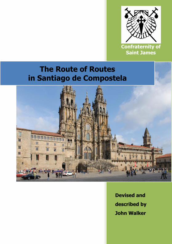
Confraternity of Saint James Devised and described by John Walker The Route of Routes in Santiago de Compostela
| Date post: | 18-Feb-2018 |
| Category: |
Documents |
| Upload: | nguyenthien |
| View: | 219 times |
| Download: | 3 times |
Confraternity of
Saint James
Devised and
described by
John Walker
The Route of Routes in Santiago de Compostela
2
Routes of Routes in Santiago de Compostela
The Route of Routes in
Santiago de Compostela
Devised and described by
John Walker www.johnniewalker-santiago.blogspot.com
This route is dedicated to the staff of the Pilgrims’ Office
in Santiago de Compostela and the pilgrims they serve

3
Routes of Routes in Santiago de Compostela
The Route of Routes in
Santiago de Compostela
Walk on five caminos,
go through three parks, meander up and down two forest trails,
visit important churches and buildings along the way, and, most of all, enjoy the best view there is of Santiago
high above the city! The route takes between 3 and 3.5 hours, depending on your
pace, or much longer depending on where you stop, linger or visit.
Why walk this route? For visitors: You know that Santiago is a pilgrim town and you may have seen walking pilgrims arriving in the Plaza Obradoiro before visiting the tomb of Saint James which has been the final destination for millions of pilgrims for hundreds of years.
You may not be able to walk several hundred kilometres to Santiago along one of the pilgrim routes but you might like to follow some of the routes for a short way and in doing so get a taste of the Camino, follow the same yellow arrows and other waymarks the pilgrims follow and see parts of Santiago often hidden from view. For pilgrims: You have arrived in Santiago and you only have a couple of days to see the city. The friends you have met on the Camino have dispersed and you’d love to keep walking, for example to Finisterre, but you just don’t have time. You may have been met in Santiago by a friend or loved one and
4
Routes of Routes in Santiago de Compostela
you’d like them to get a taste of the Camino as well as seeing Santiago. Or you just want some time to yourself, to walk, sit, relax, reflect, remember and be thankful for the wonderful experience you have had on Camino. These are only a few of the reasons you might wish to walk this beautiful and historic route. No matter which route you have walked your feet will once again travel a part of that route.
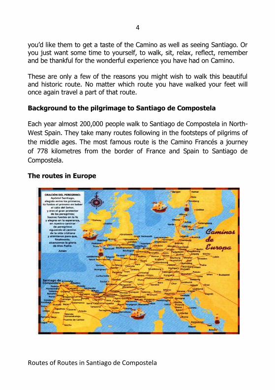
Background to the pilgrimage to Santiago de Compostela Each year almost 200,000 people walk to Santiago de Compostela in North-
West Spain. They take many routes following in the footsteps of pilgrims of
the middle ages. The most famous route is the Camino Francés a journey
of 778 kilometres from the border of France and Spain to Santiago de
Compostela.
The routes in Europe
5
Routes of Routes in Santiago de Compostela
The Saint, the book, the priest and the paintbrush
The Saint and the Book
St James was Zebedee’s son and brother of St John the Evangelist.
Legend has it that after spending some years in Spain preaching the
Gospel, James returned to Jerusalem and martyrdom. His followers are
believed to have carried his body down to the coast and put it into a stone
boat, which was carried by angels and the wind to land in the North of
Spain. The site of his tomb was lost for some 800 years when a hermit
called Pelayo discovered the burial place having been guided there by
heavenly music and a star. The relics were authenticated by the Church
and it became a place of pilgrimage and grew into the city of Santiago de
Compostela.
The popular derivation of the name Compostela holds that it comes from
the Latin campus stellae or “field of star”. Santiago means “St James”. Thus
the name Santiago de Compostela is “St James in the Field of the Star”.
However a more academic view is that the name Compostela derives from
the Latin compostare meaning “to bury”.
In medieval times the pilgrimage grew in popularity. People set off from
their homes and walked from all over Europe to Santiago. Religious Orders
provided shelter along the way and there grew up a network of refuges in
which pilgrims could sleep.
Such was the growth in numbers that in 1119 the first Holy Year was
instituted by Pope Calixstus – when these are celebrated the Puerta Santa
(Holy Door), which gives access to the cathedral, is opened on 31st
December on the eve of each Holy Year, and walled up again a year later.
A special indulgence is granted to pilgrims during the Holy Year.
In the 12th Century an illuminated set of manuscripts was brought together
now known as the Codex Calixtinus.
6
Routes of Routes in Santiago de Compostela
The Codex, alternatively known as the Liber Sancti Jacobi, or the “Book of
Saint James”, was intended to be a source of background detail and advice
for pilgrims following the Way of St James. It contains sermons, reports of
miracles and liturgical texts associated with St James, and a set
of polyphonic musical settings. It is also held to be the first Pilgrim Guide
because of the route descriptions it contains.
The book was stolen from its security case in the Cathedral archives on 3 July 2011. It has not yet been recovered. The priest and the paintbrush
Over the last 40 years the Santiago pilgrimage has seen a great revival and
in the 2010 Holy Year 271,000 pilgrims walked to Santiago. Perhaps the
biggest contribution to this revival came from Father Elias Valiña Sampedro.
He was a scholar who, following the historical records, marked out the
many routes taken by the medieval pilgrims by painting yellow arrows
approximately every 1000 paces.
Of the many stories about Father Elías this one perhaps captures him best.
One day in 1982, with fears of terrorism rife, the sight of yellow arrows
painted on trees along a Pyrenean road aroused the suspicion of the
Guardia Civil. Following the trail, they came upon a battered white van. A
small, smiling man got out. When prompted, he opened the van's back
doors to reveal tins of bright yellow paint and a wet paintbrush.
"Identification!" barked the Guardia.
"I'm Don Elías Valiña Sampedro, parish priest of O Cebreiro in Galicia".
"And what are you doing with all this?"
"Preparing a great invasion…"
The rest – apart from the Guardia's reply – is history!
7
Routes of Routes in Santiago de Compostela
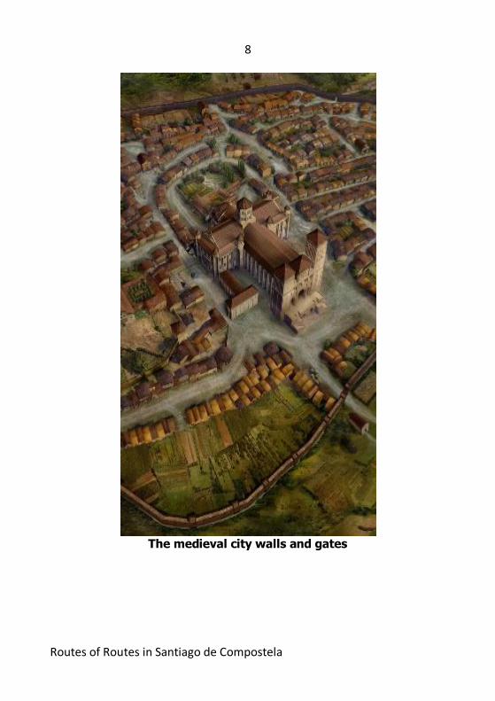
Therefore the modern pilgrim can follow the yellow arrows from Saint-Jean-
Pied-de-Port in France all the way to Santiago on the Camino Francés, or
from La Coruña in the North, where pilgrims arrived by boat on the Camino
Inglés, or on the 1000 km route from Seville in the South on the Vía de la
Plata. These are only a few of the many routes.
The work of Fr Elias and the voluntary associations called the Amigos de
Santiago also helped build up a huge network of modern refuges for
pilgrims, just like their medieval counterparts, so that all along each route
there are refuges for rest and sleep for a donation or a small charge of a
few euros. As the saying goes: “Pilgrims give what they can and take what
they need”.
All along the routes pilgrims receive a warm and generous welcome from
the people of Spain.
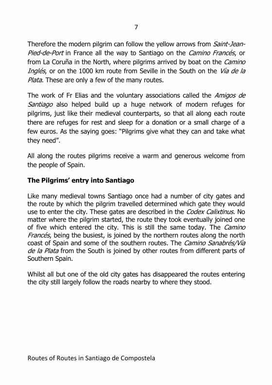
The Pilgrims’ entry into Santiago Like many medieval towns Santiago once had a number of city gates and the route by which the pilgrim travelled determined which gate they would
use to enter the city. These gates are described in the Codex Calixtinus. No matter where the pilgrim started, the route they took eventually joined one of five which entered the city. This is still the same today. The Camino Francés, being the busiest, is joined by the northern routes along the north coast of Spain and some of the southern routes. The Camino Sanabrés/Vía de la Plata from the South is joined by other routes from different parts of Southern Spain. Whilst all but one of the old city gates has disappeared the routes entering the city still largely follow the roads nearby to where they stood.
8
Routes of Routes in Santiago de Compostela
The medieval city walls and gates
9
Routes of Routes in Santiago de Compostela
Colour Key: Cyan - Camino Inglés, Blue – Finisterre Route, Red – Camino Portugués, Green – Camino Sanabrés, Yellow – Camino
Francés.
The Route of Routes – Suggested Packing list If you are a pilgrim to Santiago take: Your credencial – so that you can sit and remember the places you visited on the way. Your camera – to take more photographs today and also to remember the people you met and the places you walked through on your Camino. A packed lunch – to have a picnic with friends or on your own as you view the city from the highest point of this route.
10
Routes of Routes in Santiago de Compostela
Either walking shoes or sandals if you are comfortable walking in them. The route passes along pavements, roads and country trails. Water – and wine if you want to celebrate whilst having lunch! Is the route easy to walk?
The route is designed in two halves – like a figure of 8. The first and last parts of the route are easy walking through city streets. The middle section of the route ascends through country paths to the point of Monte Pedroso which stands at 461 metres above sea level. Santiago itself is 260 metres above sea level. The views are spectacular and whilst experienced walkers will find the ascent straightforward those who haven’t done any serious walking for a while may find parts of it challenging. If you choose this option take your time, take water if it is hot and rest at the many places available. The distance to the top of Monte Pedroso is 4kms from the starting point and the descent is 3 kms. Therefore leave at least 2 hours
plus time for rests. If you choose not to ascend the mountain the point at which you continue on the route is clearly indicated in this guide. How long is the Route of Routes? The route is approximately 14 kms in length. This divides almost equally between walking on the Camino routes through Santiago and the ascent and descent of Monte Pedroso. However set aside plenty of time to walk
the route because you will want to stop, linger, visit galleries and churches and just enjoy the many views you will encounter. If you have time you may wish to walk the route in two halves over two days. Key to Walking notes: L = Left, R = Right, KSO = Keep Straight On
11
Routes of Routes in Santiago de Compostela
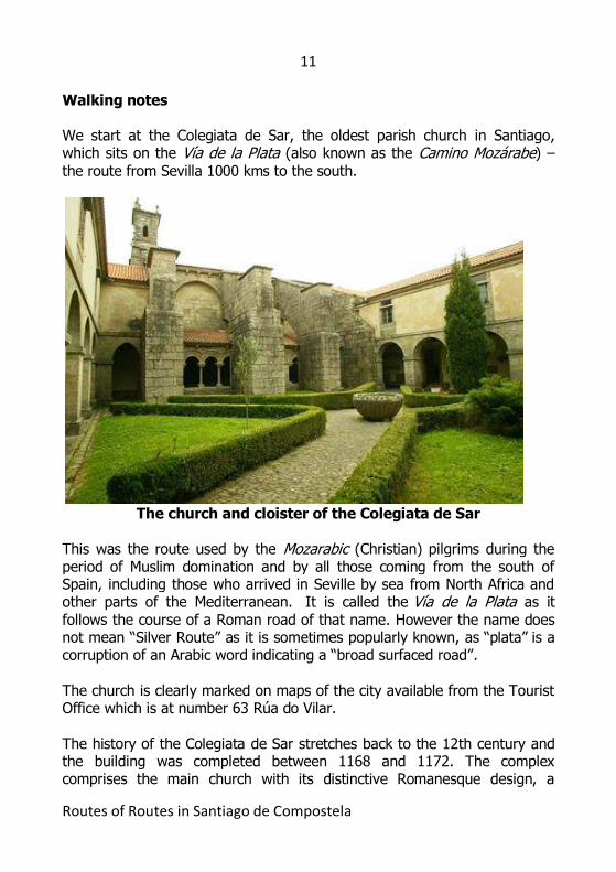
Walking notes We start at the Colegiata de Sar, the oldest parish church in Santiago, which sits on the Vía de la Plata (also known as the Camino Mozárabe) – the route from Sevilla 1000 kms to the south.
The church and cloister of the Colegiata de Sar
This was the route used by the Mozarabic (Christian) pilgrims during the period of Muslim domination and by all those coming from the south of Spain, including those who arrived in Seville by sea from North Africa and other parts of the Mediterranean. It is called the Vía de la Plata as it follows the course of a Roman road of that name. However the name does not mean “Silver Route” as it is sometimes popularly known, as “plata” is a corruption of an Arabic word indicating a “broad surfaced road”. The church is clearly marked on maps of the city available from the Tourist Office which is at number 63 Rúa do Vilar. The history of the Colegiata de Sar stretches back to the 12th century and the building was completed between 1168 and 1172. The complex comprises the main church with its distinctive Romanesque design, a
12
Routes of Routes in Santiago de Compostela
beautiful cloister and a museum. The church is characterised by a series of pillars which appear to be collapsing into the central nave. Originally some thought this was due to intentional architectural genius but in fact was caused by subsidence. The construction of the huge external buttresses in the 17th and 18th centuries stopped further movement. The museum is open each day from 10.30 – 1.30pm and 4pm – 7pm. Mass is available in the church from Monday to Saturday at 7pm in winter and 8.30 pm in
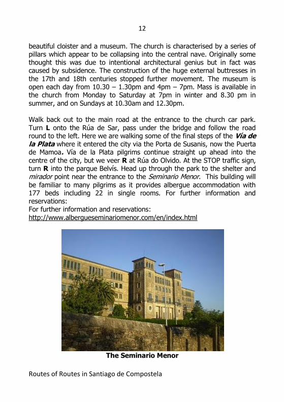
summer, and on Sundays at 10.30am and 12.30pm. Walk back out to the main road at the entrance to the church car park. Turn L onto the Rúa de Sar, pass under the bridge and follow the road round to the left. Here we are walking some of the final steps of the Vía de la Plata where it entered the city via the Porta de Susanis, now the Puerta de Mamoa. Vía de la Plata pilgrims continue straight up ahead into the centre of the city, but we veer R at Rúa do Olvido. At the STOP traffic sign, turn R into the parque Belvís. Head up through the park to the shelter and mirador point near the entrance to the Seminario Menor. This building will
be familiar to many pilgrims as it provides albergue accommodation with 177 beds including 22 in single rooms. For further information and reservations: For further information and reservations: http://www.albergueseminariomenor.com/en/index.html
The Seminario Menor
13
Routes of Routes in Santiago de Compostela
The full title of the Seminario is “La Asunción Minor Seminary Hostel” as it operates both as a seminary and as a school and provides lodging for pilgrims.
(1 km walked) Turn L out of the park, along the Avenida de Quiroga Palacios, passing the Convento de Belvís and the Santuario Virgen del Portal on the right and a seating area on the left. The church is usually
open. The religious community was founded here in the 14th century and was the first home of Dominican nuns in Galicia. The nuns make and sell delicious biscuits and cakes. Ring the bell for attention. KSO, on the Rúa de Belvís, passing the (white) Capela de San Antoniño on the left. Veer L onto the Calzada de San Pedro. KSO to the end of the road where you turn L. Here we are walking some of the final steps of the Camino Francés. Watch out for yellow arrows! Walk down to the traffic lights. This is the famous Porta Francigena now the Porta do Camiño through which pilgrims have entered the city for centuries. They still keep
coming and you can sit in the small park adjacent and see pilgrims arriving at most times of the day. This is the so-called “French way,” leading from the Pyrenees across northern Spain to Santiago de Compostela. It is the most well-known and well-travelled of the pilgrim roads to Santiago. Three of the main routes through France (from Paris, Vézelay and Le Puy-en-Velay) feed into it on the French side of the Pyrenees while the fourth, from Arles, joins it 3-4 days later (for walkers) in Puente la Reina. In 1987 this Camino de Santiago was made the first European Cultural Itinerary.
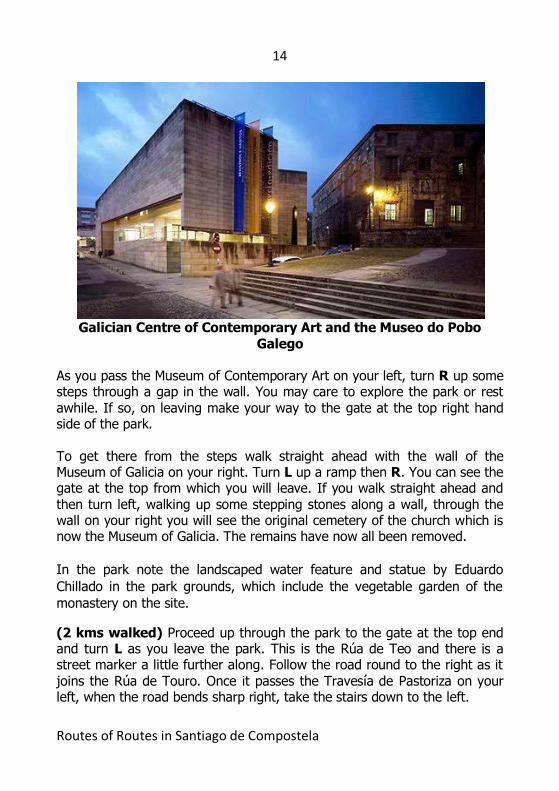
Camino Francés pilgrims continue straight on ahead into the centre of the city, but we turn sharp R at the Porto do Camiño traffic lights, onto the Costa de San Domingos. Enter the parque de San Domingos de Bonaval by the zona peatonal between the CGAC (Galician Centre of Contemporary Art) and the Museo do Pobo Galego / Iglesia de San Domingos de Bonaval. This is the “Museum of Galicia” and is open from Monday to Friday from 10am – 2pm and 4pm – 8pm as well as Sundays from 11am – 2pm. NB The museums are closed on Mondays. There are toilets and an excellent restaurant with an open-air section adjoining the route.
14
Routes of Routes in Santiago de Compostela
Galician Centre of Contemporary Art and the Museo do Pobo
Galego As you pass the Museum of Contemporary Art on your left, turn R up some steps through a gap in the wall. You may care to explore the park or rest awhile. If so, on leaving make your way to the gate at the top right hand side of the park. To get there from the steps walk straight ahead with the wall of the Museum of Galicia on your right. Turn L up a ramp then R. You can see the gate at the top from which you will leave. If you walk straight ahead and then turn left, walking up some stepping stones along a wall, through the wall on your right you will see the original cemetery of the church which is now the Museum of Galicia. The remains have now all been removed.
In the park note the landscaped water feature and statue by Eduardo
Chillado in the park grounds, which include the vegetable garden of the
monastery on the site.
(2 kms walked) Proceed up through the park to the gate at the top end and turn L as you leave the park. This is the Rúa de Teo and there is a street marker a little further along. Follow the road round to the right as it
joins the Rúa de Touro. Once it passes the Travesía de Pastoriza on your left, when the road bends sharp right, take the stairs down to the left.
15
Routes of Routes in Santiago de Compostela
At the bottom of the stairs, cross the first pedestrian crossing and turn left to walk along the Rúa da Pastoriza. On your right is a roundabout with a well known statue of a pilgrim. Here we are walking some of the final steps of the Camino Inglés. Continue along this street, passing the Capilla de Pastoriza on the left on the other side of the road. The street leads to a smaller one to the right of the main road: the Rúa Santa Clara. Take this street, passing the Convento del Carmen on your right. At this point the
large building up to your left on the main road is the Convento de Santa Clara. Continue ahead onto the Rúa dos Loureiros. Here we are near the Porta Poennae now the Porta de la Pena the traditional entrance of pilgrims on the Camino Inglés. Nowadays they pass along the Rúa Porta da Pena. The Camino Inglés is sometimes called in Spanish the Antiguo Camino Real (the old royal route), a term which still appears occasionally. The Camino Inglés provided a short, direct route from Ferrol or A Coruña to Santiago and was therefore used by pilgrims of various nationalities from northern Europe, who had travelled to Galicia by sea. (3 kms walked) Camino Inglés pilgrims continue straight on ahead into the centre of the city here, but we turn R to go down the stairs of the Costa Vella. If you wish, before going down the stairs, KSO ahead for 50 metres. To your right is the monumental Church of San Martin Pinario, now a museum. It is well worth a visit. Take your credencial to be admitted half price. To your left lies the Museum of Pilgrimages. Again this is worth a visit and entry is free. If you have visited San Martin Pinario or the museum retrace your steps and proceed down the stairs of the Costa Vella.
At the bottom of the stairs on the right is Santiago’s main public library, and straight ahead is the Iglesia de San Francisco. There is Mass everyday at 1pm. The church is huge and beautiful and is served by the Order of Franciscans who also run a small albergue providing spiritual retreats for pilgrims (by arrangement) and a shelter for homeless people. Cross over the small square in front of the church, and the large stone sculpture of San Francisco, passing the 4* Hotel San Francisco which now occupies the former monastery. Go down the Costa de San Francisco, following the wall/road round to the left, on to the Rúa das Carretas. KSO till you turn R, on to the Rúa Hortas. At the corner sits the parish Church of San Fructuoso which is open daily for visits. Walk down the Rúa Hortas.
16
Routes of Routes in Santiago de Compostela
Here, with the Cathedral directly behind us, we are walking some of the first steps of the route to and from Finisterre and/Muxia. Pilgrims would have left or arrived by the Porta de Sancto Peregrino, now the Puerta de la Trinidad. According to the Codex Calixtinus the Trinidad Chapel just outside this gate is where pilgrims were buried. Finisterre (Fisterra in Galician) was both the end of the known world until
Columbus altered things and the final destination of many of the pilgrims who made the journey to Santiago in past centuries. There are various explanations as to how this continuation came about (one such is that it was based on a pre-Christian route to the pagan temple of Ara Solis in Finisterre, erected to honour the sun) but it is also known that a pilgrim infrastructure existed, with “hospitals” in Cée, Corcubión, Finisterre itself and elsewhere. Pilgrims in past centuries also continued northwards up the coast to the Santuario de Nuestra Señora de la Barca in Muxía, 29km north of the “end of the world” itself. At the bottom of the street, at the traffic lights, cross over the Rúa do
Pombal. Here Finisterre/Muxía pilgrims continue ahead on the street to the left (the Rúa do Cruceiro do Gaio), but we take the middle passageway, up concrete steps, between this street on our left and the Rúa de Entregaleras on our right. This leads on to the Calzada do Carme de Abaixo. At the bottom of this street, cross the Roman bridge (carefully!) and pass the Capilla del Carmen, which is served by the Church of San Fructuoso on the left, continuing on the narrow pavement to the left of the road. After a short while, where there are new houses and a new road to the right, you will see up ahead the television masts at Monte Pedroso. We will be going up from here to the left, and coming back down from the right.
(5 kms walked) NB. If you do not wish to make the journey to and from Monte Pedroso, a round trip of 7 kms with an elevation of 461 metres, turn back here and follow the directions below marked X. Continue for another short while on this road, crossing over to the right – when you reach a group of buildings and a garage on the right – to take care on a blind bend on the road. At the house on the right, turn R up a small road, the Rúa de San Paio do Monte. At a T junction, with the Capilla de San Paio over to the right, turn L and continue on the path straight ahead, ignoring the road that continues through the pueblo to the right.
17
Routes of Routes in Santiago de Compostela
KSO this path, initially with a concrete wall and views of the Cathedral of Santiago on your left, and continue on the path through the trees. At the first small junction veer R and shortly come to a clearing. Cross the clearing through the gap in the wall and continue down the path on the other side. Near the bottom follow the path round to the road on your left, to the park gate and a small parking area. At the end of the parking area turn R on the start of a forest path marked with a red arrow on a granite marker. These
waymarks continue to the pinnacle. About 100m along this path, veer L (i.e. don’t take the other entrance into the park), as indicated by the red arrow on the stone wall, up a small hill. At the top go L and follow the path round to the R (where you will see a red arrow on the stone to your right). Keep on this path till you come to a yellow and white wooden marker and a car park with a wooden mounted map of “As Sendas do Monte Pedroso”. With the car park in front of you turn sharp right at a small granite stone near ground level and a red and white wooden marker. There is a (faded) red arrow on a stone to the right as you go up this small hill. Shortly, as the path runs alongside the tarmac road, go through the “Area Recreativa
Lixo”, and turn L onto the path marked “Merendeiro”. This path winds up and round to a large recreation and BBQ area, before it meets the tarmac road again. Cross the road and, almost immediately, turn R onto a narrow path, marked by a small red dot on a stone on the ground to your right. This leads onto a wider path marked by a red dot on a tree to the left. Continue on up until you reach a small piece of open ground with 3 path choices ahead. Take the narrow one in the middle, marked by a red arrow on a stone on the ground to your right. Continue on up this path, marked by red
arrows and small dots. As you make your final ascent, you will see the Monte Pedroso cruceiro (stone cross) and TV mast straight ahead, and the emerging spectacular views of Santiago on your right. Follow the red markings all the way to the top. At Monte Pedroso, at the foot of the cruceiro, there is a mirador area with stone seats: sit; look out at the wonderful view; rest and be thankful!
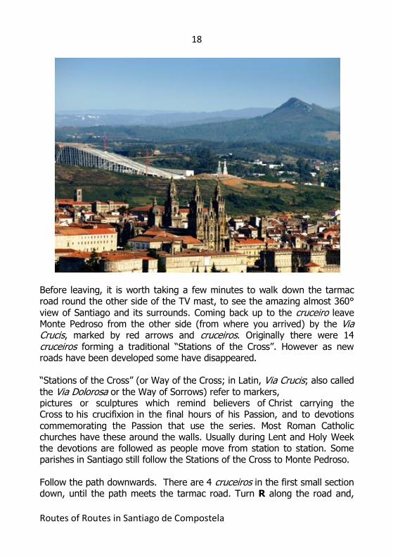
18
Routes of Routes in Santiago de Compostela
Before leaving, it is worth taking a few minutes to walk down the tarmac road round the other side of the TV mast, to see the amazing almost 360°
view of Santiago and its surrounds. Coming back up to the cruceiro leave Monte Pedroso from the other side (from where you arrived) by the Via Crucis, marked by red arrows and cruceiros. Originally there were 14 cruceiros forming a traditional “Stations of the Cross”. However as new roads have been developed some have disappeared. “Stations of the Cross” (or Way of the Cross; in Latin, Via Crucis; also called the Via Dolorosa or the Way of Sorrows) refer to markers, pictures or sculptures which remind believers of Christ carrying the Cross to his crucifixion in the final hours of his Passion, and to devotions
commemorating the Passion that use the series. Most Roman Catholic churches have these around the walls. Usually during Lent and Holy Week the devotions are followed as people move from station to station. Some parishes in Santiago still follow the Stations of the Cross to Monte Pedroso. Follow the path downwards. There are 4 cruceiros in the first small section down, until the path meets the tarmac road. Turn R along the road and,
19
Routes of Routes in Santiago de Compostela
after about 100m, turn L down another forest path with a cruceiro on the left. Follow this winding path down. It is marked by a further 2 cruceiros and a large red arrow on a small stone outhouse building, where the path veers to the right and comes to another cruceiro at a tarmac road lined by modern lamp posts. Turn L down the hill. If you walk in the centre of the road (carefully!) a
fantastic view of Santiago Cathedral is straight ahead. KSO, with houses to your right and left, till you come to the main junction and cruceiro. There is a bar on your left and what may appear a strange concrete building in front of you. This is the official residence of the President of Galicia and is known locally as “the bunker”. Turn Left at the cruceiro and follow the road downhill. Very shortly turn R to go along a path alongside the President’s residence which is on your right. (Alternatively take the paved path which is down to the left of this one). KSO this path in a straight line and when the path veers to the right
at the end of the wall KSO ahead on the grass. There are stone seats in this area. When you reach the boundary wall head downhill to your left. At the bottom descend the stairs then take another stair case on your left passing along side a block of flats and immediately turn R to follow a very pleasant river walkway all the way back to the Roman bridge from which you began the ascent to Monte Pedroso. X. (12 kms walked) Cross back over the Roman bridge, and go up the hill, veering R to cross the Rúa da Poza de Bar. Walk up the Rúa Campo do Cruceiro do Gaio and turn R into the Avenida de Compostela. Follow the
road round to the left and cut through, or pass, a play park to climb the stairs on your left. At the top, from the mirador in the parque Alameda, you can see the main campus of the University of Santiago.
20
Routes of Routes in Santiago de Compostela
With the university and mirador behind you, take the path round the park to your R, passing the Escuela Infantil. Go down the stairs and, at the church on your right, the Iglesia de Pilar, KSO following the yellow arrows leading you through, and to the exit of, the parque Alameda. Here we are walking some of the final steps of the Camino Portugués which entered the city by the Porta de Falgueriis now the Puerta Fajera. This route, which heads north following the Atlantic coast of Portugal and Spain, was used by Queen Isabel of Portugal (1271 – 1336) to make at least one pilgrimage to Santiago de Compostela. Queen Isabel was canonized in 1626 and this is celebrated on her feast day, the 8th of July. Camino Portugués pilgrims continue straight up ahead into the centre of the city – and so do we! At the exit of the park, cross the road at the traffic lights, and proceed through the traditional Portuguese entrance to the city the Porta Faxeira. Proceed ahead taking the Rúa do Franco on the left all the way into the Praza do Obradoiro ... where we have arrived ... again! (14 kms walked)
21
Routes of Routes in Santiago de Compostela
For the visitor – what pilgrims do now Pilgrims arriving in Santiago have had their own rituals for centuries. Even although you may not have walked hundreds of kilometres on this Route of Routes you have walked in the footsteps of millions of pilgrims. When you get to the cathedral you may wish to do what they have done and continue to do every time they arrive.
The Pillar, the Hug and the Tomb Each day pilgrims arrive at the Cathedral Square but their journey is not at an end, they still have things to do. Entering the cathedral each pilgrim first touches the pillar depicting the Tree of Jesse, where now you can actually put your fingers into grooves marked by centuries of hands. This is closed off for restoration at this time but you can easily see the handprint.
Then they walk to the back of the high altar to rise behind the statue of St James to give him the traditional "abrazo" – a warm hug of thanks. Then pilgrims descend to the tomb of the Saint to pray quietly, thanking God for all that has been encountered on the journey here. Seal of Approval – the Compostela
Pilgrims to Santiago de Compostela carry a Pilgrim Passport also called a
credencial with them. They have these stamped everywhere they stop on
the way. This document gives access to the network of refuges provided
along the routes.
Beside the cathedral is the Pilgrims’ Office, just like Passport Control! There the Pilgrim Passport is stamped with the final seal of the Cathedral of Santiago. Those pilgrims who have walked or travelled on horseback at least the final 100 kms, or travelled by bicycle at least the final 200 kms, will have their name written in Latin on the Compostela, the certificate
attesting to their pilgrimage.
22
Routes of Routes in Santiago de Compostela
Those who have followed this Route of Routes cannot receive a Compostela but you will now understand what the queue is for that you may see some days at the Pilgrims’ Office! Pilgrims’ Mass
Each morning around 11am people start to make their way to the
cathedral. It fills quickly and by noon, at busy times of the year, it is
standing room only. Rucksack bearing pilgrims mingle with camera toting
tourists.
At the stroke of noon the cantor intones the entrance antiphon such as
“Laudate Dominum Omnes Gentes” and to the sound of the great organ
1000 voices repeat, “All people praise the Lord”.
The procession enters. Many of the priests are still wearing their walking
boots under their vestments. A long list of the countries from which
pilgrims have arrived in the last 24 hours is read.
The Mass which follows is deeply moving, with different accents and
languages contributing. For the pilgrims there is a profound sense of
thankfullness, relief and celebration that the journey has ended.
For them perhaps...but even during the Mass still they come...rising behind
the altar and hugging the statue of St James.
Holy Smoke – The Botafumeiro
The Botafumeiro (literally “smoke spreader” in Galician) is one of the most
famous and popular symbols of the Cathedral of Santiago de Compostela.
Thjis is a huge censer that swings across the transept of the cathedral
through a pulley system pulled by eight men called tiraboleiros. It weighs
53 kgs and measures five feet in height. It is suspended from a height of
20 metres and canreach a speed of 70 miles per hour.
Some say the Botafumeiro was used as a deodorant in medieval times
when the cathedral was full of pilgrims who hadn’t washed for the duration
23
Routes of Routes in Santiago de Compostela
of their journey. Others say that the billows of incense it produces
symbolise the prayers of the pilgrims.
There are certain times of the year when the Botefumeiro is used for
liturgical purposes at the beginning of the Mass just as a priest would
normally use incense. At other times it is used at the end of the Mass by
special arrangement. You may be lucky and see it.
I hope that you have enjoyed walking this route and using this guide. If you have any suggestions or corrections please send them to me at: [email protected] Johnnie Walker Santiago de Compostela marzo de 2012 www.johnniewalker-santiago.blogspot.com
24
Routes of Routes in Santiago de Compostela
About the Confraternity of Saint James in the United Kingdom
The Confraternity of Saint James in the UK is the largest and oldest English
speaking association of pilgrims.
The Confraternity promotes the pilgrimage to Santiago de Compostela and
provides support and services to pilgrims.
Amongst these services are: Practical Pilgrim Days, where around the
country they provide an opportunity for potential pilgrims to learn more; a
regular members’ bulletin; a bookshop and library. The Confraternity also
promotes research and provides a bursary to young people undertaking
research into the movement around St James and they also offer help to
elderly, frail or disabled people who might otherwise be unable to
undertake the pilgrimage.
The Confraternity publishes guides to many of the routes to Santiago and
also runs two refuges for pilgrims at Rabanal del Camino (on the Camino
Francés) and Miraz (on the Camino del Norte). See more at
www.csj.org.uk.
Copyright © confraternityofstjames2012 Published by the Confraternity of St James Company no 4096721 Charity no 1091140 Website: www.csj.org.uk e-mail: [email protected] ISBN: 978 1 906364 30 4


![WELCOME [caminoways.com]€¦ · 20 Camino de Santiago Facts 1 Camino de Santiago means Way of St James and refers to the routes leading to Santiago de Compostela, in Galicia. 2 Santiago](https://static.documents.pub/doc/80x56/5fa06f1c7f07f8705d35d59b/welcome-20-camino-de-santiago-facts-1-camino-de-santiago-means-way-of-st-james.jpg)


