TO COMBAT TO COMBAT DESERTIFICATION, LAND DESERTIFICATION, LAND DEGRADATION, DROUGHT, DEGRADATION, DROUGHT, AND POVERTY AND POVERTY FY 2004 FY 2004 - 2010 2010 August 2004 August 2004 DEPARTMENT OF AGRICULTURE DEPARTMENT OF AGRICULTURE Bureau of Soils and Water Management Bureau of Soils and Water Management DEPARTMENT OF ENVIRONMENT DEPARTMENT OF ENVIRONMENT AND NATURAL RESOURCES AND NATURAL RESOURCES DEPARTMENT OF SCIENCE AND TECHNOLOGY EPARTMENT OF SCIENCE AND TECHNOLOGY DEPARTMENT OF AGRARIAN REFORM DEPARTMENT OF AGRARIAN REFORM N N ational Action Plan ational Action Plan The Philippine
Transcript
TO COMBATTO COMBAT DESERTIFICATION, LAND DESERTIFICATION, LAND
DEGRADATION, DROUGHT, DEGRADATION, DROUGHT, AND POVERTYAND POVERTY
FY 2004 FY 2004 -- 2010 2010
August 2004August 2004
DEPARTMENT OF AGRICULTUREDEPARTMENT OF AGRICULTURE Bureau of Soils and Water ManagementBureau of Soils and Water Management
DEPARTMENT OF ENVIRONMENTDEPARTMENT OF ENVIRONMENT
AND NATURAL RESOURCESAND NATURAL RESOURCES
DDEPARTMENT OF SCIENCE AND TECHNOLOGYEPARTMENT OF SCIENCE AND TECHNOLOGY
DEPARTMENT OF AGRARIAN REFORMDEPARTMENT OF AGRARIAN REFORM
NN ational Action Planational Action Plan The Philippine
2
C o n t e n t s 3 Endorsement 5 Joint Terms of Reference— DA, DENR, DOST, DAR 7 Messages 13 List of Acronyms 14 Executive Summary 16 Introduction 18 Philippine Scenario on Land Degradation and Drought 31 Previous and Current Efforts to Combat Land Degradation and Mitigate Drought Effects 35 General Plan of Actions (FY 2004—2010) 37 Salient Features of the National Action Plan 54 Expected Outputs 57 Implementation Arrangements and Schedule of Proposed Action Programs 58 ANNEX 1. Relevant Legislations Addressing the Underlying Factors Causing Massive Land
Degradation in the Philippines 60 ANNEX 2. Climatic Types Affecting Luzon, Visayas and Mindanao Islands 62 ACKNOWLEDGEMENT 64 GLOSSARY OF TERMS 67 REFERENCES
Soil conservation farming to arrest land degradation, BSWM-JICA Techno Demo Farm, Impasug-ong, Bukidnon
NATIONAL COOPERATION AND ENDORSEMENT FOR THE IMPLEMENTATION OF
THE PHILIPPINE NATIONAL ACTION PLAN TO COMBAT DESERTIFICATION, LAND DEGRADATION, DROUGHT AND POVERTY
IN SUPPORT TO THE UNITED NATIONS CONVENTION TO COMBAT DESERTIFICATION, AND LAND DEGRADATION (UNCCD)
We acknowledge that the Philippines has become increasingly vulnerable to drought and land degradation as a result of increasing recurrence of dry spell and alternating incidence of El Niño and La Niña as well as poor management of land, freshwater, and watershed resources, all resulting into decline in land productivity, food insecurity and poverty; That dry lands of agriculture are easily equated with food insecurity and widespread poverty because of their declining productivity and increasing economic and environmental cost to sustain desired level of production that results in the inability of vulnerable communities to access and buy safe and nutritious food; That these pressing problems in seasonally arid/dry lands and drought vulnerable areas need to be urgently addressed; That the formulation of the Philippine National Action Program (NAP) to combat land degradation, drought and desertification shall serve this specific purpose; That the NAP shall likewise, serve as a comprehensive and well-focused policy instrument and provide the platform of convergence in policy and actions of the four umbrella agencies in the country, namely, the Department of Agriculture (DA), the Department of Agrarian Reform (DAR), the Department of Environment and Natural Resources (DENR), and the Department of Science and Technology (DOST), in combating land degradation, rehabilitation of degraded lands and preservation of threatened ecosystems with a view to alleviate poverty in degraded, seasonally arid and drought vulnerable areas in the country. Considering that the Philippines is fully committed to support the full implementation of the and that its overall agenda are both global and of national concerns, we, the undersigned, hereby fully support and endorse the substance and development principles embodied in the Philippine National Action Plan and the timely implementation of its thematic programs to combat land degradation and drought and reduce their impacts on land productivity, natural resources, environmental health and rural poverty. We hereby affix our signature this 12th day of August 2004 at the Dusit Hotel Nikko, Makati City, Philippines.
HON. LUIS P. LORENZO, JR. Secretary
Department of Agriculture
HON. ELISEA G. GOZUN Secretary
Department of Environment and Natural Resources
HON. JOSE MARI B. PONCE Secretary
Department of Agrarian Reform
HON. ESTRELLA F. ALABASTRO Secretary
Department of Science and Technology
3
4
5
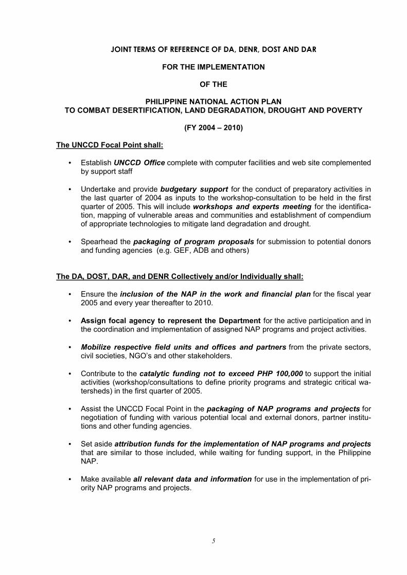
JOINT TERMS OF REFERENCE OF DA, DENR, DOST AND DAR
FOR THE IMPLEMENTATION
OF THE
PHILIPPINE NATIONAL ACTION PLAN TO COMBAT DESERTIFICATION, LAND DEGRADATION, DROUGHT AND POVERTY
(FY 2004 – 2010)
The UNCCD Focal Point shall:
• Establish UNCCD Office complete with computer facilities and web site complemented by support staff
• Undertake and provide budgetary support for the conduct of preparatory activities in
the last quarter of 2004 as inputs to the workshop-consultation to be held in the first quarter of 2005. This will include workshops and experts meeting for the identifica-tion, mapping of vulnerable areas and communities and establishment of compendium of appropriate technologies to mitigate land degradation and drought.
• Spearhead the packaging of program proposals for submission to potential donors
and funding agencies (e.g. GEF, ADB and others) The DA, DOST, DAR, and DENR Collectively and/or Individually shall:
• Ensure the inclusion of the NAP in the work and financial plan for the fiscal year 2005 and every year thereafter to 2010.
• Assign focal agency to represent the Department for the active participation and in
the coordination and implementation of assigned NAP programs and project activities.
• Mobilize respective field units and offices and partners from the private sectors, civil societies, NGO’s and other stakeholders.
• Contribute to the catalytic funding not to exceed PHP 100,000 to support the initial
activities (workshop/consultations to define priority programs and strategic critical wa-tersheds) in the first quarter of 2005.
• Assist the UNCCD Focal Point in the packaging of NAP programs and projects for
negotiation of funding with various potential local and external donors, partner institu-tions and other funding agencies.
• Set aside attribution funds for the implementation of NAP programs and projects
that are similar to those included, while waiting for funding support, in the Philippine NAP.
• Make available all relevant data and information for use in the implementation of pri-
ority NAP programs and projects.
6
N ATIONAL ACTION PLAN
The Philippine
7
Message from the Secretary of Agriculture
The Department of Agriculture, together with our partner agencies (DENR, DAR, DOST) joins the United Nations Convention to Combat Desertification (UNCCD) in vigorously addressing food security issues and concerns, as well as showing the commitment of the Filipino people in taking care of our land and water resources, forests and watersheds. As we continuously implement various initiatives to sustain the growth of the country’s agriculture and fishery sector, the stakes become even greater as we experience unfavorable natural phenomena such as El Niño and the resulting dry spells or droughts. It is therefore imperative to formulate and implement a set of goals to mitigate the incidence and adverse effects of such harsh events like land degradation that make farmlands less productive, thus further aggravating poverty in affected areas. We therefore welcome this Philippine National Action Plan to Combat Desertification, Land
Degradation, Drought and Poverty, which is anchored on sustainable long-term agricultural production, and preservation of land and water resources for the benefit of the current and future generations of Filipinos. I have always believed that given the access to technologies, together with our joint efforts to protect and conserve our natural resource base, our farmers could be productive and attain hunger-free conditions. Combating desertification, land degradation, drought and poverty is indeed an enormous task, but I am confident that we could surmount the challenges ahead. Let us therefore seize every opportunity to restore our land and water resource productivity towards achieving food security at all times, thus ensuring our future and those of our children and grandchildren. As I embark on my new challenging task, I enjoin the DA family and all other stakeholders to take active part in the implementation of this Action Plan that will undoubtedly contribute to
achieving our goal of a better quality of life, which Filipinos rightfully deserve. Again, I commend the men and women who actively participated in the preparation of this document, spearheaded by the Bureau of Soils and Water Management. Congratulations and more power! HON. ARTHUR C. YAP Secretary
8
Message from the Secretary of Environment and Natural Resources
We, from the Department of Environment and Natural Resources with the main task to protect our fragile environment, fully support the principles and framework of the UNCCD that are now in the context of the Philippine National Action Plan to combat desertification, land degradation, drought and poverty. The National Action Plan is a task of renewing and strengthening partnerships with other departments of the same concerns: Department of Agriculture, Department of Agrarian Reform and the Department of Science and Technology towards a common goal of improving the environment and helping raise productivity at the very community level. Each sector has a vital role to promote, enhance and preserve natural resource base and motivate the community for sustainable development.
As our environment copes with recurrent climatic changes and vigorously strives for restoration of depleting natural resources, our goals have taken an imperative social, economic and environmental dimension - to uplift the lives of the poor farmers, especially those in the communities of hotspots and critical watershed areas. By working together in one action plan and toward a common vision, we can all push onwards to protect and conserve our environment but more so, eradicate poverty and achieve food security for the entire Filipino people. HON. ELISEA G. GOZUN Secretary
N ATIONAL ACTION PLAN
The Philippine
9
Message from the Secretary of Science and Technology
When Dr Roger Concepcion, Director of the Bureau of Soils and Water Management and UNCCD Focal Person pre-sented to me the draft UNCCD NAP on July 30, I said “count us in” as this is a worthwhile endeavor crafted to address the country’s problems related to land degradation. I was also pleased to note that even be-fore this convergence effort among the DA, DENR, DOST, and DAR, a DOST concerned unit, that is, PCARRD, has al-ready been actively involved in related S and T activities. Combating desertification, drought, and various forms of land degradation are among the priorities being addressed by the DOST, through PCARRD under its Medium Term Research and Develop-ment Plan for 1999-2004. With the drafting of the new COR-PLAN (Corporate Plan) 2004-2010, again, this concern fig-ures prominently under the core heading of natural re-sources management. The NAP serves as potent ave-nue to showcase how the four departments are gearing efforts toward a common goal. Amidst the country’s financial
crisis, one solution that comes to mind is the pooling together of resources and identifying activities along similar and in-ter-departmental concerns such as the protection, preser-vation, and conservation of fragile environments. Our ulti-mate objective is to reduce poverty especially among the poorest of the poor who live in the marginal areas. The role of DOST cannot be overempha-sized in this fight against land degradation and desertification. Science-based knowledge is crucial to better management of natural resources. Indeed, the call of the times anchors on working together and setting aside personal in-terests that hamper our devel-opment on a sustainable basis. We, at the DOST, are your committed partners in the NAP finalization and eventual imple-mentation. We hope that in the days to come, we all, would be able to prepare the details of the plan, showing the specific commitments, roles, and ex-pectations so that our chances of meeting our set goals and targets would be responsive, effective, and within the limits of our resources – be it human,
financial, or according to time bounds. Again, congratulations to the DA-BSWM for spearheading this sig-nificant mileage in the country’s long history of battle against in-discriminate use of resources. Our accolade to the BSWM, Dr. Concepcion, and his staff for making a significant leap in bringing together the four depart-ments to work hand-in-hand to-ward the realization of sustain-able development in the country.
HON. ESTRELLA F. ALABASTRO Secretary
10
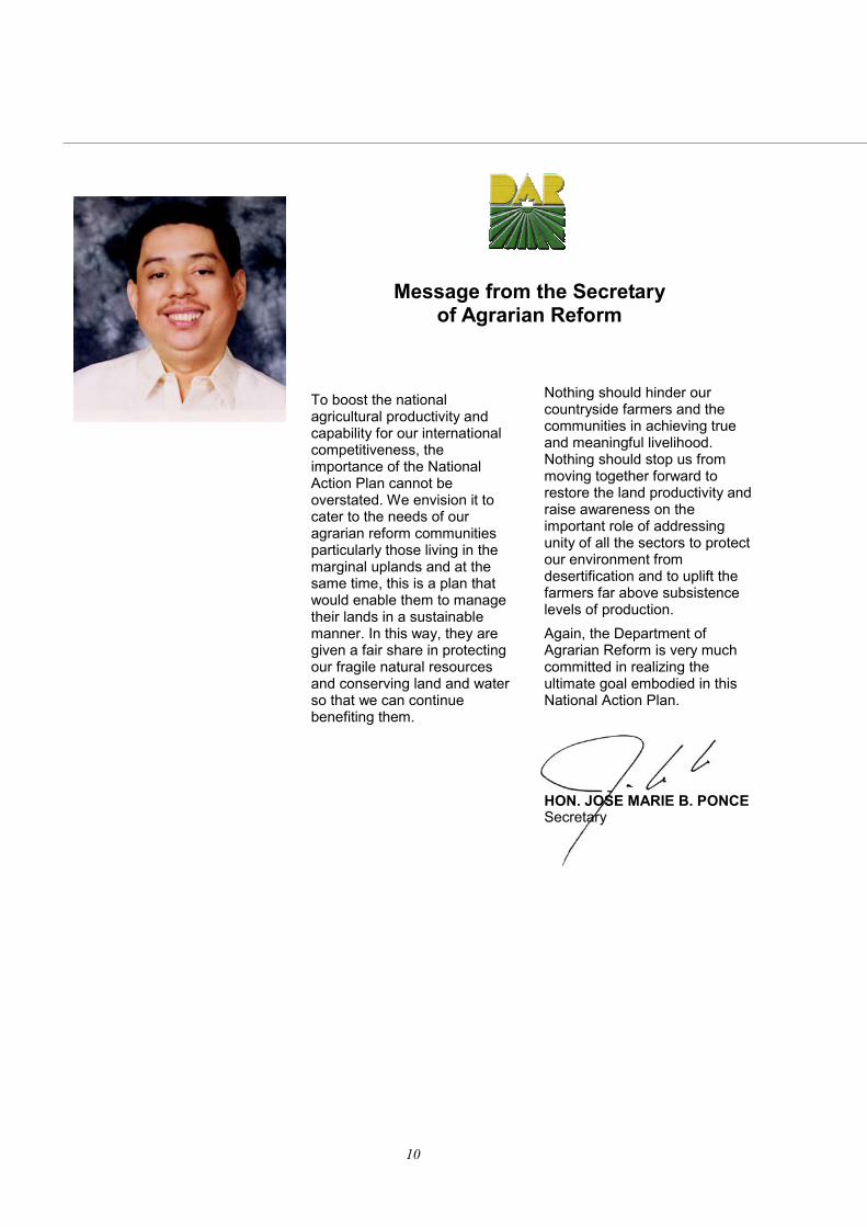
Message from the Secretary of Agrarian Reform
To boost the national agricultural productivity and capability for our international competitiveness, the importance of the National Action Plan cannot be overstated. We envision it to cater to the needs of our agrarian reform communities particularly those living in the marginal uplands and at the same time, this is a plan that would enable them to manage their lands in a sustainable manner. In this way, they are given a fair share in protecting our fragile natural resources and conserving land and water so that we can continue benefiting them.
Nothing should hinder our countryside farmers and the communities in achieving true and meaningful livelihood. Nothing should stop us from moving together forward to restore the land productivity and raise awareness on the important role of addressing unity of all the sectors to protect our environment from desertification and to uplift the farmers far above subsistence levels of production. Again, the Department of Agrarian Reform is very much committed in realizing the ultimate goal embodied in this National Action Plan. HON. JOSE MARIE B. PONCE Secretary
N ATIONAL ACTION PLAN
The Philippine
11
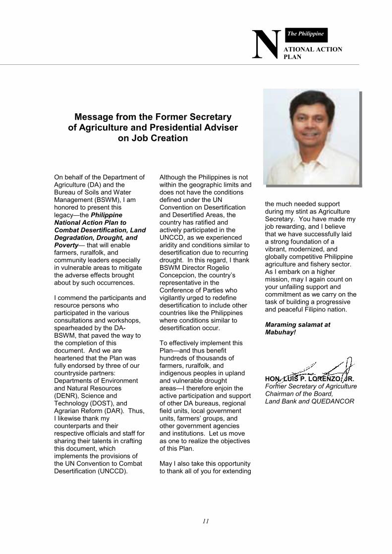
Message from the Former Secretary of Agriculture and Presidential Adviser
on Job Creation
On behalf of the Department of Agriculture (DA) and the Bureau of Soils and Water Management (BSWM), I am honored to present this legacy—the Philippine National Action Plan to Combat Desertification, Land Degradation, Drought, and Poverty— that will enable farmers, ruralfolk, and community leaders especially in vulnerable areas to mitigate the adverse effects brought about by such occurrences. I commend the participants and resource persons who participated in the various consultations and workshops, spearheaded by the DA-BSWM, that paved the way to the completion of this document. And we are heartened that the Plan was fully endorsed by three of our countryside partners: Departments of Environment and Natural Resources (DENR), Science and Technology (DOST), and Agrarian Reform (DAR). Thus, I likewise thank my counterparts and their respective officials and staff for sharing their talents in crafting this document, which implements the provisions of the UN Convention to Combat Desertification (UNCCD).
Although the Philippines is not within the geographic limits and does not have the conditions defined under the UN Convention on Desertification and Desertified Areas, the country has ratified and actively participated in the UNCCD, as we experienced aridity and conditions similar to desertification due to recurring drought. In this regard, I thank BSWM Director Rogelio Concepcion, the country’s representative in the Conference of Parties who vigilantly urged to redefine desertification to include other countries like the Philippines where conditions similar to desertification occur. To effectively implement this Plan—and thus benefit hundreds of thousands of farmers, ruralfolk, and indigenous peoples in upland and vulnerable drought areas—I therefore enjoin the active participation and support of other DA bureaus, regional field units, local government units, farmers’ groups, and other government agencies and institutions. Let us move as one to realize the objectives of this Plan. May I also take this opportunity to thank all of you for extending
the much needed support during my stint as Agriculture Secretary. You have made my job rewarding, and I believe that we have successfully laid a strong foundation of a vibrant, modernized, and globally competitive Philippine agriculture and fishery sector. As I embark on a higher mission, may I again count on your unfailing support and commitment as we carry on the task of building a progressive and peaceful Filipino nation. Maraming salamat at Mabuhay!
HON. LUIS P. LORENZO, JR. Former Secretary of Agriculture Chairman of the Board, Land Bank and QUEDANCOR
12
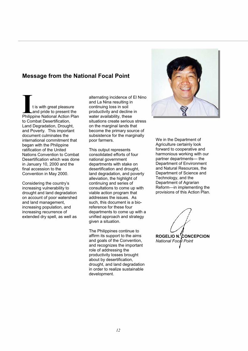
Message from the National Focal Point
I t is with great pleasure and pride to present the
Philippine National Action Plan to Combat Desertification, Land Degradation, Drought, and Poverty. This important document culminates the international commitment that began with the Philippine ratification of the United Nations Convention to Combat Desertification which was done in January 10, 2000 and the final accession to the Convention in May 2000. Considering the country’s increasing vulnerability to drought and land degradation on account of poor watershed and land management, increasing population, and increasing recurrence of extended dry spell, as well as
alternating incidence of El Nino and La Nina resulting in continuing loss in soil productivity and decline in water availability, these situations create serious stress on the marginal lands that become the primary source of subsistence for the marginally poor farmers. This output represents consolidated efforts of four national government departments with stake on desertification and drought, land degradation, and poverty alleviation, the highlight of continuing and series of consultations to come up with viable action program that addresses the issues. As such, this document is a bio-reference for these four departments to come up with a unified approach and strategy given a situation. The Philippines continue to affirm its support to the aims and goals of the Convention, and recognizes the important role of addressing the productivity losses brought about by desertification, drought, and land degradation in order to realize sustainable development.
We in the Department of Agriculture certainly look forward to cooperative and harmonious working with our partner departments— the Department of Environment and Natural Resources, the Department of Science and Technology, and the Department of Agrarian Reform—in implementing the provisions of this Action Plan.
ROGELIO N. CONCEPCION National Focal Point
N ATIONAL ACTION PLAN
The Philippine
13
List of Acronyms AFMA - Republic Act 8435, The Agriculture and Fisheries Modernization Act 1997 ARC - Agrarian Reform Communities ASSOD – Assessment of Human-Induced Soil Degradation in South and Southeast Asia BAR – Bureau of Agricultural Research BPI – Bureau of Plant Industry BSWM – Bureau of Soils and Water Management CBD – Convention on Biological Diversity CBFM - Community-Based Forest Management Program CFV - Conservation Farming Villages CHED – Commission on Higher Education CLSU – Central Luzon State University COF –Conference of the Parties DA – Department of Agriculture DA-AFIS - Department of Agriculture–Agriculture and Fisheries Information Service DA-ITCAF – Department of Agriculture Information Technology Center for Agriculture and Fisheries DA-PS- Department of Agriculture- Planning Service DAR –Department of Agrarian Reform DENR – Department of Natural Resources DECS – Department of Education, Culture and Sports DILG – Department of Interior and Local Government DOST – Department of Science and Technology FAO – Food and Agriculture Organization FPLC - Farmer’s Participatory Learning Centers GEF – Global Environmental Facility GM – Global Mechanisms IEC – Information, Education and Communication IPRA Law - Indigenous Peoples Rights Act Law IWRM – Integrated Watershed Resource Management LGU – Local Government Unit MDG – Millennium Development Goals MTPIP –Medium Term Public Investment Program NAM – Needs Assessment Meeting NAMRIA – National Mapping Resource and Information Agency NAP – National Action Plan NCIP – National Commission on Indigenous Peoples NCSB - National Statistical Coordination Board NEDA – National Economic Development Authority NGO – Non-governmental Organization NIA – National Irrigation Administration PAG-ASA – Philippine Atmospheric, Geophysical and Astronomical Services Administration PCARRD – Philippine Council for Agriculture, Forestry and Natural Resources Research and Development PCSD – Philippine Council for Sustainable Development PhilRice – Philippine Rice Research Institute PIA – Philippine Information Agency PIDS – Philippine Institute of Development Studies PSAE – Philippine Society of Agricultural Engineers PSSST – Philippine Society of Soil Science and Technology SALT – Sloping Agricultural Land Technology SCU – State Colleges and Universities SEA-SRAP – Southeast Asian Sub-Regional Action Program SOTER – Soils and Terrain Digital Database TPN – Thematic Programme Network UNCBD – United Nations Convention on Biological Diversity UNCCD – United Nations Convention to Combat Desertification UNCED – United Nations Conference on Environment and Development UNFCCC – United Nations Framework Convention on Climate Change UPLB – University of the Philippines at Los Baños WFSPA – World Food Summit Plan of Action
14
The Philippine Senate ratified the UNCCD on February 10, 2000 and the final accession to the Convention came into full force in 10, May 2000. The Philippine National Action Plan is an expression of full and unqualified commitment of the Philippine Government in the effective and accelerated implementation of the programs and project activities to combat desertification, land degradation and poverty in the identified drought vulnerable areas of the country. Approximately 27.3 percent of the Philippines is vulnerable to drought, alternating with yearly floods and typhoons, causing serious land degradation and declining land productivity.
•EXECUTIVE SUMMARY
These are provinces located in Type 1 climate, which are typhoon and drought prone and are generally vulnerable to El Nino - 6.60 million hectares are in Luzon, 1.41 million hectares in the Visayas. There are specific provinces in Mindanao that are likewise becoming vulnerable to seasonal dryness caused by natural drought and El Nino phenomenon. These include Misamis Oriental, Bukidnon, Maguindanao, Davao del Sur, Davao Oriental, Lanao del Norte, South Cotabato, Zamboanga del Norte and Zamboanga del Sur. The Philippine National Action Plan (NAP) is a working document for the convergence of actions of the Departments of Agriculture (DA), Environment and Natural Resources (DENR), Science and Technology (DOST) and Agrarian Reform (DAR). The NAP is water-centered and focused on the sustainable management of Critical Watershed Areas located in seasonally dry/arid areas, which are suffering from food insecurity. These critical watershed areas have highly threatened river systems that cut across two or more municipalities and provinces, where initiatives of local government units and their respective communities need to be guided and harmonized. These multi-related problems require multiple agency approach or the harmonized participation and collective efforts of the DA, DOST, DENR and the DAR to address integrated watershed governance and the needs of the watershed community for site-specific technologies to arrest declining agricultural productivity and further deterioration of critical
The Philippine National Action Plan (NAP) is a working document for the convergence of actions of the four departments of the national government—Agriculture, Environment and Natural Resources, Science and Technology, and Agrarian Reform.
N ATIONAL ACTION PLAN
The Philippine
15
watershed services, particularly the sustained supply of freshwater. Another key feature of the NAP is the formulation of measures to maximize the opportunity of efficient management of underground rivers and limestone cave freshwater in the Small Island Provinces. The Philippine National Action Plan is composed of two major thematic programs – Sustainable Agriculture and Marginal Upland Development and Integrated Ecosystem Management. These thematic programs have five components – Land and Water Technology Development, Local Governance and Community Initiatives, Data Base Development and Harmonization, Information, Education and Communication, and Enabling Policy Development. To accelerate the implementation of the NAP, the Focal Point is initiating series of activities to provide a strong basis for mobilization and packaging of funding resources, as follows: Conduct of workshop and experts roundtable meeting to establish selection criteria for the prioritization of programs and project activities and the compilation of existing maps and information needed to identify and develop GIS assisted maps and information of the country’s land degradation hotspots. The important deliverables of the Philippine National Action Plan within the planning period, Year 2004 to 2010, will: 1. Establish 5,000 community-learning centers
with the aim of training 15,000 upland dwellers and as well as developing community initiatives on local area development; 2. Construct in critical watershed areas some 100,000 small water retention structures for the year 2005-2010, each structure, costing anywhere from PHP 50,000 to PHP 100,000 and benefiting 1,000,000 farmers and providing jobs to about 1,000,000 upland dwellers; 3. Reduce the dependence on chemical fertilizers by 30 percent at the end of the year 2010 by
A water retention structure in a critical watershed provides irrigation water in the lowlands, fish, recreation, and soil and water conservation.
A community learning center
implementing balance fertilization through the proper combination of organic and inorganic fertilizers; 4. Prevention of desertification and further expansion of land degradation of approximately 250,000 hectares of denuded critical agricultural land s and about rehabilitation of some 500,000 hectares of critical watershed ecosystems in Mindanao and Luzon strategic areas for the improvement agriculture and fisheries production as well as the rehabilitation/reestablishment of minor forest products.
16
Introduction
United Nations Convention to Combat Desertification: An Overview The United Nations
Convention to Combat Land Degradation and Drought (UNCCD), adopted on June 17, 1994, is a special UN agenda for poverty reduction in the dry, arid, semi-arid, and dry sub-humid areas, particularly the African Continent. As of July 2004, there are 191 Signatory States and Parties to the Convention. Within the context of the
Convention, desertification is defined as land degradation in arid, semi-arid and sub-humid areas resulting from various factors, including climatic variations and human activities. Through the intervention of
the Philippines, the emerging climate phenomenon attributed to the increasing recurrence cycle of El Niño, seasonal aridity or seasonal extreme dryness, was accepted in the Convention and was considered as the primary basis for the acknowledgment of desertification in the tropical countries, particularly in the ASEAN country parties.
The Philippine Senate and House of Representatives jointly ratified the UNCCD on February 10, 2000 and final accession came to full force in May 10, 2000. Linkage of UNCCD to Other Global Efforts 1. United Nations Convention on Biological Diversity and United Nations Framework Convention on Climate Change The Philippines joined in the
UN Convention on Biological Diversity (UNCBD) and UN Framework Convention on Climate Change (UNFCC) in October 1993 and August 1994, respectively. It is recognized that land
degradation and drought are influenced by climate change and which create detrimental impact on various forms of biodiversity leading to a chain of events, including loss of prime lands for the production of food and fiber, opening of ecologically fragile lands and destruction of natural vegetation. Since desertification, climate
change and biological diversity have complex and inter-related issues and concerns that need to be immediately addressed and managed, there is a need for a synergy of efforts of UNCCD with UNCBD and UNFCC (Fig. 1).
2. United Nations Millennium Development Goals One of the eight goals set is to
reduce the proportion of people living on less than $1 a day to half the 1990 level by 2015-from 28.3% to 14.2%. The Goal also calls for halving
The UNCCD Logo
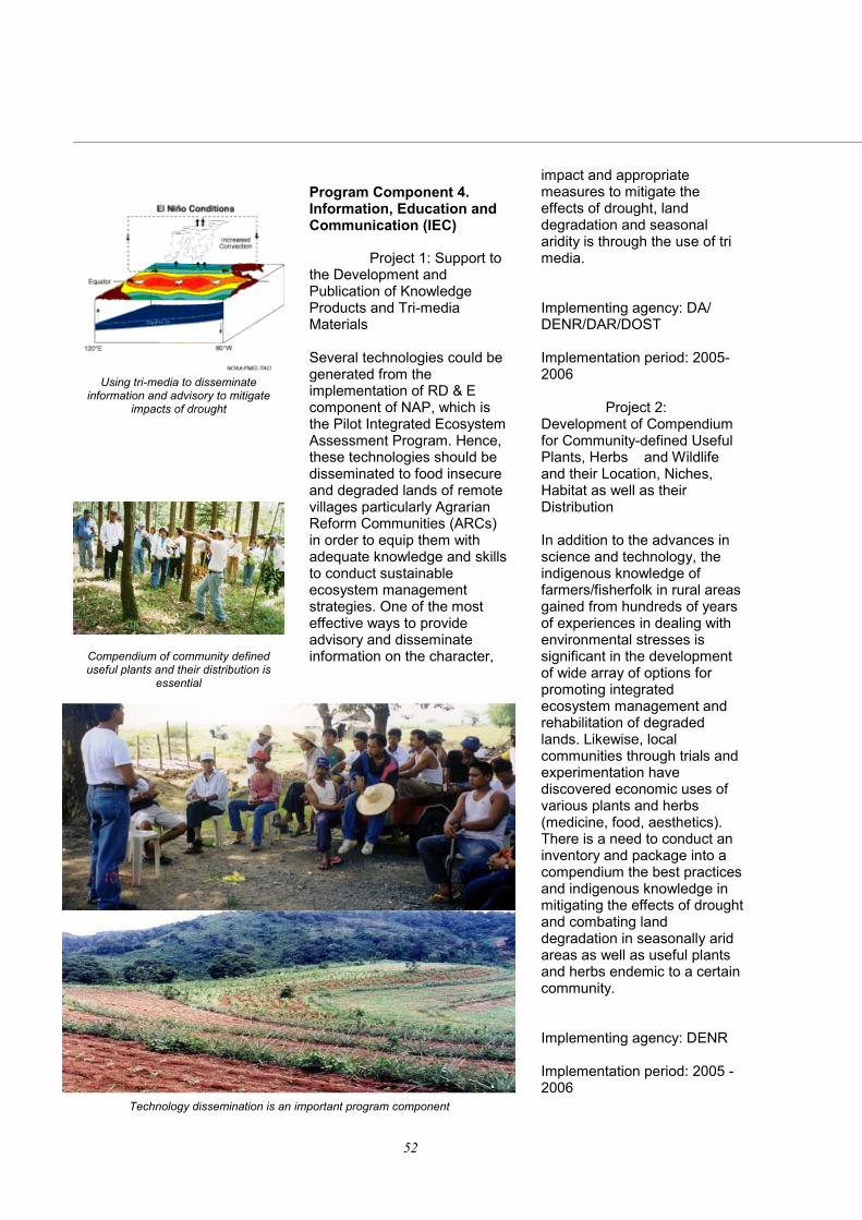
Through the intervention of the Philippines, the emerging climate phenomenon attributed to the increasing recurrence cycle of El Niño, seasonal aridity was accepted in the Convention as primary basis for the acknowledgement of desertification in tropical countries.
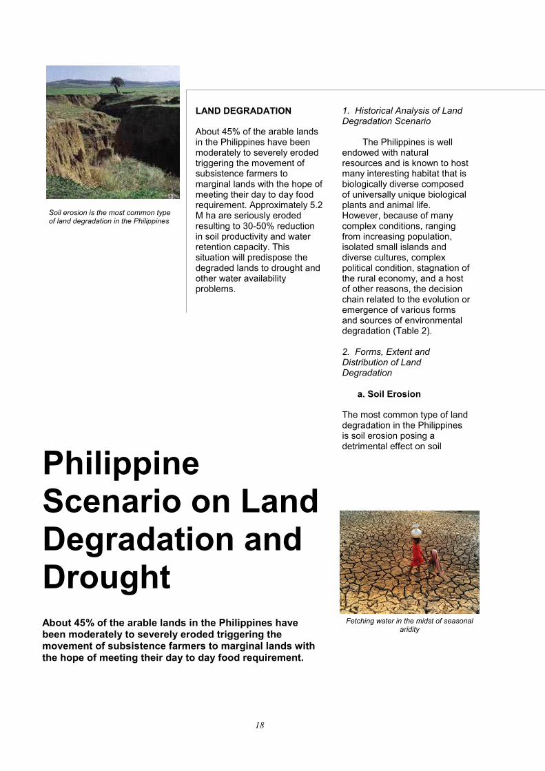
Lowland agricultural areas, like their upland counterparts, are vulnerable to
drought and land degradation.
N ATIONAL ACTION PLAN
The Philippine
17
the proportion of people who suffer from hunger between 1990 and 2015. Relevance of UNCCD to Philippine Agriculture
The participation of the Philippines and other tropical countries shall focus on the prevention of the further spread of land degradation and reduce the impacts of drought and El Niño phenomenon on the loss of land productivity, especially in areas occupied by food insecure communities. Over the decade, there is an increasing cycles of drought and El Nino in the country. More and more provinces in the Philippines are suffering from a new emerging climate phenomenon called seasonal aridity.
Desertification,
Land Degradation andPoverty (UNCCD)
Long Term Productivity:Inter-generational
Equity
Climate Change
Foundation for Global Economic
Diversification
Biodiversity
Global Genetic Foundation
Global Food Security
Global Food Systems
Natural ResourceProductivity
Global Quality of Life:
Global Peace
Figure 1. Synergy of the Three U.N. Conventions
The Philippines, particularly the Small Islands, has become vulnerable to drought and land degradation due to inadequate and inefficient irrigation systems, increasing population and rural poverty, poor land and watershed management and increasing incidence of El Niño and La Niña. Accelerated land use conversions, such as urbanization, deforestation coupled with unsustainable land use practices, contribute to widespread use of marginal lands by subsistence farmers leading to expansion of degraded and infertile lands. The most obvious impact of desertification is poverty, which is greatly manifested in degraded lands and seasonally arid areas of the country.
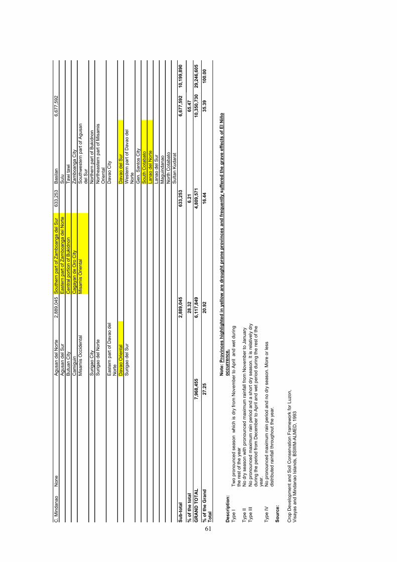
People living in these areas have very low food production, income generation and savings enhancement capacities. In the Philippines alone, as of year 2000, poverty incidence in the country or the proportion of families with per capita incomes below the poverty threshold was placed at 28.4%. In year 2000, 4.3 M families or 26.5 M Filipinos were living below the poverty line. Most of them are in the rural, upland and degraded lands. High poverty incidence level could be observed in Mindanao (Regions IX to XII, ARMM, Caraga) since it is the most vulnerable to drought and suffer most from extended dry spell brought by El Niño episodes including regions experiencing seasonal aridity and massive land degradation and those that are classified under Type 1 climate (Table 1).
Table 1. Poverty Incidence (%) by Region, 2000 (Source: NSCB)
REGION POVERTY INCIDENCE (%)
Philippines 28.4
CAR 31.1
NCR-National Capital Region
5.7
Region I 29.6
Region II 24.8
Region III 17.0
Region IV 20.8
Region V 49.0
Region VI 37.8
Region VII 32.3
Region VIII 37.8
Region IX 38.3
Region X 32.9
Region XI 31.5
Region XII 48.4
ARMM 57.0
Caraga 42.9
Note: Highlighted areas are known to experi-ence seasonal aridity
18
Philippine Scenario on Land Degradation and Drought
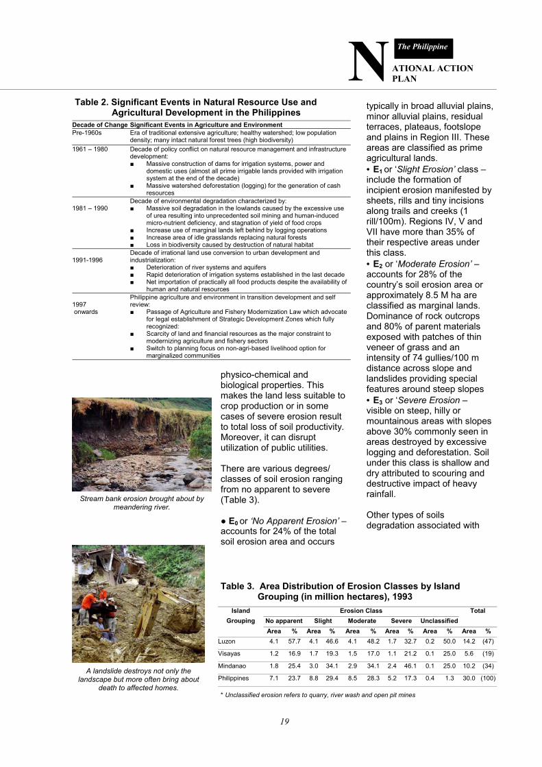
LAND DEGRADATION About 45% of the arable lands in the Philippines have been moderately to severely eroded triggering the movement of subsistence farmers to marginal lands with the hope of meeting their day to day food requirement. Approximately 5.2 M ha are seriously eroded resulting to 30-50% reduction in soil productivity and water retention capacity. This situation will predispose the degraded lands to drought and other water availability problems.
1. Historical Analysis of Land Degradation Scenario The Philippines is well endowed with natural resources and is known to host many interesting habitat that is biologically diverse composed of universally unique biological plants and animal life. However, because of many complex conditions, ranging from increasing population, isolated small islands and diverse cultures, complex political condition, stagnation of the rural economy, and a host of other reasons, the decision chain related to the evolution or emergence of various forms and sources of environmental degradation (Table 2). 2. Forms, Extent and Distribution of Land Degradation a. Soil Erosion The most common type of land degradation in the Philippines is soil erosion posing a detrimental effect on soil
About 45% of the arable lands in the Philippines have been moderately to severely eroded triggering the movement of subsistence farmers to marginal lands with the hope of meeting their day to day food requirement.
Soil erosion is the most common type of land degradation in the Philippines
Fetching water in the midst of seasonal aridity
N ATIONAL ACTION PLAN
The Philippine
19
physico-chemical and biological properties. This makes the land less suitable to crop production or in some cases of severe erosion result to total loss of soil productivity. Moreover, it can disrupt utilization of public utilities. There are various degrees/classes of soil erosion ranging from no apparent to severe (Table 3). ● E0 or ‘No Apparent Erosion’ – accounts for 24% of the total soil erosion area and occurs
typically in broad alluvial plains, minor alluvial plains, residual terraces, plateaus, footslope and plains in Region III. These areas are classified as prime agricultural lands. • E1 or ‘Slight Erosion’ class – include the formation of incipient erosion manifested by sheets, rills and tiny incisions along trails and creeks (1 rill/100m). Regions IV, V and VII have more than 35% of their respective areas under this class. • E2 or ‘Moderate Erosion’ – accounts for 28% of the country’s soil erosion area or approximately 8.5 M ha are classified as marginal lands. Dominance of rock outcrops and 80% of parent materials exposed with patches of thin veneer of grass and an intensity of 74 gullies/100 m distance across slope and landslides providing special features around steep slopes • E3 or ‘Severe Erosion – visible on steep, hilly or mountainous areas with slopes above 30% commonly seen in areas destroyed by excessive logging and deforestation. Soil under this class is shallow and dry attributed to scouring and destructive impact of heavy rainfall. Other types of soils degradation associated with
Stream bank erosion brought about by meandering river.
Table 3. Area Distribution of Erosion Classes by Island Grouping (in million hectares), 1993
Island Erosion Class Total Grouping Slight Moderate Severe Unclassified
Area % Area % Area % Area % Area % Area % Luzon 4.1 57.7 4.1 46.6 4.1 48.2 1.7 32.7 0.2 50.0 14.2 (47)
* Unclassified erosion refers to quarry, river wash and open pit mines
Table 2. Significant Events in Natural Resource Use and Agricultural Development in the Philippines
Decade of Change Significant Events in Agriculture and Environment Pre-1960s Era of traditional extensive agriculture; healthy watershed; low population
density; many intact natural forest trees (high biodiversity) 1961 – 1980 Decade of policy conflict on natural resource management and infrastructure
development: ■ Massive construction of dams for irrigation systems, power and
domestic uses (almost all prime irrigable lands provided with irrigation system at the end of the decade)
■ Massive watershed deforestation (logging) for the generation of cash resources
1981 – 1990
Decade of environmental degradation characterized by: ■ Massive soil degradation in the lowlands caused by the excessive use
of urea resulting into unprecedented soil mining and human-induced micro-nutrient deficiency, and stagnation of yield of food crops
■ Increase use of marginal lands left behind by logging operations ■ Increase area of idle grasslands replacing natural forests ■ Loss in biodiversity caused by destruction of natural habitat
1991-1996
Decade of irrational land use conversion to urban development and industrialization: ■ Deterioration of river systems and aquifers ■ Rapid deterioration of irrigation systems established in the last decade ■ Net importation of practically all food products despite the availability of
human and natural resources 1997 onwards
Philippine agriculture and environment in transition development and self review: ■ Passage of Agriculture and Fishery Modernization Law which advocate
for legal establishment of Strategic Development Zones which fully recognized:
■ Scarcity of land and financial resources as the major constraint to modernizing agriculture and fishery sectors
■ Switch to planning focus on non-agri-based livelihood option for marginalized communities
A landslide destroys not only the landscape but more often bring about
death to affected homes.
20
1960-1990 - Nitrogen fertilizer is generally required
1970-1980 - Nitrogen plus Phosphorus are generally required
1980-1990 - Nitrogen, Phosphorus, plus Potassium, including micronutrients (Zn) are generally required in rice and Mg in corn
Table 4. Types of Land Degradation (Based on SOTER/ASSOD Studies)
soil erosion are loss of soil nutrients and or organic matter, river erosion, flooding and water logging (Table 4).
b. Soil Mining and Decline of Soil Productivity
The long term and continued use of urea “alone” resulted in serious nutrient imbalance and contributed to the actual silent soil degradation widely known as soil mining. The general trend based from soil analysis covering the period 1970 to 1990 indicated very active soil mining where there is an increasing number of plant nutrients required to sustain plant growth, as follows:
This practice contributed to the stagnation of yields of rice and corn because of excessive use of urea or nitrogen fertilizer beyond the normal ratio of 3N:1P. Table 5 shows the soil mining and nutrient imbalance between N & P. Most pronounced imbalance was in 1991 where the N/P ratio was three times higher than the normal ratio. The long-term impact on soil is expressed in terms of depleted soil P, K and induced Zn deficiency. The net impact of soil mining is the increased cost of fertilization and decline in the farmers’ income. 2. Causal Factors of Land Degradation a. Natural Causes ●Topographic Variations and Problem Soils The Philippines is an archipelago with topographic variations in its various islands. It has several mountains/hillylands present all over the country which are experiencing decreased in land cover, thus, making them more prone to soil erosion. Furthermore, problem soils are dominant in the Philippines characterized
Increased cost of fertilization resulting from soil mining.
The Philippines is an archi-pelago and the topographic variations make the country prone to various types of erosion.
N ATIONAL ACTION PLAN
The Philippine
21
by steep slopes, poor drainage, coarse textures and fertility limitations. ○ Steep slopes – these are the land areas which are steeply dissected with slopes more than 30% distributed as follows:
*30-50% slope - 6,293,362 ha
50% slope and up
- 2,609,900 ha
○ Poor drainage – land areas that are water logged or flooded for significant part of the year. These lands are associated with the Fluvaquents (12,800 ha) and Hydraquents (78,080 ha) that are integrated with the Tropaquents or about 0.30% of the total land area. ○ Coarse textures – land areas, which have coarse textures with less than18% clay and more than 65% sand or have gravel stones, boulders or rock outcrops in the surface layers or at the surface. These soils belong to the Tropopsamments along with
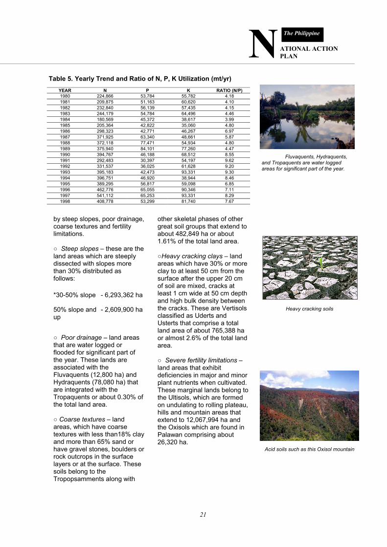
Fluvaquents, Hydraquents, and Tropaquents are water logged areas for significant part of the year.
Heavy cracking soils
other skeletal phases of other great soil groups that extend to about 482,849 ha or about 1.61% of the total land area. ○Heavy cracking clays – land areas which have 30% or more clay to at least 50 cm from the surface after the upper 20 cm of soil are mixed, cracks at least 1 cm wide at 50 cm depth and high bulk density between the cracks. These are Vertisols classified as Uderts and Usterts that comprise a total land area of about 765,388 ha or almost 2.6% of the total land area. ○ Severe fertility limitations – land areas that exhibit deficiencies in major and minor plant nutrients when cultivated. These marginal lands belong to the Ultisols, which are formed on undulating to rolling plateau, hills and mountain areas that extend to 12,067,994 ha and the Oxisols which are found in Palawan comprising about 26,320 ha.
○ Land with saline/sodic soil limitations – saline and sodic soils are coastal in nature and extend to almost 400,000 ha or about 1.33% of the total land area. ●Volcanic Eruptions There are more than 200 volcanoes in the country and four major volcanic belts, namely: the Westerly Convex Volcanic Belt in Luzon, Easterly Convex Volcanic Belt, Westerly Volcanic Belt and Southeasterly Volcanic Belt. One of the major volcanic eruptions is that of Mt. Pinatubo in 1991 emitting
enormous amounts of ash laden steam clouds reaching as high as 20 km above the vent. An estimated 6 B m3 of pyroclastic materials were deposited over a 4000 km2 area including the eight major river basins that drain the volcano. The interim effect of this eruption is the occurrence of heavy ashfalls and lahar making vast tracts of lands planted to rice and sugarcane in Central Luzon unfit for agricultural production and several residential areas unsuitable for human settlement. Furthermore, every year, particularly during the wet season, heavy rainfall continues to erode the pyroclastic material deposited
Satellite imagery of Mt. Pinatubo showing extent of lahar flows and affected areas.
Pyroclastic flows from Mt. Pinatubo has transformed agricultural lands into desert-like wastelands.
N ATIONAL ACTION PLAN
The Philippine
23
on the slopes of the volcano causing fast-moving lahar to wreak havoc and severe damage on an estimated 300,000 hectares comprising mostly of residential and agricultural communities. b. Human-Induced The Philippine population is growing at an annual growth rate of 2.3%. This increase in population is accompanied by increasing requirements for food, clothing and settlements. To improve crop yield, extensive use of chemical inputs such as inorganic fertilizers, herbicides and pesticides has been popularized which left the soil very acidic and unfit for production in the long run. While the demand for meat and meat products continue to increase, grazing lands for cattle, goat and other ruminants are extensively utilized.
The increasing demand for human settlement and other non-agricultural purposes has contributed to the great loss of prime lands. This resulted to the opening of ecologically fragile lands. Approximately 74% of the sloping uplands are actively used for subsistence farming in order to augment the demand for food supply and increase income. Moreover, people tend to migrate and occupy upland and marginalized areas including
Intrusions of population in ecologically fragile lands brought about by economic pressures such as this “kaingin” result in human-induced land degradation.
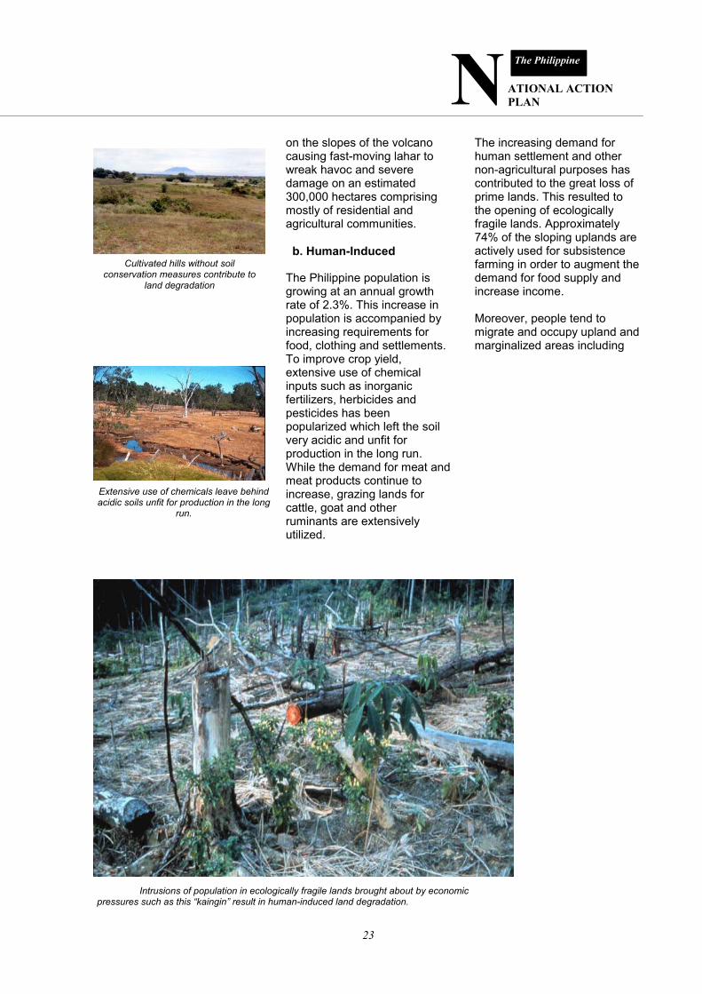
Cultivated hills without soil conservation measures contribute to
land degradation
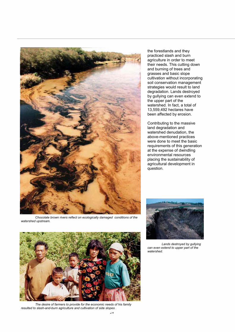
Extensive use of chemicals leave behind acidic soils unfit for production in the long
run.
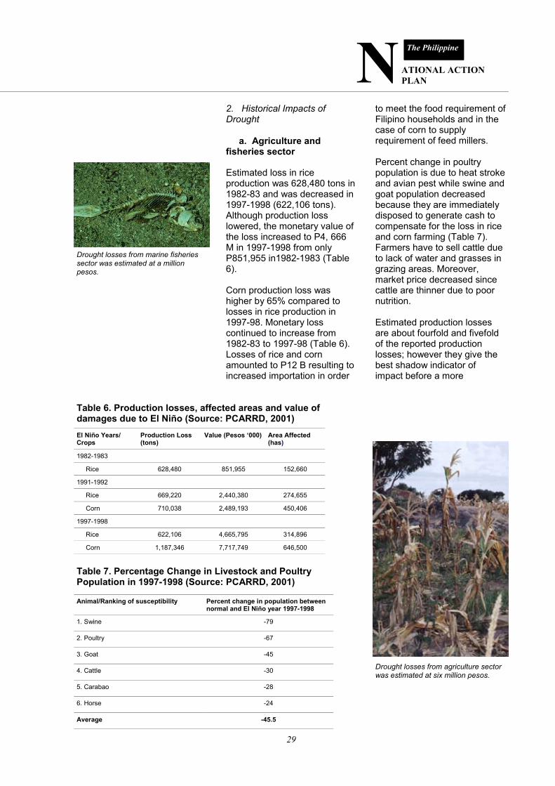
24
the forestlands and they practiced slash and burn agriculture in order to meet their needs. This cutting down and burning of trees and grasses and basic slope cultivation without incorporating soil conservation management strategies would result to land degradation. Lands destroyed by gullying can even extend to the upper part of the watershed. In fact, a total of 13,559,492 hectares have been affected by erosion. Contributing to the massive land degradation and watershed denudation, the above-mentioned practices were done to meet the basic requirements of this generation at the expense of dwindling environmental resources placing the sustainability of agricultural development in question.
The desire of farmers to provide for the economic needs of his family resulted to slash-and-burn agriculture and cultivation of side slopes .
Chocolate brown rivers reflect on ecologically damaged conditions of the watershed upstream.
Lands destroyed by gullying can even extend to upper part of the watershed.
N ATIONAL ACTION PLAN
The Philippine
25
c. Policy-Induced ● Absence of a comprehen-sive national land use policy and updated land use plans Inefficiency and improper land utilization can be attributed to the lack of a rational, compre-hensive and updated national and local land use plan that will delineate lands for agriculture, biodiversity, human settle-ments and industries/commercial centers. Non-delineation of lands re-sulted to illegal conversions of agricultural lands to non-agricultural lands, displace-ments of rural communities and entry of commercial establish-ment in some ecologically frag-ile lands. Proving in court that
the land is illegally converted would require a very long proc-ess of litigation. ● Poor enforcement of land use policies and monitoring of land use conversion Boundary between forestlands and alienable and disposable lands are not clearly delineated resulting to complication in en-forcement of land use laws and monitoring of land use changes. Illegal logging, shifting cultiva-tion, and encroachment of dwellers in forested areas are rampant. Other effects would include low land productivity, squatting and possible estab-lishment of industries and set-tlements within ecologically critical areas. In areas where zonings are in placed, zoning ordinances are not strictly implemented partly because of the absence of po-lice power of concerned gov-ernment agencies in enforcing land use and land conversion laws.
Batasang Pambansa, where the country’s lower legislative house meets
A quarry and cement factory in Iligan City showing extent of land degradation
Illegal logging in ecologically critical forest areas are rampant.
Encroachment of dwellers in forest areas contribute to land degradation.
26
DROUGHT Drought is a recurring event in the climatic system that is dic-tated by a water supply and demand phenomenon. Simply defined, it is the lack of suffi-cient water supply to meet re-quirements. Drought can strike any region at any time with varying degrees of severity re-sulting to desertification.
Climatological studies showed that major drought events in the Philippines are associated with El Niño occurrences or warm episodes in the central and eastern equatorial Pacific. Four major drought events in the Philippines that occurred in the 20th century: 1982-83, 1986-87, 1989-1993 and 1997-98. 1. Distribution and Extent of Drought Hotspots Vulnerable areas experiencing seasonal aridity and drought simulating the conditions and effects of desertification proc-esses include the following:
● Major corn and feed grain –producing areas located within the moisture-deficit, rain shadow areas of Region 11 (General Santos City, South Cotabato, Sarangani and por-tions of Davao del Sur in the southern tip of Mindanao Is-land). ● Region 2 in the Northern tip of Luzon (sand dunes of Ilocos Region, significant portions of Tuguegarao in the Cagayan Valley)
Drought can strike any region at any time with varying degrees of severity resulting to desertification.
Drought events in the Philippines are associated with El Nino occurrences.
N ATIONAL ACTION PLAN
The Philippine
27
● Provinces in the western portions of the country experi-encing Type 1 climate charac-terized by two pronounced sea-sons, dry and wet, with maxi-mum rain period from June to September due to prevalence of Southwest monsoon (Fig. 2). Seasonal aridity is exacerbated by the increasing incidence of El Niño, which is now occurring at a two to three year cycle from previous five-year interval
a. Type I: Two pronounced seasons, which is dry from November to April and wet during the rest of the year. b. Type II: No dry season with a very pronounced maximum rain period from December to January. c. Type III: No very pronounced maximum rain period, with a short dry season lasting from one to three months. This is in between the preceding two types although it resembles the first type more closely since it has a short dry season. d. Type IV: Rainfall is more or less evenly distributed through-out the year. This also is in between the first and second types, but it resembles the sec-ond more closely since it has a dry season.
Fig. 2. Climatic Map of the Philippines
(Fig. 3). The water stress peri-ods in the seasonally arid/semi arid areas are extended to four to nine months depending on the intensity of drought or El Niño dry spell (six to nine months). Mean daily temperatures in these areas ranges from 30 to 350C, which is higher than any parts of the Philippines, induce depletion of soil organic matter and significant water loss through evapotranspiration. Soil organic matter content is generally 1% or less, which is very low, compared to normal values of 2.5 to 3.5 % organic matter. On the other hand, because of El Niño recurrence, water shortage occurred in major dams of the country. The most serious was in the EL Nino year of 1997-1998, where the water level in the Angat dam fell below critical levels forcing national authorities to stop de-livery of irrigation water to some 25,000 hectares of irri-gated lands in Bulacan and Pampanga.
The water stress periods in the seasonally arid/semi arid areas are extended from four to nine months depending on intensity of dry spell.
Receding groundwater and drying rivers characterize drought vulnerable areas in the Philippines
28
Fig. 3. El Niño Events in the Philippines (Source: PAG-ASA)
N ATIONAL ACTION PLAN
The Philippine
29
2. Historical Impacts of Drought a. Agriculture and fisheries sector Estimated loss in rice production was 628,480 tons in 1982-83 and was decreased in 1997-1998 (622,106 tons). Although production loss lowered, the monetary value of the loss increased to P4, 666 M in 1997-1998 from only P851,955 in1982-1983 (Table 6). Corn production loss was higher by 65% compared to losses in rice production in 1997-98. Monetary loss continued to increase from 1982-83 to 1997-98 (Table 6). Losses of rice and corn amounted to P12 B resulting to increased importation in order
to meet the food requirement of Filipino households and in the case of corn to supply requirement of feed millers. Percent change in poultry population is due to heat stroke and avian pest while swine and goat population decreased because they are immediately disposed to generate cash to compensate for the loss in rice and corn farming (Table 7). Farmers have to sell cattle due to lack of water and grasses in grazing areas. Moreover, market price decreased since cattle are thinner due to poor nutrition. Estimated production losses are about fourfold and fivefold of the reported production losses; however they give the best shadow indicator of impact before a more
Table 6. Production losses, affected areas and value of damages due to El Niño (Source: PCARRD, 2001) El Niño Years/Crops
Production Loss (tons)
Value (Pesos ‘000) Area Affected (has)
1982-1983
Rice 628,480 851,955 152,660
1991-1992
Rice 669,220 2,440,380 274,655
Corn 710,038 2,489,193 450,406
1997-1998
Rice 622,106 4,665,795 314,896
Corn 1,187,346 7,717,749 646,500
Table 7. Percentage Change in Livestock and Poultry Population in 1997-1998 (Source: PCARRD, 2001)
Animal/Ranking of susceptibility Percent change in population between normal and El Niño year 1997-1998
1. Swine -79
2. Poultry -67
3. Goat -45
4. Cattle -30
5. Carabao -28
6. Horse -24
Average -45.5
Drought losses from marine fisheries sector was estimated at a million pesos.
Drought losses from agriculture sector was estimated at six million pesos.
30
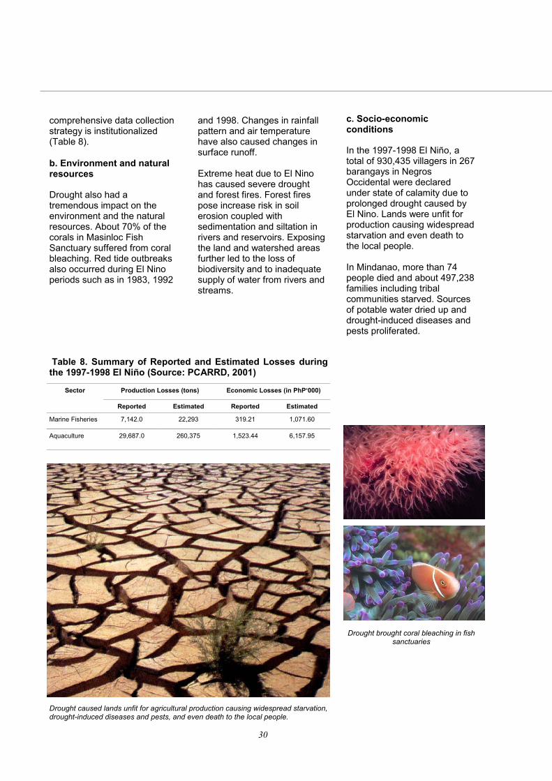
comprehensive data collection strategy is institutionalized (Table 8). b. Environment and natural resources Drought also had a tremendous impact on the environment and the natural resources. About 70% of the corals in Masinloc Fish Sanctuary suffered from coral bleaching. Red tide outbreaks also occurred during El Nino periods such as in 1983, 1992
and 1998. Changes in rainfall pattern and air temperature have also caused changes in surface runoff. Extreme heat due to El Nino has caused severe drought and forest fires. Forest fires pose increase risk in soil erosion coupled with sedimentation and siltation in rivers and reservoirs. Exposing the land and watershed areas further led to the loss of biodiversity and to inadequate supply of water from rivers and streams.
Table 8. Summary of Reported and Estimated Losses during the 1997-1998 El Niño (Source: PCARRD, 2001)
Production Losses (tons) Economic Losses (in PhP‘000)
Reported Estimated Reported Estimated
Marine Fisheries 7,142.0 22,293 319.21 1,071.60
Aquaculture 29,687.0 260,375 1,523.44 6,157.95
Sector
c. Socio-economic conditions In the 1997-1998 El Niño, a total of 930,435 villagers in 267 barangays in Negros Occidental were declared under state of calamity due to prolonged drought caused by El Nino. Lands were unfit for production causing widespread starvation and even death to the local people. In Mindanao, more than 74 people died and about 497,238 families including tribal communities starved. Sources of potable water dried up and drought-induced diseases and pests proliferated.
Drought brought coral bleaching in fish sanctuaries
Drought caused lands unfit for agricultural production causing widespread starvation, drought-induced diseases and pests, and even death to the local people.
N ATIONAL ACTION PLAN
The Philippine
31
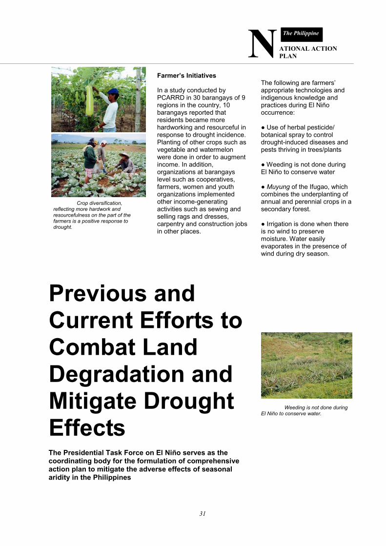
Previous and Current Efforts to Combat Land Degradation and Mitigate Drought Effects The Presidential Task Force on El Niño serves as the coordinating body for the formulation of comprehensive action plan to mitigate the adverse effects of seasonal aridity in the Philippines
Farmer’s Initiatives In a study conducted by PCARRD in 30 barangays of 9 regions in the country, 10 barangays reported that residents became more hardworking and resourceful in response to drought incidence. Planting of other crops such as vegetable and watermelon were done in order to augment income. In addition, organizations at barangays level such as cooperatives, farmers, women and youth organizations implemented other income-generating activities such as sewing and selling rags and dresses, carpentry and construction jobs in other places.
The following are farmers’ appropriate technologies and indigenous knowledge and practices during El Niño occurrence: ● Use of herbal pesticide/botanical spray to control drought-induced diseases and pests thriving in trees/plants ● Weeding is not done during El Niño to conserve water ● Muyung of the Ifugao, which combines the underplanting of annual and perennial crops in a secondary forest. ● Irrigation is done when there is no wind to preserve moisture. Water easily evaporates in the presence of wind during dry season.
Crop diversification, reflecting more hardwork and resourcefulness on the part of the farmers is a positive response to drought.
Weeding is not done during El Niño to conserve water.
32
● Utilization of ginikan or rice straw in the cut and carry system of feeding animals since during El Niño years, fresh grasses in rangelands are not available. ● Use of tubli (Derris elliptica) and makasla (Croton tiglium) as fish toxicants. ● Use of ‘payaw’ to aggregate fish ● Use of salt as prophylaxis B. Institutional Efforts 1. Creation of the Presidential Task Force on El Nino The Task Force serves as coordinating body for the formulation of comprehensive action plan to mitigate the adverse effects of El Nino. The mitigating measures include: ● Cloud-seeding/rain-making operations ● Information, education, communication (IEC) campaign ● Research and Development ● Transfer of appropriate technologies/interventions such as seeds, fertilizers, small farm reservoirs, and small water impounding projects. The country has established 369
Cloud-seeding is done on severely affected areas to induce rain.
rainwater retention structures (small water impounding projects) providing water for irrigation of 21,180 hectares of rice and other upland crops. Freshwater fish and watershed management are important outputs of SWIP establishment. There are 20,009 small farm reservoirs established serving 20,009 hectares. ● Individual shallow tube wells were installed in individual farmer’s field as a way to augment irrigation in lowland areas not covered by the national and communal irrigation system. Total number of shallow tube wells established is 23, 240 serving at least 69,720 hectares.
A small water impounding project
Shallow tube well Small farm reservoir
Information campaign
N ATIONAL ACTION PLAN
The Philippine
33
2. Approval of the National Integrated Research, Development, and Extension Agenda and Program and Operationalizing the National Soil and Water Resources RDE Network These initiatives are now implementing research and development projects related to soil and water conservation and management all throughout the country. Through the network linkages, the network RDE agenda are reviewed, formulated and prioritized. Project coordination, implementation and monitoring are likewise harmonized and unified. 3. Awareness programs on the character and impact of drought and land degradation An example of this was the conduct of a conference on “National Awareness on Combating Land Degradation and Mitigating the Effects of Drought in Mindanao” held in 2001. Another is the “ Needs Assessment Workshop for Water Resources Management” in the same year.
Another form of the awareness programs was the inclusion of environmental education in the formal education curriculum at all levels and more specifically in soil and water conservation courses in colleges and universities. This is to foster a sense of responsibility for the state of the environment among the students of all ages. 4. Promotion of soil and water conservation measures Intensification of soil and water conservation and drought mitigation measures through innovative approaches in technology promotion activities such as field days, demonstration trials and regular farmers’ training. ● Planting of best suited crops or crops contributing to the sustainability of the farming system ● Soil fertility enhancement practices such as farm waste recycling, green manuring and balanced fertilization or optimum use of organic and inorganic fertilizers
A field visit at Tanay Research Station to view soil conservation strategies
A research networking involving different institutions
Workshop-seminar on the impact of drought and land degradation
34
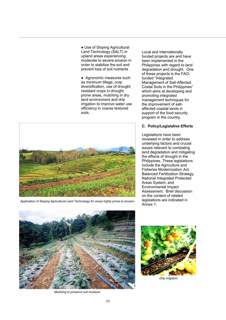
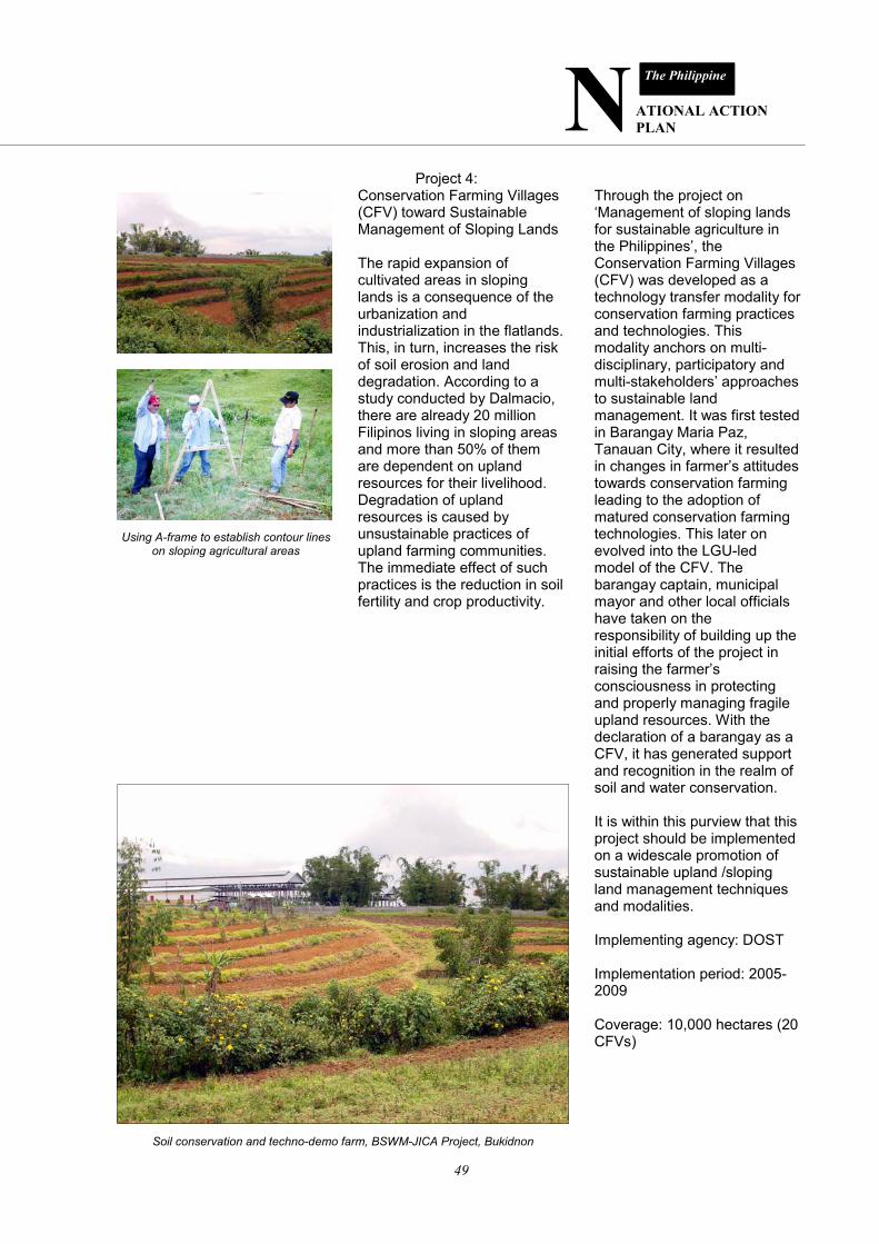
● Use of Sloping Agricultural Land Technology (SALT) in upland areas experiencing moderate to severe erosion in order to stabilize the soil and prevent loss of soil nutrients ● Agronomic measures such as minimum tillage, crop diversification, use of drought resistant crops in drought prone areas, mulching in dry land environment and drip irrigation to improve water use efficiency in coarse textured soils.
Application of Sloping Agricultural Land Technology for areas highly prone to erosion
Mulching to preserve soil moisture
Local and internationally funded projects are and have been implemented in the Philippines with regard to land degradation and drought. One of these projects is the FAO-funded “Integrated Management of Salt-Affected Costal Soils in the Philippines” which aims at developing and promoting integrated management techniques for the improvement of salt-affected coastal lands in support of the food security program in the country. C. Policy/Legislative Efforts Legislations have been reviewed in order to address underlying factors and crucial issues relevant to combating land degradation and mitigating the effects of drought in the Philippines. These legislations include the Agriculture and Fisheries Modernization Act, Balanced Fertilization Strategy, National Integrated Protected Areas System, and Environmental Impact Assessment. Brief discussion on the content of related legislations are indicated in Annex 1.
Drip irrigation
N ATIONAL ACTION PLAN
The Philippine
35
General Plan of Actions (FY 2004—2010) A four-point general plan of action is conceived to implement the National Action Plan
The general plan of actions for the development and implementation of the Philippine National Action Plan to Combat Desertification and Land Degradation is composed of four (4) steps: Administrative Collaboration and Convergence To initiate convergence plan of action while waiting for funding, the four departments (DA, DAR, DENR and DOST) will commit a catalytic funding based from the Interagency Planning Workshop hosted by the UNCCD Focal Point on the first quarter of 2005. Furthermore, to officially recognize the Philippine NAP as their convergence program in combating land degradation, it will be mainstreamed into the Medium Term Public Investment Program (MTPIP) and in their respective work and financial plans for 2005 and onwards.
Technical Collaboration and Convergence The UNCCD Philippine Focal Point shall allocate P 4.0 million to initiate the following preparatory activities for the last quarter of 2004. ● GIS mapping and assessment of vulnerable areas and communities in seasonally arid and drought prone areas based on compilation of available maps and information from BSWM and partner agencies ● Review and validation of appropriate land and water technologies to mitigate the effects of desertification, land degradation and drought and contribute to alleviation of poverty and food insecurity in marginal upland areas. ● Review and Identification of Policy Gaps for Effective Governance and Implementation of Desertification Control, Land and Water Degradation Prevention and Poverty Alleviation in Seasonally Arid Areas
GIS mapping and assessment of vulnerable areas
Review and validation of appropriate water technologies
Identification of policy gaps in prevention of water degradation
36
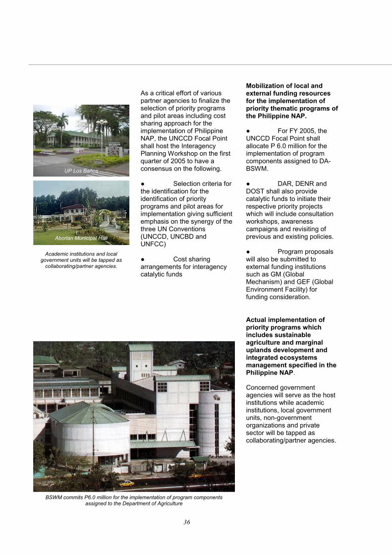
As a critical effort of various partner agencies to finalize the selection of priority programs and pilot areas including cost sharing approach for the implementation of Philippine NAP, the UNCCD Focal Point shall host the Interagency Planning Workshop on the first quarter of 2005 to have a consensus on the following. ● Selection criteria for the identification for the identification of priority programs and pilot areas for implementation giving sufficient emphasis on the synergy of the three UN Conventions (UNCCD, UNCBD and UNFCC) ● Cost sharing arrangements for interagency catalytic funds
Mobilization of local and external funding resources for the implementation of priority thematic programs of the Philippine NAP. ● For FY 2005, the UNCCD Focal Point shall allocate P 6.0 million for the implementation of program components assigned to DA-BSWM. ● DAR, DENR and DOST shall also provide catalytic funds to initiate their respective priority projects which will include consultation workshops, awareness campaigns and revisiting of previous and existing policies. ● Program proposals will also be submitted to external funding institutions such as GM (Global Mechanism) and GEF (Global Environment Facility) for funding consideration. Actual implementation of priority programs which includes sustainable agriculture and marginal uplands development and integrated ecosystems management specified in the Philippine NAP. Concerned government agencies will serve as the host institutions while academic institutions, local government units, non-government organizations and private sector will be tapped as collaborating/partner agencies.
BSWM commits P6.0 million for the implementation of program components assigned to the Department of Agriculture
Academic institutions and local government units will be tapped as
collaborating/partner agencies.
UP Los Baños
Aborlan Municipal Hall
N ATIONAL ACTION PLAN
The Philippine
37
Salient Features of the National Action Plan The Presidential Task Force on El Niño serves as the coordinating body for the formulation of comprehensive action plan to mitigate the adverse effects of seasonal aridity in the Philippines
Character of the Philippine NAP ● Water-centered, Poverty-linked Action Plan ● Critical Watershed as the priority area that served the both the requirements of agriculture and the environment ● Multi-Institutional in Implementation ● Full recognition of the need for establishing synergy of UNCCD programs with the Climate Change and Biodiverisity Convention ● Supportive of the Multi-Sectoral Community Stakeholder Consensus Decision Making ● Mutually Supportive Plan of Actions ● Focus on Community Initiatives and Area Development ● Consider Knowledge-Based Productivity Improvement (Integrated Local Knowledge and Culture with Modern Technology formulation) ● Provides role for the harmonization of Government Actions/Initiatives (e.g. Networking of RD, and E for Sustainable Agriculture, Environment and Rural Development)
A multi-institutional, multi-sectoral, community-consensus planning
Promotion of community initiatives
An integration of modern technology with local knowledge and culture
Scope and Coverage ● T h e N A P emphasizes the critical value of water in sustaining land productivity ● The NAP provides conscious effort to ensure both quality and quantity of water resources and how they impact on the final quality of safe food products. ● The NAP focuses on highly degraded lands and critical watershed areas located in vulnerable areas. The vulnerable areas are listed in Annex 2 (generally within areas under Type I climate, which has distinct wet and dry seasons; moderately degraded areas under Type III climate and selected El Niño/Drought prone provinces under Type II and Type IV climate.
Emphasis on the critical value of water
38
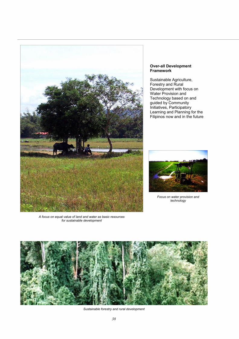
Over-all Development Framework Sustainable Agriculture, Forestry and Rural Development with focus on Water Provision and Technology based on and guided by Community Initiatives, Participatory Learning and Planning for the Filipinos now and in the future
A focus on equal value of land and water as basic resources for sustainable development
Focus on water provision and technology
Sustainable forestry and rural development
N ATIONAL ACTION PLAN
The Philippine
39
General Goals 1. To mainstream agriculture and rural environment development programs that will prevent the incidence and spread of desertification and land degradation in deprived communities living in seasonally arid degraded lands. 2. To institutionalize the NAP as Convergence Plan of Action of the National Government (DA, DENR, DOST, and DAR) against land degradation and poverty General Objectives 1. To establish close implementation synergy of the UNCCD with other relevant UN Conventions (Biodiversity and Climate Change). 2. To establish ecosystem-based technology options for the development and protection of fragile landscapes and vulnerable communities. 3. To implement community-focused RD &E and Networking programs/ projects on critical watershed suffering from land degradation and desertification
A community-based participatory learning and planning
Protection of fragile landscapes
4. To establish network of community learning centers for the promotion of community- based participatory learning and planning for critical watershed planning and development. 5. To establish a network of institutions and Farmer-Experts-Technicians service systems for the sustainability of the community-based support systems 6. To institutionalize the community initiatives for local area development for effective control and prevention of location-specific desertification, drought and land degradation in the Philippines. 7. To establish a nation-wide harmonized GIS database and information system for desertification and land degradation. 8. To harmonize and systematize enabling policies and implementation strategies with a view of developing legislations for the productivity improvement of degraded lands and mitigation measures against the expansion of desertification in seasonally arid areas of the Philippines
Establish network of community learning centers for critical watershed
planning and development
40
Thematic Programs for Land Degradation and Desertification Prevention and Synergy Promotion and Development for UN Conventions 1. Sustainable Agriculture and Marginal Uplands Development Program Food insecurity and widespread poverty are closely linked to desertification and land degradation. One of the most pressing problems in the uplands is low agricultural production because of deteriorating quality of land and water resources. Upland soils were once considered among the most fertile soils. However, natural causal factors and human activities render these lands susceptible to degradation characterized by soil nutrient depletion, soil moisture retention and water quality deterioration. These manifestations of land and water degradation appears everywhere particularly in critical watershed areas and the marginal cropland areas. Under condition where the country’s agricultural productivity is threatened by land use conflict, urbanization and increasing population, there is an urgent need to develop and implement appropriate policy measures as
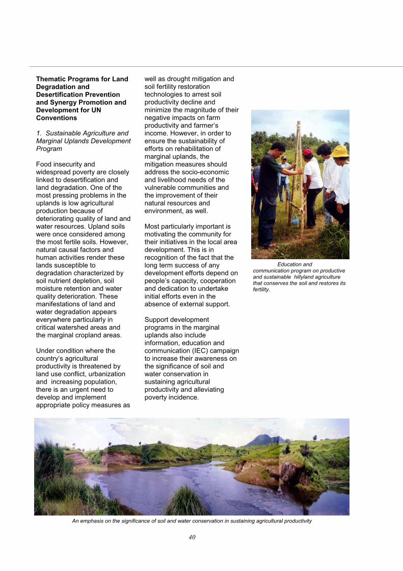
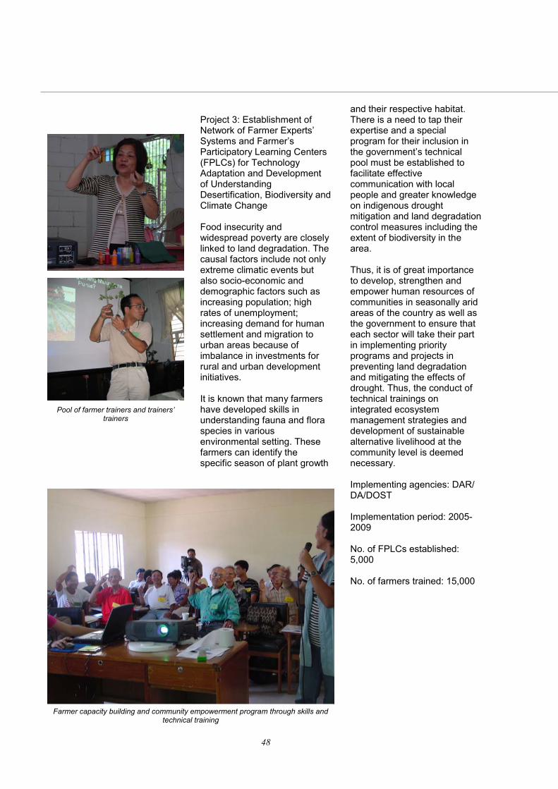
well as drought mitigation and soil fertility restoration technologies to arrest soil productivity decline and minimize the magnitude of their negative impacts on farm productivity and farmer’s income. However, in order to ensure the sustainability of efforts on rehabilitation of marginal uplands, the mitigation measures should address the socio-economic and livelihood needs of the vulnerable communities and the improvement of their natural resources and environment, as well. Most particularly important is motivating the community for their initiatives in the local area development. This is in recognition of the fact that the long term success of any development efforts depend on people’s capacity, cooperation and dedication to undertake initial efforts even in the absence of external support. Support development programs in the marginal uplands also include information, education and communication (IEC) campaign to increase their awareness on the significance of soil and water conservation in sustaining agricultural productivity and alleviating poverty incidence.
An emphasis on the significance of soil and water conservation in sustaining agricultural productivity
Education and communication program on productive and sustainable hillyland agriculture that conserves the soil and restores its fertility.
N ATIONAL ACTION PLAN
The Philippine
41
Integrated ecosystem value adding
2. Integrated Ecosystems Management The Philippine population is growing at a rate of 2.36 percent or 1.7 million new births a year. Concomitant with this population growth is the demand for increase in agricultural crops, livestock and poultry and fish production, which in turn pose an enormous pressure on land and water resources of the country. Several cases of watershed destruction, groundwater pollution and soil nutrient depletion have been reported in various parts of the Philippines resulting to environmental degradation and consequently on the overall decline in the quality of life of people living in the urban and rural areas. Hence, in order to meet the needs of current generation without sacrificing the resources allotted for the future generations, there is a need to undertake strategies on integrated ecosystems management (IEM) that will prevent further desertification in marginal upland, lowlands and critical watersheds and commercial utilization of fragile ecosystems. Furthermore, effective IEM can have positive effects in terms of rehabilitation of degraded lands, soil fertility restoration and soil productivity enhancement in several areas of the Philippines.
The formulation of the National Action Plan is designed to provide clear understanding of the need for harmonizing actions of local communities and government units and make them aware that managing watershed would require sharing of responsibilities in protecting the trans-boundary river systems, the primary source of freshwater, that cuts across more than one province and municipality as they drain towards the sea. There are five program components identified under the Philippine NAP.
Population increase creates pressure on land and water resources
Increase on agricultural crops and livestock result in watershed destruction, groundwater pollution, and soil nutrient depletion
42
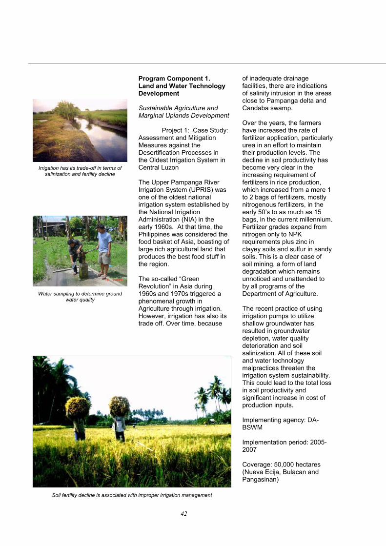
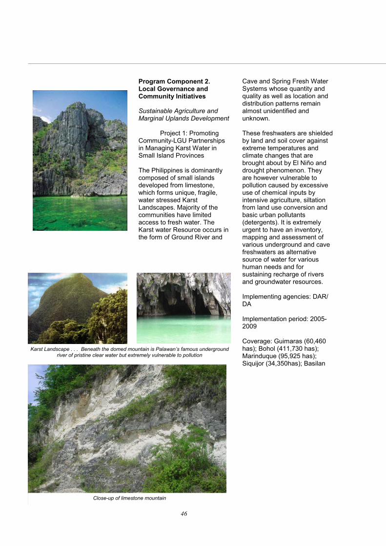
Program Component 1. Land and Water Technology Development Sustainable Agriculture and Marginal Uplands Development Project 1: Case Study: Assessment and Mitigation Measures against the Desertification Processes in the Oldest Irrigation System in Central Luzon The Upper Pampanga River Irrigation System (UPRIS) was one of the oldest national irrigation system established by the National Irrigation Administration (NIA) in the early 1960s. At that time, the Philippines was considered the food basket of Asia, boasting of large rich agricultural land that produces the best food stuff in the region. The so-called “Green Revolution” in Asia during 1960s and 1970s triggered a phenomenal growth in Agriculture through irrigation. However, irrigation has also its trade off. Over time, because
of inadequate drainage facilities, there are indications of salinity intrusion in the areas close to Pampanga delta and Candaba swamp. Over the years, the farmers have increased the rate of fertilizer application, particularly urea in an effort to maintain their production levels. The decline in soil productivity has become very clear in the increasing requirement of fertilizers in rice production, which increased from a mere 1 to 2 bags of fertilizers, mostly nitrogenous fertilizers, in the early 50’s to as much as 15 bags, in the current millennium. Fertilizer grades expand from nitrogen only to NPK requirements plus zinc in clayey soils and sulfur in sandy soils. This is a clear case of soil mining, a form of land degradation which remains unnoticed and unattended to by all programs of the Department of Agriculture. The recent practice of using irrigation pumps to utilize shallow groundwater has resulted in groundwater depletion, water quality deterioration and soil salinization. All of these soil and water technology malpractices threaten the irrigation system sustainability. This could lead to the total loss in soil productivity and significant increase in cost of production inputs. Implementing agency: DA-BSWM Implementation period: 2005-2007 Coverage: 50,000 hectares (Nueva Ecija, Bulacan and Pangasinan)
Irrigation has its trade-off in terms of salinization and fertility decline
Water sampling to determine ground water quality
Soil fertility decline is associated with improper irrigation management
N ATIONAL ACTION PLAN
The Philippine
43
Project 2: Arresting the Soil Nutrient Depletion and Water Pollution of the Strategic Zones of Agriculture Located in Seasonally Arid Areas Desertification is an active day-to-day process within the constraints set by climate or human-induced land degradation. It is characterized by inadequate soil moisture, nutrient depletion and soil pollution. Likewise, this process occurs not only in the dry lands but also in irrigated lowlands because of excessive chemical fertilizers and pesticide application. The negative effects of desertification and land degradation ranges from the reduction in agricultural crops, livestock and poultry and fish production; destruction of ecologically fragile ecosystems; increased migration to urban areas and consequently on the quality of life of the Filipino people.
In several upland and lowland farms, low crop production accelerates the heavy usage of chemical inputs, and fertilizers become an indispensable input in farming operations. Close to 98 per cent of the farmers surveyed were using fertilizers on a regular basis while only 2 per cent used them occasionally. Application of synthetic fertilizers to solve massive nutrient withdrawal would only exacerbate the problem and the cycle of desertification and land degradation continues. Lands that were once productive are now less suitable for agricultural production thus worsening the problem of meeting the food requirements of increasing population in the urban and rural areas. Poor plant growth result in poor ground cover and render the exposed soil surface to soil erosion and removal of soil organic matter. This situation is the primary cause of the rapid decline of upland crop production and the abandonment of many farms by marginal farmers. It is likewise imperative to restore the fertility and productivity of eroded/degraded lands through the proper application of soil and water conservation measures, to augment the production of the remaining good lands to meet the growing needs of increasing population. Implementing agency: DA-BSWM Implementation period: 2005-2008 Coverage: 200,000 hectares of key food producing areas
Laboratory analyses of soil and water samples to determine nutrient depletion
and pollution
Community-initiated fertility restoration and soil conservation
44
Project 3: Precision Agriculture: towards Sustaining Optimal Productivity of Rice and Corn in the Philippines At present, the Philippines is at the critical period for strategic development of agriculture for food sufficiency. Agriculture in the future must not only ensure the sufficient supply of staple crops but also sustain land productivity and agro biodiversity. Reaching towards optimal production of rice and corn had always been the top concern of the agriculture sector. Rice production is intensive in Luzon islands, and regions of Western Visayas,
Southern Mindanao and Central Mindanao while corn clusters comprised of provinces in the Central Luzon, Western Visayas, Eastern Visayas, Socsksargen and Cagayan Valley. Other regions of the country also grow rice and corn as staple grain crops. Support systems such as irrigation facilities; introduction of high yielding, disease resistant and early maturing varieties; and increased level of fertilizer application have enabled the farmers to have two to three cropping per year where only one or two rice crops were grown in the past. Although these activities contribute to crop yield increase, they posed some negative effects on the farmer’s cash flow because of very high production cost and environmental quality due to excessive application of synthetic fertilizers. Precision agriculture or the site-specific nutrient management strategy is a decision support system in which external inputs like fertilizer are applied at varying rates across a field in
accordance with the soil analysis and nutrient requirements of rice and corn. Recognizing the importance of location or site-specific nutrient management (SSNM) approach to optimize fertilizer application for rice and corn, it will be tested using the CERES Maize model under the Philippine agro-climatic condition. This study shall (1) explore the possibility of nitrogen, phosphorus and potassium recommendation and predicting the yield of rice and corn crops using the decision-aid software like the existing crop growth model or CERES, to simulate the yield; (2) evaluate the possibility of reducing the NPK recommendation of Balance Fertilization Strategy (BFS) to lessen rice and corn production cost; (3) assess the micronutrient-induced NPK imbalances on rice and corn clusters in the Philippines; (4) on the account of BFS approach using combined organic and inorganic fertilizer recommendation, valuation of the replacement index of organic fertilizer to reduce the amount of NPK to fertilizer recommendation is imperative; (5) study the effect of optimum fertilization in the biomass and grain quality of rice and corn. Implementing agency: DA Implementation period: 2005-2009 Expected Funding Source - FAO Coverage: 10,000 hectares of rice and corn producing areas
Site specific nutrient management for rice and corn
N ATIONAL ACTION PLAN
The Philippine
45
Integrated Ecosystems Management Project 4: Promotion and Development of Community-Based Wilderness Agriculture for Improvement of Forest Productivity and Rehabilitation As land pressure from population and urbanization increases, marginalized communities become an evolving component of the natural environment and biodiversity in the remaining forest ecosystems in the country. The traditional practices on fallow period on the use of fragile forest ecosystems become shorter, which make it difficult for the support systems in the forest to sustain its productive cycles. The minor forest products which are the primary sources of natural food and herbs are now scarce and in the verge of depletion. In many instances, there are signs that several emerging new plants in the remaining forests do not form the traditional food and medicinal sources of the indigenous communities, who become vulnerable to diseases and other health problems. The changing forms and composition of minor forest
products follows the changes in forest habitat and in general do not support healthy environment and desired quality of human life. However, there are opportunities for improvement of these depleted biodiversity. These remaining clusters of natural forests have open canopies, where sunlight penetration to the ground surface is enough to support selected partial shade-loving agricultural and ornamental crops, livestock and even freshwater fishes. The project will employ the Bio-referencing System, which will use existing plants and herbs as biological indicators for selection and planting agricultural crops with food and medicinal values as supplemental plants for use of the forest occupants. A form of Agri-silvicultural land use system where environmentally non-tillage requiring suitable agricultural food sources are “incorporated” into the forest systems. These mixtures of compatible food (e.g. survival food systems and wilderness products) shall create balance environment for co-existence of men, wildlife, and forest ecosystems. The balanced co-existence shall enhance natural forest rehabilitation and regeneration of various forms of wildlife. Implementing agencies: DENR/DA Implementation period: 2005-2009 Coverage: 250,000 hectares of forestlands with clusters of natural and second growth forest
Employment of bio-referencing for planting crops to supplement needs of forest occupants
Diminishing diversity of remaining network of isolated forests
Development of co-habitation program for forest, agriculture, and people
46
Program Component 2. Local Governance and Community Initiatives Sustainable Agriculture and Marginal Uplands Development Project 1: Promoting Community-LGU Partnerships in Managing Karst Water in Small Island Provinces The Philippines is dominantly composed of small islands developed from limestone, which forms unique, fragile, water stressed Karst Landscapes. Majority of the communities have limited access to fresh water. The Karst water Resource occurs in the form of Ground River and
Cave and Spring Fresh Water Systems whose quantity and quality as well as location and distribution patterns remain almost unidentified and unknown. These freshwaters are shielded by land and soil cover against extreme temperatures and climate changes that are brought about by El Niño and drought phenomenon. They are however vulnerable to pollution caused by excessive use of chemical inputs by intensive agriculture, siltation from land use conversion and basic urban pollutants (detergents). It is extremely urgent to have an inventory, mapping and assessment of various underground and cave freshwaters as alternative source of water for various human needs and for sustaining recharge of rivers and groundwater resources. Implementing agencies: DAR/DA Implementation period: 2005-2009 Coverage: Guimaras (60,460 has); Bohol (411,730 has); Marinduque (95,925 has); Siquijor (34,350has); Basilan
Karst Landscape . . . Beneath the domed mountain is Palawan’s famous underground river of pristine clear water but extremely vulnerable to pollution
Close-up of limestone mountain
N ATIONAL ACTION PLAN
The Philippine
47
Project 2: Establishment of Small Water Retention Structures for Upland Agriculture and Agrarian Reform Community Development Around 4.3 million families are living below the poverty line; most of them are in the rural, upland and degraded lands. Their lives are dependent on the income of the farms. However, agricultural production potentials were hampered by lack of enough water and irrigation structures. To achieve our common interest of sustained livelihoods for our farmers and improvement of their cash flow generation, there is a need to improve the local governance
for the trans-boundary management and development of small water retention structures. The small water retention structures include series of small dams and weir systems, diversion ditches, and other similar structures. An average cost of the structure is anywhere from PHP 50,000 to 100,000. A cost-sharing investment and development of small water retention structure are to be emphasized to enhance partnerships between and among the communities, local government units and national agencies. Implementing agencies: DAR/DA Implementation period: 2005-2009 No. of small water retention structures to be established: 100,000 units (spring boxes, series of check dams, diversion ditches and weirs) Coverage: 200,000 hectares
Small water impounding project
A diversion dam
A small farm reservoir
An irrigation canal
48
Project 3: Establishment of Network of Farmer Experts’ Systems and Farmer’s Participatory Learning Centers (FPLCs) for Technology Adaptation and Development of Understanding Desertification, Biodiversity and Climate Change Food insecurity and widespread poverty are closely linked to land degradation. The causal factors include not only extreme climatic events but also socio-economic and demographic factors such as increasing population; high rates of unemployment; increasing demand for human settlement and migration to urban areas because of imbalance in investments for rural and urban development initiatives. It is known that many farmers have developed skills in understanding fauna and flora species in various environmental setting. These farmers can identify the specific season of plant growth
and their respective habitat. There is a need to tap their expertise and a special program for their inclusion in the government’s technical pool must be established to facilitate effective communication with local people and greater knowledge on indigenous drought mitigation and land degradation control measures including the extent of biodiversity in the area. Thus, it is of great importance to develop, strengthen and empower human resources of communities in seasonally arid areas of the country as well as the government to ensure that each sector will take their part in implementing priority programs and projects in preventing land degradation and mitigating the effects of drought. Thus, the conduct of technical trainings on integrated ecosystem management strategies and development of sustainable alternative livelihood at the community level is deemed necessary. Implementing agencies: DAR/DA/DOST Implementation period: 2005-2009 No. of FPLCs established: 5,000 No. of farmers trained: 15,000
Farmer capacity building and community empowerment program through skills and technical training
Pool of farmer trainers and trainers’ trainers
N ATIONAL ACTION PLAN
The Philippine
49
Project 4: Conservation Farming Villages (CFV) toward Sustainable Management of Sloping Lands The rapid expansion of cultivated areas in sloping lands is a consequence of the urbanization and industrialization in the flatlands. This, in turn, increases the risk of soil erosion and land degradation. According to a study conducted by Dalmacio, there are already 20 million Filipinos living in sloping areas and more than 50% of them are dependent on upland resources for their livelihood. Degradation of upland resources is caused by unsustainable practices of upland farming communities. The immediate effect of such practices is the reduction in soil fertility and crop productivity.
Through the project on ‘Management of sloping lands for sustainable agriculture in the Philippines’, the Conservation Farming Villages (CFV) was developed as a technology transfer modality for conservation farming practices and technologies. This modality anchors on multi-disciplinary, participatory and multi-stakeholders’ approaches to sustainable land management. It was first tested in Barangay Maria Paz, Tanauan City, where it resulted in changes in farmer’s attitudes towards conservation farming leading to the adoption of matured conservation farming technologies. This later on evolved into the LGU-led model of the CFV. The barangay captain, municipal mayor and other local officials have taken on the responsibility of building up the initial efforts of the project in raising the farmer’s consciousness in protecting and properly managing fragile upland resources. With the declaration of a barangay as a CFV, it has generated support and recognition in the realm of soil and water conservation. It is within this purview that this project should be implemented on a widescale promotion of sustainable upland /sloping land management techniques and modalities. Implementing agency: DOST Implementation period: 2005-2009 Coverage: 10,000 hectares (20 CFVs)
Soil conservation and techno-demo farm, BSWM-JICA Project, Bukidnon
Using A-frame to establish contour lines on sloping agricultural areas
50
Project 5: Enhancement of Home Gardens for Food and Wood Sufficiency and Genetic Diversity especially in Sand Dune Areas of the Ilocos Region One of the oldest forms of agro ecosystems, the home garden is present throughout the Ilocos Region and in most regions of the Philippines. A typical home garden in Ilocos Region has a very high diversity of economically important plants per unit area. The harvest is more stable over time, the system is resistant against pests and diseases, requires
minimum inputs, and has minimum soil erosion. Moreover, the products of the home garden such as food, wood, and medicinals to name a few are more equitably shared among members of the household and village. In this age of monocropped field agriculture, the home garden is a viable alternative to this cropping system and it is a highly valuable source of food, wood, medicinals and genetic diversity. Home gardens are also practical means of preventing desertification, a common occurrence in some parts of the Ilocos Region. Despite the importance of home garden in the Ilocos Region, this valuable agro ecosystem is becoming unproductive. This is due to old age of its components particularly food crops and the extinction of some of its other components such as wood crops and medicinals. Hence in order to bring back the productivity of the home garden and thus help attain food, wood and medicine sufficiency; and prevent desertification, it is important that its plant components be augmented or enhanced. This could be done through an action project to be implemented initially in some selected home gardens of the Ilocos Region particularly those that are near the sand dunes and eventually in all home gardens in Ilocos Region. Implementing agency: DOST/DA Implementation period: 2005 Coverage: 5,000 hectares Integrated Ecosystems Management Project 1: Local Governance-Community Partnerships in Managing
The Ilocos Region is not only known for its Spanish era churches and houses,
but also for its sand dunes
Despite importance of home vegetable garden, this remains unproductive near
sand dune areas of Ilocos.
Sunset over the sand dunes of Ilocos
Degraded and Critical Multiple Watersheds: Case Studies in Mindanao and Luzon Trans-boundary River Systems The Law on Devolution (Republic Act 7160 or Local Government Code) has contributed to the land use conflict, fragmentation and imbalanced management and investments for the total improvement of the country’s watershed. Watershed Use and Development are generally influenced by the difference in political and development orientation of the elected officials of each LGU. Investment and development of watershed are always threatened by policy discontinuity, since they are long term in nature, which goes beyond the current year term of elected officials. It is extremely important to create long-term partnership between the communities and LGUs occupying one common river watershed systems. The use of community initiatives for m u l t i p l e w a t e r s h e d management will make up for the political management discontinuity to attain long term transboundary collaboration and harmonization of mitigation measures against the process of land degradation and desertification. Implementing agency: DENR/DA Implementation period: 2005-2009 Coverage: 500,000 has Central Luzon- Pampanga River Basin or Chico River Basin Mindanao: Pulangui River Basin or Tago River Basin
N ATIONAL ACTION PLAN
The Philippine
51
Database and information development using GIS
Program Component 3. Database Development and Harmonization Project 1: Village Level GIS Landscape Grid Approach for Integrated Land and Water Resources Database and Information Development It is recognized that database is a significant tool to facilitate effective data sharing among national government agencies, local government units, non government organizations, academe and private sector in order to increase their awareness on the extent of land degradation, seasonal aridity and drought, which is accentuated by recurring incidence of El Niño. It will also guide policy makers in drafting appropriate laws and administrative/executive orders pertinent to the real sentiments of farmers in the countryside as well as in the improvement of the land, water and natural resources quality. In view of this, there is an urgent need to establish a national geo-informatics database for the implementation of priority programs of the Philippine National Action Plan to Combat Land Degradation, Drought and Desertification. Implementing agency: DA Implementation period: 2005-2007
52
Technology dissemination is an important program component
Program Component 4. Information, Education and Communication (IEC) Project 1: Support to the Development and Publication of Knowledge Products and Tri-media Materials Several technologies could be generated from the implementation of RD & E component of NAP, which is the Pilot Integrated Ecosystem Assessment Program. Hence, these technologies should be disseminated to food insecure and degraded lands of remote villages particularly Agrarian Reform Communities (ARCs) in order to equip them with adequate knowledge and skills to conduct sustainable ecosystem management strategies. One of the most effective ways to provide advisory and disseminate information on the character,
impact and appropriate measures to mitigate the effects of drought, land degradation and seasonal aridity is through the use of tri media. Implementing agency: DA/DENR/DAR/DOST Implementation period: 2005-2006 Project 2: Development of Compendium for Community-defined Useful Plants, Herbs and Wildlife and their Location, Niches, Habitat as well as their Distribution In addition to the advances in science and technology, the indigenous knowledge of farmers/fisherfolk in rural areas gained from hundreds of years of experiences in dealing with environmental stresses is significant in the development of wide array of options for promoting integrated ecosystem management and rehabilitation of degraded lands. Likewise, local communities through trials and experimentation have discovered economic uses of various plants and herbs (medicine, food, aesthetics). There is a need to conduct an inventory and package into a compendium the best practices and indigenous knowledge in mitigating the effects of drought and combating land degradation in seasonally arid areas as well as useful plants and herbs endemic to a certain community. Implementing agency: DENR Implementation period: 2005 - 2006
Compendium of community defined useful plants and their distribution is
essential
Using tri-media to disseminate information and advisory to mitigate
impacts of drought
N ATIONAL ACTION PLAN
The Philippine
53
Program Component 5. Enabling Policy Development Project 1: Raw Water Valuation, Trading and Incentives for Water Systems In the Philippines, agriculture as a whole is the greatest consumer of water, accounting for about 80% of the total water demand and yet it has lower priority than domestic usage in the competition or scarce water resources. Furthermore, the present system of pricing of irrigation water results in inefficient allocation and use of water. Overall, the current system of charges for raw water, which applies throughout the Philippines, is limited in its application, is not based on the economic value of water and does not reflect
the realities of scarcity or abundance of water. Consequently, it does not promote the allocation of a scarce resource to the most productive uses and does not provide any economic incentive for efficient use or conservation of scarce resources. The current pricing of irrigation water is determined by financial, administrative and equity reasons rather than efficiency considerations. The National Water Resources Board (NWRB) has prescribed a graduated rate of annual water charge for water withdrawal, which is uniformly set since 1982 regardless of the type of irrigation systems. The Local Farmer’s Association managing the SWIS determines the rate of irrigation fee, which currently ranges from 1 to 3 cavans per hectare per cropping season (rough rice). Hence, this study would focus on the tradable water rights and the mechanism thereof as an approach to rational allocation and use of water as a resource. Implementing agency: NEDA-PIDS (for negotiation) Implementation period: 2005
Spring water
Raw water valuation
Rational allocation of water use
54
Rehabilitation of degraded lands
1. Sustainable Agriculture and Marginal Upland Development Program ● Contribute to poverty alleviation through improvement in farm production and income of farmers particularly the upland dwellers by 30-40% thereby increasing their savings formation and income generation capacities. ● Rehabilitation of approximately 200,000 hectares of degraded lands in strategic zones of agriculture located in seasonally arid areas. ● Best management practices and appropriate technologies on balanced agriculture, forest and rural development, rainwater resources management/utilization, soil
fertility restoration and rehabilitation of degraded lands in seasonally arid and Small Island Karst landscape. ● 100,000 units of small water retention structures (small farm reservoirs, farm ponds, series of weirs/small gully dams) built in marginal communities through co-sharing of funds with local government units. ● Reduced usage of chemical inputs and other non-renewable and non-biodegradable materials by 30% through enhancement of nutrient supplying capacity for crop utilization and recovery of primary productivity (organic matter build up) in the seasonally arid lands. ● Comprehensive national/in-country database on the status of soil productivity decline,
drought and land degradation in seasonally arid areas for long term monitoring of soil and water retention and for integrated management of drainage basin which will be linked with the sub-regional (Southeast Asia) database. ● GIS-aided maps on drought hotspots; and nutrient changes and soil fertility status from the early 60’s to present. ● Efficient early warning system (EWS) on drought mitigation and land degradation control and prevention including downscaling of prediction of occurrence of El Niño down to farm level. ● 5,000 Farmers Participatory Learning Center established and 15,000 trained expert farmers, farmer technicians and local technicians to act as facilitators for the prevention of land degradation and rehabilitation of degraded lands at community level. ● Documentaries on indigenous knowledge relating to sustainable resource utilization; knowledge products such as brochures and manuals on drought mitigating measures and land degradation prevention; and flyers/bulletins on early warning system and advisory on the occurrence, intensity and duration of El Niño effects and other calamities. ● Legislations and policy recommendations for the prevention of land degradation, protection of Karst Water Resources and improvement of long term productivity and sustainability in seasonally arid areas of the Philippines.
Expected Outputs About 200,000 hectares of degraded lands in seasonally arid agricultural areas are to be rehabilitated, among other things, upon implementation of the National Action Plan
N ATIONAL ACTION PLAN
The Philippine
55
Increase knowledge and awareness of communities in sustaining efforts to mitigate desertification and rehabilitate land degradation
2. Integrated Ecosystems Management ● Rehabilitation of 250,000 of forestlands and 500,000 has of watershed and river systems. ● Best practices and appropriate technologies on watershed development and management. ● Alternative technologies for Balanced Agriculture. Forest, and Rural Development for Upland Dwellers (Indigenous Peoples and migrant marginalized communities) ● Appropriate and acceptable GIS based watershed land use and monitoring systems that are acceptable to the local area development and environment. ● Compendium of Bio-references for the selection of suitable Agriculture commodities for Agro-biodiversity and forest development; ● Increased knowledge and awareness of rural communities in sustaining the efforts to easily mitigate desertification and rehabilitate land degradation. ● Enhanced local community and LGU initiatives in sharing responsibilities and knowledge in protecting the watershed resources and environment for sustaining and improving watershed biodiversity. ● Assembly of local communities and indigenous people with greater awareness and commitment to protect the watershed and preserved the biodiversity.
Rehabilitation of watersheds and river systems
56
N ATIONAL ACTION PLAN
The Philippine
57
Implementation Arrangements and Schedule of Proposed Action Programs
Program Components
National Implementing Agency
Schedule of Implementation
Land and Water Technology Development I. Sustainable Agriculture and Marginal Uplands Development
● Case Study: Assessment and Mitigation Measures against the Desertification Processes in the Oldest Irrigation System in Central Luzon
● Arresting the Soil Nutrient Depletion and Water Pollution of the Strategic Zones of Agriculture located in Seasonally Arid Areas
● Precision Agriculture: towards Sustaining Optimal Productivity of Rice and Corn in the Philippines (in collaboration with FAO).
II. Integrated Ecosystems Management
● Promotion and Development of Community-Based Wilderness Agriculture for Improvement of Forest Productivity and Rehabilitation
DA
DA/DOST
DA
DENR/DA
3 years
5 years
5 years
5 years
Local Governance and Community Initiatives I. Sustainable Agriculture and Marginal Uplands Development
● Promoting Community-LGU Partnerships in Managing Karst Water in Small Island Provinces
● Conservation Farming Villages Toward Sustainable Management of Sloping Lands
● Establishment of Small Water Retention Structures for Upland Agriculture and Agrarian Reform Community Development
● Enhancement of Home gardens for Food and Wood Sufficiency and Genetic Diversity
● Farmer Experts and Farmers Participatory Learning Center
II. Integrated Ecosystems Management
● Local Governance-Community Partnership in Managing Degraded and Critical Multiple Watersheds : Case Studies in Mindanao and Luzon Transboundary River Systems
DAR/DA
DOST
DAR/DA
DOST/DA
DAR/DA/DOST
DENR/DA
5 years
5 years
5 years
1 year
5 years
5 years
Data Base Development and Harmonization ● Village-level GIS Landscape Grid Approach for Integrated
Land and Water Resources Database and Information Development
DA
3 years
Information, Education and Communication ● Support to the Development and Publication of Knowledge
Products and Tri-media Materials ● Compendium of Community-defined Useful Plants, Herbs,
and Wildlife and their Niches, Habitat and Distribution
DA/DAR/DENR/DOST
2 years
1 year
Enabling Policy Development ● Raw Water Valuation, Trading and Incentives for Water
Systems
NEDA- PIDS (For negotiation)
1 year
Cross-Cutting Program Components
58
Annex 1
Annex 1: Relevant Legislations Addressing the Underlying Factors Causing Massive Land Degradation in the Philippines ● Agriculture and Fisheries Modernization Act (AFMA) or the Republic Act 8435 This law provides the delineation of the Strategic Agriculture and Fisheries Development Zones (SAFDZ) within the Network of Protected Areas for Agriculture and Agro-industrial Development (NPAAAD) to ensure that lands are efficiently utilized for food and non-food production and agro-industrialization. The SAFDZ considers production, processing, investment, marketing, human resources, and environmental protection. These activities are undertaken through participatory planning by the Department of Agriculture in consultation with various government agencies, local government, farmers and fishing organizations, the private sector and communities. Some SAFDZ lands are considered non-negotiable for conversion---irrigated lands, irrigable lands already covered by irrigation projects with firm funding commitments, and lands with existing or a potential for growing high value crops. ● The Balanced Fertilization Strategy (BFS), Presidential Proclamation 1071 It gives emphasis on management of crop residues, farm water recycling and an optimum combination of organic and inorganic fertilizers. This strategy was established by BSWM due to massive use of inorganic fertilizers resulting to soil acidity and low soil productivity.
● The Local Government Code of 1991, Republic Act 7160 It provides that the Local Government Units, shall in conformity with existing laws, continue to prepare their respective comprehensive land use plans and enacted through zoning ordinances which shall be the primary and dominant bases for the future use of land resources. ● The Environmental Impact Assessment System or Presidential Decree 1586 It provides the establishment and institutionalization of a system whereby the exigencies of the socio-economic undertakings can be reconciled with the requirements of environmental quality. It paved the way for the declaration of certain projects, undertakings or areas in the country as environmentally critical requiring them to prepare and submit proper land and water use pattern for the areas of said critical projects shall be prepared. ● National Integrated Protected Areas System or Republic Act 7586 It recognizes the critical importance of protecting and maintaining the natural biological and physical diversities of the environment notably on areas with biological unique features to sustain
human life and development, as well as plant and animal life. In this regard, the State adopts the policy to establish a comprehensive system of integrated protected areas within the classification of national park as provided for by the Constitution for the purpose of securing perpetual existence of all native plants and animals for the present and future generations. ● Comprehensive Agrarian Reform Law or Republic Act 6657 This law recognized that the welfare of the landless farmers and farm workers should receive the highest consideration to promote social justice and to move the nation toward sound rural development and industrialization, and the establishment of owner cultivatorship of economic-sized farms as the basis of the Philippine agriculture. It also provides a more equitable distribution and ownership of land, with due regard to the rights of landowners to just compensation and to the ecological needs of the nation, which will be undertaken to provide farmers and farm workers with the opportunity to enhance their dignity and improve the quality of their lives through greater productivity of agricultural lands.
N ATIONAL ACTION PLAN
The Philippine
59
● Indigenous People’s Rights Act or Republic Act 8371 It provides that the rights of indigenous cultural communities/indigenous people (ICCs/IPs) to their ancestral domain to ensure their economic, social and cultural well being shall be protected and the applicability of customary laws governing property rights or relations in determining ownership and extent of ancestral domain shall be recognized by the State. Specifically, the ICCs/IPs shall have the right to develop, control and use lands and territories traditionally occupied, owned or used; to manage and conserve natural resources within the territories; benefit and share the profits from allocation and utilization of the natural resources found therein; and negotiate the terms and conditions for the exploration of natural resources among others. ● Revised Forestry Code of the Philippines or Presidential Decree 705 It states that the multiple uses of forestlands shall be oriented to the development and progress requirements of the country, the advancement of science and technology and the public welfare. The protection, development and rehabilitation of forestlands shall be emphasized so as to ensure their continuity in productive condition.
● Department of Energy Act or Republic Act 7638 The State shall provide a continuous, adequate and economic supply of energy with the end in view of ultimately achieving self-reliance in the country’s energy requirements through the integrated and intensive exploration, production, management and development of the country’s growth and economic development and taking into consideration and active participation of the private sector in the various areas of energy resource developments. ● Special Economic Zone Act or Republic Act 7916 The State shall actively encourage, promote, induce and accelerate a sound and balanced industrial, economic and social development of the country in order to provide jobs to the people especially those in the rural areas, increase their productivity and their individual and family income, and thereby improve the level of the quality of their living conditions through the establishment of the special economic zones in suitable and strategic locations in the country and through measures that shall effectively attract legitimate and productive foreign investment.
● Urban Development and Housing Act or Republic Act 7279 This law provides for the rational use and development of urban land to bring about: 1) equitable utilization of residential lands in urban and urbanizable areas; 2) optimization of the use and productivity of land and urban resources; 3) development of urban areas conducive to commercial and industrial activities; 4) reduction in urban dysfunction, particularly those that adversely affect public health, safety and ecology; and 5) access to land and housing by the unprivileged and homeless citizens.
60
AN
NEX
2:
CLI
MA
TIC
TYP
ES A
FFEC
TIN
G L
UZO
N, V
ISA
YAS
AN
D M
IND
AN
AO
ISLA
ND
S
Maj
or I
slan
ds
Type
I A
rea
(in h
as)
Type
II
Are
a (in
has
) Ty
pe II
I Ar
ea (i
n ha
s)
Type
IV
Are
a (in
has
) To
tal
A. L
uzon
Ifu
gao
(exc
ludi
ng e
aste
rn p
art)
125,
899
Sou
ther
n pa
rt of
Que
zon
435,
330
Eas
tern
par
t of I
fuga
o 12
5,88
9 E
aste
rn p
art o
f Cag
ayan
22
5,06
7
K
alin
ga A
paya
o (e
xclu
ding
eas
tern
par
t) 35
2,38
2 A
lbay
15
3,15
4 E
aste
rn p
art o
f K. A
paya
o 35
2,38
2 Is
abel
a 53
3,22
8
A
bra
397,
555
Cam
arin
es N
orte
21
1,24
9 E
aste
rn p
art o
f Mt.
Pro
vinc
e 10
4,86
6 P
art o
f Nue
va V
izca
ya
39,0
39
B
engu
et
265,
538
Cam
arin
es S
ur
316,
009
Bat
anes
20
,928
Q
uirin
o 24
4,57
6
M
t. P
rovi
nce
(exc
ludi
ng e
aste
rn p
art)
104,
867
Cat
andu
anes
15
1,14
8 W
este
rn p
art o
f C
agay
an
675,
200
Eas
tern
par
t of B
ulac
an
13,1
25
Iloco
s N
orte
33
9,93
4 S
orso
gon
214,
144
Eas
tern
par
t of N
ueva
Eci
ja
52,8
43
Ilo
cos
Sur
257,
958
N
ueva
Viz
caya
35
2,53
6 A
uror
a 32
3,95
4
La
Uni
on
149,
309
Qui
rino
La
guna
8,
799
P
anga
sina
n 53
6,81
8
S
outh
ern
part
of B
atan
gas
61
,144
M
arin
duqu
e 95
,925
W
este
rn p
art o
f N. V
izca
ya
78,0
77
Sou
ther
n pa
rt of
Pal
awan
94
,974
M
indo
ro O
rient
al
349,
178
B
ataa
n 13
7,29
6
Q
uezo
n (e
xclu
ding
nor
thea
ster
n pa
rt)
372,
407
Nor
thea
ster
n pa
rt of
Que
zon
348,
264
Bul
acan
(exc
ludi
ng e
aste
rn p
art)
24,3
75
Rom
blon
87
,066
R
izal
6,
545
N
ueva
Eci
ja (e
xclu
ding
eas
tern
par
t)
396,
325
13
5,59
3 A
lbay
10
2,10
3
P
ampa
nga
218,
068
Par
t of M
asba
te
364,
292
Cam
arin
es S
ur
210,
673
Ta
rlac
305,
345
M
asba
te
40,4
77
Za
mba
les
371,
440
M
etro
Man
ila
63,6
00
B
atan
gas
(exc
ludi
ng S
outh
ern
part)
22
1,60
7
C
avite
12
8,75
5
La
guna
16
7,17
4
M
indo
ro O
ccid
enta
l 58
7,98
5
M
indo
ro O
rient
al
87,2
94
`
P
alaw
an (e
xclu
ding
Sou
ther
n pa
rt)
1,11
7,21
9
R
izal
12
4,34
7
Sub-
tota
l
6,55
9,16
7
1,48
1,03
4
2,74
7,27
7
2,59
3,79
6 13
,381
,274
% o
f the
tota
l 49
.02
11
.07
20
.53
19
.38
B. V
isay
as
Ant
ique
25
2,20
0 B
ilira
n 55
,550
A
klan
95
,694
B
ohol
41
1,73
0
P
art o
f Akl
an
86,0
96
Leyt
e 41
2,58
0 C
apiz
22
8,72
0 N
orth
ern
Ceb
u 27
2,21
2
P
art o
f Cap
iz
34,6
00
Sou
ther
n Le
yte
125,
480
Par
t of I
loilo
14
5,59
4 P
art o
f Ley
te
158,
700
Ilo
ilo
326,
346
Eas
tern
Sam
ar
424,
160
Par
t of N
egro
s O
ccid
enta
l 33
0,67
3 S
outh
ern
Leyt
e 48
,000
G
uim
aras
Isla
nd
60,4
60
Nor
ther
n S
amar
34
9,80
0 N
orth
ern
part
of N
egro
s O
rient
al
352,
571
Eas
tern
Sam
ar
9,80
0
N
egro
s O
ccid
enta
l 46
1,92
7 S
amar
38
0,20
0 S
iqui
jor
34,3
50
Sam
ar
178,
900
S
outh
ern
Neg
ros
Orie
ntal
18
7,65
9
S
outh
ern
Ceb
u 24
1,41
8
Sub-
tota
l
1,40
9,28
8
1,74
7,77
0
1,42
9,04
1
1,07
9,34
2 5,
665,
441
% o
f the
tota
l 24
.88
30
.85
25
.22
19
.05
C. M
inda
nao
Non
e A
gusa
n de
l Nor
te
2,88
9,04
5 So
uthe
rn p
art o
f Zam
boan
ga d
el S
ur
633,
253
Bas
ilan
6,67
7,59
2
Agu
san
del S
ur
Ea
ster
n pa
rt of
Zam
boan
ga d
el N
orte
S
ulu
But
uan
City
Cen
tral p
ortio
n of
Buk
idno
n Ta
wi t
awi
Cam
igui
n
Cag
ayan
de
Oro
City
Za
mbo
anga
City
M
isam
is O
ccid
enta
l
Mis
amis
Orie
ntal
S
outh
wes
tern
par
t of A
gusa
n de
l Sur
Sur
igao
City
N
orth
ern
part
of B
ukid
non
Sur
igao
del
Nor
te
Nor
thea
ster
n pa
rt of
Mis
amis
O
rient
al
Eas
tern
par
t of D
avao
del
N
orte
D
avao
City
Dav
ao O
rient
al
Dav
ao d
el S
ur
Sur
igao
del
Sur
W
este
rn p
art o
f Dav
ao d
el
Nor
te
Gen
. San
tos
City
S
outh
Cot
abat
o
La
nao
del N
orte
La
nao
del S
ur
Mag
uind
anao
N
orth
Cot
abat
o
S
ulta
n Ku
dara
t
Su
b-to
tal
2,8
89,0
45
63
3,25
3
6,67
7,59
2 10
,199
,890
% o
f the
tota
l
28.3
2
6.21
65.4
7
GR
AN
D T
OTA
L
7,96
8,45
5
6,11
7,84
9
4,80
9,57
1
10,3
50,7
30
29,2
46,6
05
% o
f the
Gra
nd
Tota
l
27.2
5
20.9
2
16.4
4
35.3
9 10
0.00
D
escr
iptio
n:
Type
I Tw
o pr
onou
nced
sea
son
whi
ch is
dry
from
Nov
embe
r to
Apr
il a
nd w
et d
urin
g th
e re
st o
f the
yea
r
Type
II
No
dry
seas
on w
ith p
rono
unce
d m
axim
um ra
infa
ll fro
m N
ovem
ber t
o Ja
nuar
y
Ty
pe II
I N
o pr
onou
nced
max
imum
rain
per
iod
and
a sh
ort d
ry s
easo
n. It
is re
lativ
ely
dry
durin
g th
e pe
riod
from
Dec
embe
r to
Apr
il an
d w
et p
erio
d du
ring
the
rest
of t
he
year
.
Type
IV
No
pron
ounc
ed m
axim
um ra
in p
erio
d an
d no
dry
sea
son.
Mor
e or
less
di
strib
uted
rain
fall
thro
ugho
ut th
e ye
ar.
Sour
ce:
C
rop
Dev
elop
men
t and
Soi
l Con
serv
atio
n Fr
amew
ork
for L
uzon
, V
isay
as a
nd M
inda
nao
Isla
nds,
BSW
M-A
LMED
, 199
3
Not
e: P
rovi
nces
hig
hlig
hted
in y
ello
w a
re d
roug
ht p
rone
pro
vinc
es a
nd fr
eque
ntly
suf
fere
d th
e gr
ave
effe
cts
of E
l Niñ
o oc
curr
ence
.
61
62
Acknowledgement Unknown to us, the Philippines has been seriously experiencing desertification caused by natural and human-induced land degradation. There is innumerable causal contributing to desertification and land degradation. To counteract these problems, the Philippine National Action Plan (NAP) to combat Desertification, Land Degradation, Drought and Poverty has been prepared in consultation with various national government, non-government agencies and stakeholders. The NAP, which requires multi-institutional planning, collaboration as a convergence program of major implementing departments, had been thoroughly reviewed by various individuals and institutions. It is for this purpose that the BSWM, as the UNCCD Focal Point acknowledges and appreciates the significant contributions of the following government agencies, NGOs, SCUs, stakeholders and others who devotedly shared their time and efforts to contribute in the identification of pertinent problems, issues and concerns
on land degradation and desertification; and providing substantial comments on the program components of the NAP. 1. Hon. Luis P. Lorenzo of Department of Agriculture (DA), Hon. Elisea G. Gozun of Department of Environment and Natural Resources (DENR), Hon. Jose Mari B. Ponce of Department of Agrarian Reform (DAR), and Hon. Estrella F. Alabastro of Department of Science and Technology (DOST), for endorsing the NAP to the UNCCD as the official convergence program of the Philippines to combat desertification, land degradation, drought and alleviate poverty incidence in the country side. 2. Ms. Ma. Theresa C. Capellan, DA- Undersecretary for Food Security, who provided valuable comments for the preparation of the NAP. 3. Dr Ben Malayang, the eminent person who provided many thoughts and suggestions, for the improvement and elaboration of the action plan. 4. Dr. Eduardo P. Paningbatan, NAP Preparation Consultant, who provided technical assistance during stakeholders meetings and contributed to the refinement of the strategic framework and implementation mechanism for the NAP.
Acknowledgement
N ATIONAL ACTION PLAN
The Philippine
63
5. Dr. William Medrano, Director of Bureau of Agricultural Research, for allocating funds for the finalization of NAP. 6. Representatives from various government agencies (National Irrigation Administration, National Nutrition Council, Agricultural Training Institute, Philippine Information Agency, Bureau of Plant Industry, Parks and Wildlife Bureau, Environmental Management Bureau, PED-FASPO of DENR, DA-AFIS, DA-ITCAF, National Economic Development Authority and Philippine Council for Agriculture, Forestry and Natural Resources Research and Development), for their comments and active participation in consultations. 7. Directors Roger C. Chio and Eduardo B. Lecciones, DA-Regional Field Unit Directors and their staff who provided logistic support to carry out the stakeholders meeting in their area. 8. Representatives from various State Colleges and Universities (Central Luzon State University, University of the Philippines at Los Baños, University of the Philippines at Visayas, Leyte State University, Central Mindanao University, University of Southern Mindanao, University of the Philippines at Mindanao, and Don Mariano Marcos State University), who responded to our invitation and shared their
knowledge in identifying problems and mitigation measures. 9. Representatives of private and non-government entities (Philippine Peasant Institute, Haribon Foundation for the Conservation of Natural Resources, Soil and Water Conservation Foundation) who willingly support and provided suggestions in the content of the program. 10. Representatives of Local Government Units (Luzon, Visayas and Mindanao), who participated in the consultation meetings. 11. The BSWM Senior Staff, Mr. Wilfredo E. Cabezon, Dr. Jose D. Rondal, Engr. Samuel Contreras, Ms. Constancia Mangao and Mr. Emiliano Sibolboro, who initiated research needs assessment and project proposals. 12. Ms. Karen A. Salandanan, Dr. Mary Jane R.
Dela Cruz and Ms. Katherine Manalang, the Technical Writers who devotedly assist the UNCCD Focal point in preparing the NAP for endorsement to department secretaries and submission to the UNCCD and coordinating consultation meetings, programs and workshops with stakeholders. 13. Mr. Rodelio B. Carating, the lay out artist and cover designer, who packaged the document into publishable form. Lastly, appreciation is bestowed to the UNCCD Secretariat who provided organizational funds for this endeavor.
64
Glossary of Terms
Glossary of Terms Agroforestry – it is a flexible agricultural system approach to manage the agricultural resource, land, for the benefits of the farmers, and the long term welfare of society; an integration of trees, plants, and animals in conservative, long-term, productive systems appropriate for all lands especially in the hillside and uplands. Arid, semi-arid and dry sub-humid areas - Areas, other than polar and sub-polar regions, in which the ratio of annual precipitation to potential evapotranspiration falls within the range from 0.05 to 0.65. Benchmarks and Indicators – scientific data used for monitoring the status of desertification and assisting the Conference of the Parties in evaluating or assessing the effectiveness of national efforts to implement the Convention. Biodiversity – refers to all species of plants, animals and micro-organisms existing and interacting within an ecosystem. Capability Building – is an important driving force for involving local stakeholders in the local area development initiatives and enhancing the sustainability of the people’s livelihood such as implementing sustainable activities, agroforestry, water resources management, etc.
monitor and evaluate impacts of their activities as to which will give equitable and multiple benefits to the local community and the environment. Desertification - Land degradation in arid, semi-arid and dry sub-humid areas resulting from various factors, including climatic variations and human activities. Documents - Official meeting documents are placed on the website, as they become available. In-session documents are distributed on site and may include CRPs, and non-papers. Informal documents are often distributed outside the meeting room by Parties or observers. Drought -The naturally occurring phenomenon that exists when precipitation has been significantly below normal recorded levels, causing serious hydrological imbalances that adversely affect land resource production systems. El Niño – a large scale oceanographic/meteorological phenomenon, manifested through a local warming of surface waters in the entire equatorial zone of the central and eastern Pacific Ocean. Minor El Niño happens every 2-3 years, and the major ones every 8-11 years. Recently, scientists reported that El Niño has a return period of 4-5 years, with a lasting period of 12-18 months.
Focal Point - A representative from each country serves as the focal point for the Convention to liaise with the Secretariat and to assist in inter-sessional work. Focal points are to be distinguished from the officially accredited Head of Delegation to the COP. Global Environment Facility (GEF) - The Global Environment Facility was established by the World Bank, the United Nations Development Programme (UNDP) and the United Nations Environmental Programme (UNEP) in 1990. It operates as the Climate Change (UNFCCC) and Biodiversity (UNCBD) Conventions’ financial mechanism. The GEF was created to provide grants and concessional funds to developing countries to finance incremental costs for programmes, projects, and activities to protect the world's environment. Anti-desertification projects relevant to the focal areas of climate change, biodiversity, ozone depletion, and international waters may be eligible for funding. Global Mechanism (GM) - Established under the Convention, the GM is in charge of promoting actions for the mobilization and channeling of substantial financial resources, including the transfer of technology, on a grant basis, and/or on concessional or other terms, to
N ATIONAL ACTION PLAN
The Philippine
65
affected developing country Parties. The Global Mechanism is hosted in Rome by the International Fund for Agricultural Development (IFAD), and functions under the authority and guidance of the Conference of the Parties. Hotspots area – regions or areas identified most vulnerable to drought and suffer most from extended dry spell brought by El Niño episodes, experiencing seasonal aridity and massive land degradation. Integrated Watershed Management – the process of formulating and implementing a course of action involving natural, introduced and human resources of a watershed, taking into account the social, economic and institutional factors operating within the watershed and the surrounding and other relevant regions to achieve specific objectives. Karst - is a term that was first applied to a plateau in the Dinaric Alps of Yugoslavia. Areas that are characterized by the presence of limestone or other soluble rocks, where drainage has been largely diverted into subterranean routes, the topography of such areas is dominated by sinkholes, sinking streams, large springs, and caves. Land Degradation – a temporary or permanent decline in the productive capacity of the land (UN/FAO definition); the aggregate diminution of the productive potential of the land, including its major uses, its farming systems and its values as an economic resource.
National Action Programme (NAP) – National Action Programmes are at the heart of the Convention and constitute the conceptual and legal framework for implementing it at the national and local levels. Their purpose is to identify the factors contributing to desertification and the practical measures necessary to combat desertification and mitigate the effects of drought. The Convention indicates that affected countries shall elaborate and implement them with the full participation of local communities and all interested stakeholders. The Programme should be fully integrated with other development programmes. Participatory Planning and Evaluation – the opposite of participatory rural appraisal, the local stakeholders and external collaborators are required to play and pro-active on the equal footing in observing the ecological characteristics and socio-economic conditions in a particular community and planning suitable activities for promoting sustainable natural resource management and community development. Philippine National Action Plan – is an expression of full and unqualified commitment of the Philippine Government in the effective and accelerated implementation of the programs and project activities to combat desertification, land degradation and poverty in the identified drought vulnerable areas of the country. This is also the working document for the convergence of actions of the Departments of Agriculture (DA), Environment and Natural Resources (DENR), Science
and Technology (DOST) and Agrarian Reform (DAR). Ratification - After signing a treaty, a country must ratify it, often with the approval of its parliament or other legislature. Such process implies not only an expression of interest as indicated by the signature, but the transformation of the treaty’s principles and obligations into national law. The instrument of ratification must be deposited with the Depositary which, in the case of the CCD, is the Secretary-General of the United Nations. The country will become a Party of the Convention by the completion of a period of 90 days after the deposit of the instrument of ratification. Regional Action Programme (RAP) - Designed through consultation with countries in the region, RAPs can help to harmonize and strengthen national programmes. In the UNCCD context, regions to develop RAPs include Africa, Asia, Latin America and the Caribbean, the Northern Mediterranean, and Central and Eastern Europe. Regional groups - In the UNCCD context, five regional groups meet privately to discuss issues and nominate Bureau members and other officials. They are Africa, Asia, Eastern Europe, Latin America and the Caribbean (GRULAC), and the Western Europe and Other Group (WEOG). Republic Act 7160 – The Local Government Code of the Philippines 1991. Seasonal aridity - refers to seasonal dryness caused by natural drought and El Nino phenomenon.
66
Secretariat of the UNCCD - The Executive Secretary and his staff are responsible for servicing the COP, including the preparation of documents and meeting arrangements. The CCD Secretariat is institutionally linked to the United Nations. Soil and Water Conservation – a field of human endeavor included in the concept of watershed management but specifically devoted to the prevention of soil erosion, the preservation of fertility, and the effective use of water resources. Stakeholder – Individuals or institutions (public and private) interested and involved in UNCCD related processes and activities. Sub-regional Action Programme (SRAP) - Designed through consultation with countries in the sub-region, SRAPs can help harmonize and strengthen national action programmes. Examples of sub- regions are Western Africa and South Asia. See also Regional Action Programme. Sustainable Agriculture – refers to the development of technology and practices that maintain and/or enhance the quality of land and water resources; a system which maintains an acceptable and increasing level of productivity that satisfies the prevailing needs and is continuously adapted to meet the future needs for increasing the carrying capacity of the resource base and other human needs. Sustainable Development – Development policies that meet
the needs of the present without compromising the ability of future generations to meet their own. Thematic Programme Network (TPN) / Regional Cooperation Networks (RCN)- Networks established at the regional level by affected country Parties to address specific themes of relevance in the framework of the UNCCD implementation. In particular, the Asian region is working on six TPNs (the following have been launched: TPN for desertification monitoring and assessment; on agro-forestry and soil conservation; on pasture management and sand dune fixation; on Water resources management for agriculture in arid, semi-arid and dry sub-humid areas), the African region is also working on six TPNs (Networks for the integrated management of international river, lake and hydro-geological basins; the promotion of agroforestry and soil conservation; the rational use of rangelands and promotion of fodder crops development; the ecological monitoring, natural resources mapping, remote sensing and early warning systems; the promotion of new and renewable energy sources and technologies; and the promotion of sustainable agricultural farming systems). UNCED - The United Nations Conference on Environment and Development, also known as the Rio Earth Summit held in Rio de Janeiro in 1992. It promoted a new, integrated approach to the problem of desertification emphasizing action to promote sustainable development. It recommended that the United Nations
General Assembly establish an Intergovernmental Negotiating Committee to prepare, by June 1994, a United Nations Convention to Combat Desertification. Water Resources – refers specifically to the quality and quantity of water produced naturally as one of the earth’s major resources. Watershed – a topographically delineated area of land from the which the rainwater can drain, as surface run-off via a specific stream or river system to a common outlet point with may be a dam, irrigation system or urban water supply take-off point, or where the stream discharges into river, lake or sea. Watershed Management – the process of guiding and organizing land and other resources uses in a watershed to provide desired goods and services without adversely affecting soil and water resources; the application of business methods and technical principles to the manipulation and control of watershed resources to achieve a desired set of objectives such as maximum supply of usable water, minimization of soil erosion and siltation problems, and reduction of flood and drought occurrences.
N ATIONAL ACTION PLAN
The Philippine
67
References
References
Bureau of Soils and Water Management. 1989. Crop development and soil conservation framework for Mindanao Island. Ser. 1 Vol. 1. Quezon City. 190 p. Bureau of Soils and Water Management. 1993. Crop development and soil conservation framework for Visayas Island. Manila. 283 p. Bureau of Soils and Water Management. 1993. Crop development and soil conservation framework for Luson Island. Manila. 298 p. Concepcion, R. N. 2000. State of land, water and plant nutrition resources: Philippine national report. Regional Workshop on Land Resources Information System, January 25-27, 2000. Bureau of Soils and Water Management, Quezon City. 88 p. National Land use Committee. 2002. National framework for physical planning 2001-2030. National Economic and Development Authority. Philippines. 347 p. PCARRD-DOST-DENR-FMB-DA-UPLB-CNFR-FDC/ENFOR. 1999. Guidelines for watershed management and development in the Philippines. Los Baños, Laguna: PCARRD-DOST-DENR-FMB-DA-UPLB-CNFR-FDC/ENFOR. 241 p. Philippine Council for Agriculture, Forestry and Natural Resources Research and Development. 2001. El Niño southern oscillation: mitigating measures. Los Baños, Laguna: PCARRD. 296 p.