Regional Workshop on GIS Energy Planning and RETScreen Training Organised by ECOWAS Centre for Renewable Energy and Energy Efficiency & The Energy Centre, KNUST Developing and Implementing GIS-Based Energy Access Projects August 23, 2011
Transcript
Regional Workshop on GIS Energy Planning and RETScreen Training
Organised by
ECOWAS Centre for Renewable Energy and Energy Efficiency & The Energy Centre, KNUST
Developing and Implementing GIS-Based Energy
Access Projects
August 23, 2011
Why a Geographic Information System-
Based Energy Access tool?
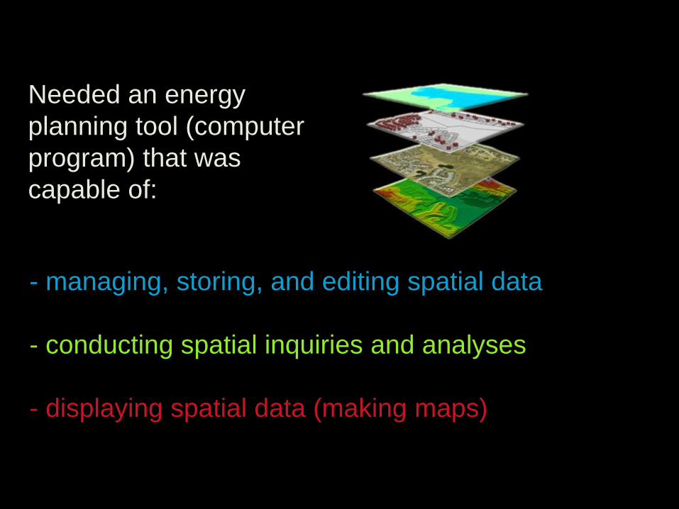
- managing, storing, and editing spatial data
- conducting spatial inquiries and analyses
- displaying spatial data (making maps)
Needed an energy
planning tool (computer
program) that was
capable of:
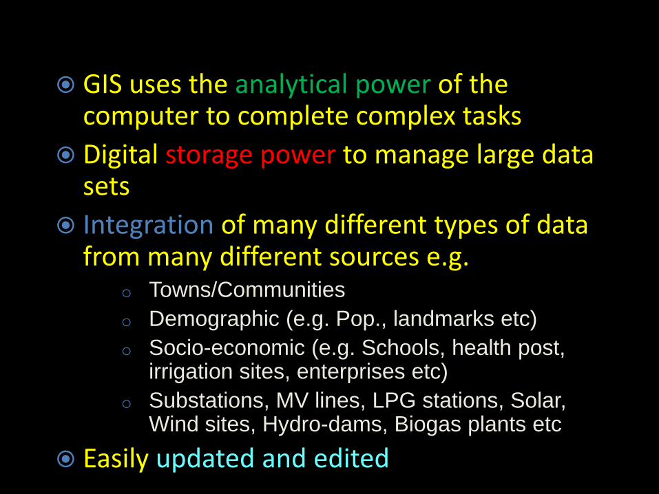
GIS uses the analytical power of the computer to complete complex tasks
Digital storage power to manage large data sets
Integration of many different types of data from many different sources e.g.
o Towns/Communities
o Demographic (e.g. Pop., landmarks etc)
o Socio-economic (e.g. Schools, health post, irrigation sites, enterprises etc)
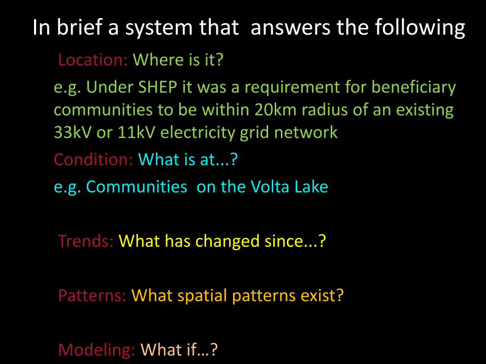
e.g. Under SHEP it was a requirement for beneficiary communities to be within 20km radius of an existing 33kV or 11kV electricity grid network
Condition: What is at...?
e.g. Communities on the Volta Lake
Trends: What has changed since...?
Patterns: What spatial patterns exist?
Modeling: What if…?
In brief a system that answers the following
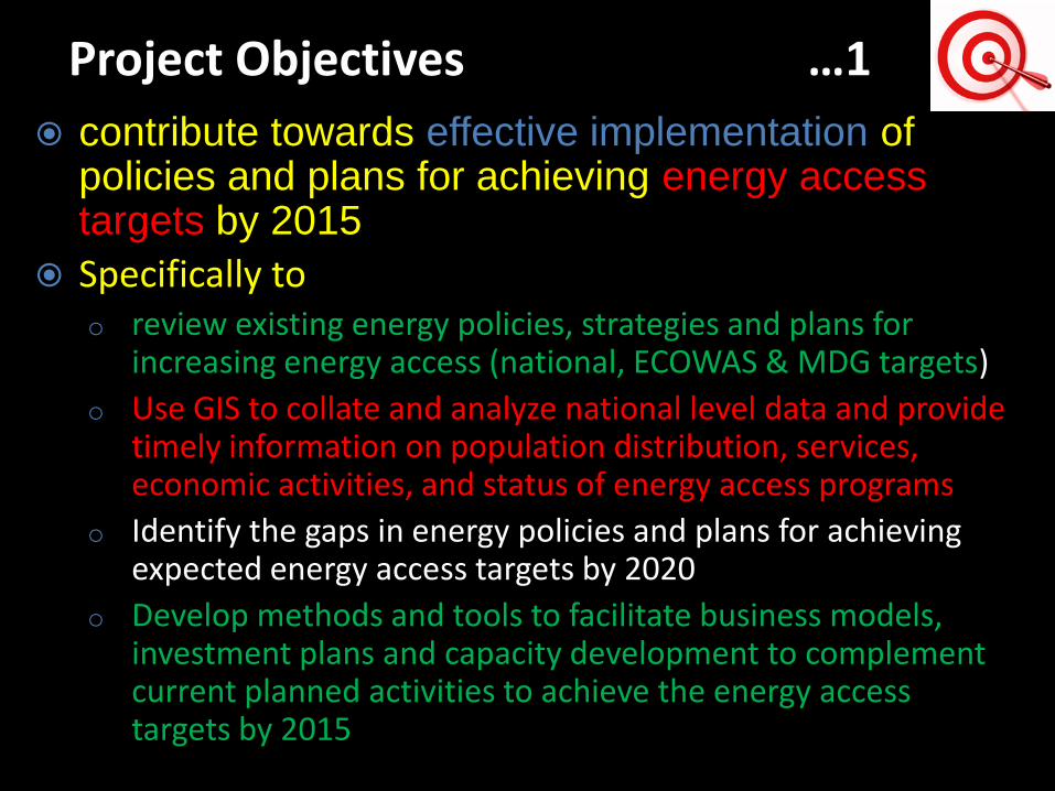
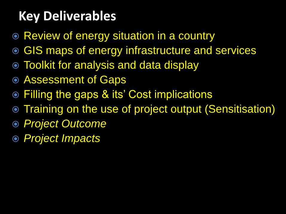
contribute towards effective implementation of policies and plans for achieving energy access targets by 2015
Specifically too review existing energy policies, strategies and plans for
increasing energy access (national, ECOWAS & MDG targets)
o Use GIS to collate and analyze national level data and provide timely information on population distribution, services, economic activities, and status of energy access programs
o Identify the gaps in energy policies and plans for achieving expected energy access targets by 2020
o Develop methods and tools to facilitate business models, investment plans and capacity development to complement current planned activities to achieve the energy access targets by 2015
Project Objectives …1
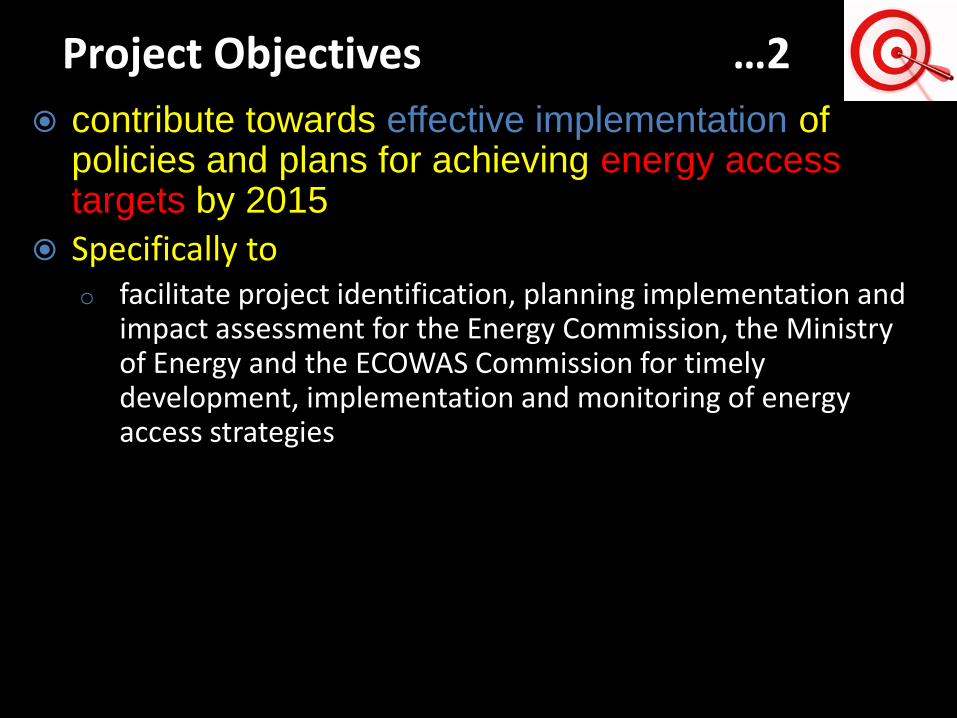
contribute towards effective implementation of policies and plans for achieving energy access targets by 2015
Specifically too facilitate project identification, planning implementation and
impact assessment for the Energy Commission, the Ministry of Energy and the ECOWAS Commission for timely development, implementation and monitoring of energy access strategies
Project Objectives …2
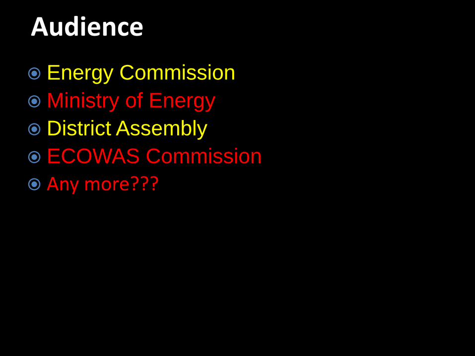
Energy Commission
Ministry of Energy
District Assembly
ECOWAS Commission
Any more???
Audience
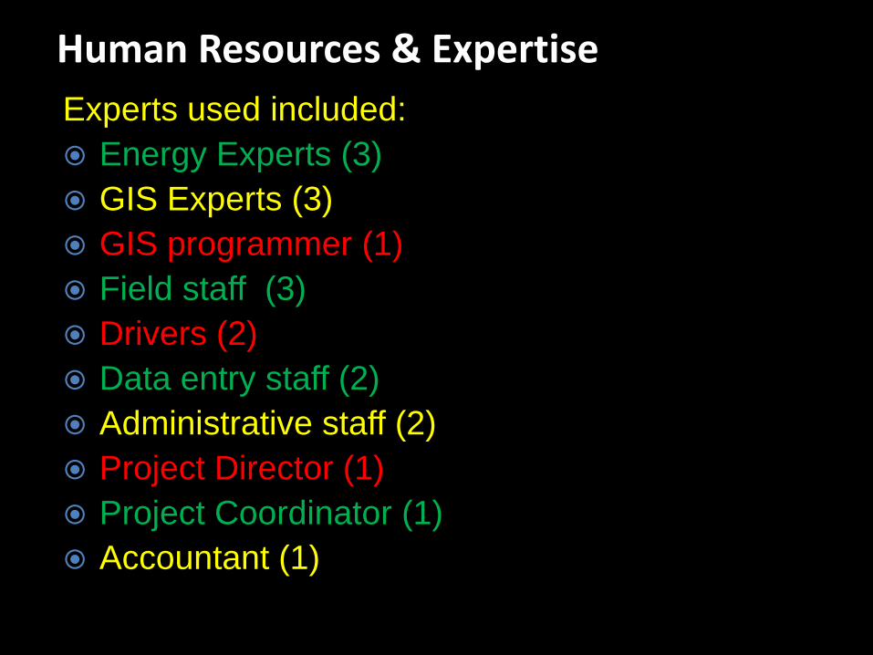
Experts used included:
Energy Experts (3)
GIS Experts (3)
GIS programmer (1)
Field staff (3)
Drivers (2)
Data entry staff (2)
Administrative staff (2)
Project Director (1)
Project Coordinator (1)
Accountant (1)
Human Resources & Expertise
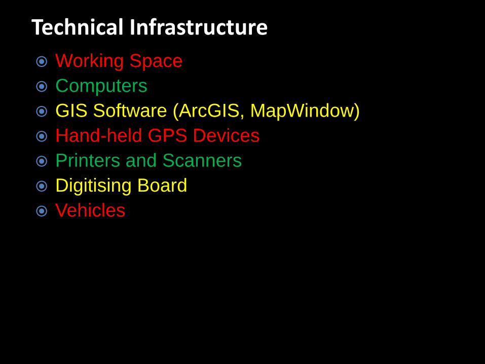
Working Space
Computers
GIS Software (ArcGIS, MapWindow)
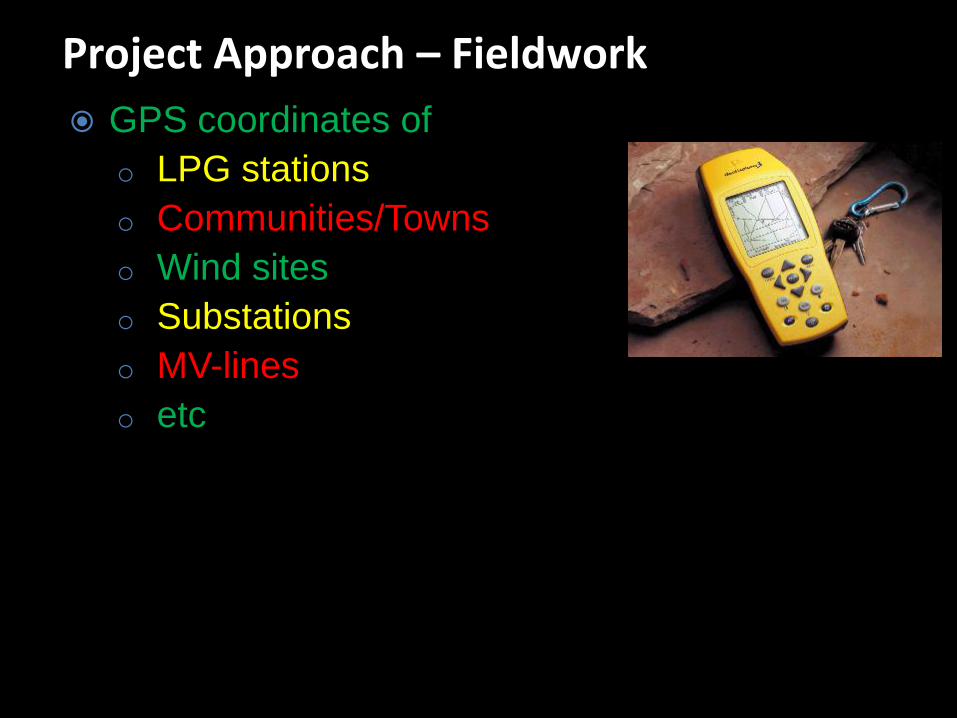
Hand-held GPS Devices
Printers and Scanners
Digitising Board
Vehicles
Technical Infrastructure
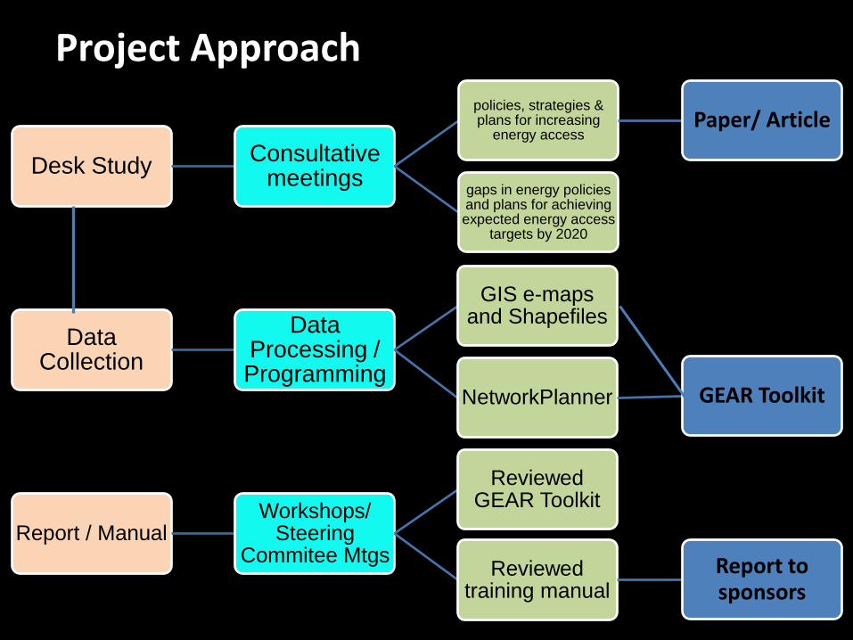
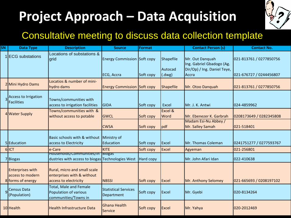
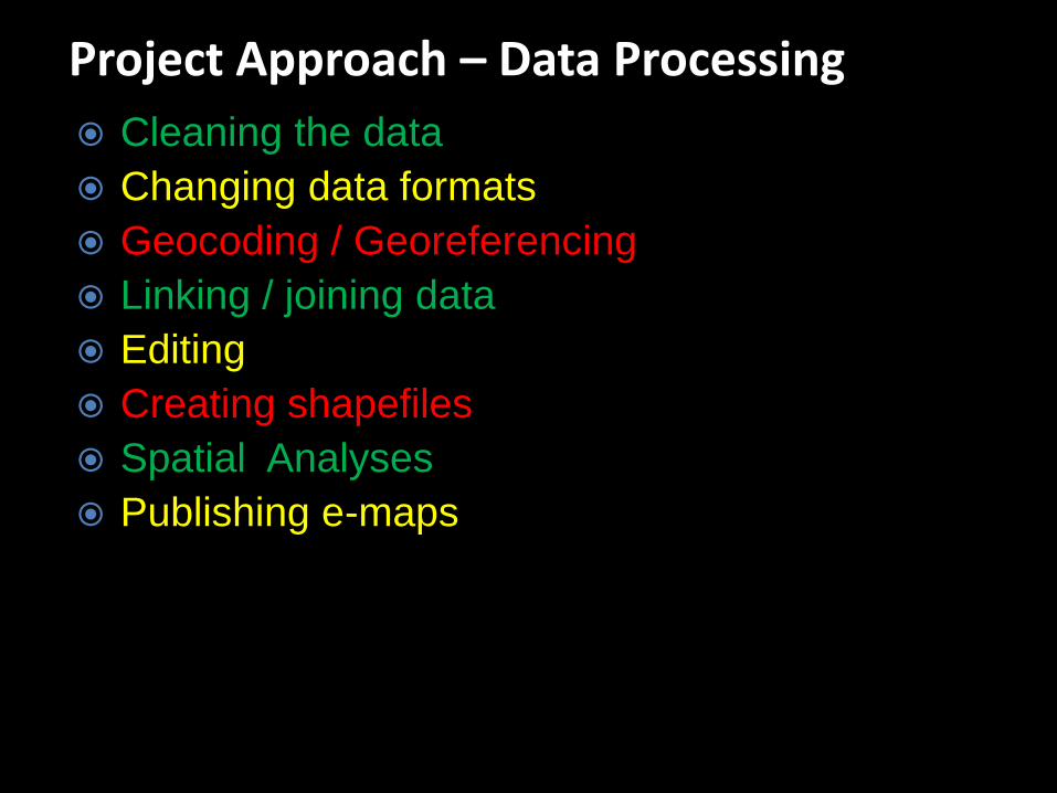
Project Approach
Desk StudyConsultative
meetings
policies, strategies & plans for increasing
energy access Paper/ Article
gaps in energy policies and plans for achieving expected energy access
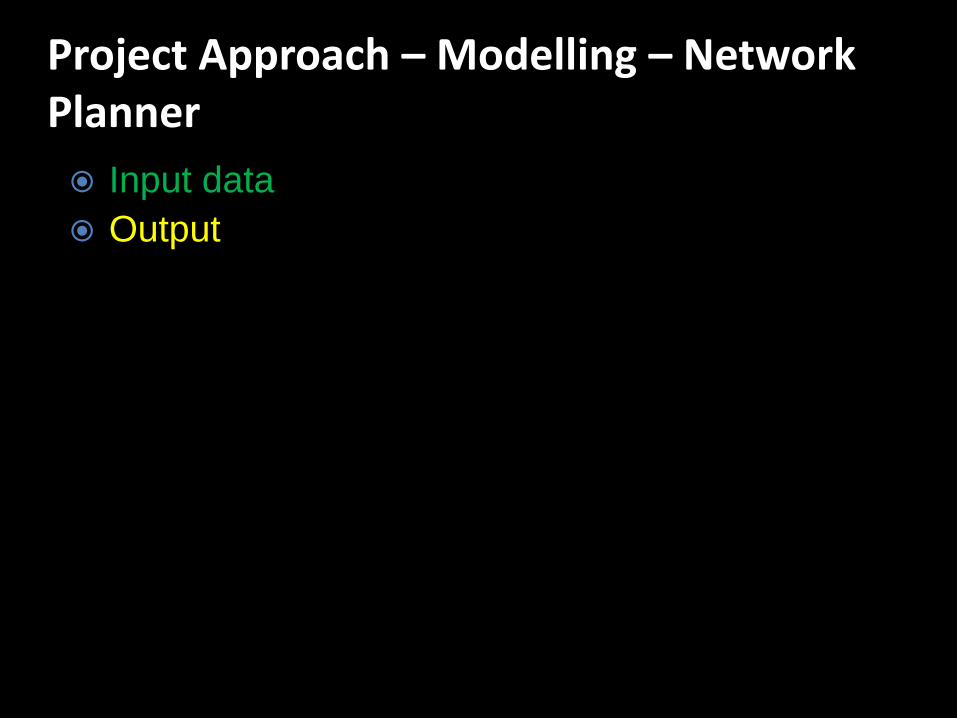
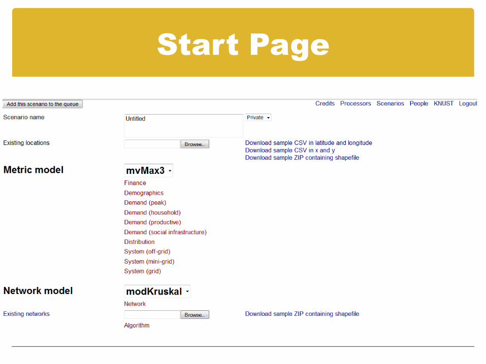
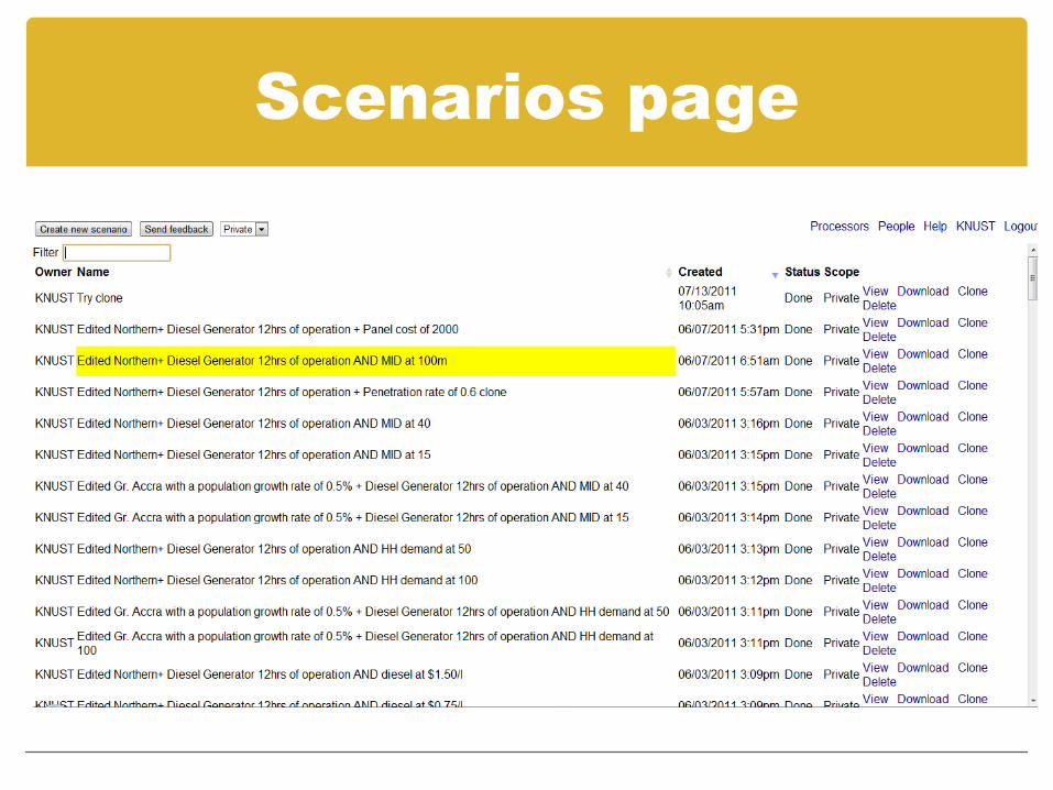
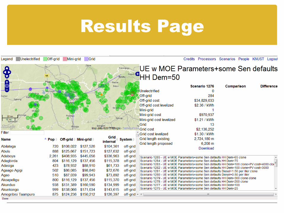
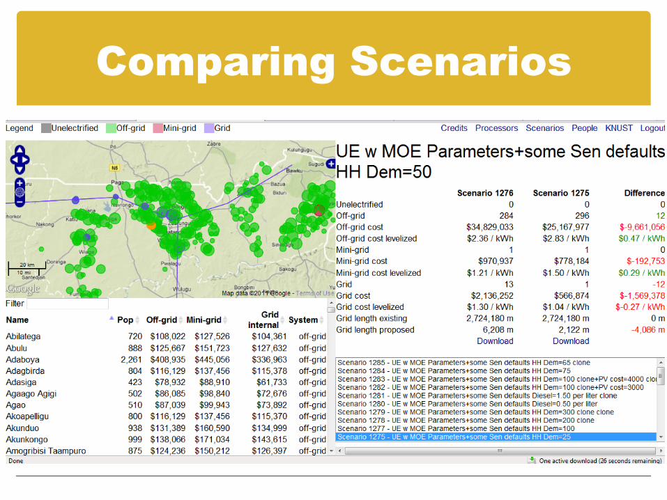
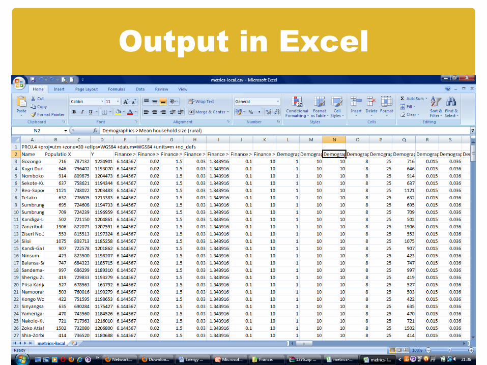
‘Network Planner’ is an online tool for planning electrification projects at national, regional, and local scales.
The model combines data on several parameters to compute detailed projection costs of three electrification options and propose the optimal cost-effective option for electrifying a community within a specified time horizon.


![Presentation eng0 [Modo de Compatibilidade] - ECREEE · August 25, 2011 Day Four 25 August 2011 RETScreen Training on RE&EE Project Analysis by ECREEE Location: KNUST, Kumasi, …](https://static.documents.pub/doc/80x56/5ba4f1d109d3f235188c51ed/presentation-eng0-modo-de-compatibilidade-august-25-2011-day-four-25-august.jpg)


