ARTICLES ROOM FOR THE RIVER: INTERNATIONAL RELEVANCE CHRIS ZEVENBERGEN et al. SOCIAL INNOVATION IN ROOM FOR THE RIVER: SELF-ORGANISING CITIZENS DON’T ALWAYS KNOW HOW TO MAKE A DIFFERENCE JURIAN EDELENBOS BOOK REVIEW MAKING SPACE FOR THE RIVER JAN WILLEM WESTERWEEL EDITORIAL LIDA SCHELWALD-VAN DER KLEY PODIUM NEW WAYS OF RIVER MANAGEMENT INGWER DE BOER CASE STUDIES MISSISSIPPI, USA STEVE MATHIES BRISBANE RIVER, AUSTRALIA GRAEME MILLIGAN RHINE, GERMANY STEFAN HILL SEINE, FRANCE REGIS THÉPOT HUAIHE, CHINA QIAN MIN WATER GOVERNANCE 02/2013 ISSN 2211-0224 E-ISSN 2211-0232 SPECIAL ISSUE: THE GOVERNANCE OF CREATING MORE ROOM FOR THE RIVER: BEST PRACTICES
Transcript
ARTIcles Room foR The RIveR: InTeRnATIonAl RelevAnce chRIs ZevenbeRgen et al.
socIAl InnovATIon In Room foR The RIveR: self-oRgAnIsIng cITIZens don’T AlwAys know how To mAke A dIffeRence JuRIAn edelenbos
book RevIew mAkIng spAce foR The RIveRJAn wIllem wesTeRweel
edIToRIAllIdA schelwAld-vAn deR kley
podIumnew wAys of RIveR mAnAgemenTIngweR de boeR
cAse sTudIes mIssIssIppI, usAsTeve mAThIes
bRIsbAne RIveR, AusTRAlIAgRAeme mIllIgAn
RhIne, geRmAnysTefAn hIll
seIne, fRAnceRegIs ThépoT
huAIhe, chInAQIAn mIn
wATeRgoveRnAnce02/2013
Issn 2211-0224e-Issn 2211-0232
specIAl Issue: The goveRnAnce of cReATIng moRe Room foR The RIveR: besT pRAcTIces
FREE SAMPLE COPYGo to the website to download your free sample copy : www.internationalwatergovernance.com
EditorsProf. dr. J. Edelenbos
Erasmus University Rotterdam, Rotterdam, The Netherlands,
in the different national contexts dealt with; from ecological values to integrated water management and the consequences of climate change. Landscape quality for example is often seen as a value that is easily connected to other values like flood safety. The interpretation of landscape values themselves is however highly contested. Local values are often more conservative than those of national planners. In case of the Netherlands, ‘Spatial quality’ reflects a lot of different frames and values, including environmental quality, ecological values, and economic potential.
These values potentially conflict. The values chosen to incorporate in the approach are important in the legitimization and acceptance of projects under Making Space for the River. The development towards multifunctionality helps to develop support for the development and implementation of Space for the River projects. Yet, adding more functions can also rise additional resistance because the impact of the project also increases and other functions and values (agriculture, serenity, openness) can be threatened. The authors state that the main governance challenges here are related to the question how to realize legitimacy in a context of strong value differences and frame controversies.
Differences in institutional contexts and coordination strategies The approach requests integration both horizontally and vertically (different policy domains). Making Space for the River can be characterized with fragmentation of organizations with different responsibilities and jurisdictions. Institutional boundary arrangements are necessary for developing and implementing Space for the River-type policies. These can be temporal or structural organizational provisions for coordination in a fragmented governance context:
formal and centralized (national) legislation and federal policies can realize coordination and alignment
boundary arrangements based on policy programs can be an instrument to realize coordination
collaborative network arrangements from a bottom-up network approach, the networks include authorities from different governance levels and actors from different policy domains
informal networks or temporal coalitions filling the institutional gap and connect different actors with various ambitions, values and interests.
The distinction between the various strategies is more gradual than principal. Strategies used in the various cases in this book vary from formal (national) legislation to informal, self-organizing network governance. In practice there are many ‘hybrids’. That makes Space for the River a collaborative challenge.
Dealing with the ‘implementation gap’ Making Space for the River is frequently obstructed or delayed. It is therefore that in almost every case a serious implementation gap shows up. These gaps are caused by lack of (powerful) instruments, complicated cooperation between different administrative domains and powerful local interests. Spatial claims give rise to new controversies, especially when existing land-use functions come at risk. The book emphasizes a need for collaboration both between organizations, as with stakeholders involved. A more inclusive approach to river management means the involvement of other stakeholders than the usual (technical) experts. At the same time it stresses that participation cannot take away deeply rooted and conflicting interests. Various cases dealt with combine stakeholder involvement with top-down instruments to enforce decision-making. Space for the River projects benefit from this combination.
But what makes a Making Space for the River approach successful?The book gives insight in traditional multilevel governance problems in this trending approach. In the various ‘bottom-up’ cases national support appears to be very difficult. The same argument can be applied to lack of local implementation of new national policies. The authors state that multilevel governance requires organizational, institutional, relational and personal skills and capacities that are often not obvious as starting conditions. The Dutch approach of Space for the River is set as a successful example for several criteria mentioned in the book: deliberate attempts and capacities to organize multilevel governance arrangements and processes, combining controversial and popular issues in a coherent program, adding values to the same project and combining stakeholder involvement with instruments to enforce national decision making. A critical note can be made on the limited scope in the definition of ‘success’ used here. Success is implicitly defined as the extent to which the organization and implementation of the approach have been realized from a ‘governance point of view’. In my opinion the reduction of flood risk should be involved as well as factor to determine the success of Making Space for the River. Or even several criteria because of the multifaceted values involved in this approach? And what does the approach mean in terms of planning and budget in relation to more traditional approaches? These could be topics for further research in an international comparison.
Cross-case and cross-country comparative studies are scarce on this approach. This book gives a broad overview of governance challenges in different national contexts. The international comparison provides valuable insights and further understanding of governance dilemma’s in the approach of Making Space for the River. Definitely worth reading, both for critics and believers.
THE GOVERNANCE OF CREATING MORE ROOM FOR THE RIVER: BEST PRACTICES
This special edition of Water Governance is entirely dedicated to the governance of rivers. The Dutch program “Room for the River” took the initiative to organise an international conference in Rotterdam on 19 November 2012. For this event several keynote speakers from different countries were QV^Q\ML�\W�XZM[MV\�KI[M�[\]LQM[�IJW]\�ÆWWL�XZWJTMU[�and water governance in their river basins. In between the presentations, panel discussions took place between foreign experts and Dutch water professionals. A main topic for debate was the involvement of stakeholders; both for creating support for spatial measures at local TM^MT�IVL�NWZ�I\\ZIK\QVO�ILLQ\QWVIT�ÅVIVKQIT�ZM[W]ZKM[��For the purpose of this journal, the keynote presentations have been edited by journalist Jac van <]QRV�QV\W�Å^M�KI[M�[\]La�IZ\QKTM[��<PM�KWVNMZMVKM�chairman and program director of the “Room for the River” program, Ingwer de Boer, introduces the articles in his “Podium” (cover) story. The Dutch experience is discussed in the article of Edelenbos. Chris Zevenbergen et al. have written an interesting synthesis article on the transferability of the concept of Room for the River, based on an analysis of the conditional NIK\WZ[�WN �\PM�Å^M�LQNNMZMV\�ZQ^MZ�JI[QV["�5Q[[Q[[QXXQ�(US), Rhine (Germany, Netherlands), Seine (France), Brisbane River (Australia), Huaihe (China).
As editorial board we can highly recommend you \PQ[�[XMKQIT�MLQ\QWV��5ISQVO�[XIKM�NWZ�\PM�ZQ^MZ[�Q[�I�‘trending topic’ in international water governance. Although each river basin has its own unique features, world-wide a paradigm shift can be seen. The wide-[XZMIL�P]UIV�ZM[XWV[M�WN �»ÅOP\QVO¼�\PM�_I\MZ�Ja�controlling, constricting and channelling the rivers is slowly loosing ground. Across the globe, the rivers themselves retaliated by bursting their banks every once in a while when the water had nowhere else to go. The conviction is now gaining ground that we should accommodate the water and give the rivers more space to expand and meander more freely. This also implies a shift towards a more integral and inclusive, XIZ\QKQXI\WZa�IXXZWIKP��1\�Q[�VW\�R][\�IJW]\�ÅOP\QVO�ÆWWL[��J]\�IT[W�IJW]\�LMITQVO�_Q\P�LZW]OP\[�IVL�_Q\P�rivers running dry.
However, countries have different geographical, historical and socio-economic backgrounds. In Australia, for a long time the main focus had been WV�LZW]OP\�Q[[]M[��<PM������ÆWWL[�QV�\PM�*ZQ[JIVM�area made the Australians realise that it was time for a more integrated river management approach, including water safety, quantity and quality issues. In the United States it worked the other way around. The
NMLMZIT�OW^MZVUMV\�ZM[XWV[M�NWZ�\PM�5Q[[Q[[QXXQ�River, being a main means of transport of national products, had always been directed at navigability WN �\PM�ZQ^MZ�IVL�ÆWWL�XZW\MK\QWV��4QSM�QV�UIVa�other countries, the budget made available on a yearly basis by the national government is based on prevalent political priorities. The all-time lowest rainfall record in the drainage basin in 2012, voiced the need for future river management from a broader, more integrated approach. It made the government realise how many citizens, the economy and nature rely on the river for their (competing) water needs. A recently started citizen’s initiative, involving many interest groups from the business world, civil engineers, science and nature groups, is now aiming for a public-private partnership.
In the Rhine basin the widespread water pollution, caused by the dumping of huge amounts of waste water by households and industries in the 1960s and ‘70s, was the lubricant for effectuating a well-oiled international river management of the entire Rhine River. Through the International Rhine Commission, the Rhine States developed successful strategies to counteract pollution and restore the water and ecological quality. Following the extremely high waters of 1995, this international approach was applied to water safety as well. Creating more space for the river goes hand in hand with improving the spatial quality of the riverine area. The cities situated along the JIVS[�WN �\PM�ZQ^MZ�:PQVM�IZM�MVRWaQVO�\PM�JMVMÅ\[�of these coordinated approaches. The German M`XZM[[QWV�¹.ZM]LM�IU�.T][[º�[Ia[�Q\�ITT��4QSM_Q[M��in Paris, the French “joie de vivre” proved to be the positive trigger for public support for future river management, whereby not threats, but new opportunities are central. Focussing on the joys people can experience from the river, as well as its economic potential, proved to be more effective for positive action than facing people with the threat of I�ÆWWL��\PI\�PILV¼\�WKK]ZZML�NWZ�ITUW[\�����aMIZ[��
In the Netherlands, the Room for the River project in the Overdiepse polder, has shown that civic engagement and co-creation, through societal self-WZOIVQ[I\QWV��KIV�XIa�WNN��1V�NIK\�Q\�Q[�[QUXTM"�?M�should embrace the river as a friend.
On behalf of the editorial board,
Lida Schelwald-van der Kley, Editor-in-chief Water Governance
As director of the Room for the River programme, I visited many rivers in foreign countries in 2008 and also received many foreign delegations wanting to see the Room for the River programme with their own eyes. It struck me that many of my foreign river manager colleagues often take a completely different approach, probably because they are working from a different financial, administrative and organisational background. Apart from that, the problems they encounter with water are often very different from ours. Certainly my foreign colleagues based outside Europe are dealing mainly with problems of drought – much more often than the problems of flooding that we have. They’re not dealing with a few weeks of drought, as it can be here; instead they talk in terms of years. Rivers that remain completely dry for months on end. With many rivers it is the case that the economic damage ensuing from the annual drought is much greater than from the substantial flooding that occurs here once in 100 years or so.
Impossible comparison This emerged more than once at the Room for the
River conference held on 15 November 2012 in Rotter-dam. Six different rivers, six different countries, six dif-ferent stories told by water managers from different corners of the world. Naturally the question arose whether we are doing it better here in the Netherlands. However, this question is virtually impossible to answer. For a start the scales are completely different – this is certainly the case if you think about some of the rivers in China for example. On the other hand, our safety standards here in the Netherlands are the highest in the world. Despite all the different circumstances, it is quite clear that water management in the Netherlands is very IL^IVKML�_PMZM�Q\�KWVKMZV[�ÆWWL�XZM^MV\QWV��?M�IZM�the safest delta in the world and the Room for the Ri-ver programme contributes towards keeping it that way. It is the biggest ever project in the Netherlands and has three innovative features that attract a lot of attention from foreign countries.
Creating opportunities;QVKM�\PM�[M^MZM�ÆWWL�\PZMI\[�QV��!!��IVL��!!���_M�IZM�now taking a different approach to raising the levels
of the dikes in the Netherlands. Higher dikes have the disadvantage of increasing the risks when things go wrong. That’s why, when the drainage capacity of the River Rhine was increased, a corresponding package of river level lowering measures was also adopted. The second innovative feature in the Room for the River programme concerns area development. With each sub-project an attempt is made to combine lowering \PM�ÆWWL�ZQ[S�_Q\P�QUXZW^QVO�\PM�[XI\QIT�Y]ITQ\a��This has emerged as an important success factor when implementing the programme, because new opportunities are created which engender enthusiasm in the parties involved. A good example of this is the ZMXTIKMUMV\�WN �\PM�LQSM�I\�4MV\�QV�\PM�6M\PMZTIVL[��The municipal authority of Nijmegen was initially very sceptical because the town was not involved in replacing the dike. Their attitude changed when they were invited to help work out the project plan. The design of the river park and the extra bridge immediately brought urban development into focus on the northern banks of the River Waal. Nijmegen recognised the potential opportunities associated with the River Waal. The municipal authority became an enthusiastic stakeholder and is now a substantial driving force behind the dike replacement.
* Ingwer de Boer is Director Programme Room for the River
WATER GOVERNANCE – 02/2013 – 7
NEW WAYS OF RIVER MANAGEMENT
Local implementationThe third innovation in the Room for the River programme concerns implementation at local level. <PM�MV\QZM�XZWOZIUUM�Q[�[M\�]X�IVL�ÅVIVKML�Ja�KMV\ZIT�government as a national key planning decision (PKB). .WZ�\PM�QUXTMUMV\I\QWV�WN �\PM����ZQ^MZ�_QLMVQVO�projects, links to other initiatives were also looked at in the areas of urban development, farming, recreation and nature. An administrative agreement was drawn up with the local parties that gave them a free hand. The XZWRMK\�WNÅKM�KWVKMZVML�Q\[MTN �WVTa�_Q\P�ZM[XMK\�\W�\PM�anticipated reduction in the water levels, the costs and the delivery date. And of course it’s all about putting words into action. Total implementation is eventually transferred to the most involved local administration, which in most cases tends to be the local water board or provincial authority and sometimes even the municipality. This way the best possible link is made between the wide ranging knowledge of central government and local area knowledge. This is a unique combination of top down and bottom up.
The river as a friendThe Room for the River programme has almost completely been put out to tender and has remained _Q\PQV�J]LOM\��5W[\�WN �\PM�[]J�XZWRMK\[�IZM�OWQVO�according to plan and will be delivered in 2015, or shortly afterwards. This is a substantial achievement bearing in mind that it is a huge infrastructure project _Q\P�I�J]LOM\�WN �����JQTTQWV��<PM�UW[\�QUXWZ\IV\�success factor has been looking at the river from a different perspective. Extremely high water levels occur seldom and so most of the time rivers remain friends that can provide a whole range of opportunities. When looking at the River Rhine it can be seen that the potential opportunities in all the sub-projects were analysed. Along with the various parties involved, opportunities were considered in the areas of habitat creation, recreation and the development of waterfronts. This paid off later on. It usually gets going once the excavation machines make their appearance, and later digging up the ground and putting any budget overruns and delays under the microscope. By emphasising the opportunities created by the river instead of the dangers, allies were found who are giving the river a central position with area developments. Water governance at its best.
Linking into different valuesThe highest level of enthusiasm shown by the foreign water managers came from the potential opportunities that could be achieved. But how do we actually do it? 5ISQVO�XWTLMZ[�Q[�[WUM\PQVO�\PI\�ÆW_[�\PZW]OP�W]Z�veins in the Netherlands. It all started with the origins of the water boards 800 years ago when farmers, town dwellers and leaders sat together round the table to LQ[K][[�\PM�J]QTLQVO�WN �LQSM[�\W�PMTX�XZM^MV\�ÆWWLQVO�
without creating a negative impact on farming. The RWJ�Q[�VM^MZ�ÅVQ[PML��+TQUI\M�KPIVOM�_QTT�JZQVO�_Q\P�Q\�extreme weather types and demand new technological interventions in our water systems. The Netherlands will have to deal with water shortages much more than it has done in years gone by. Success in this area will lie in discovering new methods and linking into different values, such as storing clean surface water and the MNÅKQMV\�][M�WN �\PM�_I\MZ�[a[\MU[��;][\IQVIJTM�MVMZOa�Q[�also related to this because during extended periods of higher temperatures, cooling water dissipates.
Faster water cycleExtreme weather situations bring with it the fact that \PM�_I\MZ�KaKTM�UIa�IT[W�[XMML�]X��5WZM�NZMY]MV\�heavy rainfall leading to accelerated river water discharge. Periods of droughts will also increase. We see this as a threat and we are building water storage facilities for collecting the higher water TM^MT[��5WZMW^MZ��_M�_QTT�ITTW_�MUMZOMVKa�_I\MZ�storage facilities to empty as quickly as possible to keep agriculture going. You could also consider the WXXWZ\]VQ\QM[�\PI\�TQM�_Q\P�ÅVLQVO�_Ia[�WN �[\WZQVO�water more permanently and therefore being able to get through these periods of drought. Collecting rainwater in towns and cities also offers opportunities. In Rotterdam for instance, the water storage facilities have been designed as water parks. Thinking in terms of opportunities instead of threats offers plenty of possibilities for water management and ensures continued social involvement.
BIOGRAPHY: INGWER DE BOER
1�2���1VO_MZ��LM�*WMZ�5;K�Q[�K]ZZMV\Ta�XZWOZIU�LQZMK\WZ�of the Room for the River programme of the Dutch ,QZMK\WZI\M�/MVMZIT�NWZ�8]JTQK�?WZS[���?I\MZ�5IVIOMUMV\��:QRS[_I\MZ[\II\���0M�PI[�UWZM�\PIV����aMIZ[�VI\QWVIT�IVL�international experience with the Directorate-General for 8]JTQK�?WZS[�IVL�?I\MZ�5IVIOMUMV\�QV�\PM�IZMI[�WN �_I\MZ�management, inland shipping and road management. His positions include that of director of Water and Shipping at Rijkswaterstaat North Holland and head engineer-director at the ,QZMK\WZI\M�/MVMZIT�NWZ�8]JTQK�?WZS[�IVL�?I\MZ�5IVIOMUMV\��Utrecht.5WZMW^MZ�PM�Q[�[MKZM\IZa�WN �\PM�;\QKP\QVO�6MLMZTIVL[M�Bouwpluim [Dutch foundation for incentivising innovative construction] for innovation in the building sector.1�2��LM�*WMZ�5;K�_I[�\ZIQVML�I[�IV�IOZQK]T\]ZIT�MVOQVMMZ�I\�Wageningen University.
8 – WATER GOVERNANCE – 02/2013
CASE STUDY - MISSISSIPPI, USA
CHANGING FROM FEDERAL GOVERNMENT TO PUBLIC- PRIVATE RIVER MANAGEMENTWith reference to the Room for the River conference with the keynote speech given by:Steve Mathies, Ph.D.*
The Mississippi river has broken two records over the last two years. In 2011, the highest water level ever recorded was measured. In 2012, the rainfall in the drainage basin was the lowest recorded over the previous 50 years. Flood protection and the navigability of the river have always been the responsibility of the U.S. Army Corps of Engineers. The extreme drought in 2012, however, made it clear that management of the Mississippi River does not stop at flood protection and navigation, but also includes the supply of fresh water to half of America and the many resources that depend upon it. A recently started citizen’s initiative is aiming for a public-private partnership involving many interest groups.
* Steve Mathies��8P�,���>QKM�8ZM[QLMV\��+WI[\IT�8ZW\MK\QWV�IVL�:M[\WZI\QWV��)-+75�<MKPVQKIT�;MZ^QKM[��=;)�
\PQZL�TIZOM[\�QV�\PM�_WZTL�IVL�\ISM[�QV����[\I\M[�QV�\PM�=�;��IVL�\_W�+IVILQIV�XZW^QVKM[��<PM�5Q[[Q[[QXXQ�River system has over 19,000 kilometres of navigable stream with a depth of at least 2.7 meters. The 5Q[[Q[[QXXQ�[\IZ\[�QV�\PM�VWZ\P�VMIZ�5QVVMIXWTQ[��5QVVM[W\I��\W�\PM�_M[\�WN �\PM�/ZMI\�4ISM[��)VW\PMZ�OZMI\�ZQ^MZ��\PM�5Q[[W]ZQ��RWQV[�I\�;\�4W]Q[��5Q[[W]ZQ��The Ohio River joins a little further downstream at Cairo, Illinois. The Ohio River provides a link with the heavily industrialised north-eastern part of the United ;\I\M[�IVL�\PM�]XXMZ�5Q[[Q[[QXXQ�IVL�5Q[[W]ZQ�:Q^MZ[�connect with the vast grain producing area of the central U.S. From Cairo south to New Orleans and the /]TN �WN �5M`QKW��\PM�5Q[[Q[[QXXQ�:Q^MZ�[MZ^M[�I[�America’s most important marine transportation corridor. The average river discharge rate is 16800 U��[��[WUM\QUM[�ZQ[QVO�I[�PQOP�I[� � ���U��[�WZ�NITTQVO�I[�TW_�I[������U��[�The characteristics of the upstream and downstream XIZ\[�WN �\PM�5Q[[Q[[QXXQ�LQNNMZ�OZMI\Ta��<PM�=XXMZ�5Q[[Q[[QXXQ�Q[�LWUQVI\ML�Ja����LIU[�IVL��!��VI^QOI\QWV�TWKS[�\PI\�[\ZWVOTa�QVÆ]MVKM�\PM�ÆW_�WN �\PM�river. Despite this, the river remains natural to a great M`\MV\�IVL�ÆW_[�\PZW]OP�\PZMM�VI\QWVIT�XIZS[��:]VWNN �
from agricultural growing areas accounts for elevated nutrient levels in the river and in turn adversely impacts water quality. <PM�5QLLTM�5Q[[Q[[QXXQ�Q[�I�ZMTI\Q^MTa�[PWZ\�[MK\QWV�WN �����SQTWUM\ZM[�ÆW_QVO�JM\_MMV�;\�4W]Q[�IVL�+IQZW��<PM�LZWX�Q[�TQUQ\ML�IVL�\PM�ZQ^MZ�ÆW_[�NZMMTa��<PM�4W_MZ�5Q[[Q[[QXXQ��[W�KITTML�»UQOP\a¼�5Q[[Q[[QXXQ��Q[�actually the downstream section below Cairo that ÆW_[�NWZ�VMIZTa������SQTWUM\ZM[��<PQ[�Q[�\PM�LWUIQV�of the enormous barges, pushing their cargos of coal and grain down the river to New Orleans, barge tows sometimes numbering up to 40 barges . Every year virtually the entire grain harvest from mid-America is transported on the river to New Orleans for shipment to the rest of the world. Nearly 600 million tons of cargo utilize the river on an annual basis.In addition, according to the U.S. Environmental Protection Agency, more than 50 cities rely on the river for their drinking water needs.
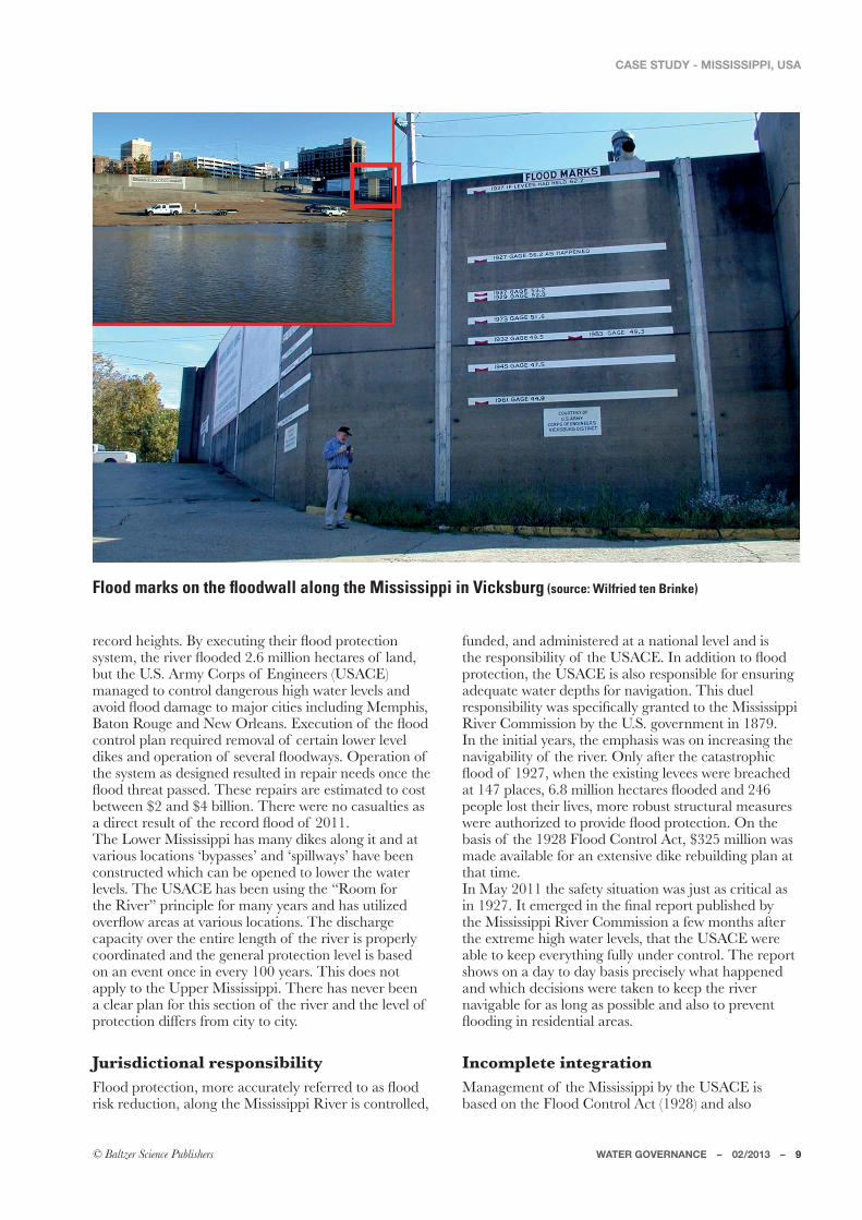
Flood history & risk perception<PM�LIVOMZ[�WN �ÆWWLQVO�IZM�_MTT�]VLMZ[\WWL�ITWVO�\PM�5Q[[Q[[QXXQ�:Q^MZ��1V��!!���\PM�=XXMZ�5Q[[Q[[QXXQ�ÆWWLML��������PWUM[��<PMZM�_MZM����KI[]IT\QM[�IVL�the damage amounted to $15 billion. In 2011, it PIXXMVML�IOIQV�_Q\P�\PM�4W_MZ�5Q[[Q[[QXXQ�ZMIKPQVO�
ZMKWZL�PMQOP\[��*a�M`MK]\QVO�\PMQZ�ÆWWL�XZW\MK\QWV�[a[\MU��\PM�ZQ^MZ�ÆWWLML�����UQTTQWV�PMK\IZM[�WN �TIVL��but the U.S. Army Corps of Engineers (USACE) managed to control dangerous high water levels and I^WQL�ÆWWL�LIUIOM�\W�UIRWZ�KQ\QM[�QVKT]LQVO�5MUXPQ[��*I\WV�:W]OM�IVL�6M_�7ZTMIV[��-`MK]\QWV�WN �\PM�ÆWWL�control plan required removal of certain lower level LQSM[�IVL�WXMZI\QWV�WN �[M^MZIT�ÆWWL_Ia[��7XMZI\QWV�WN �the system as designed resulted in repair needs once the ÆWWL�\PZMI\�XI[[ML��<PM[M�ZMXIQZ[�IZM�M[\QUI\ML�\W�KW[\�between $2 and $4 billion. There were no casualties as I�LQZMK\�ZM[]T\�WN �\PM�ZMKWZL�ÆWWL�WN �������<PM�4W_MZ�5Q[[Q[[QXXQ�PI[�UIVa�LQSM[�ITWVO�Q\�IVL�I\�various locations ‘bypasses’ and ‘spillways’ have been constructed which can be opened to lower the water levels. The USACE has been using the “Room for the River” principle for many years and has utilized W^MZÆW_�IZMI[�I\�^IZQW][�TWKI\QWV[��<PM�LQ[KPIZOM�capacity over the entire length of the river is properly coordinated and the general protection level is based on an event once in every 100 years. This does not IXXTa�\W�\PM�=XXMZ�5Q[[Q[[QXXQ��<PMZM�PI[�VM^MZ�JMMV�a clear plan for this section of the river and the level of protection differs from city to city.
funded, and administered at a national level and is \PM�ZM[XWV[QJQTQ\a�WN �\PM�=;)+-��1V�ILLQ\QWV�\W�ÆWWL�protection, the USACE is also responsible for ensuring adequate water depths for navigation. This duel ZM[XWV[QJQTQ\a�_I[�[XMKQÅKITTa�OZIV\ML�\W�\PM�5Q[[Q[[QXXQ�River Commission by the U.S. government in 1879. In the initial years, the emphasis was on increasing the navigability of the river. Only after the catastrophic ÆWWL�WN ��!����_PMV�\PM�M`Q[\QVO�TM^MM[�_MZM�JZMIKPML�I\�����XTIKM[���� �UQTTQWV�PMK\IZM[�ÆWWLML�IVL�����people lost their lives, more robust structural measures _MZM�I]\PWZQbML�\W�XZW^QLM�ÆWWL�XZW\MK\QWV��7V�\PM�JI[Q[�WN �\PM��!� �.TWWL�+WV\ZWT�)K\�������UQTTQWV�_I[�made available for an extensive dike rebuilding plan at that time.1V�5Ia������\PM�[INM\a�[Q\]I\QWV�_I[�R][\�I[�KZQ\QKIT�I[�QV��!����1\�MUMZOML�QV�\PM�ÅVIT�ZMXWZ\�X]JTQ[PML�Ja�\PM�5Q[[Q[[QXXQ�:Q^MZ�+WUUQ[[QWV�I�NM_�UWV\P[�IN\MZ�the extreme high water levels, that the USACE were able to keep everything fully under control. The report shows on a day to day basis precisely what happened and which decisions were taken to keep the river navigable for as long as possible and also to prevent ÆWWLQVO�QV�ZM[QLMV\QIT�IZMI[��
Incomplete integration5IVIOMUMV\�WN �\PM�5Q[[Q[[QXXQ�Ja�\PM�=;)+-�Q[�based on the Flood Control Act (1928) and also
Flood marks on the floodwall along the Mississippi in Vicksburg (source: Wilfried ten Brinke)
10 – WATER GOVERNANCE – 02/2013
CASE STUDY - MISSISSIPPI, USA
\PM�5Q[[Q[[QXXQ�:Q^MZ���<ZQJ]\IZQM[�XZWRMK\���!� ��emanating from it. Since that time the USACE has, with funding from the federal government, spent $14 billion on structural levee protection and building facilities for inland shipping. The discharge capacity WN �\PM�4W_MZ�5Q[[Q[[QXXQ�PI[�JMMV�QVKZMI[ML�Ja��� �\W��� ���U��XMZ�[MKWVL��)KKWZLQVO�\W�\PM�=;)+-��\PQ[�PI[�XZM^MV\ML������JQTTQWV�WN �LIUIOM��MY]ITTQVO�I�ZM\]ZV�WV�QV^M[\UMV\�WN ���"���Despite this, the situation is still not perfect, because the 1928 safety plan is limited to the downstream area WN �\PM�5Q[[Q[[QXXQ�:Q^MZ��=X[\ZMIU�\PM�5Q[[Q[[QXXQ�IVL�\PM�OZMI\�\ZQJ]\IZQM[�WN �\PM�5Q[[W]ZQ�IVL�\PM�7PQW�IZM�the responsibility of other divisions and there is no common systematic harmonisation with respect to [INM\a�TM^MT[�WZ�UIVIOMUMV\�WN �\PM�MV\QZM�5Q[[Q[[QXXQ�River watershed as a system. <PM�=XXMZ�5Q[[Q[[QXXQ�:Q^MZ�+WUXZMPMV[Q^M�8TIV�_I[�published in February 2008 and it details a strategic ^Q[QWV�NWZ�\PM�=XXMZ�5Q[[Q[[QXXQ�IVL�\PM�7PQW�ZQ^MZ[��The most striking part of the plan is the proposal to give the entire upstream area a safety level of once in 500 years for urban areas and once in 200 aMIZ[�NWZ�Z]ZIT�IZMI[��<PM�XTIV�PI[�VW\�JMMV�WNÅKQITTa�accepted by USACE and the senate has called the plan prohibitively expensive.
Drought record.WTTW_QVO�\PM�ZMKWZL�PQOP�ÆWWL�WN �������I�ZMKWZL�drought and resulting low water was recorded in 2012. By some accounts, there has never been so little rainfall in mid-America over the last 50 years. Again the USACE took action and worked tirelessly to maintain navigation despite the low water levels. The drought resulted in renewed interest in the 5Q[[Q[[QXXQ�:Q^MZ�IVL�Q\[�\ZQJ]\IZQM[�I[�I�[W]ZKM�WN �NZM[P_I\MZ��5IVa�\W_V[�IVL�NIZUQVO�KWUU]VQ\QM[��I[�well as coastal restoration interest in areas adjacent \W�6M_�7ZTMIV[�IVL�IKZW[[�[W]\PMZV�4W]Q[QIVI��PI^M�voiced the need for future river management from a broader more integrated approach to ensure that the many services provided by the river are continued to be met in years to come. To that end, in September ������\_MV\a�UIaWZ[�UM\�QV�;\�4W]Q[�IVL�KITTML�WV�\PM�=�;��OW^MZVUMV\�\W�XZW^QLM�N]VL[�NWZ�ÆWWL�XZW\MK\QWV��
sustainable development, and the ecological restoration WN �\PM�ZQ^MZ�IVL�KWI[\IT�4W]Q[QIVI�
Public initiativeThe USACE is facing a number of high costs for the renovation of some outdated shipping locks. .]Z\PMZUWZM��UIQV\IQVQVO�ÆWWL�XZW\MK\QWV�TM^MT[��management of the larger freshwater reserves, and the MKWTWOQKIT�ZM[\WZI\QWV�WN �\PM�ZQ^MZ�IVL�KWI[\IT�4W]Q[QIVI�are all going to cost a lot of money. A group of citizens from the business world, civil engineers, science and nature groups have come together to set up America’s Great Watershed Initiative (AGWI). According to the initiators, virtually all interest groups are already convinced of the importance of the river for citizens, the economy and the natural environment. According to them the only thing still missing is a shared vision and authority and funding for its implementation. The AGWI steering committee, with support from Nature Conservancy and USACE, are now working on a 100 year vision in which local, regional and federal interests IZM�ITQOVML�QV�\PM�IZMI[�WN �QVL][\Za��IOZQK]T\]ZM��Å[PQVO��energy supplies, ecosystem restoration and nature conservancy. One of the aims of the initiative is to set up a public-private partnership that maintains contact with all the interest groups and ensures wide-ranging, integral river management.
R. Unsworth (1999), Economic PrWÅTM�WN �\PM�=XXMZ�5Q[[Q[[QXXQ�:Q^MZ�:MOQWV��1VL][\ZQIT�-KWVWUQK[" +IUJZQLOM��5I[[IKP][M\\[��P\\X"��TQJZIZa�N_[�OW^�8]J[��MKWVWUQKXZWÅTMGUQ[[!!�XLN�
9] Black, R., S. Hutchison and C. Warshaw (2004), Economic 8ZWÅTM�
Additional sources used in this article:0Q[\WZa�WN �\PM�5Q[[Q[[QXXQ"�P\\X"��___�U^V�][IKM�IZUa�UQT�XIW�JZW�UQ[[\ZQJ�P\UAmerica’s Great Watershed Initiative: P\\X"��___�IO_Q�WZO�
WATER GOVERNANCE COMPARISON: THE US VERSUS THE NETHERLANDS
In the U.S., the management of large rivers is of national importance and is entirely the responsibility of the U.S. Army Corps of Engineers. The river management is typically biased towards civil engineering and is aimed at structures to benefit navigation and provide flood protection. The budget made available on a yearly basis by the national government is based on current political priorities.
INTEGRATED RIVER BASIN MANAGEMENT IN ITS INFANCYWith reference to the Room for the River conference with the keynote speech given by:Graeme Milligan*
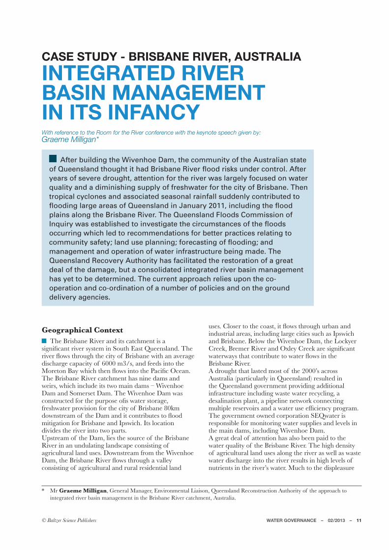
After building the Wivenhoe Dam, the community of the Australian state of Queensland thought it had Brisbane River flood risks under control. After years of severe drought, attention for the river was largely focused on water quality and a diminishing supply of freshwater for the city of Brisbane. Then tropical cyclones and associated seasonal rainfall suddenly contributed to flooding large areas of Queensland in January 2011, including the flood plains along the Brisbane River. The Queensland Floods Commission of Inquiry was established to investigate the circumstances of the floods occurring which led to recommendations for better practices relating to community safety; land use planning; forecasting of flooding; and management and operation of water infrastructure being made. The Queensland Recovery Authority has facilitated the restoration of a great deal of the damage, but a consolidated integrated river basin management has yet to be determined. The current approach relies upon the co-operation and co-ordination of a number of policies and on the ground delivery agencies.
integrated river basin management in the Brisbane River catchment, Australia.
Geographical ContextThe Brisbane River and its catchment is a
[QOVQÅKIV\�ZQ^MZ�[a[\MU�QV�;W]\P�-I[\�9]MMV[TIVL��<PM�ZQ^MZ�ÆW_[�\PZW]OP�\PM�KQ\a�WN �*ZQ[JIVM�_Q\P�IV�I^MZIOM�LQ[KPIZOM�KIXIKQ\a�WN ������U��[��IVL�NMML[�QV\W�\PM�5WZM\WV�*Ia�_PQKP�\PMV�ÆW_[�QV\W�\PM�8IKQÅK�7KMIV��The Brisbane River catchment has nine dams and weirs, which include its two main dams – Wivenhoe Dam and Somerset Dam. The Wivenhoe Dam was KWV[\Z]K\ML�NWZ�\PM�X]ZXW[M�WÅ[�_I\MZ�[\WZIOM��freshwater provision for the city of Brisbane 80km LW_V[\ZMIU�WN �\PM�,IU�IVL�Q\�KWV\ZQJ]\M[�\W�ÆWWL�mitigation for Brisbane and Ipswich. Its location divides the river into two parts. Upstream of the Dam, lies the source of the Brisbane River in an undulating landscape consisting of agricultural land uses. Downstream from the Wivenhoe ,IU��\PM�*ZQ[JIVM�:Q^MZ�ÆW_[�\PZW]OP�I�^ITTMa�consisting of agricultural and rural residential land
][M[��+TW[MZ�\W�\PM�KWI[\��Q\�ÆW_[�\PZW]OP�]ZJIV�IVL�industrial areas, including large cities such as Ipswich IVL�*ZQ[JIVM��*MTW_�\PM�?Q^MVPWM�,IU��\PM�4WKSaMZ�+ZMMS��*ZMUMZ�:Q^MZ�IVL�7`TMa�+ZMMS�IZM�[QOVQÅKIV\�_I\MZ_Ia[�\PI\�KWV\ZQJ]\M�\W�_I\MZ�ÆW_[�QV�\PM�Brisbane River. A drought that lasted most of the 2000’s across )][\ZITQI��XIZ\QK]TIZTa�QV�9]MMV[TIVL��ZM[]T\ML�QV�\PM�9]MMV[TIVL�OW^MZVUMV\�XZW^QLQVO�ILLQ\QWVIT�infrastructure including waste water recycling, a desalination plant, a pipeline network connecting U]T\QXTM�ZM[MZ^WQZ[�IVL�I�_I\MZ�][M�MNÅKQMVKa�XZWOZIU��<PM�OW^MZVUMV\�W_VML�KWZXWZI\QWV�;-9_I\MZ�Q[�responsible for monitoring water supplies and levels in the main dams, including Wivenhoe Dam. A great deal of attention has also been paid to the water quality of the Brisbane River. The high density of agricultural land uses along the river as well as waste water discharge into the river results in high levels of V]\ZQMV\[�QV�\PM�ZQ^MZ¼[�_I\MZ��5]KP�\W�\PM�LQ[XTMI[]ZM�
12 – WATER GOVERNANCE – 02/2013
CASE STUDY - BRISBANE RIVER, AUSTRALIA
WN �ZMKZMI\QWVIT�Å[PMZUMV�IVL�VI\]ZM�TW^MZ[��\PQ[�PI[�ZM[]T\ML�QV�ITOIM�JTWWU[�QV�\PM�5WZM\WV�*Ia�0MIT\Pa�?I\MZ_Ia[�Q[�I�VW\�NWZ�XZWÅ\��VWV�OW^MZVUMV\�organization working to protect and improve waterway PMIT\P�QV�;W]\P�-I[\�9]MMV[TIVL��)[�I�XIZ\�WN �\PMQZ�-KW[a[\MU�0MIT\P�5WVQ\WZQVO�8ZWOZIU��\PMa�annually assess catchments and estuaries in South East 9]MMV[TIVL�\W�IL^Q[M�KW]VKQT[��TIVL�UIVIOMZ[�WV�IZMI[�of declining health, report on the effect of different land uses, and provide actions to protect the aquatic ecosystems1.;-9�+I\KPUMV\[�Q[�I�KWUU]VQ\a�JI[ML�VW\�NWZ�XZWÅ\�WZOIVQbI\QWV�\PI\�[MMS[�\W�J]QTL�I�[][\IQVIJTM�community and promotes the values of natural resources and the biodiversity of South East 9]MMV[TIVL��;-9�+I\KPUMV\[�_WZS[�_Q\P�)][\ZITQIV��9]MMV[TIVL�IVL�TWKIT�OW^MZVUMV\[�\W�QVÆ]MVKM�XWTQKa��align planning and secure funding for environmental projects as well as provides technical advice on data collection, vegetation management, water quality and property management to the community2. With VW\�NWZ�XZWÅ\�OZW]X[�[]KP�I[�0MIT\Pa�?I\MZ_Ia[�IVL�;-9�+I\KPUMV\[��\PM�KWWZLQVI\QWV�WN �KIZQVO�NWZ�IVL�enhancing the ecosystems that are our rivers and their catchments (in this case the Brisbane River and its catchment) can be promoted to the community, governments and other stakeholders.
Flood History and Risk Perception.ZWU�,MKMUJMZ�������9]MMV[TIVL�_I[�PQ\�Ja�[M^MV�severe weather events in a four month time period. Three of these events were Tropical Cyclones – Tropical Cyclone Tasha, Tropical Cyclone Anthony and Tropical Cyclone Yasi. These weather events brought a great deal of rain to an already sodden TIVL[KIXM�ZM[]T\QVO�QV�\PM�ÆWWLQVO�WN �IV�IZMI�I[�TIZOM�as France and Germany combined (or 41.5 times the size of the Netherlands). )N\MZ�[M^MZM�ÆWWLQVO�QV�9]MMV[TIVL�QV��!����\PM�OW^MZVUMV\�WN �9]MMV[TIVL�J]QT\�\PM�?Q^MVPWM�,IU��which resulted in the perception that the Brisbane River no longer posed a threat. In early January 2011, \PM�*ZQ[JIVM�:Q^MZ�ÆWWLML�ZM[]T\QVO�QV�TIZOM�XIZ\[�WN �the city of Brisbane being submerged or isolated by ÆWWL_I\MZ[��<PQ[�TMIL�\W�UIVa�KWUU]VQ\a�UMUJMZ[�questioning the function of the Dam and its operation
before and during the rain events, noting that other ZQ^MZ[�IVL�UIRWZ�KZMMS[�KWV\ZQJ]\M�ÆW_[�LW_V[\ZMIU�WN �the Wivenhoe Dam. One month later, the northern part of the state was hit by Tropical Cyclone Yasi, which resulted in extreme winds, storm surge and associated rainfall _PQKP�KWV\ZQJ]\ML�\W�ÆWWLQVO�QV�[WUM�XIZ\[�WN �\PM�[\I\M��)�\W\IT�WN ����XMWXTM�_MZM�SQTTML�QV�\PM������9]MMV[TIVL�.TWWL[�IVL�KaKTWVM[���!�ZQ^MZ[�ÆWWLML�����WN �_PQKP�JZWSM�M`Q[\QVO�ÆWWL�ZMKWZL[�IVL�\PM�?WZTL�Bank estimated $15.9 billion in total damages and economic losses with a public reconstruction cost of approximately $7.2 billion dollars3.
Jurisdictional Responsibility9]MMV[TIVL�PI[�JMMV�UIVIOQVO�ZQ^MZ�JI[QV[�]VLMZ�IV�1V\MOZI\ML�+I\KPUMV\�5IVIOMUMV\�XWTQKa�NWZ�over twenty years. This integrated approach is central to natural resource management to ensure that individual issues and links are considered, developing holistic approaches to productive, resilient landscapes. This includes integrating economic, social and environmental values, as well as engaging the community and industry, in planning, decision making and delivery.<PM�9]MMV[TIVL�/W^MZVUMV\�_WZS[�_Q\P�\PQZ\MMV�VWV�[\I\]\WZa�ZMOQWVIT��6I\QWVIT�:Q^MZ�5IVIOMUMV\�OZW]X[��local authorities and the Australian Government to manage our natural resources wisely, address environmental problems and build healthy regions. ;-9�+I\KPUMV\[�Q[�\PM�ZMOQWVIT�VI\]ZIT�ZM[W]ZKM�management group providing on-ground services in the Brisbane River catchment.The states are responsible for river management in )][\ZITQI��_Q\P�9]MMV[TIVL�JMQVO�ZM[XWV[QJTM�NWZ�\PM�Brisbane River. The integration and coordination of XTIVVQVO�IVL�QUXTMUMV\I\QWV�WN �ÆWWL�ZQ[S�UIVIOMUMV\�occurs between state government departments and IOMVKQM[�I\�I�KPQMN �M`MK]\Q^M�WNÅKMZ�TM^MT��)N\MZ�\PM�2IV]IZa������ÆWWL[��\PM�9]MMV[TIVL�.TWWL[�+WUUQ[[QWV�WN �1VY]QZa��9.+71��XMZNWZUML�a thorough investigation of the circumstances surrounding the deadly and destructive weather events. One of the main matters that was in focus of the 9.+71�_I[�\W�QV^M[\QOI\M�\PM�QUXTMUMV\I\QWV�WN �\PM�systems operations plans for dams across the state and in particularly the Wivenhoe and Somerset release strategy and an assessment of compliance with, and suitability of the operational procedures relating to ÆWWL�UQ\QOI\QWV�IVL�LIU�[INM\a��,]ZQVO�\PM�9.+71��IV�QVQ\QIT�ZMXWZ\�_I[�ZMTMI[ML�QV�August 2011 including 177 recommendations, with \PM�ÅVIT�ZMXWZ\�JMQVO�ZMTMI[ML�QV�5IZKP�������<PM�QUXTMUMV\I\QWV�WN �9.+71�ZMKWUUMVLI\QWV[�_I[�split into implementation groups, which are overseen IVL�KWWZLQVI\ML�Ja�\PM�KPQMN �M`MK]\Q^M�WNÅKMZ[�WN �SMa�government departments and agencies.7VM�[XMKQÅK�ZMKWUUMVLI\QWV�ZMTI\QVO�\W�implementation of a study of the entire length of the
COMPARING WATER GOVERNANCE: AUSTRALIA VERSUS THE NETHERLANDS
Extended periods of drought have resulted in an Australian river management primarily focused on the freshwater supplies required for potable water, industrial and agricultural purposes. Water shortages are an ongoing issue, while excessive rainfall and related flooding, such as occurred in 2011, are still considered incidental.
WATER GOVERNANCE – 02/2013 – 13
CASE STUDY - BRISBANE RIVER, AUSTRALIA
Brisbane River, pertained to the principal of Integrated :Q^MZ�*I[QV�5IVIOMUMV\��1:*5���<PM�*ZQ[JIVM�:Q^MZ�Catchment Study is currently being performed by ,MXIZ\UMV\�WN �6I\]ZIT�:M[W]ZKM[�IVL�5QVM[��,6:5�#�Department of State Development, Infrastructure and Planning (DSDIP); Department of Energy and Water ;]XXTa��,-?;��IVL�;-9_I\MZ�QV�KWVR]VK\QWV�_Q\P�the four relevant local governments. The study also TQVS[�_Q\P�\PM�9.+71�ZMKWUUMVLI\QWV[�\W�WX\QUQbM�management of the Wivenhoe Dam and water supply for the city of Brisbane.Generally speaking, water safety policy in Australia is strongly focused on evacuation. After all, heavy TWKIT�ZIQV[�KW]TL�ZM[]T\�QV�ÆWWLQVO�IVa_PMZM�QV�\PQ[�immense country. For this reason, policy has been focused on making local communities resilient against ÆWWLQVO�IVL�ZMKW^MZQVO�NZWU�LQ[I[\MZ�M^MV\[�I[�[WWV�I[�XW[[QJTM��?Q\PQV�\PM�OW^MZVUMV\�WN �9]MMV[TIVL��\PM�,MXIZ\UMV\�WN �;\I\M�,;,18#�,6:5#�,-?;#�the Department of Housing and Public Works; the Department of Environment and Heritage Protection; the Department of Community Safety; and the ,MXIZ\UMV\�WN �4WKIT�/W^MZVUMV\��+WUU]VQ\a�
Recovery and Resilience are each partially responsible for different components of the water cycle. A cohesive water safety policy does not exist.In addition to government agencies, there are two key non-government organizations contributing to the management and monitoring of the Brisbane River KI\KPUMV\��<PM�9]MMV[TIVL�:MKWV[\Z]K\QWV�)]\PWZQ\a��9:)��PI[�X]JTQ[PML�[XMKQÅK�XTIVVQVO�O]QLMTQVM[�IKKWUXIVQML�Ja�QV\MZQU�ÆWWLXTIQV�I[[M[[UMV\�mapping that identify areas that have the potential to ÆWWL��_PQKP�QLMV\QÅM[�[\ZI\MOQM[�\W�UIVIOM�ÆWWL�ZQ[S[�at a local and regional level. These guidelines also XZWUW\M�I�U]T\Q�LQ[KQXTQVIZa�IXXZWIKP�\W�ÆWWLXTIQV�management which encourages interaction with numerous stakeholders to achieve a higher level of community and landscape resilience to the impacts of ÆWWLQVO��
Recovery OperationsFlood damage in 2011 was so great that the OW^MZVUMV\�WN �9]MMV[TIVL�LMKQLML�\W�IXXWQV\�I�special board to coordinate recovery operations. This
The Brisbane River during the flood of January 2011 (source: Jason Royals, www.flickr.com)
14 – WATER GOVERNANCE – 02/2013
CASE STUDY - BRISBANE RIVER, AUSTRALIA
JMKIUM�\PM�9]MMV[TIVL�:MKWV[\Z]K\QWV�)]\PWZQ\a���which is still fully active under the leadership of Retired 5IRWZ�/MVMZIT�:QKPIZL�?QT[WV��+PIQZ�WN �\PM�9:)�JWIZL��<PM�UIVLI\M�WN �\PM�9:)�PI[�ZMKMV\Ta�JMMV�extended until 2015.Financing of recovery operations is under the Natural Disaster Relief and Recovery Arrangements. <PM�.MLMZIT�/W^MZVUMV\�_QTT�KWV\ZQJ]\M��� �WN �ZMY]QZML�UWVMa��IVL�\PM�[\I\M�WN �9]MMV[TIVL�_QTT�KWV\ZQJ]\M��� ��1VQ\QITTa��\PM�I^IQTIJTM�J]LOM\�NWZ�\PM�ZMKW^MZa�WXMZI\QWV[�IUW]V\ML�\W������JQTTQWV�Australian dollars, but due, among other things, \W�ILLQ\QWVIT�ÆWWLQVO�QV�������\PM�IUW]V\�PI[�currently been raised to more than $12 billion )][\ZITQIV�LWTTIZ[��)\�XZM[MV\��5IZKP��������\PM�pipeline of works for events actively managed by the Authority immediately prior to Tropical Cyclone 7[_ITL�QV����������!�\W�������PI[�IV�M[\QUI\ML�program value of $12.2 billion of which $10.9 billion has been administered in the program of _WZS[�KWUXZQ[QVO�WN"
$1.0 billion dollars of reconstruction works under assessment;
� ������JQTTQWV�_WZS[�QV�\PM�UIZSM\#�IVL�
$6.8 billion of works in progress or delivered.
Integrated River Basin ManagementThe challenge is to increase the level of protection IOIQV[\�N]\]ZM�ÆWWLQVO�WN �\PM�*ZQ[JIVM�:Q^MZ��IVL�M`XIVL�Q\�QV\W�IV�1V\MOZI\ML�:Q^MZ�*I[QV�5IVIOMUMV\��1:*5��IXXZWIKP��<W�IKPQM^M�\PQ[��TIVL�][M[�U][\�be examined. This will allow additional goals to be included in the management plan, such as nature preservation, mining, urban planning and agriculture.
1UXWZ\IV\�Q\MU[�QV�\PQ[�UI\\MZ�IZM"
Involving stakeholders, and streamlining their individual activities.
Collecting information from the many studies that have recently been performed, and are ongoing.
Including the results of climate change, based on scenarios.
Justifying costs as return-on-investment.
In order to implement an Integrated River Basin 5IVIOMUMV\��TIVL�][M�IVL�]ZJIV�XTIVVQVO�perspectives will require adjustment. The government WN �9]MMV[TIVL�U][\�LM^MTWX�I�[\ZI\MOa�NWZ�ZQ[S�management. At the same time, a special governing organization to carry responsibility for the entire trajectory of the Brisbane River as its river commission, still does not exist.
7] -aZM��*���;��0W[[IQV�IVL�4��5K3MM���!! ���)�;][XMVLML�;MLQUMV\�*]LOM\�NWZ�\PM�5WLQÅML�;]J\ZWXQKIT�*ZQ[JIVM�River Estuary, Australia. Estuarine, Coastals and Shelf ;KQMVKM�������������
Additional internet sources used for this article:9]MMV[TIVL�.TWWL�+WUUQ[[QWV"�P\\X"��___�ÆWWLKWUUQ[[QWV�YTL�OW �̂I]9]MMV[TIVL�:MKWV[\Z]K\QWV�)]\PWZQ\a"� P\\X"��___�YTLZMKWV[\Z]K\QWV�WZO�I]9]MMV[TIVL�,MXIZ\UMV\�WN �-VMZOa�IVL�?I\MZ�;]XXTa"� P\\X"��___�LM_[�YTL�OW �̂I]�*ZQ[JIVM�+Q\a�+W]VKQT"� P\\X"��___�JZQ[JIVM�YTL�OW �̂I]
1 Heathy Waterways – Ecosystem Health Monitoring Program – P\\X"��PMIT\Pa_I\MZ_Ia[�WZO�-KW[a[\MU0MIT\P5WVQ\WZQVO8ZWOZIU�)JW]\-058�I[X`
2 SEQ Catchments – What we do – P\\X"��___�[MYKI\KPUMV\[�KWU�I]�_PI\�_M�LW�P\UT
WATER SAFETY A TOP PRIORITY ALONG THE UPPER RHINEWith reference to the Room for the River conference with the keynote speech given by:
Stefan Hill*
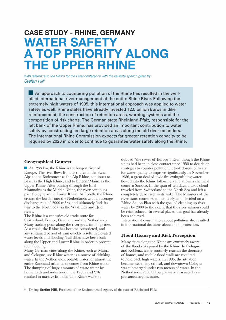
An approach to countering pollution of the Rhine has resulted in the well-oiled international river management of the entire Rhine River. Following the extremely high waters of 1995, this international approach was applied to water safety as well. Rhine states have already invested 12.5 billion Euros in dike reinforcement, the construction of retention areas, warning systems and the composition of risk charts. The German state Rheinland-Pfalz, responsible for the left bank of the Upper Rhine, has provided an important contribution to water safety by constructing ten large retention areas along the old river meanders. The International Rhine Commission expects far greater retention capacity to be required by 2020 in order to continue to guarantee water safety along the Rhine.
* Dr. ing. Stefan Hill, President of the Environmental Agency of the state of Rheinland-Pfalz.
-]ZWXM��<PM�ZQ^MZ�ÆW_[�NZWU�Q\[�[W]ZKM�QV�\PM�;_Q[[�Alps to the Bodenmeer as the Alp Rhine, continues to *I[MT�I[�\PM�0QOP�:PQVM��IVL�\W�*QVOMV�5IQVb�I[�\PM�Upper Rhine. After passing through the Eifel 5W]V\IQV[�I[�\PM�5QLLTM�:PQVM��\PM�ZQ^MZ�KWV\QV]M[�XI[\�+WTWOVM�I[�\PM�4W_MZ�:PQVM��)\�4WJQ\P��\PM�:PQVM�crosses the border into the Netherlands with an average LQ[KPIZOM�ZI\M�WN ������U��[��IVL�]T\QUI\MTa�ÅVL[�Q\[�_Ia�\W�\PM�6WZ\P�;MI�^QI�\PM�?IIT��4MS�IVL�12[[MT�rivers.The Rhine is a centuries old trade route for Switzerland, France, Germany and the Netherlands. 5IVa�\ZILQVO�XW[\[�ITWVO�\PM�ZQ^MZ�OZM_�QV\W�JQO�KQ\QM[��As a result, the Rhine has become constricted, and any sustained period of rain quickly results in elevated _I\MZ�TM^MT[�IVL�ÆWWLQVO��<ITT�LQSM[�PI^M�JMMV�J]QT\�ITWVO�\PM�=XXMZ�IVL�4W_MZ�:PQVM�QV�WZLMZ�\W�XZM^MV\�[]KP�ÆWWLQVO��5IVa�/MZUIV�KQ\QM[�ITWVO�\PM�:PQVM��[]KP�I[�5IQVb�and Cologne, use Rhine water as a source of drinking water. In the Netherlands, potable water for almost the entire Randstad urban area comes from Rhine water.The dumping of huge amounts of waste water by households and industries in the 1960s and ‘70s ZM[]T\ML�QV�UI[[Q^M�Å[P�SQTT[��<PM�:PQVM�_I[�[WWV�
dubbed “the sewer of Europe”. Even though the Rhine states had been in close contact since 1950 to decide on strategies to counter pollution, it took dozens of years NWZ�_I\MZ�Y]ITQ\a�\W�QUXZW^M�[QOVQÅKIV\Ta��1V�6W^MUJMZ��! ���I�OZMI\�LMIT�WN �\W`QK�ÅZM�M`\QVO]Q[PQVO�_I\MZ�ÆW_ML�QV\W�\PM�:PQVM�NWTTW_QVO�I�ÅZM�I\�;_Q[[�KPMUQKIT�concern Sandoz. In the span of ten days, a toxic cloud traveled from Switzerland to the North Sea and left a KWUXTM\MTa�LMIL�ZQ^MZ�QV�Q\[�_ISM��<PM�5QVQ[\MZ[�WN �\PM�river states convened immediately, and decided on a Rhine Action Plan with the goal of cleaning up river water by 2000 to the extent that the river salmon could be reintroduced. In several places, this goal has already been achieved.International consultation about pollution also resulted QV�QV\MZVI\QWVIT�LMKQ[QWV[�IJW]\�ÆWWL�XZW\MK\QWV�
Flood History and Risk Perception5IVa�KQ\QM[�ITWVO�\PM�:PQVM�IZM�M`\ZMUMTa�I_IZM�WN �\PM�ÆWWL�ZQ[S[�XW[ML�Ja�\PM�:PQVM��1V�+WTWOVM�and Koblenz, water routinely reaches the doorstep WN �PWUM[��IVL�UWJQTM�ÆWWL�_ITT[�IZM�ZMY]QZML�to hold back high waters. In 1995, the situation became extremely critical, and downtown Cologne was submerged under two meters of water. In the Netherlands, 250,000 people were evacuated as a precautionary measure.
16 – WATER GOVERNANCE – 02/2013
CASE STUDY - RHINE, GERMANY
1V�ZM[XWV[M�\W�M`\ZMUMTa�PQOP�_I\MZ[��\PM�5QVQ[\MZ[�WN �all the Rhine states gathered in 1998, and reached an agreement called the Action Plan on Floods, with the OWIT�WN �ZML]KQVO�_I\MZ�TM^MT[�Ja����KU��<PQ[�_W]TL�ZM[]T\�QV�I�ZML]K\QWV�WN �ÆWWL�ZQ[S�Ja��� ��In the Netherlands and Germany, the realization began to take hold that there was a downside to building ever taller dikes. If a very high dike were ever to fail, the height of the river would result in the release of a powerful mass of water, which would result in considerable damage as well as potential casualties near the dikes. For this reason, the preferred choice in recent years has been for river expansion measures, such as the construction of secondary channels and retention areas.
Jurisdictional ResponsibilityTen states are situated along the banks of the Rhine, each with its own sovereign responsibilities regarding river management. The protection of national interests had stood in the way of free shipping routes, and in 1815 this resulted in the establishment of the Central Commission for the Navigation of the Rhine. This commission is considered the oldest international governmental organization in the world. During the 50s, the quality of Rhine water deteriorated to such an extent, that the Rhine states decided to establish the International Rhine Commission. Unique to Germany, individual regional governments along the trajectory of the Rhine are also represented, in ILLQ\QWV�\W�\PM�VI\QWVIT�5QVQ[\Za�NWZ�\PM�-V^QZWVUMV\�The International Rhine Commission has grown into the universally acknowledged representative of the entire trajectory of the Rhine. Initially, the primary goal was to improve water quality, but since 1995, protection against elevated water levels has also become a priority.)TT�:PQVM�[\I\M[�KWWZLQVI\M�\PMQZ�VI\QWVIT�ÆWWL�XTIV[�through the Rhine Commission.
Additional SafetyThe German state Rheinland-Pfalz is currently undertaking dike reinforcements along the Rhine that are not a direct consequence of the extremely high _I\MZ�TM^MT[�WN ��!!��IVL��!!���:PMQVTIVL�8NITb�Q[�
responsible for river dikes on the left bank of the Upper :PQVM��NZWU�\PM�JWZLMZ�_Q\P�.ZIVKM�\W�*QVOMV�5IQVb��Those two high water situations occurred within such a short time span that, as in the Netherlands, German water managers became aware of the necessity of more stringent water management strategies. For the government of Rheinland-Pfalz, this resulted in the decision to increase water safety along the Rhine to IV�M[\QUI\ML�ÆWWL�ZQ[S�WN �WVKM�M^MZa�����aMIZ[��?Q\P�this, the state decided on water safety measures far more stringent than required by German law, which. XZM[KZQJM[�I�ÆWWL�ZQ[S�WN �WVTa�WVKM�M^MZa�����aMIZ[�
Three Types of Measures<PM�5QVQ[\Za�NWZ�\PM�-V^QZWVUMV\�WN �:PMQVTIVL�8NITb�is responsible for the implementation of measures to increase water safety for the Upper Rhine area. This concerns three types of measures. The most conspicuous concerns substantial widening and heightening of all dike surfaces along the Rhine. The second measure is the creation of additional space for the river by moving dikes back from the banks. This will take place in four areas. Finally, the state will create 10 water retention areas with a total storage capacity of 62 million cubic meters.
Treaty with France *a�������ITT�XTIVVML�_I\MZ�ZM\MV\QWV�IZMI[�QV�Rheinland-Pfalz must be operational. Several areas are already in use, and this means the state has the greatest water retention capacity of all the German Rhine states at its disposal. This is a consequence of the fact that the Upper Rhine is exceptionally well suited for large-scale retention, due to its many unused meanders. The old meanders are lightly populated, and therefore M[XMKQITTa�Y]ITQÅML�NWZ�ZM\MV\QWV�IZMI[��The construction of retention areas is also part of a treaty with France and the neighboring provinces of Hessen and Baden-Württemberg for the implementation of 288 million cubic meters of retention capacity. The construction of dams with hydroelectric power plants along the French-German Upper Rhine in 1977 resulted in a diminished water safety situation. The treaty was signed in order to compensate for that effect through additional water retention capacity.
Aktion BlauIn addition to construction work along the Rhine and its tributaries, Rheinland-Pfalz started the program Aktion Blau in 1995. The program is ongoing, and is focused on including the improvement of ecology and safety of all surface and ground water in every administrative decision made. These guidelines are applicable to ministries, district governments, municipalities, and residents, and manifest in four main IK\Q^Q\QM["
COMPARING WATER GOVERNANCE: GERMANY VERSUS THE NETHERLANDS
The approach by the International Rhine Commission regarding water quality in the 1960s and ‘70s has resulted in collaboration between the Netherlands and Germany, and excellent coordination of river management plans. In Germany, individual provinces are responsible for flood risks along the Rhine, which sometimes results in tensions between them.
WATER GOVERNANCE – 02/2013 – 17
CASE STUDY - RHINE, GERMANY
Development of user manuals and methods for the creation of maps, eco-morphological evaluations, etc.
Communication, such as the publication of water atlases and newsletters.
Development of concepts for such undertakings as restructuring.
Supervision of actual implementation.
Altering Discharge RegimeAccording to the International Rhine Commission, the Netherlands, Germany and France have spent nearly 12.5 billion Euros on water safety along the Rhine since 1995. The Rhine Commission concluded that climate change is already having measurable impact on the LQ[KPIZOM�ZMOQUM�WN �\PM�:PQVM��IVL�M`XMK\[�]X�\W��� �OZMI\MZ�LQ[KPIZOM�QV�_QV\MZ�IVL��� �TW_MZ�LQ[KPIZOM�in summer months by mid-century. According to the commission, the projected water retention capacity of ����UQTTQWV�U��Ja������_QTT�JM�QV[]NÅKQMV\��)[�I�ZM[]T\��additional water retention areas will be required after 2020. The commission has estimated that required KIXIKQ\a�_QTT�M^MV\]ITTa�ZMIKP�����UQTTQWV�U��The International Rhine Commission is currently [M\\QVO�]X�I�ÆWWL�ZQ[S�UIVIOMUMV\�XTIV�\PI\�·�QV�
agreement with the EU Flood Directive – must be ZMILa�I[�I�LZIN\�QV�������_Q\P�I�ÅVIT�^MZ[QWV�QV�������The current Action Plan on Floods will then become obsolete.
LOW FLOOD RISK PERCEPTIONWith reference to the Room for the River conference with the keynote speech given by:Regis Thépot*
The last major flood in Paris dates back to 1910. Parisians rarely give any thought to the possibility of the Seine flooding again. This limited perception of potential risk considerably hampers the work of the Seine Grands Lacs Institution. This Institution wants to create a large overflow basin upstream from Paris, but is facing difficulties in accomplishing this as there is little support for its financing or development. Negative information regarding the threat of flooding has been ineffective. Seine Grands Lacs wants to try a new approach, with a global and positive message.
* Regis Thépot�/MVMZIT�,QZMK\WZ��;MQVM�/ZIVL[�4IK[��.ZIVKM�
Geographical ContextThe Seine is a river in the northern part of France
_Q\P�Q\[�[W]ZKM�QV�\PM�4IVOZM[�8TI\MI]��1\�ÆW_[�\PZW]OP�the capital city of Paris, with an average discharge of ����U��[�I\�\PQ[�TM^MT��<PM�ZQ^MZ�Q[�ITUW[\�MV\QZM�navigable by ship, and is one of the most important shipping routes in France, as half of French inland VI^QOI\QWV��I�TW_�\ZINÅK�KWUXIZML�\W�6M\PMZTIVL[��takes place on the Seine.<PM�=XXMZ�;MQVM�ÆW_[�MI[\�WN �8IZQ[�IVL�PI[�\PZMM�TIZOM�\ZQJ]\IZQM["�<PM�5IZVM��\PM�)]JM��IVL�\PM�AWVVM��Heavy rainfall can cause the tributaries, especially the Yonne, to rise quickly. If heavy discharges from the tributaries coincide, this can quickly lead to peak discharge on the Seine. On the other hand, the water levels in the Upper Seine can be extremely low during summer and autumn months. Four large reservoirs were built from the 1950s to ‘90s. The upstream reservoirs have two purposes. By collecting peak LQ[KPIZOM��LW_V[\ZMIU�ÆWWLQVO�KIV�JM�I^WQLML��<PMQZ�second function is to allow additional river water through when necessary, so that the freshwater supply for Paris remains adequate. In dry periods, the volume of water in the Seine obtained from the reservoirs can QVKZMI[M�\W��� �
Flood History and Risk Perception<PM�TI[\�OZMI\�ÆWWLQVO�WN �\PM�;MQVM�\WWS�XTIKM�QV�
January 1910, and large parts of Paris were submerged. Fueled by heavy rain in the upstream area of the Seine, water levels in the Seine in Paris rose to more than seven meters above normal. The most recent high _I\MZ�UMI[]ZMUMV\�_I[�ZMKWZLML�QV�������J]\�Q\�LQL�VW\�KWUM�\W�ÆWWLQVO�I\�\PI\�\QUM��0W_M^MZ����������works of art were removed from the basements of the 5][uM�L¼7Z[Ia�I[�I�XZMKI]\QWVIZa�UMI[]ZM�>IZQW][�[\]LQM[�QVLQKI\M�\PI\�8IZQ[�Q[�I\�ZQ[S�WN �ÆWWLQVO��1V�\PM�_WZ[\�KI[M��ÆWWL�LIUIOM�KW]TL�KW[\����JQTTQWV�Euros, and more than 2.000,000 people could lose electrical power. These warnings have been mostly QOVWZML�Ja�8IZQ[QIV[��<PM�TI[\�OZMI\�ÆWWL�\WWS�place over 100 years ago, and in the years since, the XMZKMX\QWV�WN �ÆWWL�ZQ[S�PI[�QVKZMI[QVOTa�LQUQVQ[PML�QV�the French capital.
Jurisdictional Responsibility<PM�QV[\Q\]\QWV�ZM[XWV[QJTM�NWZ�ÆWWL�XZW\MK\QWV�along the Seine is the l’Etablissement public \MZZQ\WZQIT�LM�JI[[QV��-8<*��;MQVM�/ZIVL[�4IK[��This regional partnership was established in 1969 by four departments including Paris, Hauts-de-Seine, ;MQVM�;IQV\�,MVQ[�IVL�>IT�LM�5IZVM�·�IVL�Q\�KW^MZ[�the entire watershed of the Upper Seine. The name refers to the four large reservoirs that were built from the 1950s to the 90s. Its two main tasks consist of securing the water supply for Paris conurbation IVL�UQVQUQbQVO�ÆWWL�ZQ[S��<PMa�IT[W�QUXZW^M�_I\MZ�
WATER GOVERNANCE – 02/2013 – 19
CASE STUDY - SEINE, FRANCE
quality and facilitate inland shipping.1V�������.ZIVKM�KZMI\ML�I�TMOIT�NZIUM_WZS�NWZ�\PM�establishments of these EPTBs for certain sub-catchment areas. Water management, with primary responsibility for the large French catchment areas, lies with six Agences de l’eau (water agencies) with \PM�;MQVM��4WQZM��:PWVM�IVL�/IZWVVM�I[�TIZOM[\��These governmental agencies have always been XZQUIZQTa�NWK][ML�WV�_I\MZ�Y]ITQ\a�IVL�\PM�ÅVIVKQVO�WN �KWUU]VIT�_I\MZ�X]ZQÅKI\QWV�QV[\ITTI\QWV[��<PM�agencies themselves cannot directly implement river XZWRMK\[��J]\�U][\�ZMTa�WV�TWKIT�OW^MZVUMV\["����ZMOQWV[������LMXIZ\UMV\[��IVL��������U]VQKQXITQ\QM[��The newly established EPTBs are a link between water management organizations and local governments, for the purpose of reaching consensus regarding the QUXTMUMV\I\QWV�IVL�ÅVIVKQVO�WN �ZQ^MZ�XZWRMK\[�
+WV[\Z]K\QWV�7^MZÆW_�*I[QV�4I�*I[[uMBy far the largest project managed by EPTB Seine /ZIVL[�4IK[�Q[�\PM�KWV[\Z]K\QWV�WN �I�������PMK\IZM�_I\MZ�W^MZÆW_�JI[QV�I\�\PM�XWQV\�_PMZM�\PM�;MQVM�IVL�Yonne meet. The most recent design consists of ten
compartments with the potential of storing 55 million cubic meters of water. The costs are estimated at 500 million Euros, and a pilot work is expected to be KWUXTM\ML�QV������<PM�KWV[\Z]K\QWV�WN �\PM�W^MZÆW_�JI[QV�4I�*I[[uM�Q[�I�TWVO�[\IVLQVO�QLMI�\PI\�-8<*�;MQVM�/ZIVL[�4IK[�PI[�XTIKML�PQOP�WV�\PM�IOMVLI�once again as a result of the implementation of the European Flood Directive. The basin will be able to KWTTMK\�XMIS�LQ[KPIZOM��_PQKP�_QTT�OZMI\Ta�TQUQ\�ÆWWL�risk for Paris. The construction of the basin is an extremely complex civil engineering project. There is no variation in altitude in the planned area, so that the compartments must be dammed, and pumps will be required to pump water from the Seine into the compartments.
National DebateThe French law mandates a preliminary national debate for every large infrastructure project . An independent institution established for that particular purpose is required to organize the debate. The debate ZMOIZLQVO�\PM�4I�*I[[uM�XZWRMK\�\WWS�XTIKM�QV�������1V�local communities, hearings were held and the project
The Seine River in Paris (source: Cyberslayer, www.flickr.com)
20 – WATER GOVERNANCE – 02/2013
CASE STUDY - SEINE, FRANCE
was discussed with landowners and other local invested XIZ\QM[��5IVa�Y]M[\QWV[�_MZM�I[SML�IJW]\�\PM�PaLZI]TQK�parameters of the compartments and the establishment of pumps. An additional hearing was organized in WZLMZ�\W�ILLZM[[�\PQ[�[XMKQÅK�I[XMK\�_Q\P�\PM�PMTX�WN �hydrologists.<PM�VI\QWVIT�LMJI\M�QTT][\ZI\ML�\PM�LQNÅK]T\a�WN �discussing hydrological details with laymen. In addition, it became clear that threatening language regarding the XW[[QJQTQ\a�WN �ÆWWLQVO�_I[�QVMNNMK\Q^M��M[XMKQITTa�_PMV�the matter at hand concerns the reconstruction of a certain area for the purpose of safety downstream.
Enjoying the River,Q[K][[QWV[�ZMOIZLQVO�\PM�W^MZÆW_�JI[QV�4I�*I[[uM�have resulted in new relationships between local stakeholders, whereby not the threat, but new opportunities are central. Insights incurred through the European collaborative venture Freude am Fluss and “Room for the River program”. By focusing on the positive experiences people can have with the river, as well as its economic potential, an entirely new dynamic developed. River management was removed from its traditional governing framework, and has much broader public support now.
A phased approach has been determined for the ZMITQbI\QWV�WN �4I�*I[[uM��_Q\P�\PM�KWV[\Z]K\QWV�WN �\PM�ÅZ[\�KWUXIZ\UMV\�I[�I�XQTW\�XZWOZIU�QVKT]LQVO�I�OTWJIT�IXXZWIKP�\W�LM^MTWX�X]JTQK�ÆWWL�I_IZMVM[[�and ecological restoration of the river. The challenge that remains is to involve stakeholders who would also KWV\ZQJ]\M�\W�\PM�ÅVIVKQVO�WN �\PM�XZWRMK\��<PQ[�_QTT�JM�a win-win situation. Involvement reduces procedural resistance, and implementation can be achieved more Y]QKSTa��1V�ILLQ\QWV��VM_�WXXWZ\]VQ\QM[�NWZ�ÅVIVKQVO�ensue. This will be a very welcome result, because many government budgets are suffering from large cuts.
WATER GOVERNANCE: FRANCE VERSUS THE NETHERLANDS
In France, responsibility for river management lies with six regional water agencies (les Agences de l ‘Eau) which are organized around the basins of the great rivers, namely the Seine-Normandie, Rhone-Méditerranée-Corse, Loire-Bretagne, Adour-Garonne, Artois-Picardie, and Maas/Rhine. The water agencies collect water taxation, determine management plans, but do not play a role in implementation. For this aspect, they must rely on local departments, regions and municipalities.
Additional internet sources used for this article:4M[�)OMVKM[�LM�T¼-I]"�P\\X"��___�TM[IOMVKM[LMTMI]�NZ�l’Etablissement public territorial de bassin (ETPB) Seine /ZIVL[�4IK["P\\X"��___�[MQVMOZIVL[TIK[�NZ
ROOM FOR THE RIVER, THE CHINESE WAYWith reference to the Room for the River conference with the keynote speech given by:Qian Min*
The Huaihe river basin is characterized by its many locks and sluices that make the river navigable and, at the same time, make it possible to control its occasionally extreme discharges. The responsible river authority, the Huaihe River Conservation Commission, developed a comprehensive flood control system with many flood diversion channels and storage areas. Flood events with high death tolls belong to the past. Still the commission has ambitious plans for the river, especially to protect the urbanization along the river and to combat the increasing number of droughts. Instead of building more storage areas, the commission also wants to give more room to the river.
* Qian Min, Commissioner of the Huaihe River Conservancy Commission (HRCC).
Geographical contextThe Huaihe river basin is located in the eastern
part of China, with the Yellow river in the north and the Yangtze river in the south, and its catchment area is 270,000 square kilometers. The river originates in the Tongbai mountains of the Henan province, is about 1,000 kilometers long, IVL�ÆW_[�NZWU�_M[\�\W�MI[\��<PM�]XXMZ�ZMIKPM[�IZM�in the Henan and Hubei provinces, the middle reaches in the Anhui province, and the lower reaches in the Jiangsu province. <PM�ZQ^MZ�PI[�VW�KTI[[QK�M[\]IZa�_PMZM�Q\�ÆW_[�QV\W�the sea. In the past a diversion of the Yellow river into the Huaihe river caused sediments to silt up the middle-lower channels of the Huaihe river and made the river lose its outlet to the sea. The natural KW]Z[M�WN �\PM�ZQ^MZ�VW_�MVL[�QV�4ISM�0WVObM�NZWU�_PMZM�\PM�_I\MZ�Q[�LQ[KPIZOML�\PZW]OP�IZ\QÅKQIT�canals, either to the sea, or in case of water scarcity to the northern Yellow river or to the southern Jangtze river. Downstream the Huaihe is part of I�^MZa�KWUXTM`�IZ\QÅKQIT�_I\MZ�[a[\MU�NWZUML�Ja�many (smaller) rivers, navigation canals, fresh water reservoirs and huge locks.The basin is located in the transitional zone from
southern (non-arid) to the northern (arid) climate of China. Therefore the precipitation – that is KWVKMV\ZI\ML�QV�\PM�ÆWWL�[MI[WV��NZWU�2]VM�\W�;MX\MUJMZ��IVL�IKKW]V\[�NWZ��� �WN �\PM�IVV]IT�amount – varies greatly in both space and time.The fresh water supply by the Huaihe river basin does not match the demand of the population and industrial and agricultural production.The basin is situated in the agricultural heart of China, often referred to as ‘China’s food basket’. High nutrient concentrations due to the use of manure in intensive agriculture, combined with the release of untreated municipal waste water, cause water quality problems.
Flood history & risk perceptionAccording to statistics, between 246 B.C. to ���������JI[QV�_QLM�ÆWWL�IVL�LZW]OP\�LQ[I[\MZ[�occurred in the Huaihe River Basin, a frequency of once every 6.6 years on average. From the diversion (capture) of the Yellow river into the 0]IQPM�:Q^MZ�QV���!���ÆWWL�LQ[I[\MZ[�WKK]ZZML�UWZM�NZMY]MV\Ta��.ZWU�\PM���\P�\W�\PM��!\P�KMV\]Za�\PMZM�_MZM�����ÆWWL�IVL�LZW]OP\�LQ[I[\MZ[��once every 4.2 years on average. In recent years,
22 – WATER GOVERNANCE – 02/2013
CASE STUDY - HUAIHE, CHINA
TIZOM�[KITM�ÆWWL�IVL�LZW]OP\�LQ[I[\MZ[�WKK]ZZML�frequently.<PM�LMI\P�\WTT�WN �I�UIRWZ�ÆWWL�QV��!���_I[���������5WZM�ZMKMV\�UIRWZ�ÆWWL[�[I_�I�[PIZX�decrease in the death toll to a few dozens. 0W_M^MZ��\PM�JI[QV�_QLM�ÆWWL[�QV�JW\P��!!��IVL������KI][ML�UIRWZ�MKWVWUQK�TW[[M[��<PM�ÆWWL�QV������XZW^ML�\PI\�\PM�ÆWWL�LMNMV[M�UMI[]ZM[�XIQL�WNN �I[�\PM�QV]VLI\ML�IZMI�_I[��� �[UITTMZ�\PIV�\PI\�WN ��!!�"�KWUXIZML�_Q\P��!!���\PM�V]UJMZ�of people that had to be evacuated and direct MKWVWUQK�TW[[�QV������_I[����� �IVL����� �TM[[��respectively.At present, the upper main stream is protected IOIQV[\�ÆWWL[�\PI\�WKK]Z�I\�I�NZMY]MVKa�WN �WVKM�every 10 years. Flood protection level of the key ÆWWL�XZW\MK\QWV�IZMI[�IVL�QUXWZ\IV\�KQ\QM[�QV�\PM�middle and lower reaches has been raised to once every 100 years on average.
Jurisdictional responsibilityWater management in China is largely centralized. ?I\MZ�UIVIOMUMV\�XWTQKa�Q[�JI[ML�WV�\PM�Å^M��year-plan developed by the State Council. The 12th�XTIV�������������_I[�ILWX\ML�QV�5IZKP�������<PM�5QVQ[\Za�WN �?I\MZ�:M[W]ZKM[�Q[�XZQUIZQTa�responsible for the river management and heads the commission for the nation’s seven biggest rivers, including the Huaihe River Conservancy Commission based in Bengbu, the capital of Anhui.The Huaihe River Commission is in charge of ÆWWL�XZW\MK\QWV��_I\MZ�Y]ITQ\a�IVL�M`XTWQ\I\QWV�of water resources. This makes the commission responsible for the preparation of the “Plan for Comprehensive Utilization of Water Resources”, the “Plan for Water Resources Protection” and the “Plan for Water and Soil Conservation”. An important activity is the co-ordination of the integrated river basin plans with the provinces and municipalities.The commission carries out all civil engineering projects, including the construction of dikes and reservoirs, and dredging channels. Up to now, IJW]\������ZM[MZ^WQZ[�PI^M�JMMV�KWV[\Z]K\ML��_Q\P�I�\W\IT�[\WZIOM�KIXIKQ\a�WN ��!���JQTTQWV�U���)Z\QÅKQIT�KPIVVMT[�PI^M�JMMV�KWV[\Z]K\ML�_Q\P�I�
length of 2100 km. Different types of dikes have been constructed with a length of 50,000 km. In 2011, the Huaihe River Commission and the ,]\KP�:QRS[_I\MZ[\II\��5QVQ[\Za�WN �1VNZI[\Z]K\]ZM�IVL�\PM�-V^QZWVUMV\��[\IZ\ML�\W�KWWXMZI\M�WV�ÆWWL�management. In 2012, activities to train staff were exchanged and research results were shared.
Future challengesWith the rapid development of urbanization, industrialization and the impact of climate change, the Huaihe river basin faces numerous new challenges, creating new chances and opportunities. It is estimated that over 20 million people will migrate to urban areas in the next ten years. Industrial development is another inevitable trend; particularly the use of coal and electric power, and the chemical and equipment manufacturing industry will develop rapidly. The acceleration of urbanization and industrialization XZM[MV\[�VM_�KPITTMVOM[�NWZ�]ZJIV�ÆWWL�KWV\ZWT��water supply, sewage treatment and water conservation.It is expected that the uneven distribution of seasonal precipitation will increase. In summer �UIRWZ�ÆWWL�XMZQWL��[WUM��� �UWZM�XZMKQXQ\I\QWV�is expected. In other seasons the precipitation UIa�LMKZMI[M�Ja��� ��<PM�NZMY]MVKa�WN �M`\ZMUM�_MI\PMZ�M^MV\[��IVL�\PM�NZMY]MVKa�IVL�[QbM�WN �ÆWWL�and drought disasters tend to increase.
Improvement of ÆWWL�KWV\ZWT�[a[\MU
The commission has planned the following QUXZW^MUMV\[�WN �\PM�ÆWWL�KWV\ZWT�[a[\MU"
1 To continue to construct reservoirs in the ]XXMZ�ZMIKPM[�\W�MVPIVKM�ÆWWL�XZM^MV\QWV�IVL�[\WZIOM�KIXIKQ\a�IVL�ZML]KM�ÆWWL�XZM[[]ZM�for the middle-lower reaches.
2 � �<W�ILR][\�ÆWWL�LQ^MZ[QWV�IVL�[\WZIOM�IZMI[�in the middle reaches and enhance discharge capacities of the river channels.
3 � �<W�[\ZMVO\PMV�IVL�JZWILMV�ÆWWL�XI\P[�QV�the lower reaches, particularly to enlarge the direct outlet to the sea.
4 To improve drainage of the low-lying areas.
5 To improve the safety of reservoirs and sluices and to make them work effectively.
6 To implement plans to relocate people that TQ^M�QV�]V[INM�IZMI[��[]KP�I[�ÆWWL�LQ^MZ[QWV�and storage areas).
WATER GOVERNANCE: CHINA VERSUS THE NETHERLANDS
China’s water management is centrally organized under the authority of the Ministry of Water Resources in Beijing. Only for the seven largest rivers, the authority has been delegated to special river commissions.
WATER GOVERNANCE – 02/2013 – 23
CASE STUDY - HUAIHE, CHINA
All the measures mentioned above have been included in the national development plan of water conservancy and are implemented one by one. They are all expected to be completed by 2020 at the latest. The middle part of the JI[QV�Q[�\PM�UW[\�^]TVMZIJTM�\W�ÆWWLQVO#�\PM�KWV[\Z]K\QWV�WN �ÆWWL�LQ^MZ[QWV[�IVL�[\WZIOM�areas over here are most urgent.The strong urban development along the banks of the river leaves the commission less space for new by-passes and storage areas. Therefore the commission has adopted the strategy to create more room for the river so peak discharges can pass more quickly. New river projects will focus on widening the current river bed by relocating the embankments inland, lowering existing ÆWWL�XTIQV[��IVL�LMMXMVQVO�\PM�ZQ^MZ�JML��
SOURCES AS GIVEN BY THE KEY NOTE SPEAKER:
�E� �P\\X"��MV�_QSQXMLQI�WZO�_QSQ�0]IQG:Q^MZ2] World Bank (2010), China – Huai River Basin Flood
�E� �7XMZI\QWV�IVL�UIVIOMUMV\�XWTQKa�WN �ÆWWL�LQ^MZ[QWV�IVL�storage areas in the Huaihe River Basin and sustainable socio-economic development. ;W]ZKM"�+PZQ[
�E� �P\\X"��bP�_QSQXMLQI�WZO�_QSQ�轌踌
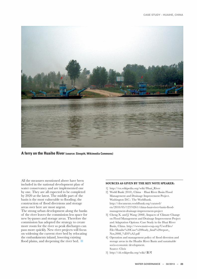
A ferry on the Huaihe River (source: Sinopitt, Wikimedia Commons)
ROOM FOR THE RIVER: INTERNATIONAL RELEVANCEC. Zevenbergena,b, J. Rijkea,b, S. van Herka,b, J. Ludyc, and R. Ashleya,b
World-wide the frequency and impacts of flooding exhibit a steep
increasing trend1. The key drivers are the world’s population growth and the increase of socio-economic activities (development) in flood-prone areas, and society’s growing interdependency on flood protection and drainage infrastructure of which a significant part is of unknown or poor condition2, 3. It is more and more recognized that flood risk management approaches should be able to respond to changes in the natural and socio-economic environment. Moreover they should perform well under various potential futures as there is inherent uncertainty about the magnitude of the drivers of flood risk.
a Delft University of Technology, Stevinweg 1, Delft 2628 CN, The NetherlandsJ� �=6-;+7�10-�1V[\Q\]\M�NWZ�?I\MZ�-L]KI\QWV��8�7��*W`������������,)�,MTN\��<PM�6M\PMZTIVL[K� �,Q^Q[QWV�WN �.TWWL�5IVIOMUMV\��)UMZQKIV�:Q^MZ[�������)TT[\WV�?Ia��;]Q\M������*MZSMTMa��+)�!������=;)
� ;XMKQÅKITTa�ZQ^MZ�JI[QV[�IZM�PQOPTa�LaVIUQK�IVL�KWUXTM`�[a[\MU[��<PM�KPITTMVOM[�NWZ�ÆWWL�ZQ[S�management strategies of river basins are manifold, as water safety issues interact with a wide range of environmental and socio-economic sectors including health, agriculture, biodiversity, industry, navigation and tourism. In addition, in transboundary river basins differences in legal frameworks, historical and cultural backgrounds add to the complexity4. Flood risk management of river basins requires a programmed approach including the supporting capabilities such as integrated and adaptive policy frameworks and the institutional capacity at multiple levels and across different jurisdictions and countries to exploit these interactions by creating synergies or avoiding undesired outcomes5,6. In the Netherlands, such an integrated and programmed approach referred to as the Room for the River Program is currently being implemented in the Dutch Rhine River Basin7. This program is considered \PM�ÅZ[\�QV�\PM�6M\PMZTIVL[�\W�ILWX\�I�U]T\Q�TM^MT�governance approach in which NGO’s and private stakeholders in different disciplines (e.g. water safety, planning, agriculture, nature) and at national, regional and local levels are actively collaborating to reduce \PM�ÆWWL�ZQ[S�IVL�\W�QVKZMI[M�\PM�[XI\QIT�Y]ITQ\a�Ja�
creating more space for the river8. There is a growing international interest to exchange innovative concepts and best practices of these integrated programmed approaches such as used for the delivery of the Room for the River Program. However, transferring these to other countries is likely to be a major challenge as it calls for fundamental changes in institutional arrangements at various levels9. <PQ[�XIXMZ�LZI_[�]XWV�\PM�ÅVLQVO[�WN �XZM^QW][�ZM[MIZKP�_PQKP�PI[�QLMV\QÅML�SMa�NMI\]ZM[�IVL�conditional factors supporting effective development and implementation of the Room for the River Program in the Netherlands7,10��=[QVO�\PM[M�ÅVLQVO[��this paper attempts to assess the potential for effective transfer of the concept of Room for the River Program across other river basins around the world. In particular, this paper focuses on the transferability of the concept of Room for the River based on an analysis WN �\PM�KWVLQ\QWVIT�NIK\WZ[�WN �Å^M�LQNNMZMV\�ZQ^MZ�JI[QV["�5Q[[Q[[QXXQ�:Q^MZ��=;���:PQVM��/MZUIVa��6M\PMZTIVL[���Seine (France), Brisbane River (Australia) and Huaihe :Q^MZ��+PQVI���<PM�UI\MZQIT�NWZ�\PM�Å^M�ZQ^MZ�JI[QV[�was collected during interviews with local, regional and national stakeholders and at an international conference (November 2012) dedicated to this topic as well as from the literature.
WATER GOVERNANCE – 02/2013 – 25
ROOM FOR THE RIVER: INTERNATIONAL RELEVANCE
The Dutch Room for the River Program In 1995, extreme river water levels nearly caused dike breaches and led to the evacuation of 250,000 people and 1 million cattle. This created enhanced awareness amongst the public, politicians, public administration and water professionals that nature cannot be controlled and that new ways of managing rivers are required; i.e. through creating more space for rivers to LQ[KPIZOM�\PMQZ�ÆW_[��)UWVO[\�W\PMZ[��\PQ[�TML�\W�\PM�initiation of the 2.2 billion Euro Room for the River Program, which started its detailed design phase in 2006 and is scheduled for completion by 2015. It has a L]IT�WJRMK\Q^M�WN"����QUXZW^QVO�[INM\a�IOIQV[\�ÆWWLQVO�WN �ZQ^MZQVM�IZMI[�WN �\PM�:Q^MZ[�:PQVM�IVL�5M][M�Ja�accommodating a discharge capacity of 16,000m3�[�NWZ�\PM�:PQVM�IVL��� ��U3�[�NWZ�\PM�5M][M#����contributing to the improvement of the spatial quality of the riverine area. At the start of the program, a set WN ��!�TWKI\QWV[��XZWRMK\[��_I[�[MTMK\ML�\W�KZMI\M�UWZM�ZWWU�NWZ�\PM�ZQ^MZ[�\PZW]OP��NWZ�M`IUXTM�ÆWWL�Ja�XI[[M[��M`KI^I\QWV�WN �ÆWWL�XTIQV[��LQSM�ZMTWKI\QWV��IVL�lowering of groynes (Figure 1).Compared to other large projects in the water sector and other sectors, the Room for the River Program performs well in terms of achieving project objectives and the overall process of delivery (satisfaction)11,12. It is on track to achieve its (local) project objectives without budget over-run or major time delay as well as the program WJRMK\Q^M[�NWZ�ÆWWL�[INM\a�IVL�[XI\QIT�Y]ITQ\a5. The majority of individuals who were actively involved in the XZWOZIU��M�O��LMKQ[QWV�UISMZ[�IVL�XZWRMK\�WNÅKMZ[�IKZW[[�ITT�OW^MZVUMV\�TM^MT[��IZM�[I\Q[ÅML�_Q\P�\PM�XZWKM[[�IVL�output of the program5, 13. Furthermore, based on a survey (hereafter referred to as “the survey”) that was PMTL�IUWVO[\�XIZ\QKQXIV\[��V%�����WN �\PM�:WWU�NWZ�\PM�River Program, it was concluded that the program’s governance arrangements were instrumental in the program’s performance5, 10. However, conclusions about the program’s effectiveness for achieving WJRMK\Q^M[�[PW]TL�JM�ÅVITTa�KWV[QLMZML�_PMV�\PM�realisation of the program is completed (completion is
scheduled for 2015).The Room for the River Program has adopted a new (multi-level) governance approach in which government agencies in different disciplines (e.g. water safety, planning, agriculture, nature) and at national, regional and local levels and other stakeholders are actively collaborating8. The program uses a mix of KMV\ZITQ[ML��VI\QWVIT��[\MMZQVO�LMKMV\ZITQ[ML��ZMOQWVIT��decision making processes14. The decision frameworks for establishing improved water safety and spatial quality are set by the national government, whilst the plans and designs are formulated and decisions are \ISMV�Ja�TWKIT�IVL�ZMOQWVIT�[\ISMPWTLMZ[�QV����ZMOQWVIT�projects. The national government has established I�KMV\ZIT�XZWOZIU�WNÅKM�\W�UIVIOM�IVL�UWVQ\WZ�progress, evaluate quality of designs, and facilitate the regional projects through guidelines, providing expert knowledge, community building, and, where needed, applying political pressure. This approach provided the opportunity for decentralised governments to link local issues, such as new urban developments and the development of natural and recreational areas, with the water safety agenda13. )\�XZM[MV\��UW[\�WN �\PM�QVQ\QIT����ZMOQWVIT�XZWRMK\[�within the Room for the River Program have completed their planning phase and entered the realisation phase15��5MIV_PQTM��\PM�:WWU�NWZ�\PM�River Program is considered an “exemplary project” for ILWX\QVO�VM_�OW^MZVIVKM�IXXZWIKPM[�Ja�\PM�5QVQ[\Za�of Infrastructure and Environment8. For example, the recently established Delta Program (2009-2015) is using Room for the River as an example for governance and developing integrated strategies. The Delta Program is currently preparing Delta Decisions for securing _I\MZ�[INM\a��IOIQV[\�ÆWWLQVO��IVL�NZM[P�_I\MZ�[]XXTQM[��These Delta Decisions will be ready in 2015 and will be implemented according to the Delta Act that provides a continuous funding stream of 1 billion Euros per year into a Delta Fund from 2020 and beyond. Hence, the lessons from the Room for the River Program have potential relevance for future water management in the Netherlands.
Figure 1.
Measures that are applied in the Room for the River Program (Source: Room for the River Program Office)
1 Lowering of floodplains2 Removal of obstacles3 Dyke relocation
4 Waterrentention and storage5 By-pass6 Height reduction of groynes
7 Deepening of summer bed8 Heightening of dykes9 Dyke improvement
26 – WATER GOVERNANCE – 02/2013
ROOM FOR THE RIVER: INTERNATIONAL RELEVANCE
Key features and contextual factors of “Room for the River” In this section the key features and the conditional factors for effective development and implementation of the Room for the River Program in the Netherlands5, 10�_QTT�JM�JZQMÆa�LM[KZQJML��
Key features The concept of Room for the River falls under the more widely applied practice of “Integrated River *I[QV�5IVIOMUMV\��1:*5��º�<PQ[�\aXQKITTa�ZMNMZ[�to a comprehensive and coordinated approach to the management of river systems. Three different perspectives on integrated river basin management can be distinguished 5.
1 Integration is about alignment and balancing of multiple objectives. For river basin management, objectives such as providing safety, transport capacity, opportunities for recreation, enabling nature, water supply, facilitating economics, safeguarding aesthetics and water quality play an important role16, 17, 18). Integrated river basin management particularly takes into account the interplay between both water and land use functions19, 20.
2 An integrated approach is a system approach that includes all relevant spatial scales 21, 22. Relevant spatial scales for river basins could be catchment and sub-catchment scales23, 24; and international, national, regional and local scales.
3 � ��1:*5�QVKT]LM[�KWUXZMPMV[QWV�WN �[PWZ\�IVL�long term time scales in order to balance short IVL�TWVO�\MZU�KW[\[�IVL�JMVMÅ\[�IVL�IV\QKQXI\M�(potential) future change21, 22. For example, the LMÅVQ\QWV�WN �\PM�/TWJIT�?I\MZ�8IZ\VMZ[PQX�NWZ�integrated water resource management that is quoted above includes the word sustainability, which is about meeting present needs without compromising the ability to meet future needs25.
;]UUIZQ[QVO�\PM�IJW^M��_M�LMÅVM�1:*5�I[�I�comprehensive water management approach that aligns multiple objectives in a river basin across different spatial scales and temporal dimensions. The Dutch Room for the River Program is an example of 1:*5�I[�Q\�ITQOV[�U]T\QXTM�WJRMK\Q^M[�IKZW[[�LQNNMZMV\�spatial scales and temporal dimensions. Based on the above, Table 1 summarizes the three key features of the concept of Room for the River.
Table 1. Key features of the concept of Room for the River.
Contextual factors<PM�ZM[]T\[�WN �\PM�[]Z^Ma��V%�����PI^M�JMMV�][ML�\W�identify the most relevant preconditions or contextual factors affecting the success of the Room for the River Program in terms of effective delivery of the program objectives (c.q. projects within budget and time). These XZMKWVLQ\QWV[�IZM"
GEOGRAPHICAL CONTEXT: AVAILABILITY OF SPACE 5ISQVO�ZWWU�NWZ�ZQ^MZ[�QV�I�[\ZQK\�XPa[QKIT�[MV[M�ZMY]QZM[�I^IQTIJTM�[XIKM�\W�M`XIVL�I�ÆWWLXTIQV�Ja�setting back the dikes, or diverting water into a bypass area. The presence of dense urban communities or critical infrastructure may preclude the ability \W�M`XIVL�I�ZQ^MZ�ÆWWL_Ia�JMKI][M�ZMTWKI\QVO�these elements would be cost-prohibitive or socially unacceptable and calls for adopting a (river basin) system approach.
HISTORICAL CONTEXT: FLOOD HISTORY (SENSE OF URGENCY)The new paradigm of making room for the river has set the stage for the Room for the River Program in The Netherlands. However, it took another decade, after the PQOP�_I\MZ[�QV��!!��IVL��!!��WV�\PM�:PQVM��\W�IKY]QZM�the political will to approve the governmental decision for the Room for the River Program (PKB Ruimte voor de River).
CULTURAL & SOCIO-ECONOMIC CONTEXT: LEGITIMACY FOR INTEGRATED RIVER BASIN MANAGEMENT
Historically up to the 1970s, there has been a weak link between river and land management in the Netherlands. The Dutch have maintained “dry feet” for centuries, due to successful engineering interventions along the rivers and coast. Driven by the recognition of protecting areas of landscape beauty and the realization that there are limits to heightening ZQ^MZ�LQSM[��\PM�ÅZ[\�QV\MOZI\ML�ZQ^MZ�UIVIOMUMV\�plans were developed in the 1980s. These plans were well received by the local stakeholders and the public. They embraced the basic principles of the concept of making room for the river which marked the offset of a transition to a new paradigm in river basin management. In turn this provided the legitimacy for the national government to initiate and further develop the Room for the River Program.
INSTITUTIONAL CONTEXT: MULTI-LEVEL AND CROSS-SECTOR COLLABORATION
In the Netherlands the Polder model of compromise prevails, along with a strong top-down government to oversee and encourage a coordinated system-wide approach. The engagement of the three governmental levels (national, regional and local) in combination with central leadership are assumed to be vital institutional conditions for initiating and implementing the Room for the River Program.
3. A (river basin) systems approach across all relevant spatial scales
WATER GOVERNANCE – 02/2013 – 27
ROOM FOR THE RIVER: INTERNATIONAL RELEVANCE
The transferability of the concept: I�KWUXIZQ[WV�WN �Å^M�QV\MZVI\QWVIT�ZQ^MZ[�There are some 270 transboundary river basins around \PM�_WZTL��KW^MZQVO��� �WN �\PM�TIVL�[]ZNIKM�WV�MIZ\P��and many more that cross sub-national jurisdictional boundaries26. Trends such as climate change, continued population and economic growth, and aging infrastruc-ture are placing greater needs for cooperation across jurisdictional boundaries within these river basins. This will require new forms of water governance such as the multi-level governance approach which has been adopted by the Room for the River Program. The concept of making space for rivers is also be-ing used in other countries27. For example, in the US \PM�ÅZ[\�XZWRMK\[�IQUML�I\�UISQVO�[XIKM�NWZ�\PM�ZQ^MZ�MUXPI[QbML�M`XIVLQVO�ZQ^MZ�KIXIKQ\a�WV�\PM�5Q[[Q[[QXXQ���!� ��IVL�;IKZIUMV\W�:Q^MZ[���!����\W safely con-^Ma�ÆWWL�LQ[KPIZOM[28, 29. New projects aim to achieve U]T\QXTM�JMVMÅ\[�QVKT]LQVO�MVPIVKQVO�MKW[a[\MU�N]VK-tion30 and water supply reliability as mandated by new [\I\M�XWTQKa�NWZ�ÆWWL�ZQ[S�ZML]K\QWV�QV\MZ^MV\QWV[31. In Greece, France and Hungary the approach’s focus is on MVOQVMMZQVO"�XPa[QKIT�QV\MZ^MV\QWV[�IQUML�I\�MVTIZOQVO�the river bed or restricting or (re)allocating obstacles from the river bed such as buildings. In the UK and the Netherlands the concept is based on a holistic, inte-grated approach embracing a multi-functional river in _PQKP�ÆWWL�[INM\a�Q[�KWV[QLMZML�QV�KWUJQVI\QWV�_Q\P�other values such as landscape, environmental and cultural values27. Despite the success of this holistic, integrated approach in the Netherlands, its process of delivery should not be translated one-on-one to other contexts. Different KWV\M`\]IT�NIK\WZ[�UIa�QUXMLM�\PM�IXXTQKIJQTQ\a�IVL�or effectiveness of the Dutch approach. Therefore, we PI^M�IVITabML�IVL�KWUXIZML�\PM�Å^M�ZQ^MZ�JI[QV[�WV�the basis of the four categories of contextual factors QLMV\QÅML�QV�\PM�XZM^QW][�[MK\QWV��[MM�<IJTM�����<PM[M�categories comprise the geographical context, the historical context, the institutional context and the cultural & socio-economic context.
GEOGRAPHICAL CONTEXT
<PM�5Q[[Q[[QXXQ�QV�\PM�=VQ\ML�;\I\M[�Q[�\PM�TWVOM[\�ZQ^MZ�QV�\PM�[\]La��I\������SU��1\�Q[�UWZM�\PIV����\QUM[�longer than the shortest, which is the Brisbane River in )][\ZITQI�����SU�TWVO��)TT�WN �\PM�ZQ^MZ�JI[QV[�QVKT]LML�QV�\PM�[\]La�PI^M�JMMV�PMI^QTa�UWLQÅML�IVL�UIVIOML��and they cover both rural and more developed densely populated landscapes. The initial channelization was for navigation purposes, but ultimately building embankments, reservoirs, and drainage infrastructure JMKIUM�KZQ\QKIT�NWZ�ÆWWL�UIVIOMUMV\�IVL�IOZQK]T\]ZIT�and economic interests on adjacent lands. 5IVa�LMV[M�KQ\QM[�TQSM�:W\\MZLIU��8IZQ[��;\�4W]Q[�IVL�*MQRQVO�LM^MTWXML�ITWVO[QLM�\PM�4W_MZ�:PQVM��\PM�UQLLTM�;MQVM��\PM�UQLLTM�5Q[[Q[[QXXQ��IVL�\PM�0]IQPM�River in China, but the majority of the Brisbane River basin is sparsely populated, with the exception of the +Q\a�WN �*ZQ[JIVM��<PZW]OP�;\��4W]Q[��\PM�5Q[[Q[[QXXQ�
River would be constrained, as is the Seine as it passes \PZW]OP�8IZQ[��0W_M^MZ��WV�\PM�TW_MZ�UQLLTM�5Q[[Q[-[QXXQ�:Q^MZ��\PM�Z]ZIT�6M_�5ILZQL�.TWWL_Ia�IK\[�I[�IV�MUMZOMVKa�[XQTT_Ia�\W�XZW\MK\�������ZM[QLMV\[�QV�Cairo, Illinois when water levels are high. The lower ZMIKPM[�WN �\PM�;MQVM�_I\MZKW]Z[M�IZM�[QOVQÅKIV\Ta�TM[[�developed, supporting agriculture which is a land use KWUXI\QJTM�_Q\P�ÆWWLQVO��?QLMVQVO�\PM�ZQ^MZ�PMZM�UIa�be possible.
HISTORICAL CONTEXT
Where history demonstrated a need for new policy IVL�ÆWWL�ZQ[S�ZML]K\QWV�QV\MZ^MV\QWV[��XWTQ\QKIT�_QTT�NWZ�\ISQVO�IK\QWV�PI[�JMMV�PQOPMZ��5IRWZ�ÆWWL[�ZM[]T\ML�in heavy investments in infrastructure on all rivers in \PM�[\]La��_Q\P�\PM�UW[\�ZMKMV\�TIZOM�ÆWWL[�ITWVO�\PM�5Q[[Q[[QXXQ�IVL�*ZQ[JIVM�:Q^MZ[�QV������<PM�*ZQ[JIVM�IVL�0]IQPM�:Q^MZ[�PI^M�ÆWWLML�\PM�UW[\�NZMY]MV\Ta�in comparison with others in the study, though in Brisbane, frequency has been largely reduced since the construction of the Wivenhoe dam in 1974. There PI^M�JMMV�VW�UIRWZ�ZMKMV\�ÆWWL[�ITWVO�\PM�:PQVM�WZ�\PM�;MQVM���!�����0QOP�_I\MZ[���!!��IVL��!!���WV�\PM�Rhine resulted in evacuation of people, cattle or prop-erty, but no severe damages or disruption occurred. 1V�[WUM�KI[M[��NZMY]MV\�WZ�KI\I[\ZWXPQK�ÆWWLQVO�resulted in an institutional change as well, and the creation of water management bodies, for example the 5Q[[Q[[QXXQ�:Q^MZ�+WUUQ[[QWV��?PMZM�\PM�=;�NMLMZIT�government previously concerned itself with navigation WVTa��\PM�/ZMI\�5Q[[Q[[QXXQ�.TWWL�WN ��!���IVL�\PM�[]J-[MY]MV\�.TWWL�+WV\ZWT�)K\�WN ��!� �UILM�ÆWWL�KWV\ZWT�a federal responsibility as well.
CULTURAL AND SOCIO-ECONOMIC CONTEXT Where communities or authorities do not perceive I�ÆWWL�\PZMI\��\PMa�_W]TL�JM�TM[[�TQSMTa�\W�QV^M[\�\PM�high capital costs required for interventions. People (and maybe experts) can tend to think that dikes and LIU[�_QTT�XZW\MK\�\PMU�NZWU�ITT�ÆWWL[32, 33, and they do not see a need to take individual action. Studies have [PW_V�\PI\�\PM�XZM[MVKM�WN �ÆWWL�KWV\ZWT�[\Z]K\]ZM[�ZML]KM[�\PM�XMZKMX\QWV�WN �ÆWWL�ZQ[S33. This could per-petuate a societal expectation that lands behind dikes and dams are safe and immune to failure.The city of Paris, France, has not experienced such a ÆWWL�[QVKM�\PM�MIZTa��!��[�\PIVS[�\W�PMI^a�QV^M[\UMV\�in infrastructure. As such, implementation of Room NWZ�:Q^MZ�XZWRMK\[�ITWVO�\PM�;MQVM�UIa�JM�LQNÅK]T\��1V�Brisbane and along the Huaihe, however, they experi-MVKM�NZMY]MV\�ÆWWLQVO��[W�\PM�XMZKMX\QWV�WN �I�VMML�\W�ILLZM[[�\PM�ÆWWL�XZWJTMU�Q[�TQSMTa�PQOPMZ��0QOP�ÆW_[�ITWVO�\PM�5Q[[Q[[QXXQ�:Q^MZ�QV������SMMX�LQ[K][[QWV[�about management in the spotlight even today. Because it is rare that one entire river system lies within one jurisdiction, or one level of government, the concept of Room for the River most likely requires KZW[[�R]ZQ[LQK\QWVIT�KWWXMZI\QWV��<PM�KW[\[��JMVMÅ\[��and physical footprint of the individual Room for the River projects are distributed unevenly over a large area
28 – WATER GOVERNANCE – 02/2013
ROOM FOR THE RIVER: INTERNATIONAL RELEVANCE
RIVER BASINS GEOGRAPHICAL CONTEXT(general)
GEOGRAPHICAL CONTEXT(interventions)
HISTORICAL CONTEXT(flood history)
INSTITUTIONAL CONTEXT
Mississippi
Basin: 2,981,076 km2 Length: 3,734 km
Urbanised river basin with very low population density in some areas, and high population density and critical infrastructure in others: such as St. Louis, MO, and New Orleans, LA.
Heavily managed river with channel modifications and dike systems and flood storage reservoirs and detention basins.
Major modifications of the Mississippi River began in late 1800s directed under Engineer General Humphreys. Initial policy was “levees” only (Barry 1997).
After the 1927 flood, the Mississippi River and Tributaries project (MR & T) was proposed in 1928 (Jadwin Plan) on the lower Mississippi – It was a series of channel improvements, outlets, and spillways (MRC 2011).
1849 and 1850 floods caused widespread damage on the Mississippi River Valley, and demonstrated national interest in river modification and “control”.
The 1927 Great Flood caused enormous devastation, (over 600,000 evacuated) economic damage and life loss. It catalyzed institutional change. High discharge in 2011 activated MR & T project (floodways and spillways for high Mississippi river flows). There were no deaths, and the action prevented $110 Billion in damages (MRC 2011).
Additional major floods were in 1927, 1937, 1993, 2011.
1879 Created Mississippi River Commission –first comprehensive river planning agency in USA.
After the Great Flood, 1928 the Flood Control Act made flood control a federal responsibility. Previously they were responsible for only navigation. The US Army Corps of Engineers is the federal agency responsible for the design and construction of flood protection works along the Mississippi.
The Great Mississippi Flood (1993) had a significant impact on US flood management Policy which distributed management and responsibilities among federal, state and local authorities (IFMRC 1994).
Brisbane River
Basin: 13,600 km2
Length: 344 km
Largely rural river basin with high population density in some areas (Brisbane).
The Brisbane river is dammed by the Wivenhoe Dam, forming Lake Wivenhoe, the main water supply for Brisbane. The dam was built in response to flooding in 1974 and now serves as Brisbane’s main water supply.
The Brisbane River floods frequently, although the occurrence and magnitude of flooding has diminished following the construction of the Wivenhoe dam. The most significant flood events were in 1974 and in 2011. In 2011 major flooding occurred throughout most of the Brisbane River catchment, most severely in Toowoomba and the Lockyer Creek catchment (where 23 people drowned), the Bremer River catchment and in Brisbane, the state capital of Queensland.
The State Governments are responsible for natural resource and emergency management. Following the January 2011 floods, Brisbane City Council commissioned an independent Board to undertake a review of their performance during the flood disaster. Legislative responsibilities are currently distributed among different local and state organizations,. Consequently, there is a lack of coordination on waterways issues, authorities and water utilities.
Huaihe
Basin: 187,000 km2
Length: 1,076 km
Heavily managed river with scattered concentrations of densely populated areas (560 people/km2) in some parts and large rural areas in other parts (17% of China’s grain production).
Around 3600 reservoirs and 2100 km of channels have been constructed during the last two decades.
From 246 BC to 2010, a total 340 basin-wide flood and droughts disasters have occurred (on average a frequency of around 6.6 years). In the last two decades large flood and drought disasters have happened more frequently.
The management of waterways in China is highly centralized and based on policies of the Five Year Plan developed by the State Council. The management of China’s five biggest rivers is the responsibility of a specially formed river commission, of which the Huaihe River Commission is one of them. There is no public involvement in decision making and local authorities are considered as service providers for the central government
Rhine (Germany and the Netherlands)
Basin: 185,000 km2
Length: 1,233 km
Heavily managed river with channel modifications and flood storage reservoirs. In the Upper Rhine region the population has a low density, the land-use is predominantly agriculture and the land to significantly increase flood storage capacity by installing flood storage reservoirs is available. In the Lower Rhine the river basin is largely urbanised with concentration of highly populated and industrialized areas.
The Upper Rhine region was changed significantly by a Rhine straightening program in the 19th century. Like the Upper Rhine, the Lower Rhine used to meander until engineering constrained the river into a solid river bed. Because the dikes are at some distance from the river, at high tide the Lower Rhine has more room for widening than the Upper Rhine.
In 1993 and 1995 extreme peak discharges . although no dike breaches have occurred in the Netherlands. Severe flooding in the city of Köln, Germany, and 250,000 people were evacuated in the Netherlands.
In Germany and the Netherlands, River Basin Management is the responsibility of the States (Laender) and the central government (c. Rijkswaterstaat), respectively.In the Rhine basin institutional stability has created the conditions for transboundary cooperation. In the Integrated Rhine Programme the riparian countries have cooperated for many decades, resulting in an integrated river management programs in order to compensate for some of the adverse effects of channelling and confining (raising dikes).
Seine
Basin: 78,650 km2
Length: 776 km
The Seine is a heavily managed river with flood storage reservoirs and locks and an important commercial waterway within the Paris Basin in the north of France. It is navigable by ocean-going vessels as far as Rouen 120 km from the sea.
In the City of Paris, the Seine is constrained between high stone embankments. The water level reaches 24 m above sea level, 445 km from the mouth of the river, making it slow flowing and thus easily navigable. In the North beyond Rouen there is a section that has 4 large multiple locks until the mouth of the River Oise. Until these locks were installed in the 1800’s to artificially raise the water level for navigation, the levels did fluctuate, but today, the depth is tightly controlled.
A very severe period of high water in January 1910 produced extensive flooding throughout the city. The Seine again rose to threatening levels in 1924, 1955, 1982 and 1999–2000. After a first-level flood alert in 2003, about 100,000 works of art were moved out of Paris, the largest relocation of art since World War II.
In France legislative responsibilities for water management are historically distributed among different authorities. The EPTB Seine Grands Lacs is a French local authority responsible for the management of flood risk caused by overflowing of the Seine and its tributaries affecting Paris and 3 surrounding departments (Hauts-de-Seine, Seine-Saint-Denis and Val-de-Marne). EPTB Seine Grands Lacs manages 4 reservoir-dams located in derivation of the Seine, the Marne, the Aube and one on the Yonne, to control the water levels and to maintain sufficient flows of the Seine and its tributaries. Apart from flood control EPTB is also responsible for the preservation and management of wetlands in her territories.
Table 2. Characterization of the five river systems based on the four categories of contextual factors.
WATER GOVERNANCE – 02/2013 – 29
ROOM FOR THE RIVER: INTERNATIONAL RELEVANCE
RIVER BASINS GEOGRAPHICAL CONTEXT(general)
GEOGRAPHICAL CONTEXT(interventions)
HISTORICAL CONTEXT(flood history)
INSTITUTIONAL CONTEXT
Mississippi
Basin: 2,981,076 km2 Length: 3,734 km
Urbanised river basin with very low population density in some areas, and high population density and critical infrastructure in others: such as St. Louis, MO, and New Orleans, LA.
Heavily managed river with channel modifications and dike systems and flood storage reservoirs and detention basins.
Major modifications of the Mississippi River began in late 1800s directed under Engineer General Humphreys. Initial policy was “levees” only (Barry 1997).
After the 1927 flood, the Mississippi River and Tributaries project (MR & T) was proposed in 1928 (Jadwin Plan) on the lower Mississippi – It was a series of channel improvements, outlets, and spillways (MRC 2011).
1849 and 1850 floods caused widespread damage on the Mississippi River Valley, and demonstrated national interest in river modification and “control”.
The 1927 Great Flood caused enormous devastation, (over 600,000 evacuated) economic damage and life loss. It catalyzed institutional change. High discharge in 2011 activated MR & T project (floodways and spillways for high Mississippi river flows). There were no deaths, and the action prevented $110 Billion in damages (MRC 2011).
Additional major floods were in 1927, 1937, 1993, 2011.
1879 Created Mississippi River Commission –first comprehensive river planning agency in USA.
After the Great Flood, 1928 the Flood Control Act made flood control a federal responsibility. Previously they were responsible for only navigation. The US Army Corps of Engineers is the federal agency responsible for the design and construction of flood protection works along the Mississippi.
The Great Mississippi Flood (1993) had a significant impact on US flood management Policy which distributed management and responsibilities among federal, state and local authorities (IFMRC 1994).
Brisbane River
Basin: 13,600 km2
Length: 344 km
Largely rural river basin with high population density in some areas (Brisbane).
The Brisbane river is dammed by the Wivenhoe Dam, forming Lake Wivenhoe, the main water supply for Brisbane. The dam was built in response to flooding in 1974 and now serves as Brisbane’s main water supply.
The Brisbane River floods frequently, although the occurrence and magnitude of flooding has diminished following the construction of the Wivenhoe dam. The most significant flood events were in 1974 and in 2011. In 2011 major flooding occurred throughout most of the Brisbane River catchment, most severely in Toowoomba and the Lockyer Creek catchment (where 23 people drowned), the Bremer River catchment and in Brisbane, the state capital of Queensland.
The State Governments are responsible for natural resource and emergency management. Following the January 2011 floods, Brisbane City Council commissioned an independent Board to undertake a review of their performance during the flood disaster. Legislative responsibilities are currently distributed among different local and state organizations,. Consequently, there is a lack of coordination on waterways issues, authorities and water utilities.
Huaihe
Basin: 187,000 km2
Length: 1,076 km
Heavily managed river with scattered concentrations of densely populated areas (560 people/km2) in some parts and large rural areas in other parts (17% of China’s grain production).
Around 3600 reservoirs and 2100 km of channels have been constructed during the last two decades.
From 246 BC to 2010, a total 340 basin-wide flood and droughts disasters have occurred (on average a frequency of around 6.6 years). In the last two decades large flood and drought disasters have happened more frequently.
The management of waterways in China is highly centralized and based on policies of the Five Year Plan developed by the State Council. The management of China’s five biggest rivers is the responsibility of a specially formed river commission, of which the Huaihe River Commission is one of them. There is no public involvement in decision making and local authorities are considered as service providers for the central government
Rhine (Germany and the Netherlands)
Basin: 185,000 km2
Length: 1,233 km
Heavily managed river with channel modifications and flood storage reservoirs. In the Upper Rhine region the population has a low density, the land-use is predominantly agriculture and the land to significantly increase flood storage capacity by installing flood storage reservoirs is available. In the Lower Rhine the river basin is largely urbanised with concentration of highly populated and industrialized areas.
The Upper Rhine region was changed significantly by a Rhine straightening program in the 19th century. Like the Upper Rhine, the Lower Rhine used to meander until engineering constrained the river into a solid river bed. Because the dikes are at some distance from the river, at high tide the Lower Rhine has more room for widening than the Upper Rhine.
In 1993 and 1995 extreme peak discharges . although no dike breaches have occurred in the Netherlands. Severe flooding in the city of Köln, Germany, and 250,000 people were evacuated in the Netherlands.
In Germany and the Netherlands, River Basin Management is the responsibility of the States (Laender) and the central government (c. Rijkswaterstaat), respectively.In the Rhine basin institutional stability has created the conditions for transboundary cooperation. In the Integrated Rhine Programme the riparian countries have cooperated for many decades, resulting in an integrated river management programs in order to compensate for some of the adverse effects of channelling and confining (raising dikes).
Seine
Basin: 78,650 km2
Length: 776 km
The Seine is a heavily managed river with flood storage reservoirs and locks and an important commercial waterway within the Paris Basin in the north of France. It is navigable by ocean-going vessels as far as Rouen 120 km from the sea.
In the City of Paris, the Seine is constrained between high stone embankments. The water level reaches 24 m above sea level, 445 km from the mouth of the river, making it slow flowing and thus easily navigable. In the North beyond Rouen there is a section that has 4 large multiple locks until the mouth of the River Oise. Until these locks were installed in the 1800’s to artificially raise the water level for navigation, the levels did fluctuate, but today, the depth is tightly controlled.
A very severe period of high water in January 1910 produced extensive flooding throughout the city. The Seine again rose to threatening levels in 1924, 1955, 1982 and 1999–2000. After a first-level flood alert in 2003, about 100,000 works of art were moved out of Paris, the largest relocation of art since World War II.
In France legislative responsibilities for water management are historically distributed among different authorities. The EPTB Seine Grands Lacs is a French local authority responsible for the management of flood risk caused by overflowing of the Seine and its tributaries affecting Paris and 3 surrounding departments (Hauts-de-Seine, Seine-Saint-Denis and Val-de-Marne). EPTB Seine Grands Lacs manages 4 reservoir-dams located in derivation of the Seine, the Marne, the Aube and one on the Yonne, to control the water levels and to maintain sufficient flows of the Seine and its tributaries. Apart from flood control EPTB is also responsible for the preservation and management of wetlands in her territories.
30 – WATER GOVERNANCE – 02/2013
ROOM FOR THE RIVER: INTERNATIONAL RELEVANCE
ConclusionsThe results of this study substantiate the need to exchange innovative concepts and best practices of PWTQ[\QK��QV\MOZI\ML�XZWOZIUUML�IXXZWIKPM[�NWZ�ÆWWL�risk management of river basins across the globe. The Room for the River Program is considered as an “exemplary project” in this respect both in the Neth-erlands as well as internationally. This study reveals that transferring the Dutch concept and best practices to other countries is likely to be a major challenge as there is no blueprint and each river basin has its unique features requiring customized programs for strategic institutional change. Although the motivations and practical interpretations may differ, the implications for governance and man-agement have commonalities between countries. This is partly because the denominator of the concept is the QV\MZNIKM�JM\_MMV�ÆWWL�ZQ[S�IVL�]ZJIV�LM^MTWXUMV\��agriculture, ecological restoration or recreation. The need to have a cross-disciplinary perspective is support-ML�Ja�\PM�ZM[XWV[QJTM�I]\PWZQ\QM[�WN �\PM�Å^M�ZQ^MZ�JI[QV[��The institutions, however, representing the “disciplines” and necessary to provide authority do exist in the river basins, but generally lack the incentives and capacity (and possibly the acceptance at the national level) to engage and participate in this cross-disciplinary govern-ance process. Additionally, while interventions are built on a local project level, program boundaries may cross multiple jurisdictions, and planning, construction, and operations and maintenance costs are usually distrib-]\ML�IKZW[[�TWKIT��[\I\M�IVL�WZ�NMLMZIT�IOMVKQM[��U]T\Q�spatial levels). Coordination and implementation of these integrated multi-level programs require dialogue and interaction amongst all involved stakeholders. To address the complexity and dynamic nature associ-ated with these governance processes new, institutional structures and arrangements are required. The Room for the River Program as an internationally recognized vanguard in multi-level governance, has gained highly relevant experience to provide guidance on how to shape these institutional arrangements.
2 Ashley, R. and Cashman, A. (2006) Infrastructure to 2030: Telecom, Land Transport, Water and Electricity, Organization for Economic Cooperation and Development (OECD), Paris.
�� �6I\QWVIT�+WUUQ\\MM�WV�4M^MM�;INM\a�����!��Recommendations for a National Levee Safety Program: A Report to Congress from the National Committee on Levee Safety, Washington, DC. P\\X"��___�Q_Z�][IKM�IZUa�UQT�VKT[�LWK[�6+4;�:MKWUUMVLI\QWV :MXWZ\G�����!
�� �<QUUMZUIV��2��IVL�4IVOII[��;���������?I\MZ�QVNWZUI\QWV"�what is it good for? – The use of information in trans boundary water management Regional Environmental Change, Vol 5, pp 177–187.
and are borne by more than one community or level of jurisdiction. Therefore, the collaborative nature (or lack of it) of a given region could determine the success or failure of project implementation. In the United States, strong local governments and in-dividual property rights infringement prevail as critical factors in the planning process. Implementing projects NWZ�[a[\MU�_QLM�JMVMÅ\[�IKZW[[�I�ZMOQWV�N]TT�WN �QVLQ^QL]-als can be more challenging because it will always be perceived that there are “winners” and “losers.” The JMVMÅKQIZa�WN �WVM�ÆWWL_Ia��NWZ�M`IUXTM��UIa�VW\�JM�QV�\PM�[IUM�ZMOQWV�_PMZM�\PI\�ÆWWL_Ia�Q[�KWV[\Z]K\ML��1V�5Ia�������PQOP�_I\MZ[�WV�\PM�5Q[[Q[[QXXQ�:Q^MZ�\PZMI\MVML�������TQ^M[�QV�+IQZW��1TTQVWQ[��<PM�VMKM[[IZa�federal action to save Cairo was to activate the Bird’s 8WQV\�6M_�5ILZQL�.TWWL_Ia�IVL�ÆWWL�NIZUTIVL[�QV�5Q[[W]ZQ28��<PM�;\I\M�WN �5Q[[W]ZQ�]V[]KKM[[N]TTa�NW]OP\�on behalf of landowners to prevent activation of the ÆWWL_Ia�NWZ�NMIZ�WN �XZWXMZ\a�LIUIOM34. While not impossible in these cases, it takes strong leadership amongst regional governments and unlikely partnerships between many different stakeholders to identify and support common objectives. Since the KW[\[��JMVMÅ\[�IVL�XPa[QKIT�NWW\XZQV\�WN �ZWWU�NWZ�\PM�river projects are experienced at different scales and across multiple jurisdictions, these projects will likely be easier implemented in situations with either a strong river management governance based on catchments, or with strong federal government. Increased stakeholder participation could either hinder or enable project implementation. In regions with strong local government and many stakeholders, this could delay the planning process until all parties agree, or it could result in political stand-still through litiga-tion or other means. In regions with stronger top-down governments, stakeholder involvement up front could prevent discrepancies down the line, where ultimately \PM�LMKQ[QWV�UISMZ�_QTT�PI^M�\PM�ÅVIT�[Ia�IVa_Ia��
INSTITUTIONAL CONTEXT
5IVIOMUMV\�WN �\PM�5Q[[Q[[QXXQ�:Q^MZ�QV�\PM�=VQ\ML�States and the Huaihe River in China are federal responsibilities with specially designated authorities in KPIZOM�WN �\PM�MV\QZM�ZQ^MZ�KW]Z[M"�\PM�5Q[[Q[[QXXQ�:Q^MZ�Commission (within the US Army Corps of Engineers) which was established in 1879, and the Huaihe River +WUUQ[[QWV��<PM��!!��/ZMI\�.TWWL�ITWVO�\PM�5Q[[Q[-sippi, however, affected policy to redistribute authority amongst federal, state, and local authorities. In Aus-tralia, responsibilities for management of the Brisbane River are similarly shared amongst various local and [\I\M�WZOIVQbI\QWV[��<PM������KI\I[\ZWXPQK�ÆWWL[�KI\I-lyzed a review of performance. In contrast, the Rhine :Q^MZ�Q[�UIVIOML�M`KT][Q^MTa�Ja�;\I\M[��4IVLMZ[��QV�Germany, and by the Federal Government (Rijkswater-staat) in the Netherlands. An integrated Rhine Pro-gram promotes cooperation between the two to ensure KWUXI\QJQTQ\a��4I[\Ta��<PM�-8<*�;MQVM�/ZIVL�4IK[�Q[�a local authority responsible for managing the Seine River near Paris.
WATER GOVERNANCE – 02/2013 – 31
ROOM FOR THE RIVER: INTERNATIONAL RELEVANCE
5 Rijke, J., van Herk, S., Zevenbergen, C., Ashley, R. (2012) :WWU�NWZ�\PM�:Q^MZ"�,MTQ^MZQVO�QV\MOZI\ML�ZQ^MZ�JI[QV�management in the Netherlands. International Journal of :Q^MZ�*I[QV�5IVIOMUMV\�������!�� ��
�� �0]V\RMV[��8���8IPT�?W[\T��+���:QPW]`��*���;KPT�\MZ��5���Flachner, Z., Neto, S., Koskova, R., Dickens, C., Nabide Kiti, I. (2011) Adaptive water management and policy TMIZVQVO�QV�I�KPIVOQVO�KTQUI\M"�I�NWZUIT�KWUXIZI\Q^M�analysis of eight water management regimes in Europe, Africa and Asia. Environmental Policy and Governance 21, ��������
7 Rijke, J., van Herk, S., Zevenbergen, C., Ashley, R., Hertogh, 5���\MV�0M]^MTPWN��-���]VLMZ�ZM^QM_��)LIX\Q^M�XZWOZIUUM�UIVIOMUMV\�\PZW]OP�I�JITIVKML�XMZNWZUIVKM�[\ZI\MOa�oriented focus across all management levels. International 2W]ZVIT�WN �8ZWRMK\�5IVIOMUMV\�
� �̂ IV�LMZ�*Z]OOM��:���:W\UIV[��2���4WWZJIKP��,���������The transition in Dutch water management. Regional Environmental Change 5, 164-176.
9 Zevenbergen, C., van Herk, S., Rijke, J., Kabat, P., Bloemen, P., Ashley, R., Speers, A., Gersonius, B., Veerbeek, W. (2012) <IUQVO�OTWJIT�ÆWWL�LQ[I[\MZ[��4M[[WV[�TMIZVML�NZWU�,]\KP�experience. Natural Hazards, 1-9.
10 van Herk, S., Rijke, J., Zevenbergen, C., Ashley, R. (2012) /W^MZVIVKM�WN �QV\MOZI\ML�ÆWWL�ZQ[S�UIVIOMUMV\�\W�LMTQ^MZ�TIZOM�[KITM�QV^M[\UMV\�XZWOZIUUM["�LMTQ^MZa�NWK][ML�[WKQIT�learning in the Netherlands, Floodrisk 2012 – 2nd European +WVNMZMVKM�WV�ÆWWL�ZQ[S�UIVIOMUMV\��:W\\MZLIU��Netherlands.
��� �.Ta^JRMZO��*���0WTU��5�3���;SIUZQ[�IVL�*]PT��;��4���������+W[\�]VLMZM[\QUI\QWV�QV�X]JTQK_WZS[�XZWRMK\["�MZZWZ�WZ�TQM'�Journal of the American Planning Association, 68, 279-295.
��� �0MZ\WOP��5�2�+�5���?M[\MZ^MTL��-���������8TIaQVO�_Q\P�+WUXTM`Q\a��5IVIOMUMV\�IVL�WZOIVQ[I\QWV�WN �TIZOM�infrastructure projects, PhD thesis. Erasmus University Rotterdam.
��� �̂ IV�<_Q[\��5���<MV�0M]^MTPWN��-���3WZ\��5���7TLM�?WTJMZ[��5���^IV�LMV�*MZO��+���*ZM[[MZ[��6���������<][[MVM^IT]I\QM�PKB Ruimte voor de Rivier.
��� �\MV�0M]^MTPWN��-���LM�*Z]QRV��0���LM�?IT��5���3WZ\��5���^IV�>TQM\��5���6WWZLQVS��5���*WPU��5���������8ZWKM[M^IT]I\QM�Totstandkoming PKB Ruimte voor de Rivier. Berenschot, Utrecht.
15 PDR. (2011) 19e Voortgangsrapportage Ruimte voor de :Q^QMZ���R]TQ������·����LMKMUJMZ������
��� �;IMQR[��0����!!���1V\MOZI\ML�_I\MZ�UIVIOMUMV\"�I�VM_�concept. From treating of symptoms towards a controlled MKW[a[\MU�UIVIOMUMV\�QV�\PM�,]\KP�,MT\I��4IVL[KIXM�IVL�Urban Planning 20, 245-255.
18 Downs, P.W., Gregory, K.J., Brookes, A. (1991) How integrated is river basin management? Environmental 5IVIOMUMV\������!!���!�
�!� �5W[[��<���������<PM�OW^MZVIVKM�WN �TIVL�][M�QV�ZQ^MZ�JI[QV["�prospects for overcoming problems of institutional interplay _Q\P�\PM�-=�?I\MZ�.ZIUM_WZS�,QZMK\Q^M��4IVL�=[M�8WTQKa�21, 85-94.
��� �)LOMZ��?�6���)ZVMTT��6�?���<WUXSQV[��-�4���������;]KKM[[N]T�adaptation to climate change across scales. Global Environmental Change Part A 15, 77-86.
22 Zevenbergen, C., Veerbeek, W., Gersonius, B., Van Herk, ;������ ��+PITTMVOM[�QV�]ZJIV�ÆWWL�UIVIOMUMV\"�\ZI^MTTQVO�across spatial and temporal scales. Journal of Flood Risk 5IVIOMUMV\���� �� �
��� �2I[XMZ[��.�/�?���������1V[\Q\]\QWVIT�IZZIVOMUMV\[�NWZ�integrated river basin management. Water policy 5, 77-90.
24 Savenije, G. (2009) HESS Opinions’The art of hydrology’. 0aLZWTWOa�IVL�-IZ\P�;a[\MU�;KQMVKM[�������������
25 Brundtland, G.H. (1987) Report of the World Commission WV�-V^QZWVUMV\�IVL�,M^MTWXUMV\"�7]Z�+WUUWV�.]\]ZM��United Nations, World commission on environment and development, New York, USA
26 Cosens, B. A., and Williams, K. (2012) Resilience and water OW^MZVIVKM"�ILIX\Q^M�OW^MZVIVKM�QV�\PM�+WT]UJQI�:Q^MZ�JI[QV��-KWTWOa�IVL�;WKQM\a������"���
��� �?IZVMZ��2�.���*]]ZMV��5�?��^IV���-LMTMVJW[��2���-L[�����������Making space for the river. Governance experiences with multifunctional ZQ^MZ�ÆWWL�UIVIOMUMV\�QV�\PM�=;�IVL�-]ZWXM��4WVLWV"�1?)�Publishing
This paper focuses on the transferability of the concept of Room for the River based on an analysis of the conditional NIK\WZ[�WN �Å^M�LQNNMZMV\�ZQ^MZ�JI[QV["�5Q[[Q[[QXXQ�:Q^MZ��=;���Rhine (Germany, Netherlands), Seine (France), Brisbane River (Australia) and Huaihe River (China). There is a growing international interest to exchange innovative concepts and best practices of holistic, integrated programmed approaches NWZ�ÆWWL�ZQ[S�UIVIOMUMV\�WN �ZQ^MZ�JI[QV[�[]KP�I[�][ML�NWZ�the delivery of the Room for the River Program. However, transferring these to other countries is likely to be a major challenge as there is no blue print and each river basin has its unique features requiring customized programs for strategic institutional change.
SELF-ORGANISING CITIZENS DON’T ALWAYS KNOW HOW TO MAKE A DIFFERENCEJurian Edelenbos*
This article discusses two projects from the Room for the River programme, namely the Overdiepse Polder and the Dike Relocation at Lent. A comparison is made between the two projects in order to learn lessons regarding the worthwhile involvement of citizens (residents, farmers) in the development and implementation of the Room for the River measures. This is done from the perspective of societal self-organisation, in other words, the capacity to take the initiative with respect to the development and the implementation of plans for complex projects.
* Jurian Edelenbos is hoogleraar Erasmus University Rotterdam, Public Administration Department, Governance of Complex Systems research group.
� <PQ[�IZ\QKTM�ÅZ[\�XW[Q\QWV[�\PM�OMVMZIT�VW\QWV�WN �public participation. This is followed by assessing two projects, structured by a number or recurring questions. The discussion is based on a number of core publications.1�.QVITTa�_M�ZMÆMK\�WV�\PM�KI[M[�with regard to successful societal self-organisation in water governance projects. How is it possible that the resident’s initiative for the Overdiepse Polder was recently awarded the Water Innovation Prize for 2012 (category for interest group and private initiatives) and \PM�QVQ\QI\Q^M�NWZ�4MV\�PI[�JI[QKITTa�NITTMV�QV\W�WJ[K]ZQ\a'
Societal self-organisation For over 40 years now attempts have been made in the Netherlands to encourage citizen participation in the LMKQ[QWV�UISQVO�XZWKM[[M[�[XMKQÅKITTa�KWVKMZVQVO�\PM�areas of spatial development, water and infrastructure.2 Nowadays, in practice there are at least three different types of participation.3�<PM�ÅZ[\�WVM�KWVKMZV[�\PM�TMOIT�ZQOP\[�WN �KQ\QbMV[�_Q\P�ZM[XMK\�\W�XIZ\QKQXI\QWV"�KQ\QbMV[�have the opportunity to react to a (proposed) decision. The second one is known as interactive policymaking, where at the initiative of the government, citizens are given the opportunity to become actively involved in policy preparation, creation and implementation, albeit WN\MV�NZWU�I�KTMIZTa�LMÅVML�NZIUM_WZS��XZMKWVLQ\QWV[�
and terms). This means that the level of participation can vary from simply informing citizens, through to ambitious levels of participation, in such cases the citizens help make decisions and assist in formulating policy.4�)�NMI\]ZM�WN �\PM�ÅZ[\�\_W�\aXM[�WN �XIZ\QKQXI\QWV�is that they are initiated, conditioned and organised by the government. This is different from the third type WN �XIZ\QKQXI\QWV��KITTML"�[WKQM\IT�[MTN�WZOIVQ[I\QWV��0MZM�the initiative is taken by the citizens who demonstrate self-organisation initiating planning and presenting ideas. Typical for self-organisation is that the initiatives are started voluntarily by one or more citizens for the JMVMÅ\�WN �W\PMZ[�WZ�NWZ�[WKQM\a�QV�OMVMZIT�5 Examples WN �[]KP�QVQ\QI\Q^M[�QVKT]LM"�KQ\QbMV�J]LOM\[��OZMMV�[XIKM�management by citizens, and the Burgernet [citizen’s network] (security). All three types of participation play important roles nowadays, and in practice they alternate.Attention for the third type of participation, societal self-organisation, has risen over the past years. The idea of societal self-organisation connects closely to the quest towards citizens to take on more responsibility, and to lay less responsibility at the feet of government. The line taken by the previous Rutte government �UW\\W"�».ZMMLWU�IVL�ZM[XWV[QJQTQ\a¼��Q[�JMQVO�continued by the current Rutte II government. The idea of citizens taking more individual responsibility,
WATER GOVERNANCE – 02/2013 – 33
SOCIAL INNOVATION IN ROOM FOR THE RIVER
PW_M^MZ��Q[�VW\�WVTa�ÅVLQVO�QVKZMI[QVO�ZM[XWV[M�NZWU�government, but also from the citizens themselves. <PQ[�LM^MTWXUMV\�Q[�ZMQVNWZKML�Ja�\PM�ÅVIVKQIT�crisis and the reducing capacity of government to organise and pay for public services. Governments also seek other ways of making citizens take on more responsibility. Examples of this development can be observed in healthcare (e.g. informal care), sustainable energy (e.g. local energy companies) and urban developments (e.g. joint project commissioning). But self-organisation is mainly visible in the areas of spatial development and water management. Research into creating room for rivers shows that local stakeholders develop their own plans via self-organisation in order to introduce changes to OW^MZVUMV\�XTIV[��;XMKQÅK�M`IUXTM[�WN �\PQ[�QVKT]LM�Noordwaard, Overdiepse Polder and Dike Relocation I\�4MV\�6 Societal self-organisation does not develop in a vacuum. It tends to develop within a generally busy institutional landscape where public issues are to a large extent appointed to in formal political authorities (in the state or state-related organisations). 4Q\\TM�Q[�IK\]ITTa�SVW_V�IJW]\�PW_�M`KPIVOM[�between societal self-organisation and administrative and political institutions develop, or what constitutes a stimulating context for the blossoming and viability of societal self-organisation.7
Further examination of two self-organisation projects in Room for the RiverIn order to obtain a better understanding of self-organisation within the context of area developments and water management, this section discusses the Dike :MTWKI\QWV�I\�4MV\�IVL�\PM�7^MZLQMX[M�8WTLMZ�XZWRMK\[�from this perspective. The following questions are ZM\IQVML�I[�\PM�[\Z]K\]ZM"�
How did the project get started?
When did the citizens enter the picture and how did self-organisation get started?
What was the role of the citizens in the self-organisation?
What was the effect of self-organisation?
How did the project get started?
LENT Since the 1950’s a dike reinforcement XZWOZIUUM�PI[�M`Q[\ML�NWZ�\PM�JW\\TMVMKS�I\�4MV\��However the programme never properly started because there was no sense of urgency attached to Q\��)T\PW]OP�\PM�PQOP�_I\MZ�TM^MT[�QV��!!��IVL��!!��did bring about change, and people realised that
something really had to be done with the bottleneck. When considering the latest measures at the end of the 1990’s, an important change in the way of thinking about water security took place. Instead of improving the dike, the emphasis would be put on river widening. In 2000 the secretary of state gave \PM�,]\KP�5QVQ[\Za�WN �<ZIV[XWZ\��8]JTQK�?WZS[�IVL�?I\MZ�5IVIOMUMV\�QV[\Z]K\QWV[�\W�QV^M[\QOI\M�\PM�XW[[QJQTQ\QM[�NWZ�ZMTWKI\QVO�\PM�LQSM�I\�4MV\��<PQ[�signalled the start of the project, and from that date \PM�VIUM�»,QSM�:MTWKI\QWV�4MV\¼�_I[�][ML�M^MV�JMNWZM�\PM�:WWU�NWZ�\PM�:Q^MZ�XZWOZIUUM�WNÅKQITTa�[\IZ\ML��A quick-scan was implemented. It appeared from the scan that in view of the current standards, measures had to be taken at the bottleneck. The proposed measure was to lay a green river. The river could JM�TIQL�IKKWZLQVO�\W�\PZMM�IT\MZVI\Q^M["�IJW^M�\PM�residential area, through the centre of the residential area, or in the southern part of the residential area. 0W_M^MZ��\PM�ÅZ[\�\_W�IT\MZVI\Q^M[�_MZM�VW\�XW[[QJTM�W_QVO�\W�\PM�PQOP�ZQ[S[�I[[WKQI\ML�_Q\P�ÆWWLQVO#�\PM�third alternative, therefore, running to the south of the residential area was selected. In the same period the Brokx commission got involved by carrying out I�[]Z^Ma�NWZ�\PM�,]\KP�5QVQ[\Za�WN �<ZIV[XWZ\��8]JTQK�?WZS[�IVL�?I\MZ�5IVIOMUMV\�\PI\�TWWSML�I\�\PM�third option. According to the plans at that time, part WN �\PM�^QTTIOM�WN �4MV\�_W]TL�PI^M�\W�JM�LMUWTQ[PML��
OVERDIEPSE POLDER The Overdiepse Polder is approximately 550 ha (excluding the river washland areas) located in the province of North Brabant and []ZZW]VLML�Ja�\PM�*MZO[M�5II[�IVL�\PM�7]LM�5II[RM�rivers. The polder is in an area that belongs to two U]VQKQXIT�I]\PWZQ\QM["�?IIT_QRS�IVL�/MMZ\Z]QLMVJMZO��=V\QT��!���\PQ[�IZMI�_I[�ZMO]TIZTa�ÆWWLML�QV�\PM�winter period. But after the Haringvliet Dam was ÅVQ[PML�QV��!���\PM�ZMO]TIZ�QV]VLI\QWV�WN �\PM�IZMI�came to an end. This resulted in the area becoming suitable for agricultural purposes. Seventeen farmers settled in this new land, each one being allocated between 25 and 40 hectares. The total population of the area is around 95 people. One could say that it has become a interconnected community; there is intens social contact between the famers who help each other in times of crisis.8 Because it appeared to be a suitable location with ZM[XMK\�\W�\PM�:Q^MZ�5II[��\PM�M`Q[\QVO�_I\MZ�[\WZIOM�function, as well as because of the limited number of people living there, the polder area was referred to as a ‘search location’ within the framework of the ‘Room for the River’ programme. In the Integrale Verkenning Benedenrivieren (1998) [integrated survey of tidal rivers] the Overdiepse Polder was named as a retention area. This study was carried out by a relatively closed group and also involved \PM�B4<7�C;W]\PMZV�)OZQK]T\]ZIT�IVL�0WZ\QK]T\]ZIT�Organization] and the water board. The area players from the Overdiepse Polder were not involved at this stage.
34 – WATER GOVERNANCE – 02/2013
SOCIAL INNOVATION IN ROOM FOR THE RIVER
When did the citizens enter the picture and how did self-organisation get started?
LENT Because of the dissatisfaction with progress being made regarding creating a plan for the dike relocation, \PM�ZM[QLMV\[�WN �4MV\�[M\�]X�\PM�4MV\�.MLMZI\QWV�\PI\�included various resident groups who were already IK\Q^M�QV�\PM�^QTTIOM��<PM�4MV\�.MLMZI\QWV�QVKT]LM[�\PM�.TW\][\�I[[WKQI\QWV��\PM�>M]Z�4MV\�ZM[QLMV\[�OZW]X��the GEWA foundation (victims of moving the River ?IIT�LQSM��IVL�\PM�4MV\�^QTTIOM�KW]VKQT��<PM�IQU�WN �the federation was to organise an opposing force by developing a comprehensive alternative. Therefore during the second half of 2000, two plans were developed parallel to each other, one by the Brokx KWUUQ[[QWV�IVL�\PM�W\PMZ�Ja�\PM�4MV\�.MLMZI\QWV��<PM�\_W�XTIV[��VIUMTa�»8TIV�*ZWS`¼�IVL�»4MV\[M�?IZIVLM¼��were ready by the end of that year. Figure 1 gives an overview of the proposed high water level measures.The impacts of the Brokx plan were made public in 2001 and on 22 April 2002 the administrative parties formally agreed the plans by signing the administrative agreement. All parties accepted the signing of the agreement for the Brokx plan. Central government, the water board and the province were all convinced that the Brokx plan was necessary for ensuring future safety. The municipal authority, the initial opponent of dike
relocation, was no longer in opposing because it was given assurances with regard to the Waalsprong new housing development, and generous compensation was offered, and money would also be provided by central government for a second bridge. Simultaneously a second administrative agreement was signed between <ZIV[XWZ\��8]JTQK�?WZS[�IVL�?I\MZ�5IVIOMUMV\�IVL�the municipal authority of Nijmegen in which it was agreed that central government would contribute ¤90 million for the second bridge.
OVERDIEPSE POLDER In 1999 the area players accepted the plans for the Overdiepse Polder as a retention area and initially especially the farmers perceived the development plans as a threat and they very quickly took legal steps to hold them back. The whole area was gripped by a sense of fear of the government that was much greater than their fear of water.10 During a presentation of the plans by the province of North Brabant, two area actors who were lobbying, approached Jan Boelhouwer the provincial executive member to demand direct involvement in the preparation of the plans. From then on scope was given for participation by representatives of the Overdiepse Polder area. The residents of the area came together in the Vereniging Belangengroep [lobby group association] Overdiepse Polder, and decided early on that the defensive strategy of delaying the decision-making process would no longer work (because the
Illustration 1. Plan Brokx versus Lentse Warande9
Plan Brokx Lentse Warande
Plan Brokx Lentse Warande
Measures:- Relocating river dike 350 metres inland- Excavating a second channel
Consequences:- Meets the normative discharge of 18,000 m3/s- Demolition of 50 houses in Lent
Measures:- Excavating floodplain at ground level- Reserves for any dike relocation
Consequences:- No houses demolished- Meets the standard of 16.000 m3/s, for 18,000 m3/s extra
measures are needed
WATER GOVERNANCE – 02/2013 – 35
SOCIAL INNOVATION IN ROOM FOR THE RIVER
plan was coming anyway) and adopted the strategy of developing their own, alternative plan. The project was designated as a so called mirror project, meaning that administrative innovation would become a special theme while the project was being developed. The administrative innovation included an experiment in which government departments worked closely with the residents of the area. The ,]\KP�5QVQ[\Za�WN �<ZIV[XWZ\��8]JTQK�?WZS[�IVL�?I\MZ�5IVIOMUMV\�LMKQLML�\W�\ISM�I�[\MX�JIKS�from the project and transferred the management to the province of North Brabant. However, it took 16 months (July 2001 until October 2002) JMNWZM�\PM�XZWKM[[�_I[�ÅVITTa�KITTML�I�UQZZWZ�IVL�demonstration project. Before the experiment was ÅVITTa�QUXTMUMV\ML��^IZQW][�WNÅKQIT�IVL�ILUQVQ[\ZI\Q^M�hurdles had to be overcome, especially with the ,]\KP�5QVQ[\Za�WN �<ZIV[XWZ\��8]JTQK�?WZS[�IVL�?I\MZ�5IVIOMUMV\��-^MV\]ITTa�\PM�XMZ[M^MZIVKM�WN �provincial executive member Boelhouwer played an QUXWZ\IV\�ZWTM�QV�OM\\QVO�\PM�M`XMZQUMV\�IÆWI\��
What was the role of the citizens in the projects?
LENT �<PM�4MV\[�?IZIVLM�IT\MZVI\Q^M�_I[�LM^MTWXML�in self-organisation by the residents federation. The NMLMZI\QWV�LM^MTWXML�\PM�IT\MZVI\Q^M�4MV\[M�?IZIVLM�plan coached by (the late) professor Van Ellen (professor of hydraulic engineering at TU Delft). The ZQ^MZ�ÆWWLXTIQV�QV�\PM�IT\MZVI\Q^M�XTIV�_I[�TW_MZML�[W�\PI\�PW][M[�KW]TL�JM�[XIZML��<PM�ZQ^MZ�ÆWWLXTIQV�was excavated down to the level of the bottom of the River Waal. Between the channel and the River Waal a ‘longitudinal dam’ was placed along the river. <PM�4MV\[M�?IZIVLM�XTIV�Q[�IV�[WXPQ[\QKI\ML�alternative and could rely on support from the majority of the town council of Nijmegen, which could not easily be ignored by the steering committee. An important comment made by the Nijmegen town council stated that the plan does not take account of the urban development programme (including Waalsprong) of the municipal authority. However, XZM[[]ZM�_I[�IT[W�X]\�WV�\PM�WNÅKQIT�XZWRMK\�OZW]X�IVL�administrators by the Nijmegen town council in order \W�OQ^M�[MZQW][�KWV[QLMZI\QWV�\W�\PM�4MV\[M�?IZIVLM��1\�was decided to give the residents’ organisation support _Q\P�\PMQZ�KWV\QV]ML�LM^MTWXUMV\�WN �\PM�4MV\[M�?IZIVLM�XTIV�[XMKQÅKITTa�Ja�OQ^QVO�\PMU�LM\IQT[�about the urban development aspects. An ‘essential co-production’ between the societal groups and the government now came into being. The municipal authority of Nijmegen also set up an advisory group in which representatives of the area players could participate. Although the residents hesitated to participate, mainly because the recommendations were not binding, they nonetheless decided to take part in
the advisory group because they wanted to actively discuss the plans and also the procedures for this had to be gone through. Thereafter it was decided to include \PM�4MV\[M�?IZIVLM�I[�I�N]TTa�ÆMLOML�IT\MZVI\Q^M�_Q\PQV�the Environmental Impact Assessment procedure. Naturally this was to the great satisfaction of the residents.
OVERDIEPSE POLDER The Overdiepse Polder residents association came up with an alternative ‘terp plan’ at \PMQZ�W_V�QVQ\QI\Q^M�IVL�QV�TQIQ[WV�_Q\P�\PM�B4<7��<PM�plan was received positively in the Bezinningsgroep Water [water appraisal group] and matched the status of front runner that had been given to the project in the meantime within the Room for the River programme. This status (the Noordwaard project also received it) meant that the parties involved (government departments and societal groups) got preference to create rapid clarity and did not have to wait for formal decision-making in 2006 within the framework of the national PKB procedure. The ‘terps plan’ proposed a water level reduction of ���KMV\QUM\ZM[��5WZMW^MZ��\PM�XTIV�PIL�\W�TMIL�\W�\PM�structural enhancement of agriculture. The original plan included eight to ten ‘terps’ (mounds) meaning that a number of farms would have to disappear out of the area. This is why the plan was submitted with a number of preconditions, including 1) full compensation for all farmers (compensation for leaving the area and compensation for the transformation from an inner to an outer dike terrain as a result of \PM�UMI[]ZM������\PM�ZQ[S�WN �ÆWWLQVO�WVKM�QV����aMIZ[��IVL����I�ZIXQL�IVL�LaVIUQK�XTIVVQVO�XZWKM[[�[W�\PI\�the plan could be quickly developed and be properly completed and implemented. The last item was to avoid substantial levels of uncertainty over long periods for farmers in the future. The original plan was further detailled in collaboration with experts from government departments and external consultants (including the Habiforum Knowledge Network) in the areas of water and spatial planning. The province became the process supervisor ensuring that the experimental process ran smoothly. <PM�ZWTM�WN �\PM�,]\KP�5QVQ[\Za�WN �<ZIV[XWZ\��8]JTQK�?WZS[�IVL�?I\MZ�5IVIOMUMV\�ZMUIQVML�\PI\�WN �supervisory agent and coordinator. The remaining role relationships between the province and the Dutch 5QVQ[\Za�WN �<ZIV[XWZ\��8]JTQK�?WZS[�IVL�?I\MZ�5IVIOMUMV\�MUMZOML�QV�XZIK\QKM�\W�JM�]VKTMIZ��_PQKP�led to a level of friction and extended discussions. Tension remained within the top-down control [\Z]K\]ZM�\PI\�Q[�VWZUIT�I\�\PM�,]\KP�5QVQ[\Za�WN �<ZIV[XWZ\��8]JTQK�?WZS[�IVL�?I\MZ�5IVIOMUMV\��while bottom-up control and self-organisation was coordinated under the supervision of the province WN �6WZ\P�*ZIJIV\��<PM�XMZ[M^MZIVKM�IVL�ÆM`QJQTQ\a�of the province (particularly by executive members Boelhouwer and later Verheijen) as well as a number WN �SMa�ÅO]ZM[��[XMKQÅKITTa"�>IV�:WWa�^IV�0IJQNWZ]U��meant that the process was able to continue.
36 – WATER GOVERNANCE – 02/2013
SOCIAL INNOVATION IN ROOM FOR THE RIVER
What was the ultimate effect of self-organisation?
LENT �*W\P�XTIV[��\PM�LQSM�ZMTWKI\QWV�IVL�\PM�4MV\[M�Warande, were included in the Environmental Assessment procedure. The conclusion was that JW\P�XTIV[�_MZM�WN �MY]IT�^IT]M��<PMa�JW\P�[I\Q[ÅML�the standards required for the Room for the River programme and the effects of the measures were comparable. Based on this conclusion, a new discussion arose about both plans. The eventual decision would be taken by the ministry of Transport, Public Works and ?I\MZ�5IVIOMUMV\��J]\�PMZM�\PM�XIZ\QM[�KW]TL�M`MZKQ[M�QVÆ]MVKM�JMKI][M�\PM�[\MMZQVO�OZW]X�PIL�\W�UISM�Q\[�preference known to the ministry. The steering group had two recommendations within the framework of the option that they had to choose. First of all the advisory OZW]X�UILM�\PM�4MV\[M�?IZIVLM�Q\[�XZMNMZMVKM��1\�_I[�WN �\PM�WXQVQWV�\PI\�\PQ[�XTIV�PIL�[]NÅKQMV\�MNNMK\�on the water levels generated and simultaneously limited the consequences for the area. The second recommendation came from the project group. With this recommendation the preference was for relocating the dikes, because this plan was best able to meet the requirements for water safety over the longer term. By the end of 2004 there were two recommendations and it was up to the steering committee to make the ÅVIT�LMKQ[QWV��<PM�KPWQKM�JM\_MMV�LQSM�ZMTWKI\QWV�IVL�\PM�4MV\[M�?IZIVLM�_I[�IT[W�I�[MV[Q\Q^M�Q[[]M�QV�\PM�steering committee. Both the province and the water board preferred dike relocation, because it met the standards over the long term. The region adopted a neutral position, this applied also to the municipality of Nijmegen. The latter found itself caught in a dilemma. During the negotiations over the plans the municipality had achieved quite a lot, including retaining the planned new housing, money for a second bridge and generous compensation levels. With this background and with the agreements that had been made, the council wanted to go with the dike relocation option. However, the town council was of the opinion that the consequences for the residents must be kept as limited as possible. At the beginning of 2005 the municipal council voted unanimously against dike relocation and NWZ�\PM�4MV\[M�?IZIVLM��<PQ[�UMIV\�QV�\PM�[\MMZQVO�group that the Nijmegen municipal authority took a neutral position and would settle for the option chosen by the secretary of state. Of the four parties in the steering group, two were neutral and two were for dike ZMTWKI\QWV��ZM[]T\QVO�QV�\PM�WNÅKQIT�ZMKWUUMVLI\QWV�given by the steering group to the ministry stating a preference for the dike relocation option. With this decision the recommendation given by the steering group was pushed to one side, much to the indignation of the group members. The discussion started at central government level in 2005. An active lobby was started in both Houses of Parliament mainly by the residents. When the
initial version of the PKB Room for the River IXXMIZML��\PM�4MV\�LQSM�ZMTWKI\QWV�_I[�ILWX\ML�I[�a short-term measure. The secretary of state also stated indirectly that he was for the dike relocation. )�ÅVIT�LMKQ[QWV�_I[�VW\�aM\�\ISMV�PW_M^MZ��JMKI][M�\PM�83*�X]JTQK�KWV[]T\I\QWV�PIL�\W�\ISM�XTIKM�ÅZ[\��<PM�X]JTQK�KWV[]T\I\QWV�\WWS�XTIKM�QV������IVL�����ZMIK\QWV[�_MZM�ZMKMQ^ML�NWZ�\PM�,QSM�:MTWKI\QWV�4MV\��Intensive consultations took place between the regional ILUQVQ[\ZI\Q^M�XIZ\QM[��\PM�ZM[QLMV\[�WN �4MV\�IVL�\PM�4W_MZ�0W][M��)N\MZ�TMVO\Pa�LMJI\M[��\PM�4W_MZ�0W][M�voted nevertheless on 7 July 2006 for the short-term dike relocation as proposed in the PKB Room for the River. Now that the decision had been taken, the residents had now become battle-weary and gave up pushing for their alternative.
OVERDIEPSE POLDER Representatives of the Overdiepse Polder residents’ association were frequently involved in the project group that was working on further elaboration of the ‘terp’ plan. There was a lot of discussion about the location, the design and the number of ‘terps’ in the area. There was also a lot of discussion about land values and the corresponding KWUXMV[I\QWV�NWZ�LIUIOM�KI][ML�Ja�ÆWWLQVO�IVL�NWZ�farmers who would have to leave the area because no ‘terps’ were available for them. Eventually things were worked out and a ‘terps plan’ was drawn up for implementation (see illustration 2). The ‘terps plan’ was drawn up mainly because residents were united and they tranformed the initiative into a plan. Supported by the province and by external experts, the plan was worked out so that it was feasible and could be implemented. The plan proposed a water level reduction of 27 centimetres. Although the construction of the ‘terps’ did not contribute directly to the aims of water safety, it did ensure societal acceptance of the measure. Some of the ‘terps’ have already been constructed and some are even inhabited. Currently the last of the residents are leaving. They talk about ‘leavers’ (9) and ‘stayers’ (8). The community has fallen apart and there are clear winners and losers among the farmers. Some farmers were able to manifest themselves better than others in the mirror project. This led to a lot of disappointment for the farmers concerned. Some farmers took legal action against the plans. On 21 April 2010 the Council of State declared their objections to be unfounded. From that moment on it was possible to implement the ‘terps plan’.
+WVKT][QWV[���ZMÆMK\QWV"� learning lessons for self-organisation and water governanceBoth projects displayed similarities and differences that will now be discussed in this closing section. The initial similarity is that both projects started where the government had plans for the area that would not be supported in the area itself. In the case of the
WATER GOVERNANCE – 02/2013 – 37
SOCIAL INNOVATION IN ROOM FOR THE RIVER
,QSM�:MTWKI\QWV�4MV\�XZWRMK\��\PM�*ZWS`�XTIV�_I[�\PM�ÅZ[\�^MZ[QWV�WN �\PM�LQSM�ZMTWKI\QWV�WX\QWV�IVL�required approximately 50 houses to be demolished. The local residents strongly resisted this and organised opposition. The residents in the Overdiepse Polder case were also not happy with government’s plans, because they didn’t trust the government to take their interests properly into consideration when drawing them up. The second similarity concerns the reaction to the governments’ plans and initially a defensive strategy was drawn up aimed at causing delays in the decision-
making process through taking legal steps. In the second situation the citizens decided to develop their own plans, because they realised that opposition only delayed the process, but didn’t lead to its cancellation. ?Q\P�\PM�4MV\�KI[M�Q\�_I[�\PM�4MV\[M�?IZIVLM��IVL�with the Overdiepse Polder case it was the ‘terps plan’ that was drawn up on the initiative of the residents. The third similarity concerns the initial reaction of OW^MZVUMV\��_PQKP�_I[�QLMV\QKIT�QV�MIKP�KI[M"�QVQ\QITTa�they didn’t know how to deal with the initiative shown by the residents. It took quite a while before they took
Illustration 2. Terps plan11
Plan boundary Pumping station
Overdiepse Polder river wideningProject plan
Water
Washlands
Water retaining structure
Recreation
Ecological riverbank
Agriculture and water collection
‘Terp’ [mound or knoll]
Veerweg / War monument
Monument retainedExisting dike around monument retainedSpecial panorama/info pointRetain ash tree laneMove Veerlaan west
Pond
Water management and ecological function
Washlands
No measures taken here (subject to widening the watercourse at the discharge sluice
Intermediate dike
Lower existing dikeFoot/cycle path over the dam crown (polder walk/trip)
New dike
Flowing route (no sharp bends or piers).Sufficient distance to the Oude Maasje river for future dike reinforcement or ecological zoning.
Ferry house
Recreation area & yacht marina.Fitting into ecological zone.Sufficient distance to farm on a ‘terp’.
Mounds
Series of ‘terps’.Equal distance between each one.Flowing curve.Sturdy landscaping (plants, shrubs, trees).Urban development & architectural coherence with buildings.
Flower meadow on levee between watercourse and road towards old water pumping station.Footpath from dike to dike.Info point near pumping station.
Ecological zone along Oude Maasje
Nature compensation & widening existing EVZ.Retain old embankment as far as possible (pathway).Space for future dike reinforcement.Space for collecting water.
38 – WATER GOVERNANCE – 02/2013
SOCIAL INNOVATION IN ROOM FOR THE RIVER
it seriously. With the Overdiepse Polder project, the resident’s initiative was taken seriously at an earlier [\IOM�\PIV�Q\�_I[�_Q\P�\PM�,QSM�:MTWKI\QWV�4MV\�XZWRMK\�� However, both projects had interesting points and differences that explain why societal self-organisation in the Overdiepse Polder case did have a positive MNNMK\�QV�KWV\ZI[\�\W�\PM�,QSM�:MTWKI\QWV�4MV\�XZWRMK\��<PM�ÅZ[\�UIRWZ�LQNNMZMVKM�JM\_MMV�\PM�XZWRMK\[�_I[�that the province (North Brabant) quickly embraced the ‘terps plan’ and insisted on supporting it from the position of having a vision of the area and a strategy. ,]\KP�5QVQ[\Za�WN �<ZIV[XWZ\��8]JTQK�?WZS[�IVL�?I\MZ�5IVIOMUMV\�OI^M�\PM�XZW^QVKM�\PM�[KWXM�\W�carry out the project management, but still felt that it was ultimately responsible and crept into the role of supervisor. The new role relationship caused a period of groping around and tension between the bottom-up process initiated by the province, and the traditional \WX�LW_V�KWV\ZWT�QUXTMUMV\ML�Ja�\PM�,]\KP�5QVQ[\Za�WN �<ZIV[XWZ\��8]JTQK�?WZS[�IVL�?I\MZ�5IVIOMUMV\��When combined with the ‘not-invented-here’ attitude WN �\PM�,]\KP�5QVQ[\Za�WN �<ZIV[XWZ\��8]JTQK�?WZS[�IVL�?I\MZ�5IVIOMUMV\��Q\�_I[�ZM[XWV[QJTM�NWZ�\PM�problems experienced at start-up. Nonetheless, the province was able to get the upper hand and designed an interactive process in which the initial ‘terps plan’ would be taken further in a project group where
water experts from the province, the water board IVL�M`\MZVIT�KWV[]T\IV\[��[XMKQÅKITTa�0IJQNWZ]U��together with the area players, and would continue to develop the ‘terps plan’ thereby making it feasible and workable.� :MOIZLQVO�\PM�,QSM�:MTWKI\QWV�4MV\�XZWRMK\��Q\�_I[�only because of strong pressure from the Nijmegen \W_V�KW]VKQT�\PI\�\PM�4MV\[�?IZIVLM�ZM[QLMV\¼[�initiative was taken seriously. Heavy lobbying by the resident’s federation ensured that the council in turn put the pressure on alderman Depla who was soon NWZKML�\W�KWV[QLMZ�\PM�4MV\[M�?IZIVLM�IVL�QVKT]LM�Q\�QV�\PM�MV^QZWVUMV\IT�QUXIK\�I[[M[[UMV\��<PM�WNÅKQIT[�NZWU�\PM�U]VQKQXITQ\a�UWLQÅML�I�NM_�VMKM[[IZa�Q\MU[�and aspects of the alternative plan in order that it could play a comprehensive role in the assessment. This indicated a second major difference between both projects. With Overdiepse Polder the resident’s initiative was acted upon and developed even further in the project group that consisted of a wide collection of government professionals and local experts from the area – the initiative received a place in a co-creative XZWKM[[��<PM�4MV\�ZM[QLMV\¼[�QVQ\QI\Q^M�IT[W�UILM�IV�impact, but this didn’t happen within co-production, J]\�Ja�_Ia�WN �WNÅKQIT�XZWNM[[QWVIT[�_PW�_WZSML�QV�relative isolation from the societal players. No co-creative process was started. Although an advisory
Illustration 3. International interest in the Overdiepse Polder project
WATER GOVERNANCE – 02/2013 – 39
SOCIAL INNOVATION IN ROOM FOR THE RIVER
group was set up in which representatives of the resident’s group had places, this was principally intended to make recommendations for further development and dealings with the plans. There isn’t voting of any substance in the group. The recommendations given by this group for continuing _Q\P�\PM�4MV\[M�?IZIVLM�LQLV¼\�ZMKMQ^M�[]NÅKQMV\�support in the steering committee and so it was decided to proceed with the dike relocation option, because this guaranteed the highest water level ZML]K\QWV�QV�\PM�N]\]ZM���������1V�\PM�[PWZ\�\MZU��2015, both alternatives were considered to be equal. The third major difference between the processes WN �[MTN�WZOIVQ[I\QWV�KIUM�NZWU�\PM�[XMKQÅK�preconditions and administrative context in which both projects were developed. With the Dike :MTWKI\QWV�4MV\�XZWRMK\��\PM�\QUQVO�WN �\PM�KQ\QbMV¼[�initiative was poor. The alternative only came to the fore after various administrative agreements concerning dike relocation had been agreed between the governmental departments involved (province, central government and municipal authority). Their preparatory survey took place in a relatively closed circle and was consolidated into a number WN �ILUQVQ[\ZI\Q^M�IOZMMUMV\[��1\�_I[�[XMKQÅKITTa�\PM�agreement in which the dike relocation (preferred by \PM�,]\KP�5QVQ[\Za�WN �<ZIV[XWZ\��8]JTQK�?WZS[�IVL�?I\MZ�5IVIOMUMV\��IVL�\PM�[MKWVL�JZQLOM�W^MZ�\PM�River Waal (preferred by the Nijmegen municipality) _I[�JIVLML�IJW]\�IVL�M^MV\]ITTa�ÅVITQ[ML�\PI\�proved to be a limiting factor for making further LM^MTWXUMV\[�_Q\P�\PM�4MV\[M�?IZIVLM�IT\MZVI\Q^M��Every time the alternative plan was brought up, KMV\ZIT�OW^MZVUMV\�\PZMI\MVML�\W�KIVKMT�\PM�ÅVIVKQVO�of the second bridge if the municipal authority did not agree with the dike relocation option. These ]VNI^W]ZIJTM�[\IZ\QVO�KWVLQ\QWV[�MV[]ZML�[XMKQÅKITTa�that the resident’s alternative plan would not see the light of day. The starting conditions for the Overdiepse Polder project were better and the timing was better, because no strict administrative preconditions had been created or agreements made. This ‘lapse’ worked positively and ensured that there was more room for the citizen’s initiative to grow and be included in a process of co-creation, ultimately leading to plan implementation. The role of the province was important for keeping the resident’s alternative alive. <PQ[�Q[�QV�KWV\ZI[\�\W�\PM�4MV\�KI[M�_PMZM�\PM�WNÅKQIT[�didn’t bother at all about the initiative from the residents.
<QUQVO��[]XXWZ\�NZWU�\PM�ILUQVQ[\ZI\Q^M�SMa�ÅO]ZM[�and inclusion of the alternative plan in a concerted process of co-creation are important conditions for self-organisation before water governance and resident’s initiatives have any chance of success. Social innovation and societal self-organisation must be timed properly and linked into existing administrative forces in order to obtain practical development.
�� �-LMTMVJW[��2���,��:W\P�IVL�5��?QVV]J[\���������,MITQVO�with uncertainties in the Dutch Room for the River XZWOZIUUM"�I�KWUXIZQ[WV�JM\_MMV�\PM�7^MZLQMX�8WTLMZ�IVL�6WWZL_IIZL��QV"�?IZVMZ��2��)��^IV�*]]ZMV�IVL�2��-LMTMVJW[��ML[����5ISQVO�[XIKM�NWZ�\PM�ZQ^MZ��/W^MZVIVKM�M`XMZQMVKM[�_Q\P�U]T\QN]VK\QWVIT�ZQ^MZ�ÆWWL�UIVIOMUMV\�QV�\PM�=;�IVL�-]ZWXM��4WVLWV"�1?)�8]JTQ[PQVO��XX�������#� ?QVV]J[\��5����������Turbulent Waters��)UMZ[NWWZ\"�dissertation.
�� �*]]ZMV��^IV��5�?���2��-LMTMVJW[�MV�-�0��3TQRV���������Gebiedsontwikkeling in woeling water. Over water governance bewegend tussen adaptief waterbeheer en ruimtelijke besluitvorming��,MV�0IIO"�*WWU�4MUUI��
�� �-LMTMVJW[��2���1��^IV�5MMZSMZS�MV�A��*I\MVJ]ZO��Burgerinitiatief Vlaardingen en de Veerkracht van 1V[\Q\]\QM[��QV"�*M[\]]Z[S]VLM�����!��VZ���XX� ��!���
4 Edelenbos, J. Proces in vorm: procesbegeleiding van interactieve beleidsvorming over lokale ruimtelijke projecten��4MUUI��=\ZMKP\��2000.
�� �-LMTMVJW[��2���1��^IV�5MMZSMZS�MV�A��*I\MVJ]ZO��Burgerinitiatief Vlaardingen en de Veerkracht van 1V[\Q\]\QM[��QV"�*M[\]]Z[S]VLM�����!��VZ���XX� ��!���
6 Warner, J. A. van Buuren and J. Edelenbos (2012, eds.), Making space for the river. Governance experiences with multifunctional ZQ^MZ�ÆWWL�UIVIOMUMV\�QV�\PM�=;�IVL�-]ZWXM��4WVLWV"�1?)�Publishing.
�� �-LMTMVJW[��2���1��^IV�5MMZSMZS�MV�A��*I\MVJ]ZO��Burgerinitiatief Vlaardingen en de Veerkracht van 1V[\Q\]\QM[��QV"�*M[\]]Z[S]VLM�����!��VZ���XX� ��!���
11 Provincie Brabant (2011), Projectplan Rivierverruiming 7^MZ\aXM[�8WTLMZ��WV\TMMVL�IIV�P\\X"��___�JZIJIV\�VT�LW[[QMZ[�LW[[QMZ[�WX�\PMUI�_I\MZ�JM[KPMZUQVO�\MOMV�_I\MZ�ZQ^QMZ^MZZ]QUQVO�W^MZLQMX[M�XWTLMZ�I[X`
ENGLISH SUMMARY
This article deals with civic engagement in two Room for the :Q^MZ�XZWRMK\[��7^MZLQMX[M�8WTLMZ�IVL�4MV\��NZWU�I�[WKQM\IT�self-organisation perspective. Today, citizens show more self-organising capabilities by drafting their own plans alongside those of (local, regional and national) governments. Citizens use all kind of resources (e.g. knowledge, connections, time) to mobilise self-organising capacity. However, this article argues that societal self-organisation in the Overdiepse Polder case has XIQL�WNN��_PQTM�QV�4MV\�Q\�PI[�JMMV�TMN\�[\ZIVLML��?Q\P�KZW[[�KI[M�analysis it becomes clear that good timing, the organisation of co-creation between citizens and representatives from governments, and the smart linking of self-organisation into existing governmental institutions can be considered the three most important factors in making societal self-organisation meaningful in the practice of water governance.
40 – WATER GOVERNANCE – 02/2013
BOOK REVIEW
MAKING SPACE FOR THE RIVER: Governance experiences with multifunctional ZQ^MZ�ÆWWL�UIVIOMUMV\�QV�\PM�=;�IVL�-]ZWXM¼
Arwin van Buuren, Jurian Edelenbos and Jeroen Warner (Eds.), 2012
Jan Willem Westerweel*
The main goal of this book is to uncover patterns and diversity in Space for the River practices all over the world. The current trend of Making Space for the River results in a diversity of challenges for water governance. The approach implicates competing claims and values to the same space in combination with a diverse distribution of responsibilities. ‘Space-seeking approaches’ are essentially a governance challenge. The challenge is to organize decision making in such a way that legitimate and effective solutions will be developed and implemented. That makes this approach an interesting showcase to highlight governance challenges for integrated river management. The book describes and compares the governance issues of 11 cases in the USA and Europe. It offers insight in how the concept of Space for the River is framed in various countries, how it is implemented and how governance dilemmas are faced.
1 Jan Willem Westerweel ([email protected]), water governance consultant Twynstra Gudde. Jan Willem was previously a.o. consultant for the program ‘Room for the River’.
An incrementally shifting policy paradigm � 5ISQVO�;XIKM�NWZ�\PM�:Q^MZ�Q[�I�KPIVOM�QV�\PM�ZQ^MZ�management paradigm. The approach involves a more integrated orientation, a move from local orientation to a more holistic approach and stakeholder involvement. New values have entered the water management arena IVL�WNNMZ�VM_�WXXWZ\]VQ\QM[�\W�KWUJQVM�Q[[]M[�WN �ÆWWL�safety with other spatial claims. Critics often raise the Y]M[\QWV�_PM\PMZ�VM_�IXXZWIKPM[�IZM�I[�MNÅKQMV\�I[�LQSM�ZMQVNWZKMUMV\�IVL�IZ\QÅKQIT�LMNMV[M[��<PM�I]\PWZ[�state that it is both a technical and a policy innovation \PI\�WN\MV�UMM\[�ÅMZKM�ZM[Q[\IVKM�NZWU�^M[\ML�QV\MZM[\[��In all countries unexpected surprises are faced by implementing new approaches in contexts aimed at maintaining existing routines and practices.
Value differences and frame controversiesThere is no common denominator for Space for the River. The authors are explicitly interested in the way national contexts give direction to Space for the River programs and projects. The book deals with differences in the origin of space-seeking approaches and in the values attached. Approaches which are aimed at MVTIZOQVO�ÆWWL�ZQ[S�[INM\a�IZM�UW[\�LWUQVIV\��AM\��JW\P�the content of approaches and the extent to which approaches are mono- or multifunctional can differ. The dominant discourse suggests both a move from ^MZ\QKIT�ÆWWL�LMNMV[M[�\W�PWZQbWV\IT�M`XIV[QWV�WN �ZQ^MZ[��and from vertical (top-down) management to a more egalitarian governance approach. ,QNNMZMV\�XWTQKa�^IT]M[�IZM�LQ[\QVO]Q[PML�IVL�ZMÆMK\ML�
conTenT
Editorial05 Rivers: from foe to friend
- Lida Schelwald-van der Kley
podium06 New ways of river management
- Ingwer de Boer
casE studiEs 08 • Mississippi, USA
- Steve Mathies11 • Brisbane River, Australia
- Graeme Milligan15 • Rhine, Germany
- Stefan Hill18 • Seine, France
- Regis Thépot21 • Huaihe, China
- Qian Min
articlEs 24 Room for the River: International relevance
- Chris Zevenbergen et al.
32 Social innovation in Room for the River: self-organising citizens don’t always know how to make a difference - Jurian Edelenbos
Book rEviEw 40 Making Space for the River
- Jan Willem Westerweel
colophon
Editor-in-Chief
Drs. Lida Schelwald - Van der Kley,
Envision-S / Waterschap Zuiderzeeland
Editorial Board
Dr. Willem Bruggeman, Deltares
Drs. Gert Dekker, Vereniging van Nederlandse Gemeenten
in the different national contexts dealt with; from ecological values to integrated water management and the consequences of climate change. Landscape quality for example is often seen as a value that is easily connected to other values like flood safety. The interpretation of landscape values themselves is however highly contested. Local values are often more conservative than those of national planners. In case of the Netherlands, ‘Spatial quality’ reflects a lot of different frames and values, including environmental quality, ecological values, and economic potential.
These values potentially conflict. The values chosen to incorporate in the approach are important in the legitimization and acceptance of projects under Making Space for the River. The development towards multifunctionality helps to develop support for the development and implementation of Space for the River projects. Yet, adding more functions can also rise additional resistance because the impact of the project also increases and other functions and values (agriculture, serenity, openness) can be threatened. The authors state that the main governance challenges here are related to the question how to realize legitimacy in a context of strong value differences and frame controversies.
Differences in institutional contexts and coordination strategies The approach requests integration both horizontally and vertically (different policy domains). Making Space for the River can be characterized with fragmentation of organizations with different responsibilities and jurisdictions. Institutional boundary arrangements are necessary for developing and implementing Space for the River-type policies. These can be temporal or structural organizational provisions for coordination in a fragmented governance context:
formal and centralized (national) legislation and federal policies can realize coordination and alignment
boundary arrangements based on policy programs can be an instrument to realize coordination
collaborative network arrangements from a bottom-up network approach, the networks include authorities from different governance levels and actors from different policy domains
informal networks or temporal coalitions filling the institutional gap and connect different actors with various ambitions, values and interests.
The distinction between the various strategies is more gradual than principal. Strategies used in the various cases in this book vary from formal (national) legislation to informal, self-organizing network governance. In practice there are many ‘hybrids’. That makes Space for the River a collaborative challenge.
Dealing with the ‘implementation gap’ Making Space for the River is frequently obstructed or delayed. It is therefore that in almost every case a serious implementation gap shows up. These gaps are caused by lack of (powerful) instruments, complicated cooperation between different administrative domains and powerful local interests. Spatial claims give rise to new controversies, especially when existing land-use functions come at risk. The book emphasizes a need for collaboration both between organizations, as with stakeholders involved. A more inclusive approach to river management means the involvement of other stakeholders than the usual (technical) experts. At the same time it stresses that participation cannot take away deeply rooted and conflicting interests. Various cases dealt with combine stakeholder involvement with top-down instruments to enforce decision-making. Space for the River projects benefit from this combination.
But what makes a Making Space for the River approach successful?The book gives insight in traditional multilevel governance problems in this trending approach. In the various ‘bottom-up’ cases national support appears to be very difficult. The same argument can be applied to lack of local implementation of new national policies. The authors state that multilevel governance requires organizational, institutional, relational and personal skills and capacities that are often not obvious as starting conditions. The Dutch approach of Space for the River is set as a successful example for several criteria mentioned in the book: deliberate attempts and capacities to organize multilevel governance arrangements and processes, combining controversial and popular issues in a coherent program, adding values to the same project and combining stakeholder involvement with instruments to enforce national decision making. A critical note can be made on the limited scope in the definition of ‘success’ used here. Success is implicitly defined as the extent to which the organization and implementation of the approach have been realized from a ‘governance point of view’. In my opinion the reduction of flood risk should be involved as well as factor to determine the success of Making Space for the River. Or even several criteria because of the multifaceted values involved in this approach? And what does the approach mean in terms of planning and budget in relation to more traditional approaches? These could be topics for further research in an international comparison.
Cross-case and cross-country comparative studies are scarce on this approach. This book gives a broad overview of governance challenges in different national contexts. The international comparison provides valuable insights and further understanding of governance dilemma’s in the approach of Making Space for the River. Definitely worth reading, both for critics and believers.