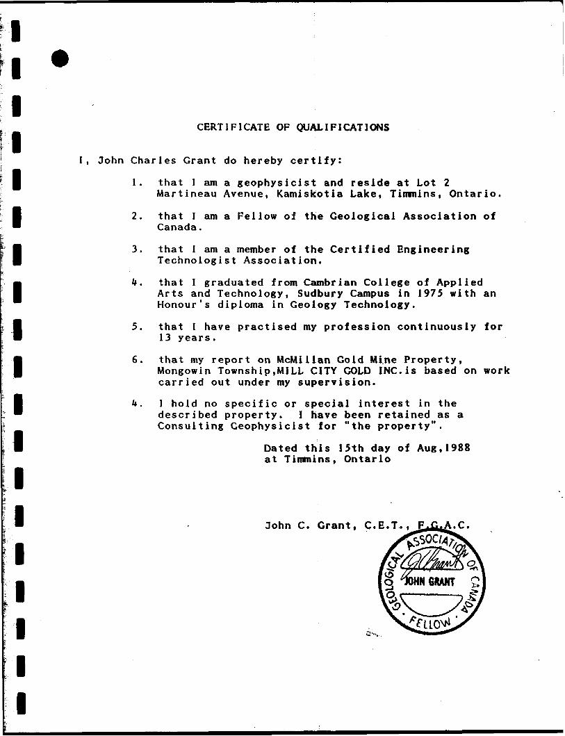
l l l l l l l l l l l l l l l l l l i 41IMNWMM 2.11552 MONGOWIN 010 GEOPHYSICAL REPORT ON THE McMillan Gold Mine Propertij r r C l W C T \ Mongowin Township ** c ^ s Sudbury Mining District n Ontario, Canada AUG ^ Mill c^oold I NC. MINING UNOS SECTION Prepared by: 3. C. Grant Exsics Exploration Ltd. August ,1988
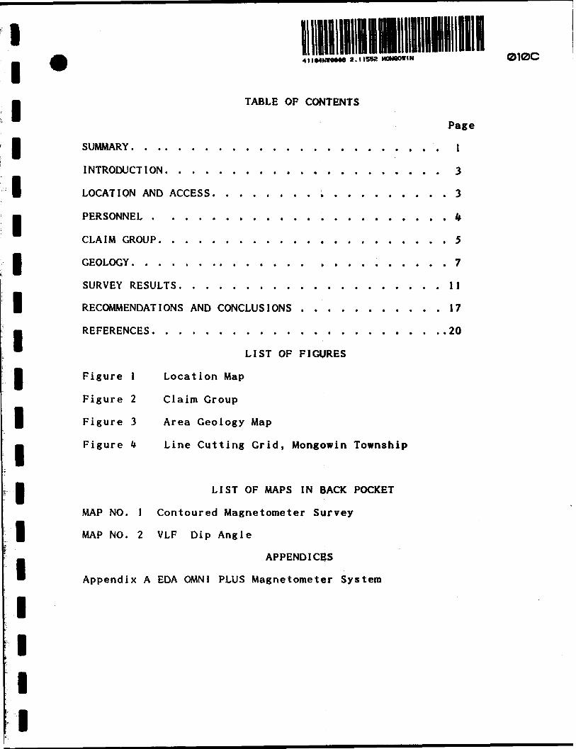
Transcript
l l l l l l l l l l l l l l l l l l i
41IMNWMM 2.11552 MONGOWIN 010
GEOPHYSICAL REPORT
ON THE
McMillan Gold Mine Propertij r r C l W C T\Mongowin Township ** c ̂ s
Sudbury Mining District nOntario, Canada AUG ̂
Mill c^oold I NC. MINING UNOS SECTION
Prepared by:3. C. GrantExsics Exploration Ltd.August ,1988
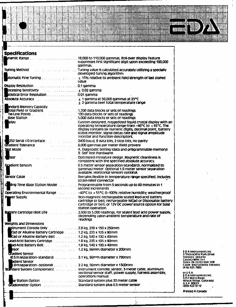
Weights and Dimensions tostrument Console only Cad or Alkaline Battery Cartridge Rkad or Alkaline Battery Belt Lead-Acid Battery cartridge
l-Acid Battery Belt.
it sensor JD.5 m separation - standard)
lent Sensor.0 m separation-optional)..
d System Complement
Station Option liometer Option
18,000 to 110,000 gammas. Roll-over display feature suppresses first significant digit upon exceeding 100,000 gammas.Tuning value Is calculated accurately utilizing a specially developed tuning algorithm 150/*) relative to ambient field strength of last storedvalue0.1 gamma± 0.02 gamma0.01 gamma± 1 gamma at 50.000 gammas at 23'C 2 gamma over total temperature range
1,200 data blocks or sets of readings100 data blocks or sets of readings5,000 data blocks or sets of readingsCustom-designed, mggedized liquid crystal display with anoperating temperature range from -400C to -i- 55ec. Thedisplay contains six numeric digits, decimal point, batterystatus monitor, signal decay rate and signal amplitudemonitor and function descriptors.2400 baud, 8 data bits, 2 stop bits, no parity6,000 gammas per meter (field proven)A. Diagnostic testing (data and programmable memory)B. Self Test (hardware)Optimized miniature design. Magnetic cleanliness isconsistent with the specified absolute accuracy.0.5 meter sensor separation (standard), normalized togammas/meter. Optional 1.0 meter sensor separationavailable. Horizontal sensors optional.Remains flexible in temperature range specified, includesstrain-relief connectorProgrammable from 5 seconds up to 60 minutes in 1second Increments-400C to 4- 55"C; D-100% relative humidity; weatherproofNon-magnetic rechargeable sealed lead-acid batterycartridge or belt; rechargeable NiCad or Disposable batterycartridge or belt; or 12V DC power source option for basestation operation.2,000 to 5,000 readings, for sealed lead acid power supply,depending upon ambient temperature and rate ofreadings
.2.8 kg, 238 x 150 x 250mm 1.2kg, 235 x 105 x 90mm 1.2kg, 540 x 100 x 40mm 1.8kg, 235 x 105 x 90mm
.1.8 kg, 540 x 100 x 40mm 1.2 kg, 56mm diameter x 200mm
2.1 kg, 56mm diameter x 790mm
2.2 kg, 56mm diameter x 1300mminstrument console; sensor; 3-meter cable, aluminumsectional sensor staff, power supply, harness assembly,operations manual.Standard system plus 30 meter cableStandard system plus 0.5 meter sensor
EDA instruments inc. 4 Thornclif fe Pnrk Drive Toronto, Ont.irio Con.iti.iM4H IHI Telex: 06 25222 EDA TOR Came: instruments Toronto 1416)425 7800in USA.EDA instruments Inc.5lS1W.irdRo.idWhe.it Ridge. ColoradoUSA 8003313031422 9112
Printed in Canada
Ministry ofNorthern Developmentand Mines
Ontarintariq
Report of Work
(Geophysical, Geological Geochemical and
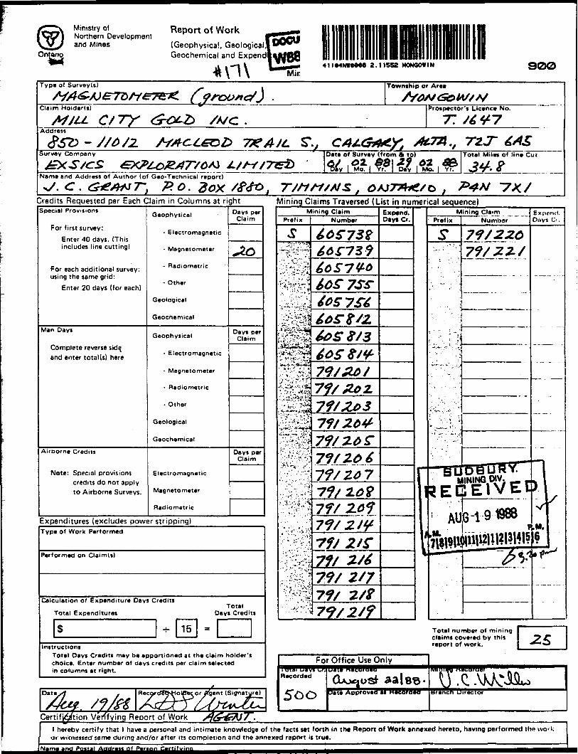
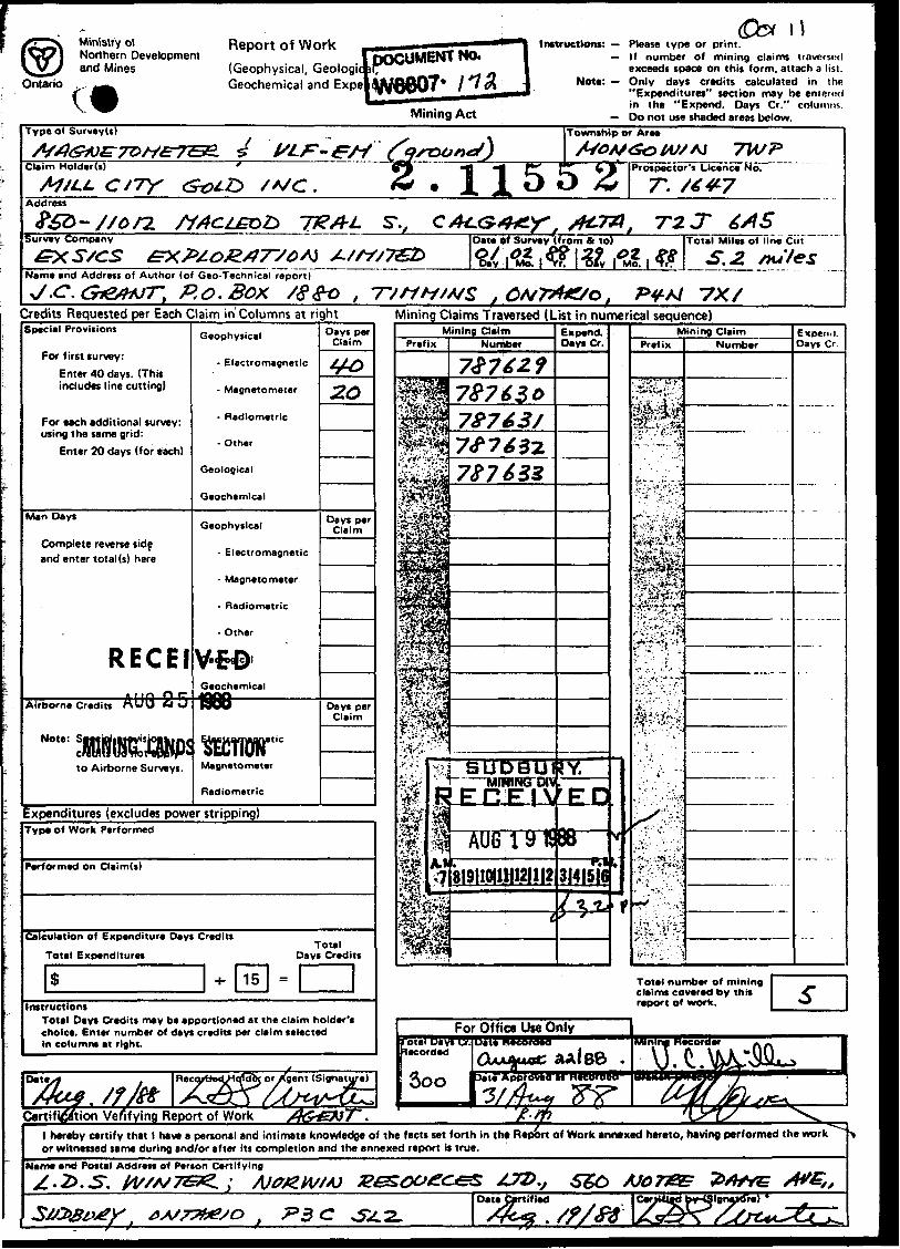
*n\ 41I94NWQM8 2.11552 MONGOWIN 9OOType of Survey(s)
CertifJ^/tion Verifying Report of Work /J(f^A}7^.hereby certify that 1 have a personal
or witnessed' same during and/or afterand intimate knowledge of the facts set forth in the Report of Work annexed hereto, having performed the wo* k its completion and the annexed report is true.
Ministry olNorthern Developmentand Mines
Ontario cReport of Work,(Geophysical, Geologi -Geochemical and Expe|jWQQ07* l l A
l^H*^*^*^*^^
Mining Act
H— Please type or print.— If number of mining claims traversed
exceeds space on this form, attach a list.— Only days credits calculated in the
"Expenditures" section may be entered in the "Expend. Days Cr." columns.
— Do not use shaded areas below.Type of Survey(s)
Claim Holder(s)
CJ7Y * 115ITo
|T^5
Township or Area
1*rospector's Licence No.
T.Address
Survey Company
Name and Address of Author (of Gee-Technical report)
, P.O.Box /Sgo ,
Date *f Survey if rom a to) (Total Mile* of Fine Ciif
Credits Requested per Each Claim in Columns at rightSpecial Provisions
For first survey:Enter 40 days. (This includes line cutting)
Expenditures (excludes power stripping)Type of Work Performed
Performed on Claim(s)
Calculation of Expenditure Days Credits Total Expenditures
Total Days Credits
InstructionsTotal Day* Credits may be apportioned at the claim holder's choice. Enter number of days credits per claim selected In columns at right.
Certification Verifying Report of Work
Mining Claims Traversed (List in numerical sequence)
For Office Use Only
l hereby certify that l have a personal and intimate knowledge of the facts set forth in tht Report of Work annexed hereto, having performed the work or witnessed same during end/or after its completion and the annexed report is true.
Name and Postal Address of Person Certifying•t*
Oate Certified
Ontario
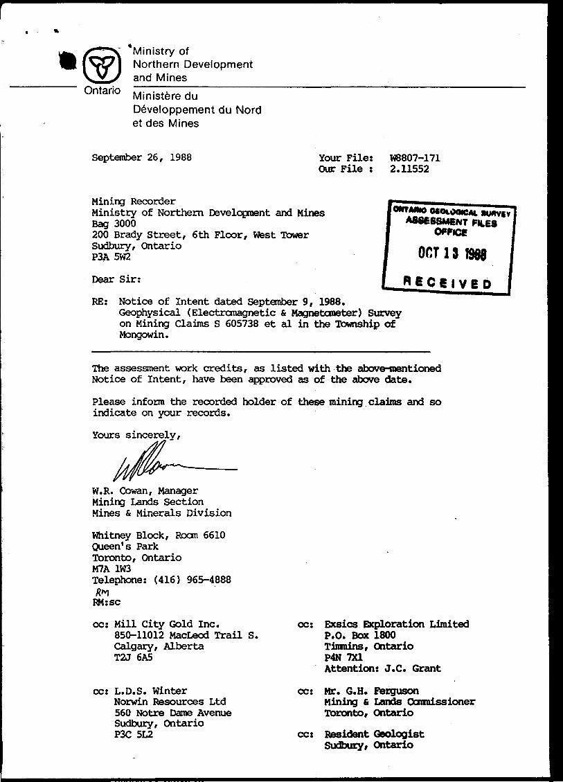
Ministry ofNorthern Developmentand MinesMinistere du Developpement du Nord et des Mines
September 26, 1988 Your File: Our File :
W8807-171 2.11552
Mining RecorderMinistry of Northern Development and MinesBag 3000200 Brady Street, 6th Floor, West TowerSudbury, OntarioP3A 5W2
Dear Sir:
ONTMNO OCOMXMC*. BU ASSESSMENT FILE
owce OCT13 1908
j* 6 C 6 l V B DRE: Notice of Intent dated September 9, 1988.
Geophysical (Electromagnetic S. Magnetometer) Survey on Mining Claims S 605738 et al in the Township of Mongowin.
The assessment work credits, as listed with the above-mentioned Notice of Intent, have been approved as of the above date.
Please inform the recorded holder of these mining claims and so indicate on your records.
Yours sincerely,
W.R. Cowan, Manager Mining Lands Section Mines St Minerals Division
cc: Mr. G.H. FergusonMining 6 Lands Commissioner Toronto, Ontario
cc: Resident Geologist Sudbury, Ontario
Ministry ofNorthern Development*"*
Ontario
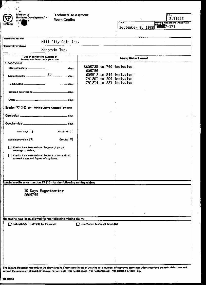
Technical Assessment Work Credits
DIM
September 9. 1988
FM*
2.11552Mining Recorder^ Report of
Recorded HolderMill City Gold Inc.
Township or Am
Mongowin Twp.Type of survey and number of
Assessment days credit per claimGeophysical
?0Magnetnmater tu Hays
Parametric Hays
|nHiir*rl polaris'"" . Hays
nthar rtay*
Section 77 (19) See "Mining Claims Assessed" column
Ganlngirjii Hay*
Geochemical , riayc
Man days Q Airborne Q
Special provision (29 Ground PT|
FI Credits have been reduced because of partial coverage of claims.
l~l Credits have been reduced because of corrections to work dates and figures of applicant.
Mining Claims Aitsoed
S605738 to 740 inclusive 605756 605812 to 814 Inclusive 791201 to 209 Inclusive 791214 to 221 Inclusive
Special credits under section 77 (16) for the following mining claims
10 Days Magnetometer S605755
No credits have been allowed for the following mining claimsQ not sufficiently covered by the survey Q insufficient technical data filed
exceed the maximum allowed as follows: Geophysical - 60; Geologocal - 40; Geochemical - 40; Section 77(19) - 60.
Ministry ofNorthern Developmentand Mines
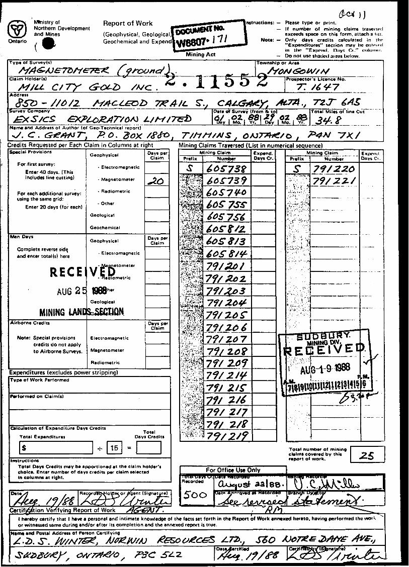
Ontario (*Report of Work(Geophysical, Geological Geochemical and Expend!
Mining Act
nstructions: — Please type or print.—If number of mining claims traversed
exceeds space on this form, attach a list. Note: — Only days credits calculated in iho
"Expenditures" section may he enn-ird in tin? "Ex|MMnl. n.-iyr. Ci." ruhiniir.
— Do not use shaded aieas below.Type of Survey(s)
Claim Holder(s) H |* A JL
Township or Area
Prospector's Licence No.
77Address
7** A/LSurvey Company
&XS/CS
,, 7V.T
Name and Address of Author (of Geo-Technical report)^/. c .
Date of Survey (from 4 tp)
Mo.
Total Miles of line Cut
Credits Requested per Each Claim in Columns at rightSpecial Provisions
For first survey:Enter 40 days. (This includes line cutting)
For each additional survey: using the same grid:
Enter 20 days (for each)
Man Days
Complete reverse side, and enter total (s) here
RECEAU625
MINING UNOAirborne Credits
Note: Special provisions credits do not apply to Airborne Surveys.
Geophysical
- Electromagnetic
- Magnetometer
- Radiometric
- Other
Geological
Geochemical
Geophysical
- Electromagnetic
-J/laflnetometer
VEp- Haoiometric
868*"Geological
SG&ECIJQN
Electromagnetic
Magnetometer
Radiometric
Days per Claim
J.O
Days per Claim
Days per Claim
Expenditures (excludes power stripping)Type of Work Performed
Performed on Claim(s)
Calculation of Expenditure Days Credits
Total Expenditures
S -i- 15
Total Days Credits
s
Instructions Total Days Credits may be apportioned at the claim holder's choice. Enter number of days credits per claim selected in columns at right.
Date
Certification Verifying Report of Work
RecordeTJsHolpeior/igent (Signature)
Xgfrr/
Mining Claims Traversed (List in numerical sequence)Mining Claim
Prefix
Sif
Number
66^739
7SS-t OS 7 St
60S 9/3
79/&0/
7? f ZO S[•V'Vi'V'iif f t l *^w V
gl7f/ ZO 7 20?
\jjl
2/S"
2/7
7J/2/9
Expend. Days Cr. Prefix
Mining ClaimNumber
Expend. D.iys Ci .
73/22.0
MINING.-.- — m^ECIEiVEt)
Total number of mining claims covered by this report of work.
T^xy/h"l hereby certify that l have a personal and intimate knowledge of the facts set forth in tht Report of Work annexed hereto, having performed the wot k or witnessed same during and/or after its completion and the annexed report is true.
Name and Postal Address of Person Certifying
7*3 C . s?/f*
5115000 m
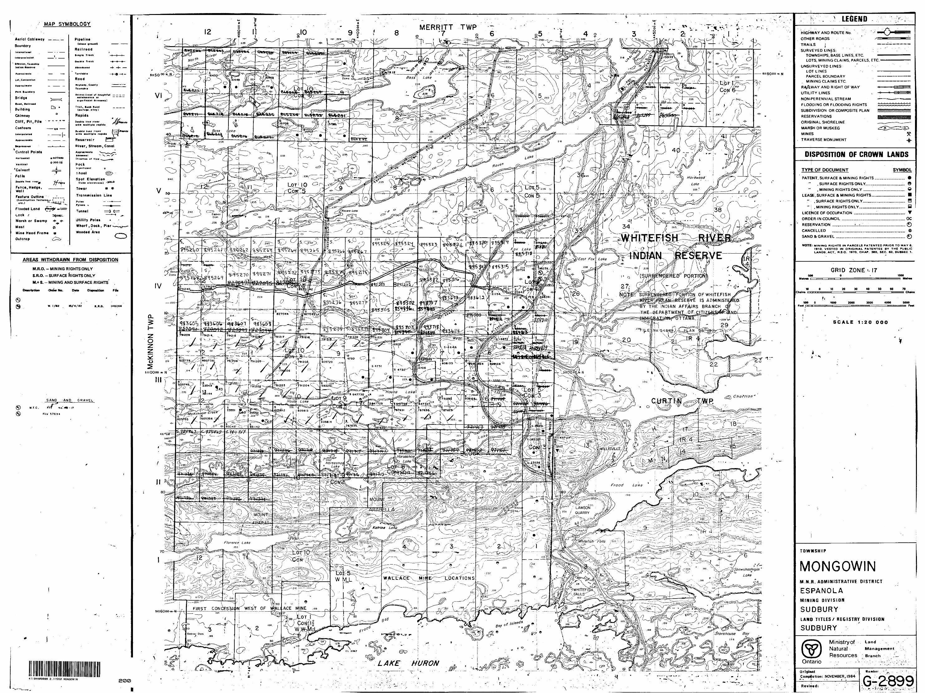
MAP SYM80LOGY MERRITT TWP•7 0 6
Aerial Cabltway
Boundary
Building
Chimney Cliff, Pit, Pile
ContoursBass e^g t . -*~ — "-*
— .Rt**rvoir, Stream. Canal
Control Points
Vtrtltvl
'Culvert Falls
(,~*. ....... —— i -300.0
Tower a *
Transmission Line
Fvnct, Hedge, WallFeature Outline
*4lr le.)
Flooded LandLock tMarsh or Swamp 4* -^ Utility Poles
Wharf .Dock, Pier
Wooded AreaMastMine Head Frame aOulcrop i'"^--"-1
AREAS WITHDRAWN FROM DISPOSITION
M.R.O. - MINING RIGHTS ONLY
S.R.O. - SURFACE RIGHTS ONLY
M.+ S. - MINING AND SURFACE RIGHTS
OrdW No.WHITEFISHAOMINISTFJ^CT \
INDIAN AFFAIRS BRANCH OE-PART-MEN-T—OE-CIT4Z
SAND -AND GRAVEL
787633, /-J78T62
Frooa Lake
LAWSON /' QUARRY
hitefi'sh-' Falls"211
ShawshashtqM
LI .ACE MINECONCESSim
Storehouse Bay
LAKE HURON
•B
LEGENDHIGHWAY AND ROUTE No.OTHER ROADSTRAILS j -SURVEYED LINES: ; l
TOWNSHIPS, BASE LINES, ETC.LOTS, MINING CLAIMS, PARCELS, ETC
UNSURVEYED LINES:LOT LINES -PARCEL BOUNDARY
^ MINING CLAIMS ETC.
RA^lWAY AND RIGHT OF WAY
UTILITY LINES , -
NON-PERENNIAL STREAM
FLOODING OR FLOODING RIGHTS
SUBDIVISION OR COMPOSITE PLAN
RESERVATIONS
ORIGINAL SHORELINE
MARSH OR MUSKEG
MINES
TRAVERSE MONUMENT
DISPOSITION OF CROWN LANDS
TYPE OF DOCUMENT SYMBOL
PATENT. SURFACE St MINING RIGHTS ___._.......... *
.SURFACE RIGHTS ONLY________TO___ O
. MINING RIGHTS ONLY ___..______,.__ O
LEASE. SURFACE ft MINING RIGHTS—_.___-—__ H" .SURFACE RIGHTSONLY____.,-—™...___ H" .MINING RIGHTSONLY—__.______....._- B
NOTE: MINING RIGHTS IN PARCELS PATENTED PRIOR TO MAV 6. 1913. VESTED IN ORIGINAL PATENTEE BY THE PUBLIC LANDS, ACT. H.S.O. 197O, CHAP. 380. SEC. 83, SUBSEC 1.